
While they are mighty slow in coming, I have added two new pages in the Washington section.
Category: Trails
Trails in General
Lake Calvera with Jake
With all of the competing interests pulling at my boys’ time such as friends, hockey practice, hockey games, etc…It was really cool that Jake wanted to join me on a ride at Lake Calvera this morning.

I took him on a different group of trails than what I have typically done in the past. Some of it was due to some of the trails being closed by the City of Carlsbad as they have started actively managing thier slice of the Calvera “Area”. Another reason for the trail change up is tha Jake has gotten strong and better on the bike so I thought it was time to take him on some of the more technical bits.

Jake did quite well on the technical bits. I was surprised that the squeeze type rock moves gave him more troubles than having to go up and over rocks.
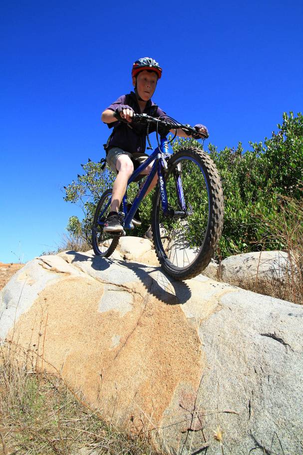
Which he seemed to find easy to just pop up onto and roll off of. Makes me wish I had started riding a mountain bike when I was a little grommet.

This trail feature should have a sign “You can be no taller than this to got on this ride”. It would have been a face smasher if I would have tried it. All together we did about 12 miles or so.

On our pedal back to the house we started thinking about tasty brown cold beverages for post ride refreshments.

Ahh, Coke Slurpees!
Oahu’s Manana Trail
I’m back from my quick work trip to Hawaii, but before I finished up there, I was able to squeeze in a second ride. The Manana trail was less than 15 minutes from where I was working so it fit the bill for a post-work ride. It was pretty short trail mileage-wise but mileage can be deceptive sometimes, particularly if the terrain is interesting.

Such was the case with this trail. There were plenty of roots to contend with on the first half of this ride. I was glad today was a dry day as these things can turn your bike into an ejection seat rather easily when wet. With the roots dry they were manageable and allowed for some serious brushing up on the technical “monkey motion” skills. There were two unscheduled nose-wheelies that I still have no idea how I managed to keep from going over the bars.

Somewhere around the 1.5 mile mark the trail comes out of the thick foliage and starts following a somewhat open ridgeline. In the picture above you should be able to make out the cut of the trail. The trail was actually easier for a while along this ridge as the roots were much more sparce. The views of the Ko’olau Mountains to the east continued to be intriguing as I climbed but the peaks were mostly shroud by the tradewinds clouds spilling over from the windward side of the island.

The views of the Waianae mountain range on the west side of island opened up behind me as I climbed. I imagine that a morning time ride would be the best time to take in this view.

The trail follows up the ridge for a while and then started a bit more roller coasteering with things getting steeper. It was easy to tell that I was moving beyond where most hikers where opting to turn around and head back as the trail transitioned from a dirt tread to a short grassy tread. There were also plenty of strawberry guava plants along the trail which gave me great excuses to stop and sample the goods. Snacking on tasty native edibles seemed downright decadent.

As the ridgeline undulations became larger and steeper, the hike-a-bike sections became more frequent and longer. The trail started giving me glimpses of what a tropical version of the Los Pinos Trail in Orange County would look like. Hike-a-Biking rarely bothers me as some of the best riding I have ever done has involved some quality time with your feet on the ground. The Manana trail goes up to the Ko’olau summit over the course of six miles so this could be up to a 12-mile ride. I did maybe six to eight miles total opting to turn around at a point where I thought the daylight buffer and expected return time equation seemed to balance out. The actual return time was much quicker than expected and I wish I would have pressed onward a little further. Maybe next time.
Aloha from the Hau’ula and Ma’akua Trails
So I am in Hawaii this week for a bit of work but I have managed to carve out a little time to grab a rental bike and get it dirty. The destination for this excursion was the north-east shore of Oahu to ride the Ma’akua Ridge Loop and the Hau’ula Loop Trails.

I have always wanted to be able to give these trail directions, “Just past the trail sign, turn left at the engine block”.

Got Chunk? There is a creek crossing in Papali Gulch that will put most people on their feet.

The trade winds were bringing lots of puffy clouds across the windward side of the island so there were lots of transitions from bright sunny conditions to threatening patches of rain clouds. The terrain was often tricky in spots with bits of roots and rocks.

After climbing up along a ridgeline for quite some time I came to this exception section of trail where the ridge had eroded down to a 3 foot wide knife-edge section about 50 yards long with vegetation covered cliffs to either side. The flora hid most of the exposure but was certainly there. The photo does little justice.

Before long the trail reached the highpoint of the loop and the trail turned back towards the ocean and a run down the Ma’akua Ridge proper. It was quite a blast and I only stopped for a couple of pictures.

Once I reached the bottom of the loop and connected up with the Hau’ula Loop Trail which goes up a series of ridgelines to the north of the Ma’akua Ridge I was just on.

There was some significant difference in the flora along this trail as there were stands of pine trees on these ridges. While I’m not sure of the exact species of the pine it was something along the line of a Douglas fir. While I had been sprinkled on a little earlier in the ride, and really nice storm cloud blew through and gave the ground a good and steady pelting for about 10 minutes while blowing through. I waited it out under thick foliage tree and stayed basically dry.

One thing that was pretty awesome along this trail was the wild tropical fruit growing along the trail. Snacking on Guava and Lilikoi (Hawaiin Passionfruit) right along the trail truly gave the impression of being in a tropical paradise.

What was not paradise was the numerous roots that had now become wet which turned the normally challenging trail features into full on treachery.

The last half of this loop was mostly downhill and the descent through pines was pretty freaking cool and not what I expected in Hawaii. The trail pops out about half a mile from the ocean and my waiting car at the Hau’ula Beach Park. Before driving back to Waikiki I scrubbed off all the mud and muck from the ride with a nice swim in the Pacific. Life is good on a bike.
Washington Riding
Man do I have a lot of catching up to do. My six weeks in Washington went by really fast and I was really busy with work. I did get in quite a bit of riding but much of my other work trips in the past, it is often tough to find time to work, ride and blog about. I’m sure you can guess which one I set to the side. I am going to get the story and pictures of the cool rides I get in up on my site once my schedule drops back down to “normal” but here are a few pictures of these to come.

The furtherest trail away from my basecamp on the west side of Puget Sound was the Devil’s Gulch trail in the northern central area of the state. It is often touted as one of the best XC trails in the state. While I would have to ride all the singletracks in the state to be for sure, this is one really awesome trail. I did about 14+ miles of mellow forest road climbing to get to the top of this trail and was rewarded with 12 miles of singletrack awesomeness.

Since I was in thea area I strung Devils Gulch and the Red Devil Trail together. The Red Devil trail has a devil of some climbs to it and it fully polished off my leg after the Devils Gulch loop. The grand total for the day was 36 miles, 4,500 feet of climbing and enough joygasm smiles to make my face hurt.

I made a total of two trips out to the “410 Area” east of Mt Rainier to ride the Palisades, Ranger and Noble Knob trails. There is some stout climbing to be done but trail and the view are well worth it.

Got Wilderness? The Noble Knob trail takes you right up to the edge some impressive looking wilderness.

Got Sunlight? I could have used some at the end of this ride.

Google Duthie Hills, it is Seattle newest Mountain Bike Park. It is a 120 acre park dedicated to mountain. It offers something for everyone from tame,

to insane. This place is a city park that is 100% legal. Bottom line Washington gets it while SoCal is still in the stone-age.

Not everthing was an adventure to get to. There were a handful of places that filled out the weekday ride schedule. Like Port Gamble.

Green Mountain (Where is Waldo’s Shadow?) as well as other spots.
Like I said, I’ll get them up before long, but first I have quick work project to take care elsewhere. I might get in some riding there too 🙂
The Opening Week in Washington
Last week was really busy. While work was plenty busy, I did have enough time to get out and about on some trails. After starting the week out by finding out with my bike being stolen, I was able to get my hands on a rental hardtail on Tuesday. Wednesday after work I hit up Banner Forest. I had hiked a small slice of this area in December of 2008 but this was the first time on the bike. This places is a lot of fun. Lots of the twists and turns and quick up and downs on nearly all singletrack. Quite the fun XC playground.

Wednesday was supposed to be a quick afternoon ride at Green Mountain near Bremerton. The trail was billed as well marked out-up and back-down. Just a few miles into the climb I spied and sweet looking narrow singletrack heading off to the west and someone had made a wooden arrow on the ground pointing to it. For those that know me, know what happened next. Yes I took the sweet looking singletrack that was not on my map. This was indeed a really awesome singletrack saw much less traffic the the one I started on. This trail lead to another and another and the next thing I know I was much futher out than I had planned on being. I had to dust off some orienteering skills that I had not had to use so thoroughly in quite sometime. When all said an done my 12-14 miles afternoon spin ended being a stout 21 miler that ended in the waning moments of the day.

Saturday it was raining the Seattle-Tacoma area so I headed inland to the east of Mt Rainer to ride the Ranger Creek and Palisades trail. The 20 miles of pure singletrack did not disappoint. I am going to get back here when the sun is out.

Sunday I headed out to the Olympic Pennisula for a ride that is considered a Washington Classic/Epic. The Lower Dungeness to Gold Creek Trail loop. For much of the ride I was in the clouds which made the fantastic singletracks take on a primordial rainforest feel. The cloud ride in thick old growth woods was sometimes spooky and I often found myself whistling so as not to surpise any critters further up the foodchain.

I’ll get some proper ride reports put together when I get some downtime, but for now it will just be the samplers.

San Marcos – Its not a F$%)ing Trail!
Tripe (noun)
- Lining of the stomach of a ruminant (especially a bovine) used as food.
- A slang term synonymous with rubbish, in the sense of something of little value, or nonsense.
- (see also San Elijo Trails)
Definition #2 particularlythe “something of little value” is the theme of this rant.
So for the last week or so I have been investigating some of trails not to far from my hood. The San Elijo Hills area. I was not expecting much and I was quite underwhelmed. More than just underwhelmed, I was pissed at what the developer was allowed to get away with calling trails.

The Gardens View Tripe – Are you f$%^ing kidding me! When two trucks can pass one another on it, it is not a trail. It is a dirt road.

I laughed out loud at this sign. “Give Life A Chance”. What the sign from the San Elijo Hills Development Company should say is “YOU need to give life a chance, because WE have already bulldozed all the habitat in this area”

Take a look at the crap they have on their website. 18 miles of trails. There is less than one mile of trail in this development. There are over 17 miles of Dirt Sidewalk Pathway Tripe throughout this development. Try a little truth in advertising.

The Double Peak Tripe. The “trail” is the dirt sidewalk on the side of the pavement and then starts up the hill. Where is the natural outdoor experience here? You have either pavement or a cement gutter on one side and a wooden rail fence to keep from even contacting nature on the other. Most of this climb is compacted and absolutely smooth decomposed granite. It is a nearly sterile outdoor experience where you never escape development. I have been on treadmills that were only slightly less interesting. If you can drive a Ferrari or a Prius on it, it is not a trail, it is TRIPE!

Do I even need to say it, “It is not a F$%^ing Trail! TRIPE, TRIPE, TRIPE! This is part of the 18 miles that San Elijo is selling as an attraction.

The Lake San Marcos Tripe. PAVED! I will not buy any blabage about American Disabilites Act Access with this “trail”. What this picture does not show is how stupidly steep this thing is. There is no Rascal, Humaround or any other battery powered mobility chair that is going to get up this thing. The city has a formula for how many miles of trail the community should have for its size and population. The mileage of this tripe counts towards meeting that trail requirement. What does that mean? It could mean less funding for real trails in the future because the city already has its mileage.

This is part of the “Make A Wish Trail”. I sure did make a wish. I wish there were more trails like this in the area. This IS a trail. Part of it looks to be pre-developement but portions of it are obviously newer.

This is the “Secret Trail” aka Trail 90. While it is fairly short this is good stuff that not only offers a high quality outdoor experience it is substainually less impacting on existing habitat. This is the best legal and sanctioned trail out here. It is also a legacy trail from before the develeopment started.
Okay so maybe I’m being rash and a trail snob but this is some of the worst stuff I have seen in an urban area interfacing to open space in San Diego County yet. The dirt pathways have their place down between the homes, but running this crap all the way up into the open space is just dumb. It does not meet the needs of the users who would venture up that far and it needlessly destroyed even more habitat by making the “trails” three to five times wider than they need to be. Arrrrrrrgh, What a nearly complete failure on the part of those charged with the oversight of this development. I’m not sure if this failure is due to incompetence, ignorance, or just a simple lack of caring but it certainly did occur.
You can download a map of all this Tripe here and go see for yourself. While it is a good workout it is not a high quality outdoor experience. If you disagree, you need to start looking for some new places to ride as you are missing out on the good stuff elsewhere in the county.
Two Peaks and Two Canyons
For the mid-week ride this week, it ended up being a doozie. The plan was to met up with some folks for a ride through Spring and Oak Canyon at 5pm. I was able to finish off the day’s work early and figured I had enough time to get some mileage before the scheduled ride.

I parked at the trailhead for the Spring and Oak Canyon ride (Bushy Hills at MTRP campground) and did some street riding over to the Mesa singletrack for a climb up Cowles Mountain. It was a beater as usual but love trying to clear the waterbars at their highest points but by the time I got up to the fireroad I was contend to get up the trails. The fireroad up to the top was as always brutal.

At the top of Cowles I was still looking really good on time so I decided to do the out and back to Pyles Peak. Plenty of waterbars here as well which made the down section pretty fun.

I was at the turnaround spot on Pyles Peak before I knew it and it was time for return climb back up to Cowles. I was still feeling pretty good when I got back to the summit and was all smiles on the way down the Big Rock trail. I got back to the campground just a couple of minutes before the first person showed up for the 5 pm ride. I could have been happy with a beer and some dinner at this point, but yeah I already said I was going to do the ride.

Spring and Oak Canyon was a good ride, but I had to dig into the energy reserves pretty deep to stay on pace with the fresh legged crew. I was good and pooped when we finished up and shortly thereafter we made our way over to the MTRP visitor center for the monthly SDMBA advocacy meeting. I slept well that night.
Lost Webpage Found! Cuyamaca – Noble – Big Laguna Epic
Riding from the Cuyamaca to the Laguna Mountains and back is a really awesome ride that can range from 31 miles upwards towards 40 to 65 miles and beyond according to what you add on at the ends. The most I have done is around 40 miles. I have made a couple of videos of this ride in the past but I thought it was about time that I put together a page with maps and pictures of the ride. As I working on the map I came across a map file with a similiar name as the one I was starting. When I opened it up I was surprised to see it was the route I was working on. I started digging around through my local copy of my website and found a page I had orginally done up in 2003 and updated in 2007. Somehow, when I did my big website makeover in 2008 I failed to include this page in the menu directory for the trails.

East Mesa in Spring 2007

More East Mesa Spring Goodness

Wildflowers in Big Laguna Meadow
While part of me is a little bummed that I missed this page in the first place, it is sort of cool that it shown up now. It is like finding treasure I buried myself and forgot about.
Check out the Cuyamaca to Noble Loop
A week of SD Weather Weenie Whining
Okay, so we San Diego folk are self-admitted “weather weenies”, particularly us coastal types. You get us out of our typical weather of 65-75 and sunny for more than a few days we start whining like a jet turbine. There was a lot of noise happening this week.
Wednesday, I met Steve for an after work MTB stoke at Anderson Truck Trail. I knew it was going to be warm as this was our first really hot day of the year. I was ready with extra fluids and electrolytes. When I pulled into the trailhead the temp gauge in my truck read 100 degrees. My first thought was that can not be right. Within seconds of stepping out of the truck, I knew my truck was not lying to me. Really rough but manageable was my overall assessment for the upcoming ride. As I’m pulling out all my gear, I realized I had left my cycling short, shirt and socks at home. I normally keep an emergency stash of cycling clothes stashed for just such an occasion. Opening up the under seat compartment revealed that I had not resupplied my stash after the last time I forgot my digs. Crap, I was in my work clothes which would not do at all and my after ride clothes consisted of a heavy black cotton Tee-shirt and a thick pair of cotton shorts. I did find a dirty cycling socks that I missed taking out of truck after the last ride so they were called back into service. The cotton shorts and T-shirt would be the apparel for the day.

This was the only smile Aqua would make on this climb.
It was readily apparent that these clothes were not going to help me out much at all. These was zero cooling happening with this outfit and it was blistering already. The heat of this climb makes you suffer pretty good on its own but the my stifling apparel took it to a whole new level. I thought about just not wearing a shirt at all, but even high SPF sunblock would not be able to help my glowing white-boy torso out whatsoever. I would have been fried in no time so the shirt stayed on. I have to take lots of breaks and had to spin in the granny ring for the overwhelming majority of the climb. Even with lots of breaks, by the time I reached the top I could feel I was close to some heat stress coming on. Amazing what the right apparel can do for you – More importantly what the wrong apparel can do to you as well.

After cooling down as much as to be expected I felt better and we set off on the descent. Steve was doing just fine, but I soon realized that I was off-game. My reaction time was off just a little bit and on this terrain that can cause problems. I made a point to stay well within my normal limits.

Brian soon joined us, he started later in the day, so he did not get as cooked as we did, but it was still freaking hot. By the time we finished up the ride, it had cooled off to a “balmy” 90 degrees which felt pretty descent after what we had already suffered through. I was pretty much a wreck and completely drained.
The following day was the San Diego Mountain Biking Associations annual Beer and Burrito ride. I was still feeling a pretty beat from the heat the day before, but I had volunteered to help with pictures so I could not back out. This was a work for your supper event where you do a ride and then got to kick back with a tasty burrito from Chipotle and some tasty brews from Lagunitas.

Over the course of the day leading up to the event the temps start to drop and a monsoon storm started to peculate. It was cloudy with ominous rumblings in the sky in the distance. This event was capped at 70 RSVPs and it looked like everyone of them made it out. There were lots of new faces and lots of folks I had not seen in a really long time. It was good times before we even started rolling.

At a regroup spot

In the middle of the ride, we actually got rained for awhile. It nice to get the trail patted down right in front of us. The rain did not last long but it was certainly enough to register as “rain” for San Diego.

Before long we had all did enough to qualify for dinner and the with rain gone, it was time for some kicking back and socializing for a couple of hours. It was a mighty fine event. A good chunk of the photos from the event are on SDMBA’s facebook page.

Friday and Saturday were back to the summer toastiness, so Mark and I planned on beating the heat with a crack of dawn ride and the San Clemente Singletracks (aka weekpatch). Sunrise was at 5:52 so we met at 5:45 and were rolling at 6:00AM. The morning temps were cool and the marine layer held off the sun long enough that it was just starting to think about punching through as we finished up the ride.

It felt pretty wierd being done with my ride so early in the day. I’ll finish of the weekend with a little bit of honey-dos and a lot of lounging (in the shade).