| Located near the southern end of the Santa Ana Mountains in Orange County this is a pretty remote, steep and rugged trail that runs right along the spine of an undualating ridge for about nine miles. On clear days it seems like you can see forever as the San Jacinto, Gegorino, Baldy and other prominent peaks cans be seen inland. Out in the Pacifc, San Clemente, Catalina and the Channel Islands may make an appearance. Wear comfortable shoes as you are going to do some hike-a-biking. Just on the trail alone there is about 1200 feet of climbing/hike-a-biking and 4,500 of descending. This trail is not for everyone, ummmm it would probably not be a stretch to say this trail is not for most riders. Much like it's little cousin to the north, Bell Ridge, this kind of riding is an acquired taste like a well aged single barrel scotch or bourbon. Some riders are just not going to like it. For others, the remote experience and technical challenges are worth a little tension in the calves from the required hike-a-biking. |
 |
  Directions: The Los Pinos trail can be done as a loop or as a shuttle. If the main divide truck trail is open to vehicular traffic you can drive all the way to the trail head if you have a moderate to high clearance 2WD vehicle. Main Divide however is often closed to motorized access for a myriad of reasons that range from things like summer wildfire danger to winter snow damage. For this reason I recommend if you are going to do a shuttle, start from either Blue Jay Campground (near the top) where vehicular access is typically assured. Once you get to know this end of the Santa Anas Mountain you can use this trail as a leg for some stupidly huge loops. Directions: The Los Pinos trail can be done as a loop or as a shuttle. If the main divide truck trail is open to vehicular traffic you can drive all the way to the trail head if you have a moderate to high clearance 2WD vehicle. Main Divide however is often closed to motorized access for a myriad of reasons that range from things like summer wildfire danger to winter snow damage. For this reason I recommend if you are going to do a shuttle, start from either Blue Jay Campground (near the top) where vehicular access is typically assured. Once you get to know this end of the Santa Anas Mountain you can use this trail as a leg for some stupidly huge loops.
|
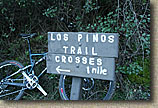
Lower Trailhead: No matter what option you go with you are going to have a vehicle at the at the bottom which is also the popular San Juan Trailhead. The bottom of the Los Pinos trail is about 0.8.miles further up the Hot Springs Canyon Road from the San Juan Trailhead.
- From the I-5 in San Juan Capistrano take Ortega HWY (74) East for about 12.7 miles. Turn left on Camp Road. There is a sign for the Lazy R Ranch as well as a CDF Fire Station on the corner. Go down the road for about 1.2 miles until you reach a large dirt parking lot in the trees on your left. The trail is right beside the road.
Upper Trailhead: The closest place to reliably park is Blue Jay Campground.
 From the lower trailhead: Take the Hot Springs Canyon Road back to 1.2 miles to Ortega Highway (74) and turn left (east). Travel 9.3 miles then turn left onto Main Divide Road (FS6S05) and take it for about 3 miles. There is a turn or two, look for "campgrounds" signs. When it doubt go uphill. As you approach Blue Jay campground, there will be a dirt pull out on your right and about 40 yards further up the road there will be a pull out on your left. The San Juan trail starts right here. The entrance to the campground is just ahead on your left. From the lower trailhead: Take the Hot Springs Canyon Road back to 1.2 miles to Ortega Highway (74) and turn left (east). Travel 9.3 miles then turn left onto Main Divide Road (FS6S05) and take it for about 3 miles. There is a turn or two, look for "campgrounds" signs. When it doubt go uphill. As you approach Blue Jay campground, there will be a dirt pull out on your right and about 40 yards further up the road there will be a pull out on your left. The San Juan trail starts right here. The entrance to the campground is just ahead on your left. |
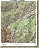  Map: Here is map of the area. I also show the San Juan trail on this map as well. The GPS data files however, do not include the San Juan Trail. Map: Here is map of the area. I also show the San Juan trail on this map as well. The GPS data files however, do not include the San Juan Trail.
Data Files: TOPO! GDB GPX KML |
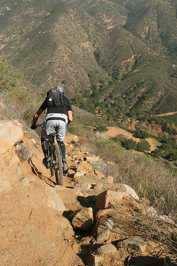
HAZARDS: This is a pretty raw, rocky, and steep monster that demands good bike handling skills. This is not a heavily used trail so getting hurt out here could be a real bummer. This place gets stupidly hot in summer and there is no shade or water until you get to the bottom. |
Ride report:If you are doing this ride as a San Juan - Los Pinos Loop, according to the way you do it, you could have several different mileages when you reach the junction of Blue Jay and Main Divide but typically you will have around 11 miles and around 3,000 feet of climbing under your belt at that point. |
  Leave Blue Jay Campground and make a left of the paved Main Divide Road/Truck Trail and enjoy a bit of descending or mild climbing. After about 0.9 miles, Main Divide switchbacks to the left and turns to dirt while another road continues off slightly downhill. Take the left and go uphill. From here “Pain Divide�? steepens up in places. You will gain about 950 feet over the course of the next 1.6 miles. You will then come to a flat spot with a large pullout on the left. The trailhead for both the Trabuco and Los Pinos Trails are in the north corner of this pullout. (This description resets the mileage at this point, take note yours) This is a good spot to take a break. Leave Blue Jay Campground and make a left of the paved Main Divide Road/Truck Trail and enjoy a bit of descending or mild climbing. After about 0.9 miles, Main Divide switchbacks to the left and turns to dirt while another road continues off slightly downhill. Take the left and go uphill. From here “Pain Divide�? steepens up in places. You will gain about 950 feet over the course of the next 1.6 miles. You will then come to a flat spot with a large pullout on the left. The trailhead for both the Trabuco and Los Pinos Trails are in the north corner of this pullout. (This description resets the mileage at this point, take note yours) This is a good spot to take a break.
|
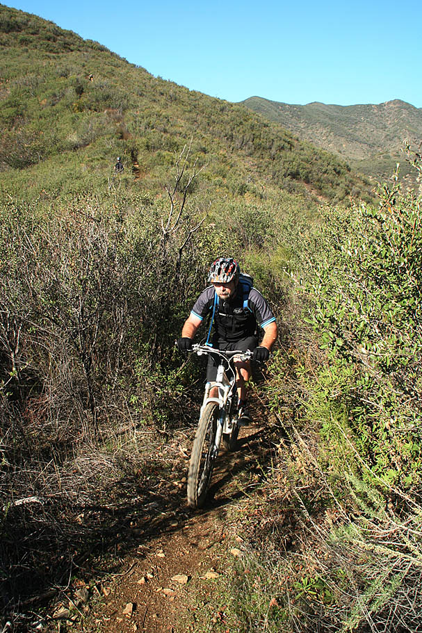
  When done chilling, roll onto the Trabuco Trail and immediately peel off to the left onto the Los Pinos Trail. Welcome to ridge top riding. After the first 100 yards or so you are not going to see much in the way of mild grades for a while. Let the ridge top riding begin. Over the next 1.1 mile on the Los Pinos trail the average grade is 12 percent. When done chilling, roll onto the Trabuco Trail and immediately peel off to the left onto the Los Pinos Trail. Welcome to ridge top riding. After the first 100 yards or so you are not going to see much in the way of mild grades for a while. Let the ridge top riding begin. Over the next 1.1 mile on the Los Pinos trail the average grade is 12 percent.
|
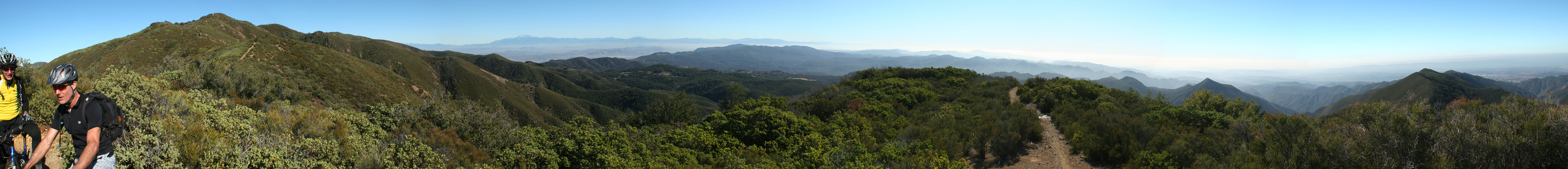
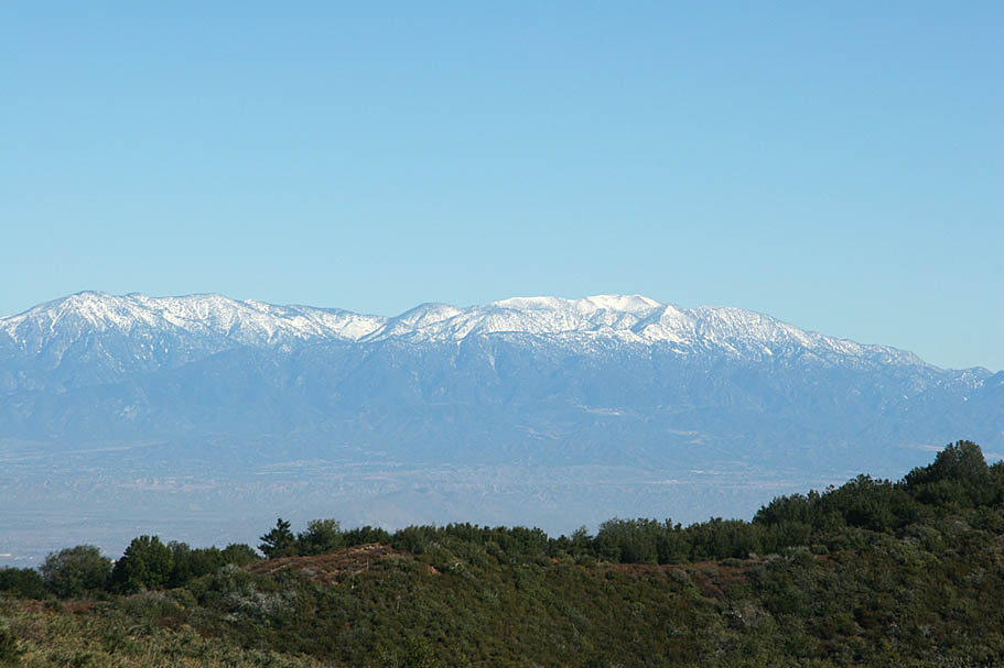
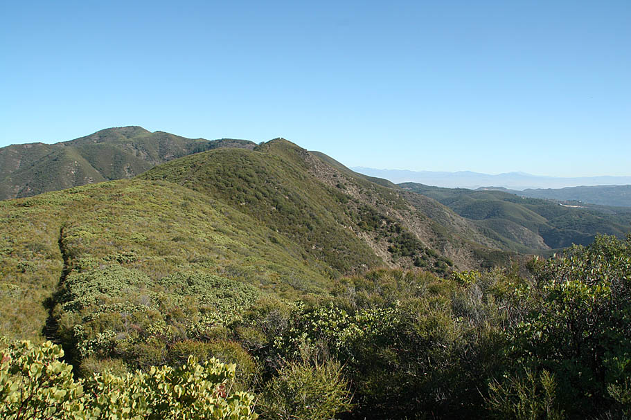
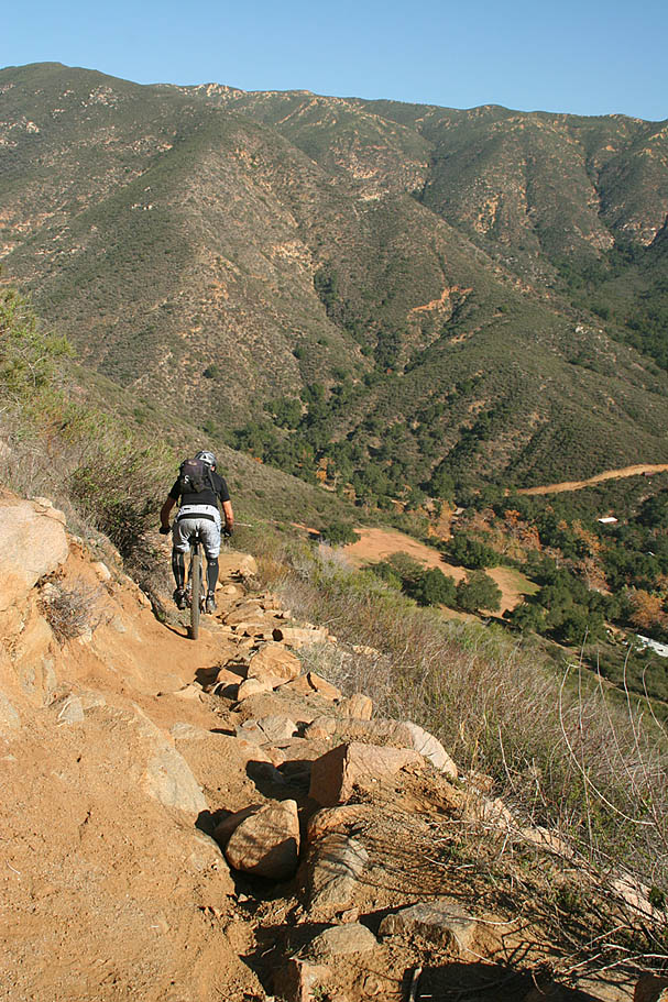
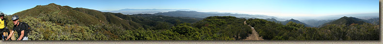
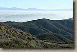
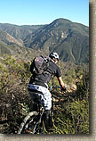
 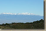 The views along this first section are pretty awesome as you can easily see the San Bernardino Mountains, Lake Elsinore, Santiago Peak as well as other points of interest. From this vantage point you get a really good look at the section of Main Divide Truck Trail between the Holy Jim and Trabuco Trails. It will give you a good appreciation of the elevations changes on that loop. The views along this first section are pretty awesome as you can easily see the San Bernardino Mountains, Lake Elsinore, Santiago Peak as well as other points of interest. From this vantage point you get a really good look at the section of Main Divide Truck Trail between the Holy Jim and Trabuco Trails. It will give you a good appreciation of the elevations changes on that loop.
|
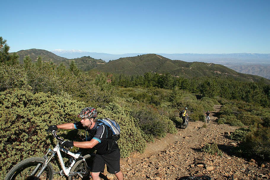
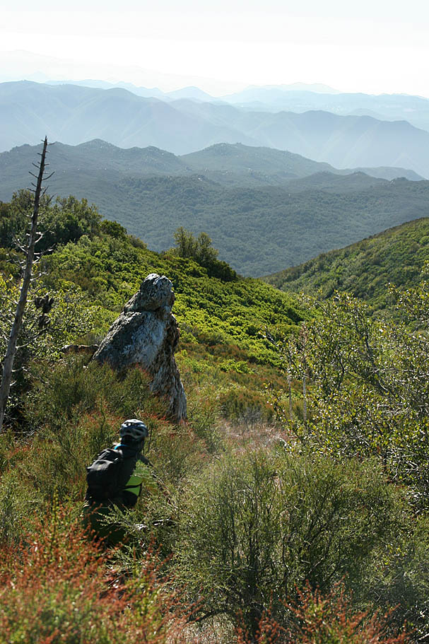
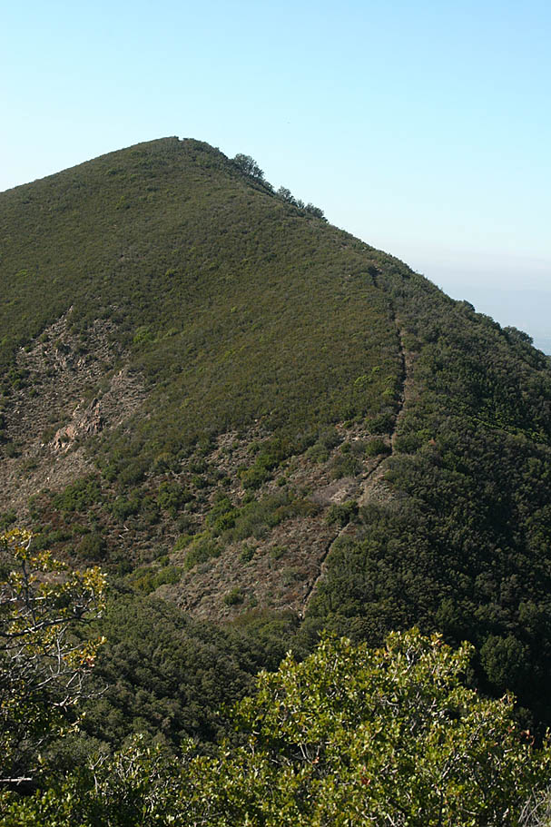
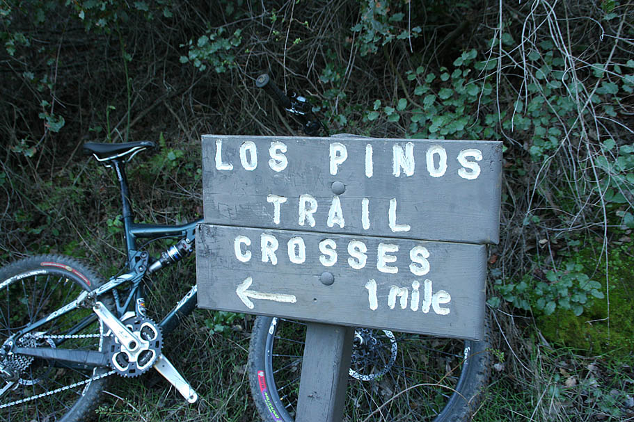
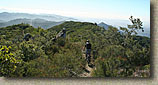
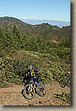
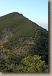
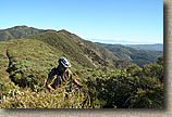
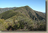
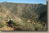
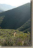
 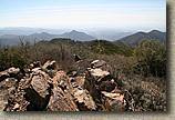 As you approach Los Pinos Peak at 4,510 feet, (1.1 miles) you will see a small unsigned trail splitting off to your right. This is the Bell Ridge trail and you are not going that way today. (Refer to the picture on the right) Go to the left/straight for maybe 20 yards further to the Los Pinos peak and enjoy the great view. There is a rocky outcropping on the peak that you should hop onto to get the best views. Looking off to the east you can see the Los Pinos trail diving and climbing across the many peaks of that ridgeline. If you have ridden the San Juan Trail before you should notice the terrain to the south and southeast as the area where that trail transverses. The views are going to continue to be impressive for most of this ride. As you approach Los Pinos Peak at 4,510 feet, (1.1 miles) you will see a small unsigned trail splitting off to your right. This is the Bell Ridge trail and you are not going that way today. (Refer to the picture on the right) Go to the left/straight for maybe 20 yards further to the Los Pinos peak and enjoy the great view. There is a rocky outcropping on the peak that you should hop onto to get the best views. Looking off to the east you can see the Los Pinos trail diving and climbing across the many peaks of that ridgeline. If you have ridden the San Juan Trail before you should notice the terrain to the south and southeast as the area where that trail transverses. The views are going to continue to be impressive for most of this ride.
|
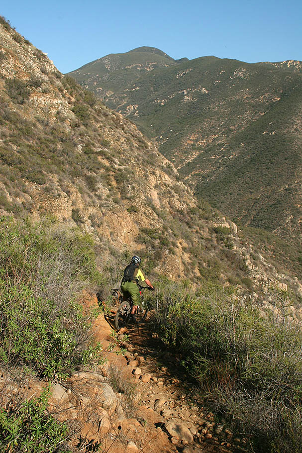
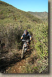
  Now the cycle of downhill fun and uphill brutallity starts. For those that have ridden the Bell Ridge trail before, I found the Los Pinos trail to be much more enjoyable. The downhill portions are better in the way that you can carry more speed and enjoy yourself much more than Bell Ridge. Most of the downs on Bell Ridge were so steep that you spent most of your time riding the razors edge of slow speed controlled braking. Now the cycle of downhill fun and uphill brutallity starts. For those that have ridden the Bell Ridge trail before, I found the Los Pinos trail to be much more enjoyable. The downhill portions are better in the way that you can carry more speed and enjoy yourself much more than Bell Ridge. Most of the downs on Bell Ridge were so steep that you spent most of your time riding the razors edge of slow speed controlled braking.
|
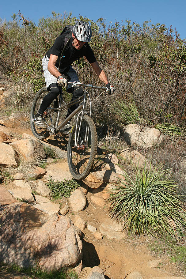
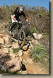
  Directions wise, there is little more to add as there are no other trail splits that you can really take from this point on until the end. There is one trail reroute but that will become blatantly obvious within seconds if you accidently try to ride it. Some of the downs are flowing ripfests while in other sections you will come around a corner and find loose rocky and rutted trail segment that demands surgical precision to maintain the line. Directions wise, there is little more to add as there are no other trail splits that you can really take from this point on until the end. There is one trail reroute but that will become blatantly obvious within seconds if you accidently try to ride it. Some of the downs are flowing ripfests while in other sections you will come around a corner and find loose rocky and rutted trail segment that demands surgical precision to maintain the line.
|
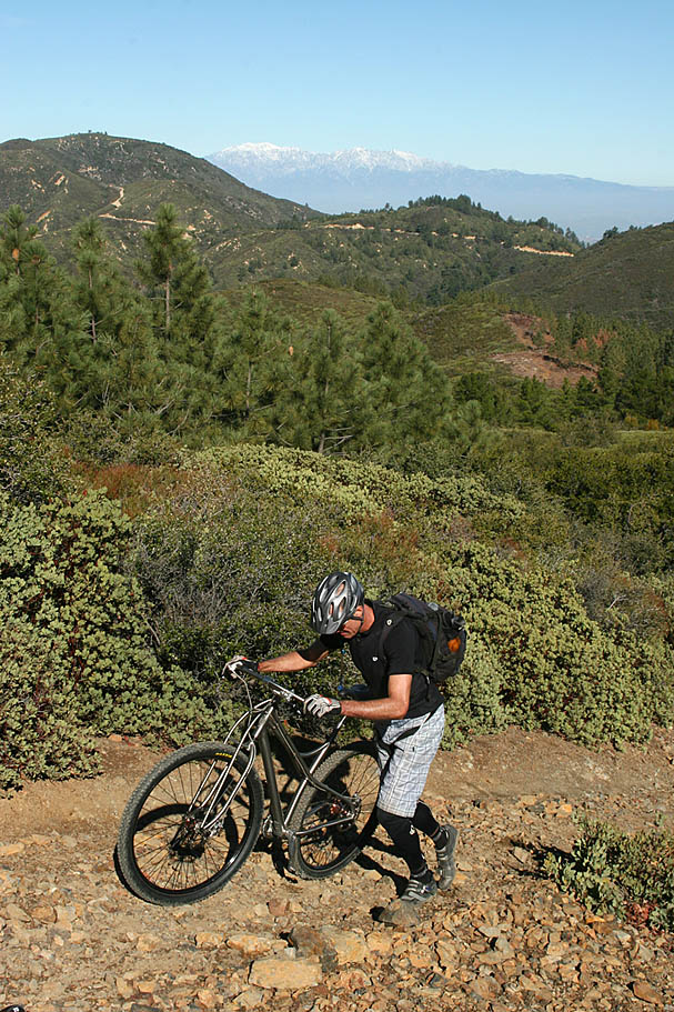
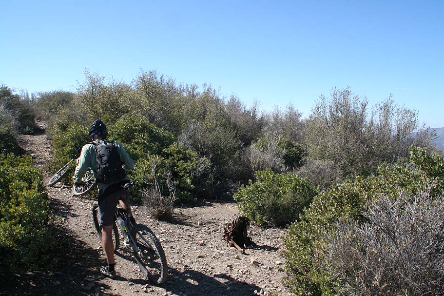
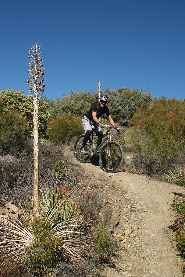
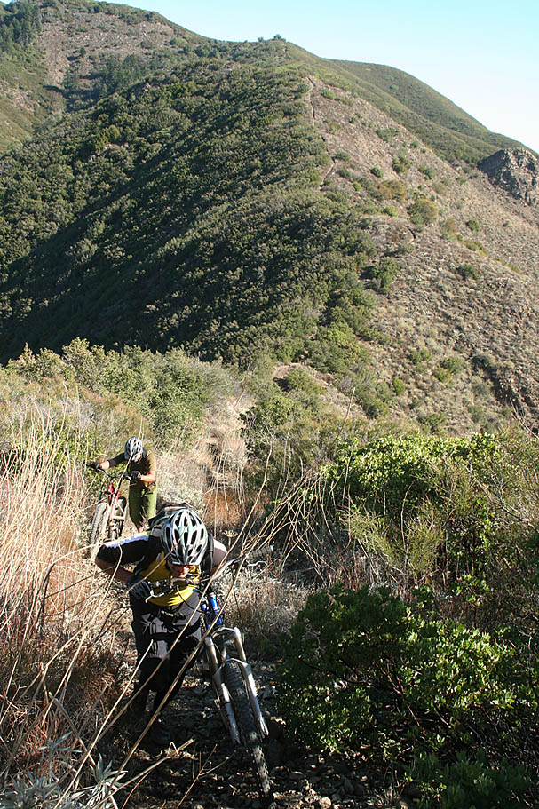
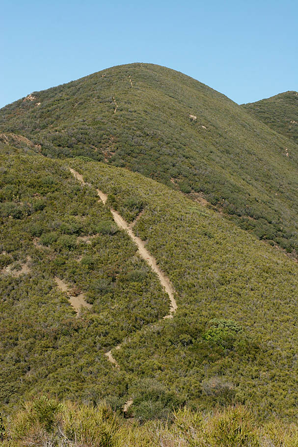
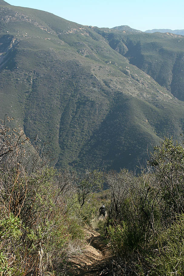
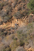
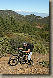
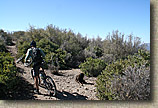
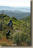
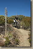
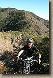
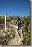
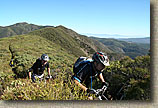
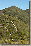
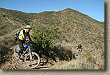
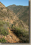
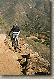
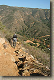
 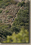 At around the 2.5 mile mark you will come to one big hike-a-bike. It is a little under 1/4th of a mile but has a 22% grade. You should be aware that you have some calve muscles when you get to the top of it. Can you find the riders in the picture on the left? The picture to the right is a hint. At around the 2.5 mile mark you will come to one big hike-a-bike. It is a little under 1/4th of a mile but has a 22% grade. You should be aware that you have some calve muscles when you get to the top of it. Can you find the riders in the picture on the left? The picture to the right is a hint.
|
  Somebody told me that there are something like 14 potential uphill hike-a-bike sections on this trail. I'm not sure about how many there actually were but 7 is a solid minimum and there could have benn as many as 14. If you are the type of person who would meticulously count the number of hike-a-bikes you do, then this may not be the kind of trail for you. My best advice is wear comfortable riding shoes and don't count the hike-a-bikes. I love my Sidi Dominator racer-style shoes but they stayed at home for this ride. Somebody told me that there are something like 14 potential uphill hike-a-bike sections on this trail. I'm not sure about how many there actually were but 7 is a solid minimum and there could have benn as many as 14. If you are the type of person who would meticulously count the number of hike-a-bikes you do, then this may not be the kind of trail for you. My best advice is wear comfortable riding shoes and don't count the hike-a-bikes. I love my Sidi Dominator racer-style shoes but they stayed at home for this ride.
|
  After the big hike-a-bike at 2.5 miles, we seemed to do quite a bit of more frequent but smaller white knuckers descents followed by hike-a-bikes. Around the 3.2 mile mark we came to a longer section of downhill that I remember as requiring you to be "fully in the moment". After this section we all commented on how millions of synapses had to all be firing just right for such a long time to pull that one off. After the big hike-a-bike at 2.5 miles, we seemed to do quite a bit of more frequent but smaller white knuckers descents followed by hike-a-bikes. Around the 3.2 mile mark we came to a longer section of downhill that I remember as requiring you to be "fully in the moment". After this section we all commented on how millions of synapses had to all be firing just right for such a long time to pull that one off.
|
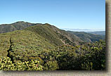   
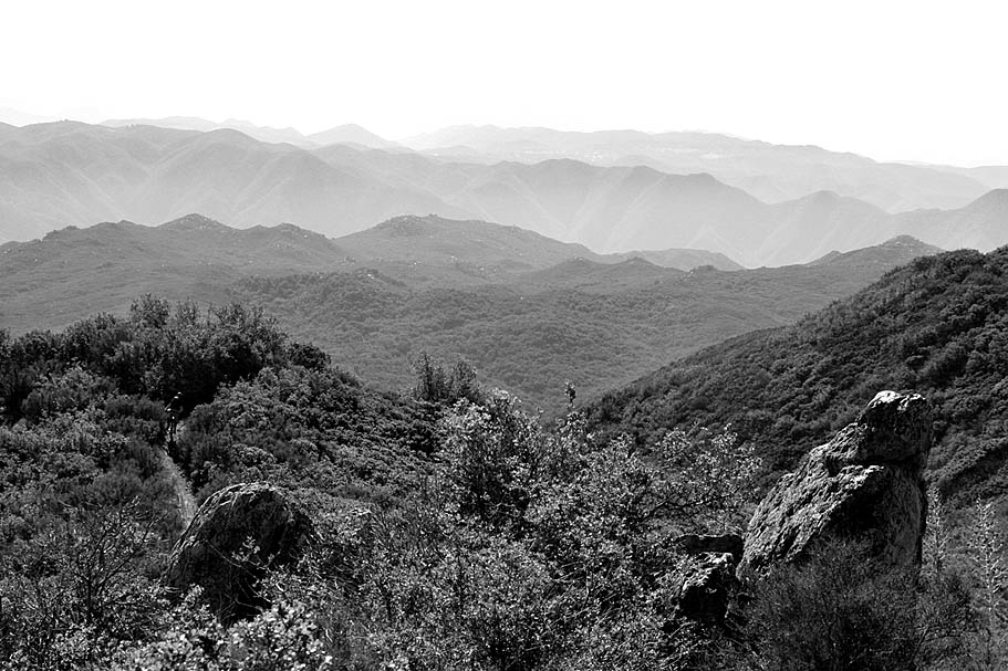
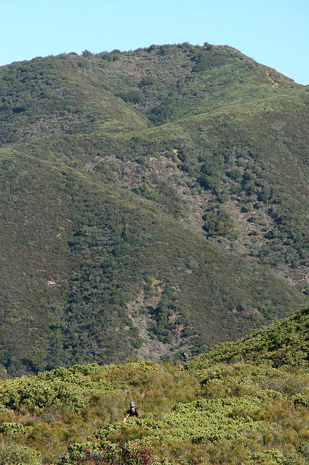
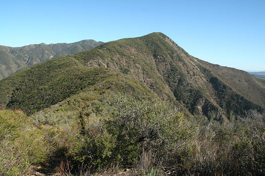
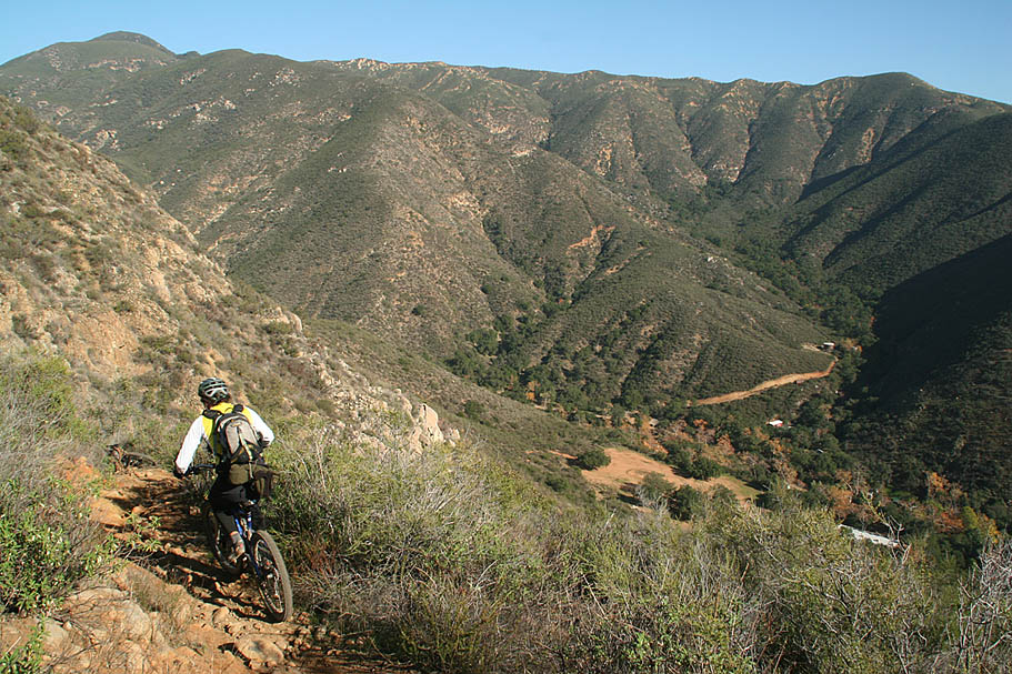
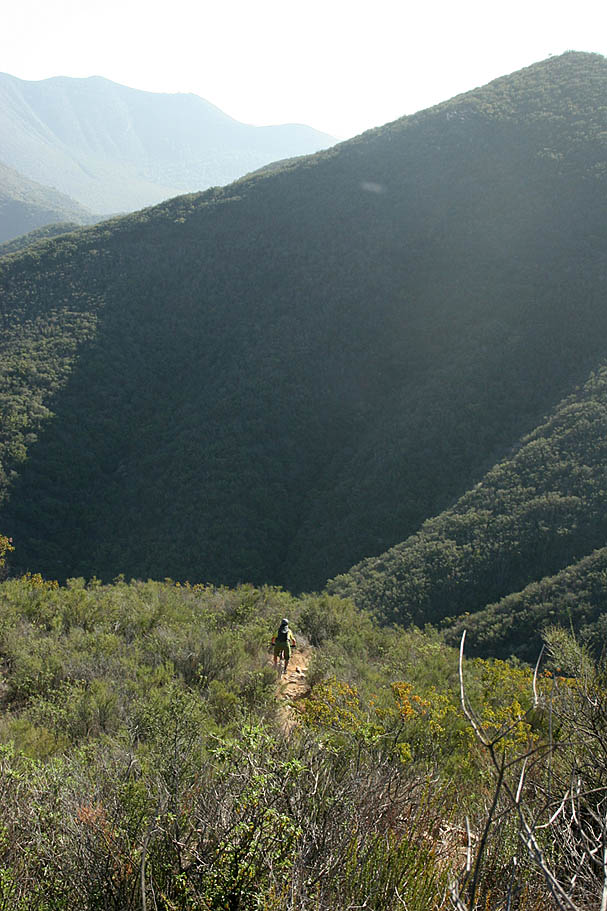
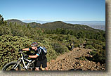
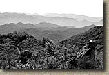
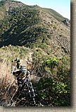
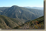
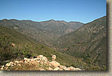
Take a look at the ridge lines in the background. You can often see where we came from. We came over the tallest peak in the background.
|
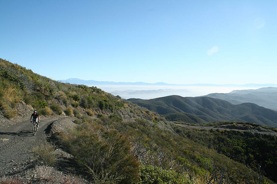
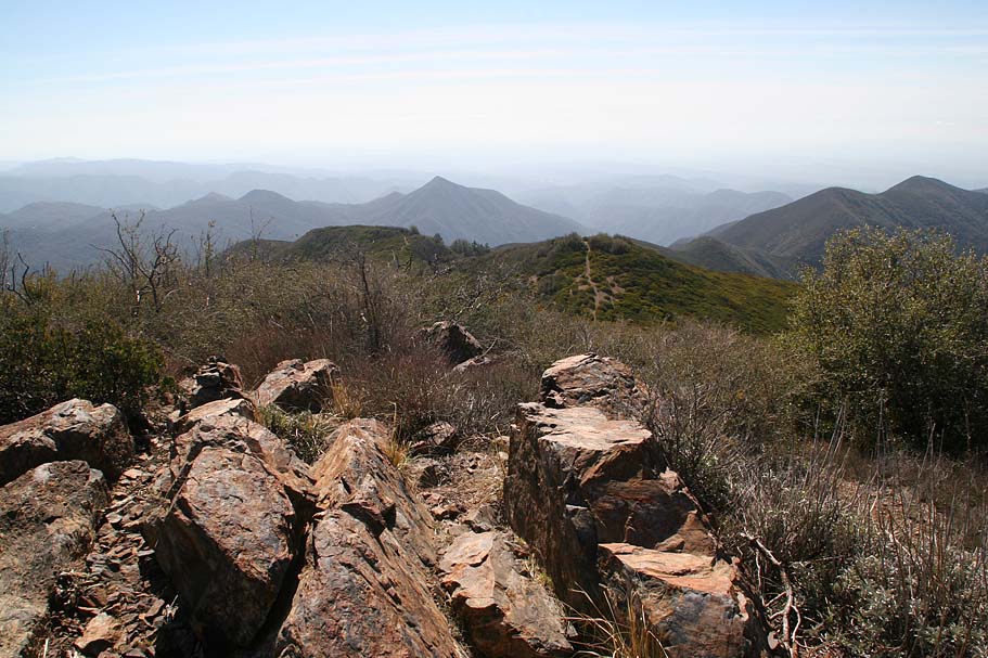
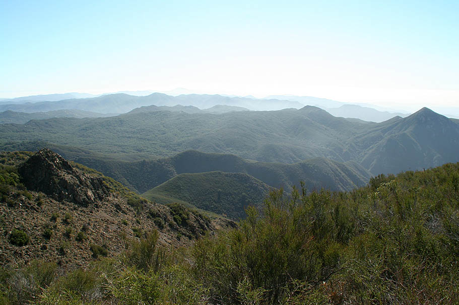
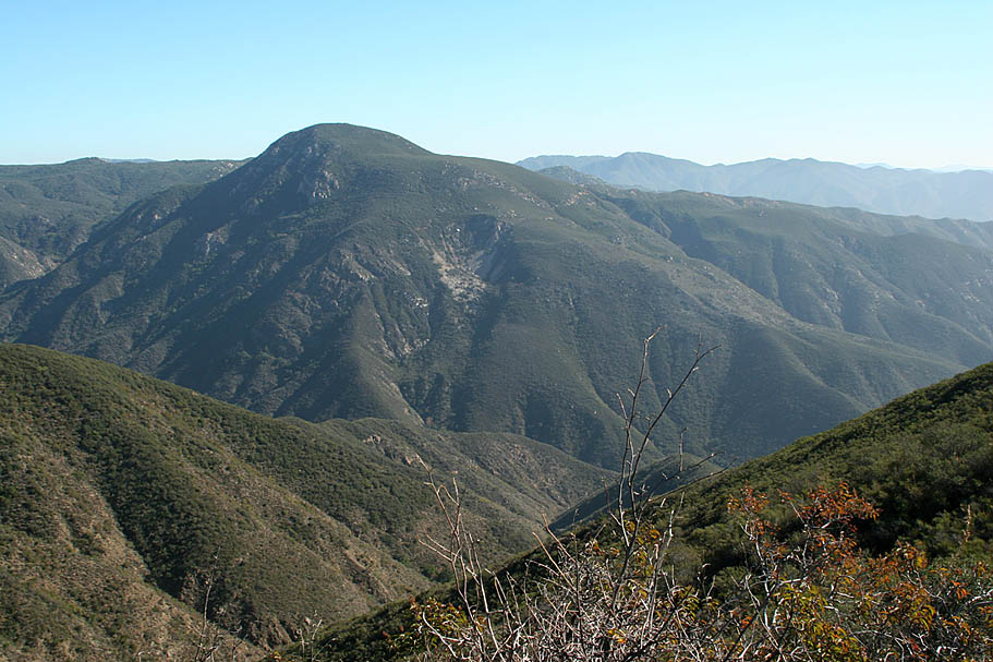
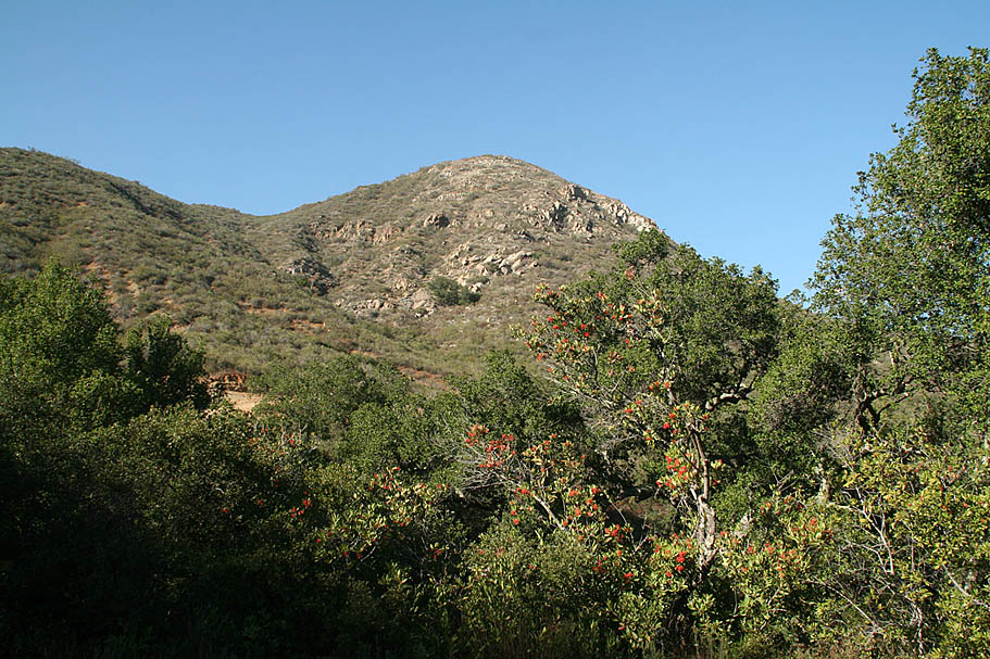
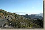
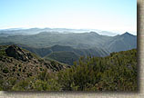
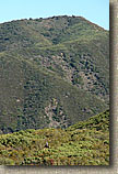
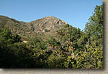
 On the later part of the trail you could look over to the south-southeast make out portions of the the San Juan trail. The picture to the left shows Sugarloaf peak. The San Juan trail comes in from the ridge line on the right and works it way up along the two flatter parts you can see just below the peak. We could see flashes from the shiny bits on the bikes of riders working their way up to Cocktail Rock. On the later part of the trail you could look over to the south-southeast make out portions of the the San Juan trail. The picture to the left shows Sugarloaf peak. The San Juan trail comes in from the ridge line on the right and works it way up along the two flatter parts you can see just below the peak. We could see flashes from the shiny bits on the bikes of riders working their way up to Cocktail Rock.
|
  At around 6.5 miles we came to the steepest section of descending we had seen all day. It was pretty rutted and loose and most of us had to tripod down at least a portion of it. There was one more quick hike-a-bike and then it was pretty much downhill all the way from there. At around 6.5 miles we came to the steepest section of descending we had seen all day. It was pretty rutted and loose and most of us had to tripod down at least a portion of it. There was one more quick hike-a-bike and then it was pretty much downhill all the way from there.
|
|
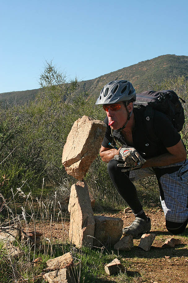
 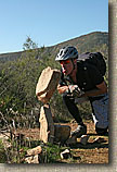 Now downhill does not me a cake walk by a long shot. We did have some pretty mellow and flowing sections but there were also some more white knuckle descent sections to deal with. About a mile or so from the bottom we came across some balanced rocks that a trail user showed some real skill in getting those things balanced. We would notice about six more of these along the rest of the route . Now downhill does not me a cake walk by a long shot. We did have some pretty mellow and flowing sections but there were also some more white knuckle descent sections to deal with. About a mile or so from the bottom we came across some balanced rocks that a trail user showed some real skill in getting those things balanced. We would notice about six more of these along the rest of the route .
|
With less than a mile to go from the bottom the chunk factory stepped up a few notches. There was one series of switchbackes that we sessioned for a while before moving on.
|
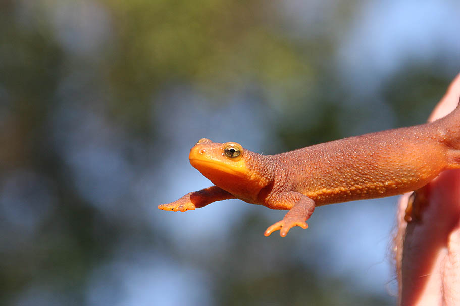
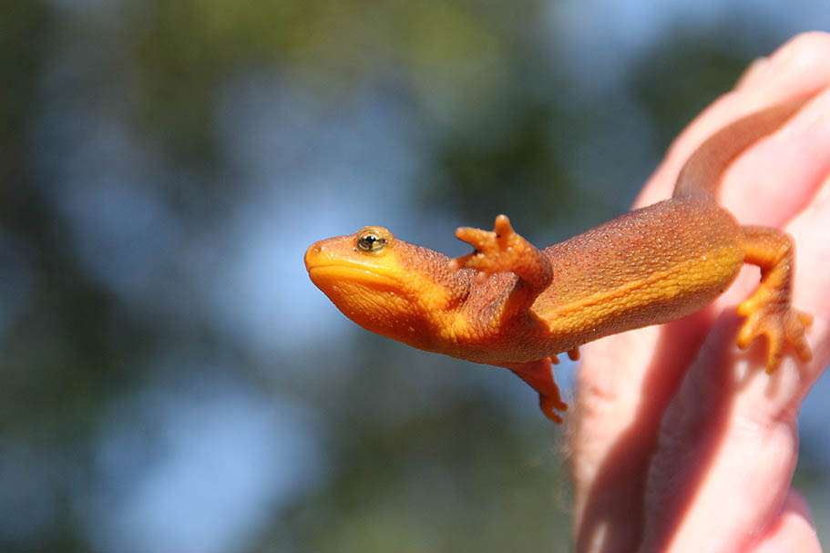
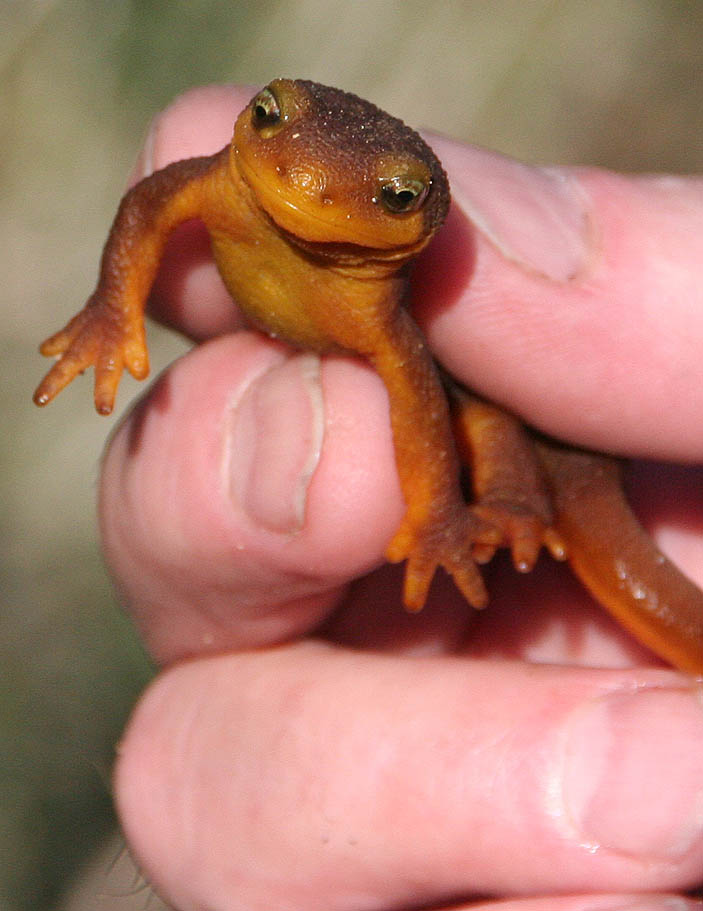
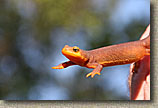
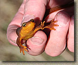
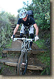  That final 1/4th of mile gets shaded again and contains of series of switchbacking wooden steps. Most of it is build pretty shoddy and doing little to help either erosion or function as steps. Just as we were doing the last steps. Steve spotted a California Newt on the trail, I have seen a few of these before and they are always pretty cool and pretty. They are somewhat brownish on top with a bright orange belly. They virtually have no natural enemies as their body contains a powerful neurotoxin which is harmful to other animal species including humans. The toxin is so powerful, that only 1 drop can kill up to 7 000 mice. It is the same kind of stuff in the infamois Puffer Fish. Lucky for us humans we need to injest the toxin for it to take effect. That final 1/4th of mile gets shaded again and contains of series of switchbacking wooden steps. Most of it is build pretty shoddy and doing little to help either erosion or function as steps. Just as we were doing the last steps. Steve spotted a California Newt on the trail, I have seen a few of these before and they are always pretty cool and pretty. They are somewhat brownish on top with a bright orange belly. They virtually have no natural enemies as their body contains a powerful neurotoxin which is harmful to other animal species including humans. The toxin is so powerful, that only 1 drop can kill up to 7 000 mice. It is the same kind of stuff in the infamois Puffer Fish. Lucky for us humans we need to injest the toxin for it to take effect.
|
|
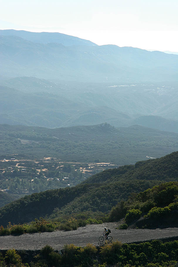
AFter checking out this little fellow, we put him back into bushes and continued along our way. The trail comes out along a dirt road and graded dirt lot. Following the dirt road downhill for about 30 yards, you will come out onto Hot Springs Canyon Road, where you will have a mild downhill cruise for about 0.8 miles back to the San Juan trailhead. This was a pretty cool trail even if there was plenty of hike-a-bikeage. I highly recommend this trail for those riders who feel they have mastered nearly all of the other trails in Santa Ana Mountains. |