All this remastering videos has really got me jonesing to get back on some trails. This video was from April of 2004 inZushi, Japan. The area was also known as “Duck Pond” as one of the entrances into the area required a righteous hike-a-bike up a trail behind a duck pond. This area was also part of bigger adventures into the Tennin, Takatori, Yokohama Woods and Kamakura trail systems. I had some really good times out in this area.
Some of these trails document back 800+ years
At 1:40 you will see us pass by the back of the Kumano Shrine which was first built in the eighth year of the Japanese Genroku Era which equates to 1696AD. As best as I can research it was last refurbished in 1978.
At 2:52 and 4:45 until the end. We are on the Asaina-kirodoshi. It is one of the seven greater notches through the mountains leading to and from Kamakura. Kamakura is surrounded on three sides by steep mountain and the notches served as defensive passages and passes through the mountains back in “the day”. “The day” in this particular case one was 1241AD.
I have been in this area of Japan quite a few times. Check out some of my other blog posts from those trips. If you would like to see some some old school photos shot with my then fancy 1.2MP camera check out this old page.
My final outing on the mountain bike for this trip to Japan was to head back out to the Takatori area east of Zushi. I passed through here on my lasting outing but it was mostly a transit through it. This time I wanted to futz around a bit.
Coming in from the south
I did some street riding from Yokosuka to make may way over to the entrance of the trail system. Like most of the trails in the area, you have to do so grunting immediately after the leaving the streets.
Trail Goodness
I entered the trail system were I had exited on the last outing and I was planning on retracing my way back up to top of Takatoriyama. I was however going to investigate all of the various spurs that split off of the main trail I was on.
There were a few spurs of particular interest to me as I remembered them as being really cool during my last time on them more than a few moons ago.
I just love these kind of locals helping folks signs.
So much steeper and slick than it looks
I was armed with my GPS loaded up with my personal archive of adventures in this area. The goal was to jog my memory and avoid a few of the spurs that will quickly dump you off the mountain resulting in pain and/or hike-a-bike to get back up to the prime riding stuff.
Trails old enough to have worn notches through the peaks of the hills.
On my way up to the summit, I did find the junctions that I wanted to hit on the return half of the route. I even came across about five other mountain bikers out on trail. One interesting thing I noted about this group was that while most of them while had rather high-end new bikes (Within 2-3 years), none of them were running single chain rings up front. Actually most them were running triples up front. My theory is that most them ride their bikes to the trailhead which according to where you live on the peninsula you can easily end up being 7-10+ miles on the streets/roads. While my rental rig is pretty much old and has seen better days I find the big rig to be a really welcome feature on it.
Once up to the summit, I hooked up with one of the trails that I used as part of the Takatori to Sengen-yama (Duckpond) connector. I was not going to take it all the way out to the duckpond trails today but it took me more a couple of minutes to reorient myself at a couple of the trail junctions. That section was just a good as I remembered. This was also my first time on the trail during winter so I was able to see a more things than in the past as most of the foliage was dormant. There were a couple of spots were I had never noticed that I was riding along a ridgeline that was less than 10 feet wide with extremely steep slopes on both sides with homes 100 plus feet below. Other times of the year the trail is just in a tunnel of green.
More cool Nippon signs
The particularly trail that I chose to peel off on led me to the top of a long series of stairs back down to a street. Riding these are just part of the mainstream skillset for riding here on the peninsula. The rental hardtail added some additional fun to this descent.
Da-da-da-da-da-da-da-da-da-da-da-da-da-da…
After knocking out the stairs, I did a bit of street riding to make my way back over to the north side of the Takatoriyama area where I then made my way back up to the summit.
Climbing is what this spot is really known for in the area
From the summit I retraced my way (the trail was really fun in this direction) back the spur I had scoped out earlier in the ride. This trail worked it is way towards the east along a series of ridgelines between two communities/towns. There are several exit trails off of these ridgelines and according to my archives there was at least one I had not done before.
It is my understanding that most of this section of trail has a history of being a primary pedestrian route between several of the local communities. (I suspect trains/buses my have lessened that usage in modern times). One interesting bit is that there are long sections of this trail which have about an 18″ wide section of concrete walkway poured down the middle of it. Pretty weird to have a “singletrack sidewalk” through the middle of the woods. The trail/sidewalk in the woods eventually took me off the ridgeline and in an area of the peninsula I had not been before. It was a bit of an adventure to find my route back to familiar streets which included traversing more topology than planned but it was all good stuff.
My final week of work in Japan end up being more work than I thought it was going to be so I did not get back out onto trails again. Well one thing is for certain, my fondness for riding a bike in Japan has not diminished after this visit.
After a week full of nasty rainy weather the sun was out! I headed to a trail system in Zushi colloquially known as “Duck Pond”. I have been there numerous time before but it has been about eight years since my last time here. I have a GPS track on how to get there, but I intentionally did not have my GPS turned nor did I look at a map to refresh my memory. Instead I opted to use the Swartz on this adventure. I enjoyed aspect of the retracing my steps. On this day I knew I had a right to make somewhere after getting on the backside of the Zushi train station. In this case a barbershop pole jogged my memory and it was smooth sailing from there to the trailhead. I find spinning through the small streets of Japan and route finding to be just as fun as the trails sometimes.
Using the Swartz
The cheery blossoms were going off of the trees at trailhead entrance.
Chery Blossoms thinking about spring
Ye Ole Duck Pond
Duck Pond
To get up on the ridgeline where the trails are require some work from Duck Pond. Nothing like some hike-a-bike get you going.
So much steeper than it looks!
Once up on the top the rolling sometimes contouring singletrack started.
Got Roots?
I was thoroughly enjoying myself getting reconnected with this “old friend” of a trail system. You get to see more stuff during the winter months when the foliage is sparser. In addition to seeing some of the exposure which is otherwise hidden you have more opportunities for distant scenery. On this particular day Mt Fuji could be seen.
Mt Fuji making an appearance along the trail
I did take one trail that started dropping elevation off in a hurry. By the time I realized this was really not the way I wanted to go down, I really did not want to go back up. So I took the trail down to the bottom and would get back up another way. I got back up onto the ridgelines by climbing the Asaina-kirodoshi. It is one of the seven greater notches through the mountains leading to and from Kamakura. Kamakura is surrounded on three sides by steep mountain and the notches served as defensive passages and passes through the mountains back in “the day”. “The day” in this particular case one was 1241. I climbed up from the west and I was quite satisfied with my performance through the technical sections of this climb. The picture below is from the saddle.
From here I did some more exploring/reconnecting with the trails up on the ridge that included passing by the back side of the Kumano Shrine.
Backside of the Kumano Shrine
When done on the trails up top I would come back by this shrine again and connect up with another trail that would drop me down into Asahina. The bottom of this trail rolls right through a community farm space which always makes me feel like I’m sneaking through someone’s backyard.
The trail going through a community farm
From here this was have been a good time just cruise back along the streets. There was however plenty of daylight left so I decided to go through one of my other trail systems I am fond of Takatoriyama.
The road route to get over there was not particularly straight forward. I decided to give Google Maps a shot at getting me over there. After selecting the walking route I was on my way. Well the walking route was the most direct route but it did include a bountiful amount of stairs. Once the route become clearer to me, I turned off the guiding voice of pain in my pocket and worked my way along the streets.
Off the beaten path treasures at Takatoriyama
As I climbed up the street on the north side of the mountain, I pulled off on a side trail I recognized to check out some of the shaded relief carved to the walks of this old stone quarry.
Off the beaten path treasures at Takatoriyama
My legs where getting pretty well cooked at his point so I opted to settle for a long distance view of the budda vice committing to the work to get over to it. Below is a closeup from my 2009 visit here.
The Takatoriyama Budda as seen on a 2009 ride through here.
Once at the quarry/peak it took me a minute or two to get my bearings straight for the connector I wanted. Twenty seconds down the trail I knew I was on the right trail as I recognized the spot where I had one hell of an endo in 2004 which left me with a cracked sternum. The Ghost of Biker Injuries Past has a long memory.
A section of trail on Takatoriyama
I had worked my way south along what seemed like half a dozen plus trail junctions. I ended up resorting to loading up my old GPS files as my legs were doing some serious wanking at this point and I was not up for more bonus mileage. Turns out I was less the 100 yards for popping out where I was expecting too.
It’s not a train!
The final bit was descending some steep little residential streets and then going through one of the largest pedestrian/cyclist tunnels I have ever been through. It is wider than the street I was on. After that it was about 6 or 7 miles of street riding back to the hotel.
It has been quite a few moons since I was last in Japan, and even more since being in Yokosuka. Work has brought me back for a few weeks and I am pretty stoked about. In addition to catching up with a couple old friends and reacquainting myself with the culture I was excited about revisiting some the trails I have fond memories of.
The rent-a-wreak
All of the mountain bikes at my local rental place were out when I first arrived. I really did not have much to ride anyway as there was plenty to do with getting the work project rolling. The second weekend a couple came in and grabbed one.
A mighty fine looking tree
The Fugatoyama trail system I hit up is near Zushi and the route would take me up to Fugatoyama. I had uploaded some of my old track into my GPS. Well so I thought. Turns out I gooned something up and while I had plenty of tracks for the other trails in the area, I did not have the trails I planned on riding.
I love this section
I have ridden the trails numerous times so while not having my “safety blanket” of old bread crumbs I felt confident about being able to find my way around.
Shrine/marker along the trail.
I went to the trails system near the Arden Hills are of Zushi and was soon it old stomping grounds. I had no issues with the figuring and the six trails junctions need to get my way up to the peak of Fugatoyama.
The trail has been around long enough cut a notch through the ridgeline.
After getting to the peak I retraced my steps back to the main junction that was going to take me down to the east side of the peninsula. There are a handful of opinions to get down from where I was at. The downhill was pretty awesome just as I remembered. I got to one trail junction I had real tough time figuring out which way to go. Either way would work but one of them was better than the other and extended your time on the dirt.
I pondered at the junction for quite sometime before picking and I picked…WRONG! The route I took dropped me out of the woods way too quickly. You also shed off so much elevation that I was not about to hike a bike back up to the junction. I guess I’m just going to have to go back!
After some snack Nippon style it was time to cruise back to Yokosuka and my hotel.
Okay I have been back from Japan for nearly a month now and I am just starting to get caught up of some of my goings on while in land of the rising sun. On one of my weekends there I set off to do a ride that I would involve a bit of this and a bit of that as far as riding goes. I know quite a few trails over here and while I wanted to get in some dirt time I was also interested in taking in some of the sights and sounds of Japan life as well. So I set off on my ride with a bit of eye for looking for new things along an old route.
I started out in Yokosuka on the eastern shore of the Muira peninsula (about an hour and change south of Tokyo) and pedaled the streets over to the city of Zushi. The route itself is always interesting with lots of Mom and Pop stores, stairways to temples and narrow streets and sidewalks. There is this school that I pass by along this route and while I Have seen kids at play on it a few times in the past for the most part it was empty during my passings. Today was quite different. There was some kind of the school function that involved both the parents, kids and facility. There were lots of chants, shouts, cheering and laughing on the playground. I was already well down the street before I decided I needed to check this out with more than a pedal by so I hit the brakes and went back.
There was a hilarious race being held that had me laugh my arse off. It looks like four groups of parents and children were split up into four teams. They were in lines at one end of the field and some guy/official was sitting in chair at the other end of the field. At the man’s feet were two burlap sack filled with something. One sack was small and the other was large. Once the whistle went off, the person at the front of each line ran across the field to their corresponding guy in the chair at the far end. As they approached the guy that had to play the guy in a single hand of “rock paper scissors”. If the runner won, they got the small sack, if they lost they got the big sack. Either way you the runners had to take their sack back across the field as fast as they could and hand it off to the next person in the line. For the subsequent runners, winning the rock-paper-scissors bout meant you got to keep or get the small sack. The entire race we exceptionally funny to watch.
After getting in my fill of giggles I soon veered off the narrow streets and onto trails on and around Mount Sengen. Most of the locals refer to this area as “Duck Pond” as the most common route has you starting at a small pond. It has rained quite a bit over the past week and the trails had a lot more moisture than I had expected.
The soil here is clay based and while it does not cake up on your tires at all , it is some exceptionally tricky stuff to ride on where power and balance but be carefully finessed to keep yourself from becoming an amateur geologist taking unplanned soil samples.
Now sprinkle in some leaves and wet roots over this clay and you have some exceptionally interesting bit of trail to content with. You can find more information about this kind of stuff on Slickopedia.
One of my favorite little curves along the route, the ferns in this area almost popping. Like many of the hiking trails in this area they have a long history of use to connect between the numerous temples throughout the peninsula. This particular trail dates back to around the mid 1300s. After dropping this trail off of west of Mount Sengen, I did a bit of residential street riding before hitting up another series of trails. Shortly after this I found myself at several trail junctions enjoying the scenery while I sorted through the scribbled on maps and disjointed GPS files floating around in my brain. Eventually I channeled “The Schwartz” and figured out my way (The other ways, are now officially on my to-do list).
The series of trails I was on at this point where leading me to Kamakura on the western side of peninsula on Segami Bay. These trails were created sometime between 1185 – 1333AD. It is really kind of cool knowing that you are riding a trail nearly four times as old as my home country.
The drop into Kamakura proper is not a gentle one, there is some seriously steep and slippery steps to contend with as most of your elevation is cashed out rather quickly.
The final bit of the trail before hitting tiny concrete pathways and alleyways that led down into the streets of Kamakura.
With its numerous temples and cultural shops and restaurants one could spend weeks enjoying Kamakura before they would feel as if they have done more than scratched the surface. For me it was a quick stroll along the streets.
The “scramble” crosswalk. All traffic briefly stops and pedestrian pandemonium ensues. Very cool to watch.
This was what I was really looking for on this day, some of the tasty street vendor offerings. This stuff is some form of grilled chicken skin/bits will tasty sauce and shredded veggies.
So what if is bad for me, but yeah there were a bunch of skinny Japanese folks eating this stuff so how bad can it be. After mowing this thing down and a bit of Japanese fashion watching I made my way back over to Zushi along the streets. I had big plans to hit of up the trails of Fugato-yama on my way back but by the time I reach the turnoff street my legs were wanking so I continued along the streets back to Yokosuka. Turns out I did just a few yards under 27 miles so I did not feel bad about bailing on the last riding area. Another good day to be on a bike and a great day to be out stroll around in Japan.
After spending a few days in Seattle finishing up some work, I headed out to Japan to spend a week scoping out a project for next year. As always I was hoping to squeak in a ride if time permitted. I rented a mountain bike for the duration of my visit to serve as my primary means of daily transportation and potentially some recreation as well. The weather was forecast to be pretty much icky for the week with Wednesday being partly sunny. Wednesday came around and partly sunny was indeed the case with a full serving of windy and brisk to boot. I was able to open my afternoon enough to get in some “Off-Site Strategic Planning” accomplished on the bike. While I still have some places to explore in this area on my list from previous visits, I would not have time for that with the shorter days October. I had a handful of miles to ride on the streets to get to Zushi City where I would pick up the first part of the afternoon’s dirt adventure. I had nearly forgotten just how culturally interesting in can be riding on the streets over here. Narrow sidewalks, mom and pop businesses, scooters whizzing by, Japanese School Girl Uniforms, lots of people out walking and peddling, etc… It is just an intersting scene.
On one section of road with a bit of a climb in it I came across a new sign that was not there in June of last year. I can’t read this sign but I know what it means. And I like it. The Japanese have a knack for iconing things so that just about anybody can figure things out. Rider Up!
Once I made it over the Sengen Trails which is commonly referred to by us Engrish folk as Duck Pond since the trail starts at a small pond that typically has ducks in it. What a bunch creative Gaijins we are . The trail starts with a heiniouly steep hike-a-bike up to a ridge that typcially requires you to shoulder the bike. With the rain the day before I knew this was going to be a fun section with plenty of slick clay. It was about this time I thought about the fact I had never taken the trail around this little pond. So I decided to delay my hike-a-bike fun and go around the pond. I was fairly stoked to find that at the end the pond was a little boardwalk that was quite fun on the bike. It was just tight enough to be interesting and combined with the really brisk air and the thought of falling into the shallow mucky end of this pond made this section downright fun. I had to do it a couple of times in both directions. This was a pretty cool 5 minute detour and added some newness the ride right out of the gate. The Hike-A-Bike up to the ridge was every bit of clay treachery I expected, but I was soon rolling along the ridgetops.
After climbing along the trails I made it up to the top of Sengen Hill (or Peak – can’t remember ) there was some nice views of the mountains in the Hakone National Park in the distance, but it tooks some effort to see as mother nature is reclaiming the clearing in a hurry. As is often the case, Mt Fuji was hiding behind distant clouds. From here it was time to head down and I took one of my favorite routes down through the Tennin trail system before popping out on another street.
After a short bit of road interconnecting I got onto a series of trails that headed westward towards Kamakura. There are some really good trails that are quite popular with hikers. Many of the trails are hundreds of years old with some of the more direct routes between the temples being over a thousand years old.
There are several sections along the route where the trail cuts through the top of the ridge via a slot or notch. Sometimes the notches are 20-30 feet deep. I orginally thought that this was a result of the trail being “cut” by some machinery or tools sometime in the past. The slots in the ridge were actually created from the countless footsteps of people who have walked these trails for hundreds of years. Feet, time and errosion have cut through the ridge tops. After riding and climbing along these ridges the exit was like most of the trails in the mountains around here, Hike-A-Bike up and White Knucklers on the way down. The wet conditions earlier in the week made the descent quite challenging to ride and not much easier to walk. There was a least a couple of clay samples taken.
Once I dropped off the ridgelines down into Kamakura I worked my way along the streets back to Yokosuka and my hotel. Later on that evening I met some old friends for dinner to catch up on thngs and to fawn over their new baby girl. It was good times on pretty much all facets of the day.
I finally got all my notes, photos and map information together for the Takatori-yama area near Zushi and Yokosuka, Japan. I added a Google Earth KMZ file to this review that is mashed up with my photos and trail notes as well as Japanese topo map to help you get to know the area better. One thing I like about this setup is that you can find all sorts of other information on the area in addition to photos from other people. If you find yourself in the area you should definitely check this place out. For all my peeps on the Far East Side that call this place home, keep the trails ridden and shot me some more information on the trail spurs I did not get to.
The weather Gods showed favor on us last weekend as we had a couple of days of no rain and it looked like it was going to hold through most of the weekend. Friday afternoon, Dan and I headed out for some riding in an area near Zushi.
We were enjoying the afternoon as we had plenty of daylight ahead of us. We had time to stop and smell the flowers (so to say)
Over the course of ride through the area we came to one of those spots were either going to be at the apex of your loop or you are going to jump ship and head for another area near Kamakura and extend your loop. The fork in the road at this junction was at the top of a pass know as the Asaina-kirodoshi. Kamakura sets on the ocean, but is also surrounded on three sides by mountains. They are not tremendously tall, but really steep. For defensive purposes notches, passages and passes call kirodoshi were cut through some of these mountains. The Asaina-kiridoshi is one of the seven greater kiridoshi leading in and out of Kamakura. It was built in 1241 and is rumored to have been built in a single night. We opted to descend the eight century old road down towards Kamakura and see if I could figure out a route I followed a local on five years ago.
After quite a bit snooping around I had to resort to “Umm, it feels this way” tactics. My “it feels this way” tactic has gotten me and the poor saps with me in trouble on more than a few occasions. We were starting to watch our daylight as things can get dark really quick under the foliage of the forest. Just when I was really starting to doubt if I was on the right track, I recognized a trail feature and had a “full navigational recall” occur. The feature is a trail junction know as the Okirigishi juncture, in the Nagoe Kirtoshi pass. (It was too dark in this area to get a photo) This pass was used primarily from 1185 to 1333 to connect the Kamakura and Miura areas. It was just a narrow path back then just wide enough for a single horse to pass through. Today it is still narrow and quite a bit on the burly side with some natural stone steeps that require your due diligence to navigate.
There are a few spots along the trail were some trees were and underbrush are strategically cutout to provide scenic viewpoints. It was amazing to see home much light was actually being obscured when under all the foliage. Below us and in the distance were could see where we were going to be dropping out at.
From here to there took a little longer than expected and there were a couple of trail junctions were some thinking had to be done before choosing a direction. We ended popping out right where I expected (okay hoped is a better word 🙂 ) to and we still had just a bit of daylight to play with. From here we did some street cruising back to where we started from. We did make a pit stop along the way at a small mom and pop restaurant that my friend Ken turned me onto during a visit last year. The food here is just awesome with the kind of yumminess that “grandma used to make”. The husband and wife who run the place are in fact grandparents and she kindly treats us like one of her grandkids. She sees enough of the local mountain bikers that she keeps a newspaper around so that we can cover up the chairs so we do not funk up their chairs. She even helps me out when I screw up my Japanese and notices when I use a new phrase. It is always more than a meal when eat here. I slept good that night.
The following day still looked good and by lunch time I had polished off all of the work than needed to be tended to so Dan and I headed out for some more exploration. This would be another area that I had ridden a few times five years ago and but I was always just tagging along. We did quite a bit of street exploration before finding a route up into the trail system. I had never been this way before to get up into the trail system and we went for quite sometime before we came to a trail junction that “felt” like I had been here before. Riding around over here would be a whole lot easier if I was just learn kangi, hirokana and kitokana.
A few trail junctions later and I knew where I was at and where we were going. Takatori has some really cool technical features strewn about on the trails. The section below is gnarly little root fest and it is also the spot where five years ago I cracked by sternum and bruised up a few ribs pretty good.
The summit of Mt Takatori is the site of an old stone quarry that has become a favorite spot for area climbers. There are at the least a dozen such faces where folks can come and get thier climb on.
The quarry area also has some cool rock features to play on so we did. Here is Dan giving his front tire and fork a workout. Take note that Dan is riding with flat pedals and no shin pads. Dan told this was the first time and months he had gone for a ride without them on.
I have a feeling that Dan is going is not going to forget those next ride.
After playtime on the summit, we set off on another trail that included a bunch of steps to descend, but the cultural payoff is really awesome. You are literally just riding along and pop out into a clearing with this in front of you.
This carved relief statue is around 30-40 feet high and is simply impressive. If you do not say something along the lines of a awesome, wow, or holy crap when you first see this then something is wrong with you. Dan was pretty stoked to see this. After this point we continued along the trail that included lots of steep descents and natural log steps that dumps us out at the bottom of Takatori off the north slope.
From here we worked our way back up the mountain on a easily climbable road. Once back at the peak were retraced our way back to where we started. I have a new to-do list item to go back and explore the numerous trail juctions in the Takatori area. By the time we got back I was pretty much done and spent the rest of the evening relaxing. A couple of days well spent.
I arrived in Japan last Saturday for a handfull of weeks worth of work in Yokosuka. The travel schedule to get here is a tough one as your internal clock is totally thrown out of wack. I spent most of the week just stuggling through the day and having a tough time sleeping at night. It took until Thursday for my “body clock” to get adjusted. Finally getting some rest was a good thing as I was looking forward to getting onto some single track this weekend. I shipped my 6.6 here vice putting it on the plane so I would not have lug the cumbersome box on the trains to get to Yokosuka from the Tokyo airport.
My bike had not arrived on Friday so I rented a hardtail. One of my friends and his wife had just purchased a new home and invited me over to check it out. I declined on having them pick me up at my hotel. Instead I opted to have a nice cruise along the streets which I had nearly forgotten what a cultural experience you can have along the streets of a foreign country. I had a nice time visiting and catching up on things with my friends. Afterwards, I had a really cool late night cruise back to the hotel.
The following morning it was time to get onto some dirt. I had not been on the trails between Zushi and Kamakura since 2004 and I was looking forward to it. It takes a quite a bit of riding along the streets from Yokosuka to get to the trailhead, but like last night riding along the streets is an experience all to it’s own. I had barely started on my way when there was a bunch of of activity going on over the roses at Verny Park.
It had been a long enough since I was last here that there were spots where I was unsure if I was going the right way or not. Every time I would start to get concerned about my route I would see something that would jog my memory. I love riding when you are route finding or someplace new as your senses seem to elevate just a little. While this route was more about rediscovery, it was extremely fun just getting to the trailhead.
Once I got to the trailhead, it was time to get some hike-a-bike on. Like many of the trails in this area, there are some steepness to be dealt with. The opening trail up onto the ridgelines was every bit as steep as I had remembered. I did not count them but I’m guessing there are at least 100 wood log steps that got the calves burning in no time flat.
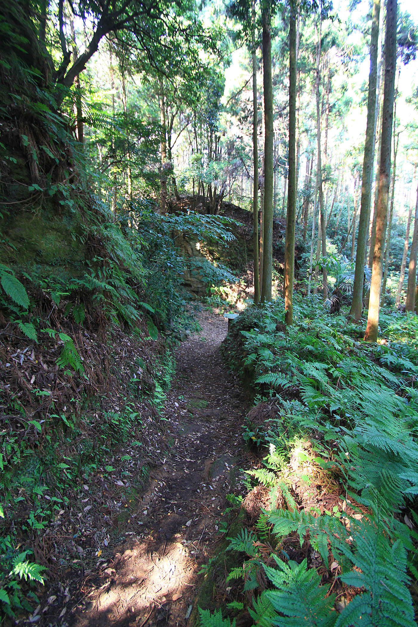
Once up onto the ridge the trails flowed and swooped gracefully through the trees. Most times there were fairly buff in nature but there were numerous section of roots and rocks to test your skills. I rode here many times in 2004 and this ride was like catching up with an old friend.
I forget the Japanese name for this section of trail but I believe it loosely translates to “Roots of Death”
I like the way this signs bridges the language barrier. 🙂
Visually this is one of my favorite sections of trail out here as it passes by one of the numerous temples in the area. Nearby Kamakura is steeped in deep history and many of the trails are centuries old. I played on the trails here until I late in the afternoon and then enjoyed the street cruising back to Yokosuka. I finished the evening off with a tasty plate of curry from a tiny mom-and-pop resturant that I was turned onto during my last visit here. It was not a bad day to have a bike 🙂


