Mountain Bike Bill, The Dirt on the Dirt

Iron Mountain and Ellie Lane

I had been needing a  little Iron in my diet so a ride out at Iron Mountain near Poway was in order.    This place is pretty popular with the hikers so if you are going to ride out here you need to plan to be real patient and mind your trail etiquite  as you will certainly have plenty of interactions.  That is one of the reasons why it is best to do this ride on a weekday.   It has been some time since I was last out here and I was quite shocked to see some of the maintenance that was done to the lower half of the Iron Mountain trail.    There were lots of sections were most of the rocks has been either removed from the trail or buried in decomposed granite.   While it may make the trail smoother in the near term I think it will cause more erosion problems in the long-term than it will fix.   There were some sections that had been needlessly widened and debrushed to the point where they may never recover as the vegitation that stabilized the soil has been removed.  

Luckily the upper half of the Iron Mountain trails has not been touched (yet) so the iconic rocks and technical features of this trail are still intact.   The trail can be quite exhausting on the way up and on more than one occasion I had to stop and catch my brest breath.   I felt like a boob for not being able to clean some of the sections that I have handled in the past. 

After a nice break at the top it was time to play on the way back down.  The chunk of this trail is always a challenge and we sessioned our way back down the trail.

Steve working an interesting line.

One of numerous gnarly switchbacks.

Steve taking a roller

After the Iron Mountain trail we hooked up with the Ellie Lane trail.  I had nearly forgotten how much of a grunter it is get get up up the first saddle where the downhill chunk-o-rama starts. 

Once over the first saddle on Ellie Lane there was some high quality chunk to tackle on the way down.

Steve taking on an interesting line.  After the first chunky descent were would have two more grunt/hike-a-bike sections before the final technical descent of the day.  By the time we got down I was feeling pretty worked over but stoked to have got in some solid technical riding.

From there we had some mellow cruising to loop back over to the trailhead where…. 

the marvels of modern MTB frame designs could be really appreciated.  This Santa Cruz frame features a built-in bottle opener!

El Capitan Open Space Preserve

Last Sunday and this Wednesday I spent some time exploring the El Capitan Open Space Preserve located near Lakeside.   El Cajon Mountain is the extremely promient granite mountain on the preserve you can’t miss if you are driving into El Cajon from the west.  And if you have ever ridden Anderson Truck Trail it is mountain on the other side of the reservoir.  I can’t count how many times I have said I wanted to get up on that mountain and snoop around.  I finally got around to doing just that.  

So for the first go around on Sunday, I checked out this area on a whim.  I literally left my house in the morning and did not know where I was going to go ride.  I did not feel like driving forever and I did not feel like the usual stuff.   After remembering how many times I had commented on “What’s on that hill?”  I started pulling up maps on my phone and headed towards Lakeside and ultimately the staging area for the El Capitan Open Space Preserve off of Wildcat Canyon Road.  

I knew I was in for some climbing, and it started right out of the gate.  After climbing about half a mile on dirt streets I came to the trailhead proper and keep going on a sorta wide singletrack up from there.  The going was steep in spots but I soon came out to a saddle and junction with an old mining road.   I could see lots of ups ahead and some of it looked steep.

All along the route there were wildflowers here and there making an appearance.  

It became pretty clear early on that there was a lot more climbing to be done than the simple bottom to top elevation would lead you to believe.  There was a lot of “UP three” and “DOWN one (sometimes two)” action going on.  One of the mental bummers of this was that you could see that you were just going to have to pay back the elevation real soon.   While most of the climbs were workable (hello granny gear) there was some heinous pitches that required the foot gear.

I was amazed how much water was up here on the mountain, little brooks and the sounds of running water were often heard along the route.   One week ago to the day, there was snow of this mountain. 

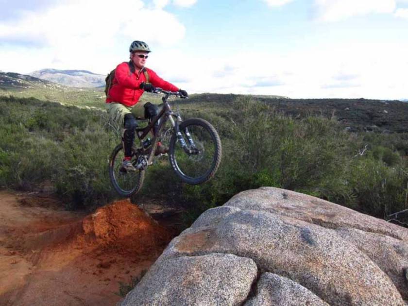
One of the things that had been intriguing me about this mountain was all the huge slabs and rocks that could be seen from afar.  On this first outing when I got up to what I thought was the main ridgeline with the bulk of the climb behind me, I started snooping out lines and playing on some of the rocks. 

I ultimately wanted get on the east end of the mountain to be be able to look down at El Capitan Reservoir and across to Anderson Truck Trail.  After checking out an off-shoot trail I saw I still had a long way to go to get there and no trail heading directly in that direction.

Also in this area I came across an old mine that was pretty cool looking.  It had three opening that only went back about 20 feet before stopping.   I don’t know if this was its as-left state or wither the shafts were later plugged but it was an interesting bit of history carved into the rocks.

Beyond the mine site the old mining road turned downhill in a big way.  I followed it for a ways and it looked like it was going off of the ridge and towards the Barona Indian Reservation area.  I did not have good cell coverage here and I could not pull up any kind of aerial or map views of the area.   I thought about continuing on but the thought of slogging back up in the other direction or having to ride way around on the roads did not sound appealing at this point in the day’s effort.   So I chocked it up  to thats what I get for not preparing enough for this exploration and decided not continue downward from there.  I started heading back and played on some rocks here and there on the way.  At the bottom of some of the descents, my rotors had that dark blue hot look and the smell of burning pads filled the air near the bike.

Fast forward to Wednesday and armed with some new information, I repeated the Sunday ride but pressed beyhond the sadddle at the old mine and commited to loosing a good chunk  of elevation, knowing that I was just going to have to gain it back.  The descent had some pretty gnarly steep bits.

(The “Much Steeper Than It Looks” moniker applies here)

I know I did not lose as much elevation as I thought, but knowing that you have to come back up this stuff later in the ride makes the terrain seem much steeper and each foot of descent seems like it is going to be 18″ of gain going the other way.  Just as Google Earth had shown the old mining road soon turned aburptly back towards the ridgeline and started going uphill in a semi-heinous manner.

Part way up this climb there is an old jeep along the route that was pretty cool to check out.   Not sure of the era, but it seemed way old.

The rocks and natural features along the route were also pretty interesting but I did not spend anytime exploring these as it was later in the day and I had some uphill ground to cover still.  To compound things, the signs at the trailhead said the gate is locked at 5PM which seems a little crazy. (Why not something reasonable like “sunset”)

I soon got up to a junction where if I would continue straight to get out to the point I was looking to get to.  Going off to the right would take me to a viewpoint on a secondary peak, and to the left was a foot trail that would take me up to the main peak.   There were still no views of the reservoir at this point.  The old trail out the point straight ahead was quite overgrown, way rutted  and downhill from were I was at so I opted to forgo going that way.   I spent some time working my way up the foot trail towards the main peak but once it started becoming mostly a rock scramble I decided to turn around as I did not want to test the 5PM gate policy.

After turning around I enjoyed a sizable bit of tricky descending before getting back into the granny and foot gear.  I had plenty of UPs to do on the way back but I was ultimately loosing elevation.    I made back with 15 minutes to spare before the gate was scheduled to be closed.  I was pretty good and pooped.  While I had only covered 11.5 miles I had climbed 3,491 feet.   I think I am going to go back out there maybe once more on a weekend just to fully see the rest of the place, but I don’t know how much more beyond that I will spend out here as it is ultimately a high price to pay to play kind of place.

Yet More Alpine Wendesday Fun

Another Wednesday and another day to go play in Alpine.

Climb Climb Climb

The winter storm over the weekend through a nice dusting of snow on the mountains.  There was snow all the way down to ATT on Sunday, but I had retreated up the hill by Wednesday.

A little airtime

There was much discussion about how I look way too serious and tense when getting air or in the technical bits.  

So some funny faced air-time was in order!   I did actually feel more relaxed on those moves while trying to make a funny face.  Wither it actually helped or not who knows, but it was cheap comedy either way.

I started thinking about the 911 roll today.  I could not pull the trigger but gave it a few run-ins.  Stay Tuned.

Oh Yeah, there was some Squirrel Hucking added into the mix today as well.   (No dead squirrels were further harmed in the making of this blog post)

Wednesday Stoke in Alpine

Time for another round of Wednesday fun in Alpine.  The weather was starting to roll in but most of the time sky was full of white puffy clouds with a pretty blue backdrop. 

I had not been here since the big batch of rain we had a while back and it was pretty astonished to see all the little changes momma-nature had done to the place.  Of course the the trail elves has been out making “shoes” so to say. 

Historically I have had a bad habit of riding this place in the middle of the summer and stewing my brain in the process.   I  have ridden this place quite a bit over these cooler months and it was quite nice to do the climb in reasonable conditions.  Maybe I am not as retarded as I thought (ask me again in August!)  Once at the top it was time to play in some chunk.   Steve up near the top.

Me getting started.

This bump-a-bump line gave me some troubles today.  It took me three tries and a little skin exfoliation to get it done today.

More playing on the rocks.

The Big Black Fatty coming in for a landing.

The trails elves had tweaked this kicker since my last time here and the thing really pops up now.  I carrried nearly all the way over the rock tranny to a rather harsh landing.  Yeah for forgiving suspension.

The descent down the main trail was pretty awesome as the dirt has just right moisture in it be both velcro-ish and stupidly fast.   The dirt was way too good to stop and take pics.   Another great day on a bike.

Noble Canyon and the BLT

What an awesome weekend I had.   Jeff Sherman was down for the weekend from Kernville for the weekend and Bill O’neil came down from West LA as well.   Friday was yummy grub and tasty beverages at Stone Brewing Company.   Saturday was Big Laguna – Noble Canyon ride.   We had a sizable group of 11 and did it in semi-slacker fashion by cutting out the Pine Valley and Indian Creek segment and doing a point-to-point ride versus the classic climb-o-rama Tour De Noble

We started thing off up top by taking the Redtail Roost singletrack down into Aqua Dulce,  from there we worked our way up to the top of Los Gatos Ravine.  We did of course play on a log or two in the process. 

Trickier than it looks.

Once on Los Gatos we stopped and played on an feature or six.   Here is “Dental Plan” 

 Some more of “Dental Plan”

There was some log ridage and log pileage to be played on.

Once down on Big Laguna Meadow.  We went clockwise around to the west side where we found the “Water of the World” pond almost frozen over. 

Halfway up the west side we cut back over to the east side of the meadow at the lake and the went up the meadow counter-clockwise.  There was some log chunkage found to play on before making our way over to Noble Canyon.

Noble Canyon was as awesome as always and the there was some log airage to be had.  

As well as some Rock Airage.

Stairway to Hell did not disappoint.

Stairway Chunkage.

A bit of roman wallage on Extra Credit. 

After polishing off the trail we were treated to the first release of Kernville Brewing Company’s Chocolate Porter creation courtesy of JFSH…….Tasty Stuff!

A mighty fine day on a bike with old and new friends a like.

Sycamore and Santee playtime or “Plague-aholic” rides again

Wednesday afternoon I got out for a ride out at Sycamore Canyon and the Santee area in general.  Steve had been off the bike for over two weeks with what he described as “The Plague”.   Last week  the germal infestion caused an aborted attempt for a ride with Steve, but this week “Plague-aholic” made the show.  Not wanting to push his recovery luck we opted for something much more XC oriented and mellow than the typical Wednesday stoke rides. 

This area is pretty singlespeed friendly  so I decided the bring out my one-geared steed out today for a little bit of trail luvin.

XC mellow day or not Steve has a passion for rocks, so I made a point show him a couple of play spots

The steep head angle of this bike was not most rock hounding capable rig (for my skills) so picking the lines carefully was the name of the game.

We ventured over towards Santee and did some more line scopeage and rock play.

The texture of this rock was pretty freaky and we could not help but want to call this the “Brain Rock”

We played and snooped around until daylight became and issue and then headed back.  Not a bad way to spend a Wednesday afterwork.

(Photos: Mostly by Steve, all with his camera)

A windy and chilly romp through the Cuyamacas

Today I decided to go check out Cuyamaca Rancho State Park as I had not been there after the 2007 wildfires.   We have been having some awesome weather as of late here in San Diego so I was blissfully expecting more of the same for the ride today.  The early morning clouds hovering over Vista made me think all was not going to be well up in the mountains.  I keep just about all of my cold weather stuff in a small bag, so I chunked it in the truck and was on my way.  At the the trailhead it was overcast and the truck thermometer read 40 degrees.  Not heinious by a long shot and I had the right gear.  However, upon opening up the truck door the breeze was quite biting.  As I was getting all layered up what I would guess were gusts of up to 20mph were letting me know that today could get real interesting.  I started off from the Sweetwater staging area and  headed north up the west side trail towards the vistor center.  I had barely gotten started when I came across a flock of wild turkeys.  They were quite content to run ahead of for quite some time before veering off the trail.   I had only brought along my ultra wide angle lens for the camera so trying get a good shot of them would have been futile so I just enjoyed the encounter and rolled on.  Once at the visitor center I hooked up with the Upper Green Valley Fireroad and continued northward.  

Taking the Upper Green Valley fireroad is part of the large counter clockwise loop known as the “Grand Loop”  that I was intending to do today.  The cruise/mild climb up Green Valley was pretty nice as I was mostly sheltered from the wind but I could watch the clouds spill over the top of the ridges to the west and continue on with great haste.   Often times I could hear the winds rippinng across the top of the ridges.  


At the bottom of Soapstone Grade I veered off the traditional loop to check a trail I had not done before.   While the trailsign was not up, I believe it is called the Upper Green Valley Trail but I have also heard it referred to as the La Cima trail.  The singletrack climbed gradually for the most part and it had some nice rocky character here annd there.  I was getting a little more exposed to the wind the further I went up.  About 3/4th of the way up this trail (about a mile) I left Cuyamaca Rancho State Park and entered the Anza Borrego State Park.   The trail ultimately went out to the two-laned Sunrise Highway and loosely paralled it both to the east and west.  I went to the west and after a bit of climbing followed by some swoopy descending I connected up with the California Riding and Hiking Trail (CHRT).

Once I was on the CHRT, I was not sheltered from the gusty winds much and the intensity of the winds had built up.  (I later learned the winds were 25-35mph with an advisory out for gusts up to 65mph)   I often had to countersteer into the wind and just put my head down and pedal on.

The CRHT was in great shape and I was amazed at how much water was in Lake Cuyamaca. I had not ridden this section before and I was impressed. 

The open alpine meadows were exceptional to look at and the singletrack was swoopy and fast once things turnned slightly downhill.   Even with a now biting cross wind, there was some zippy sections along through here.  I also came across a pair of coyotes in this area.   They were certainly not the acclimated to humans types like we often seen in the semi-urban areas.  This couple were definitely not interested in being anywhere near me and they were heading up the ridgeline in  a hurry.  After 2.4 miles the CHRT connected up the top of Soapstone grade and I continued back along the traditional Grand Loop route.   Once I made it out to HWY79 I headed over to Milk Ranch Road, I had a decision to make.  The wind was gusting pretty bad and my toes were getting pretty darn cold despite the winter wool socks I had on.   I could climb Middle Peak and descend the Black Oak trail or just skip it and stay on Milk Ranch Road.  After grabbing a very quick bite to eat and shaking out the feet I decided to do the climb even though I could see that the clouds were completely engulfing the upper half of the peak.  

This place has never been the same since the 2003 wildfires.  It is such a tragedy the awesome old oaks and goliath pines on this peak burned in that fire.  As I made my way up the mountain I could not help but be once agained saddened by the loss of such a forested treasure.    

As I neared the top I entered the clouds and while I was sheltered fairly well from the wind coming from the far side of the peak, I could hear it howling above me.  The Middle Peak fireroad does not go directly over the peak, instead goes close by it  as it circles around to the other side of the mountain.   I was not interested in any side trip up up to the actual peak here as it had gotten colder and moister.  As the fireroad transitioned over to the east slope and topped out at 5,800 feet the shelter from the wind disappeared.  It was now in a very stiff cold and gusty headwind.   Luckily it was time to turn downhill on the Black Oak Trail.   

I last remember this as a ripping fun singletrack with lots of rocky character.    While most of that is true, it was a very segmented ripper today as there were at least a dozen deadfalls across the trail.  The visibility was also an issue due to the clouds and the fact that I had to keep wearing my glasses to keep my eyes from being dried out in seconds.  Once down to the lower half of this trail the deadfall was no more and things got zippy was again.   Somebody somewhere downwind may have heard the faint sound of giggles riding along with the clouds as I descended through here.  The Black Oak Trail drops down to Milk Ranch Road where I hooked up with the Azalea Springs, Fern Flat, West Mesa and Japacha series of fire roads to get back and my truck.   The visibility was rather short through most of this route and the wind was still often stiff.   My feet were freezing, and I was ready to get to the truck.  The good news was most of this route was a zippy descent and who was I to argue with gravity.   Fireroad or not, it was plenty of fun.  I even got to see a herd of deer up close along this route that included two sizable bucks.    I was happy to see my truck and was once again was thrilled at exceptional quality of it’s heater.   While the elements made today a bit of challenge, it was once again a good day out on a bike.

Midweek Cowles Mountain and Pyle’s Peak

Wednesday was a mighty fine day in San Diego so an after work ride was in order.  The ride today was Cowles Mountain and Pyles Peak.  I have done this ride quite a few times and I always enjoy the technical as well as cardio beat down this place can put on you.  I started the ride at Mesa Road on the Santee side of the mountain and hooked up with the Mesa singletrack.  This singletrack has a bunch of railroad tie waterbars that can really help you work on your uphill ledge climbing skills.  The nice thing about them is you can usually pick how much ledge you want to attempt as the waterbars are a uniform height all the way across the trail.

I still have no idea how many of those waterbars are on the trail, but it is a lot.   It has been some number of years since I cleaned this trail and today was no different.  I suppose if started taken the easier lines I would had a much better chance of cleaning the trail but what is the fun in that.  Yes the singletrack kicked my ass but I certainly felt a little polish on the ledge skills by the time I came out on the fireroad.

It has also been some number of years since I cleaned the freaking steep fireroad up to the top.  However I did just that on this day.   I can’t say that it was physical prowess that got me up the fireroad, nope wisdom was the primary factor in cleaning the fireroad.  Right from the get-go I put the bike in the granny gear and paced myself up to the top.  Having done this climb some number of times I knew right were the easier spots were and I made a point to go even easier through these spots to try and get the heart and lungs under control.   The fireroad is steep enough that in quite a few spots I had my nose just inches above the handlebar to keep enough weight  on the front wheel to keep it from popping up.  My the time I got to the top I was microseconds from a cardio meltdown but was glad to pedal it out.  It was not the most macho way to clean the fireroad but it counts. 

The views from the top were pretty darn nice with quite a few people out on the mountain.

After I was able to get my lungs back into my chest.  It was time for the out and back trail to Pyle’s Peak.  I am a big fan of the trail.  It sees a ton less use than the rest of  the trails and has quite a bit of technical character to it.

The Pyle’s Peak trail is not too long but it is a lot of fun.  Above is the view from end of the Pyle’s Peak Trail looking back Cowles Mountain.   Yep there was some work to be done to bet back up to Cowles from here.

The sagebrush seem to be digging the wet winter.

Once back up to Cowles things were pretty zippy the rest of the way.  The fireroad is so steep that you really can’t enjoy it as much as you should because you have to keep the on the brakes to maintain control.  Once back ont the singletrack of the Mesa Trail life is grand with lots of micro-chunk and  small jump opputunites.  It got even better when I split off onto the Big Rock trail which has even more of the rocky goodness.  This is a really fun in town trail that some often refer to as “Little Noble”.  One thing for certain it was a nice bit of fun.  The Big Rock trail took me back to Mesa Road and my truck.  A mighty fun weekday ride with a really good workout through in as well.

Trailwork at La Costa

 I was long overdue for giving some loving back to the trails so Saturday morning I got managed to carve out some time to help out with some trailwork out at La Costa. I would like to bring my boys along, but they both had hockey games later in the day and I’m sure thier coach would not appreciate them showing up to the game dog tired.  Maybe next time.


There was a good showing of folks out at this event, I think I saw 45 at the start and another half dozen showed up a little latter on.

Much of the work was routine treadwork, with some corrective work had to done due to some folks just riding way too soon after our heavy rains earlier this month.

There were folks of all ages out and for some it was an entire family affair.

In addition to working on the trails, there was also a revegitation work being done up on the peak.  Some hard ground was broken up and some seed was laid in hopes having some more green on the summit in the future.

NASCAR also saw some TLC along with a good to-do list getting started for future efforts on this trail.

All in all some good work was done and afterwards it was time to burn and flip a few burgers and dogs before some swag from the SDMBA Sponsors were tossed about.  A Saturday morning well spent.  Wanna get in on the action?  Check out the San Diego Mountain Biking Association’s website, sign up for the Trailnews or better yet, join.

Checking out Nate

Last weekend was busy with my kid’s hockey games and honey-dos but I grabbed Sunday afternoon for a ride.  I needed to get in some climbing and since I had not been on Nate Harrison Grade since before the 2007 fires, it was a good time to revisit the place.

It did not take long along the climb to realize that the visibility was exceptional on this day.   As soon as I climbed out of the valley the ocean as well as Catalina and San Clemente Island could be seen.   To the south downtown San Diego could be seen as well as the Coronado Islands.   Simply impressive.

I was a little surprised to see that there was a few sections of the road that had been paved with some rough asphalt but understand the need to do so considering all the erosion issues that existed after the fires.

The views continued to just get better the further up I went.

B&W with Catalina in the distance.

Up near the top there was some remanents of snow here and there.   Not enough for a snowball fight but nice to see none the less.

Just before reaching Boucher Peak view to the north opened up.  San Jacinto in the distance.

The views from Boucher Peak at 5,438 feet were pretty impressive today. I was more than readay to chill for a while after the 4,700 feet of climbing to get here.

It did not take too long before the low angle of the sun urged me to get moving down the mountain.  I knew this was going to be a twilight finish.  About halfway down the mountain I stopped to watch the sunset.

It was simply fantastic.  I even got to see a bit of the green flash thing you hear people talking about.  I did not however have my camera setup to capture it.

After watching the sun finish up it’s march across the sky I released the hounds and enjoyed a blistering descent back down to my truck.  Just another awesome day on a bike in San Diego County.