Mountain Bike Bill, The Dirt on the Dirt

Mt Saint Helens return

So I am working in the Puget Sound area of Washington for the next few weeks. This is a great time be up in this area of thr country. Last year I went out to Mt Saint Helens and rode the Ape Canyon and Plains of Abraham trails. It was a pretty incredible ride but the weather did not cooperate so my views were quite limited. Here is report from that day

On the top of my MTB list for this trip was a return outing to here when the weather was clear. My first weekend here and the weather report looked good so I pulled the trigger. Boy was I rewarded for it.

Along the Ape Canyon trail looking at the south fsce of the mountain.

I saw a lot more of the mountain than last year even before I got to the trailhead. The climb up Ape Canyon was fantastic and the further up I went the better things got. The tops of Mt Adams and Mt Rainier were even visible in spots.

The view from the top of Ape Canyon

The view when you reach the top of Ape Canyon is incredibly impressive. In the pan shot above you can see the Rainier, Adams and of course Mt Saint Helens.

The south-southeast slopes of the mountain.

It is crazy to think that much of the foreground was forest before the eruption in 1980. The mountain used to have a typical volcano shape to it but the eruption blasted off 1,300 feet off the top. This is just the non-blast side of the mountain.

From here I rode the Plains of Abraham trail over the eastern slope of pumice and lava rock. Riding through here I once again felt very small seeing what the power of Mama Earth can do. There were also lots of wildflowers and other low growing stuff.

The northestern slope as seen on the fireroad out Windy Gap.

The trail takes you around to the northeastern area of the mountain where you can get your first view of the side of the mountain that was blown off. In the picture above you can see the trail in the ridgeline.

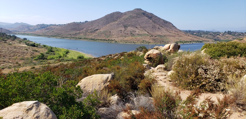
Spirit Lake and the “log raft”

The singletrack dumps you off a ridgeline and onto a dirt forest service road. I took that out to Windy Gap and the onward to the Smith Creek trailhead. Here I was treated to a nice view of Spirit Lake and the “Log Raft”. The lake took the brunt of the blast and most of the water was thrown up into the higher elevations in the form of a wave estimated to be about 850 feet high. When the dust settled and water drained back into the lake it was a much larger and shallower lake that had 40% of it surface area covered in the floating trunks of the trees between it and the mountain. Check out this wikipedia article on it. Moat of those trunks are still floating on the lake.

I thought about dropping the Smith Creek trail to do a more epic loop, but I wanted to retrace my steps and descend Ape Canyon to finish the ride.

In the trees of the Ape Canyon Trail

Retracing my steps was plenty of work but I was once again rewarded with killer views and the descent down Ape Canyon was the source of multiple joygasms. What an opener for this trip!

More Cuyamaca

I was back out in the Cuyamaca Mountains this weekend.

Spring is still hanging on. Today I started out on the west side singletrack and then crossed over to the visitor center and then took the Coldwater trail northward.

If you look close there are two turkeys in the field.

The climb up and over to the Stonewall peak fireroad was quite manageable. This is a really well built trail that I have found to be manageable and engaging in both directions.

Blooming goodness in July!

Once at the top of Stonewall Peak fireroad I turned east. Technically I was in the California Riding and Hiking trail (CRHT) at this point but the next section north of here is what I consider the “real trail”. When I reached the junction of the CHRT and the top of Soapstone Grade fireroad I had to think about my options.

It has been over a decade since I found myself and this location having arrived from the west. I have long ago given up on climbing Soapstone grade to this point as the Upper Green Valley singletrack at at the bottom of this grade is so much better. My other option is to climb the next section of the CRHT which would be good but it is fantastic in the southern direction. I decided to descend Soapstone grade and then climb Upper Green Valley singletrack.

I have been doing a fair amount riding lately and I feel I have been on the fitness and injury mend as if late. I felt really good on this climb and I think I did as well as I ever have in recent time. I still can’t beat that that much younger version of me but that is a different story. I ended up climbing the La Cima trail over to the Lucky 5 staging area (a first for me). I resisted the urge to poach the PCT back to CRHT today and made my way back along the La Cima trail to the CRHT and back the way I came. It was glorious!

La Costa Bike tweaks

So I recently made a tweak to my Santa Cruz Bronson. It is built up as an XC rig and it rocks! It is a single track carving machine. The minor compromise I feel have had been making with this setup is that is not the most confidence inspiring rig when thingd get downhill and gnarly. I’m not talking downhill bike gnarly but both wheels on the ground kind of normal. It is not bad by any stretch of the imagination, I just feel I can “over ride” the bike. I hate all the micro-genre names but I wanted to shift more towards a trail/enduro feel on the bike.

I ended up trying something simple and relatively inexpensive. I switched from a 90mm 0 degree rise stem out for a 70mm 17 degree rise. I took the bike out to La Costa to see how this felt. As I predicted the climbs felt a bit awkward at firdt as my weight was shifted back slightly. On the climb I had plenty of switchbacks as well as some steeper pitches. By the time I made it up to the top of the climb I was feeling comfortable with the new setup. I descended down the back side and then up to the towers. This improvement was immediately noticed and I was feeling much more comfortable with the downhill chunkish bits.

Oh and the trails, the backside stuff was a bit overgrown with the flowerinf weeds starting to dry out. Meaning I got a free exfoliation treatment. Good Times.

Lake Hodges

Lake Hodges is not in bad shape right now. On this particular outing I combined both the south side and the north side trail

South side of Hodges

All together I did about 24 miles of fairly quick paced riding (for me). I did not add in Bernardo peak. If I had that would have made for some pretty legit “in town” mileage. I think I have caught myself being a trail snob and passing by this place to go ride something better. It was nice to give myself a bit of a mental reset on this area. I don’t care how fit you are you should be able to come out here and find a way to both put a smile on your face and wipe it off all while putting some burn on your legs.

North side trail by the dam

If you think I’m stretching things a bit, try combining Raptor Ridge, the south and north side and Bernardo peak in a single ride.

East Mesa and Oakzanita

I made it out to the Cuyamaca Mountains for a a dawn patrol ride this morning. It was a brisk 55 when I started out but it not take long to warm up.

The east side singletrack followed by the fireroad climb up east mesa was quite manageable.

It was about a three to four mile climb up to fireroad to get to the single track that tasks our across the meadow.

I was a little bit past prime time for the wild flowers but there were still a plenty. I took the singletrack out to where you start descending down towards the Indian Creek trail. Here is some info on that option.

After a very peaceful break I retraced my tracks back to the fireroad. For something new to me I took the Oakzanita peak trail.

It was a little under two miles long and most of the climbing occured during the last half of a mile or so. Most of the peak prominence is on its western slopes so you have already gain much of thr elevation when coming in from the east. The last half mile is very much a loose rock and techy bit of fun ckimbing.

The view from Oakzanita peak was really cool and worth the effort. On the return trip, I took an unmarked trail that took me most of the way down the mountain. It was a great bit singletrack. It popped me out on the East Mesa fireroad. This was the upper Descanso Creek trail and saddly it is not only marked at the bottom, but also marked no bikes. Its a shame as it would be my preferred way to come off the mesa. I would not want to climb it. After that it was a quick spin on the East Side singletrack back to my truck. A great morning in the bike.

Daley Ranch

Daley Ranch is still holding onto some springtine!

I did a loop that include the Sage trail up and over into Jack Meadow and the up the way an over to Engelman Oak and back around.

Sometimes I find myself with a ho hum attitude about the local stuff. This is particularly case after roadtrips. But rides like that this help to shake those feelings off.

Norcal Roadtrip

So my youngest son, Jake has been accepted to Humbolt State University to finish off his degree in Forestry and Wildland Fire Management. We decide to take the travel trailer up there for a week to get the lay of the land and find him a place to live out in town. First stop along the journey was a overnighter to see my oldest son who lives south of San Jose. It was really nice to have both of my not so much boys anymore in the same spot.

The next made the rest of the way up north and setup shop in Trinidad at a campsite nestled between redwoods.

So everyday we had some chores to do which mostly included scoping out rooms for rent and doing interviews with the landlords/owners.

But that stuff took up less than half of each day so we were about to checkout some stuff.

As luck would have it a good friend, JD, has a brother who lives in nearby Bluelake. After some emails and phone calls his brother Tim took Jake and I out for a tour through the local woods. We even started right from the HSU campus. I do believe Jake is pretty stoked about this.

The last day our planned stay up there we ended up finding “The Place” and put some ink to paper. The next morning we headed out but this time we decided to take a different route we took us inland though some mighty pretty country side. I’m not so sure SoCal is ever going to get Jake back.

We made our way down to Fresno and had enough time to check out thier MTB skills park. It was not bad. I would not make a special trip for it, but if you are passing through, go for it.

The next day we mad our way back to home. A very productive and fun trip.

Springtime in the Lagunas

Life has been busy. In a good way. Busy enough that I have been living life and not carving out time to share it in this format. I go throgh these spells. I have come to realize that this blog is just as much a sanitized log of my life on two wheels for myself as much as it is for sharing with others. So I’m going to fill in the historical gap from my last ride until present with a handful of ride stories and pics to tell the story. It is currently the later half of August but this post is going to be date back to middle of May. I will close the gap until the posts about the amazing times on the bike I am currently having in Washington state.

—— Now onto the catchup ——

So I bought a new toy. A 19-foot travel trailer. Its has a queen size murphy bed for my sweetie and I. Along with that he has two bunks so it could also support MTB roadtrip with the broz. After a very close to home shake down outing we took it up to Laguna Meadow for our first real outing.

I did not have a reservation but the campgroup has a number of sites that are not part of the reservation system. So I went up midweek grabbed a spot for the remainder of the week and the weekend. After setting up the trailer I went for a spin around the meadow, up Chico ravine and down Los Gatos.

There was plenty of springtime going off on the meadow. I have to say it was very cool to have a baby house waiting for me at the end of the ride. I ended up spending the night there and going straight into work in the morning.

Last Call at Takatori

My final outing on the mountain bike for this trip to Japan was to head back out to the Takatori area east of Zushi. I passed through here on my lasting outing but it was mostly a transit through it. This time I wanted to futz around a bit.

Coming in from the south

I did some street riding from Yokosuka to make may way over to the entrance of the trail system. Like most of the trails in the area, you have to do so grunting immediately after the leaving the streets.

Trail Goodness

I entered the trail system were I had exited on the last outing and I was planning on retracing my way back up to top of Takatoriyama.   I was however going to investigate all of the various spurs that split off of the main trail I was on.

There were a few spurs of particular interest to me as I remembered them as being really cool during my last time on them more than a few moons ago.

I just love these kind of locals helping folks signs.

So much steeper and slick than it looks

I was armed with my GPS loaded up with my personal archive of adventures in this area.    The goal was to jog my memory and avoid a few of the spurs that will quickly dump you off the mountain resulting in pain and/or hike-a-bike to get back up to the prime riding stuff.

Trails old enough to have worn notches through the peaks of the hills.

On my way up to the summit, I did find the junctions that I wanted to hit on the return half of the route.   I even came across about five other mountain bikers out on trail.    One interesting thing I noted about this group was that while most of them while had rather high-end new bikes (Within 2-3 years), none of them were running  single chain rings up front.   Actually most them were running triples up front.    My theory is that most them ride their bikes to the trailhead which according to where you live on the peninsula you can easily end up being 7-10+ miles on the streets/roads.    While my rental rig is pretty much old and has seen better days I find the big rig to be a really welcome feature on it.

Once up to the summit, I hooked up with one of the trails that I used as part of the Takatori to Sengen-yama (Duckpond) connector.   I was not going to take it all the way out to the duckpond trails today but it took me more a couple of minutes to reorient myself at a couple of the trail junctions.    That section was just a good as I remembered.   This was also my first time on the trail during winter so I was able to see a more things than in the past as most of the foliage was dormant.    There were a couple of spots were I had never noticed that I was riding along a ridgeline that was less than 10 feet wide with extremely steep slopes on both sides with homes 100 plus feet below.   Other times of the year the trail is just in a tunnel of green.

More cool Nippon signs

The particularly trail that I chose to peel off on led me to the top of a long series of stairs back down to a street.    Riding these are just part of the mainstream skillset for riding here on the peninsula.   The rental hardtail added some additional fun to this descent.

Da-da-da-da-da-da-da-da-da-da-da-da-da-da…

After knocking out the stairs, I did a bit of street riding to make my way back over to the north side of the Takatoriyama area where I then made my way back up to the summit.

Climbing is what this spot is really known for in the area

From the summit I retraced my way (the trail was really fun in this direction) back the spur I had scoped out earlier in the ride.   This trail worked it is way towards the east along a series of ridgelines between two communities/towns.    There are several exit trails off of these ridgelines and according to my archives there was at least one I had not done before.

It is my understanding that most of this section of trail has a history of being a primary pedestrian route between several of the local communities.  (I suspect trains/buses my have lessened that usage in modern times).   One interesting bit is that there are long sections of this trail which have about an 18″ wide section of concrete walkway poured down the middle of it.   Pretty weird to have a “singletrack sidewalk” through the middle of the woods.    The trail/sidewalk in the woods eventually took me off the ridgeline and in an area of the peninsula I had not been before.     It was a bit of an adventure to find my route back to familiar streets which included traversing more topology than planned but it was all good stuff.

My final week of work in Japan end up being more work than I thought it was going to be so I did not get back out onto trails again.   Well one thing is for certain, my fondness for riding a bike in Japan has not diminished after this visit.