I have a new video up for the San Diego Flume Trail as well as new page on my site. This is nice little gem of a trail tucked away in El Monte valley where you might find a nice serving of Chicken Noodle Soup for the MTB Soul this time of year.
Nice scenery along the San Diego Flume Trail
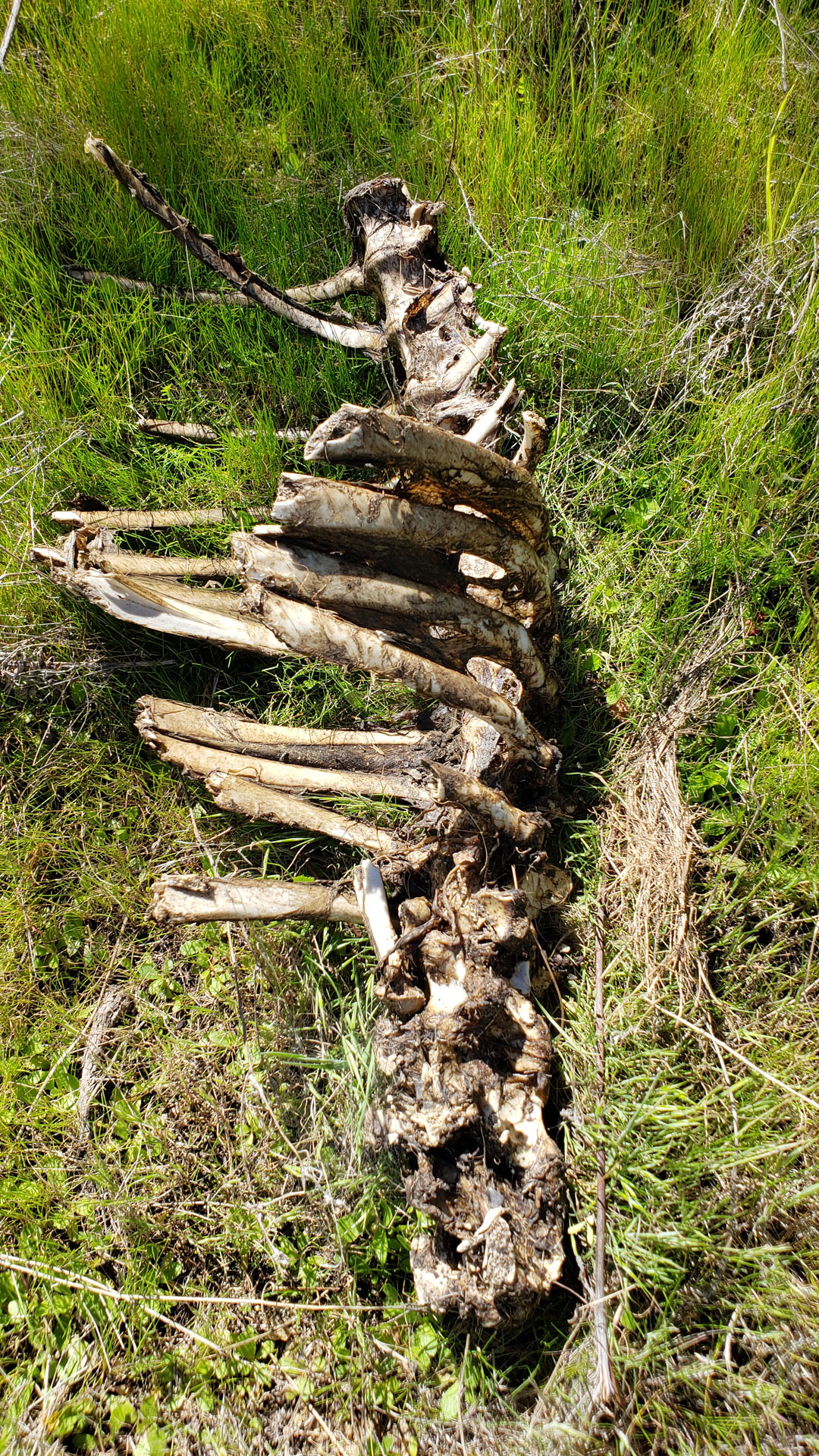
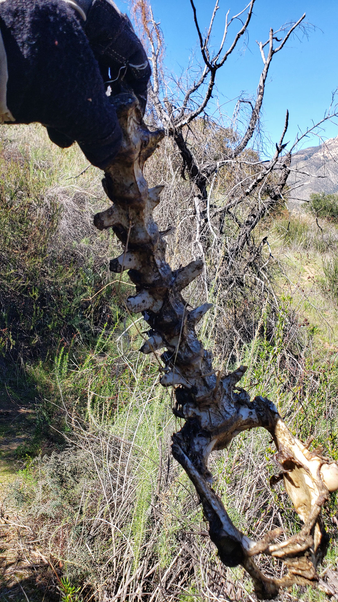
I spent a few a more hours out in the El Monte Valley area this past week refreshing my memory on a couple of trails in the area. While out on the flume trail east of El Monte Park out I came across of leftover Kittle snacks.
I have added a page to my site for this trail. In the course of making the page I also added the trails in that area to the Trailforks database as well as mirroring my recommended route discussed on that site as well. I will be doing some more of that in future but that is for another day.
I also finished up a video from Nichol and I riding this trail during our camping outing at Lake Jennings.
and maybe even a find a nice serving of Chicken Noodle Soup for the MTB soul.
If you have not done the San Diego Flume trail before, it is worth taking a checking out this time of year when its exceptionally green out there. It really is an nice little gem tucked away near Lakeside.
You can get in 10 miles or so, a climb or two, a quick a hike-a-bike or two and maybe even find a nice serving of Chicken Noodle Soup for the MTB soul.
Located near the tiny community of Green River in Washington, the Palisades Trail (#1198) offers some stunningly great views, superbly thin single track that varies between super flowy to rooty that should challenge just about anyone’s bike handling skills. While there are quite a few ways to get to the top of the trail, the three times I have done this trail I have climbed the Ranger Creek trail which a hefty about of work but it is also an exceptional trail You can check out my description and pictures of that route
PNW Goodness!
MTBProject also some other routes that include the Palisade trail that are worth checking out.
This video was shot using a GoPro Hero 5 Black and Feiyutech 3-axis gimbal. I really disliked the audio of the Hero 5 and it was one of the reasons that this footage languished on my hard drive for well over a year. I used Adobe Preimere and Audition to clean it up but there are still some funkiness to the audio. I’m really glad to have upgrade to the Hero 8 since then which has much better audio.
This past weekend, I did a “nearcation” at the Lake Jennings Campground in Lakeside. While enjoying the weekend I checked out the nearby Flume Trail. It is called the “Historic Flume Trail” in many sources the west end of it is referred to as the Helix Flume Trail. To further complicate matters there is another trail out of El Monte Park to west that is called the flume trail that only crosses over the actual Flume trail.
Sprocket surveying his “Kingdom” overlooking Lake Jennings
All of the naming up-bub aside, The Flume Trail follows along the route of the a 35-mile long wooden water flume that was completed in 1889 that brought water from Lake Cuyamaca in San Diego’s East County into the La Mesa area and beyond. The flume employed numerous cuts, several tunnels, and more than 300 wooden trestles wood to maintain a uniform fall of 4 feet, 8 inches to the mile. Two of the tunnels can be seen from along the segment of the trail we rode.
There are plenty of kiosks along the trail to provide some history of the route
The completion and filling of El Capitan Reservoir in the 1930s put an end to the flume’s usefulness, but it was plagued with issues well before that such as a trestle collapse in 1919 and just not enough water moving and evaporation. The nine million board-feet of lumber used for the flume itself and the trestles were scavenged a long time ago.
One of the ravine dips along the flume trail
If you are not staying at Lake Jennings campground like we were you will have to put in some work to get up to the flume. Wither you start at the Helix Water district end or the El Monte Park end you will have a relentless set of switchback to climb up to get the the Flume trail proper. 10-16% grade and around 400 feet of elevation to gain. Here is a route I did that involved using both the El Monte and Helix switchbacks. (I don’t recommend this route, use one or the other and do an out and back on the flume) Once up on the flume things are pretty flat except where there were trestles in those spots you will have to descend down and then back up the other side of the small ravines. There are a couple of spots that will be hike-a-bike for most folks, but they are very short.
One of the spots that most folks might do some hike-a-bike
Our effort started from the campground was easy with four miles and change from and camp out and the same back. We turned around at the Cape Horn Tunnel.
One of the Ravine DipsLittle bits like this are worth the price of admission
This section of the flume was not shown on Trailforks so I added it. This was my first time adding a trail to the site and the GPS track could use a little cleaning up but you can find it on there now. There are some other trails that need to be added as well.
Raptor Ridge (Located near Escondido) the Mule Hill and San Pasqual Valley Trails goes between Lake Hodges to the west and along the agriculture fields to the east in San Pasqual Valley. The high point along this route is Raptor Ridge. There is a little something for most XC style riders as beginners can enjoy non-technical relatively flat terrain on either side of the Raptor Ridge and work their way into climbing the ridge.
This footage is from an outing where the trail conditions are pretty much perfect. AKA Hero Dirt! Here is my webpage on Raptor Ridge along with Mule Hill and the San Pasqual Valley.
This trail is also part of the the Coast-to-Crest Trail which when fully completed will travel 70 miles from Vulcan Mountain near Julian to Del Mar on the coast.
Yeah Yeah, Yeah stop your rambling Bill and give me a track to follow already. Strava for this ride (Includes a lot more stuff than just Raptor Ridge)
This has been a pretty awesome week. Sunday I did my first MTB ride since my heart valve replacement surgery in November. The big litmus test was having enough upper body strength to lift the bike up onto my over the bed truck rack on my truck. I had also been doing some tooling around on the bike on the street and curbs and not being jostled so it was time to give the sternum (along with its titanium wire reinforcements) some mild strength tests.
Orosco Ridge and Pamo ValleyLower Santa Ysabel Truck Trail Area
The climb up onto the ridge was good and it was so nice to be doing some huffing and puffing on a real bike out in the sunshine. I also checked out the Lower San Ysabel truck trail. All of which was in good shape. My sternum felt pretty good but there was mild discomfort over some of the chatterish stuff. None of the discomfort rose to the level of a sneeze! All together about I did 15 miles and change with about 1,400 feet of climbing.
South side of Lake Hodges
Wednesday, I went out to South Lake Hodges. Well I actually parked on the North Side and took the bridge over. My tenure at riding this place predates the bridge so I still refer to them as two separate places. But I did the typical Southside stuff and then made my way over to the Highland Valley trail. At this point it was pretty obvious that most of my workouts have been no longer than 60 minutes so I took bit of a break. After that I was back at it and the Highland Valley trail was a fun as I remembered it. I decided to do a touch of road connection and made my way over to Raptor Ridge. I was pretty tired after climbing Raptor Ridge and I was going to close out day with a return back via Mule Hill.
The bottom of Raptor Ridge. I ran out of gears shortly after those rocks 🙂
I was almost back to the kiosk area of Mule Hill when I was stopped by an SDGE crew who had the trail closed for some pipeline work. There was no detour so I had to backtrack about 2 miles to get back onto Highland Valley road to get then work my way back around. The trail should have been close at the last trail junction where people could divert around. While this was inconvenience for my tired legs. There was a hiker who got turned around that was really bummed. I did make them aware of this and hopefully they apply some common sense on where they close at for the remainder of their workdays.
All together I got in about 25miles and 1,200 feet of climbing. It was more than I had planned and I was well whooped. It is so good to be back on the dirt and certainly better to be on the dirt than in the dirt!