Cuyamaca Big Loop

Off to an early start on the West Side Trail

I was ready to get in a sizable ride, but when record highs projected I decided a mighty early start with plenty of water was in order for my outing up in the Cuyamaca Mountains. I was at the trail-head at sunrise and was rolling shortly thereafter. The temps were nice at that time of the morning but I knew it would not last.

Upper Green Valley Singletrack

I made good time up the West Side trail and the Green Valley Fireroad and was on the Upper Green Valley Singletrack before things started really warming up.

Lucky Five Trail

I really enjoy the La Cima trail along with the Lucky 5 trail so at the top the Upper Green Valley singltrack I did the out and back on those two trails. I “imagine” that someday when MTB access to the PCT is restored you could make a good loop with it and the Pedro Fages Trail. Even if you could do a legal loop with those trails I would have a hard time passing up the downhill section of the La Cima trail over the the California Riding and Hiking Trail.

California Riding and Hiking Trail (CRHT)

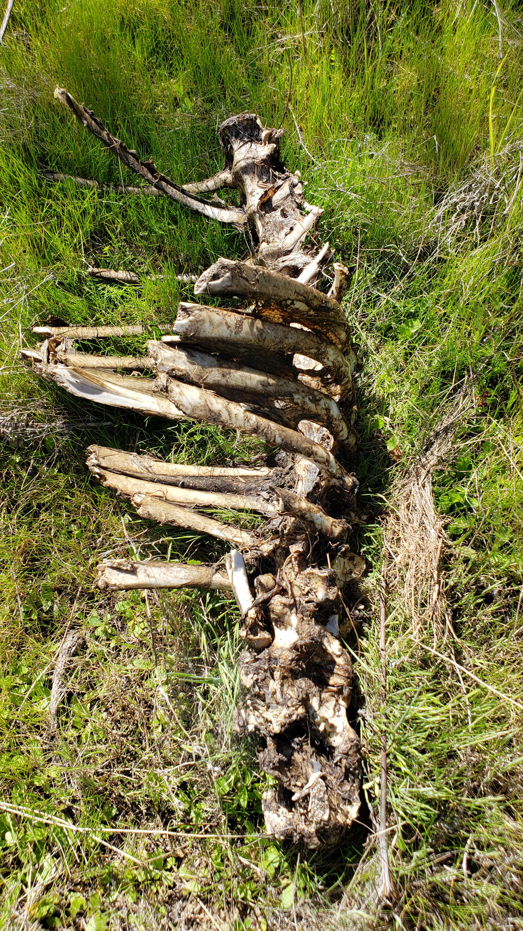
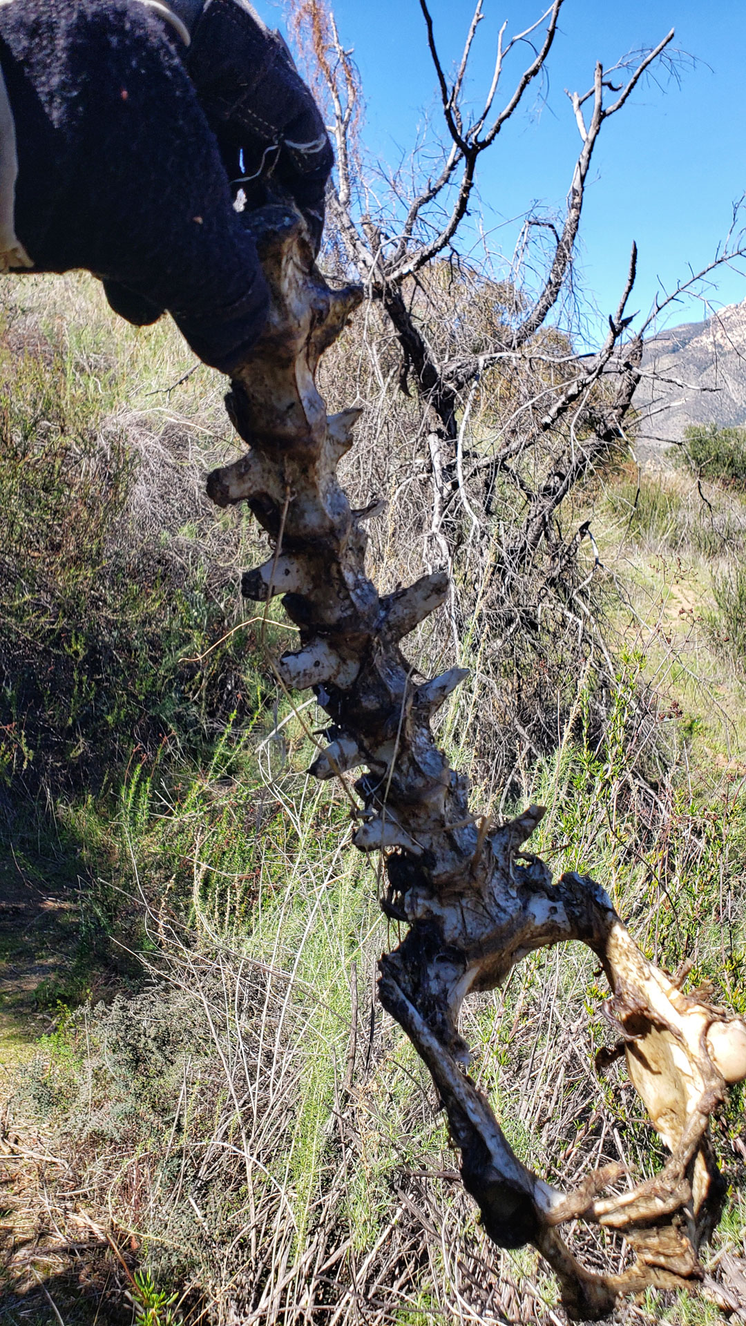
The CHRT is mighty nice through here. While on this section I saw a pair of Coyotes and one of them had a rabbit in his mouth. I really wish I had my real camera (DSLR with some quality glass on it) with me. My phone has a really good camera on it suitable for a lot of situations, but it is no match for a DSLR with a quality lens on it.

Marty Minshall trail going by Lake Cuyamaca

It was plenty toasty at this point. I started with a three liters in my bladder and 750ml in a separate water bottle with a couple of electrolyte tablets in it. By this point in the ride I had killed the water bottle and refreshed the tablets and filled with water from my bladder. I connected up with the Marty Minshall trail which skirts near Lake Cuyamaca before coming out across from Milk Ranch Road.

Middle Peak and the tombstones of the forest

It has been a while since I had been up Middle Peak and I was interesting in seeing how things are progressing since the fires back in 2003. Without the trees on the mountain, there was little respite from the sun which was cooking things at this point. I was pretty stoked at how well I was handling the heat compared to how things were pre-surgery but the climb was still plenty taxing. After a water check at the top, I decided that it would be unwise to try and complete the ride without restocking up on water. The descent down Black Oak was fun but the descent down Milk Ranch Ranch Road seemed like wasted elevation loss.

Water Stop with bonus items

Once back at HWY79, I diverted off the planned route over to the general store at Lake Cuyamaca to resupply my water. While there I found a giant frozen ice stick that I simply could not live without. I enjoyed it along with nice cold Gatorade. I completely refilled water bladder even through I doubted I would need to all of that to get back to the truck. Better to be safe that sorry in these conditions. If I had a mechanical in a bad spot I could end up being out here a lot longer than planned. I also figured that if I came across someone in distress I could help.

Good to see some of you out on the trail

After enjoying my treat and the shade on the porch of the store I made my way back to the Marty Minshall trail where I retraced my route back to the top of the Soapstone Creek Fireroad. I descend this fireroad and picked up the Cold Spring Trail. I was feeling tired at this point but was still stoked at the fact I was not destroyed by the heat.

Team Cow was Moooooving Today!

As I descended down the trail you could felt the temperature climbing. By the time I connected back up with the West Side trail it was roasting. No more stopping for pictures at this point, I was ready to be done. When I got back to the truck it was was 103 degrees. My truck reads a little high after sitting so I think 98 or 99 is closer to legit. The difference being DAMN HOT and REAL HOT! Either way it was a new milestone for me in dealing with the heat. I went through 5.0 liters of liquids on the day along with six electrolyte tablets (Nuun brand).

You can download my current recommended route or the Old School Classic Grand Loop for this area here or get the exact route I did on this day over at Trailforks.

Black Mountain (Ramona)

Evil leaf all over the place where I started from.

Since recovering from a heart valve replacement last year I have been noticing that the heat does not crush me like it used to do.   To test this theory, I decided to ride the Upper San Ysabel Truck Trail and ascend Black Mountain in Pamo Valley.

I purposely started a little later in the morning knowing that it was going to be toasty at the end of the ride.  

The temperature was fairly reasonable when I started from the east end of the Santa Ysabel Truck Trail.   It is mostly a climb to the west to Black Mountain Truck Trail. The last time I rode this was on a bikepacking outing and it was much easier on this day than  back then with all the gear.

One of the few shaded sections of the Upper Santa Ysabel Truck Trail.

Once on the Black Mountain Truck Trail I settled into the climb and I was feeling good.  It was nice to have my seat post working for this climb.

The temps were climbing only slightly quicker than I was.   I had a full 3 liters of water in my camelbak.  I only put water in my bladder.   I used to put things like energy or electrolytes mixes in them but I have learned that I’m not dilengent enough to prevent inadvertent science experiments from occurring.  Instead I have a separate water bottle that I mix that stuff in using the water from my bladder.   

Along the Black Mountain Truck Trail.

About 2/3rds of the way up the climb I took a break and made another batch of electrolytes in the water bottle (I use Nuun tablets).  It was good and warm but I was still feeling good. 

The top of Black Mountain

Continuing on I made it though a steeper section that previously would have put a hurting on me, but today it was hard work but not a crusher.  After that section, it felt like a cruise in comparison to the top. 

Plenty of climbing

I was plenty glad to be done with the climbing and felt really good about the effort I put in.

After taking in some sights at the summit, it was downhill time.

Pamo Valley below
Views to the east

The descent was mighty zippy and I could feel the heat cranking up as I dropped in elevation.   It was quite hot when I got back on the Santa Ysabel Truck Truck and had to start using the pedals again.  When I got back to the truck it was 95 degrees out.   I was tired but I did have the kind of heat beat down that I would have previously had. At least it looks positive evidence to the theory from my perspective. One thing for certain, It was a good day to be on a bike.

Recovery….DONE!

I really enjoyed being back back on the bike for the last two months.   I started out sticking to tamer trails as I was still dealing with some sternum discomfort related to the wires used to initially close up my chest.   When the trails got chattery, it was uncomfortable enough to be distracting.   Not where you want your head when getting into techy bits.

My heart surgeon advised me the discomfort was common beyond the 3-month mark with it typically subsiding by the 6-month mark.  In some cases people have mild discomfort well beyond that.

The discomfort has indeed been getting better.  I am pretty sure that early on after my return to the bike there was a fair amount of just building up my tolerance to the discomfort.   

Nice to ride some tech.

Over the last few weeks, I have been riding more technical trails and getting more comfortable on them.  The chest discomfort is nearly gone and no longer a distraction.

I don’t quite have my technical chops back yet and I know its mental thing about not wanting to deal with a superman endo to the chest. I’m sure that will come back as well.

Photobomber Alert!

Enough on recovery, I’m Calling It DONE!

While out riding with Steve last week we played around a rock formation for 15 or 20 minutes.   We collectively rolled up on the entry rock about half a dozen times before noticing a sizable rattlesnake warming up underneath it.  We both kinda wigged out for a bit as we had been scrambling all over the rock formation looking for lines to ride.

Another Spectator

We then took a closer look around and saw another rattler hanging out on the otherside of the same rock.   It was time to call it a day for playing on the “Snake Eyes” rock.

Steve playing on “Snake Eyes”

Tasty Burritos closed out a great day to be on the trails.

San Diego Flume Trail

I have a new video up for the San Diego Flume Trail as well as new page on my site. This is nice little gem of a trail tucked away in El Monte valley where you might find a nice serving of Chicken Noodle Soup for the MTB Soul this time of year.

Nice scenery along the San Diego Flume Trail

I spent a few a more hours out in the El Monte Valley area this past week refreshing my memory on a couple of trails in the area. While out on the flume trail east of El Monte Park out I came across of leftover Kittle snacks.

I have added a page to my site for this trail. In the course of making the page I also added the trails in that area to the Trailforks database as well as mirroring my recommended route discussed on that site as well. I will be doing some more of that in future but that is for another day.

I also finished up a video from Nichol and I riding this trail during our camping outing at Lake Jennings.

and maybe even a find a nice serving of Chicken Noodle Soup for the MTB soul.

If you have not done the San Diego Flume trail before, it is worth taking a checking out this time of year when its exceptionally green out there. It really is an nice little gem tucked away near Lakeside.

You can get in 10 miles or so, a climb or two, a quick a hike-a-bike or two and maybe even find a nice serving of Chicken Noodle Soup for the MTB soul.

Historic San Diego Flume Trail

This past weekend, I did a “nearcation” at the Lake Jennings Campground in Lakeside. While enjoying the weekend I checked out the nearby Flume Trail. It is called the “Historic Flume Trail” in many sources the west end of it is referred to as the Helix Flume Trail. To further complicate matters there is another trail out of El Monte Park to west that is called the flume trail that only crosses over the actual Flume trail.

Sprocket surveying his “Kingdom” overlooking Lake Jennings

All of the naming up-bub aside, The Flume Trail follows along the route of the a 35-mile long wooden water flume that was completed in 1889 that brought water from Lake Cuyamaca in San Diego’s East County into the La Mesa area and beyond. The flume employed numerous cuts, several tunnels, and more than 300 wooden trestles wood to maintain a uniform fall of 4 feet, 8 inches to the mile. Two of the tunnels can be seen from along the segment of the trail we rode.

There are plenty of kiosks along the trail to provide some history of the route

The completion and filling of El Capitan Reservoir in the 1930s put an end to the flume’s usefulness, but it was plagued with issues well before that such as a trestle collapse in 1919 and just not enough water moving and evaporation. The nine million board-feet of lumber used for the flume itself and the trestles were scavenged a long time ago.

One of the ravine dips along the flume trail

If you are not staying at Lake Jennings campground like we were you will have to put in some work to get up to the flume. Wither you start at the Helix Water district end or the El Monte Park end you will have a relentless set of switchback to climb up to get the the Flume trail proper. 10-16% grade and around 400 feet of elevation to gain. Here is a route I did that involved using both the El Monte and Helix switchbacks. (I don’t recommend this route, use one or the other and do an out and back on the flume) Once up on the flume things are pretty flat except where there were trestles in those spots you will have to descend down and then back up the other side of the small ravines. There are a couple of spots that will be hike-a-bike for most folks, but they are very short.

One of the spots that most folks might do some hike-a-bike

Our effort started from the campground was easy with four miles and change from and camp out and the same back. We turned around at the Cape Horn Tunnel.

One of the Ravine Dips
Little bits like this are worth the price of admission

This section of the flume was not shown on Trailforks so I added it. This was my first time adding a trail to the site and the GPS track could use a little cleaning up but you can find it on there now. There are some other trails that need to be added as well.

El Monte Valley from along the Flume Trail

Rapter Ridge Video

Raptor Ridge (Located near Escondido) the Mule Hill and San Pasqual Valley Trails goes between Lake Hodges to the west and along the agriculture fields to the east in San Pasqual Valley. The high point along this route is Raptor Ridge. There is a little something for most XC style riders as beginners can enjoy non-technical relatively flat terrain on either side of the Raptor Ridge and work their way into climbing the ridge.

This footage is from an outing where the trail conditions are pretty much perfect. AKA Hero Dirt! Here is my webpage on Raptor Ridge along with Mule Hill and the San Pasqual Valley.

This trail is also part of the the Coast-to-Crest Trail which when fully completed will travel 70 miles from Vulcan Mountain near Julian to Del Mar on the coast.

Yeah Yeah, Yeah stop your rambling Bill and give me a track to follow already. Strava for this ride (Includes a lot more stuff than just Raptor Ridge)

Back in the Saddle!

This has been a pretty awesome week. Sunday I did my first MTB ride since my heart valve replacement surgery in November. The big litmus test was having enough upper body strength to lift the bike up onto my over the bed truck rack on my truck. I had also been doing some tooling around on the bike on the street and curbs and not being jostled so it was time to give the sternum (along with its titanium wire reinforcements) some mild strength tests.

Orosco Ridge and Pamo Valley
Lower Santa Ysabel Truck Trail Area

The climb up onto the ridge was good and it was so nice to be doing some huffing and puffing on a real bike out in the sunshine. I also checked out the Lower San Ysabel truck trail. All of which was in good shape. My sternum felt pretty good but there was mild discomfort over some of the chatterish stuff. None of the discomfort rose to the level of a sneeze! All together about I did 15 miles and change with about 1,400 feet of climbing.

South side of Lake Hodges

Wednesday, I went out to South Lake Hodges. Well I actually parked on the North Side and took the bridge over. My tenure at riding this place predates the bridge so I still refer to them as two separate places. But I did the typical Southside stuff and then made my way over to the Highland Valley trail. At this point it was pretty obvious that most of my workouts have been no longer than 60 minutes so I took bit of a break. After that I was back at it and the Highland Valley trail was a fun as I remembered it. I decided to do a touch of road connection and made my way over to Raptor Ridge. I was pretty tired after climbing Raptor Ridge and I was going to close out day with a return back via Mule Hill.

The bottom of Raptor Ridge. I ran out of gears shortly after those rocks 🙂

I was almost back to the kiosk area of Mule Hill when I was stopped by an SDGE crew who had the trail closed for some pipeline work. There was no detour so I had to backtrack about 2 miles to get back onto Highland Valley road to get then work my way back around. The trail should have been close at the last trail junction where people could divert around. While this was inconvenience for my tired legs. There was a hiker who got turned around that was really bummed. I did make them aware of this and hopefully they apply some common sense on where they close at for the remainder of their workdays.

All together I got in about 25miles and 1,200 feet of climbing. It was more than I had planned and I was well whooped. It is so good to be back on the dirt and certainly better to be on the dirt than in the dirt!

Futzing at La Costa

I recently upgraded by GoPro cameras and replaced a gimbal I retired. I finally broke them out at to tinker around with the setups. La Costa is pretty much a local trail for me so that was where the tinkerfest was held.

While I managed to goon up some of the footage with the gimbal in wrong mode or the mounting positions not best for all conditions I did get some usable stuff. I put most some of that together here.

I moved from Hero 5s to Hero 8s and I am quite happy with the audio in in Protune mode vs what I had to deal with on the 5s. I have added wind mufflers over the mics in addition to setting changes.

The hypersmooth of the GoPro 8s is really good, almost gimbal quality. So why the GoPro 8 and not the 9? Well quite simply the 9 was not out yet and I got a screaming deal on the GoPro 8 while working on a military base overseas. All told, I got two GoPro 8s for $425 out the door which is almost Buy One Get One Free compared to MSRP.

For those of you you ride at La Costa you will most notice there are a couple of scenes where things look amiss. When I had the gimbal in the inverter mounted position, if I leaned over a certain about in a turn, the gimbal would flip and lock on to stabilizing in that inverted position. I flipped the vertically in post, but forgot to also flip in horizontally as well. I did not notice this until after the video was published.

Big Laguna Camping

I have had a big project on my to-do list for quite some time since I bought the trail-trailer. That being a highly capable solar upgrade. I had previously installed 500 watts of solar panels on the roof along with a solar charge controller in a earlier effort. The next phase was to add a bank of LiFePo batteries, a 3,000 watter inverter, an automatic bus-transfer and a battery monitoring system. That stuff took sometime to complete and now it was time to head out for a weekend of fun and testing things out.

Campsite on Laguna Meadow

The Cleveland National Forest was shutdown due to the CA wildfires drawing away all of their resources so we had to wait until the closures were lifted. The morning that it did I was already headed into the mountain to try and grab a first-come first-served site. I was rewarded with a nice spot on the meadow.

Oops on Los Gatos

After setting up camp it was time for quick spin around the place. It was still early in the day on the first day the forest had opened back up so the place was pretty much empty. From camp I went along the meadow and then up Aqua Dulce to Los Gatos. There was a tree down on Los Gatos that was a bit too big for me to try and muscle out of the way. Another thing that was pretty cool was the the number of pine cones all over the trail. With the forest being closed to the public for two weeks no one has been kicking them off the trail so there we all these little land mines along the trail. It was an added layer of fun for the day.

Traeger Smoker (Ranger Model)

To go along with the solar/power upgrade I bought a small Traeger wood pellet smoker for the RV. These nice thing about these is you pretty much set, forget and go for a ride. While they use wood pellets to cook/smoke they do need a little bit of 115VAC power to run the controls. The power upgrade took care of this without even thinking about. Considering that this thing uses less than 250Watts max and less than 50Ws most of the time, I basically have a solar powered smoker 🙂

Pulled Pork – Yummy! (Yeah we are not really camping)

The In-the-field operational test of the smoker was a hit! Pulled Pork awesomeness.

The next day was a pretty mellow cruise around the meadow with Nichol. At the top of the meadow there is a pine tree that the Acorn Woodpeckers have taken over a pine tree to be used as a granary or “Acorn Tree”. The whole woodpecker family/community will use these trees and they will take turns guarding it.

One thing I think is really cool about this behavior is that initially they will get a acorn jammed into the hole so tightly that it cannot be easily removed. As the acorn dries out it will shrink. The woodpeckers maintain the tree and will rotate acorns as they shrink to smaller holes were they will more snuggly fit.

Top of Los Gatos

Sunday a friend of mine came up and we did a sizable loop that included a climb up to Redtail Roost followed by a run down the singletrack to Aqua Dulce. When then went up and over Wooded Hills and then a loop around the meadow. Definitely good stuff. We finished off the ride with Pulled Pork Tacos!

There was plenty of chilling done over the weekend as well.

We chilled out with the dogs leisurely broke camp the following morning to head back home. So nice to get out of town for a few days.

Home Dirt

So I spent that a little over two months working in the Kingdom of Bahrain. No quality mountain biking to be had there. You could make do, and I know some folks who have because they lived there, but not worth it for a visitor. Anyway, I got back and have been hitting up some of the local goods.

Daley Ranch
Daley Ranch
Santee
Candygram out in Santee

I can really say I have been in much of an exploring mood, just getting in some local dirt. After being away for that long, I kinda want to spend plenty of time with my wife. There is also a considerable amount of things that have to be taken care of as well.

What the hell is that?

I did however manage to grow as scraggly looking beard while I was gone. I don’t know how much longer this thing is going to hang around