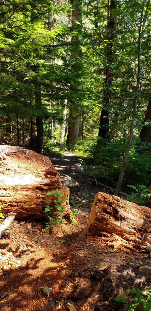
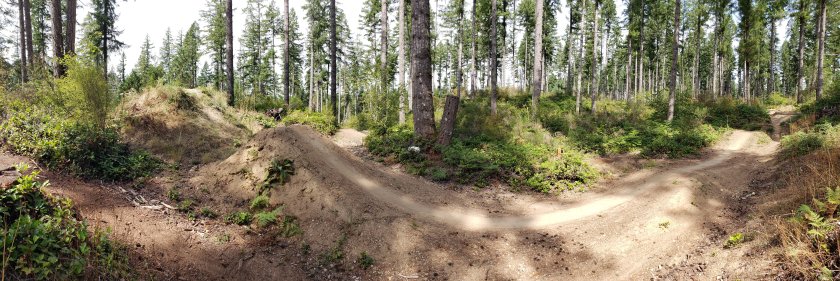
Lower Dungeness/Gold Creek

One of my favorite trails to date in the Puget Sound area is the Lower Dungeness and Gold Creek Trail Loop.    I have ridden it twice before and I was excited to get back out for another outing in the area.

A fire road that does not suck

The first few miles of the Lower Dungeness trail can be brutally steep and amazingly pretty.   A lot of people opt to take  the fire roads around to 3 o’clock ride and then take a connector trail down to the Lower Dungeness cutting out much of the brutal climbing section of the trail.

Views from along the forest service road heading towards 3 o’clock ridge.

I have done both options and decided to take the forest service roads/3 o’clock ridge option.

More views from along the forest service roads

The views from along the forest road are really nice and grades are reasonable but you are missing out on pristine stuff my bypassing those first few miles.

Lower Dungeness Trail

Once I reached 3 o’clock ridge there was quite a bit of zippy downhill singlet rack goodness down into the creek watershed.  Once down there it was just sublime Pacific Northwest loamy, mossy forested goodness following the creek up stream.

There is plenty of undulations along the Lower Dungeness trail and since you are heading upstream you know you are trending uphill.   You probably will not care as the experience is pretty incredible.

Once the trail reached the junction of the Dungeness Creek trail and another fire road it was time for some more climbing to get to the top of the Gold Creek Trail and the Tubal Cain Trail at the edge of the Buckhorn Wilderness.   It was not a horrible climb, but you certainly did some work.

From along side the forest service road climb

The Gold Creek is pretty awesome section of trail that spends a lot of time along the a steep hillside with the Lower Dungeness Creek far below.

Along Gold Creek Trail


It was not recently that I learned that a portion of this trail is also part of the Pacific Northwest Trail.  Established in the 2009, the Pacific Northwest trail is 1,200 miles long and goes from the Continental Divide to the Pacific Oceans.

Hmmmm, I was a little lite on pictures through much of the ripping downhill sections of this trail.    Gold Creek will eventually drop down off of the high ridge sides.  Where you will enjoy some more creek-side riding before you have to a wee bit of climbing on an decommissioned forest road back up to the trail head.

On this day I logged right at 20 miles with 3,900 feet of climbing.   My legs were drained and my soul was full!

Rainy Day Banner

One of the things I like about the typical loamy soil of the Pacific Northwest is that it can stand up to some rain.   So a little drizzle or rain is not automatically a ride stopper.

Such was the today’s ride out at Banner Forest.   Here are a few pictures.

Moss moss and more moss

Cool trail names

What would have been a bust in San Diego turned into another fun after work ride up in the Puget Sound area.


Ranger Creek/Palisade

Plan A was to ride on the Olympic  Peninsula today but that whole area looked socked with clouds.   Plan B was to head east for the big ride I had planned for the following weekend.   A return to the Ranger Creek and Palisades Trails.

Time for some significant climbing!

I first rode out in August of 2010 and it was fantastic.   This time was still fantastic and slightly different.

Chicken Soup for the MTB Soul


The elevation gain be deceptive to the eyes in the forest. You legs and lung will tell you the truth after a while.

As I climbed further up the trail, I could see that some fire damage had occurred in 2017 up near the ridge tops.

Little Ranger Peak

I would guess during the last mile up to where the Ranger Shelter would be, started going through some fire damage along the trail.  The trail was in pretty descent shape

The shelter that was at the junction of the Ranger Creek and Palisade Trails burned during a forest fire. This I pretty much all that remains
When I stopped at the location of the old shelter, I had to deal with some horseflies and gnats. Luckily I was prepared with bug goop!
Mt Rainier in the not so distance

Once I got rolling on the Palisades Trail, the views did not disappoint!

If this looks like it would be awesome to ride, you would most certainly be correct!

What also did not disappoint was the riding on Palisades as well.   Fast, tight and technical root bits made for a banging good time shedding off the elevation gained on Ranger Creek Trail.  One thing is for certain, it did not suck to be me today!

Good Times on the Palisade Trail. Last photo taken before ripping down the trail!

360 Trails, Purdy WA

This trail is located turn the town on of Purdy, WA in the Gig Harbor Area.   It is good example of what good city, county and user group relations can get accomplished.    Here is a link to the park’s map.

Most the forest here is new growth, kinda recently worked land is the vibe I get.    There are is a lot of purpose built MTB trails.  Some of them are even one way.

Most of the trails area XC type trails with a little bit of tech here and there.   There is a pump track as well as pump trail.

Even a wee bit of a log riding as well.


Top of the upper jump lines

There is a set of jump trail near the upper end of the trail system that allows for some progression as you develop your skills.

Down near the bottom of the trail system are a couple of serious jump lines (not the ones pictured above)  they are not joke jump lines.  (Marvik and NWT3K)

Not all of the trails are on the current city map of the place, but if you check out Trailforks, you can see the delta.  Interestingly enough trailforks is missing some trails that is on the city map of the place.

It is well worth a visit, but I have to admit, it does not have the same classic Pacfic Northwest trail appeal that I get at some of the other nearby places like Green Mountain State Park and Banner Forest.

Green Mountain State Park

Green Mountain State Park is located within about 15 minutes of where I am working here in the Puget Sound area so it is part of the post-work ride rotation.

The Olympic Mountains seen along the fire road climb.

There are plenty of way to ride the trails out here at Green Mountain State Park.   I have not created a dedicated page on my site for this place yet.    Here you can find some of my previous posts on this area.

Most of the trails in this area are on Trailforks.com.  The Wildcat Trail is one of many trails out in the area.    It is well worth a look see for the network out there.

The Wildcat trail is one of the hardest ways to get up the mountain and it will certainly test your lungs and how well you can handle redlining into the anaerobic end your cardio reserves.   Lately I have been taking a longer series of fireroads up to the top of the mountain and then take Wildcat down.   Well mostly down there are some uphills even on the descent to keep you honest.

Downtown Seattle in the distance as well as Mount Rainier peaking out in the distance.

A great workout with good views on clear days.    A good way work out the stress of a solid day’s work.


Mt Saint Helens return

So I am working in the Puget Sound area of Washington for the next few weeks. This is a great time be up in this area of thr country. Last year I went out to Mt Saint Helens and rode the Ape Canyon and Plains of Abraham trails. It was a pretty incredible ride but the weather did not cooperate so my views were quite limited. Here is report from that day

On the top of my MTB list for this trip was a return outing to here when the weather was clear. My first weekend here and the weather report looked good so I pulled the trigger. Boy was I rewarded for it.

Along the Ape Canyon trail looking at the south fsce of the mountain.

I saw a lot more of the mountain than last year even before I got to the trailhead. The climb up Ape Canyon was fantastic and the further up I went the better things got. The tops of Mt Adams and Mt Rainier were even visible in spots.

The view from the top of Ape Canyon

The view when you reach the top of Ape Canyon is incredibly impressive. In the pan shot above you can see the Rainier, Adams and of course Mt Saint Helens.

The south-southeast slopes of the mountain.

It is crazy to think that much of the foreground was forest before the eruption in 1980. The mountain used to have a typical volcano shape to it but the eruption blasted off 1,300 feet off the top. This is just the non-blast side of the mountain.

From here I rode the Plains of Abraham trail over the eastern slope of pumice and lava rock. Riding through here I once again felt very small seeing what the power of Mama Earth can do. There were also lots of wildflowers and other low growing stuff.

The northestern slope as seen on the fireroad out Windy Gap.

The trail takes you around to the northeastern area of the mountain where you can get your first view of the side of the mountain that was blown off. In the picture above you can see the trail in the ridgeline.

Spirit Lake and the “log raft”

The singletrack dumps you off a ridgeline and onto a dirt forest service road. I took that out to Windy Gap and the onward to the Smith Creek trailhead. Here I was treated to a nice view of Spirit Lake and the “Log Raft”. The lake took the brunt of the blast and most of the water was thrown up into the higher elevations in the form of a wave estimated to be about 850 feet high. When the dust settled and water drained back into the lake it was a much larger and shallower lake that had 40% of it surface area covered in the floating trunks of the trees between it and the mountain. Check out this wikipedia article on it. Moat of those trunks are still floating on the lake.

I thought about dropping the Smith Creek trail to do a more epic loop, but I wanted to retrace my steps and descend Ape Canyon to finish the ride.

In the trees of the Ape Canyon Trail

Retracing my steps was plenty of work but I was once again rewarded with killer views and the descent down Ape Canyon was the source of multiple joygasms. What an opener for this trip!