Ranger Creek - Palisades Loop
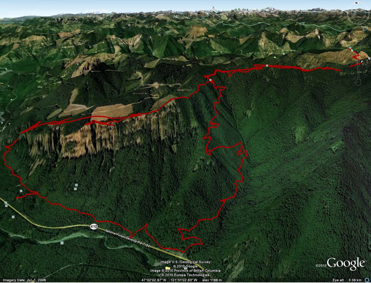
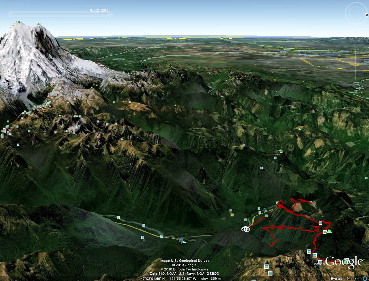
| Located to the east of Mount Rainer near the tiny little community of Green River the Ranger Creek - Palisades Loops offers a great workout, stunning views, ripping dental floss thin singletrack and technical bits to make the most hardened of singletrck snobs grin from ear-to-ear. The route described here is about 21 mile long and contains about 4,000 feet of climbing but there are tons of options to add some massive mileage to dirt adventures in this area. |
| Directions: (From Seattle) Take I-5 south for about 10 miles south from downtown. Take Exit 154A (left exit) to I405N for 2.2 miles. Take Exit 2 to WA167 South to Auburn for 12 miles. Turn left onto WA164 East and take for 15 miles. Turn left onto WA410 East and take for 28 miles. Turn left at signned road for Camp Sheppard Boyscout Camp. Trailhead Parking lot (and pit toilets) are on your left in 1/10th of a mile. NOTE: The little community of Greenwater is located 8 miles before you get to the trailhead. You can pick a map as well as last minute supplies/water at the gas station. |
|
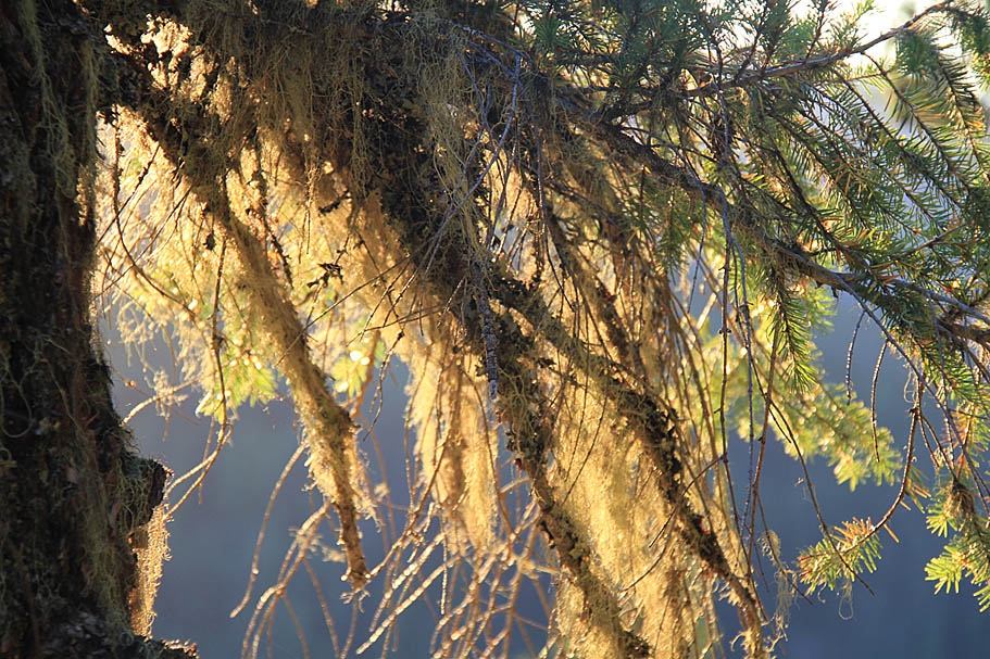
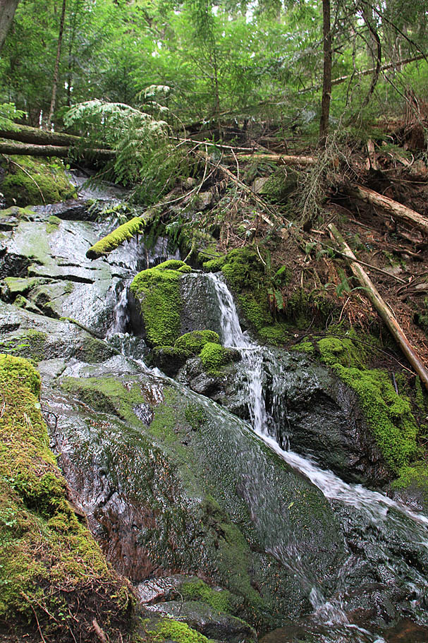
| Ride Report: This is a combination of two rides done here during the month of August 2010. One day was overcast and gloomy for the entire day and the other was clear and sunny. Neither day adequately captured how pretty it can be in this area. |
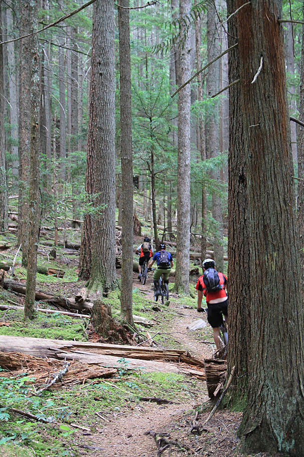
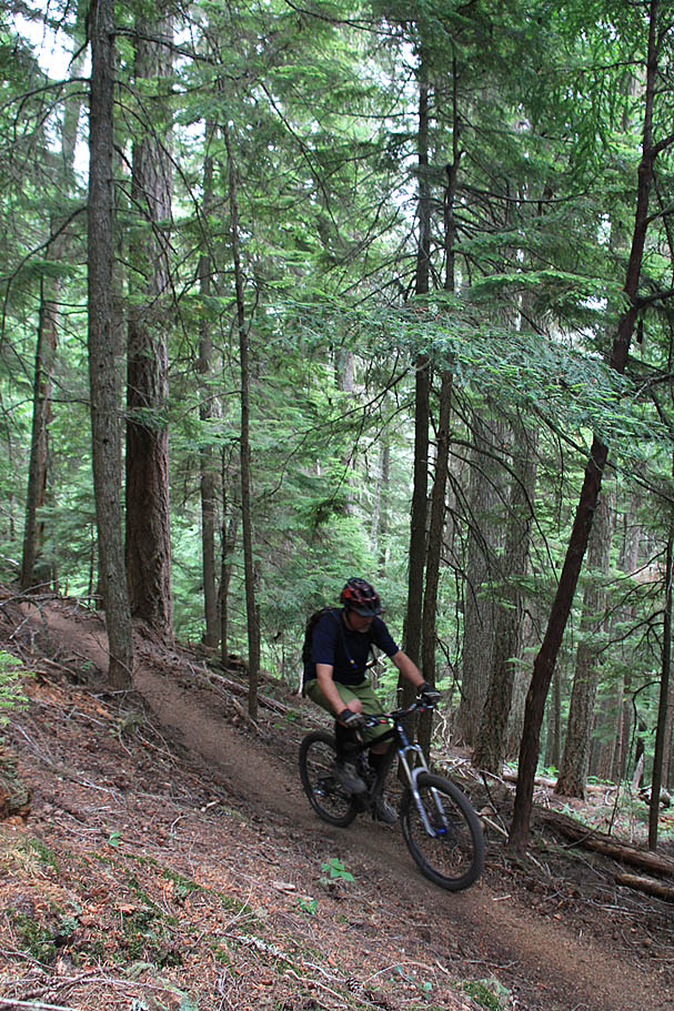
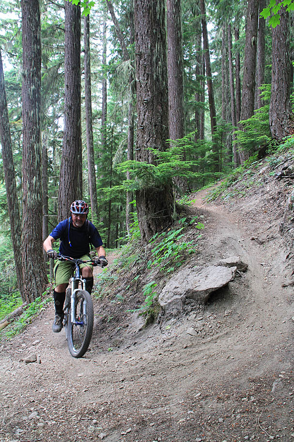
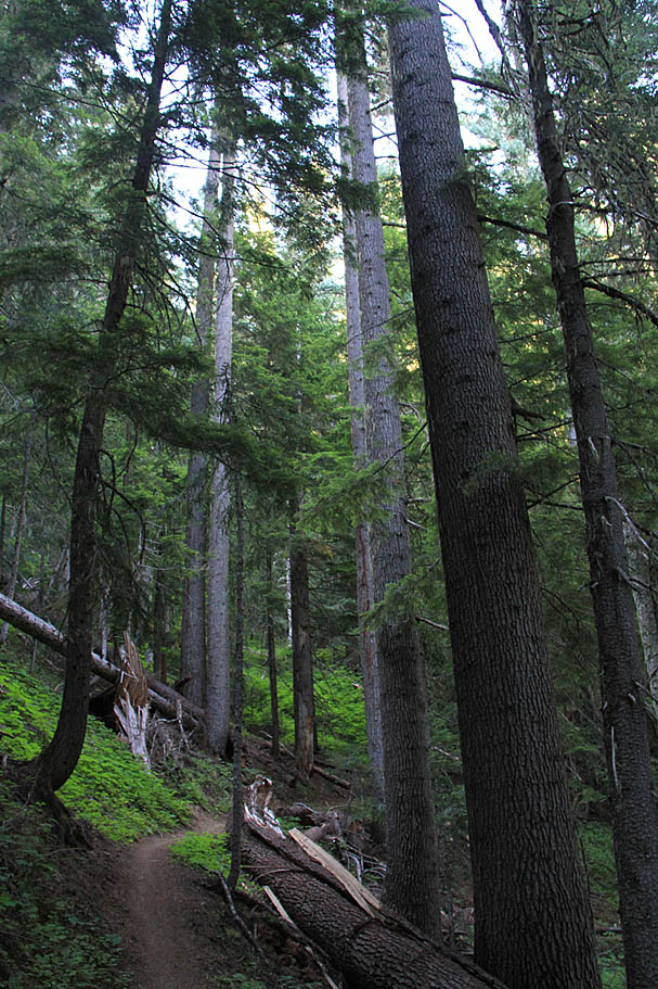
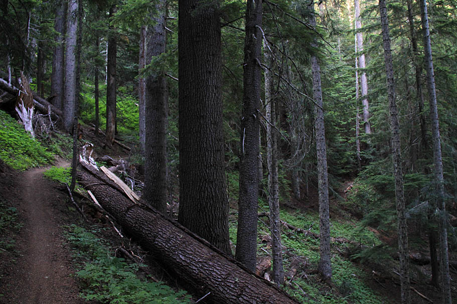
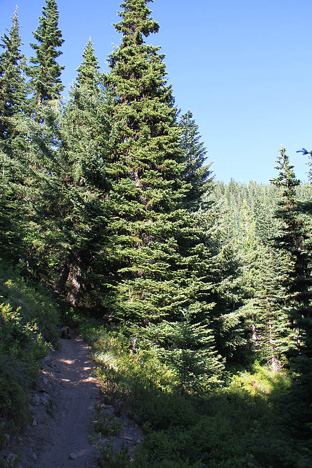
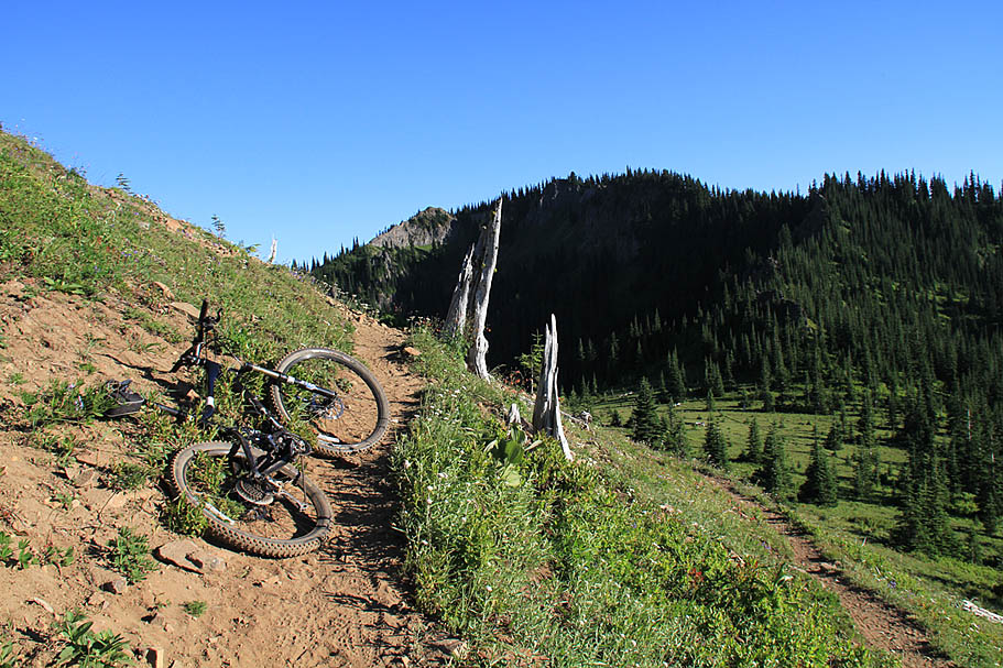
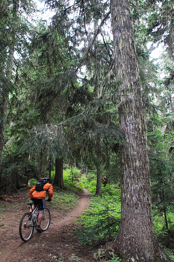
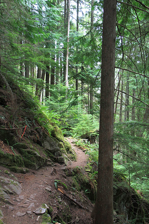
 Starting the trailhead near Camp Sheppard we picked up a small trail that take you through a bit of the camp before climbing up to the White River Trail (#1199) at 0.2 miles (RNP-01). From here go to the right. At 0.3 (RNP-02) you will come to a Y-junction with the Snoquera Falls Trail (#1167) stay to the right. At just under 0.5 miles (RNP-04) come to a four-way trail junction with the Snoquera Falls Trail (#1167) off to the left and uphill while the Buck Creek Trail (#1169) comes in from the right. Continue straight. At 1.5 miles (RNP-05) you will come down very close to the road with a connector trail coming up from HWY 410. Stay left and away from the road. You will start getting your climb on now. At 1.9 miles (RNP-06) you will come to the junction with the Ranger Creek Trail (#1167) which cuts back sharply to the left while the While River trail continues on to the east. Take the Ranger Creek Trail and get ready for some significant climbing over the next 4.8 miles where you gain about 2,300 feet. Starting the trailhead near Camp Sheppard we picked up a small trail that take you through a bit of the camp before climbing up to the White River Trail (#1199) at 0.2 miles (RNP-01). From here go to the right. At 0.3 (RNP-02) you will come to a Y-junction with the Snoquera Falls Trail (#1167) stay to the right. At just under 0.5 miles (RNP-04) come to a four-way trail junction with the Snoquera Falls Trail (#1167) off to the left and uphill while the Buck Creek Trail (#1169) comes in from the right. Continue straight. At 1.5 miles (RNP-05) you will come down very close to the road with a connector trail coming up from HWY 410. Stay left and away from the road. You will start getting your climb on now. At 1.9 miles (RNP-06) you will come to the junction with the Ranger Creek Trail (#1167) which cuts back sharply to the left while the While River trail continues on to the east. Take the Ranger Creek Trail and get ready for some significant climbing over the next 4.8 miles where you gain about 2,300 feet. |
     |
     |
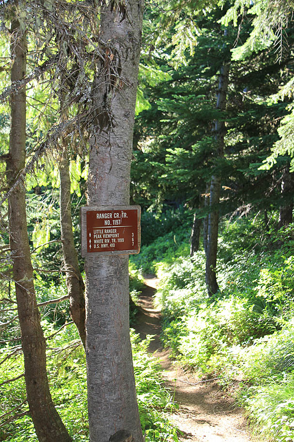
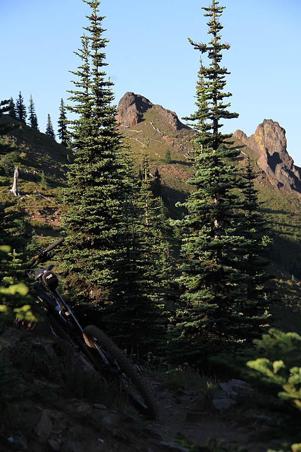
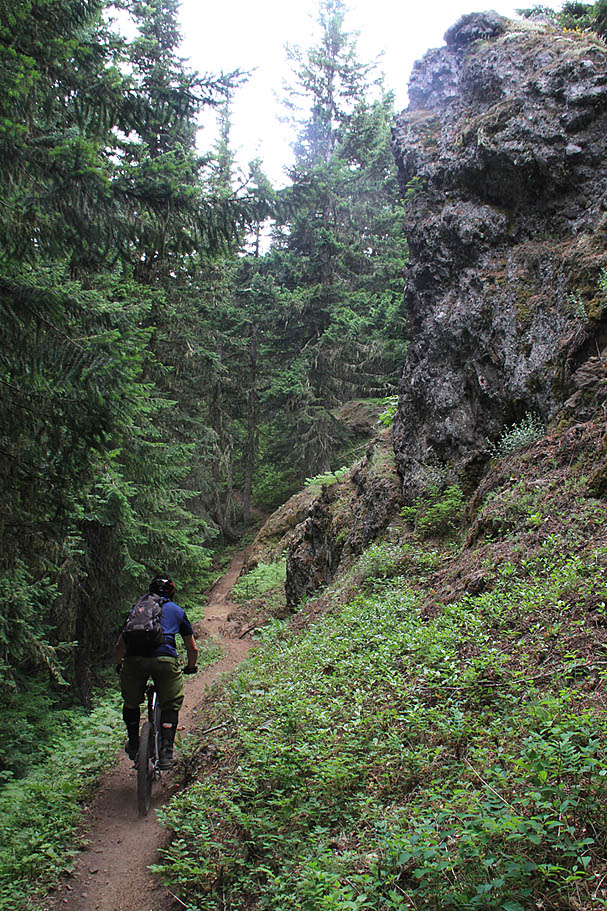
 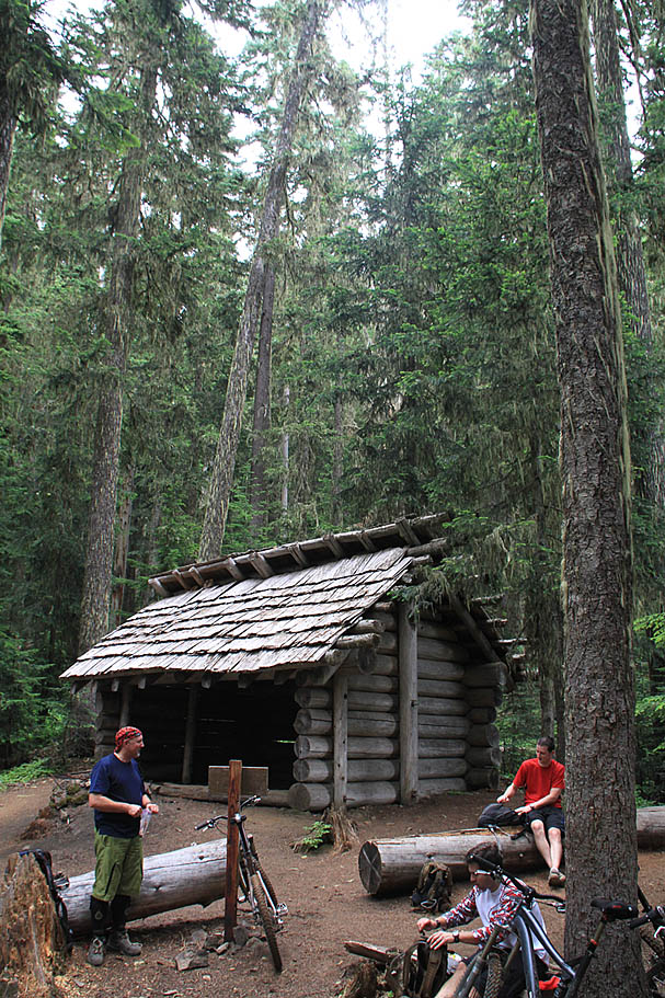 At 6.6 miles (RNP-07) you will come to the Ranger Creek Shelter. This is also the upper junction of the Palisades Trail (#1198). The first time I rode here we took the Palisades Trail from here and the second time we continued on uphill on the Ranger Creek trail. The Palisades Trail is off to your right as you are coming up to the shelter and the Ranger Creek trail goes in front of and around the shelter and continues up hill. At 6.6 miles (RNP-07) you will come to the Ranger Creek Shelter. This is also the upper junction of the Palisades Trail (#1198). The first time I rode here we took the Palisades Trail from here and the second time we continued on uphill on the Ranger Creek trail. The Palisades Trail is off to your right as you are coming up to the shelter and the Ranger Creek trail goes in front of and around the shelter and continues up hill. |
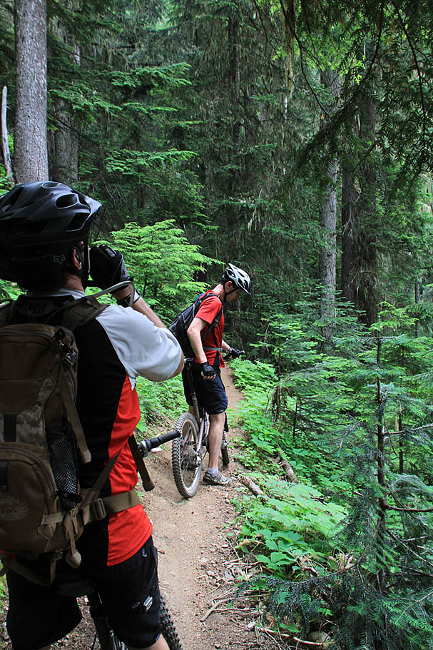
  At this point you have to decide if you have much more climbing you have in you. If you are pretty gased you can take the Palisades Trail which is still a pretty sizable and awesome loop on its own. If you have got some gas left in the legs for about 3 more miles of climbing (one way with some undulations) then I highly recommend checking out Noble Knob as and out-and-back from this point before heading off on the Palisades Trail. At this point you have to decide if you have much more climbing you have in you. If you are pretty gased you can take the Palisades Trail which is still a pretty sizable and awesome loop on its own. If you have got some gas left in the legs for about 3 more miles of climbing (one way with some undulations) then I highly recommend checking out Noble Knob as and out-and-back from this point before heading off on the Palisades Trail. |
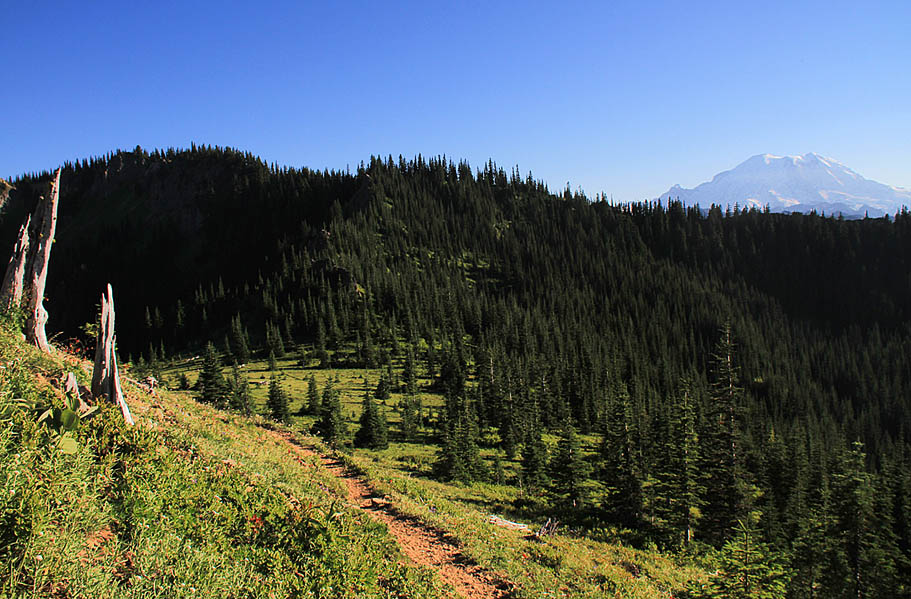
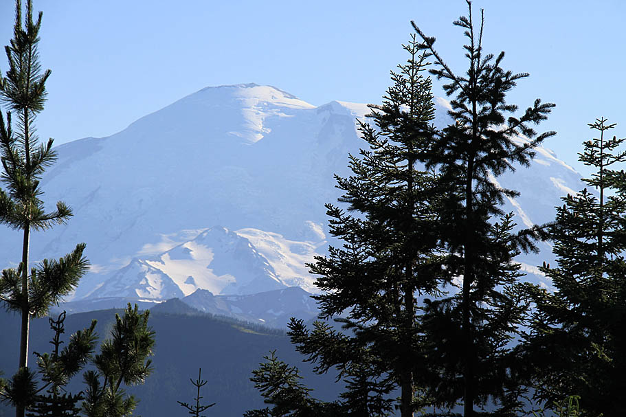  To do the Noble Knob out and back continue on the Ranger Creek Trail uphill past the shelter. If it is a clear day make a point to look your shoulder when you go through a sparse spot in the trees and should have a great view of Mount Rainer. At about 1 mile from the shelter (RNP-08) you will come to shallow junction of the Dalle's Ridge Trail (#1173). Your options are to cut back sharply to the left or take a very slight right and merge onto the Dalle's Ridge trail heading southeast. Take the slight right and merge onto the Dalle's Ridge trail. To do the Noble Knob out and back continue on the Ranger Creek Trail uphill past the shelter. If it is a clear day make a point to look your shoulder when you go through a sparse spot in the trees and should have a great view of Mount Rainer. At about 1 mile from the shelter (RNP-08) you will come to shallow junction of the Dalle's Ridge Trail (#1173). Your options are to cut back sharply to the left or take a very slight right and merge onto the Dalle's Ridge trail heading southeast. Take the slight right and merge onto the Dalle's Ridge trail. |
    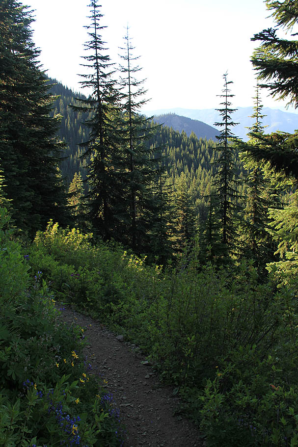 |
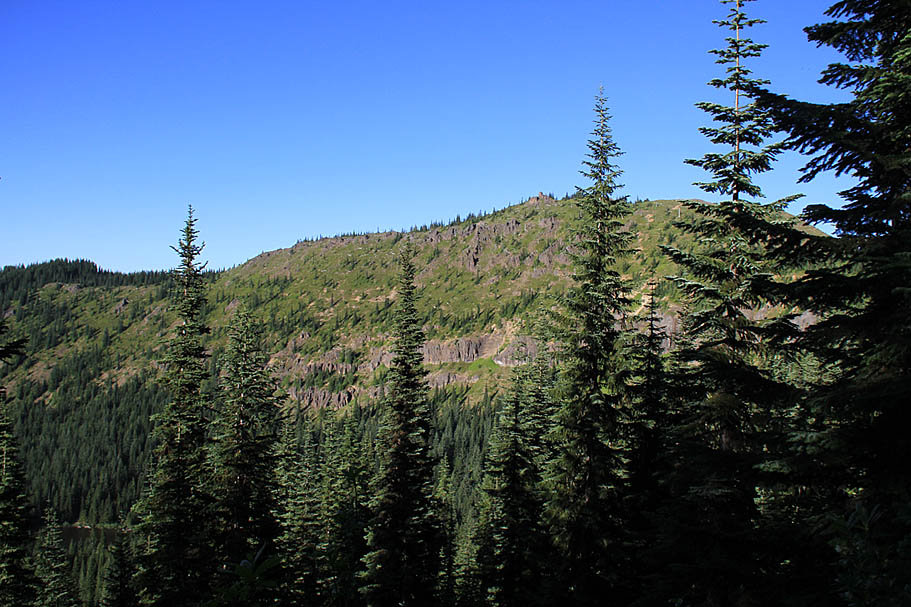
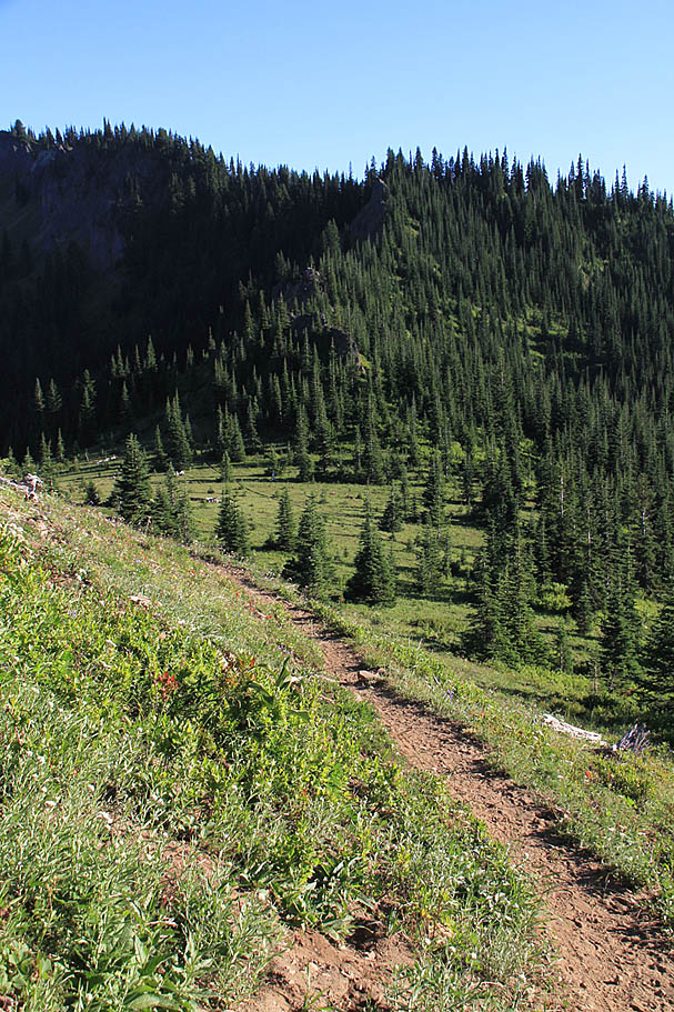
| The first part of the Dalle's Ridge Trails has some views between the trees to the south before you descend shortly over to the north side of the ridge where views of the Twenty-Eight Mile watershed and Noble Knob come into the view. The trail will make an undulation or two before you have to grunt up about 200 feet in a quarter of mile. This grunt will bring to the junction of the Noble Knob Trail (#1184) (RNP-09) at around 8.7 miles. You will want stay to the left turning north towards Noble Knob. |
 |
| You now get to enjoy a quick break from climbing as you roll down hill onto the Noble Knob Ridgeline. You will very soon come out to an expansive view and a three way trail junction (RNP-10). From your left to your right is the Noble Knob Trail, A spur trail to the Noble Knob summit, and the Lost Lake Trail(#1185). Pretty much everything within the immediate view to the right of the spur trail to the summit is in Norse Peak Wilderness Area (aka no bikes). |
      |
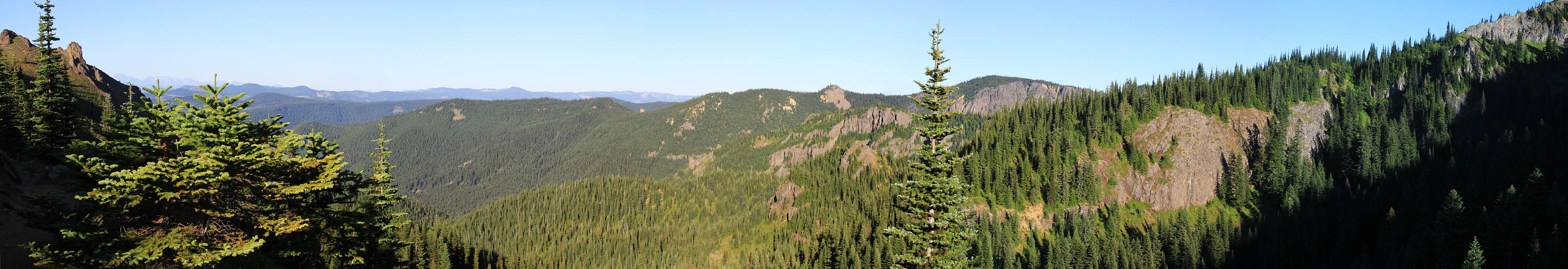
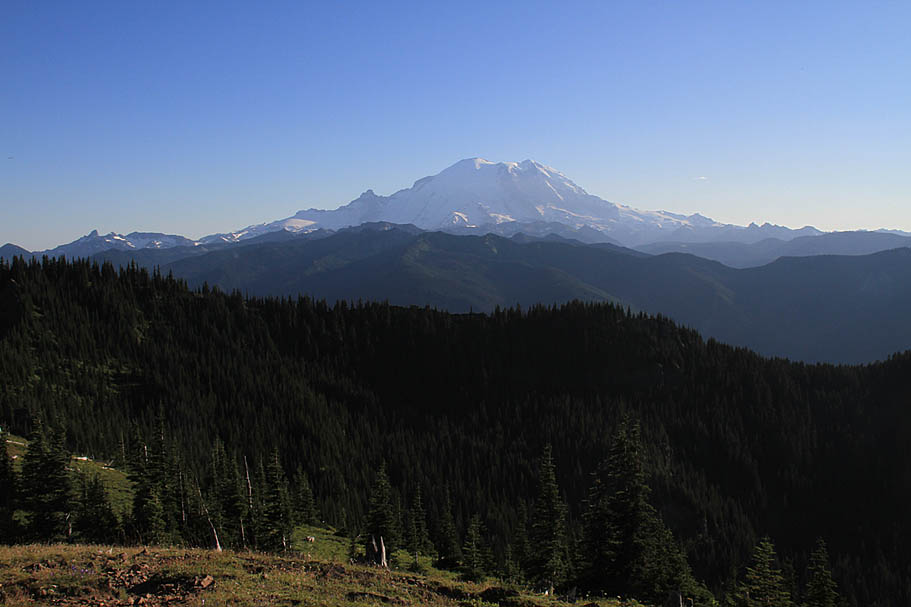
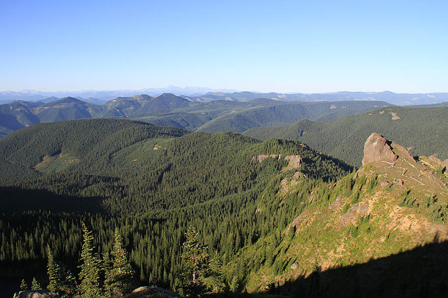
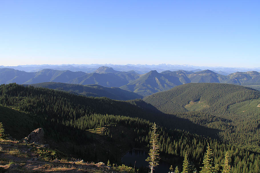
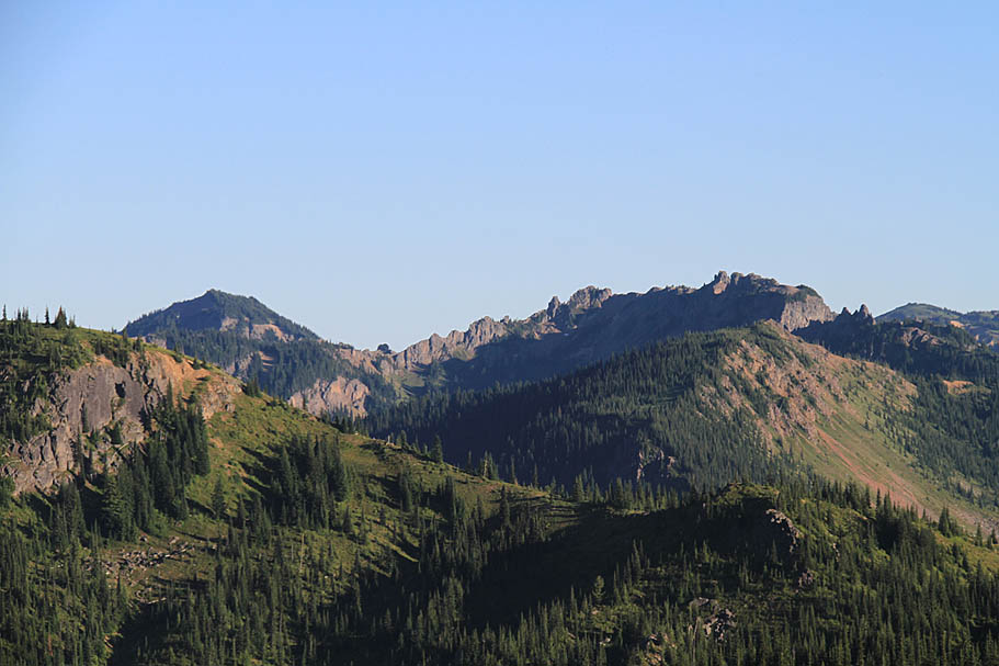
| It is well worth the slightly less than half mile effort up to Noble Knob (Elevation 5,997 feet)(RNP-11). The views are fantastic will good views of Norse Peak, Mount Rainer and other bits of the Mount Baker-Snoqualmie National Forest. |
   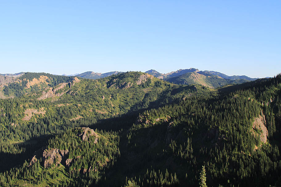  |
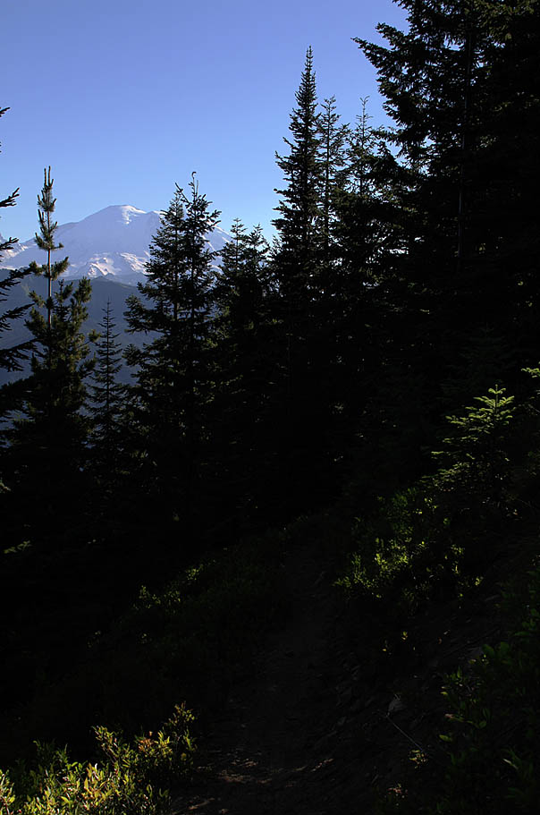
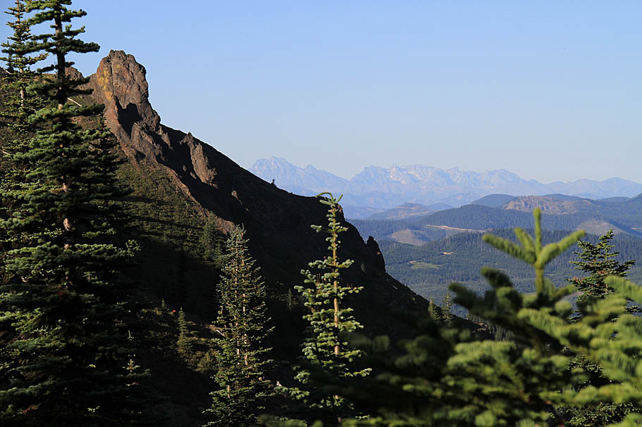
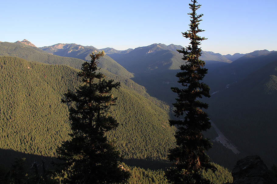
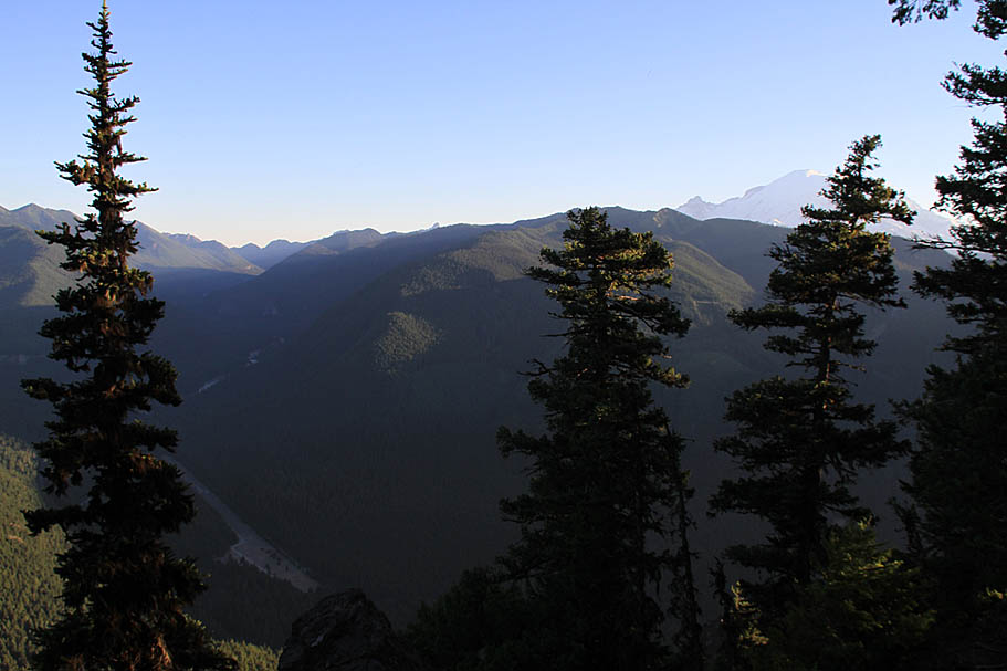
| After taking in the views it was time to start heading back. I was a little concerned with daylight at this point. I made fairly quick work retracing my steps back to the Ranger Creek Shelter (RNP-07) with the descent off of Dalle's Ridge being fantastically fun. From the Ranger Creek Shelter I took the Palisades Trail (#1198). There is a bit of mild climbing that starts pretty much right from the camp shelter followed by some undulations. While you are pretty much in the trees still you can tell that a fantastic views is in the work. A little less than a mile from the shelter (Somewhere around RNP-13) some fantastic views of the valley below and the Mount Rainer open up. |
 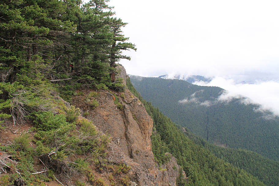 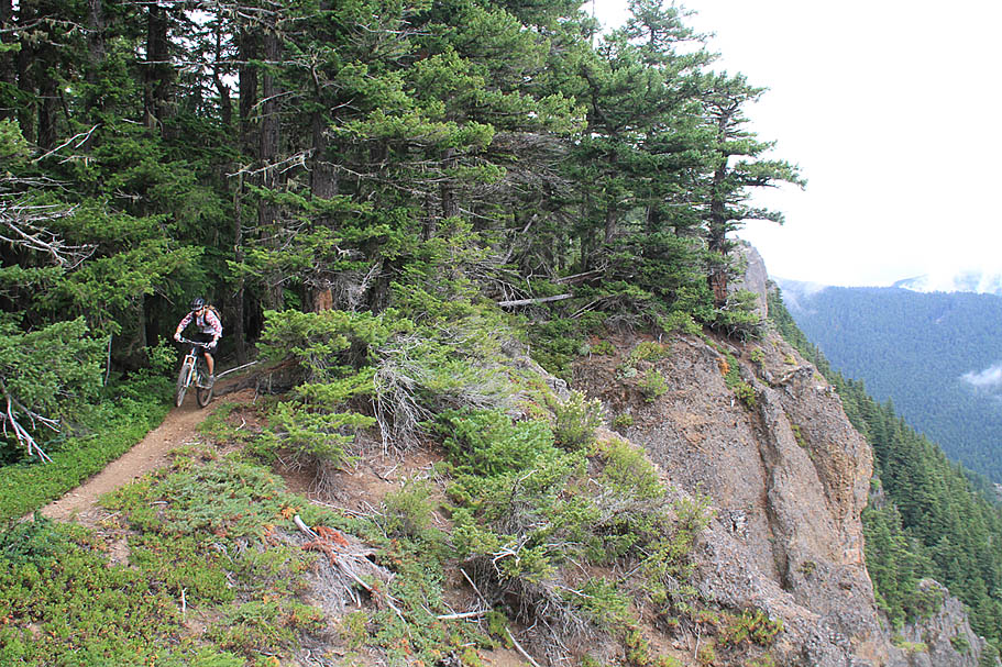 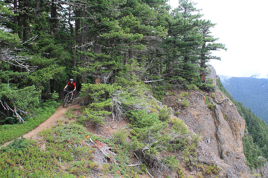 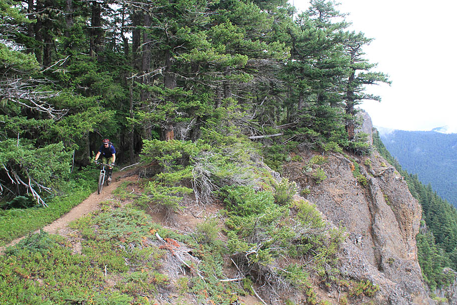 |
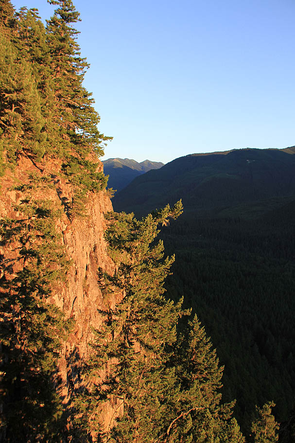
| The sheer cliffs make for stunning and views. During my first ride out there was lots of cloud cover that maske Rainer but the views to the valley floor below were impressive none the less. It was one of the reasons I had to come back the following week when the skies were clear. I was not disappointed. |
 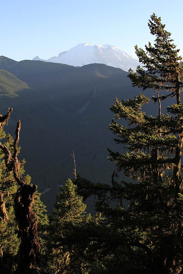     |
| For the next 1.25 miles after coming out onto the Palisade cliffs (RNP-13 to RNP-14) the trails is almost exclusively downhill and there are many spots to take in fantastic views. On my second ride out here I was really concerned with the daylight at this point and it was time to get on the gas as I had not taken into account that even through the last part of the trail was on a western slope, the ridgelines on the opposite side of the river were going to shade the last bits of the day. |
  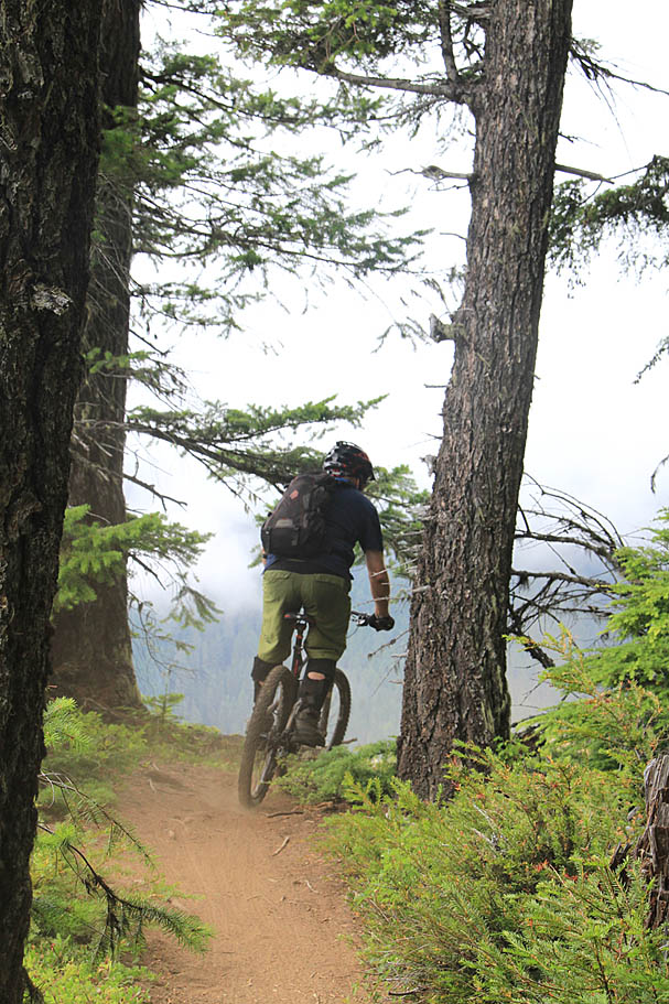   |
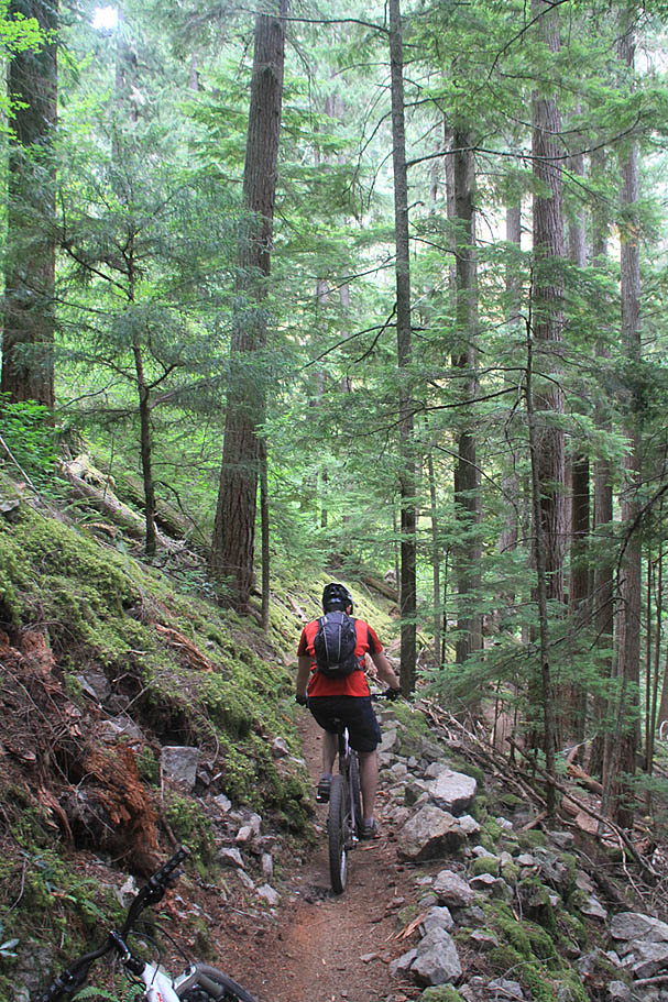
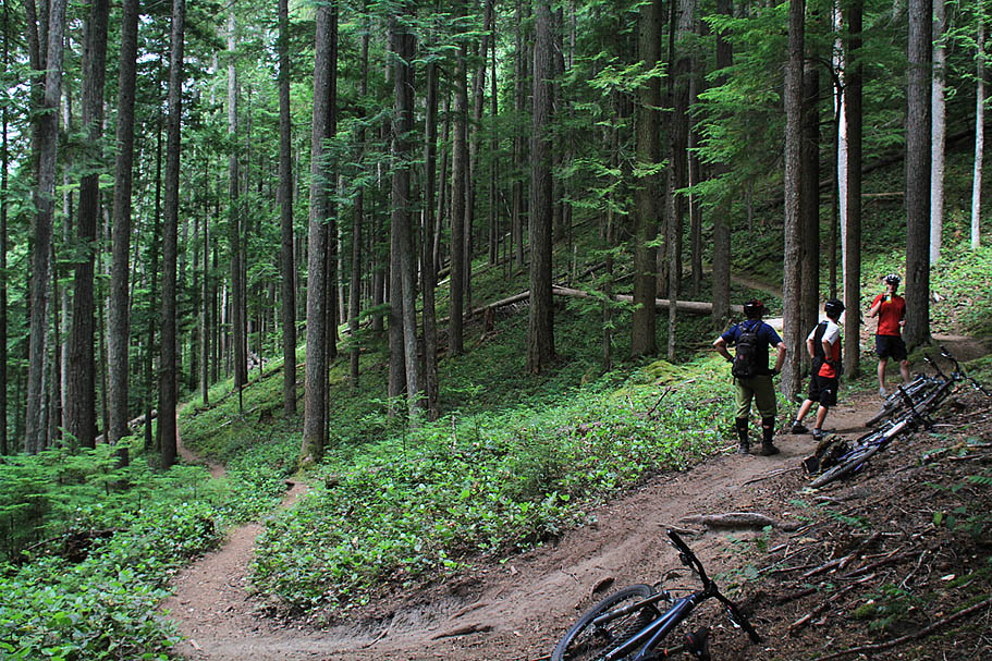
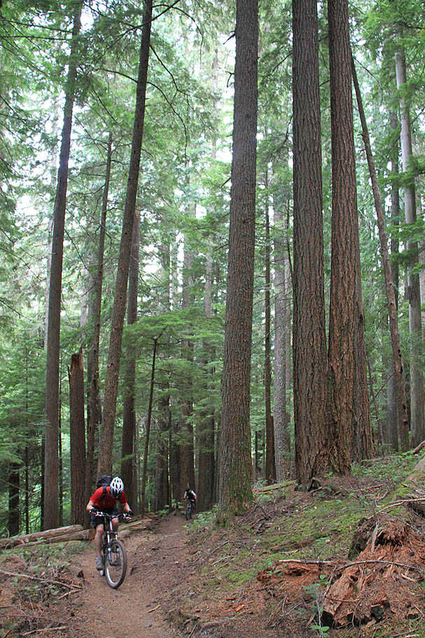
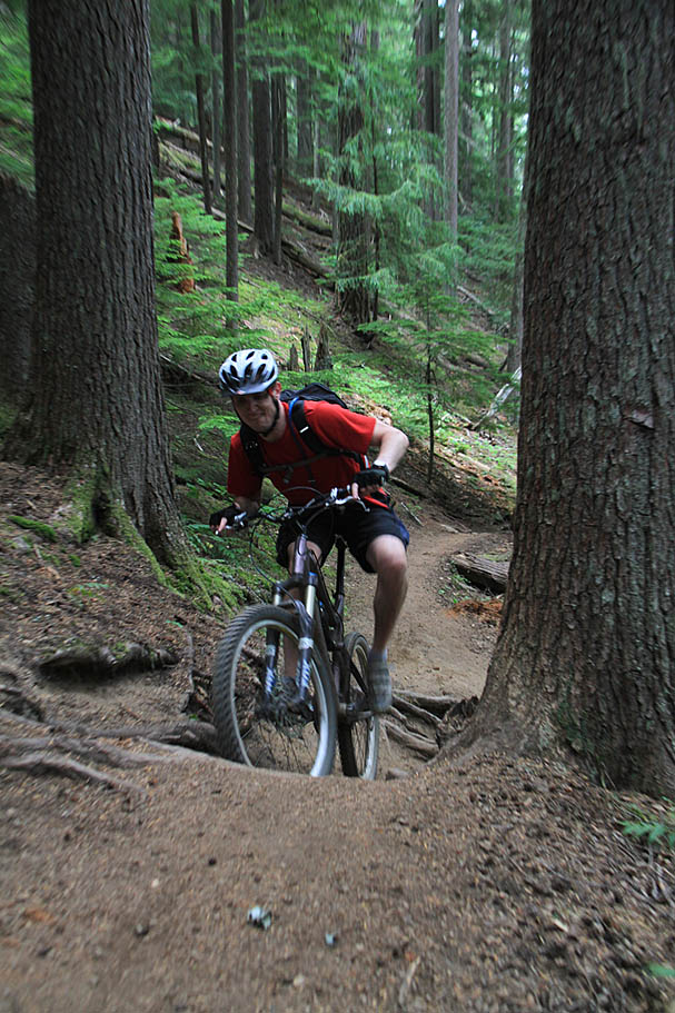
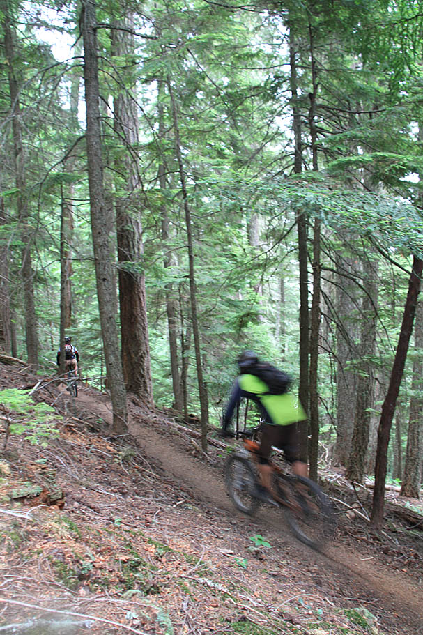
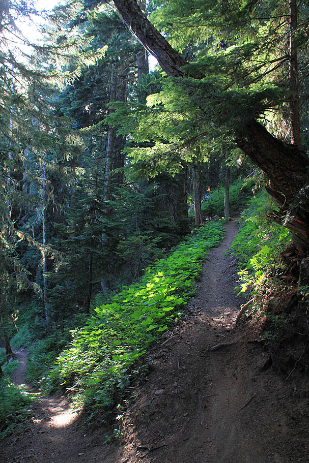
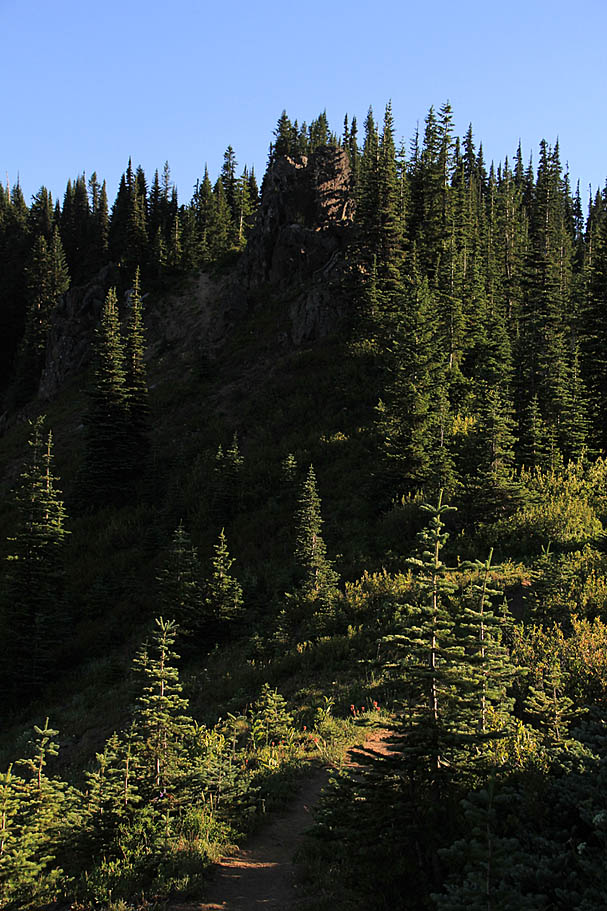
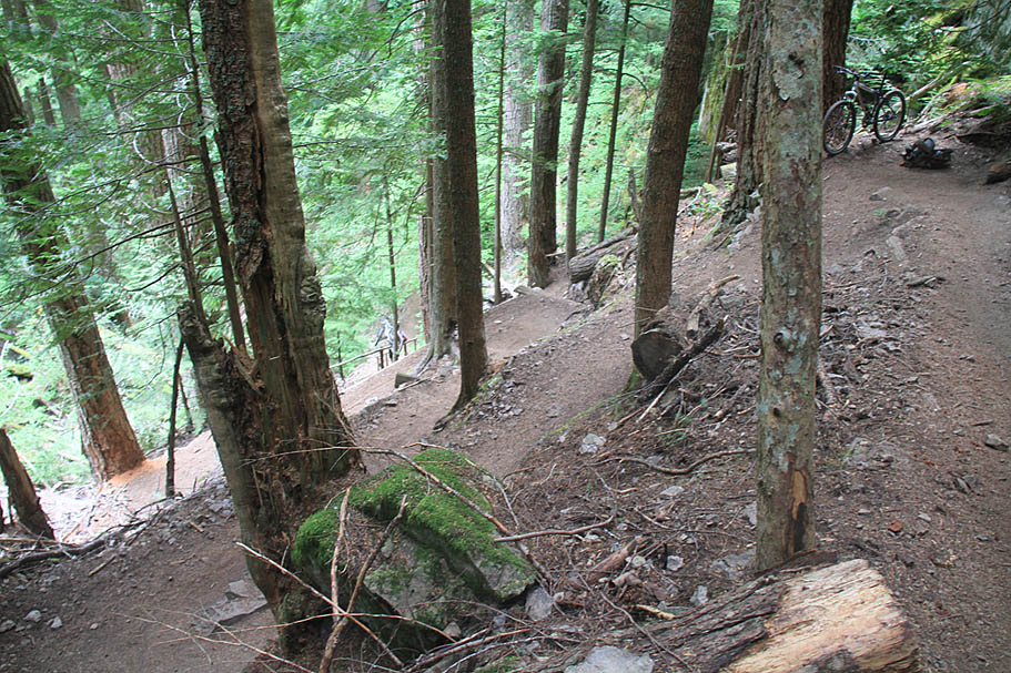
| Once the trail turns away from the Palisades and heads eastwardly the trail continues to be a real forest ripper of a trail. This section is technical with roots in many spots, quite narrow most of the time and completely fantastic. After about nearly a mile of rip-o-rama, the trails gains a little bit of elevation and flattens out a bit as you traverse through an extremely dense stand of young growth that has not been thinned yet. The ambient light levels there here are much lower than the rest of the forest and on my chasing daylight ride, it was quite dark through here. |
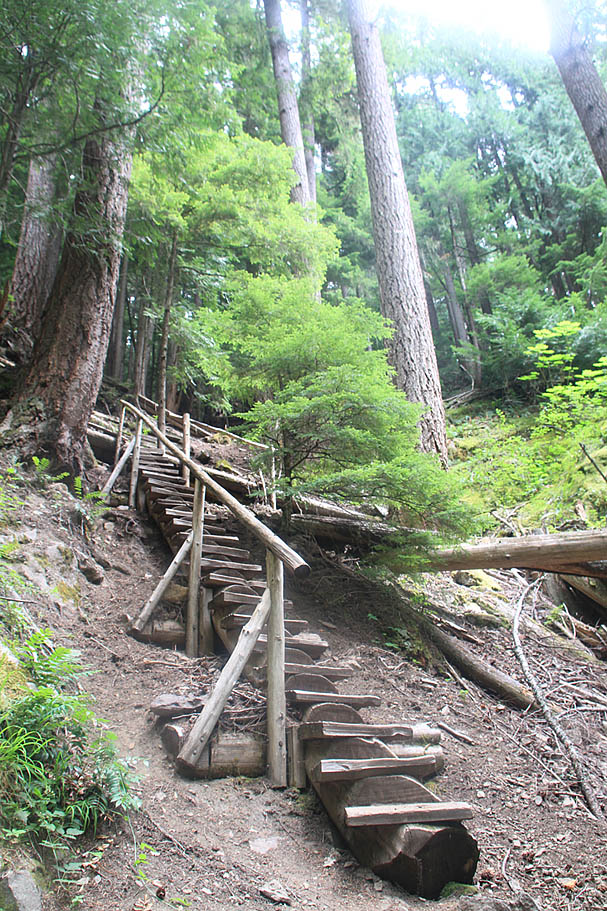  Soon the trail turned downhill again and trail ripapalooza was back on with some more rooty technical bits to keep you honest. Somewhere around the 18 mile or so mark the ride (including Noble Knob) and you come to a series of short and severely tight switchbackes leading to a steep wooden staircase built primarily from a log. (Waypoint is "Palisades Trail 1198" on the map). Below the staircase the trail rapidly takes on an entirely different character full rocky chunk. With Southern California as my homebase, this section was not a completely foreign style of riding for me, but it was none the less challenging. It is also worth noting that his section of trail dumps almost 800 feet in a mile. Somehow I managed not to take any pictures of this area. Soon the trail turned downhill again and trail ripapalooza was back on with some more rooty technical bits to keep you honest. Somewhere around the 18 mile or so mark the ride (including Noble Knob) and you come to a series of short and severely tight switchbackes leading to a steep wooden staircase built primarily from a log. (Waypoint is "Palisades Trail 1198" on the map). Below the staircase the trail rapidly takes on an entirely different character full rocky chunk. With Southern California as my homebase, this section was not a completely foreign style of riding for me, but it was none the less challenging. It is also worth noting that his section of trail dumps almost 800 feet in a mile. Somehow I managed not to take any pictures of this area. |
The Ranger Creek - Palisades Loop with the out and back to Noble Knob thrown in will net you about 21 miles with around 4,000 feet of climbing. More importantly you should have some out of breath moments as well as some take your breath away moments. This is a fantastic loop and if you are anywhere near here it is well worth checking out. |