Black Mountain (Rancho Bernardo)
| Black Mountain is located where Rancho Bernardo, Poway, and Rancho Peñasquitos, sort of met. There is another Black Mountain in San Diego County near Ramona. If that is what you are looking for click here. It is hard to miss this mountain if you are in the area as it sticks out from the surrounding terrain and it has a ton of antennas on its peak. I consider the Black Mountain area to be Black Mountain itself and the ridges and hills just to the east of the mountain. There are many options in the Black Mountain area and while this place used to be a hard nut to crack the San Diego Mountain Biking Association along with local leadership has made drastic improvements to the rideablity of this place. The heinously steep trails cut by 4WDs back in the day are being decommisioned and replaced with much more enjoyable and sustainable trails. This area is still very rocky and will typically make for some exciting downhills and challenging ups. The routes I suggest below should minimize any hike-a-bike time and maximize your "yee hah" time. That being said, you are going to get in some climbing out here. This area also has trail access to some of the other trails systems in the area such as the Santa Luz/Lusardi Loop with connections to Los Penasquitos Canyon and Lake Hodges and has been on the Archipelago Ride route since its inception. This area is slated to continue to improve. If it has been a bit since you were last here, you should give it another look. |
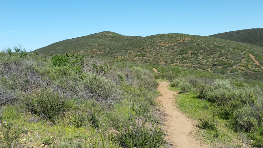
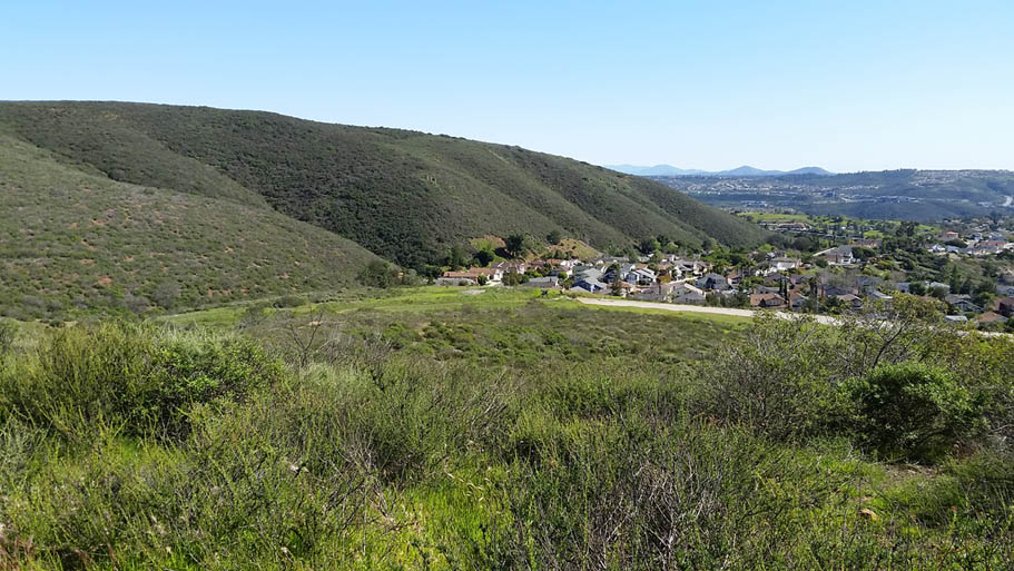
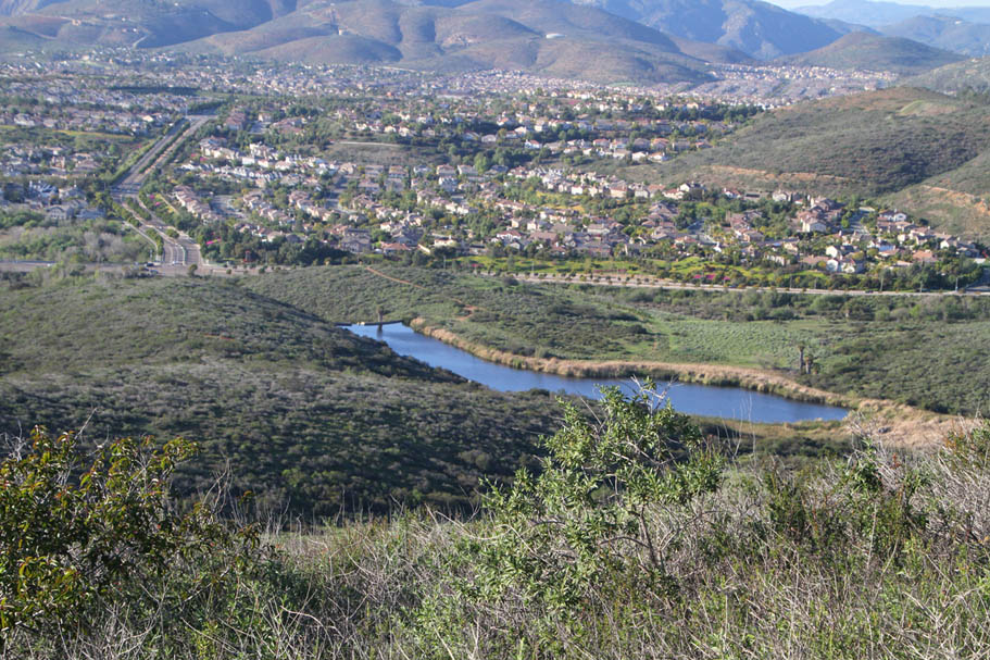
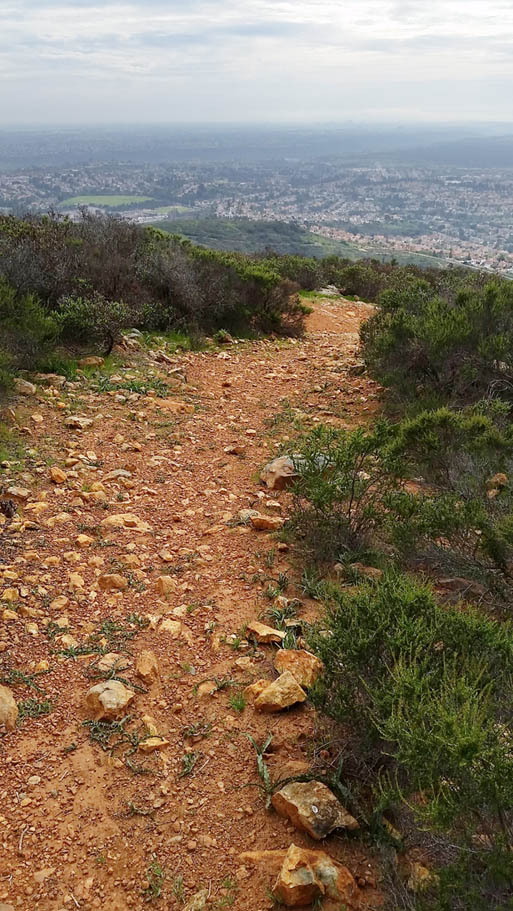
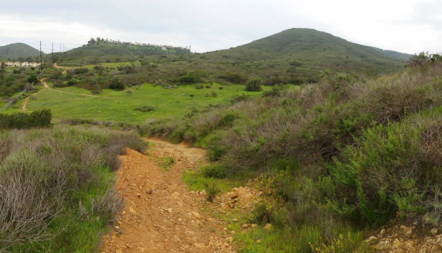
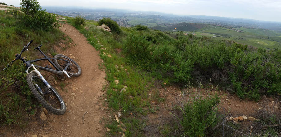
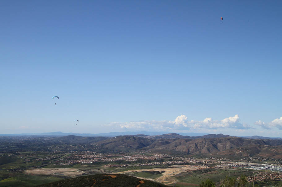
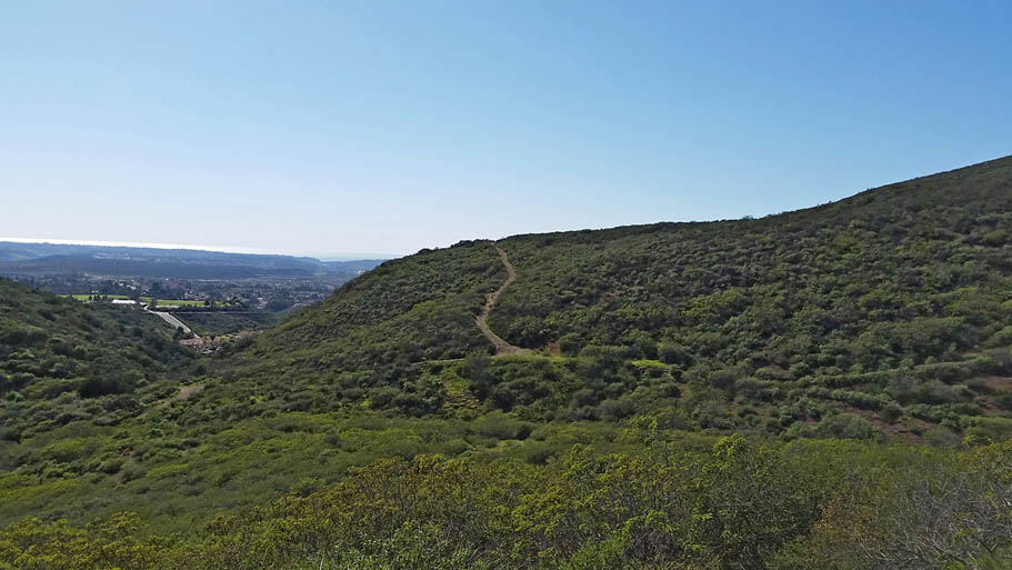
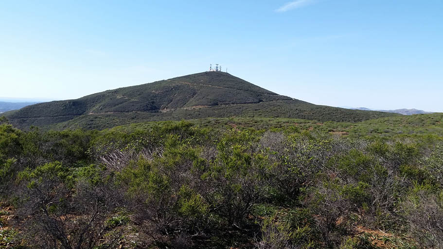
 Black Mountain as seen from the southern end of the East Ridge (Little Black Mountain) looking northwest. |
| Hazards: Water is available at the Hilltop Community and Black Mountain Ranch parks. Otherwise there is no water out on the trails. |
| Directions: There are a bunch of trail head options here, These are just the ones I reference in my suggested routes. (They are all on the embedded Trailforks map below) |
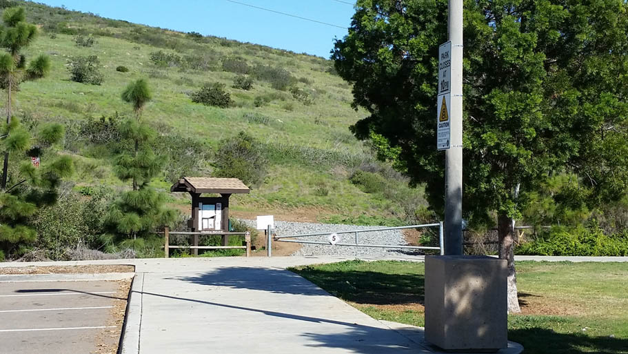
- Black Mountain Ranch Park: (Directions) This is my primary trailhead as I am generally coming from the north
- Hilltop Community Park: (Directions)
- Miners Ridge Loop Trail head. (Directions) I only use this if I'm doing the shortest of loops out here
- Trail head On Maler Road: (Directions)
Map and Route Details |
Awee - Lilac - Miner's Ridge Loop from Black Mountain Park |
||
This route is 5.7 miles with 722 feet of climbing. Download the GPX File: |
||
 |
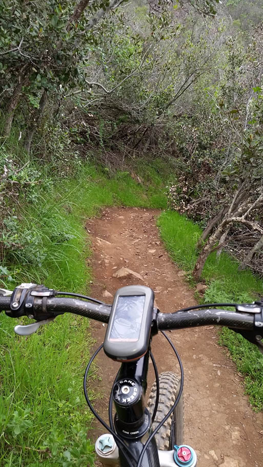
Note: My orginal short loop description was just Miner's Ridge Loop. The basic consenus with my riding buds has been that since the construction of the Lilac and Ahwee trails, virtually no one is doing just Miner's Ridge anymore. With that in mind I have updated the short route to include it. Starting from Black Mountain Ranch Park Trailhead, ride to the north towards the back of the park and pick up the doubletrack at the end ofthe parking lot. Just past the first metal power line pole on your right pick up the singletrack on your right. This is a nice bit of contouring singletrack that loops around the east and passes under the Carmel Valley Road bridge at 0.75 miles. After going under the bridge turn to your right on the doubletrack. In about 30 yards the doubletrack will bend sharply to the left. You should already see a singletrack coming off the right side of the doubletrack and switchbacking up the side of a small hill. Take the singletrack that heads to the east. This just under a mile section of trail does some very nice contouring over to the Miner's Ridge Loop Trailhead. When you arrive at the trailhead parking lot (1.6 mi), follow the signs for the Miner's Ridge Loop. You will follow a fireroad for a bit and then you will see a sign pointing to the right for the loop. You are at the "bottom" of the loop. While you can do this loop clockwise if you like, the trail signage is clearly steering you to do the loop counterclockwise. I suggest you hang a right here and do the loop counterclockwise. After following signs and making a right at the loop, you will almost instantly have to navigate a series of tight rock stair step switchbacks which can be quite difficult. After you get past the switchbacks it is a fairly straight forward climb up to the first break in the climbing at split in the trail that goes up to the gliderport (2.5mi) You will also see that the singletrack trail bends to your left and back downhill. Take the singletrack to the left for a very short respite from the climbing before you are back at it again. At just under 1.1 miles you will top out and start heading downhill on some fun singletrack. At 2.95 miles you will come to the junction of the Nighthawk trail. This trail is one of the most important improvements made to this area over the last two decades as it provides a ridable link to the peak and the east ridge without having to go the long way around. For this route you are going to to continue straight along the Miners Ridge Loop. Beyond this point you have some seriously enjoyable and often techish trail back to the bottom of the loop. There are a few stair step drops near the bottom to keep you excitement level up. |
 |
| At 4.1 miles you should be back at the Miner's Ridge Loop trailhead. Retrace your route on the Lilac Trail back to the Ahwee Trail. Pass under the Carmel Valley Road underpass at 5.1 miles and then take the gradual climb back to the double track where you will hang a left and finish off the climb back at Black Mountain Ranch Park. The mileage marks mentioned here start/end where the doubletrack meets the parking lot pavment. |
The Peak Widow Miner Loop |
||
| This route is 9.0 miles with 1,430 feet of climbing. Download the GPX |
||
 |
This route is you have more time and would like to hit up the Black Widow trail which an MTB focused downhill/flow trail. From the north end of the parking lot at Black Mountain Ranch Park, pick up the trail that heads to the west just beyond the ball field fences. The trail follows the fence line and turns south to pickup a service road that quickly comes out to Carmel Valley Road. Cross the road (don't be play frogger get on the evening news). And pickup an aqueaduct service road that heads south-southeast directly across the road. The service road will make a small rise then descend quickly and then angle to left and come out on the Maler Road cul-de-sac. You make a left, cross over the street and pickup a single track just to the left of gate across a paved service road. The single track will climb and switch back for a short bit then come out on that paved service road. Turn left and climb up the service road where after 1/10th of a mile you go over a rise where you will coast down to the the junction of the Black Mountain Summit fireroad 1.3 miles. Settle in for a bit of fire road climbing. It is steady but not a bruiser. At 2.6 miles you will pass the Night Hawk connector trail on your right, take note of it but keep on climbing. At 2.9 miles you will pass by the top of the Black Widow trail on your left. Don't even think about dropping in now, you need to get that summit checked off, keep on climbing. At 3.3 miles you reach the summit. Take in some views, call your Mom (tell her I said Hiiiiiiii!) and maybe have a snack.
Turn around and head back down the fire road (That technical looking trail heading downhill off to the west "are not the trails you are looking for"). Don't blow by the Black Widow that is now on your left at 3.6 miles you want to make that turn and take it. The Black Widow trail is an intermediate trail that has some berms (both natural and paver stone varieties), some rock rollers and short rock gardens all while heading downhill. The trail is not designated as a downhill only trail (yet) but don't be that guy. Climb the fireroad not this trail. At 4.6 miles the trail drops out onto a dirt service road. Turn left and quickly roll back down to the Black Mountain Summit Road you previously climbed. Turn left at this junction and climb back up the fireroad. This time when you come to the junction of the Nighthawk Trail at 5.9 miles, turn right and take it downhill. This is quite jumble rock garden that is about a football field long and drops about 75 feet. At the bottom of this turn left onto the Miner's Ridge - Nighthawk connector singletrack on your left. This single does some contouring for just under 1/4th of a mile where it meets Miner's Ridge Loop at 6.2 miles.
Turn right (and downhill) onto Miner's Ridge Loop and enjoy the often techish trail ast it works its way down the northeast slope of the mountain. There are a few stair step drops near the bottom to keep you excitement level up. At 7.31 miles you should be back at the Miner's Ridge Loop trailhead. At the west side of the trailhead parking area pick up the Lilac Trail. This is a mighty fine trail that has some ups but for the most part it is a downhill affair. At 8.1 miles the singletrack comes out to a doubletrack. It should be hard to not follow the tire tracks as the doubletrack bends around and then the singletrack Ahwee Trail is goes off tot eh left and makes it way under the Carmel Valley Road bridge at 8.3 miles and then takes a the gradual climb back up to a double track just north of the park where you started. Hang a left and knock off the last short bit of climbing back to the park.
|
 |
     |
||
 |
For now proceed with the climbing until you reach the top of Black Mountain at 3.92 miles. Take in some scenery. After that head back down the mountain and when you get to back to the rocky trail that is now on your right take it. This trail is rocky and steep in spots. There are several permutations of trail down this way (Some which are slated to close) At the first 3-way split take the middle trail (Its the only one that looks like singletrack). Follow this trail down the mountain and it should bring you out on the main access road at 4.88 miles (You mileage may vary based on which braid you took). Once back on the main access road turn left (uphill) and starting climbing up the access road. At 5.94 miles you are back at where you first came out on the main access road. Turn right and take the now heinously steep and rocky descent. At the bottom of the steep rocky section hang a left back onto the Night Hawk trail and retrace your tracks back to the Miners Ridge Loop trail at 6.23 mile . Hang a right here to complete the Miners Ridge Loop as described in the section above. When you get back to the Miners Ridge Loop Trailhead at 7.29 miles pick up the Lilac trail and retrace your way back to the Black Mountain Ranch Park Trailhead at 8.98 miles. | 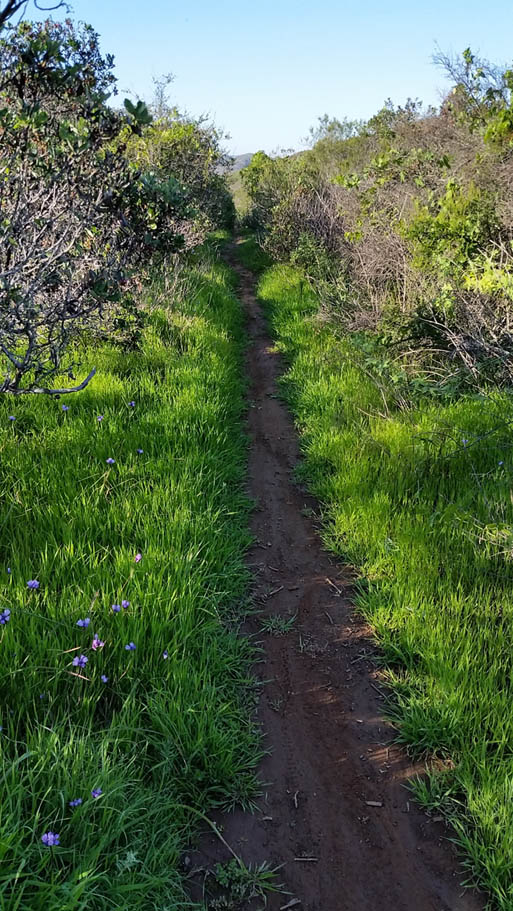 |
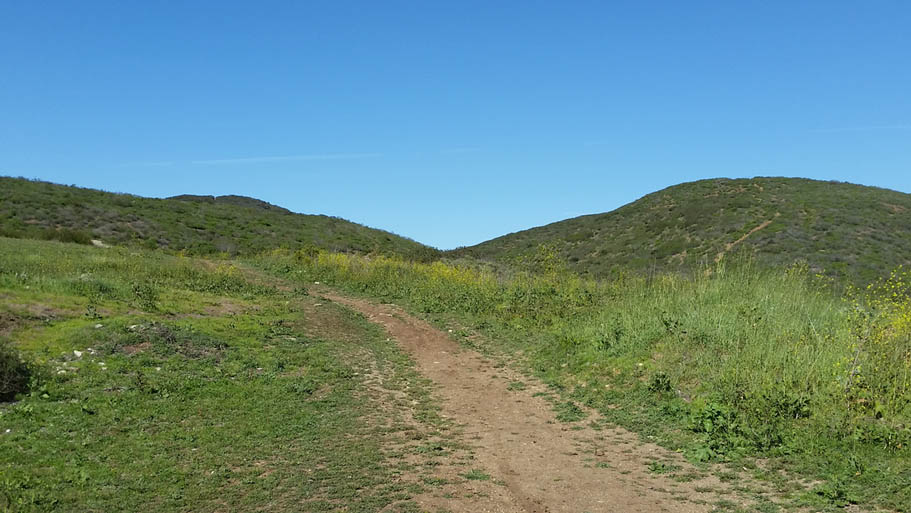
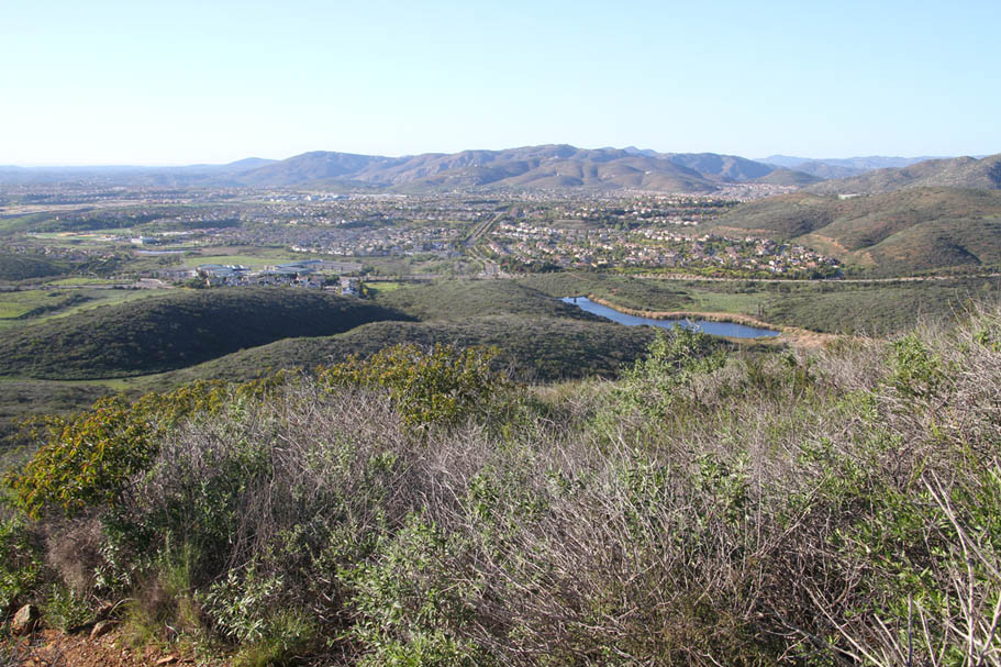
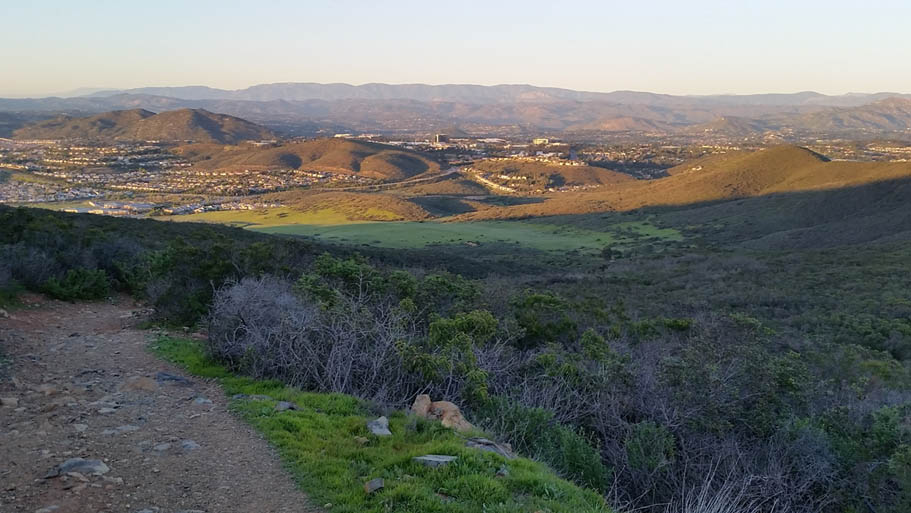
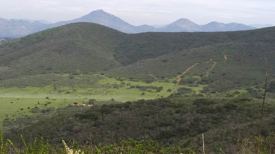
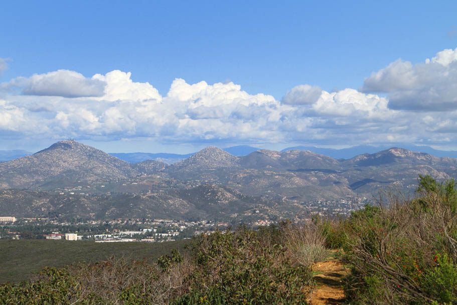
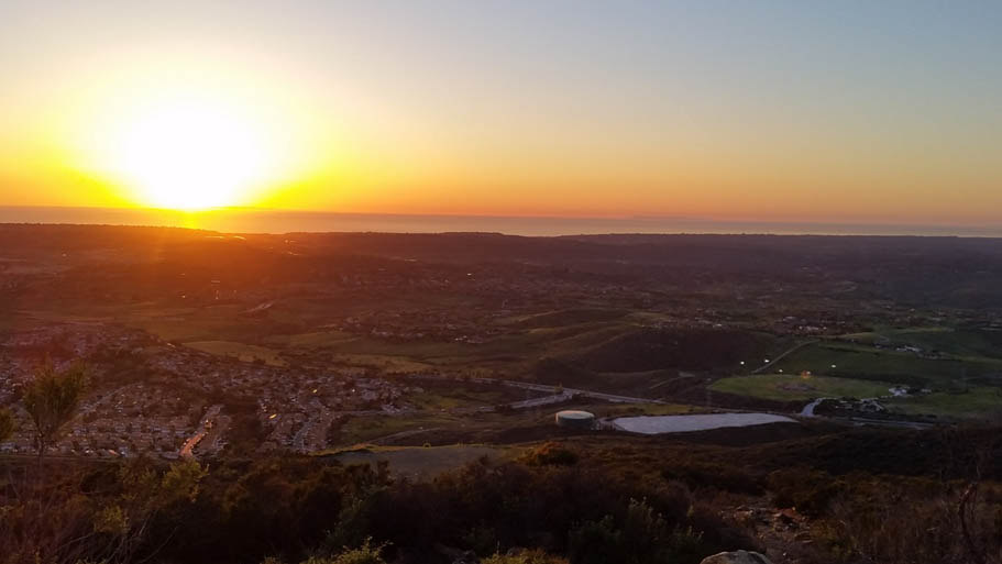
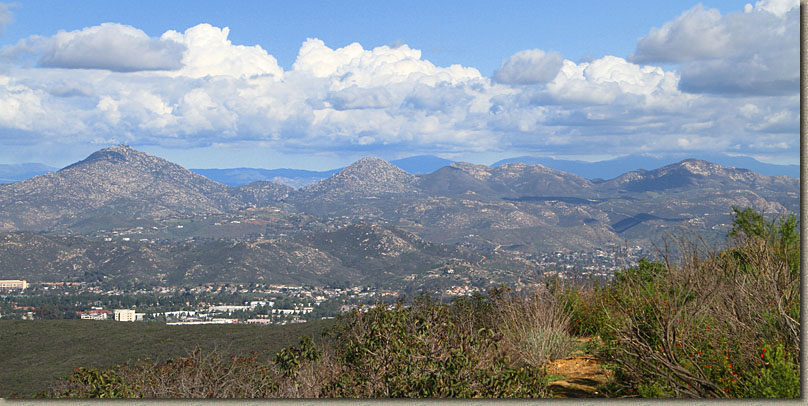 Looking East from the top of Black Mountain |
||
The Long Route |
||
| This route is 13.7 miles and has 1834 feet of climbing. Download the GPX |
||
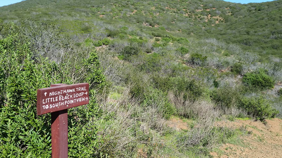
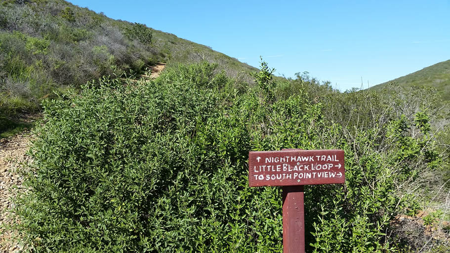
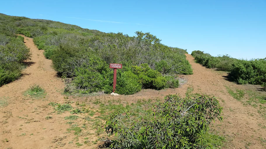
This route starts at the Black Mountain Ranch Park trailhead as well. It is basically and add-on Peak-Widow-Miner Loop described above. Follow the route as described above but instead of turning left on to the Miner's Ridge - Nighthawk singletrack at 5.9 miles, continue straight on the Nighthawk trail. At 6.1 miles take the singletrack trail off to the left (Danger is My Buisness). Take this down to where the Demaca-Nighthawk connector comes up from the south. There is a also a SDMBA sponsorerd Bike Repair Post. Contines stright uphill and east to a higher saddle at 6.65 miles and slighty funky junction of trails very close together As you come up to the saddle map kiosk on your left and The Little Black Loop trail going off right. The trail you are on contines about 30 feet to the Manzanita Loop. The Mazanita Loop Starts/Ends at this junction. Take the Mazanita Loop to the left and enjoy this contouring singletrack with some rocky bits as it works around the northern half of the eastern ridge. There are a few lesser used unsanctioned trails spurring off along this route. If you find yourself suddenly going heinously steep downhill, you gooned up the navigation. The contouring action work its way back to where you started the loop. You should be at about 8.3 miles at this point. |
||
    |
||
Take the Little Black Loop now that contours south along the eastern flank of Little Black Mountain. At 9.7 miles you will come to a trail junction where there is another map kiosk as well a bench to take a breather at if you desire. There is a singletrack that continues south. This is known as Roadrunner Ridge. Take it. This is a lollipop trail that will follow along the ridgeline and then bring you back to where you started. (There is an OG singletrack off of this loop goes down to Carmel Mountain Road. It is blocked off but the railing is often vandalized. (See my final thoughts section below). Stay on the main trail and work your way right back to that bench. When you get back to the bench, get back on the Little Black Loop trail going north this time and retrace your way back to the the high saddle junction. You should be at about 10.1 miles now. Hang a left and continue back the way you over to the East Ridge on. Past the bike repair stand and uphill back to the Nighthawk trail where you will hang and right. Just as you start to see the heinous rockgarden you came down earlier, Make a right onto Nighthawk-Miner's Ridge Connector. You are now back on the Peak Widow Miner Loop describe in the previous section. The next two miles is some good mostly downhill fun followed by just enough of of a climb at the end to keep you honest. You should get back to the parking lot with 13.7 miles and 1,834 feet of climbing on your legs. |