Noble Canyon
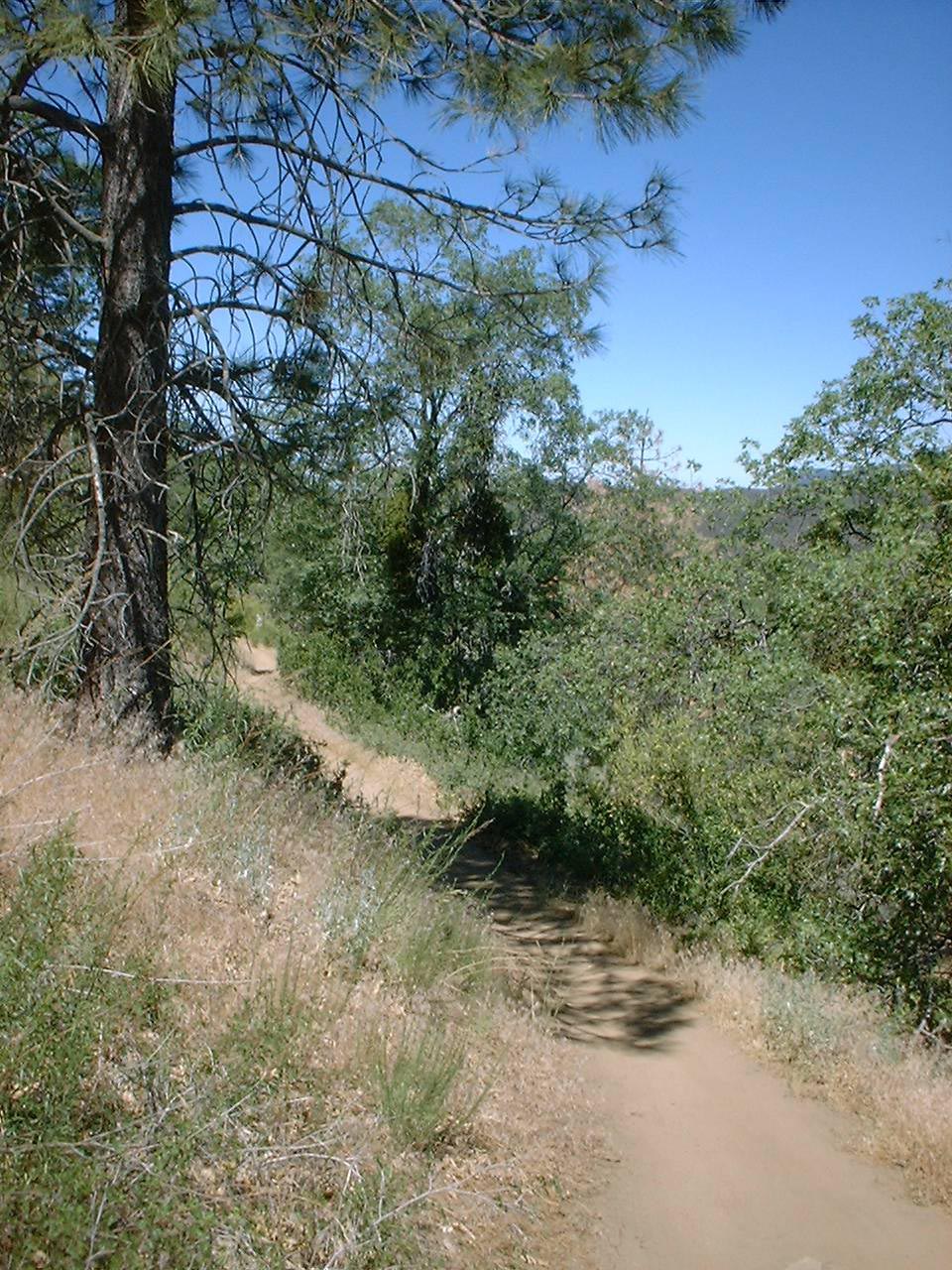
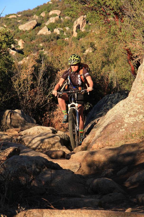
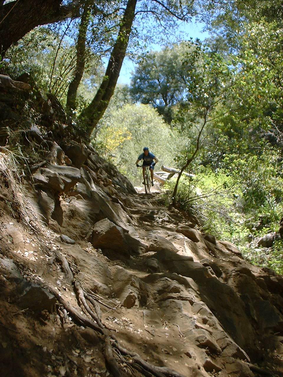
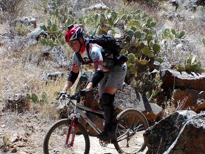
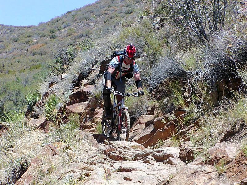
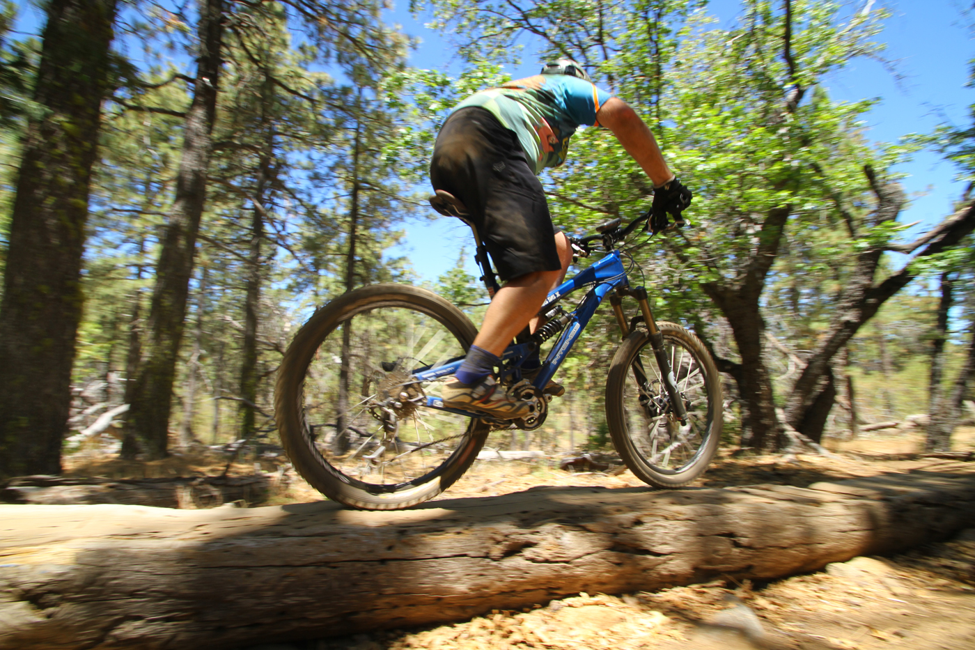
Noble Canyon is considered to be one of the best trails around Southern California. It is technically difficult with narrow single track, gnarly rocks and tight switchbacks. This ride takes you through three distinct ecosystems. You start out in alpine meadows and oak trees that transitions into typical Southern California chaparral and finally into the arid desert climate near the Anza-Borrego desert. At some times of the year you can start the ride will plenty of snow on the trail and by the end of the ride be in 85 degree desert heat. This is normally considered an advanced ride. This ride can be fun for strong intermediate riders but you will most likely find yourself doing some walking over and down obstacles and maybe beat up, bruised and leadking at the end.
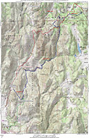
Directions: There are several ways to do Noble Canyon. You can certainly do to the shuttle thing and start at the upper trailhead on Sunrise Highway. You can start at the lower trailhead at the Pine Creek Picnic Area and have yourself a really good climb up Deer Creek Road and Laguna Meadows Road to get to the upper trailhead and then go down Noble, My favorite method is to combine the Big Laguna Meadow and Noble Canyon together . The map here and the description should be enough for you to do what ever variation you desire.
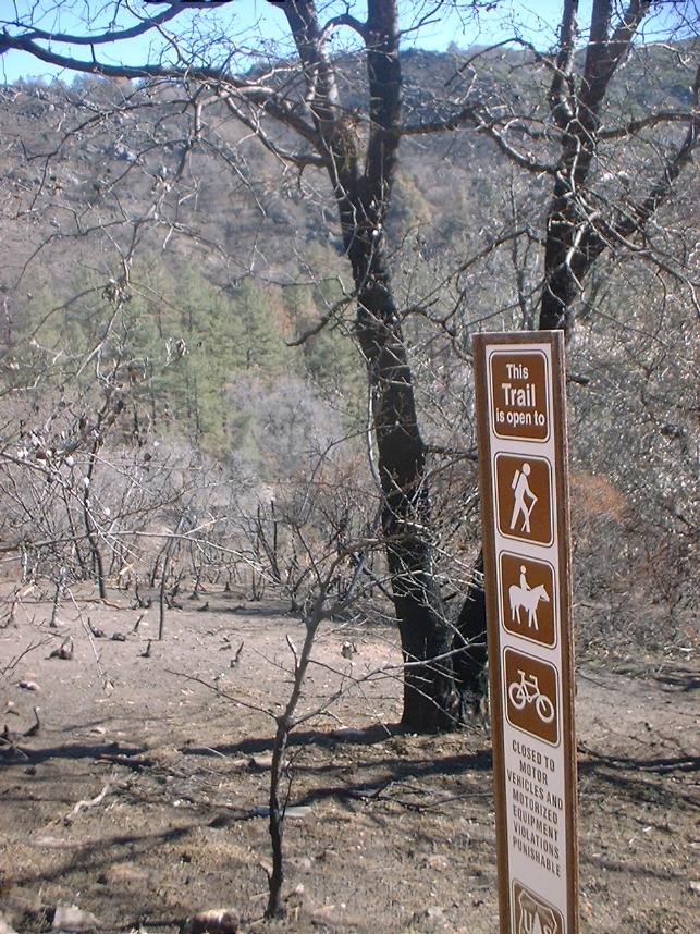
A National Forest Adventure Pass is required at the Upper Trailhead and the Lower Trailhead as well.
- Redtail Roost: From San Diego, take I-8 east to Pine Valley. Take exit 47 for Sunrise Highway and turn left. Travel north up into the Laguna mountains for 8.9 miles. Redtail Roost will be on your left. Turn in and Park. If you pass a fire station on your right you have gone too far.

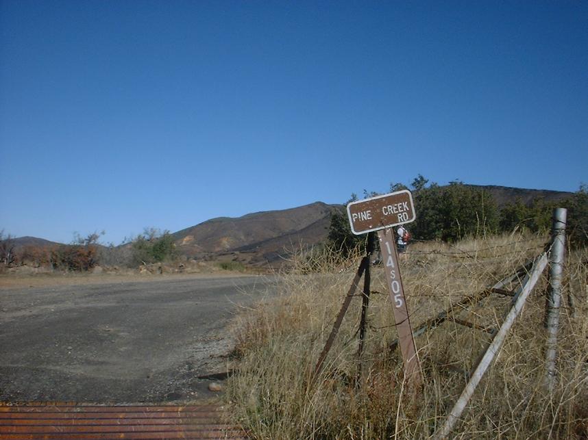
- Upper Noble Canyon Trailhead (Penny Pines): From San Diego, take I-8 east to Pine Valley. Take exit 47 for Sunrise Highway and turn left. Travel north up into the Laguna mountains for 13.6 miles. You will pass through the hamlet of Mount Laguna and a general store along with the Big Laguna Campground. There is parking on both sides of the road and Penny Pines. If you Pine Creek Road on your left you have gone too far. Park here.
- Lower Noble Canyon Trailhead:
From San Diego, take I-8 east to the off ramp for Pine Valley. Exit the
highway and turn left. Travel north for .3 miles to Old Highway
80. Turn left onto Old Highway 80 and travel about 1.2 miles to Pine
Creek Road. Turn sharply right onto Pine Creek Road and travel 1.6 miles
to the trailhead parking on the right.

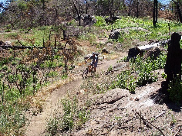
Hazards: Treacherously technical trail with steep drop offs just off the trail in spots. Noble Canyon is not a place to bring a beginner or someone just breaking into the intermediate catergory. For San Diego locals, if Miner's Ridge Loop at Black Mountain gives you fits, you will most likely not be a happy camper on Noble Canyon. DO NOT underestimate the late spring to early fall heat or overestimate how long your hydration is going to last! The lower portions of the trail can get be much hotter than the general surrounding area with little shelter from the sun .
Route Descriptions: I will start off my describing the shuttle option, followed by the loop route, then the Laguna - Noble Point to Point Route
The Shuttle Option :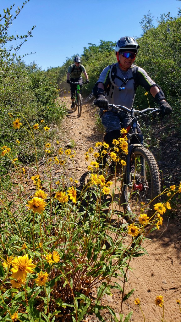
 Starting from the Penny Pines Upper trailhead off of Sunrise highway, Noble Canyon heads south and within a couple hundred yards, you will notice the Big Laguna Trail coming in from the right. Continuing straight (south) the Noble Canyon trail starts climbing up a couple hundred over the next 3/4ths of a mile topping out at 5,531 feet. It is not a tough climb on its own, but if you are a sea-level slacker like myself you will notice the elevation. Once over the top you get get to enough a bit of swooping downhill cruising and at 1.2 miles you come to the junction of the Filaree Flat Spur. This trail will go up to the Laguna Meadow but that is a different route. Continue on the Noble Canyon and you will soon cross over Pine Creek Road. It rarely sees traffi, but is open to vehicles.
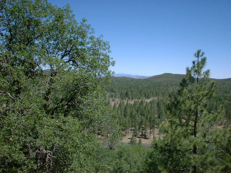
 After crossing Pine Creek Road, you will have a short climb. At this point you should have noticed some old fire damage. In 2003, this area got pretty toasted by a wildfire. The area has seen other wildfires since then, but the 2003 one was a doozy. The climb is over soon enough and you start descending in earnest. You will soon pass by the junction with the Indian Creek trail on your left that will take you out towards the Cuyamacas. You can use this trail to do a truly epic Cuyamaca to Noble Loop.
 After descending for some time along the fast
smooth stuff you will cross over Pine Creek Road again. At this point you maybe
e thinking to yourself "What is the BIG deal? The is not technical at
all" NOTE: Your next bailout point off the trail is in 4.3 miles. You can eather turn left and climb back up the road towards the upper trailhead or turn right and go mostly downhill to the lower trailhead on Pine Creek Road. Beyond this point the trail changes dramatically. Shortly after the road you will a have to navigate some tight switchbacks and the terrain starts changing from forest to chaparral. Also the trail starts get rockier and more technical.
After descending for some time along the fast
smooth stuff you will cross over Pine Creek Road again. At this point you maybe
e thinking to yourself "What is the BIG deal? The is not technical at
all" NOTE: Your next bailout point off the trail is in 4.3 miles. You can eather turn left and climb back up the road towards the upper trailhead or turn right and go mostly downhill to the lower trailhead on Pine Creek Road. Beyond this point the trail changes dramatically. Shortly after the road you will a have to navigate some tight switchbacks and the terrain starts changing from forest to chaparral. Also the trail starts get rockier and more technical. 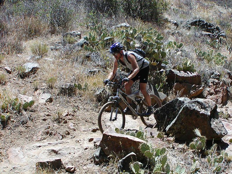
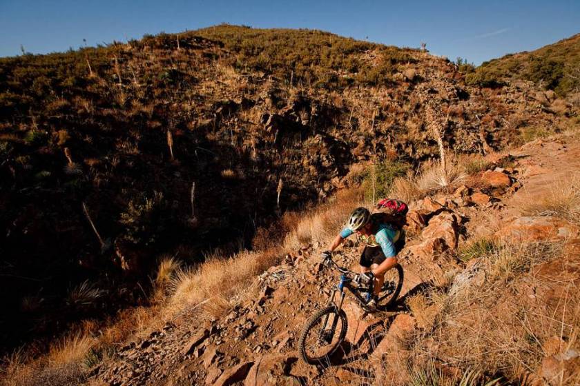
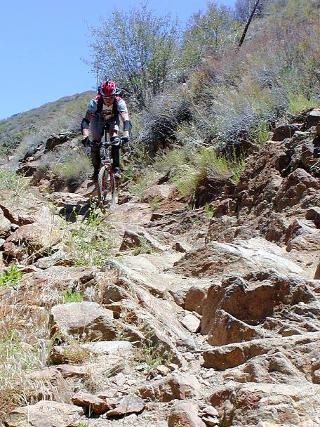
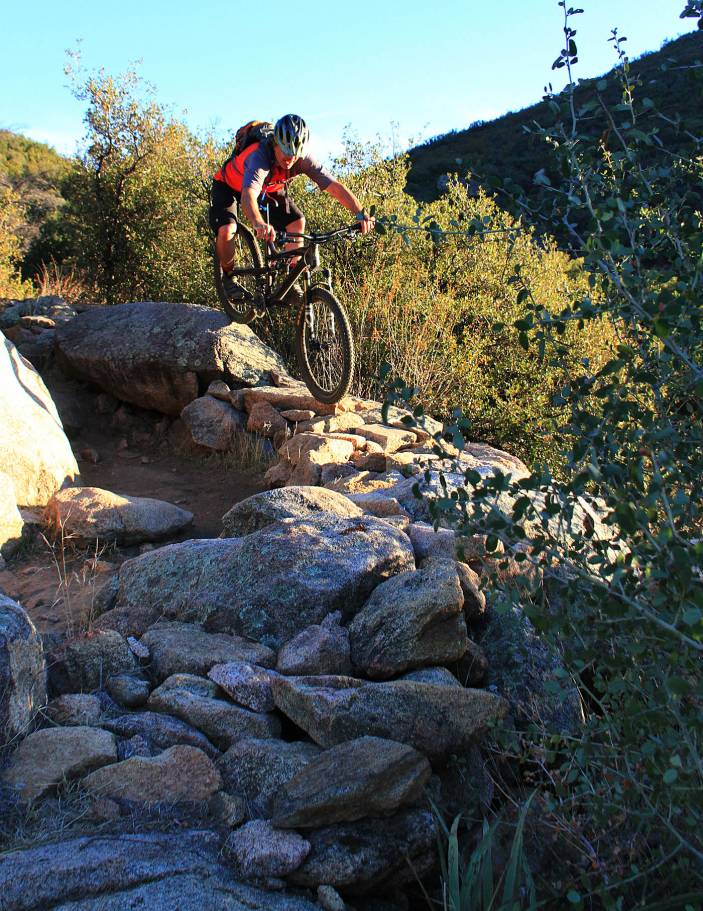
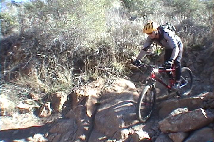
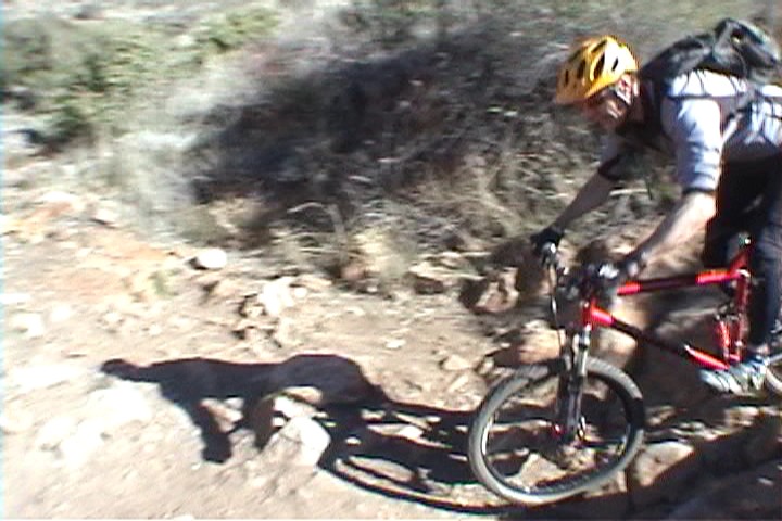
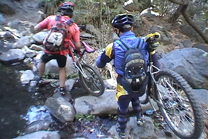
 At the first (typically dry) creek crossing is where you encounter the first really technical rocky
outcropping known as Widow Maker. The USFS has put in a trail that bypases this feature so your first time here you will probably miss the feature. It worth eyeballing first and then hiking up and giving it a go if you are so inclined. TIP: Speed is your friend! After this section you have a long descent that is packed with small drops and rocks that
requires good bike handling skills. Speed can be your friend
here as well. Before the second creek crossing you come out to a fairly often section of trail that is extremely rocky and typically loose. This section is known as "Barney Ruble". You get back into some trees after the second creek crossing where you will have some rocky technical section interspresed with some nearly buff singletrack. The terrain continues to
change the further down you go. After the third creek crossing (typically has some water in it) you will transition from the chaparral into mostly desert scrub. The trail is very narrow with the penalty
for failure being a bit steep if you screw up. No macho pride here for me,
I often put on some additional protection.
At the first (typically dry) creek crossing is where you encounter the first really technical rocky
outcropping known as Widow Maker. The USFS has put in a trail that bypases this feature so your first time here you will probably miss the feature. It worth eyeballing first and then hiking up and giving it a go if you are so inclined. TIP: Speed is your friend! After this section you have a long descent that is packed with small drops and rocks that
requires good bike handling skills. Speed can be your friend
here as well. Before the second creek crossing you come out to a fairly often section of trail that is extremely rocky and typically loose. This section is known as "Barney Ruble". You get back into some trees after the second creek crossing where you will have some rocky technical section interspresed with some nearly buff singletrack. The terrain continues to
change the further down you go. After the third creek crossing (typically has some water in it) you will transition from the chaparral into mostly desert scrub. The trail is very narrow with the penalty
for failure being a bit steep if you screw up. No macho pride here for me,
I often put on some additional protection.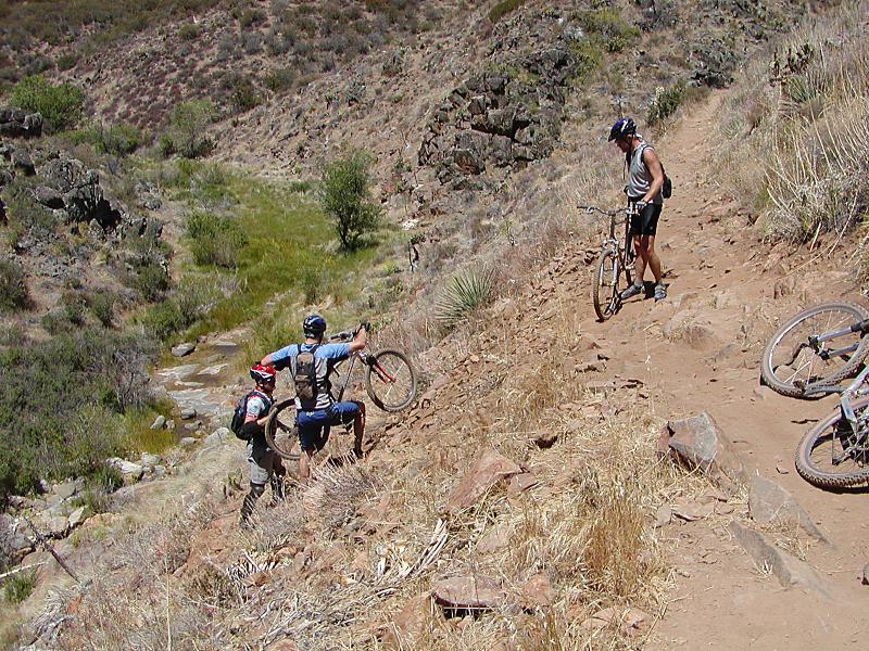
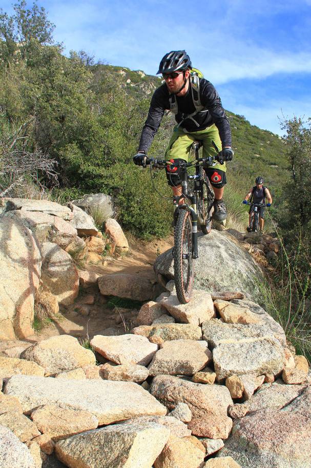
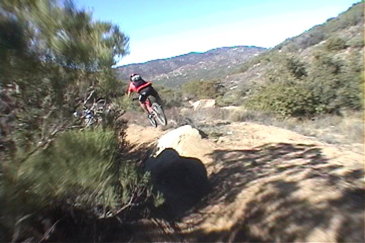
 You will have to do a little bit of contouring and climbing before you come to a section of trail that is rocky and loose with some large rocks to negoitate known as "dragon's back". Everything seems to want to push you to the left and downhill off the trail. There are not soft landing spots in this area. Dragon's Back ends with a sharp left hander followed by a short and very technical climb that ends with a right hand turn at the top. This is a great spot to regroup and watch those behind you work their way across Dragon's Back.
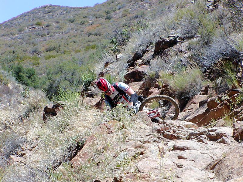
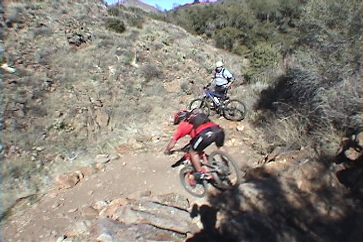
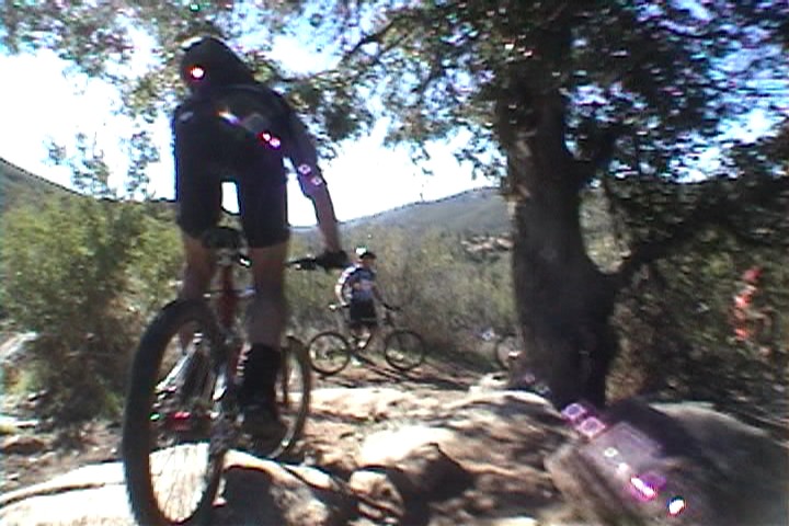
 The next significant section further down the trail is the locally iconic "Stairway
to Hell. A technical tight left hand switch back leads into the stairway. Orginally there was no "line" per se through this
section. Just a bunch of rocks all over the place where speed, skill and good weight transfers were the name of the game here. No shame at all in wearing some extra protection through here. Over the last decade people have made a low line on the stairway to avoid some of features that made this section iconic. The orignal line is the far left (high) side of the trail. Folks have ridden that orginal line on 26er hardtails so you I don't think you get full credit by taking that right-hand low line. Why yes, yes I am having a "Back in my day we had to walk to school in the snow uphill both ways" moment. So you have options on Stairway To Hell these days. It is up to you wither you want to say you had bacon, eggs, and coffee for breakfast or wither you had a bowl of cream of wheat and a glass of pulp-free orange juice. (Full disclosure, I did a big fat Endo on the orginal line on a recent run down Stairway. The ground gets harder every year so maybe Cream of Wheat for breakfast is not too terrible)
The next significant section further down the trail is the locally iconic "Stairway
to Hell. A technical tight left hand switch back leads into the stairway. Orginally there was no "line" per se through this
section. Just a bunch of rocks all over the place where speed, skill and good weight transfers were the name of the game here. No shame at all in wearing some extra protection through here. Over the last decade people have made a low line on the stairway to avoid some of features that made this section iconic. The orignal line is the far left (high) side of the trail. Folks have ridden that orginal line on 26er hardtails so you I don't think you get full credit by taking that right-hand low line. Why yes, yes I am having a "Back in my day we had to walk to school in the snow uphill both ways" moment. So you have options on Stairway To Hell these days. It is up to you wither you want to say you had bacon, eggs, and coffee for breakfast or wither you had a bowl of cream of wheat and a glass of pulp-free orange juice. (Full disclosure, I did a big fat Endo on the orginal line on a recent run down Stairway. The ground gets harder every year so maybe Cream of Wheat for breakfast is not too terrible)
First Time on Stairway
Strike One
First Time on Stairway
Strike Two
First Time on Stairway
3rd Time is a Charm
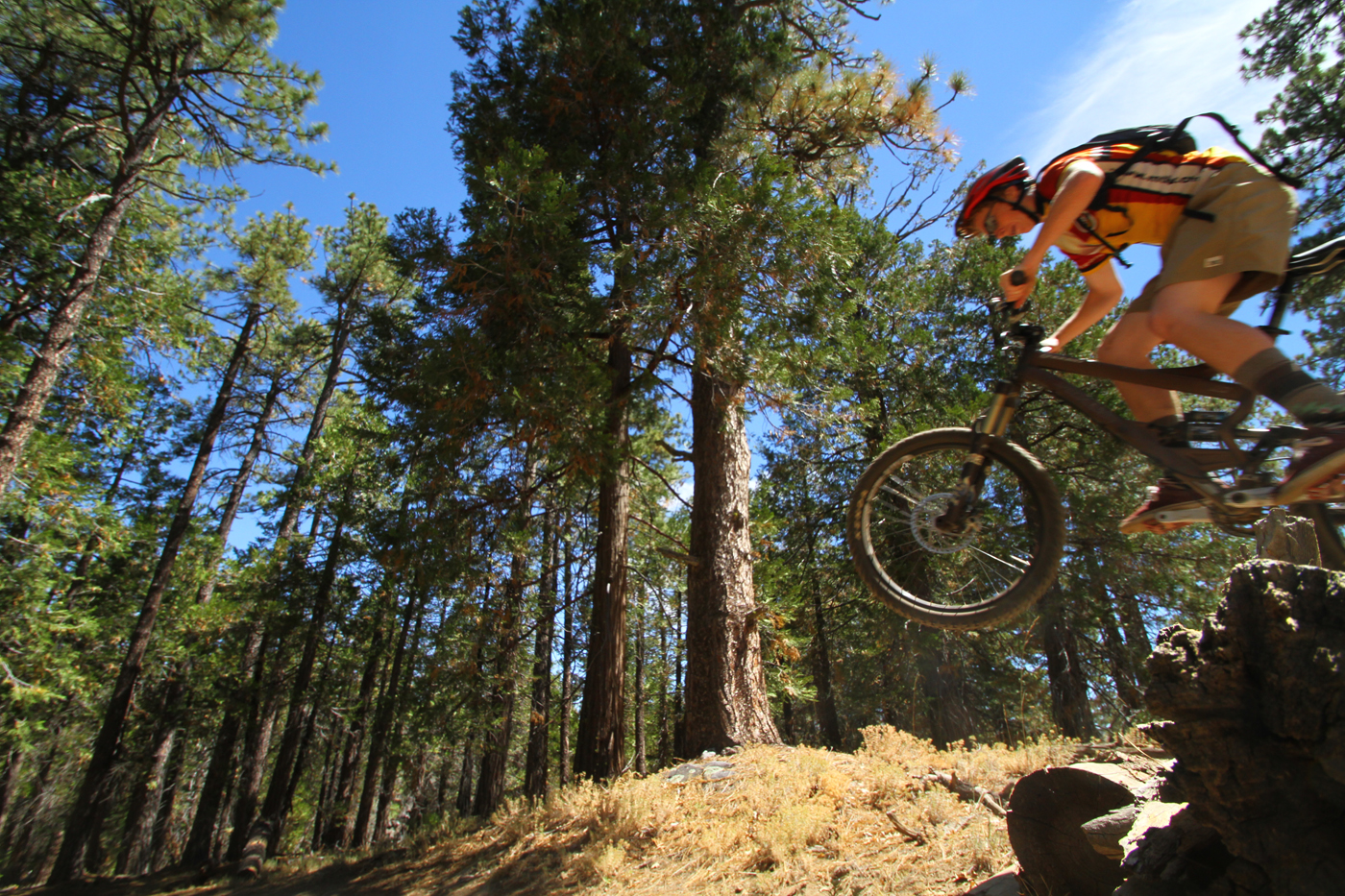
Michael
Hardtailing It
Collin getting some
Hardtail Action
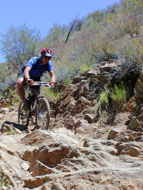
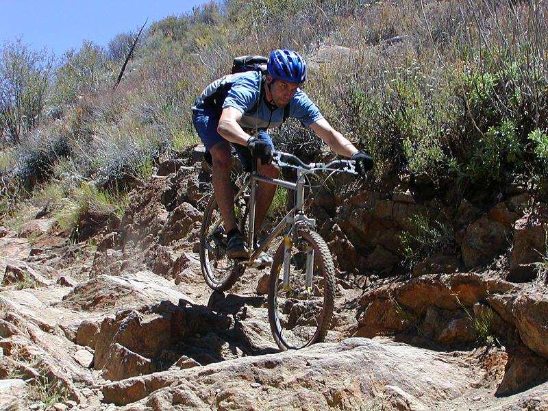
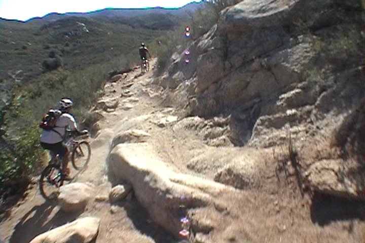
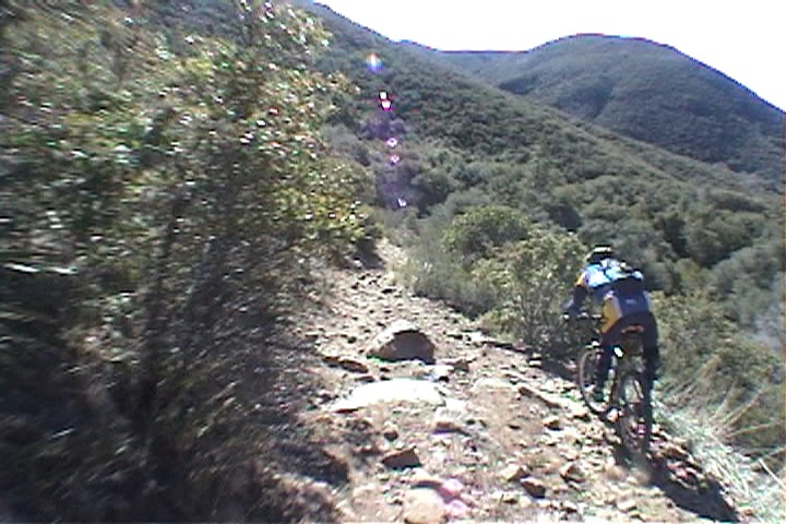
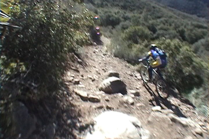
After Stairway you will do some technical countouring and as well as some downhill bits to a trail junction. (You have about 7.3 miles at this point) If yo go to your right you will quickly come out on Pine Creek road. If you are already spent, beat up or broken your easiest/safest option is to turn left on Pine Creek road and head down to the Noble Canyon Trailhead. At this junction, Noble Canyon is the sharp left turn. After making that left the trail does its fourth creek crossing (Has water most of the year) and you then start a 1.5 mile climb. The trail here is not technical at all but can be sandy and while it is shaded at the bottom, you quickly get out into the desert scrub where the sun can be brutal when it is hot out. This climb is often referred to by various bad names as it can be brutal in the heat. The summit of the climb is obvious and it is a common regroup spot. About a 1/4th a mile over the summit, you come to the junction of the Deer Creek trail which peels off to the left and downhill as the Noble Canyon Trail bends to the right. Stay on the Noble Canyon Trail
 From this point down to the lower trailhead is known as "Extra Credit". After a short bit of climbing normally easy (may not seem so easy at this point in the ride) you get into some swoopy fun non-technical downhill singletrack. Enjoy it while it lasts as the trail will soon be back to jumbly rock sections that are often unrelenting. The rocks in this section are different that what you had to deal with further up the trail but they are no less treacherous. Speed and good "Monkey Motion" will help keep you out of the front wheel grabbers. The rocky technofest continues until just short of the trailhead. You have certainly earned a tasty beverage!
The Climbing Loop (Pine Creek Road)
 If you are a "How can you have your pudding if you DON'T eat your meat?" rider, this route is for you. Starting from the lower trailhead you can either go back to
the road you came in on and turn right onto Pine Creek Road or you can ride up the
trail. If you are into the challenge of some technical climbing I
recommend taking the trail up, but for this route we are taking the road. The first mile up the road is not particularly hard but at around 1.2 miles things start getting tougher. At 1.5 miles you pass a connector trail on your right that leads out to Noble Canyon.
If you are a "How can you have your pudding if you DON'T eat your meat?" rider, this route is for you. Starting from the lower trailhead you can either go back to
the road you came in on and turn right onto Pine Creek Road or you can ride up the
trail. If you are into the challenge of some technical climbing I
recommend taking the trail up, but for this route we are taking the road. The first mile up the road is not particularly hard but at around 1.2 miles things start getting tougher. At 1.5 miles you pass a connector trail on your right that leads out to Noble Canyon. 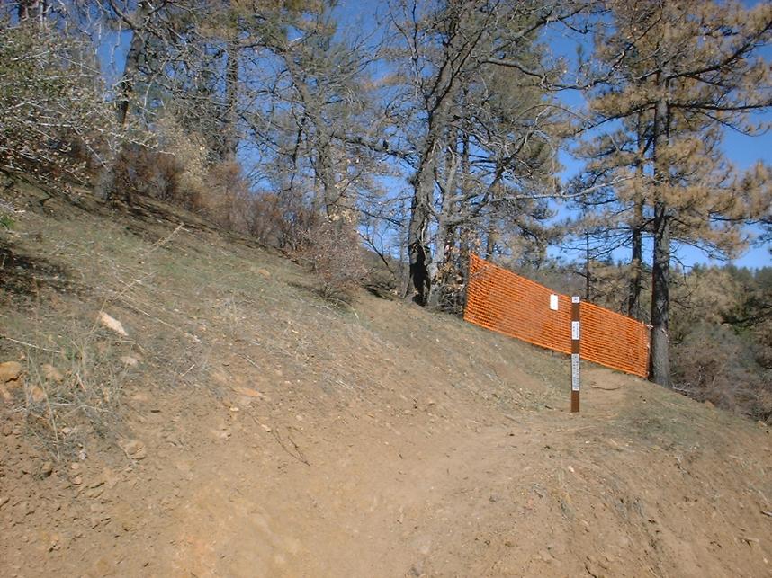
 From here Pine Creek road is its steepest and the next mile and change is known as Alpe D'Wheez. At 3.8 miles and 950 feet of climbing later you come to the junction with Deer Park Road in a sharp right-hand bend in the road. Continue on the climb which still has some tough bits but not like what you have already done. At 5.8 miles the Noble Canyon Trail crosses the road. You could descend down the trail from here and still have a great ride. Before you make such a choice, take stock of your water, during warmer times of the year you may need to continue on upward to restock your water. Continue on up Pine Creek Road. It is not all an uphill grind from this point and at 6.4ish miles the Noble Canyon trail will again cross the road. Hang a right onto the Noble Canyon Trail and climb it for about a 1/4 mile to the junction with Filaree Flat Spur of the Big Laguna Trail. Take this trail which climbs up to the junction of the Big Laguna Trail. Once you get to the Big Laguna trail (7.1 miles) hang a left onto the Big Laguna Trail and enjoy one heck of a fun bit of fun non-technical singletrack down to junction of the Noble Canyon Trail near its upper trailhead. Before you head off on the Noble Canyon Trail as described above top off your water using the faucet near the trailhead kiosk. This loop will get you about 17 miles and 2,800 feet elevation gain/loss.
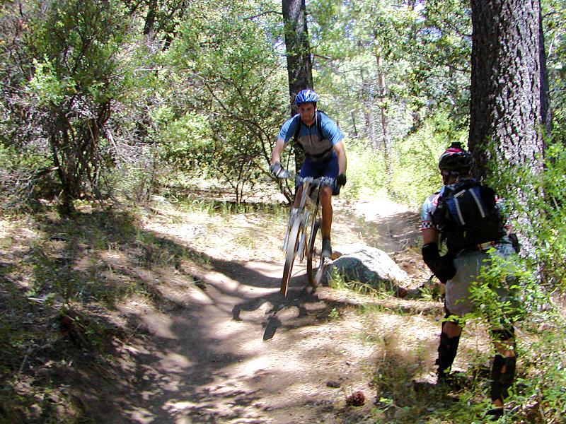
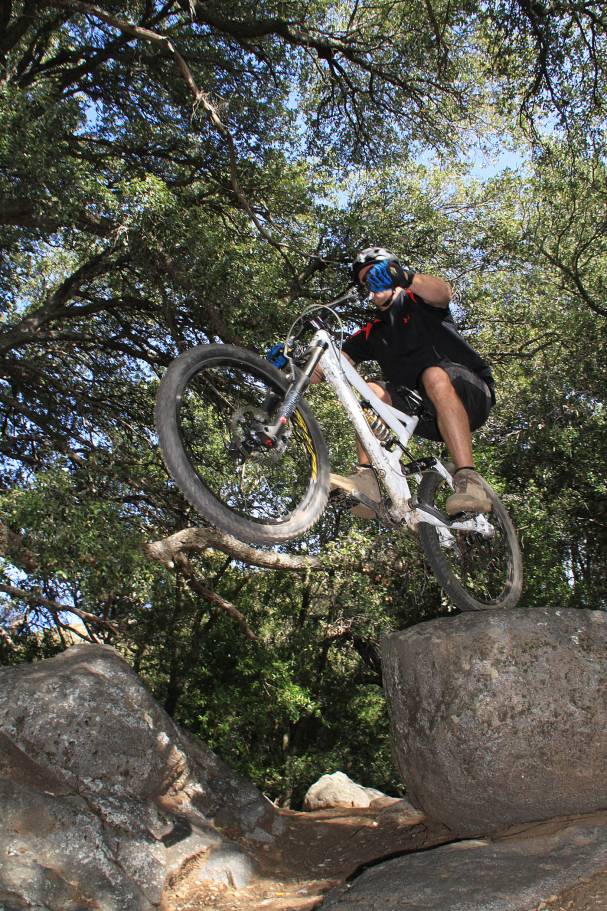
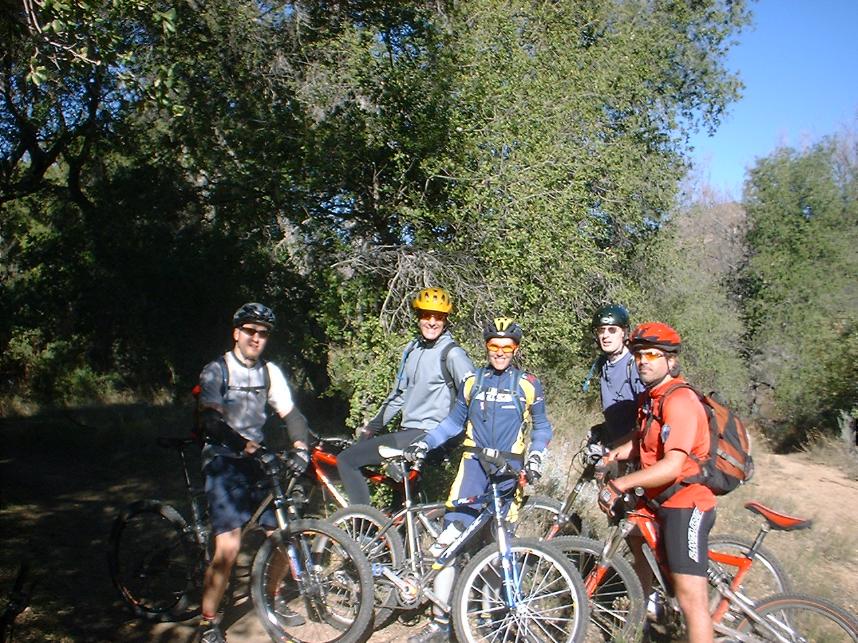
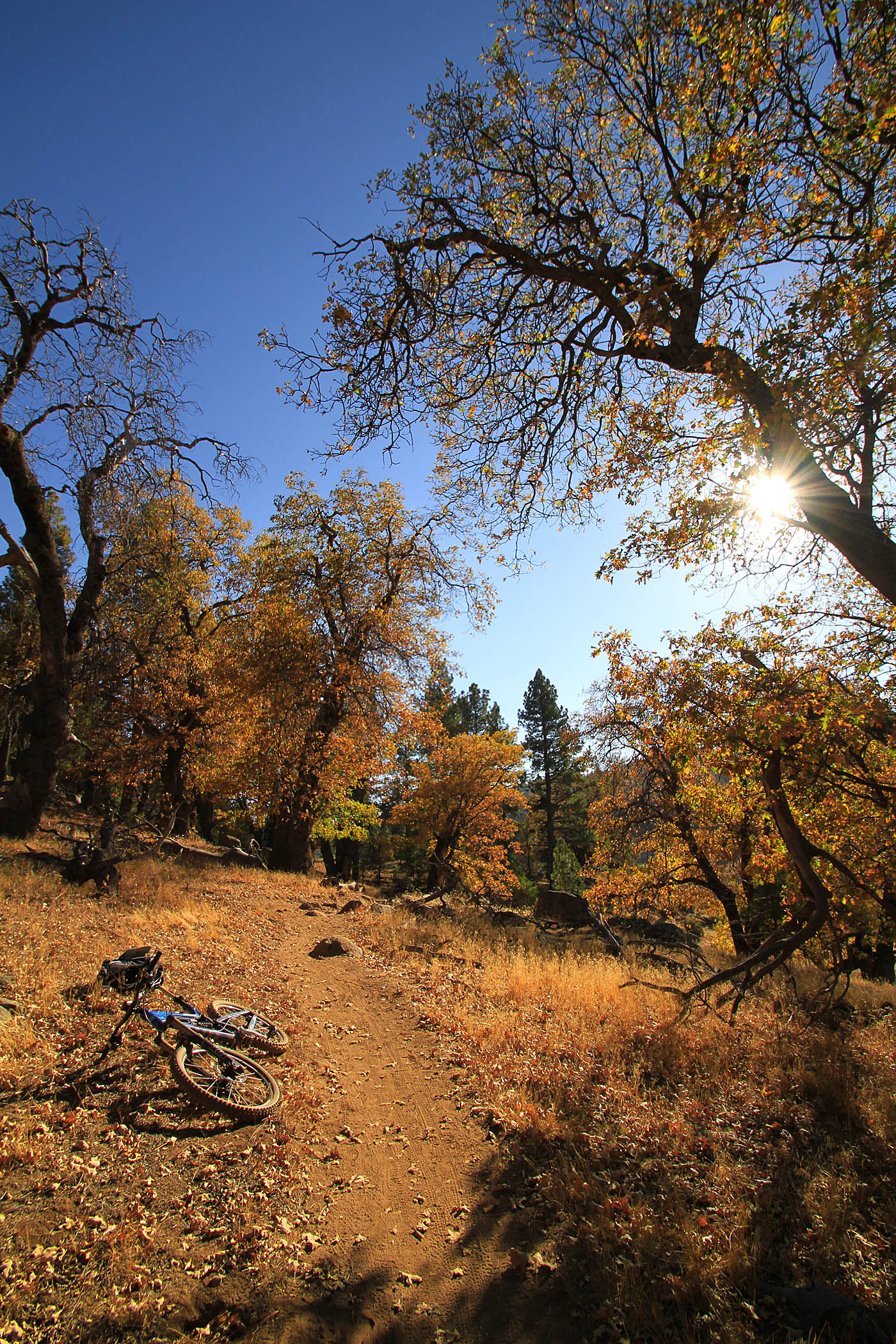
More Pictures from the ride
You never know who you may run into on this trail. Here is two-time XC
NORBA Champ Jimena Florit
out "playing" with the guys in 2004. She totally schooled us all while
not even appearing to break a sweat.

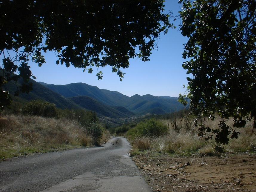
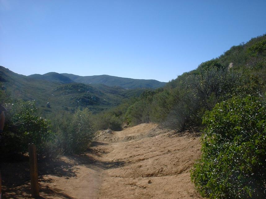
The view from the lower portions of Noble looking back up towards the Laguna Mountains on July 31st,2005.
Laguna to Noble Combination Ride
Make sure to read my Laguna Mountain Recreation Area review as I'm not going to talk about the whole area just the route here. This is one of favorite ways to do Noble Canyon. Combining the buffed single track with picturesque views of the Laguna Mountains adds a good cross country ride to the demanding thrill of a technical downhill ride. You will of course need two cars to do this ride as it is a point-to-point. Sure you could just continue on up Sunrise Highway to the top of Noble Canyon, but that would make you a shuttle monkey cheating the gravity gods. Besides you know that you need the exercise. The total mileage for this combination is around 19 miles with 1,200 feet of climbing and 3,400ft of descent.
Parking: Leave one vehicle at the lower traihead and take the other up to Redtail Roost where this ride will start.
Route Description:
 Leave a vehicle at the lower trailhead and stage at Redtail Roost. Pick up the trail from the back of the parking lot. Very shortly after starting on the trail you will see another trail coming in from the right. Continue straight will you will do a little bit of climbing up to this routes highest point at 6,062 feet. The Redtail Roos trail will soon start mostly descending as a very trail with some techy bits here and there. At 1.6 miles the trail comes out ontp Escondido Rave Road (an old dirt road) at a cattle guard. Turn left and zip downhill to the junction with the Aqua Dulce Spur of the Big Laguna Trail. Turn left (and uphill) and continue on Escondido Ravine Road. This is pretty ravine that offers some shade along the climb. The climb is mild until make a sharp right hand turn where is gets much steeper for a short bit. At 3.1 miles you will come to the junction of Wooded Hills Rd and the Los Gatos Trail.
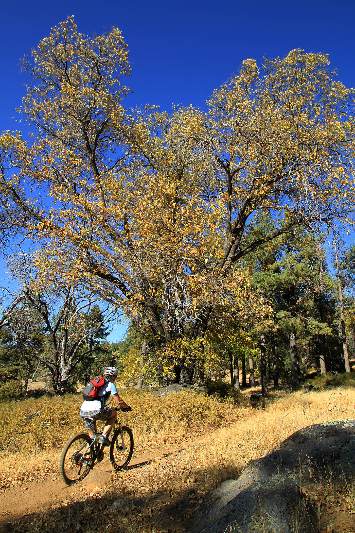
 The Gatos Ravine trail is a very fun bit of singletrack. There is a slight rise in the trail earlier on that goes up to a fantastic veiwpoint where on super clear days you can see downtown San Diego and Pt Loma. Continue on the Los Gatos passing the junction of the Chico Rivine connector on your left at 3.9 miles. The rest of the Gatos Raveine trail is very flowy with a little bit of tech and some nice optional feature to play on. On the trail comes out onto the meadow, take the Kemp Spur trail (aka as just the BLT) left and proceed around the meadow. When you get to the corner of a fence turn right. When you come to a cow/bike gate at 5.5 miles (Can ride your bike over, but cows won't step on it) go through it and climb up out of the meadow on a nice bit of singletrack. At the top of the climb you will come to the junction with the Water of the Woods trail. Turn right and enjoy another bit of nice singletrack back down to the meadow, where you will bear left at the next junction to stay along the edge of the meadow. When you get to the Water of the Woods pond, take continue on the trail around the pond passing the two junctions with the Sunset trail. Continue up with the west side of the meadow passing Big Laguna Lake on left. At the top end of the meadow you will pass the northern junction of the Sunset trail on your left before continuing around the north/upper end of the meadow to the junction of the Big Laguna trail at 9.0 miles. Hang a left and shortly you will come to the junction of the Filaree Flat Spur.
Here are a few screen captures from the 2003 video
2003 Firestorm and Early Recovery Pictures
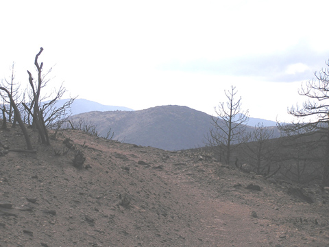
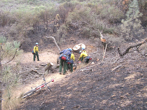
The 2003 San Diego wildfires devastated some our best trails. The upper portion of Noble Canyon was heavily damaged by the fire.
These pictures where shot by Mark Costantino on November 2nd, 2003
Looking West from Noble Canyon Trail
A fire crew from the Tahoe area doing mop up, they kindly
offered to remove debris from the trail. These guys rock!
Not much left
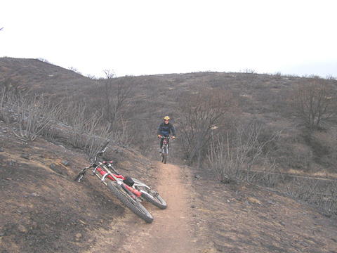
Here is a picture I took from Laguna Meadow Road on January 17th, 2004

Recovery
This picture was taken by WINSTON (MTBR.com Handle) in June of 2004 and shows that the upper portion of Noble Canyon is recovering.