
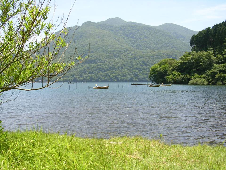
Lake Ashi
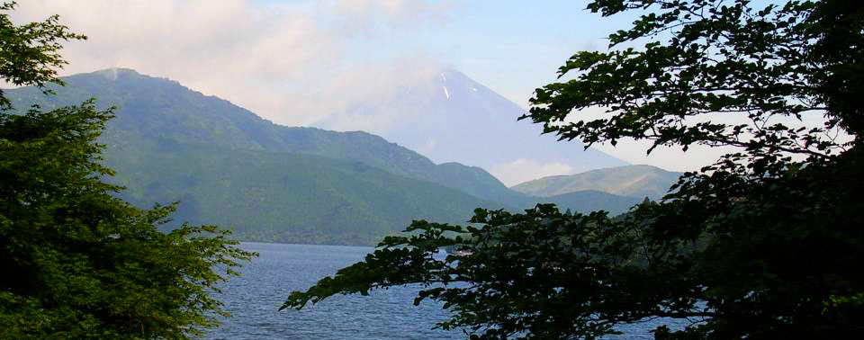
Located in the Fuji-Hakone-Izu National Park in Japan, Ashinoko, (Lake Ashi) is a wonderfully picturesque lake formed in the caldera of Mt. Hakone after the volcano's last erruption 3000 years ago. On clear days you will have incredible views of Mt Fuji beyond the lake. There are plenty of trails throughout the area and I have only only explored a few of them. Yes you can ride your bike through the National Parks of Japan. Cruise boats, some of which look like pirate ships, are an interesting means of transportation along the lake where there are hotels and small towns located along the lake's shores. Well worth a visit.
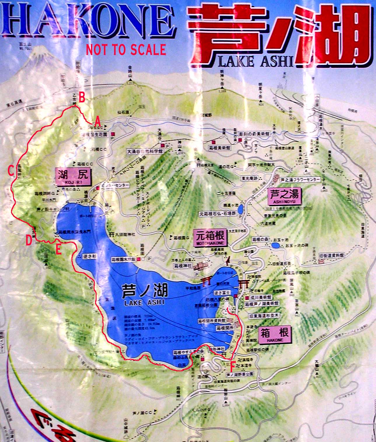
I have done two rides in this area one was the Lake Shore trail and the other is the Skyline trail.
Lake Ashi Loop: (12.1mi, 1,300'▲)
Ashinoko Skyline & West Side of Lake (9.4mi, 2390'▲)

- Southend of Lake General Parking:

- Near End of Westside Trail:
Video
Paying to Play on the Virgin River Rim Trail
Lake Shore Trail
This ride is a mild where the only thing that puts this at an intermediate level is its distance and small sections of the singletrack along the southwest area of the lake. The ride we did was roughly a 14 mile counterclockwise loop around the lake and consisted of a combinations of payment, cobblestone walkways, fireroads, and singletrack.
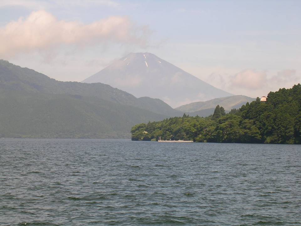
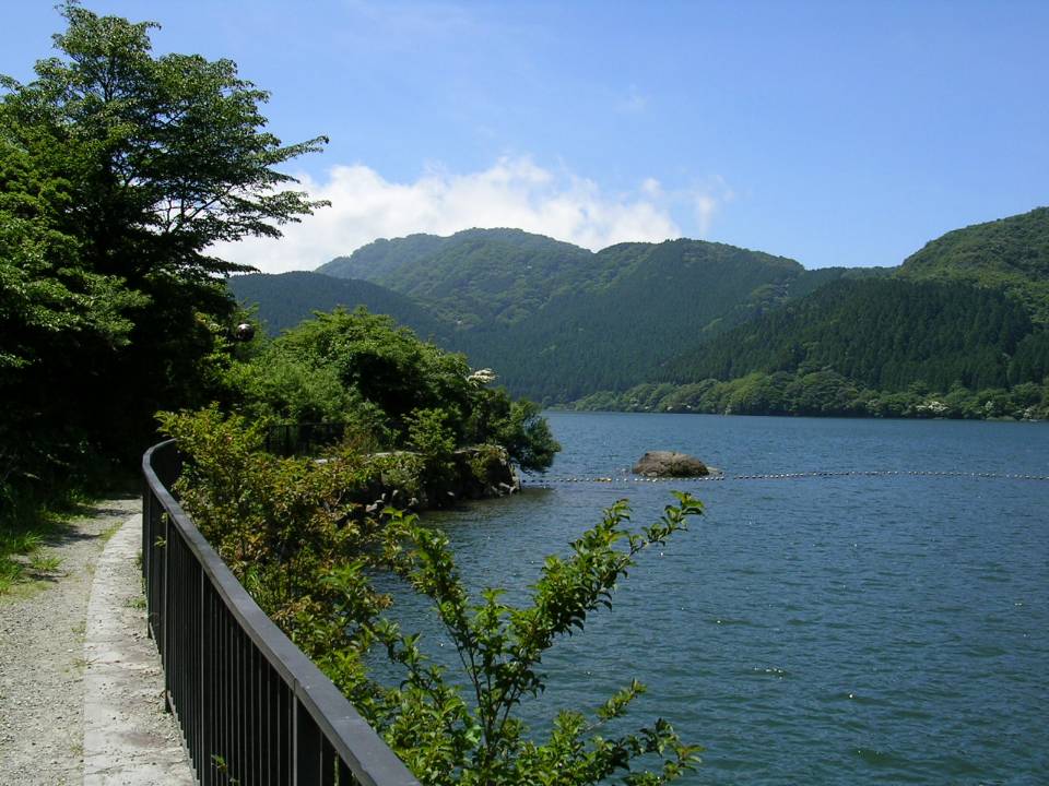
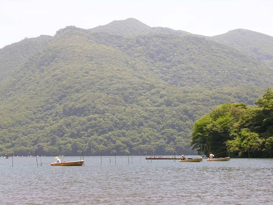
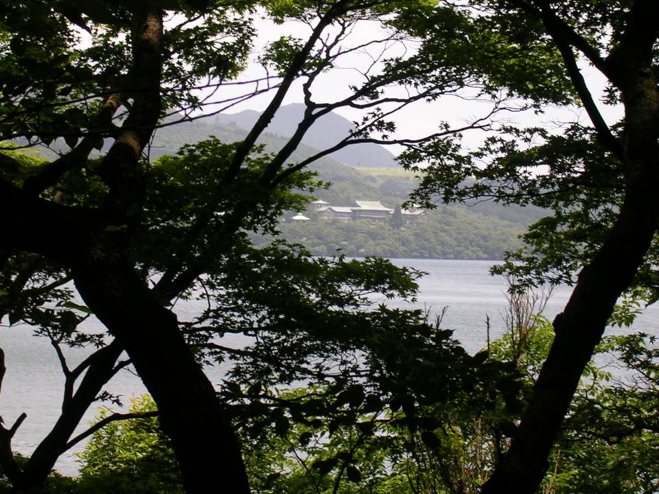
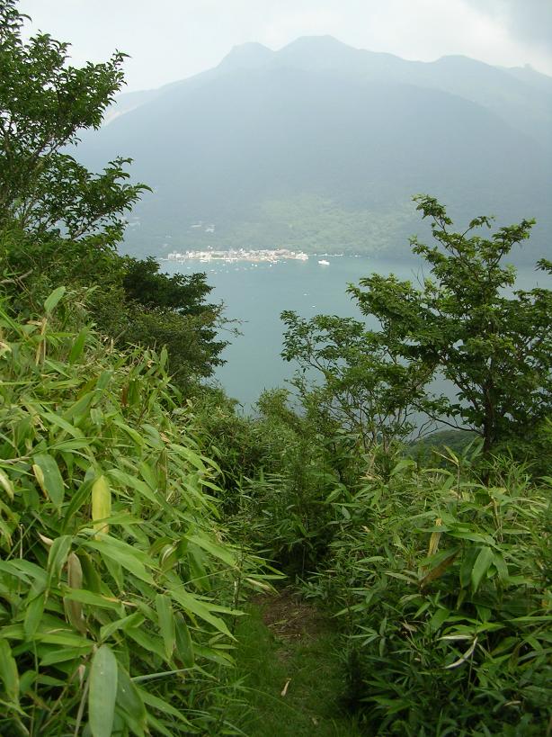
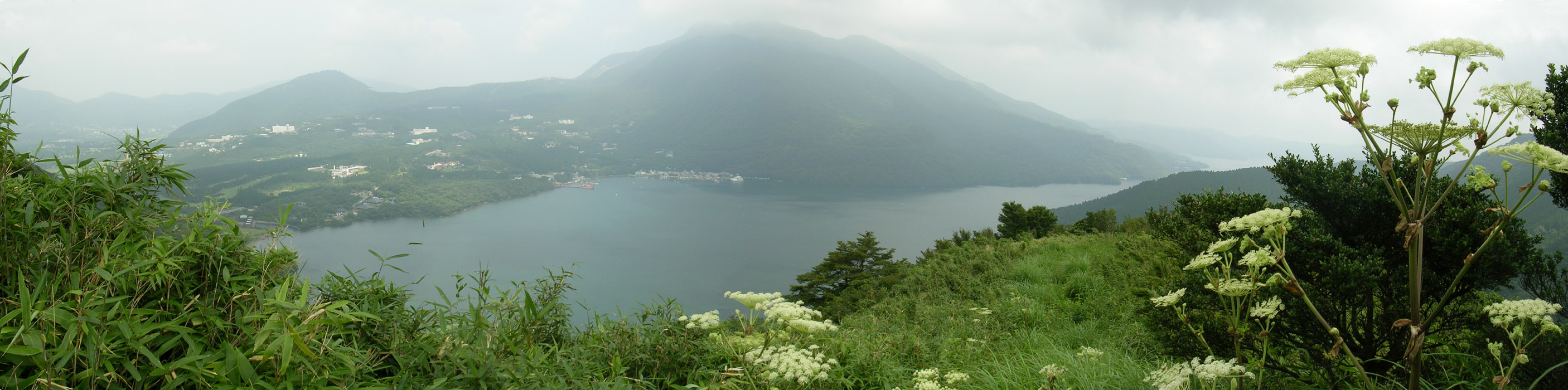
We started at south end of the lake near Point A. There are plenty of shops and restaurants which makes this a nice place to start and end the ride from. On clear days you are treated to a view of the lake with Mt Fuji in the background. The picture to the left does it no justice whatsoever. From here to point B is just pavement and sidewalks.
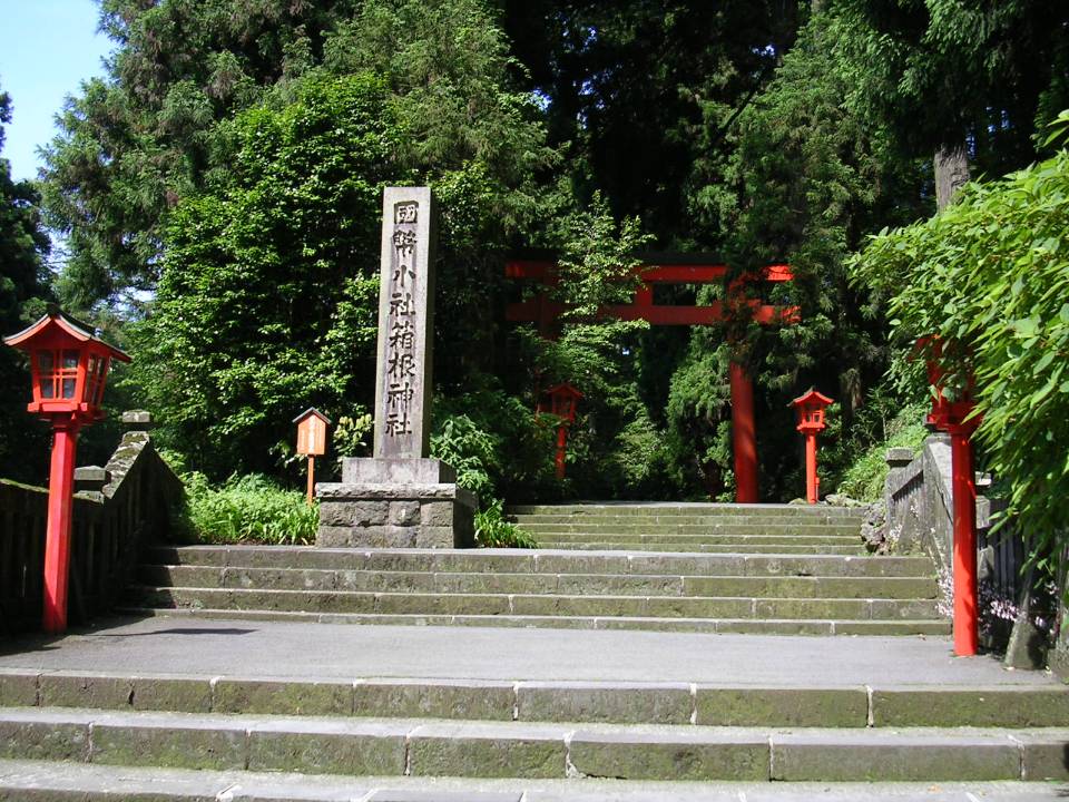
From Point A we proceeded counter clockwise around the lake. At Point B is the entrance to a large shrine on the southeast end of the lake. Unfortunately I did not take the time to check it out. From here to about halfway to Point C is a walkway made out of alternating stone slabs, that make for a little bit of a bumpy ride. From Point C to Point D is a closed-to-vehicles road that gains some elevations about the lake while being covered by a nice tree canopy for nearly the entire section. At Point D, you have to get onto the surface streets for a bit. You will soon pass under a gondola cableway that crosses over the street. You will take the next small road to your left which is at Point E.
Here are some of the wonderful flowers we encountered along the eastern side of the lake.
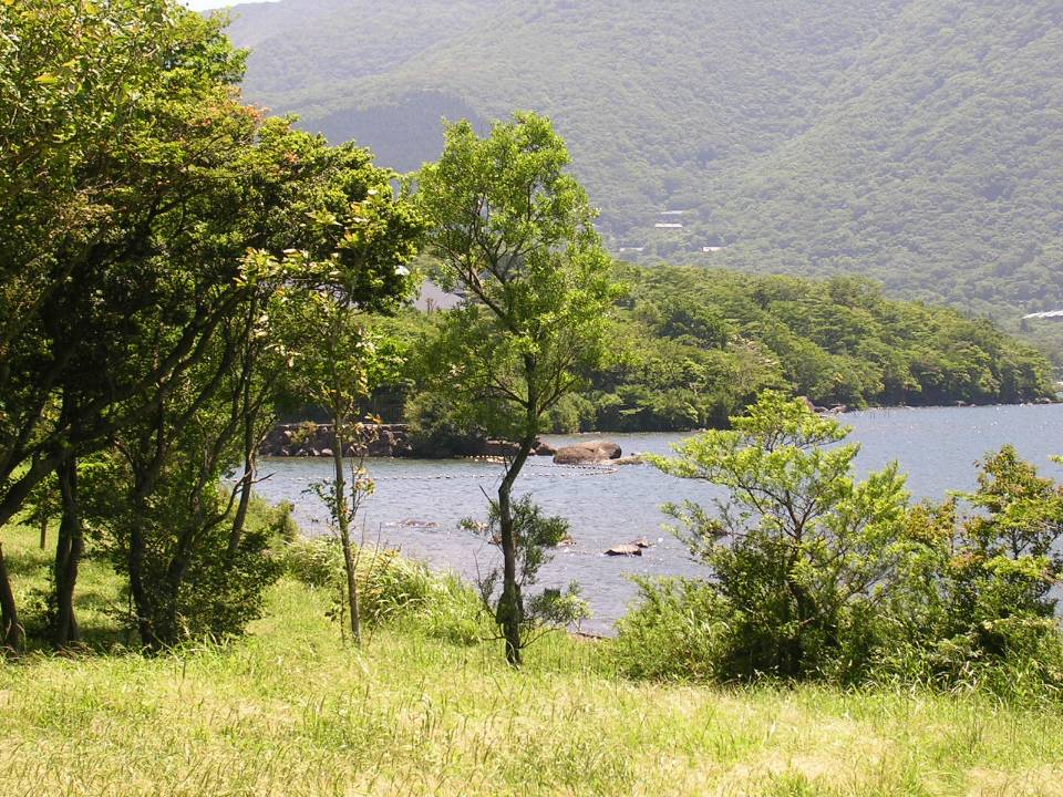
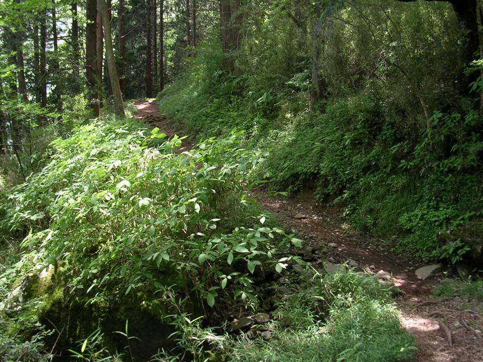
From Point E, you are headed back down towards the lake. You will pass through campground made up of nice cottages along a gravel double track. You will soon be back along the shore at the far north end of the lake. These two pictures were taken at Point F where you cross over a flood control gate. From here the "trail" is a gravelly fireroad. which continues that way until a little bit past Point G.
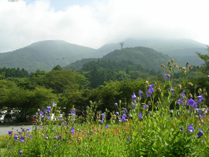
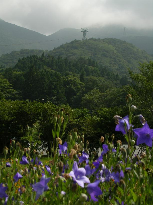
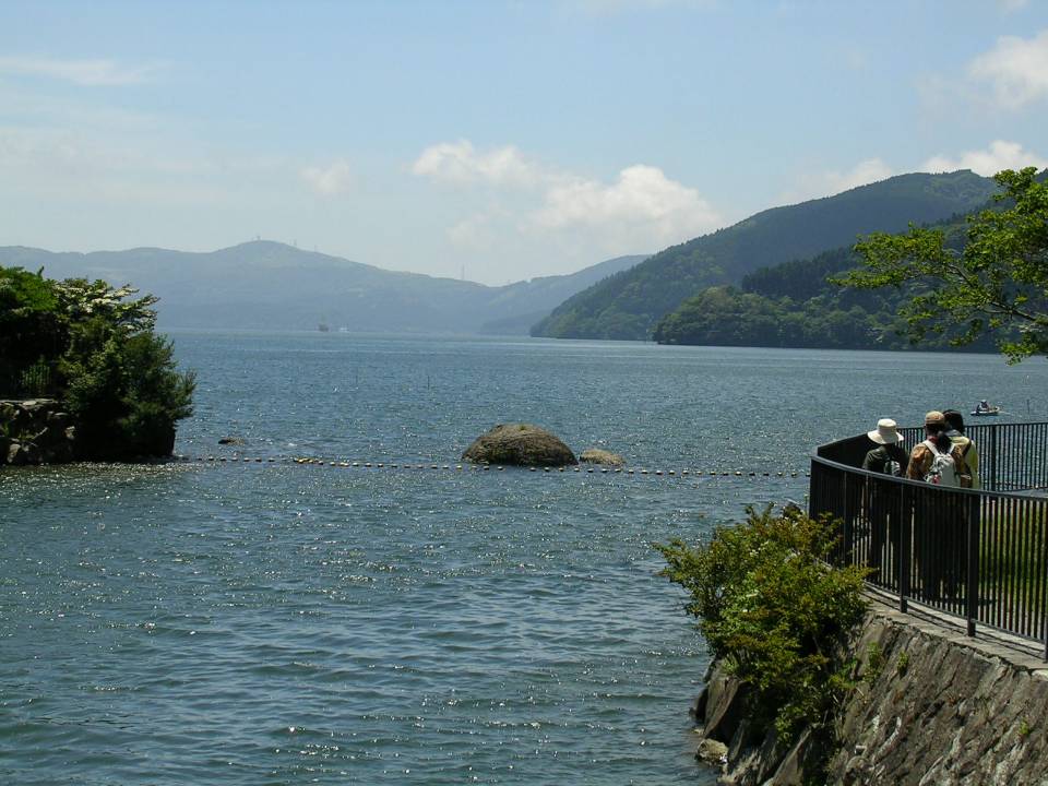
Here are some of the views from the west side of the lake looking east from Point G. Right here is also were the Ashinoko Skyline trail connector meets with this trail (That trail is described below).
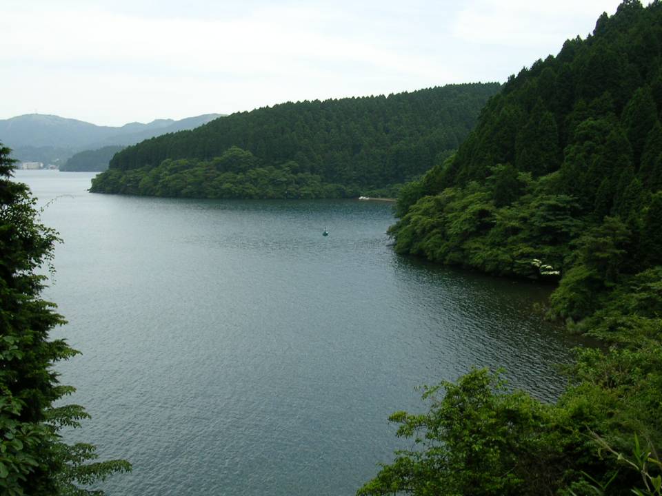
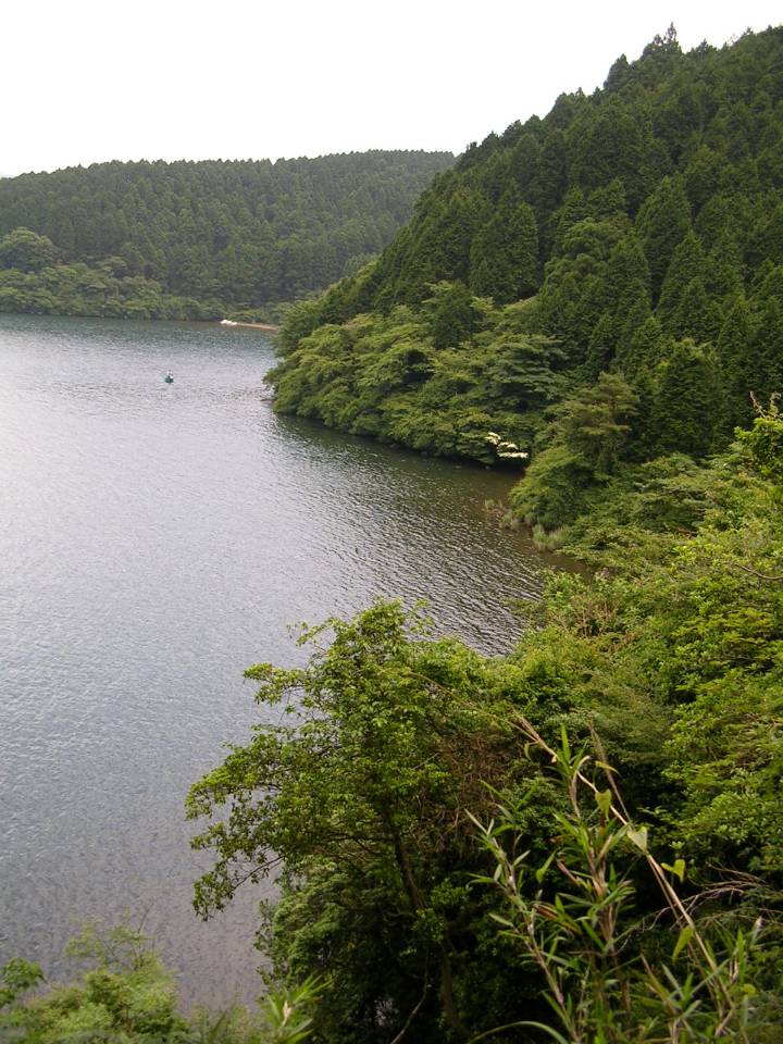
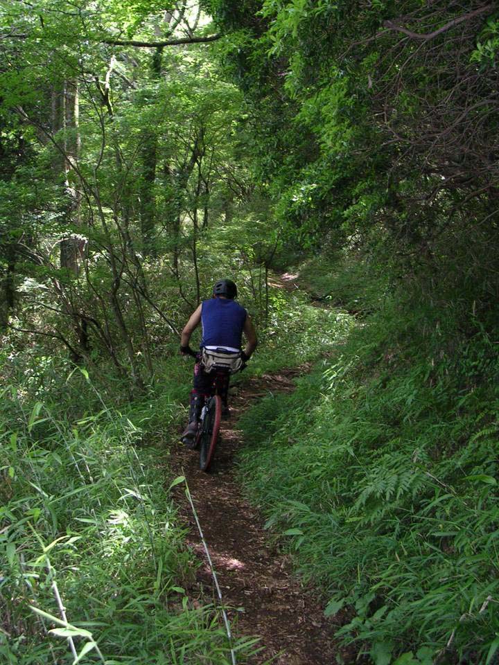
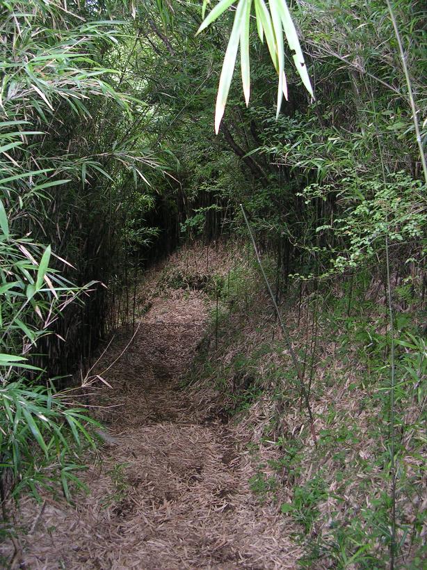
From Point G right along the lake the trail slowly gains some elevation above the lake where brings in better views. The trail stays well above the lake for pretty much the entire western shore. Soon the fireroad gives way to fairly buff singletrack which was easy to ride on yet would give a beginner mountain biker an interesting challenge or two.
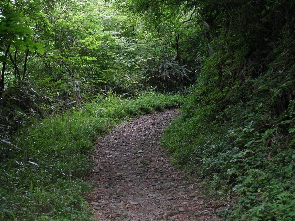
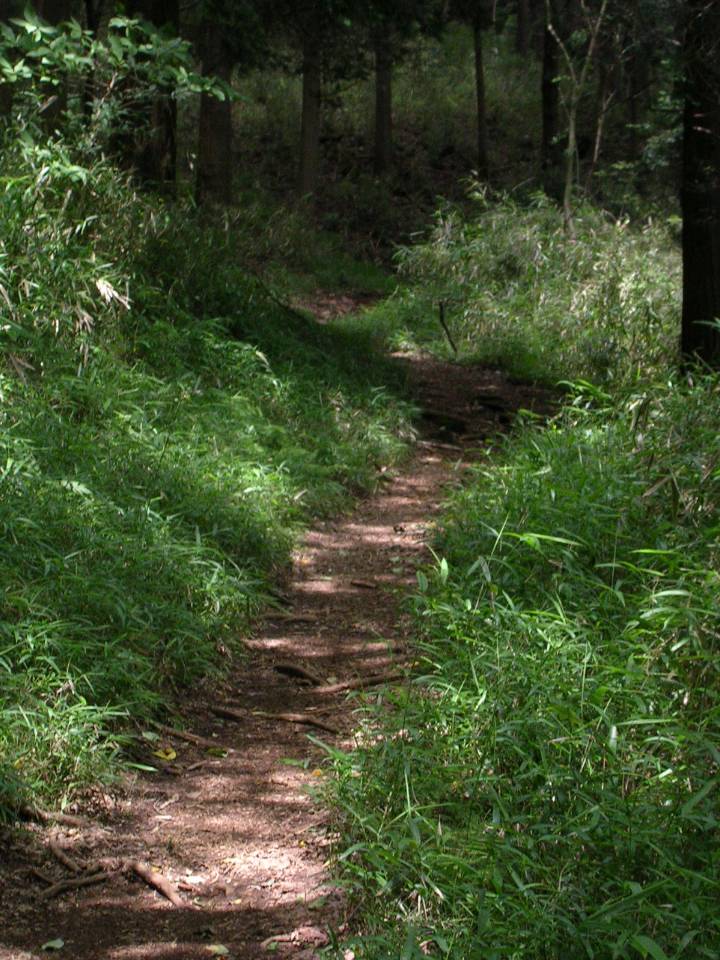
Some the buff sections of the singletrack on the western side of the lake

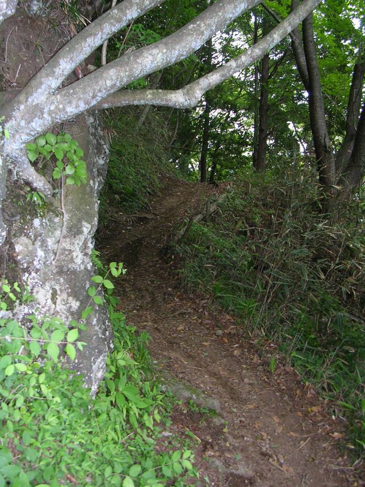
From about halfway down the west side of the lake down to the south end the trail became rougher with more roots and rocks. There are a few spots that would require just about any biker to dismount. At around Point H the single track runs into a paved road where your only option is follow for about 3/4ths of a mile to a stoplight. From there you will hang a left and follow the street back to Point A.
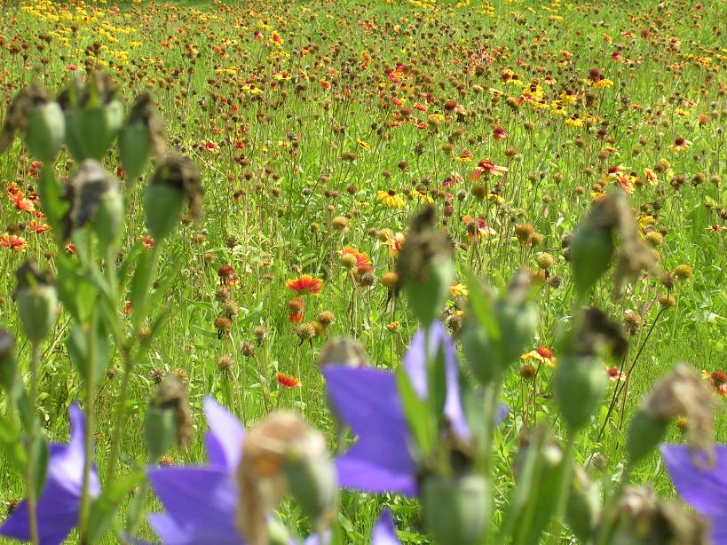
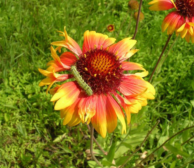
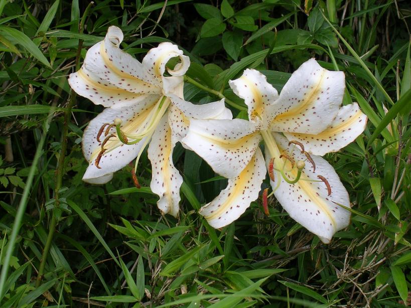
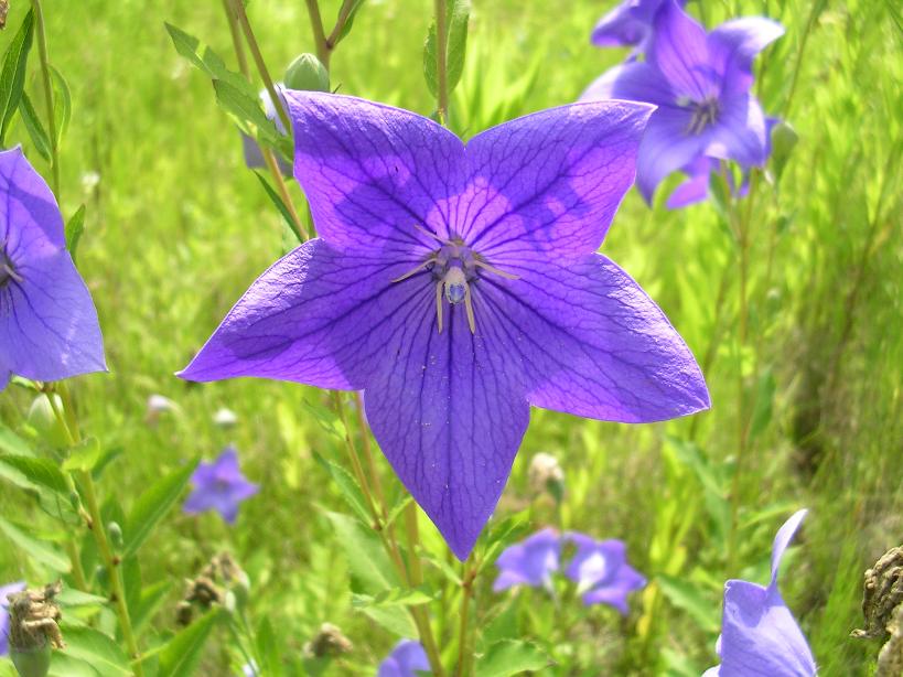
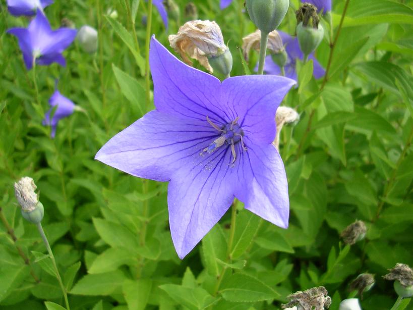
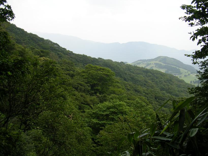
Some more of the flora of the Ashinoko area
Ashinoko Skyline Trail
While the Lake Shore trail is scenic it does not offer much in the way of a good workout. I noticed some other trails on some of the maps in town so we set out to do some exploration of the area. We started off by hiking a few sections of the Ashinoko Skyline trail to see if it was worth checking out on the bike. After little bit of hiking we decided it would be worth a trip on the bike so we came back the following week.
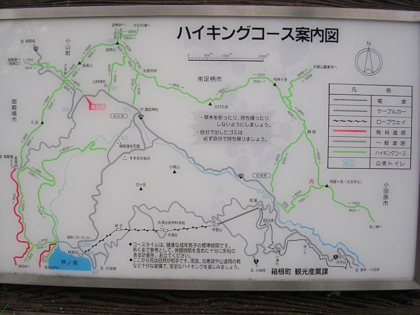
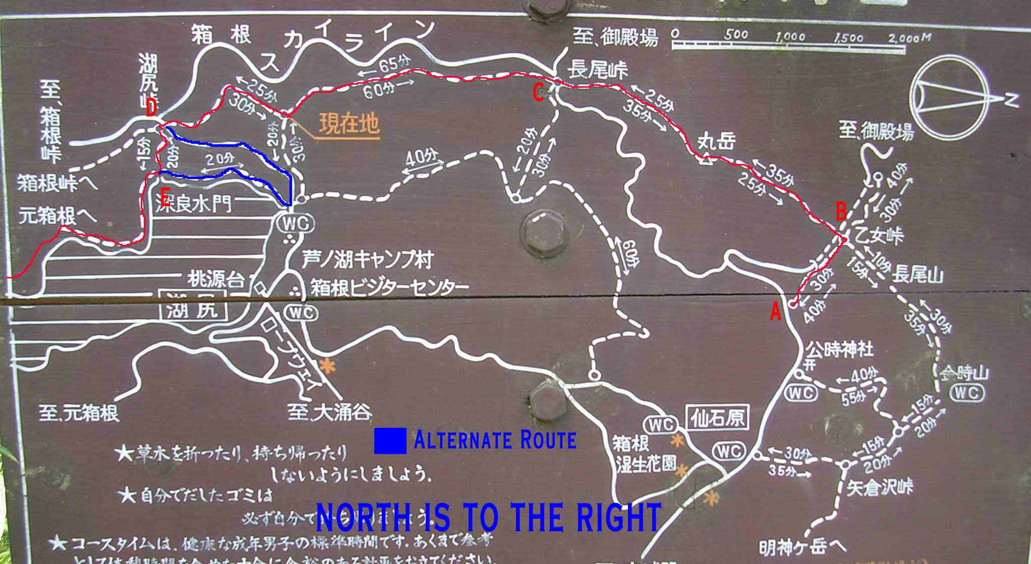
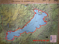
Here are a couple of maps of the area. The letters between these two maps correlate with one another but not with Lake Shore Trail map above.
This ride was a Point-to-Point ride and we were dropped off at Point A. I have no idea what the name of the trail is in English. If you are coming in from Gotemba, take the 138 option described above. After you come out of tunnel you will soon go through a hairpin turn. About 1/2 mile after the turn is the trailhead on the left. Just before the trailhead on the right hand side of the road is a small store and parking lot. This is a good spot to unload and get your stuff together. There is also map at the trailhead to help get yourself orientated. (It is a North-Up map which is somewhat uncommon around this area).
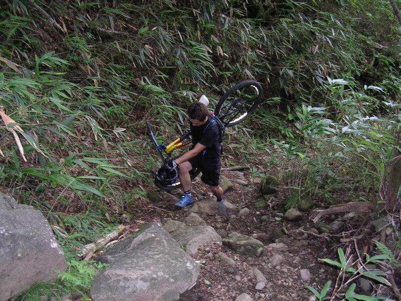
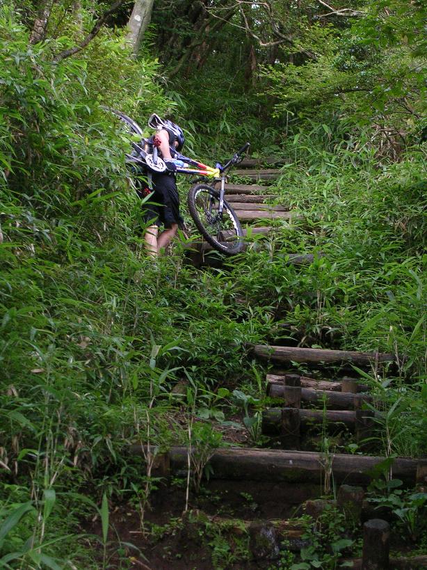
Quality Hike A Bike Action
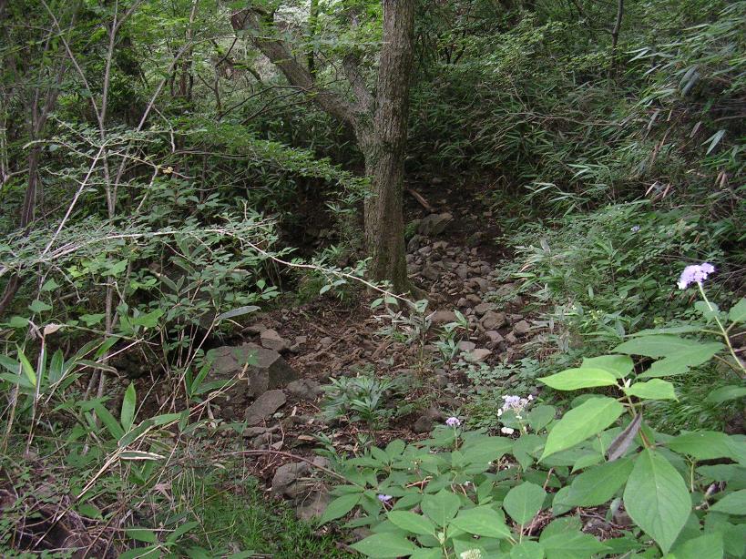
Yep this is the climb
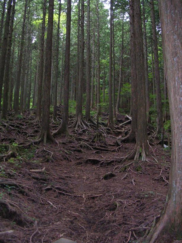
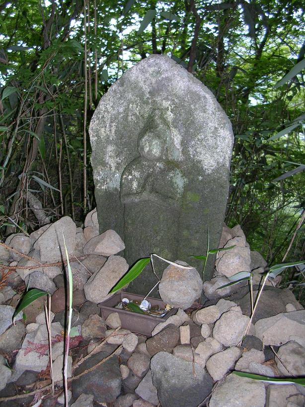
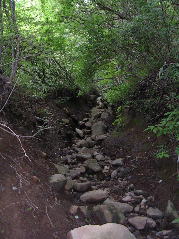
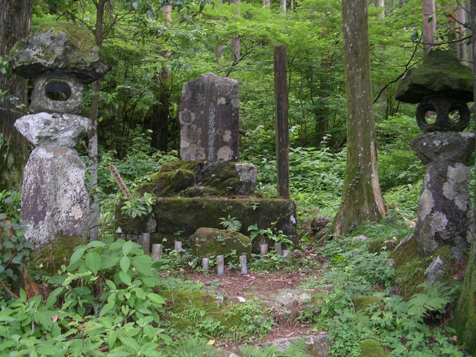
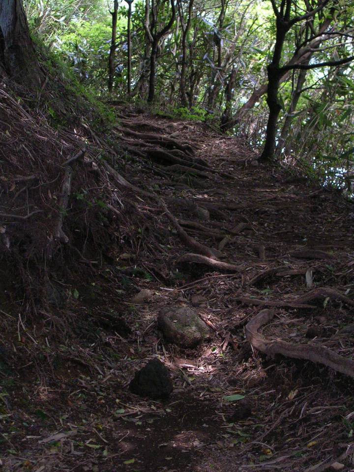
From the trailhead (Point A) we started up what turned out to be an extremely strenuous hike/carry-a-bike up a very rooty and rocky trail. We gained about 1500 feet in an a little under 1/2 mile. Along the way we came across a little shrine, memorial, or "prayer spot" where you people leave a small yen offering. Typically it is the 1 and 5 yen coins that are left. (They don't work in the drink machines ;) )
View from the top of the hike-a-bike
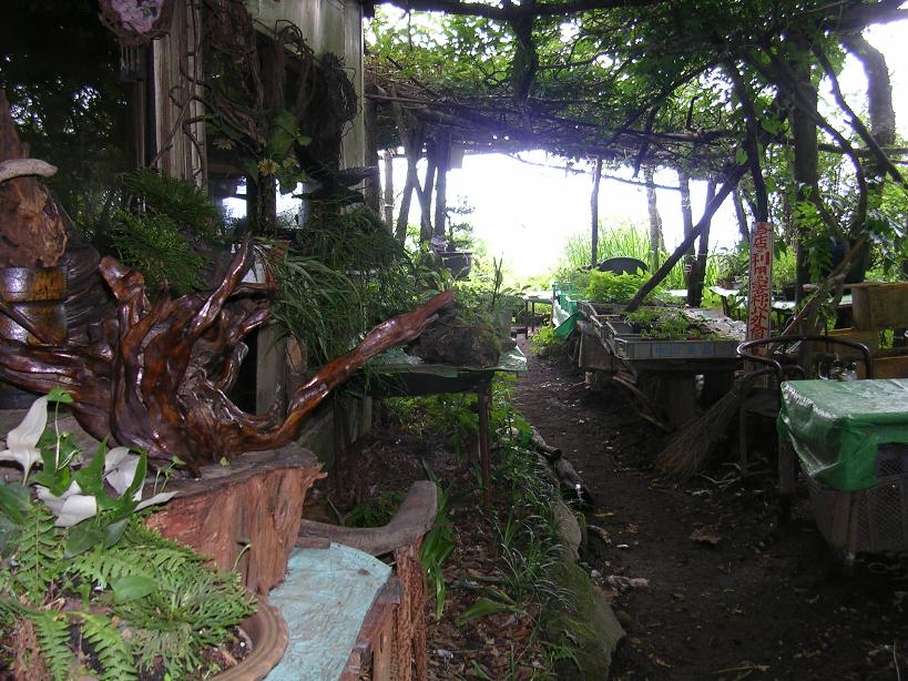
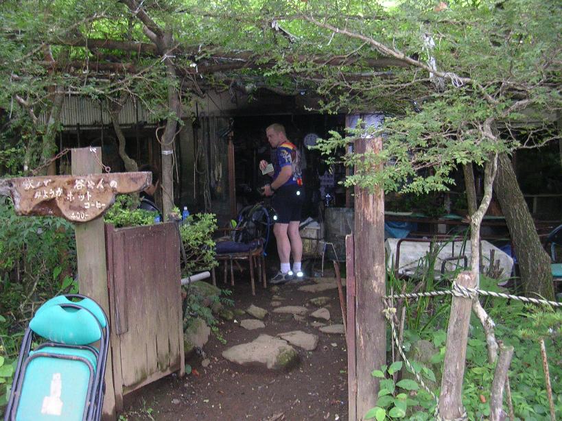
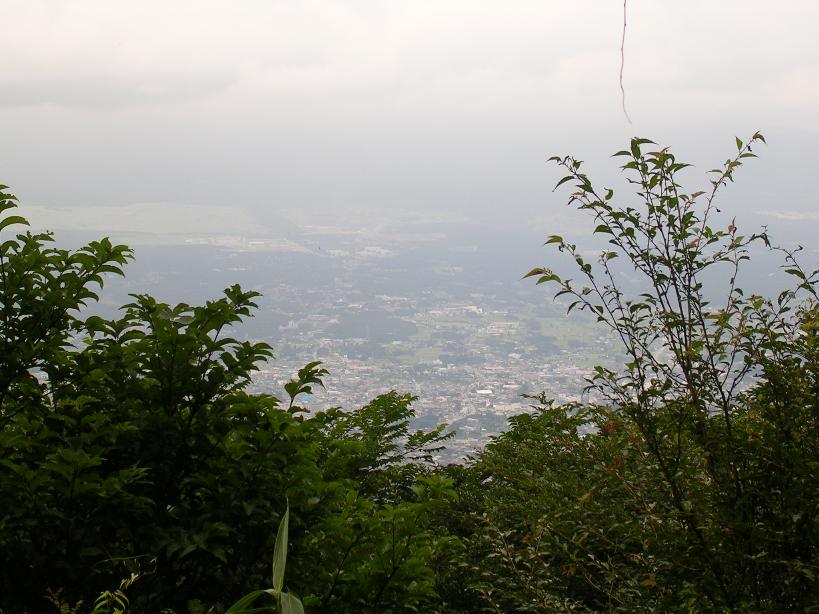
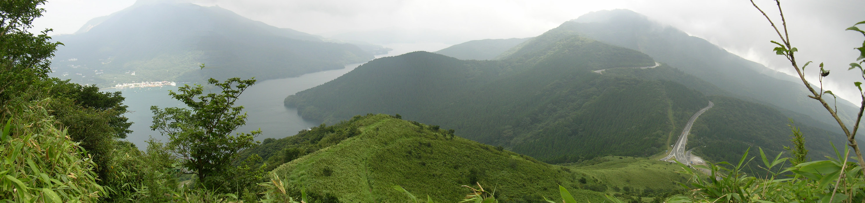
After forty-five minutes of bike lugging we were starting to wonder if this was a good idea. Thankfully after a few more minutes we reached the ridge top where we were surprised to see to find mountain hut at the four-way trail junction that offered some cool stuff to drink. We were more than ready for a breather so grabbed a seat and a drink. The old guy that operates the place lives here most of the year until the snow or cold forces him down the mountain in the winter where he rents an apartment for a couple of months. The rest of the time he makes a living doing horticulture and making art out of tree stumps and roots. The day we did this ride it was overcast and clouds were shrouding Mt Fuji. On a clear day the view from here would have been absolutely incredible. The center picture shows Gotemba down below and behind that would have been the full view of Fuji.
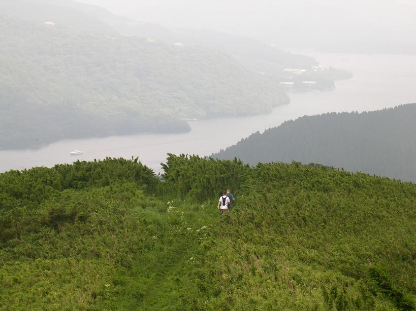
After the breather, we took the left at the four-way junction (Point B) and proceeded south. We rode for a short bit before the trail turn uphill and steep, so it was back to the hike-a-bike scene. The trail spent much of time right along the spine of the ridge so there were plenty of ups and down, but the ups were for the most part hike-a-bike. This continued up a summit marked by a triangle on the map halfway between B and C.
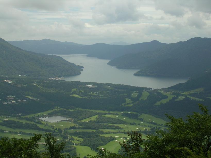
The views from this point were impressive and on a clear day you could look in one direction and see the lake and turn around and see Mt Fuji. Once again no such luck the day of this ride. From here to Point D was mostly ridge top riding were we were losing elevation overall.
At Point C is another trail which can be used to get onto the ridgeline. This is only about a 10 minute easy hike-a-bike instead of the torture trail we took. It does bypass some nice sections of trail but could be a good option the first time you ride this. You can access this trail buy taking taking the road to your right after the hairpin turn on HWY 138 described above, or by take Skyline Toll Road off HWY 138 and taking your first left. The trail head is at the lake side of a tunnel by a small restaurant.
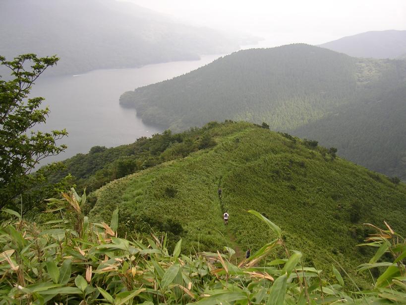
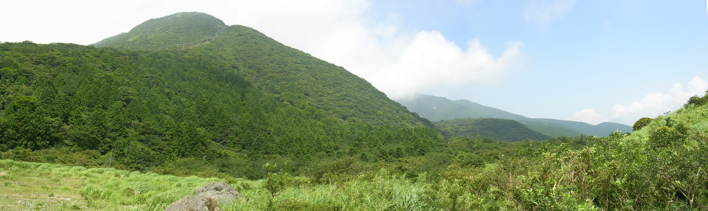
 One of the many incredible views of the Skyline trail
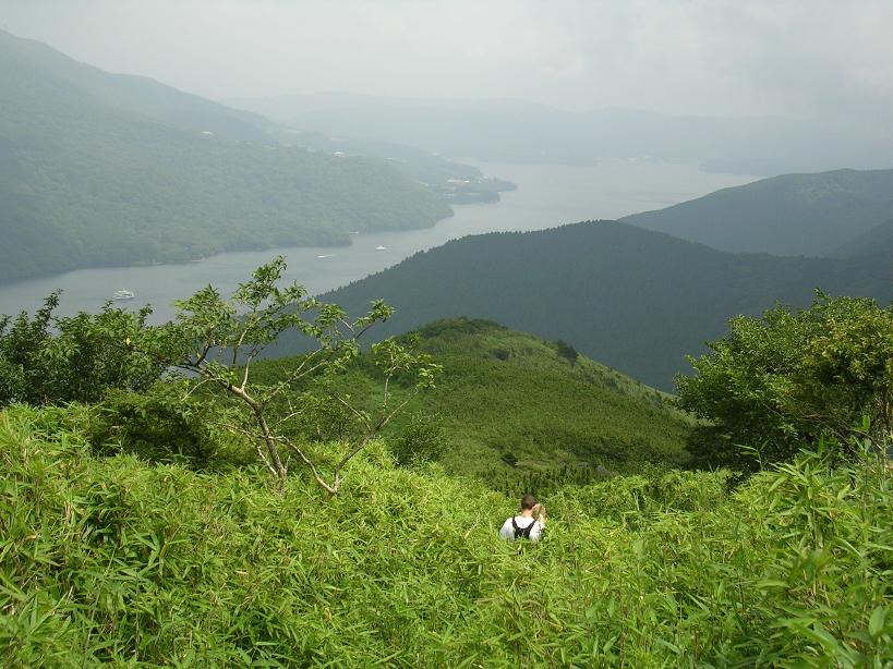
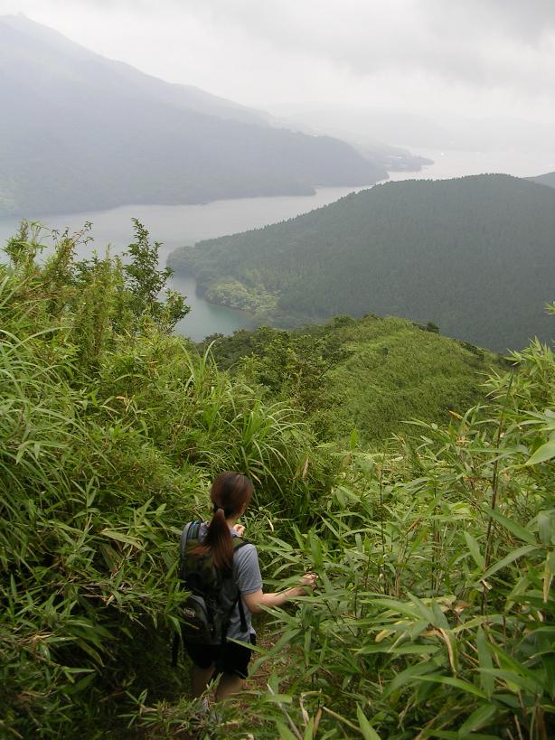
 Views from the ridgeline as just before approaching Point D. These pictures were taken on our scouting trip.
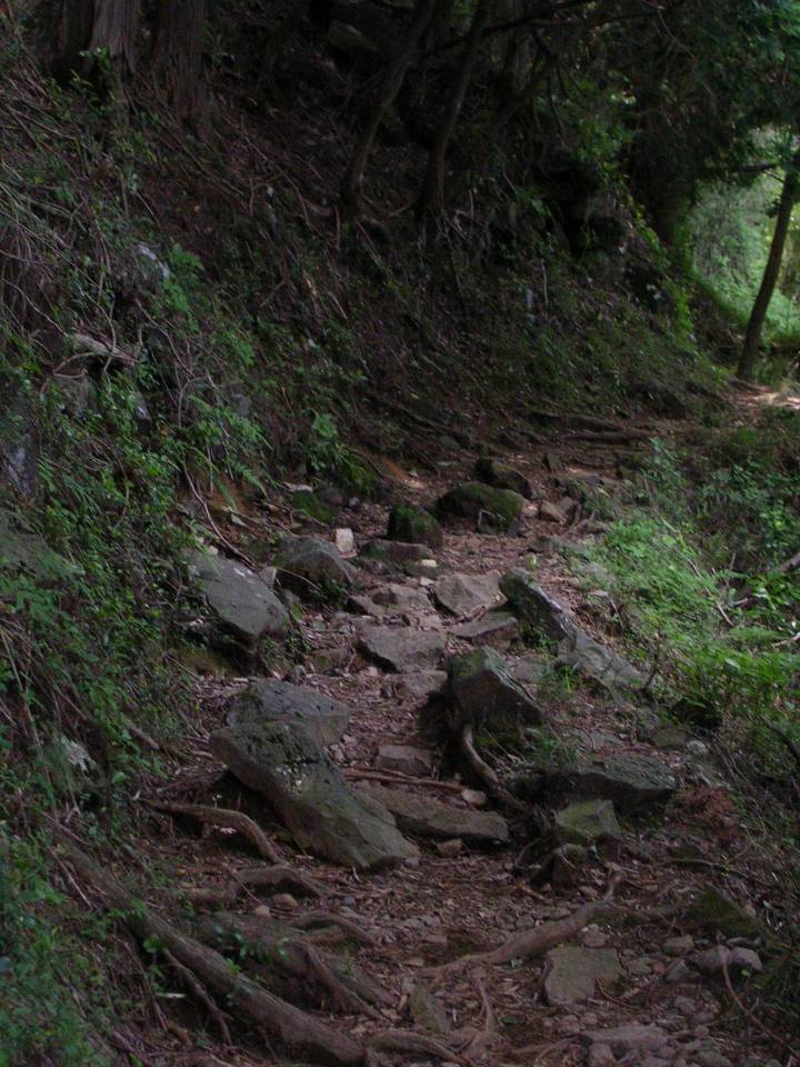
 At Point D the trail crosses a paved road the goes down the lake. The trail continues on uphill along the ridgeline. Here we took a trail off to the left that goes down to the lake. This trail is quite steep and is made up of mostly rock slab steps. The construction of these steps is quite dumb. Instead of the steps being horizontal, the slabs are at nearly the same angle as the slope of the mountainside. Now Japan gets plenty of rainfall which means moss on the rocks. The moss plus the angle of the rocks makes for a stairwell that for the most part freaking hard to get a good foot hold and very slippery even when it is dry out. It is treacherous to ride down, and a little unnerving to hike down. I recommend taking the road down to the lake and riding the shore line trail back to the bottom of descending trail at Point E. That route is in blue on the map above.
From Point E you take the Shore Line trail described above to the south end of the lake where you have your friends or car waiting for you. The distance of this entire ride is only 15 miles or so but it is quite strenuous particularly early on. Linking up a few more trails together could make this a real epic.

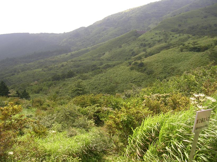
Other Trails in the Area
 This is the mountain on the east side of the lake, if you look on the map there is a ropeway (gondola) that
goes up to the top of the mountain. On the map their are trails that go off from the top. I may go back and do some further exploring.