
Freeman Creek and the Giant Sequoia
|
|

Directions: From Los Angeles it is about a 200 mile trip. Drive north on interstate 5, then take highway 99 north. North of Bakersfield take CA65. In Porterville, go east on CA190. About 28 miles beyond Springville and a super long series of switchbacks, you will come to 21S50 on your left. To go directly to the trailhead turn left and take the first dirt road on your right about .5 miles up the road and park in the dirt lot. If you are going to the Quaking Aspens campground , stay on CA190 and the road will make a quick right hand turn and will now be called the Western Divide Highway. Almost immediately, the entrance to the campground is on your right.
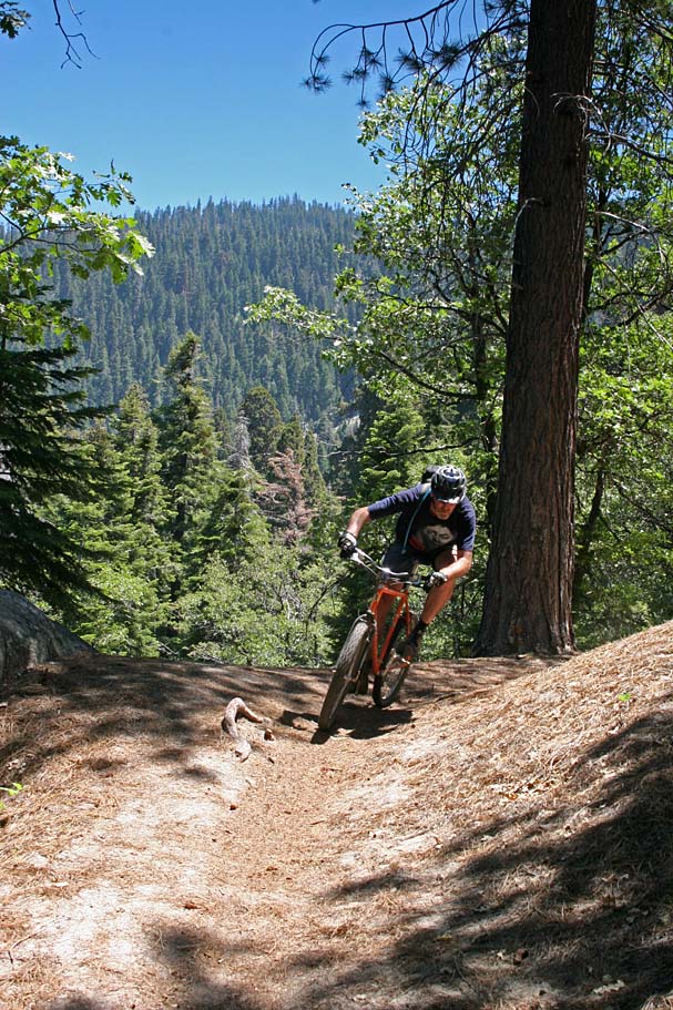
Ride Notes: Greg and I managed to escape from LA on Friday just before a brush fire turned Interstate 5 into an ugly bumper-to-bumper mess for hours that would hamper Jerry and Bill's run for singletrack freedom. The plan was to meet up in Kernville and then head up to our campsite. Greg and I made what turned out to be a really good call and shot straight up to the Quaking Aspens campground, not even a mile from the trailhead. Our Saturday ride was going to be the Cannell Trail with some bonus mileage up to Sherman Peak so after setting up camp alongside the meadow, Greg and I headed down to Kernville to meet up with our delayed cohorts and leave my truck in town to be used as the shuttle return vehicle the following day. The timing was perfect as we waited less than 10 minutes for Jerry and Bill. We arrived back at camp after dark and had some pre-ride hydration that included some mighty fine brews with roots in Bend, Oregon and San Marcos, California. Greg and I had the pleasure of seeing the meadow the evening before, but Jerry and Bill were quite impressed with the views from their tent windows in the morning. The Cannell trail was a bunch of fun, but that is another story.
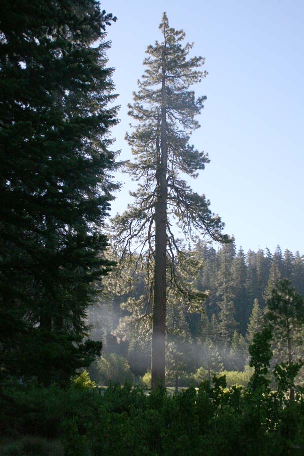
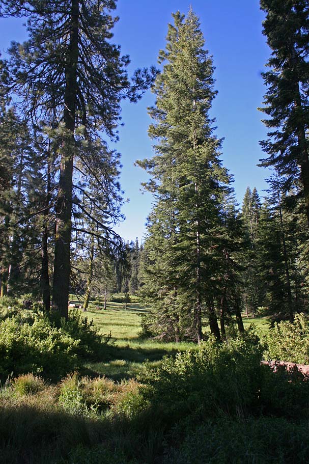
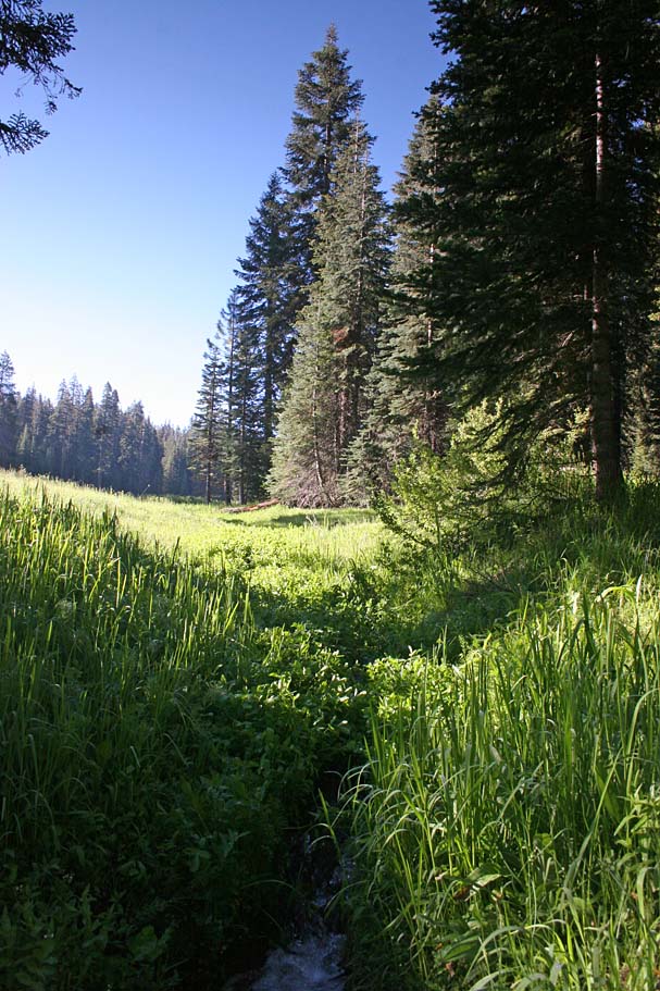
Our base camp for the weekend's riding.
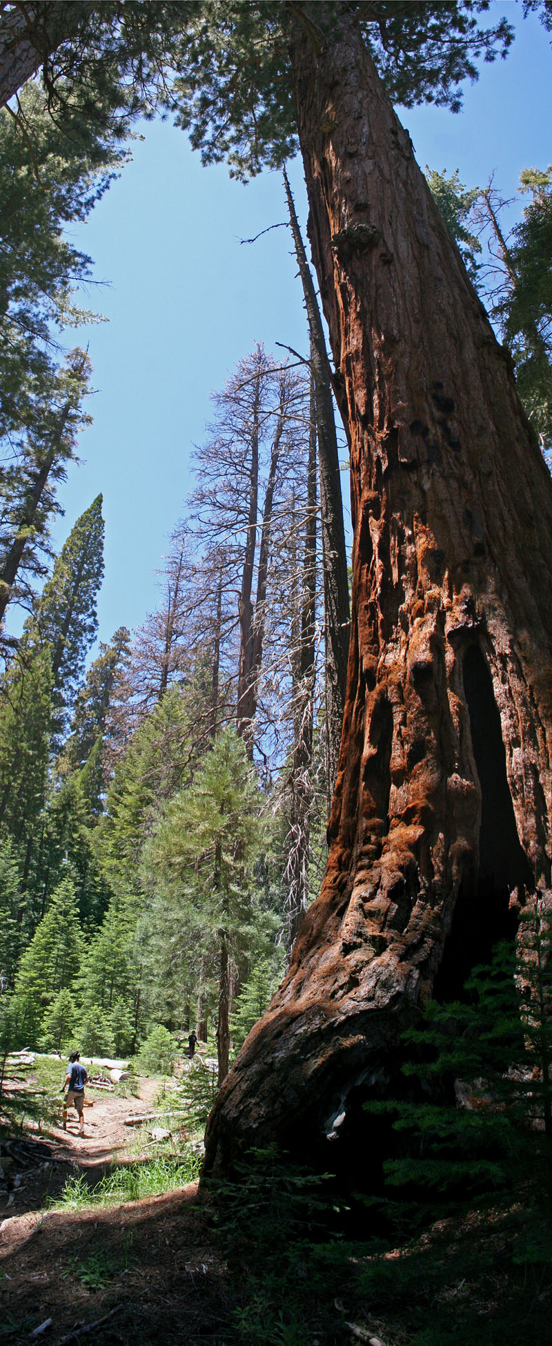
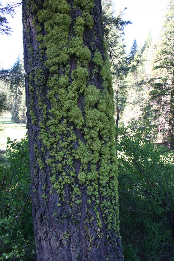
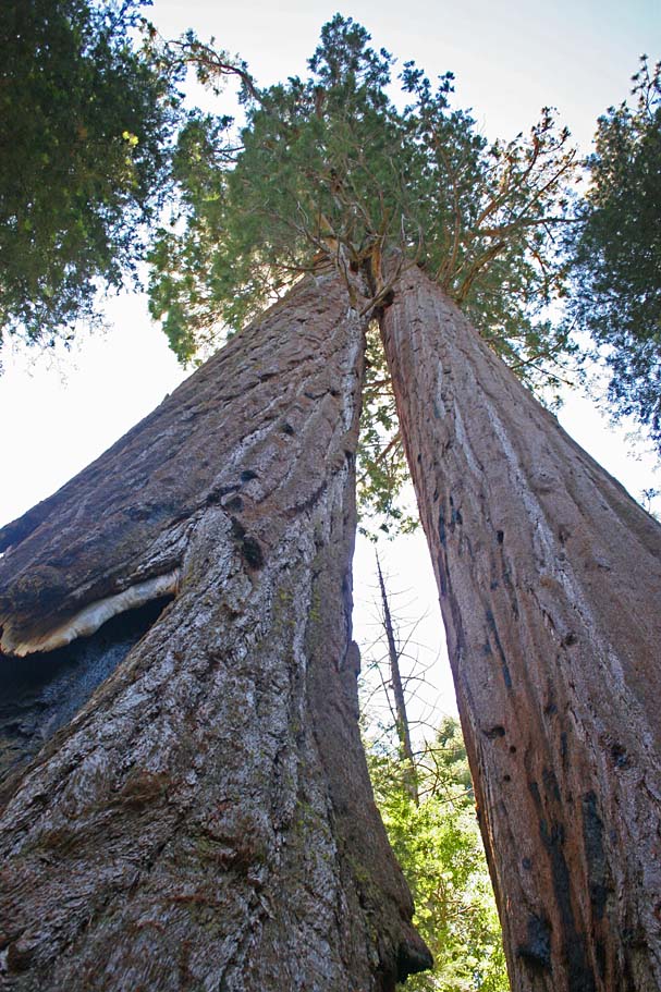
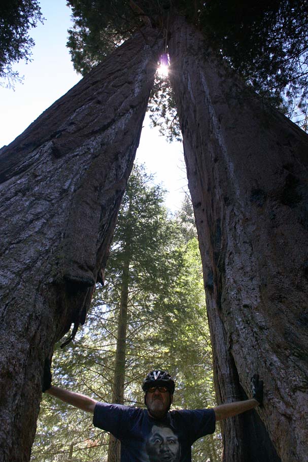
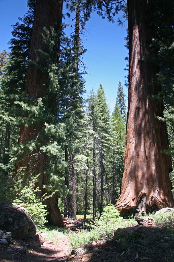
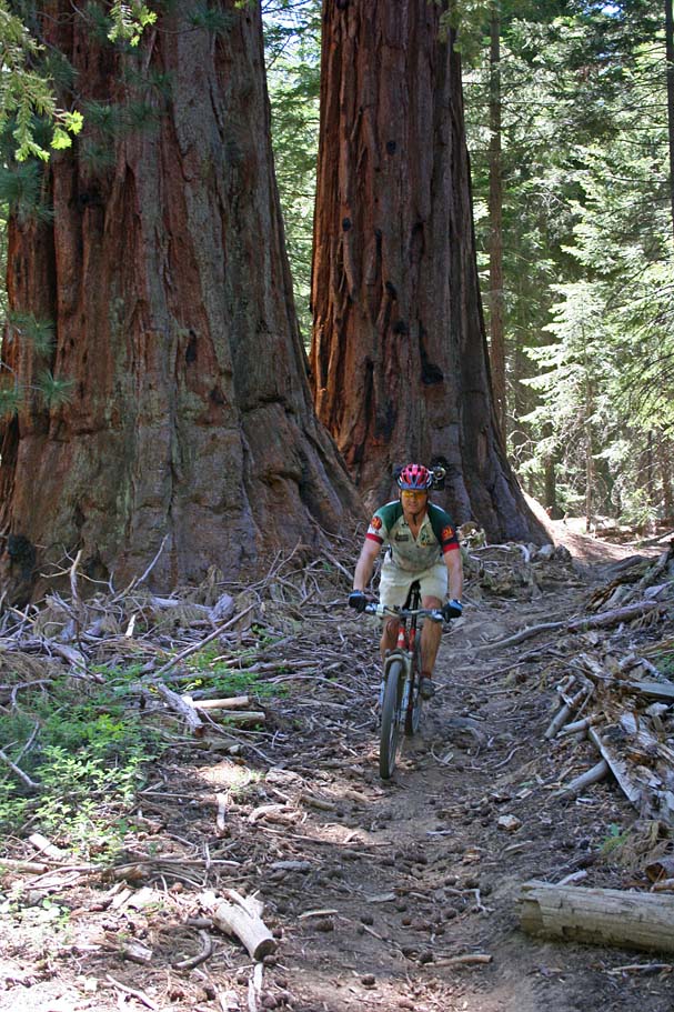
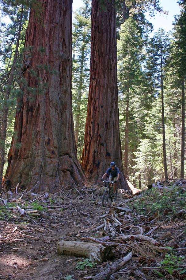
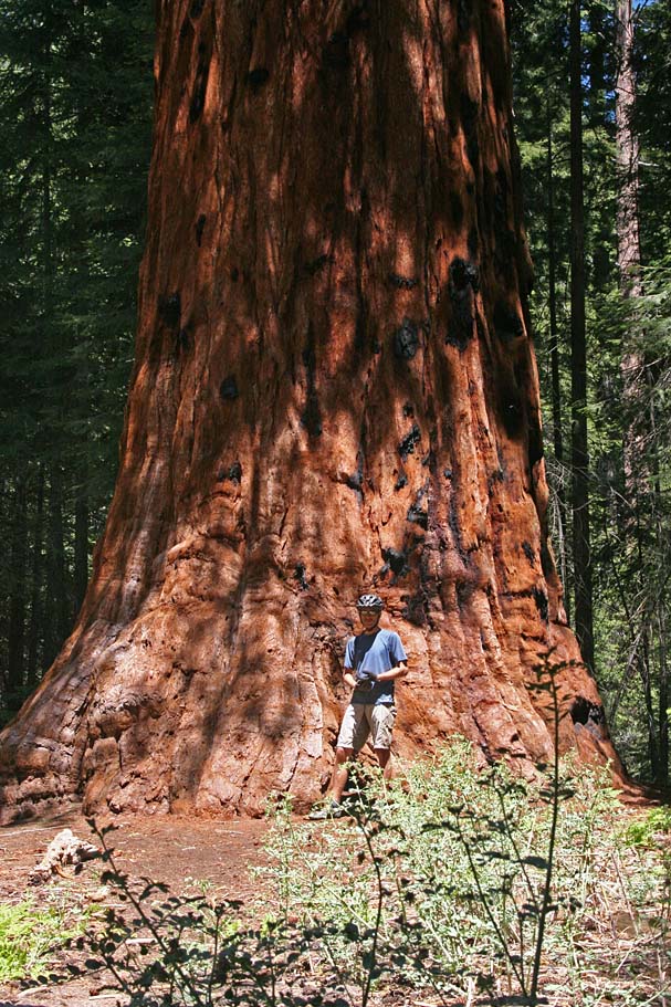
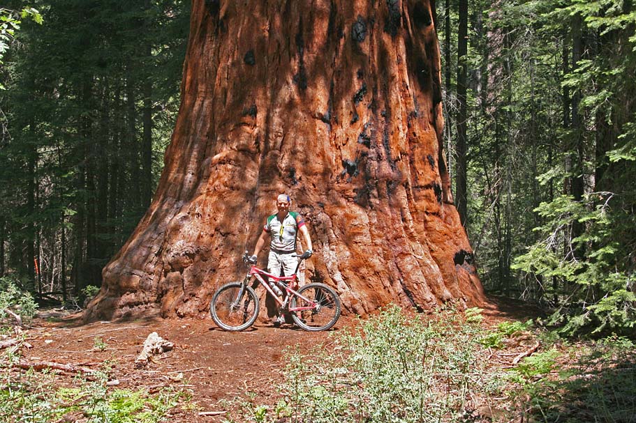
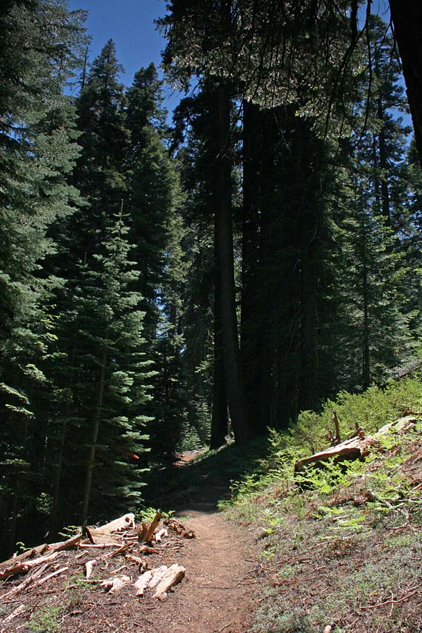
Sunday was the Freeman Creek trail (USFS trail 32E20). We rode our bikes right from camp and within a mile we where at the turnoff for the trail. You rolled down a couple 10ths of a mile on fire road before the singletrack started. The singletrack was a real treat as it was mostly a buff trail that also had really good flow. There are some pretty impressive large firs in the upper end, but it is not until you are about a mile down the trail until you start passing by the giant sequoias. My pictures are absolutely inadequate at capturing the impressiveness of these trees.
 The
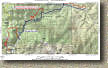
Freeman Creek trail is 4.4 miles long and drops roughly 1,500 feet into the
Lloyd Meadows and Pyle's Camp area. Most of that elevation is lost in the
first 3 miles of the trail. On the map you will see a red trail in
addition to the blue trail. The blue line is the trail as it is shown on
the USGS topographic maps. My GPS lost lock several times under the tree
canopy during this descent causing quite a few large errors. From what I
can tell there are indications that the trail varies somewhat from the map.
The red plot is my best guess based on what data I did get and the contour
riding I remembered doing that day. While we did stop to ogle and gawk at
the giants our plan was to enjoy a good downhill rip and save most of the picture taking for the climb when we could use an
excuse for taking a break. :-)
The
Freeman Creek trail is 4.4 miles long and drops roughly 1,500 feet into the
Lloyd Meadows and Pyle's Camp area. Most of that elevation is lost in the
first 3 miles of the trail. On the map you will see a red trail in
addition to the blue trail. The blue line is the trail as it is shown on
the USGS topographic maps. My GPS lost lock several times under the tree
canopy during this descent causing quite a few large errors. From what I
can tell there are indications that the trail varies somewhat from the map.
The red plot is my best guess based on what data I did get and the contour
riding I remembered doing that day. While we did stop to ogle and gawk at
the giants our plan was to enjoy a good downhill rip and save most of the picture taking for the climb when we could use an
excuse for taking a break. :-)
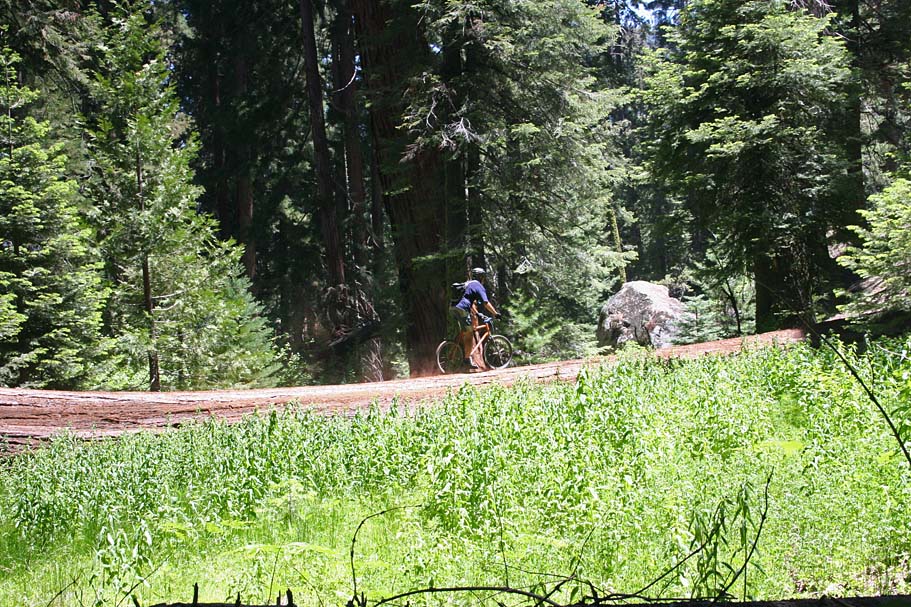 |
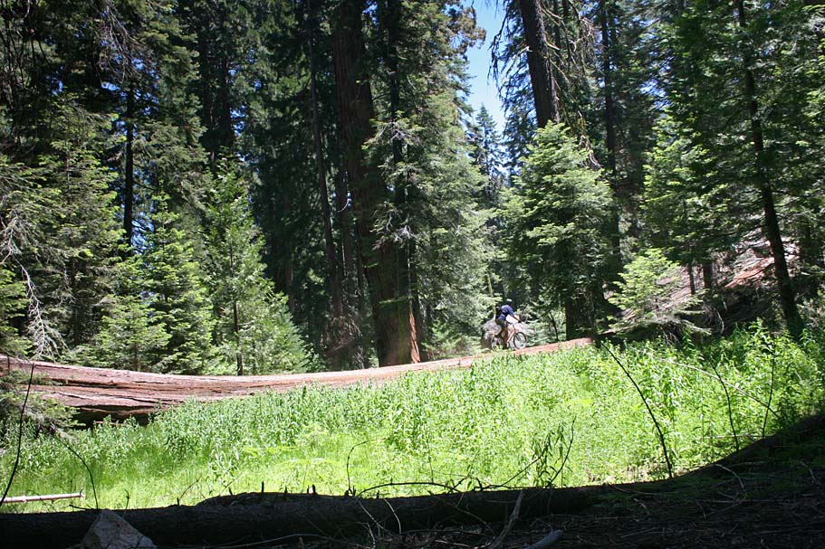
About half-way down the descent the trail wraps around a small meadow where a giant sequoia had fallen across the entire meadow. Now normally log riding can be tricky business but this log was like riding on a sidewalk. Then again, if you where to fall off near the bottom-end of this log you would have at least 12 feet of air-time before hitting the ground. | 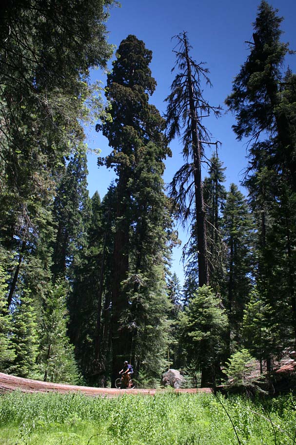 |
 |
||
 |
When the trail starts to flatten out somewhat
near the bottom, be on the lookout for a well defined trail splitting off
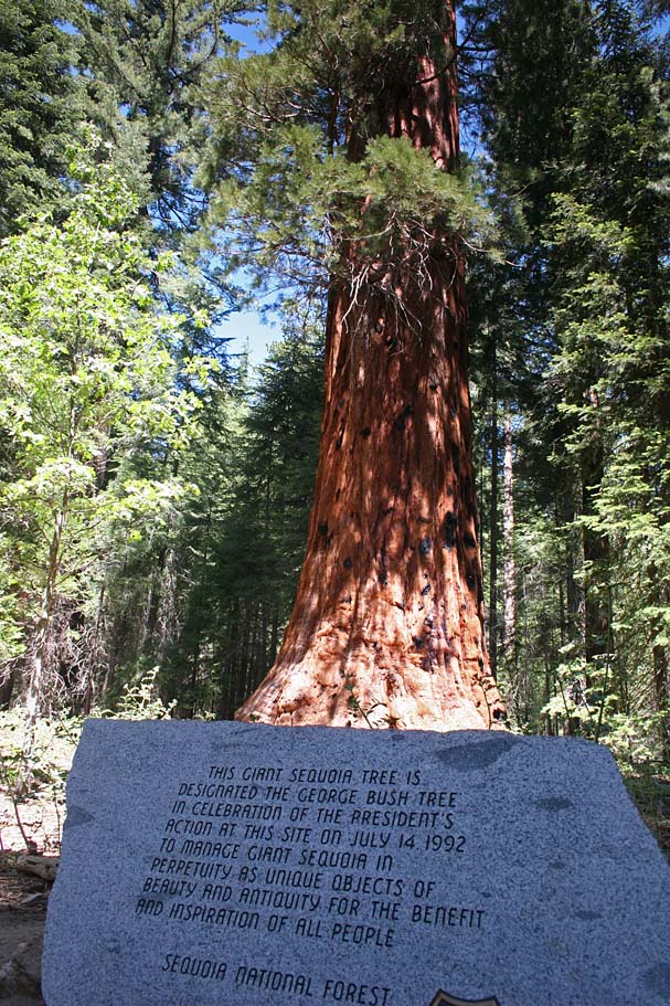
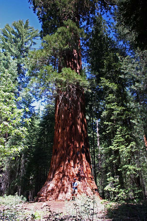
to the left. This will lead you to the President George Bush Tree
which you should see from the main trail (Near Point B) .
The President George Bush Tree near the bottom of the trail |
 |
 The
trail from the George Bush tree out to forest service road 22S82 (Point C) gets
sandy and sees some horse traffic. It is still a pretty good trail but you
are now in just mere pine trees. On this ride we hung a left on the paved
road and did come gradual climbing up to Point D. (Refer to the
large scale map if you want to see this optional trail) Once at Point D, we
hooked up with 33E20 which I think is called the Lloyd Meadows trail. This
was supposed to be a mostly gradual downhill singletrack so we were optimistic
that it was going to be bunch of fun. While there was some fun
sections along it, it was quite sandy and beat up from horse traffic.
There was even one section we called "The Sahara" as it was a big sandy pit
that sucked the will to peddle right out your legs. At Point E, the trail
crossed a dirt road that heads out to the forks of the Kern River.
Based on the poor trail conditions and several equestrians we could see ahead on
the trail
The
trail from the George Bush tree out to forest service road 22S82 (Point C) gets
sandy and sees some horse traffic. It is still a pretty good trail but you
are now in just mere pine trees. On this ride we hung a left on the paved
road and did come gradual climbing up to Point D. (Refer to the
large scale map if you want to see this optional trail) Once at Point D, we
hooked up with 33E20 which I think is called the Lloyd Meadows trail. This
was supposed to be a mostly gradual downhill singletrack so we were optimistic
that it was going to be bunch of fun. While there was some fun
sections along it, it was quite sandy and beat up from horse traffic.
There was even one section we called "The Sahara" as it was a big sandy pit
that sucked the will to peddle right out your legs. At Point E, the trail
crossed a dirt road that heads out to the forks of the Kern River.
Based on the poor trail conditions and several equestrians we could see ahead on
the trail
 we decided that this trail would mostly like not get any better so we opted to
turn west on the dirt road and go back to the pavement and return to the Freeman
Creek Trail. Just before getting back to the Freeman Creek Trail there is
a dirt road on your right that offers access out to the President George Bush
Tree. We opted to bypass the lower portion of the trail and take the
access road. At the tree we rejoined the Freeman Creek trail and
started our climb out. The climbing was no where near as difficult
as we thought it would be but we were stopping often to check out the trees and
enjoy the trail. If you hammer up this trail you are one Grade-A
Bonehead. Save the training and conditioning for your local stuff, these trees
are some of the oldest living things on the planet, enjoy yourself and take
everything in.
we decided that this trail would mostly like not get any better so we opted to
turn west on the dirt road and go back to the pavement and return to the Freeman
Creek Trail. Just before getting back to the Freeman Creek Trail there is
a dirt road on your right that offers access out to the President George Bush
Tree. We opted to bypass the lower portion of the trail and take the
access road. At the tree we rejoined the Freeman Creek trail and
started our climb out. The climbing was no where near as difficult
as we thought it would be but we were stopping often to check out the trees and
enjoy the trail. If you hammer up this trail you are one Grade-A
Bonehead. Save the training and conditioning for your local stuff, these trees
are some of the oldest living things on the planet, enjoy yourself and take
everything in.
 Once
we had made it back up to the paved road at the top we hung a right and pedaled
uphill for 3/4ths of a mile and turned left onto the a forest service road. Two tenths of a mile
later you will see a singletrack coming onto the road from right. Continue
on the forest road (I'll talk about the singletrack later). The
forest road will bend around to your left and south and follow along a
meadow on your right. At the end of that meadow, which is at .6
miles from the pavement, the road ends and singletrack continues straight
through a cattle gate (Close behind you).
The singletrack from this point is downhill and narrow with some switchbacks and
numerous spots where the brush is encroaching into the trail. The trail
has a raw feel to it that does not see too much traffic on it. It was
quite a blast. It dumps you out onto highway 190 where you can either turn
left and go uphill back to your car or pickup the trail across the street and
cut across a meadow and uphill into the Quaking Aspens campground.
Either way you choose you are less than a half mile from where you started the
ride.
Once
we had made it back up to the paved road at the top we hung a right and pedaled
uphill for 3/4ths of a mile and turned left onto the a forest service road. Two tenths of a mile
later you will see a singletrack coming onto the road from right. Continue
on the forest road (I'll talk about the singletrack later). The
forest road will bend around to your left and south and follow along a
meadow on your right. At the end of that meadow, which is at .6
miles from the pavement, the road ends and singletrack continues straight
through a cattle gate (Close behind you).
The singletrack from this point is downhill and narrow with some switchbacks and
numerous spots where the brush is encroaching into the trail. The trail
has a raw feel to it that does not see too much traffic on it. It was
quite a blast. It dumps you out onto highway 190 where you can either turn
left and go uphill back to your car or pickup the trail across the street and
cut across a meadow and uphill into the Quaking Aspens campground.
Either way you choose you are less than a half mile from where you started the
ride.
There is no shortage of singletrack on the maps for this area and I plan on snooping around more during future visits to the Southern Sierras. On the large scale map of this area I have annotated some other trails that were on the snoop list that we did not get around to during this visit. You could continue climbing up the paved road 21S50 and pick the singletrack I mentioned earlier further up the mountainside. I have labeled the spots where the singletrack in the area crosses the roads with letters. The roads goes up very close to the borders of the Golden Trout Wilderness Area. These trails could end up being a bust like our experience at Lloyd Meadows, but you never know if there could be a real gem of a trail up there. Exploration rides in the backcountry can turn ugly in a hurry even when you are prepared so take plenty of precautions if you and your buddies decide to do some snooping.
Update
Please disregard my pictures of the nice singletrack and flowing lines from the video. The forest service in conjunction with "Trails (or is Sanitizers) Unlimited" came in a few weeks after I shot the video and basically destroyed the singletrack, turning into a freaking road that looks like this. I have friend who went back here almost a year later and classified the trail as "sad".
Photo by Greg Thomas
This is a bunch of crap. The trail could have used a little nip and tuck here and there as well as little debrushing in a couple of spots , but what they did is absolutely dumb. I'm surprised they did not cut down some of the ancient Sequoias to make room for the "trail". Take a look at the video and tell me if you think that level of maintenance was needed. I am really scared to think of what other active contracts the US Forest Service has with "Trails Unlimited" throughout the country.
Here is a letter to the editior of the Southern Sierra Messenger from a conservation group concerning the "maintenance".
 EDITOR:

 In June, local hikers enjoyed their walk down the Freeman Creek trail through
the Giant Sequoia National Monument after the Forest Service completed their
standard annual maintenance and cleared the trail of fallen trees. So they did
not need to do anything more because the trail was just fine.

But, in July 2006, the Forest Service completed construction of a four to
six-foot wide road through the grove without disclosing to the public the
impacts of this project. Public controversy is one of those impacts.

The road crew moved boulders, dug out hillsides and piled the dirt on the
downhill slope, created a number of wide switchbacks, and cut down dozens of
trees to create a space wide enough for this road. If this trail had the
“original four foot width” that the Forest Service falsely claims, why did
they have to move those boulders, dig out those hills, cut down those trees,
and create those downhill embankments?

 This grove was an historic, Native American footpath that was here way before
the Forest Service came into being. There was no erosion sufficient to inspire
this project; the trail through this grove was probably stabilized eons ago.

But the ground-disturbing activities that the Forest Service authorized with
this project will result in erosion and sediment flows into the downstream
watershed that could damage fish and other aquatic species for years to come.
The May 4, 2001 scoping letter that was recently provided by the Forest Service
for the proposed project fails to disclose the road-building scope of the
project that was actually implemented. This Freeman Creek road-building project,
as implemented, was done without the public's knowledge.

Changing the scope of the project and implementing something other that what was
originally proposed seems to be business as usual for the Forest Service and a
violation of forest management laws. Similarly, the Forest Service told the
public in 2004 that a so-called “public safety” hazard tree removal project (not
a timber sale) would be done in the Trail of 100 Giants with all trees retained
for use in the Monument. But they ended up doing a fuels reduction project
without the required environmental analysis, and 67 commercially-valuable trees
were sold that ended up at the Sierra Forest Products sawmill.

 Local hikers who have seen the damage are appalled by the Forest Service's
carelessly harmful management in Giant Sequoia Groves. This historic trail cannot
be restored to its original condition, but perhaps the Forest Service will
refrain from conducting such a travesty again. Besides the damage to the
environment this created a needless waste of your tax dollars.

 ARA MARDEROSIAN

 SEQUOIA FORESTKEEPER

 KERNVILLE
If the actions of the Forest Service pisses you off then voice your displeasure by writing the forest service office at:
Sequoia National Forest
1839 S. Newcomb St.
Porterville, CA 93257
or call them at 559-784-1500
VIDEO
 |
Here is the video shot on June 18th, 2006. Right click on the image to the left to download this 9 minute video that is 70MB. |