
The Cannell Plunge - Kernville CA
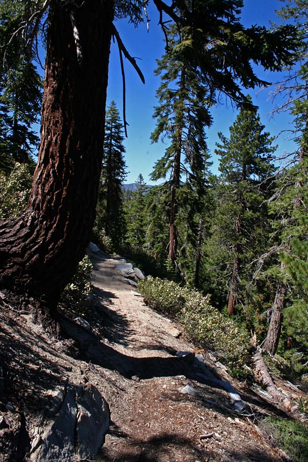
Located in the Southern Sierra Nevada Mountain this ride is definitely an epic ride with some of the best riding and most incredible views that I have enjoyed in Southern California. You will get over 32 miles of riding in on 98 percent single track. With the low point at the rides end in Kernville at 2,700 feet and the high point of 9,900 feet on Sherman Peak you are guaranteed to get in some epic descents. The primary descent is "The Plunge" where this wonderful single track drops 5,000 feet in just 8 miles. This ride is not an all fun and games ride as there are a couple of grinder climbs that combined with the altitude will certainly wipe the small off your face for a while. This ride is well worth the drive to Kernville and the hour long shuttle from just about anywhere. Take the Plunge and you will not be disappointed!
| Trail Maps | ||
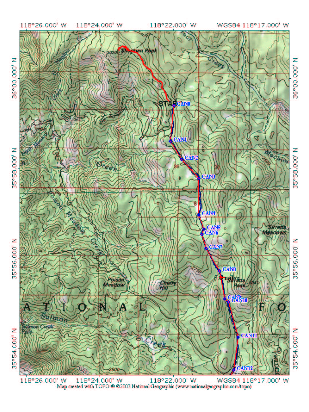
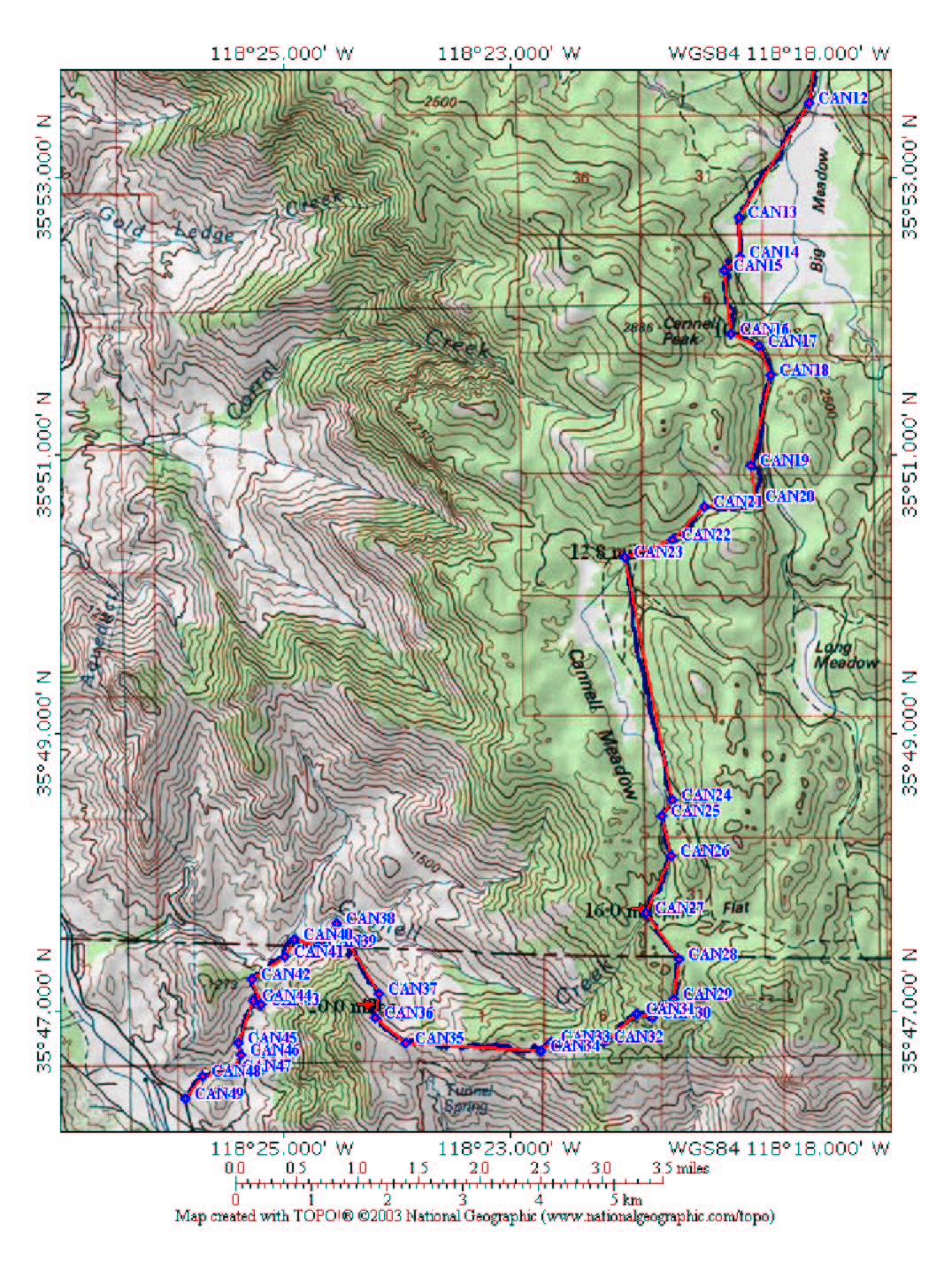
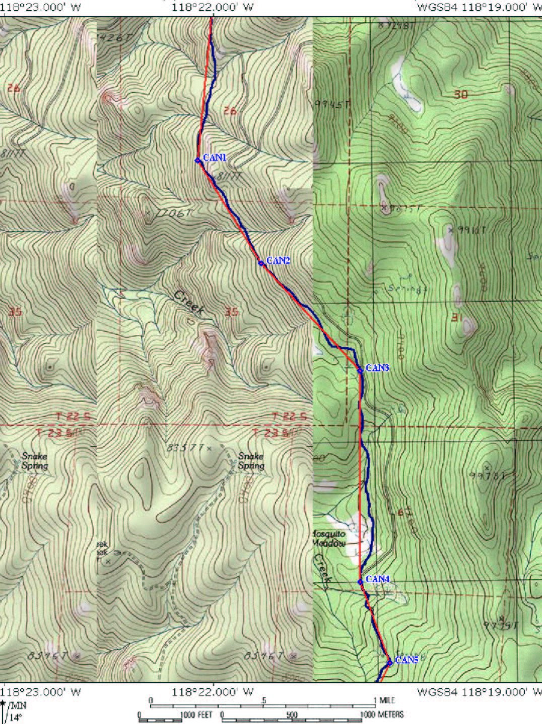
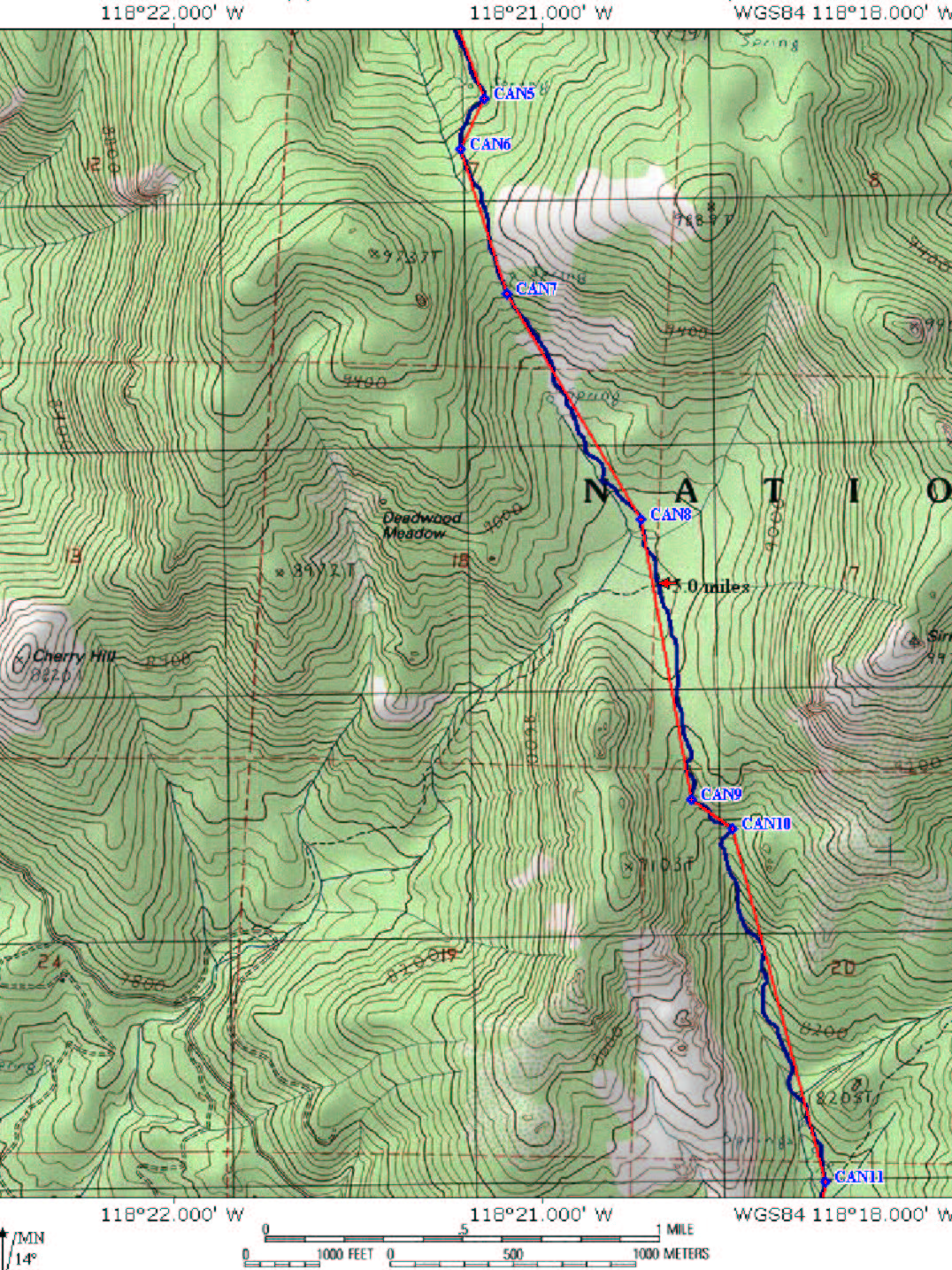
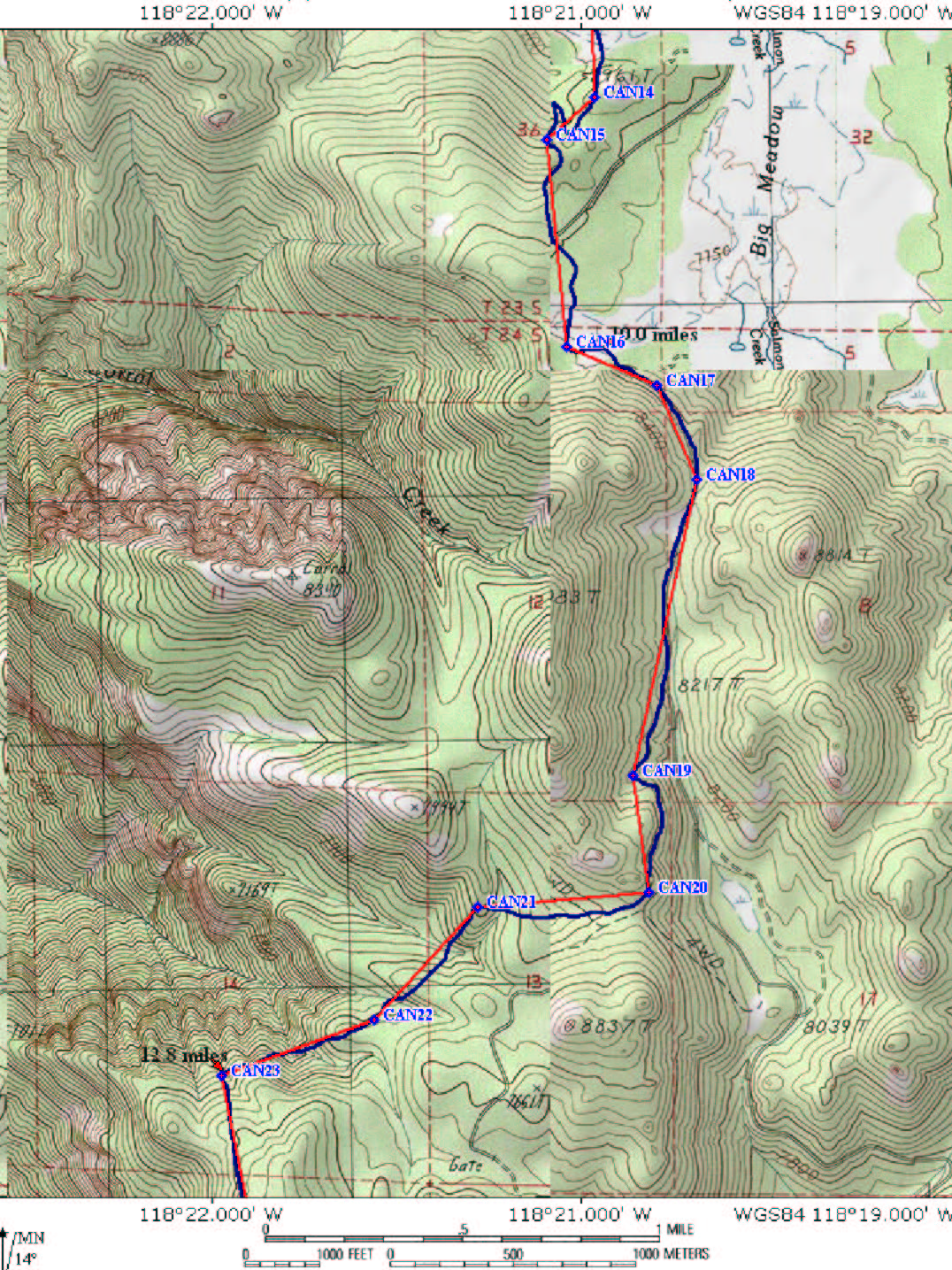
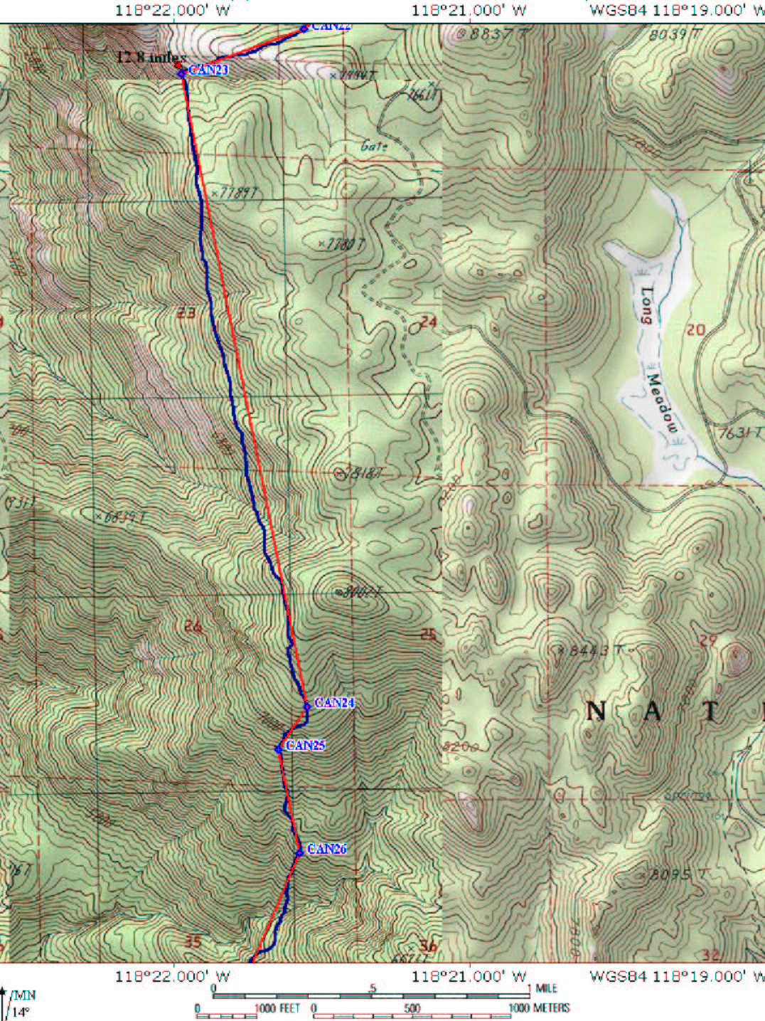
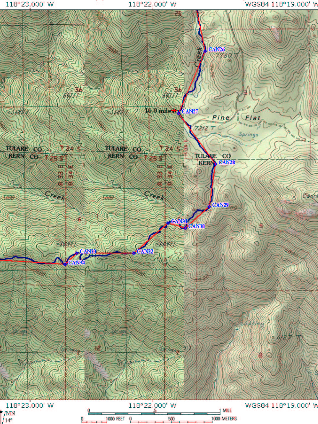
| A single map of this ride would be absolutely huge so I have broken it up into a large scale map in two parts and a smaller scale map in eight parts. They should print out properly on 8.5 x 11 paper. | ||
| Larger Scale Maps | Smaller Scale Maps | |
  Also check out Trailforks for this ride |
Data Files TOPO! GPX GDB GPS How-To |
|
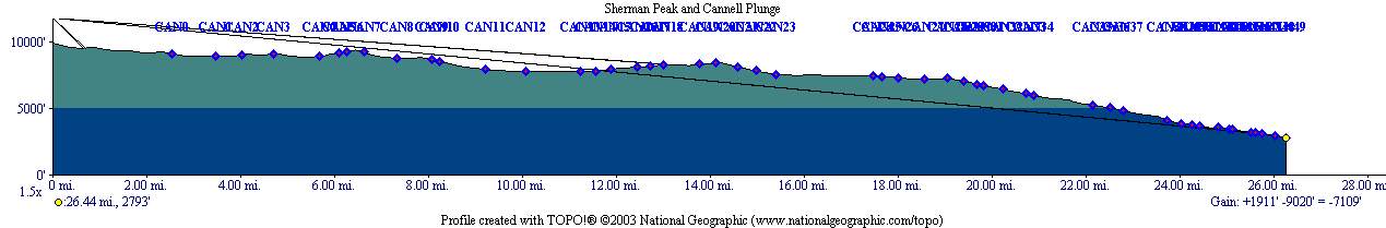 "16" />Elevation
Profile from Sherman Peak to the bottom of the Plunge. "16" />Elevation
Profile from Sherman Peak to the bottom of the Plunge. |
||


Directions: Get yourself to Kernville. Try this Mapquest link. Kernville is about an hour drive from Bakersfield, CA on highway 178. Kernville is one of those places you can miss if you blink twice so it is pretty hard to get lost once you are in town. If you are coming in from Bakersfield, the shuttle service is on the left just before you cross the Kern river bridge. Hang a right just before the bridge and you can park you car along a green belt alongside the river.
HAZARDS/WARNING: This is a long route, bring plenty of water. There are a couple of streams along the way but you will certainly want to filter and treat water from those sources should you choose to use thme. Blindly uploading up my track data into your GPS and hitting the trail is inviting bad luck. This is not a terribly difficult route to follow but you need to have some experience with map reading and visual navigation. A map, compass and the skills to use them should be considered a vital item in your "toolkit" for this route in additional to a GPS you may carry.
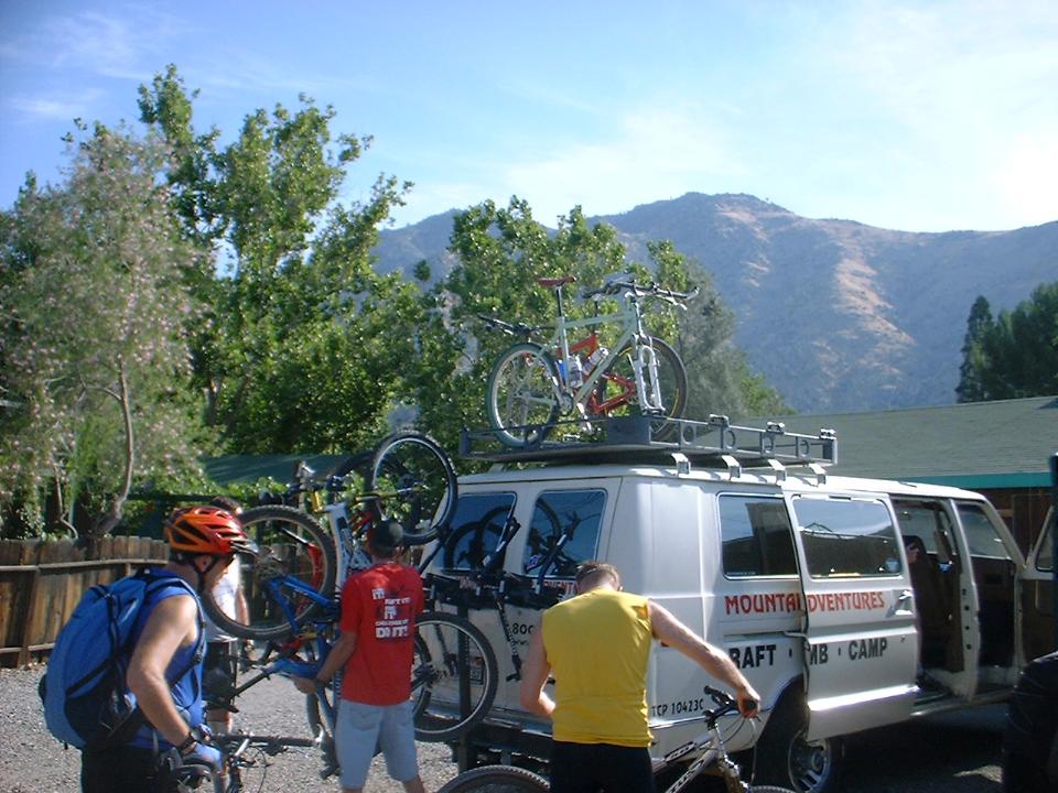
Shuttle service: This is a shuttle ride (I prefer
to call this a point-to-point ride). When I did this ride we used Mountain
River Adventures located right in town. The rate when we went was $25
each with a four person minimum. You can do the shuttle yourself by
parking one car in town and with the other, cross the bridge (You will be on
Kernville Rd). At the T-junction head north on Sierra Way (Which is also
known as Mountain Road 99). Shortly after passing through the small hamlet
of Roads End (Which is clearly not the end of the road) You will make a right
and a road that states the mileage to Sherman Pass and Kennedy Meadows. (If you
cross over the river you have gone to far). Drive up what seems like many
miles. When you stop going up you are at Sherman Pass. (It is also
marked very well with a parking lot.
NOTE: A few of the pictures on the page where taken by
Dennis Baker AKA The Ogre from the Ogrehut.net
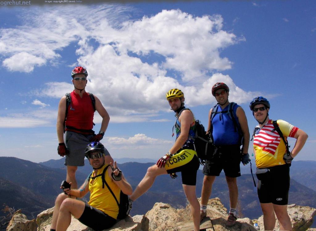
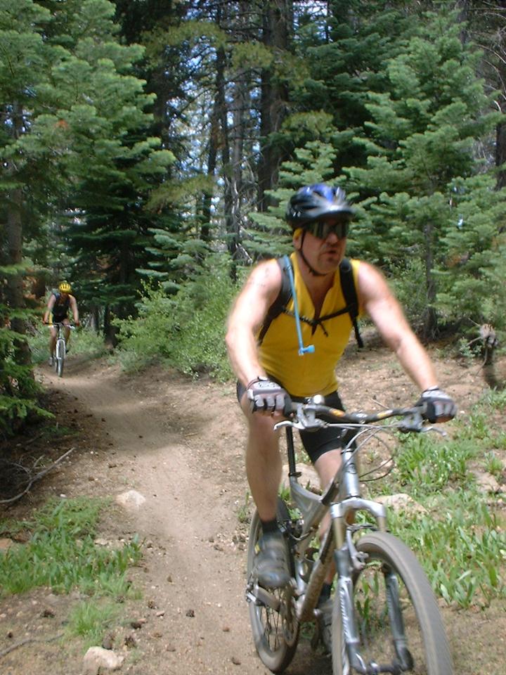
 RIDE NOTES: I had been itching to do this ride for over a year so when I heard
some folks from NorCal where coming down to do this ride we all made plans to
meet up and get the ride done. My usual riding suspects drove up to
Bakersfield the night before and got some cheap accommodations. We
met Steve Wolf,
Dennis Baker (The Ogre), and
Bryan Lee from up north the next morning and headed up to Kernville for what
would be the most incredible riding I have every done in SoCal.
RIDE NOTES: I had been itching to do this ride for over a year so when I heard
some folks from NorCal where coming down to do this ride we all made plans to
meet up and get the ride done. My usual riding suspects drove up to
Bakersfield the night before and got some cheap accommodations. We
met Steve Wolf,
Dennis Baker (The Ogre), and
Bryan Lee from up north the next morning and headed up to Kernville for what
would be the most incredible riding I have every done in SoCal.
 We
parked our vehicles along a little greenbelt by the river in town and took all
our stuff across the street to Mountain River Adventures and loaded up.
Once loaded up and on the road it was about and hour until the van dropped us
off at Sherman Pass at 9,200 feet. After getting unloaded and all
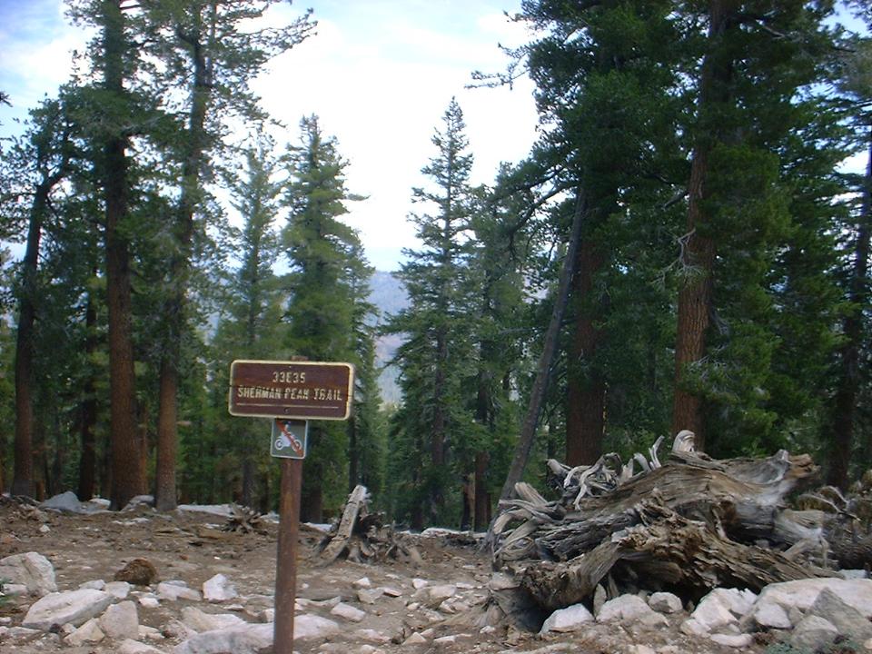
setup we decided to clock in a little bonus mileage and climb up the Sherman
Peak trail to (you guessed it) Sherman Peak. The first thing I noticed was
that the air was darn thin compared to my normal sea level efforts. So
after about 200 yards of my normal effort I had to dial it back a few notches
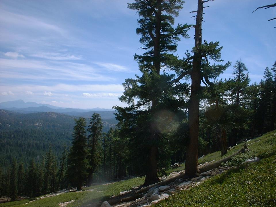
and work some gear I normally don't use. The scenery was already
pretty darn cool with tall pines, interesting trail features, plenty of
mountains off in the distance. The trail up to the peak was 2.5
miles long and it was all rideable with the last 1/8th of a mile or so being
technical enough that when combined with my wussy sea-level lungs I did some
pushing. (I was not alone in making foot prints :-) )
We
parked our vehicles along a little greenbelt by the river in town and took all
our stuff across the street to Mountain River Adventures and loaded up.
Once loaded up and on the road it was about and hour until the van dropped us
off at Sherman Pass at 9,200 feet. After getting unloaded and all
setup we decided to clock in a little bonus mileage and climb up the Sherman
Peak trail to (you guessed it) Sherman Peak. The first thing I noticed was
that the air was darn thin compared to my normal sea level efforts. So
after about 200 yards of my normal effort I had to dial it back a few notches
and work some gear I normally don't use. The scenery was already
pretty darn cool with tall pines, interesting trail features, plenty of
mountains off in the distance. The trail up to the peak was 2.5
miles long and it was all rideable with the last 1/8th of a mile or so being
technical enough that when combined with my wussy sea-level lungs I did some
pushing. (I was not alone in making foot prints :-) )
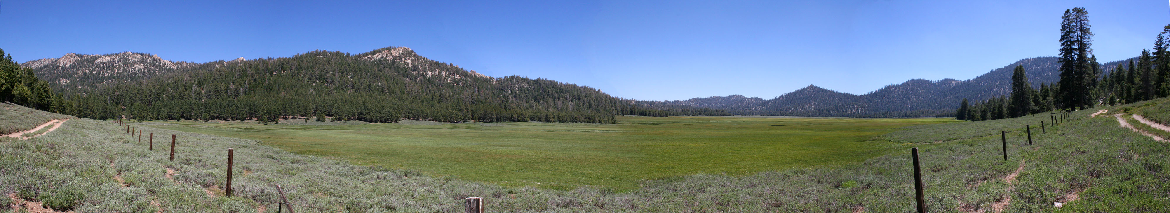
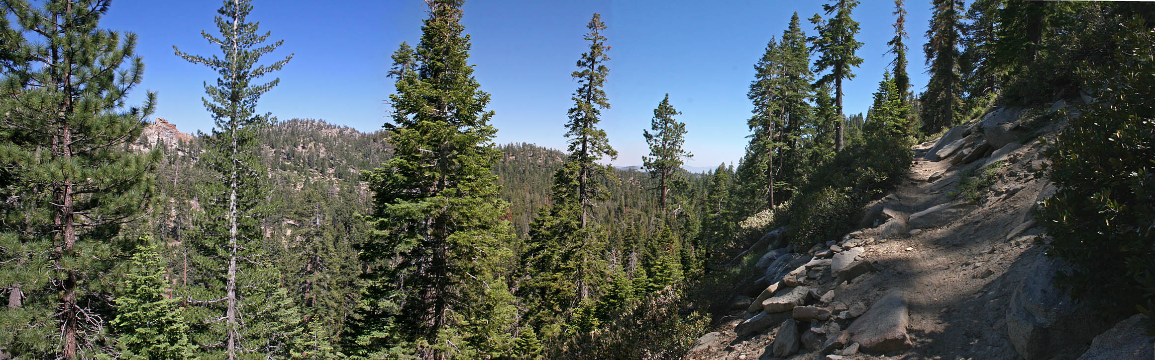
 360 degree pan shot from the top if
Sherman Peak at 9,902 feet
360 degree pan shot from the top if
Sherman Peak at 9,902 feet
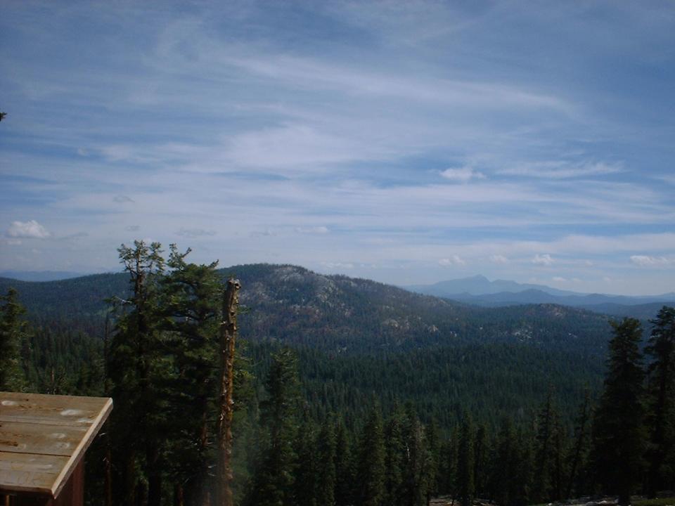
 Once
up on top of the peak the views were absolutely fabulous 360 degrees of sensory
overload views including Mount Whitney. We did the prerequisite
poseur thing with plenty of pictures and then signed in a guest book we found in
a sealed container. Once we had our fill of the peak, we fired up
our video gear (there was three of us on the peak with video gear) and headed
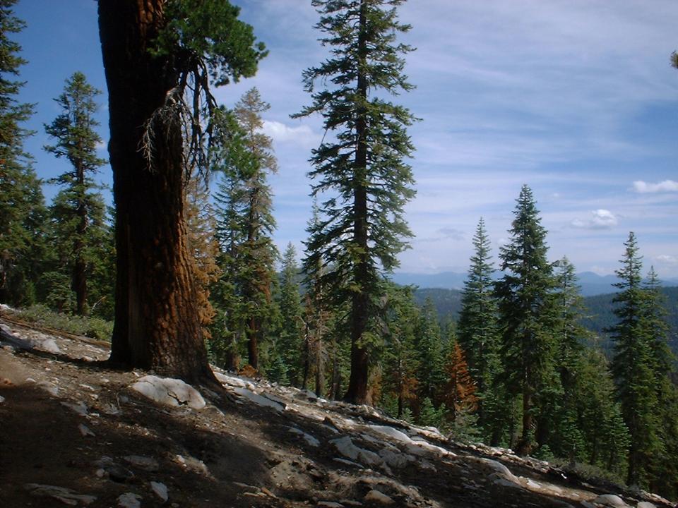
back down the trail. The first part of the trail that we hiked on
the way up was rideable going down with some nice technical sections with some
extremely white rocks and boulders that kept you on your toes. On the way
back to Sherman Pass there was one boulder field the had us off our bike for 30
or 40 yards. After that it was hoot all the way back to the pass.
Once
up on top of the peak the views were absolutely fabulous 360 degrees of sensory
overload views including Mount Whitney. We did the prerequisite
poseur thing with plenty of pictures and then signed in a guest book we found in
a sealed container. Once we had our fill of the peak, we fired up
our video gear (there was three of us on the peak with video gear) and headed
back down the trail. The first part of the trail that we hiked on
the way up was rideable going down with some nice technical sections with some
extremely white rocks and boulders that kept you on your toes. On the way
back to Sherman Pass there was one boulder field the had us off our bike for 30
or 40 yards. After that it was hoot all the way back to the pass.
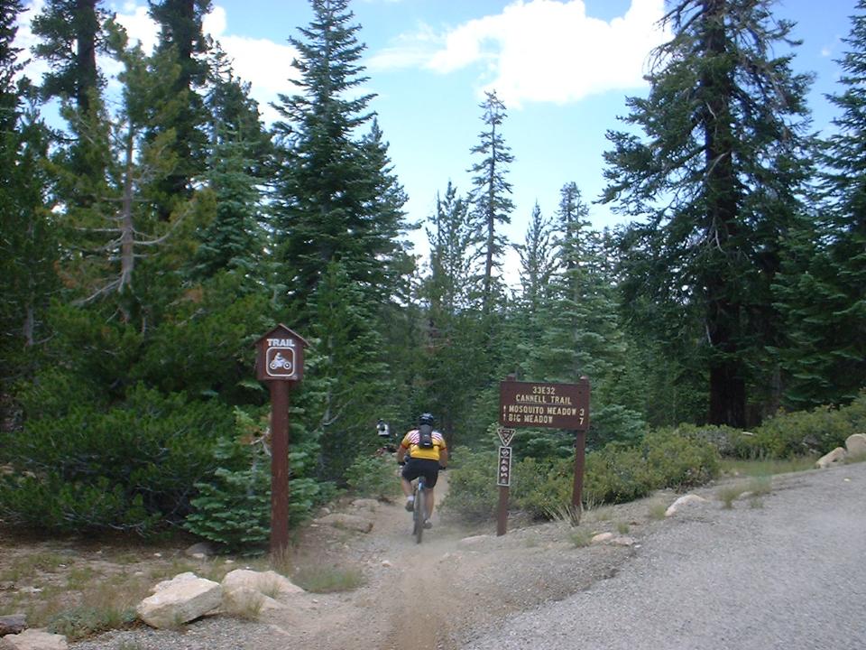
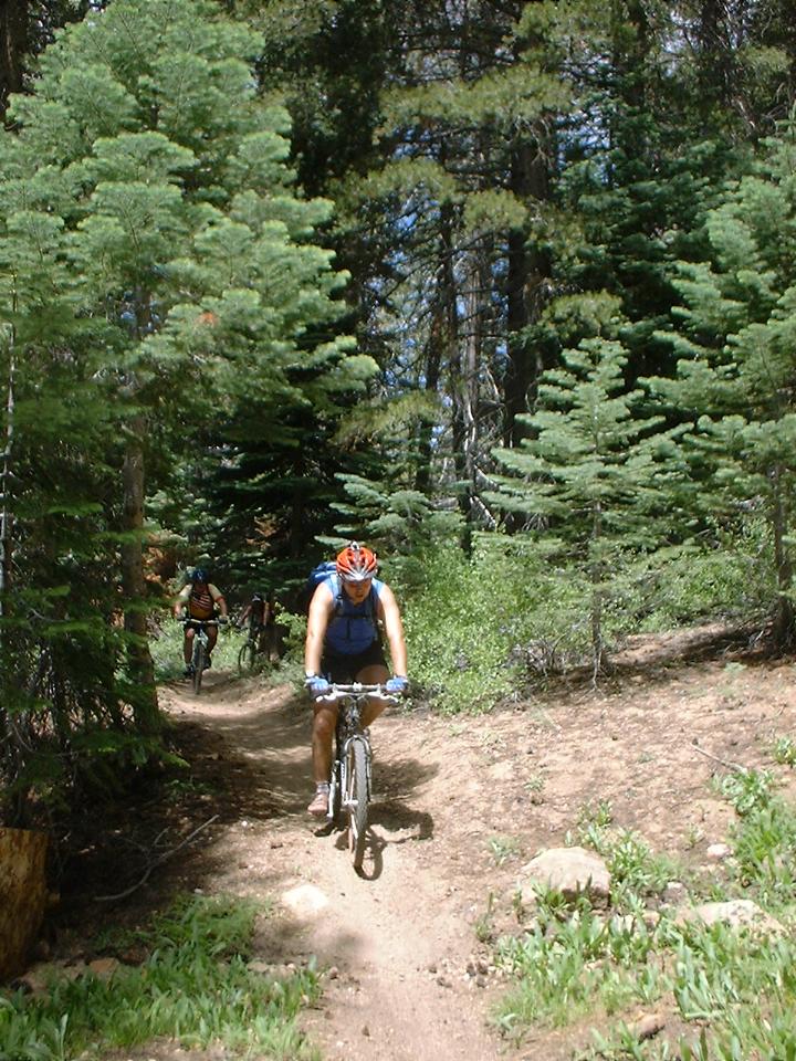
 Once
back at the pass we hit the Cannell trail which starts off by heading downhill
with some motorcycle whoop-dee-doos. The trail was sandy in a few spots
and after about half a mile the trail flattened out and you then started
climbing. After a little over 2 and 1/4 miles you get a quite reprise from
the mild climbing as gone down to Mosquito Meadows. As the name
implies you should keep moving or you will find out why they call it
that. It is tough to do as the Meadow is quite pretty.
After the meadow you have a mile long grinder up to a saddle. Once again I
was reminded that I was above 9,000 feet. Once up the saddle at 9,400 feet
we took a break and knocked back some snacks.
Once
back at the pass we hit the Cannell trail which starts off by heading downhill
with some motorcycle whoop-dee-doos. The trail was sandy in a few spots
and after about half a mile the trail flattened out and you then started
climbing. After a little over 2 and 1/4 miles you get a quite reprise from
the mild climbing as gone down to Mosquito Meadows. As the name
implies you should keep moving or you will find out why they call it
that. It is tough to do as the Meadow is quite pretty.
After the meadow you have a mile long grinder up to a saddle. Once again I
was reminded that I was above 9,000 feet. Once up the saddle at 9,400 feet
we took a break and knocked back some snacks.
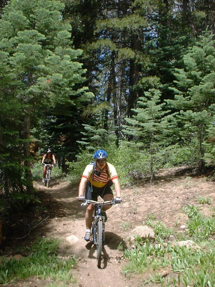
 Once
we got rolling again we were treated to a most wonderful 2 mile descent down
into Big Meadow. The descent was really buffed up near the top with some
awesome swiping turns which egged you on to see just how much you could push
your speed through the turns. The trail gradually got looser and rockier
with some small drops here and there. While technical it was the kind of
technical you can still blast down. By the time we rolled into Big
Meadow at around the 8.5 to 9 mile mark (from Sherman Pass) we were all grinning
from ear-to-ear.
Once
we got rolling again we were treated to a most wonderful 2 mile descent down
into Big Meadow. The descent was really buffed up near the top with some
awesome swiping turns which egged you on to see just how much you could push
your speed through the turns. The trail gradually got looser and rockier
with some small drops here and there. While technical it was the kind of
technical you can still blast down. By the time we rolled into Big
Meadow at around the 8.5 to 9 mile mark (from Sherman Pass) we were all grinning
from ear-to-ear.

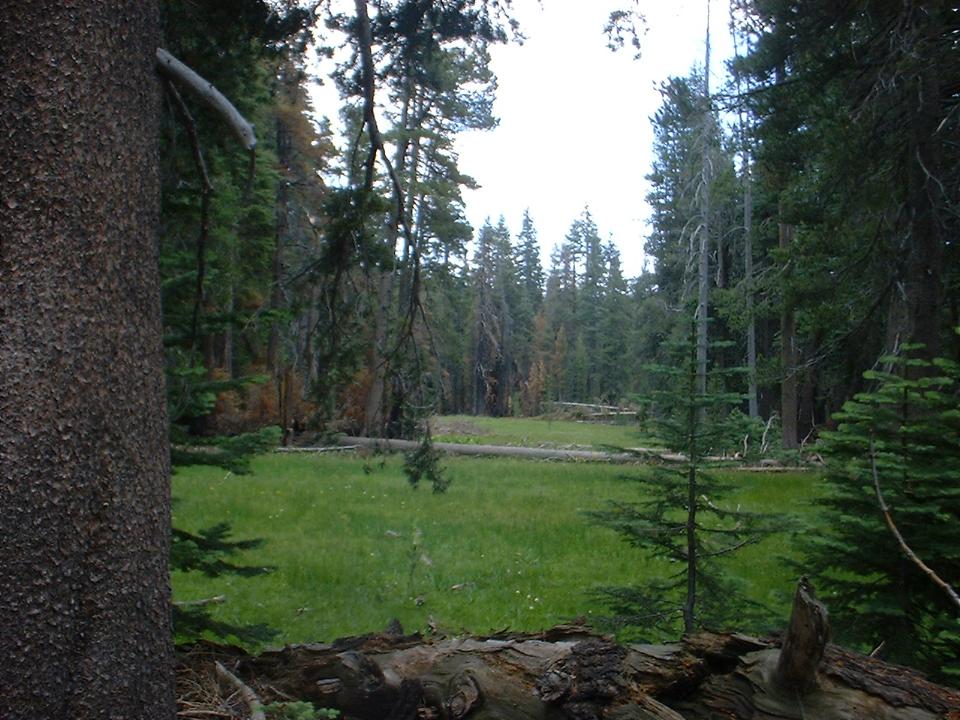
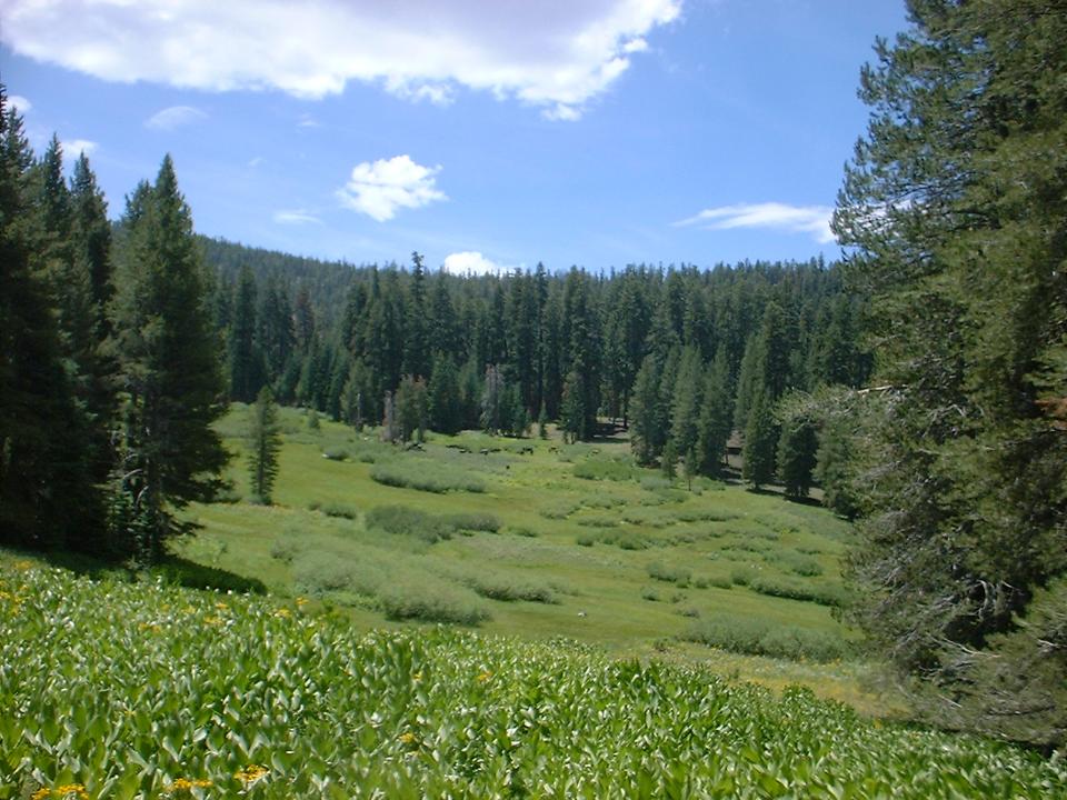
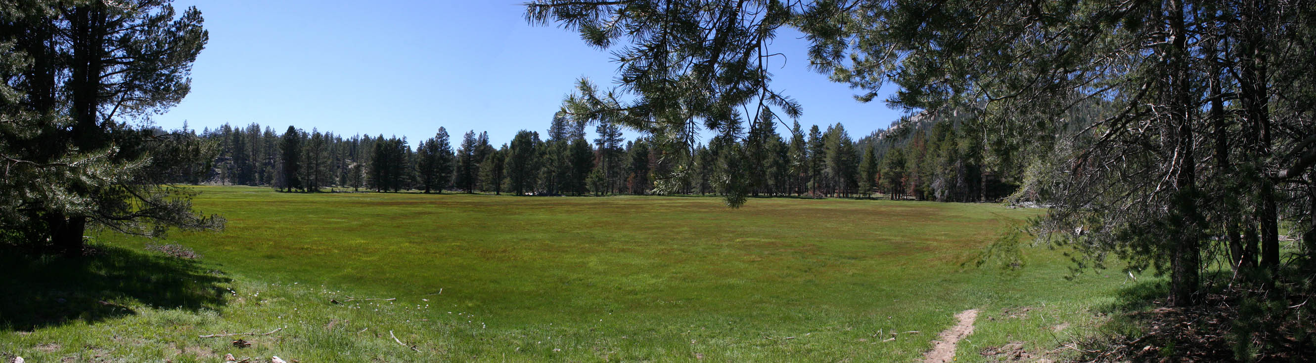
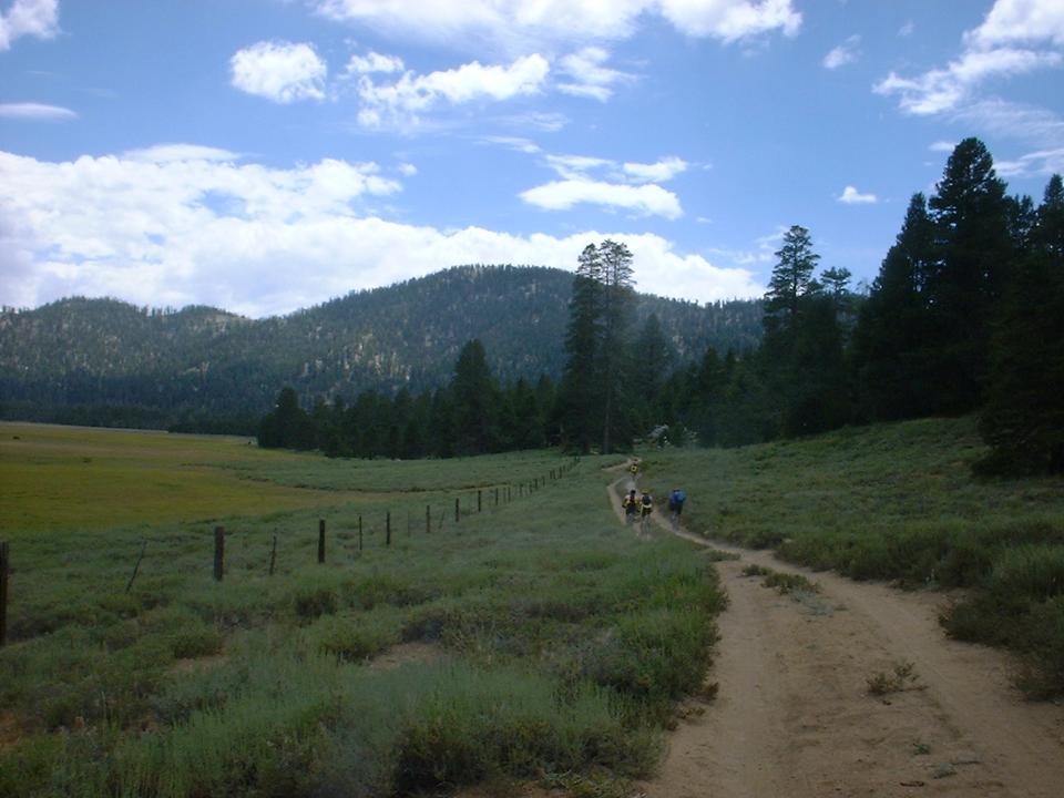 Big
Meadow is quite striking in contrast to the rest of the ride as it is so big and flat.
This also where you ride on your first section of fire road. You will
follow the fire road around the north side and west sides of the
meadow. The Cannell trail will peel off to the left about 1.7 miles
after you enter the meadow (between waypoints 12 and 13) and you will be back on
singletrack for a while. (If it is early in the year or it has been
raining you may want to stay onto the fire road as the singletrack across the
meadow can get quite boggy.) The single track will roll through some
woods for a while and then roll back onto the meadow and cut across it.
Once you are across the meadow you will intersect with a fire road that goes up
to a horse staging area. The singletrack continues off the to left somewhere but
take the fire road and head off to your right (and slightly uphill) There is a
gate that you will have to go through (make sure to close it behind
you). You will now be at a T-junction with another fire road.
Big
Meadow is quite striking in contrast to the rest of the ride as it is so big and flat.
This also where you ride on your first section of fire road. You will
follow the fire road around the north side and west sides of the
meadow. The Cannell trail will peel off to the left about 1.7 miles
after you enter the meadow (between waypoints 12 and 13) and you will be back on
singletrack for a while. (If it is early in the year or it has been
raining you may want to stay onto the fire road as the singletrack across the
meadow can get quite boggy.) The single track will roll through some
woods for a while and then roll back onto the meadow and cut across it.
Once you are across the meadow you will intersect with a fire road that goes up
to a horse staging area. The singletrack continues off the to left somewhere but
take the fire road and head off to your right (and slightly uphill) There is a
gate that you will have to go through (make sure to close it behind
you). You will now be at a T-junction with another fire road.
 You now have to ask yourself something, Do you feel like a
badass? You can either go to the left and downhill and catch the Cannell
trail when it crosses the fire road and then go up a brutal section of single
track that will be hard to ride on anybodies good day or you can hang a right
and climb the fire road up the hill and intersect with Cannell trail after the
brutal singletrack uphill section. I highly recommend the fire road
climb by going the right. We went to the left and hooked up
with the uphill singletrack. It was quite brutal
indeed and a real calf burner. Once we slugged our way up the
climb the trail we then followed along the fire road for some ways downhill until
it crosses the fire road.
You now have to ask yourself something, Do you feel like a
badass? You can either go to the left and downhill and catch the Cannell
trail when it crosses the fire road and then go up a brutal section of single
track that will be hard to ride on anybodies good day or you can hang a right
and climb the fire road up the hill and intersect with Cannell trail after the
brutal singletrack uphill section. I highly recommend the fire road
climb by going the right. We went to the left and hooked up
with the uphill singletrack. It was quite brutal
indeed and a real calf burner. Once we slugged our way up the
climb the trail we then followed along the fire road for some ways downhill until
it crosses the fire road.

 From here we took the singletrack off the right and started
climbing again. The climb is only about 1/2 mile long but you gain a
couple hundred feet and there are a few steep spots coupled with a few tough rocks
to navigate. You peak out at 8,400 feet and then you are rewarded with a
1.5 mile rocky technical singletrack descent of into Cannell Meadow. When
you get into the meadow the singletrack rolls out onto a fire road. Follow
the fire road and look for another fire road off to the south. Right
around here look for the singletrack heading off to the left just after that
fire road. For the next 2.5 miles you will meander in and out of the
meadow as you work your way south. Near the south end of the Meadow there
is nice rock formation to play around on.
From here we took the singletrack off the right and started
climbing again. The climb is only about 1/2 mile long but you gain a
couple hundred feet and there are a few steep spots coupled with a few tough rocks
to navigate. You peak out at 8,400 feet and then you are rewarded with a
1.5 mile rocky technical singletrack descent of into Cannell Meadow. When
you get into the meadow the singletrack rolls out onto a fire road. Follow
the fire road and look for another fire road off to the south. Right
around here look for the singletrack heading off to the left just after that
fire road. For the next 2.5 miles you will meander in and out of the
meadow as you work your way south. Near the south end of the Meadow there
is nice rock formation to play around on.

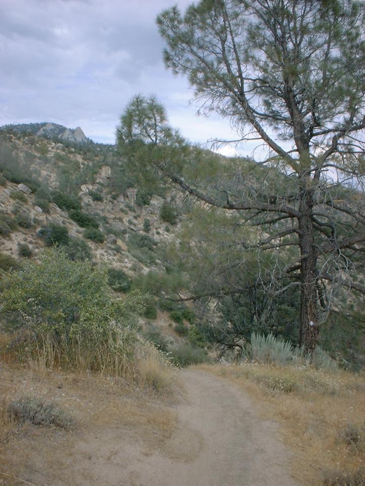
 The
south end of the meadow gives way to somewhat narrow canyon that Cannell Meadow
creek runs through. This canyon has some technical sections that will
require some slow speed skills as you have some tight spots to weave and squeeze
through. After this technical section you will come out to Pine Flats on a
fire road. Pick up the trail to your left and continue on. There is
a barbed wire fenced gate shortly after the trail starts to turn slightly
downhill. Make sure to put the gate back up behind you.
The
south end of the meadow gives way to somewhat narrow canyon that Cannell Meadow
creek runs through. This canyon has some technical sections that will
require some slow speed skills as you have some tight spots to weave and squeeze
through. After this technical section you will come out to Pine Flats on a
fire road. Pick up the trail to your left and continue on. There is
a barbed wire fenced gate shortly after the trail starts to turn slightly
downhill. Make sure to put the gate back up behind you.
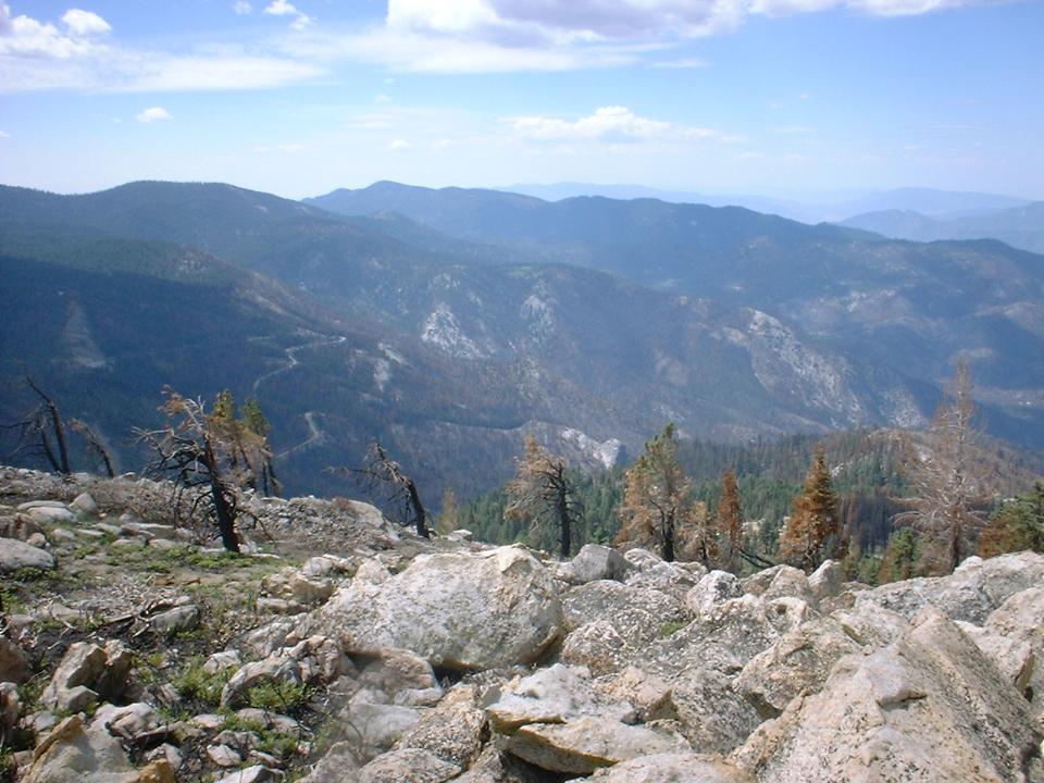
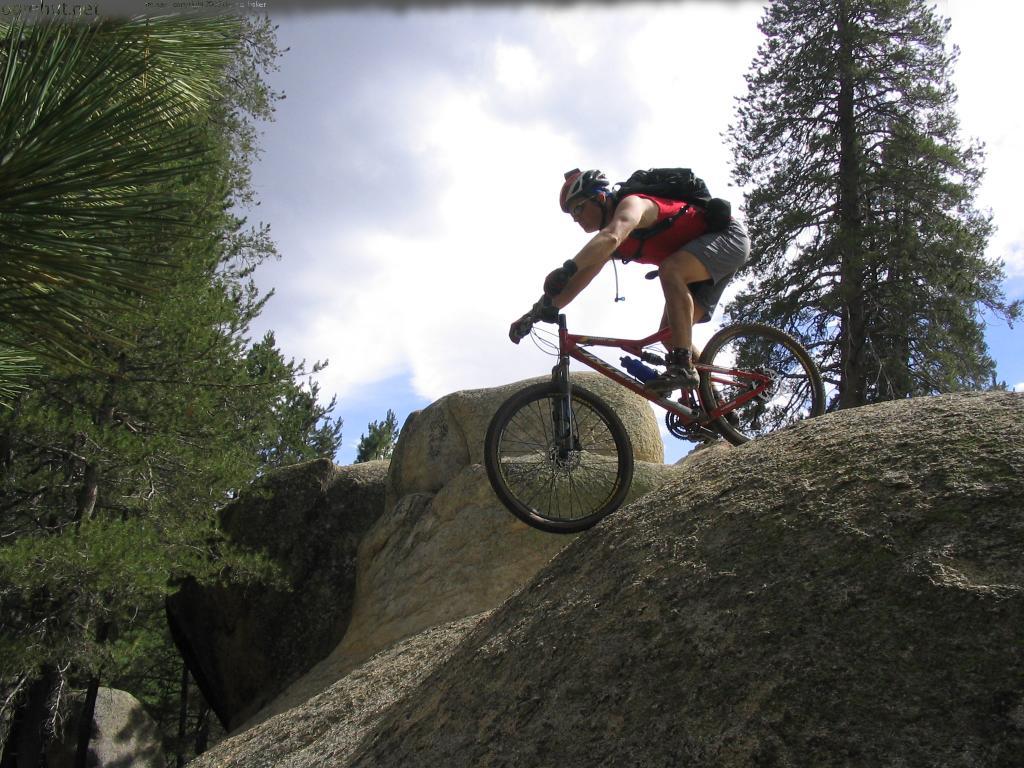
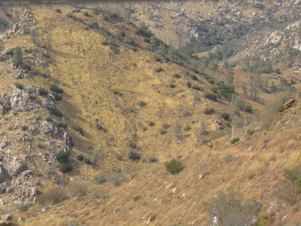
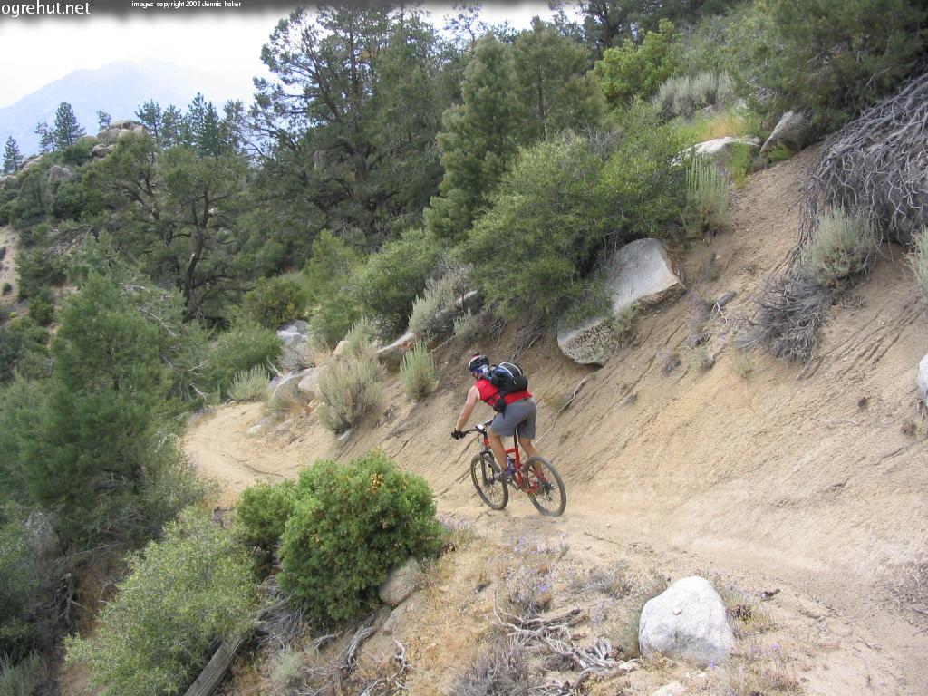
 This
gate marks the beginning of the plunge. The plunge is around 8 miles
long and it drops 5,000 feet. The trail is for the most part pretty buff with a
few technical patches here and there. Right after the gate you will not be
on the pedals much as you just lay off the brakes and start screaming.
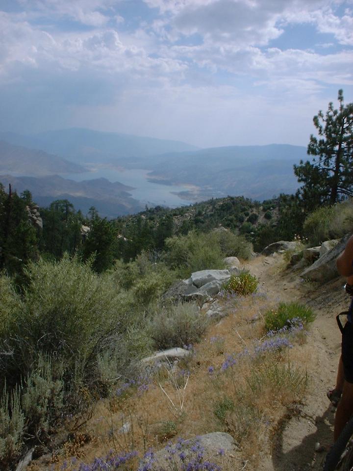
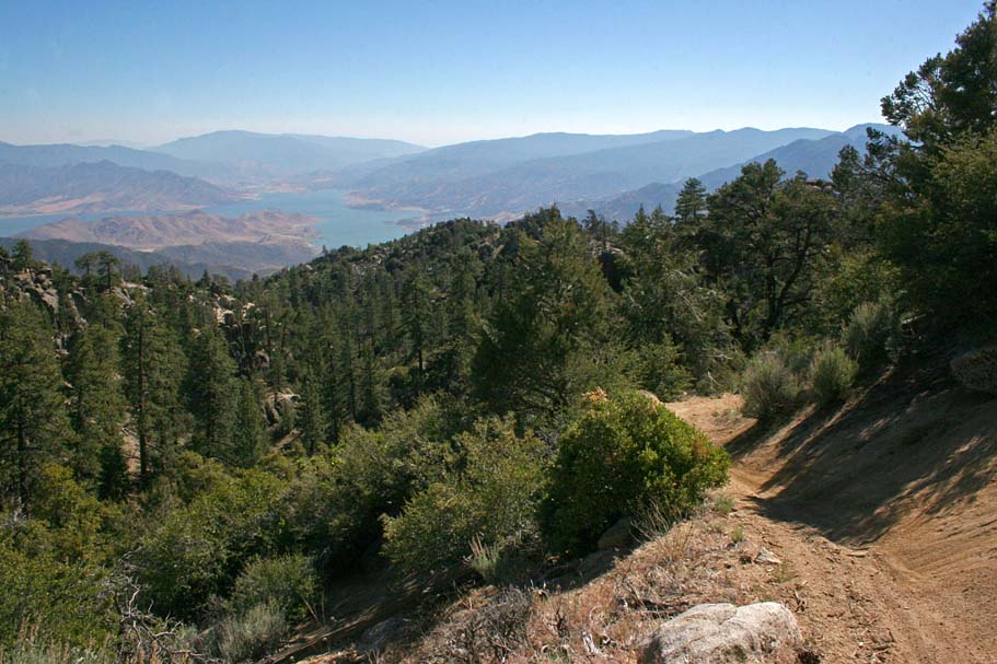
Shortly after you start on the plunge you will come around a turn and WOW! You
will have an incredibly amazing vista of Lake Isabella far below. From
here it is an absolute bomb fest that just keeps going and going and
going. As awesome as the trail is it is worth it to stop occasionally just
to take in the views. There is only one short steep rise in the trail
about of 1/3rd of the way down. After that the trail gets looser and you
will have some switchbacks that can trip you up if not proficient with
navigating them. Either way it will still be a bombfest if you are so
inclined.
This
gate marks the beginning of the plunge. The plunge is around 8 miles
long and it drops 5,000 feet. The trail is for the most part pretty buff with a
few technical patches here and there. Right after the gate you will not be
on the pedals much as you just lay off the brakes and start screaming.
Shortly after you start on the plunge you will come around a turn and WOW! You
will have an incredibly amazing vista of Lake Isabella far below. From
here it is an absolute bomb fest that just keeps going and going and
going. As awesome as the trail is it is worth it to stop occasionally just
to take in the views. There is only one short steep rise in the trail
about of 1/3rd of the way down. After that the trail gets looser and you
will have some switchbacks that can trip you up if not proficient with
navigating them. Either way it will still be a bombfest if you are so
inclined.

 The
bottom of the trail comes out at a fire road. Bear left and go up to
gate. Once through the gate you will see a singletrack heading down
through the meadow. Follow this and it will take you out to Mountain Road
99. Hang a left and down about 3/4th of a mile or so back into town.
All told this about a 32 mile ride with 1,900 feet of climbing and 9,000 wonderful
feet of falling out of heaven.
The
bottom of the trail comes out at a fire road. Bear left and go up to
gate. Once through the gate you will see a singletrack heading down
through the meadow. Follow this and it will take you out to Mountain Road
99. Hang a left and down about 3/4th of a mile or so back into town.
All told this about a 32 mile ride with 1,900 feet of climbing and 9,000 wonderful
feet of falling out of heaven.
2006 Trip
 After
three years of missing chances to do this ride, I finally made it back and I was
not disappointed. This was a fairly early in the season for this area and there
were some remnants of snow here and there at the higher elevations.
We opted to do the Sherman Peak out-and-back and it was well worth it. We
are pretty sure we were the first mountain bikers to go to the peak this year as
we were making the first discernable tracks in both dirt and snow. There
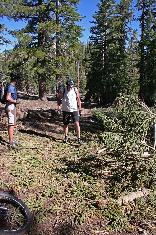
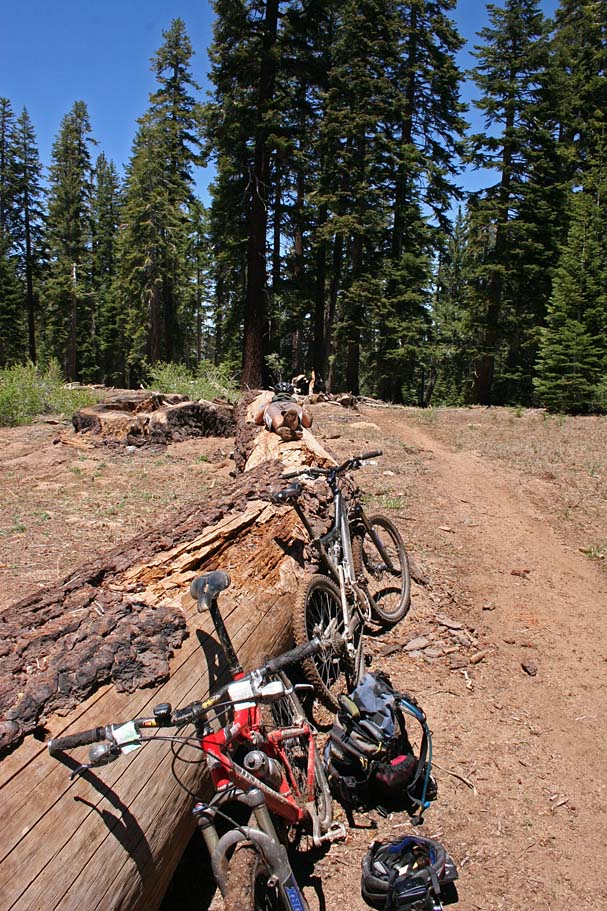
was quite a bit of deadfall on the trail up to the peak and we cleared four
trees out of the way and bits of others. There are at least four other big
trees still across the trail that will take more than the saws in our packs to
get through.
After
three years of missing chances to do this ride, I finally made it back and I was
not disappointed. This was a fairly early in the season for this area and there
were some remnants of snow here and there at the higher elevations.
We opted to do the Sherman Peak out-and-back and it was well worth it. We
are pretty sure we were the first mountain bikers to go to the peak this year as
we were making the first discernable tracks in both dirt and snow. There
was quite a bit of deadfall on the trail up to the peak and we cleared four
trees out of the way and bits of others. There are at least four other big
trees still across the trail that will take more than the saws in our packs to
get through.
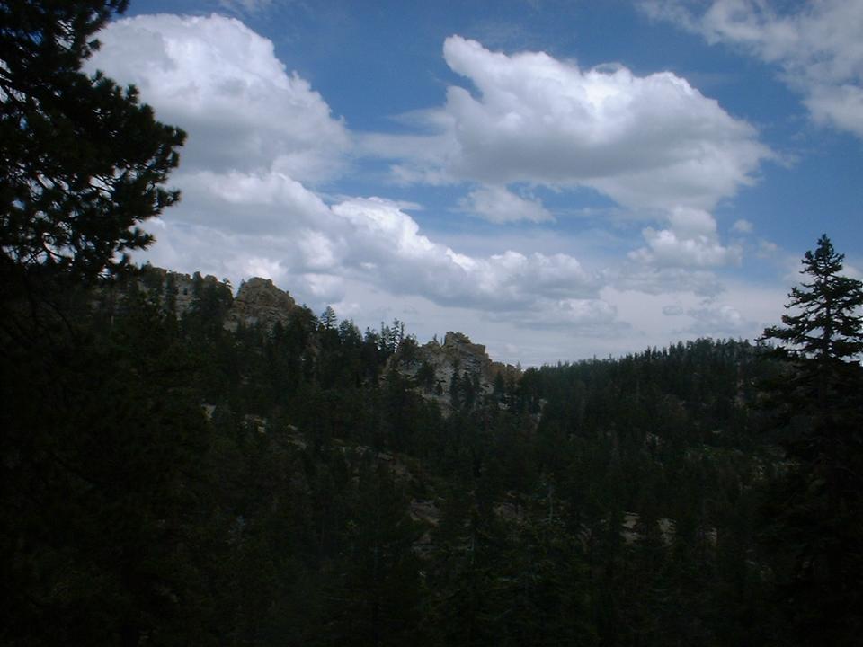
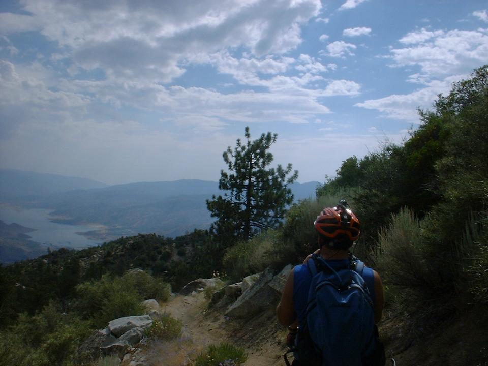
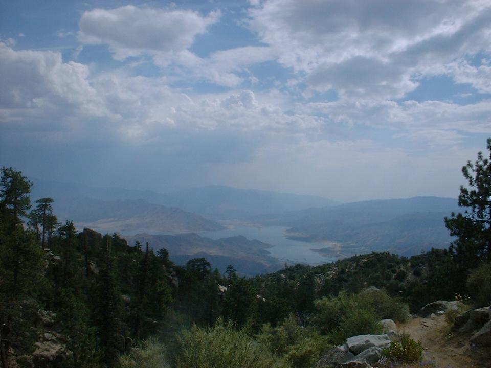
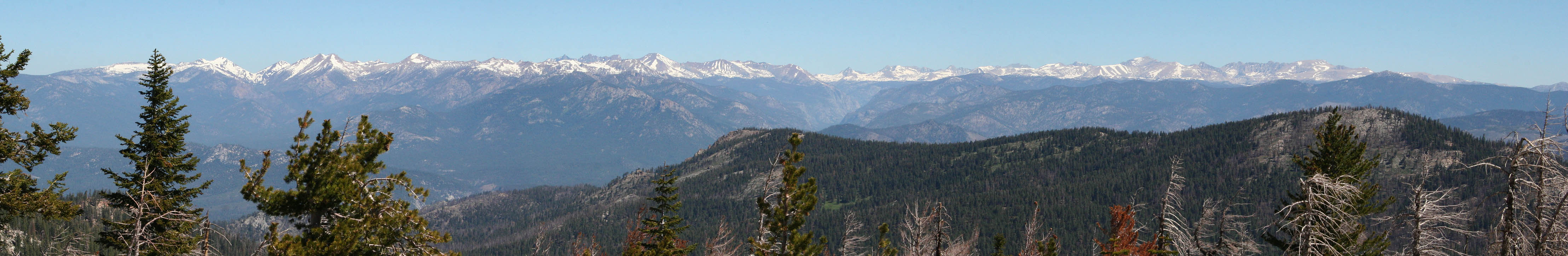 The view from the top was as stunning as ever. This is
the view to the north.
The view from the top was as stunning as ever. This is
the view to the north. The trail from the peak back down to the pass is the most technical stuff you will do on the entire ride and we took care to fully enjoy it. Once back down to the pass we started down the Cannell trail and it was quickly obvious that the moto-types had chewed up the trail a bit. It was still a hoot but a bit of a bummer to see such an awesome trail with quite unnecessary damage.
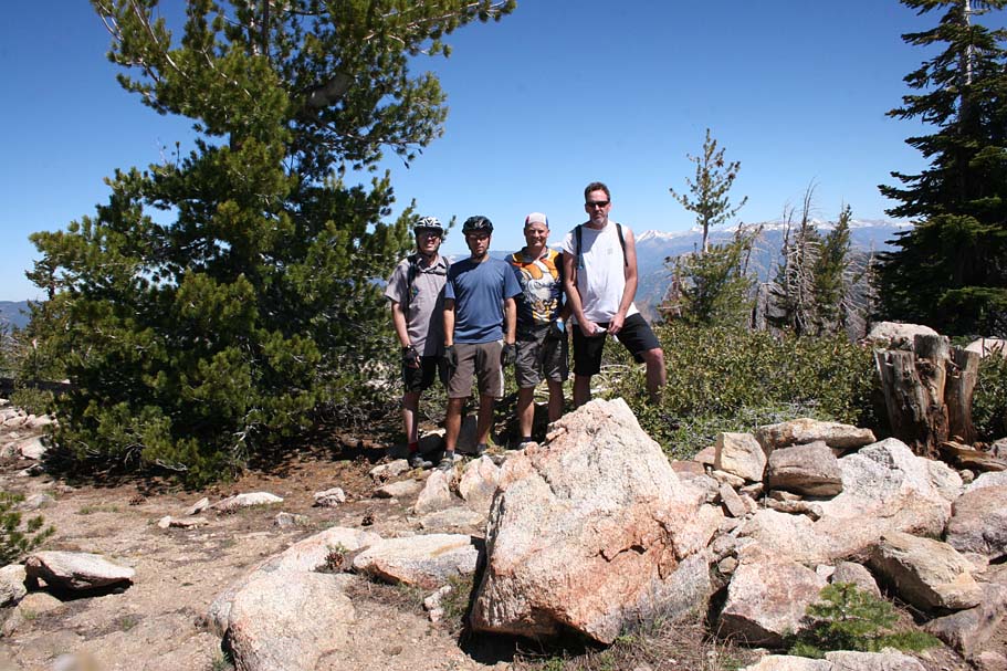
The group on Sherman Peak
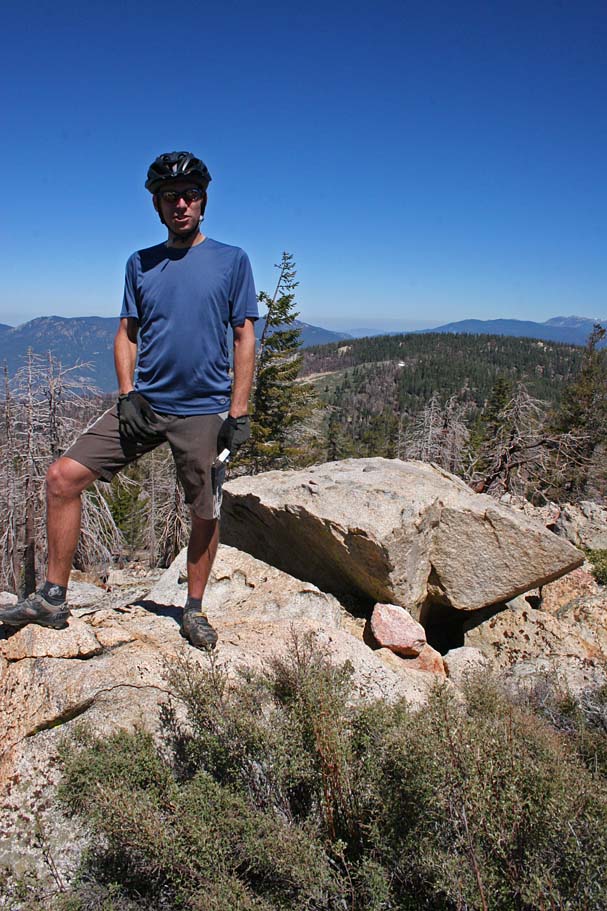
Bill O'neil on Sherman Peak
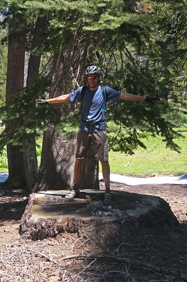
Thats a BIG stump
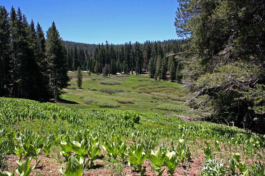
Mosquito Meadow
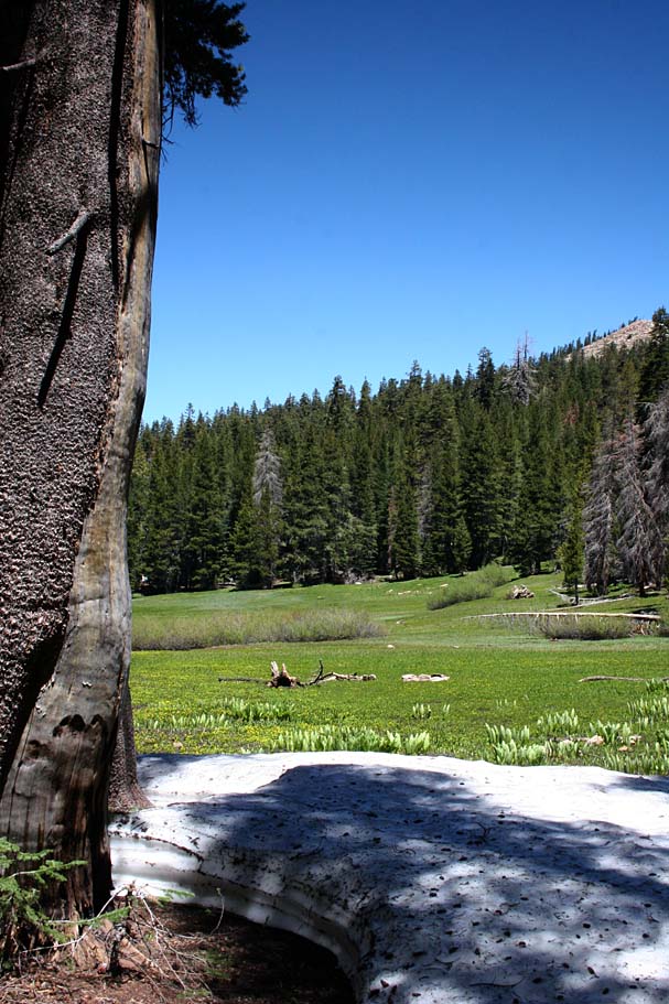
Round Meadow
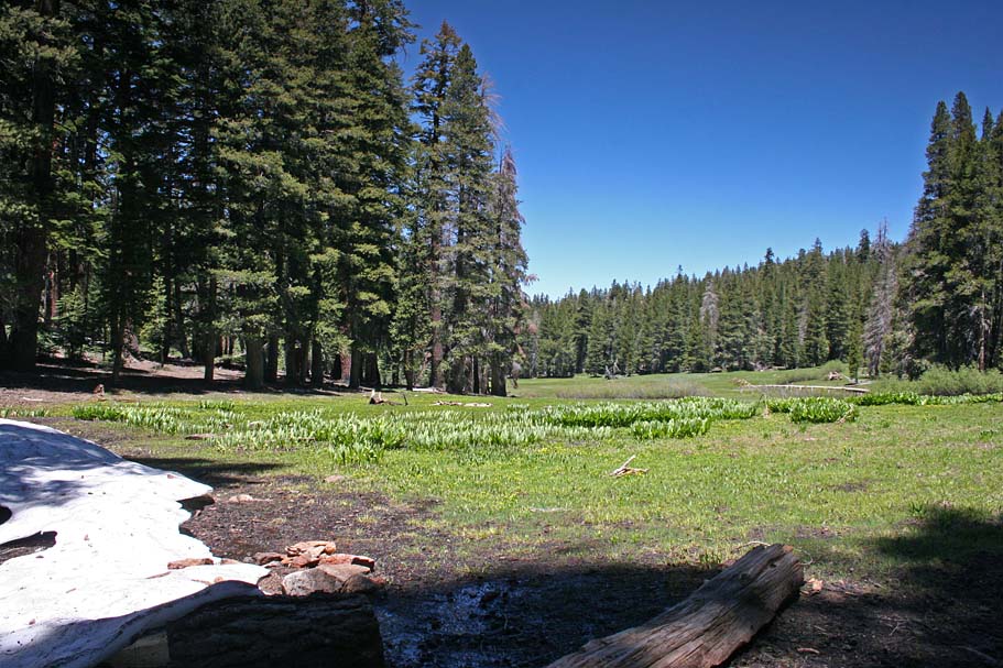
Round Meadow
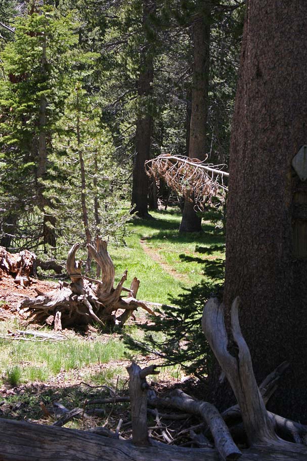
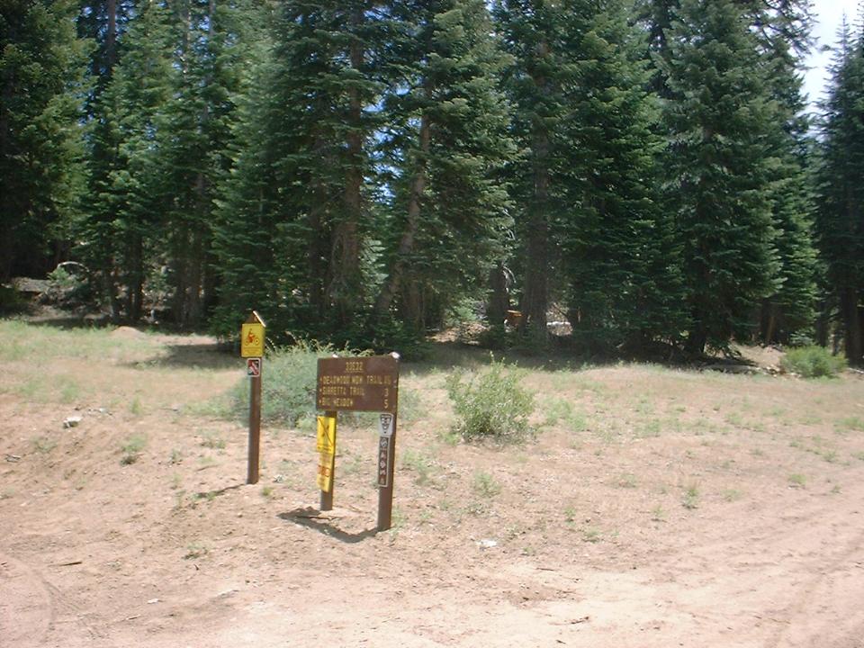
The Deadwood Meadow Trail
The Classic Plunge Shot

Interesting tree in Cannel Meadow
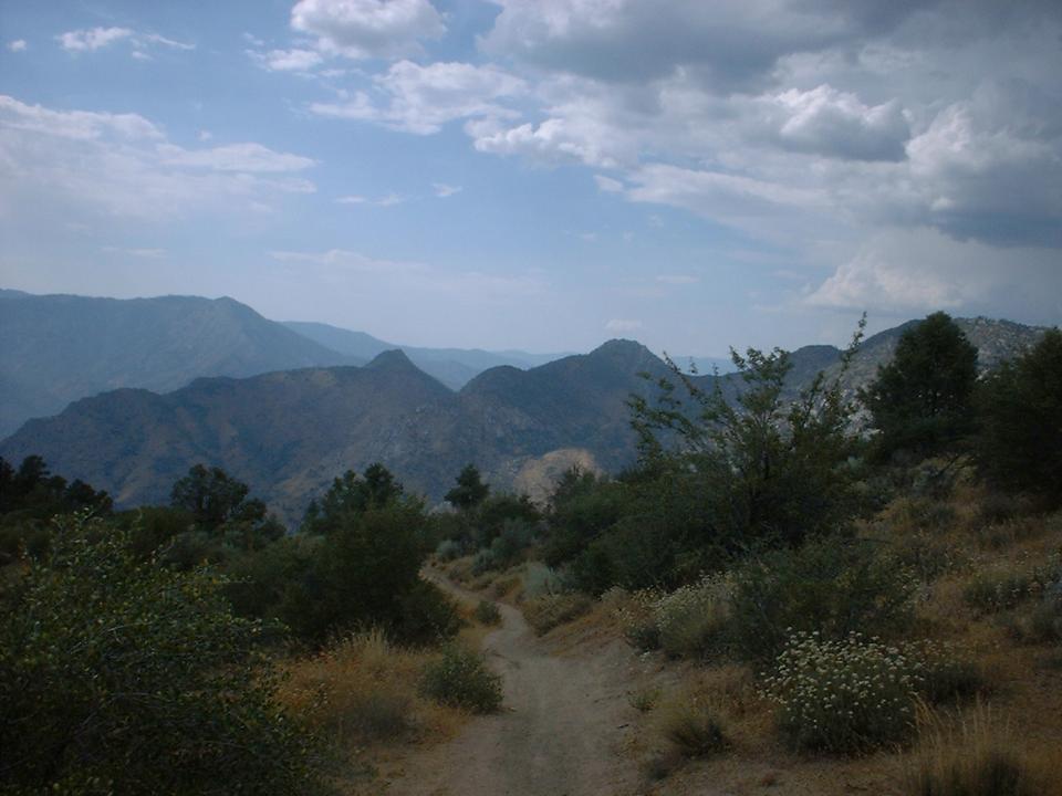
Near Pine Flats looking north
On the way to Cannell Meadow
A nap at9,380' before dropping into Deadwood Meadow.
The further down the trail the we went the less beat up the trail was. Big Meadow always has a mushy spot in the middle and since this was early in the season we opted to bypass the singletrack that cuts across the meadow and stick to the fireoroad that goes around it and up towards Cannell Peak, where it rejoins the singletrack. The Motos are not allowed on the trail beyond Big Meadows and things got back to the conditions I remembered. This was a great ride and I am pretty sure I will not wait three years for my next visit here. In addition to the pictures I took, I also shot another video.

Big Meadow
 The extremely sweet section of trail that climbs up from the Big Meadow fireroad
up to the saddle near Cannell Peak before dropping into Cannell Meadow
The extremely sweet section of trail that climbs up from the Big Meadow fireroad
up to the saddle near Cannell Peak before dropping into Cannell Meadow
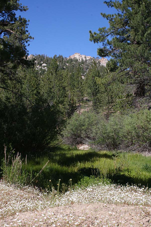
 A slice of the Cannell Meadow
Video
Here is the video from the June 2006 Cannell Plunge trip. Same bike and route as in 2003, but some new video gear and editing software.
Here is the video from the June 2006 Cannell Plunge trip. Same bike and route as in 2003, but some new video gear and editing software.
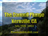
Here
is the video that I shot on July 26th, 2003. There were four of
us filming the ride that day. Michael Paul and I shared some footage
and you will see some of his clips in this video.
Right Click on the
image to the left to download.
Length 6:52 Size:
37MB