
California Riding and Hiking Trail (San Diego)
In 1945 a landmark legislation envisioning a 3000-mile multi-use loop trail extending from the Mexican border to the Oregon border called the California Riding and Hiking Trail was authorized. The original 1945 Act provided funds to begin the project. By 1955, 29 of the 38 counties on the proposed route submitted plans approved by the State Park Commission. In addition, the trail was to be constructed by state park personnel and built through contracts with private firms and the U.S. Forest Service. The state Department of Parks and Recreation worked on developing the trail through the 1960s. But after funding and planning difficulties made the single trail seem impossible, that act was repealed in 1974 and replaced with the California Recreational Trails Act, which focused on pursuing shorter trail segments statewide. Although the trail was never fully completed, over 1,000 miles of trail was built which laid the groundwork for many future long distance trails such as the The Pacific Crest Trail that was established by the National Trails System Act of 1968.
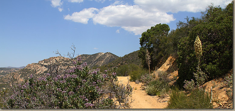
In San Diego County there is is about 108 of those 1000+ miles of the trail are recognized as part of the County Master Trails Plan. Currently only about 76 miles of the orginal system are usable. The sections vary from complete crap to breath takeningly amazing. I still have a fair amount of this trail to put eyes, feet and wheels on. Portions of this trail system are already included in quite a few of my trails reviews and blog posts as the CRHT passes through some of our other riding areas through out the county. The trail starts at Otay Lake at the south end and goes up thorugh Hollenbeck Canyon, then by the Loveland Reservior, through the Vejas Indian Reservation, up into the Cuyamacas, down into San Felipe Valley, over to Warner Springs and then into Chillihua valley and then northward to the San Diego County line.
There are plenty of access issues with the trail as some private land owners and public agencies are not honoring the public easements that were granted for this trail. Additionally some of the trail segments established back in "The Day" utilized old dirt farm roads and truck trails they have since been "improved" to the point of being paved. These sections are obviously no longer trails. One thing is for sure there are some good sections out there and the best thing you could do is get out and ride what is left of this trail.
Information on the Map
The primary tool I am going to provide here is a Google Earth File with embedded note. Consider this page a work in progress as it will take some time to get out onto all of the trail. The trail data was orginally exported from the San Diego Counties GIS database of the General Trails Plan. There is a lot of information in the file such as the trail ownership, access, usage type, etc... The trail is broken down into 120+ segments in the County GIS database to account for any change in one of those elements of data. I have linked some of those segments together were practical for assessing the various parts of the trail. Waypoints are spaced roughly 1/2 mile apart and increase in number from south to north. Waypoints with a letter at the end of them are used to designated turns or junctions occuring between the 1/2 mile waypoints. Each segment is named CRHT-XXX-XXX which represents the starting and stopping waypoints of the segment.
The map below is a working document that includes my on-going notes on the sections of the CRHT that have ridden on or assessed. Zoom and click away. You can download the KML directly here. Also availabe are a GPX and GDB file that have all the segments combined and include the waypoints
Here are a couple of interesting articles on the California Riding and Hiking Trail:
