
Devil's Gulch and Red Devil Trails
| The Devil's Gulch trail located in the Wanatchee National Forest south of the little community of Cashmere is often touted as one of the best singletracks in the entire state of Washington. While I would have to ride a lot more of the Washington state singletrack goodness to come close to qualifying those touts, I can certainly attest that this is one of the most exceptional trails I have ever had the pleasure of riding. An extremely mellow 11+ mile forest road climb through some beautiful nice scenery leads to a downhill return on 12 miles of gloriously buff and narrow single track that will leave all but the most hardended of singletrack snobs smiling (and most likely giggling as well). It is firmly planted in my Top 10 list of XC singletracks of all time. |
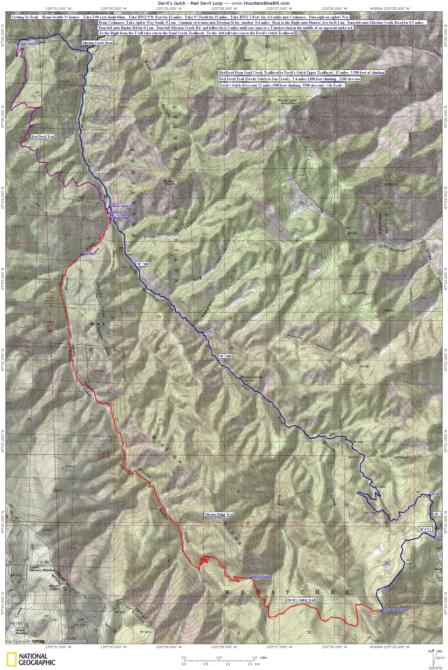
Directions: (From Seattle 3+ hours) Take I-90 east about 84mi . Take HWY 970 East for 12 miles. Take 97 North for 35 miles. Take HWY 2 East for 6.6 miles into Cashmere . Turn right onto Aplets Way. From Cashmere: Take Aplets Way South 0.1 mi. Continue at it turns into Division St for another 0.4 miles. Bear to the right onto Pioneer Ave for 0.1 mi. Turn left onto Mission Creek Road for 0.5 miles. Turn right onto Binder Rd for 0.1 mi. Turn left onto Mission Creek Rd and follow it for 6.2 miles until you come to a T intersection at a dirt road in the middle of an apparent junkyard. To the Right from the T will take you to the Sand Creek Trailhead. To the left will take you to the Devil's Gulch Trailhead |
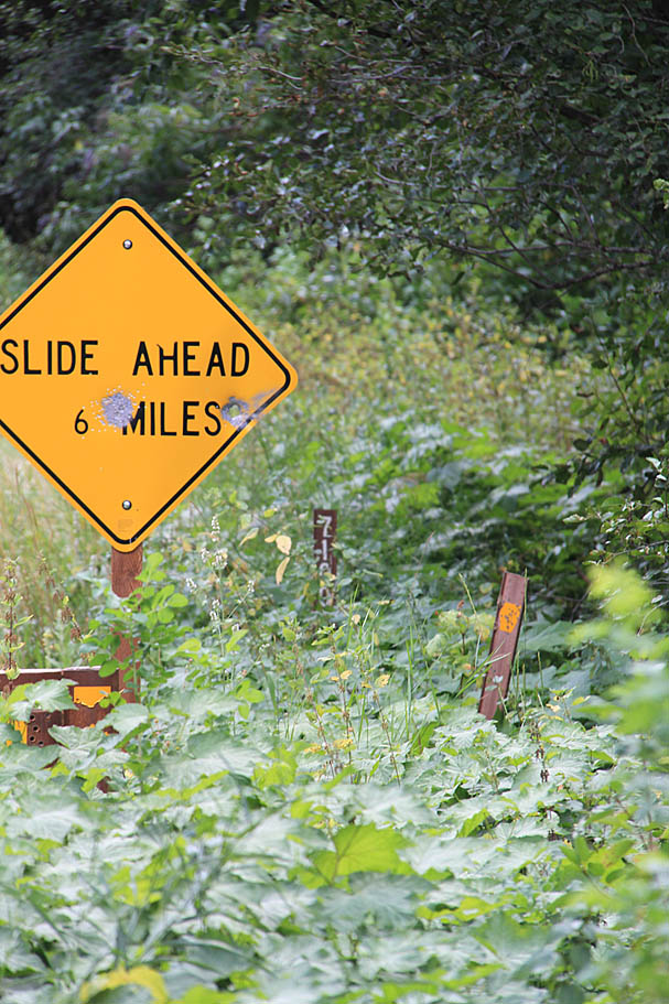
| Hazards and Notes: An often narrow trail and a steep hillside. You can get a long way from help. Easily changing mountain weather. This is considered a summertime ride due to typical snow levels. |
| Map and Resources: Here is a map of the area suited for printing on 8.5" by 14" paper. For you gadget users here is some GPS data in several formats: GPX, Garmin GDB, Google KML and National Geographic TOPO! For you Garmin User make sure to check my page on map resources for Garmin. |
| Ride Report: |
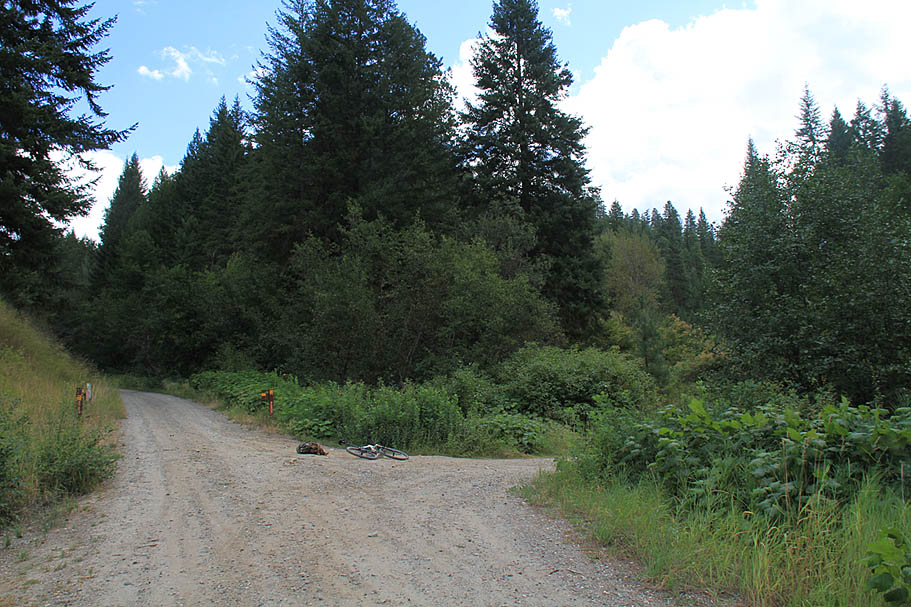
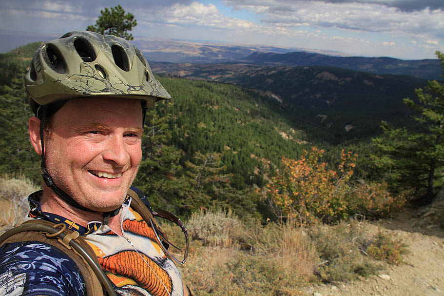
 This was a long ride from the Seattle area to get out here but it was well worth the trip. When I did this ride you could not drive all the way to the lower trailhead for the Devil's Gulch trail as NF-7100 was washed out about a mile before the trailhead. Instead I parked at the Sand Creek Trailhead. There are a couple of trails that can be used to access the Devil's Gulch trail from there. Those two trails are the Red Hill trail and the Red Devil trail. They are both five miles and some change long and both have a good chunk of climbing involved. NF-7100 was still open to mountain bikes and foot traffic so instead of taking one of those trails on the way out I opted to take the forest road back around to the Devil's Gulch trailhead. Knowing I had a big day ahead of me I wanted conserve a little energy in the front end. If I had to do it over again, I would most likely would have taken the Red Hill trail over to the Devil's Gulch trail. This was a long ride from the Seattle area to get out here but it was well worth the trip. When I did this ride you could not drive all the way to the lower trailhead for the Devil's Gulch trail as NF-7100 was washed out about a mile before the trailhead. Instead I parked at the Sand Creek Trailhead. There are a couple of trails that can be used to access the Devil's Gulch trail from there. Those two trails are the Red Hill trail and the Red Devil trail. They are both five miles and some change long and both have a good chunk of climbing involved. NF-7100 was still open to mountain bikes and foot traffic so instead of taking one of those trails on the way out I opted to take the forest road back around to the Devil's Gulch trailhead. Knowing I had a big day ahead of me I wanted conserve a little energy in the front end. If I had to do it over again, I would most likely would have taken the Red Hill trail over to the Devil's Gulch trail. |
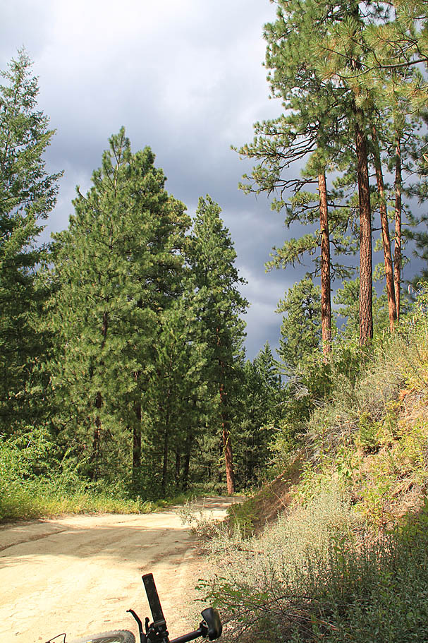
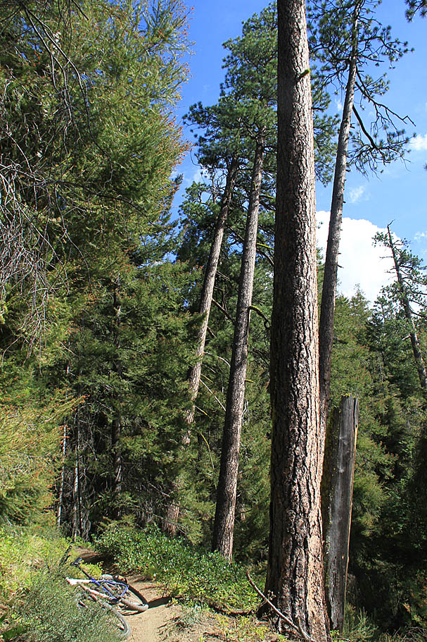
| From the Sand Creek Trailhead I went back on the forest road I came in on for 1.1 miles back to the junction with Mission Creek Road and one of the largest residential junkyards I have ever seen. The owner has lots of free roaming dogs, but other than barking they did not act hostile towards me. After the junction I continued straight (Which would have been a left as you were driving in) and started up NF-7100. I do not recall how far up the road the washed out creek crossing is but it was not too far. (The repairs will most likely be done by Winter 2010) After 2.5 miles of some extremely mellow climbing you will come to to the lower trailhead for the Devil's Gulch trail. There is a small bridge that crosses over Mission Creek to get to the trail. About 100 yards up the trail is the junction with the Red Devil trail. |
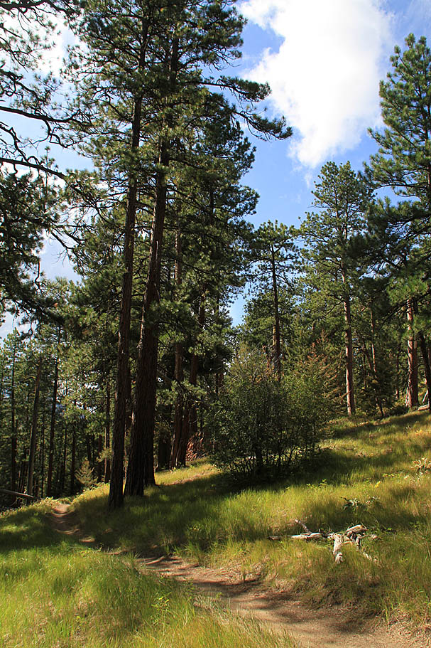
| You can certainly climb the Devil's Gulch trail, but it is my understanding that is best not to be climbed on the weekends. I decided to take the forest road route up to the top of the trail. It was an extremely pretty day that was a rather warm but not what I would call hot. The climbing was still quite mellow although the fireroad was a little gravelly in spots which added a little resistance. |
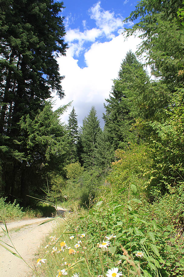
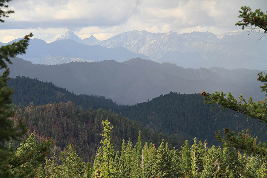
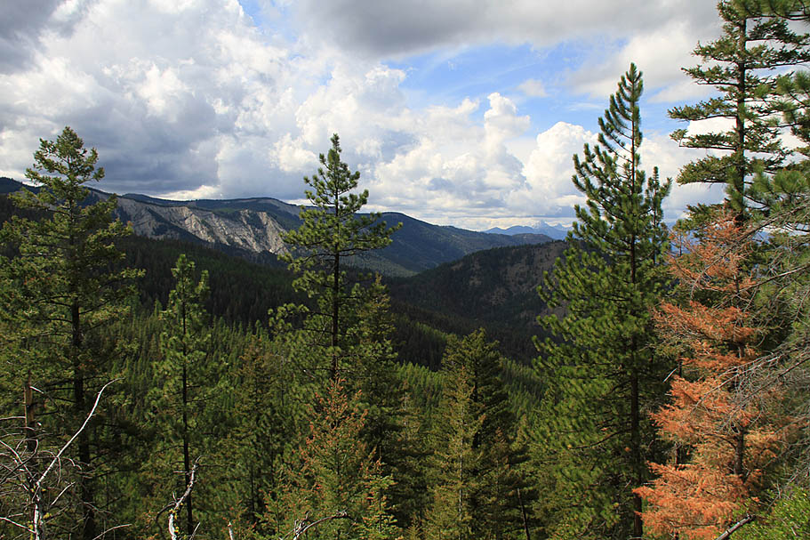
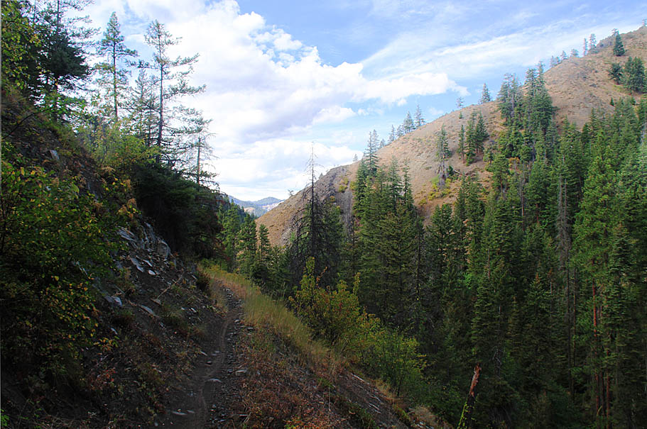
  2.5 miles after the lower trailhead (Waypoint DG-01 on my map) you will make a right-hand turn to stay on NF-7100. The forest road is marked but you have to look for it. The climbing was still not bad at all. From the lower trailhead it is an 11.4 mile jaunt and almost 3,500 feet of climbing which works out to something like around an average 6% grade. It is a little steeper over the second half but the gravelish surface turns to packed dirt in the upper half so the climbing does not feel tougher. 2.5 miles after the lower trailhead (Waypoint DG-01 on my map) you will make a right-hand turn to stay on NF-7100. The forest road is marked but you have to look for it. The climbing was still not bad at all. From the lower trailhead it is an 11.4 mile jaunt and almost 3,500 feet of climbing which works out to something like around an average 6% grade. It is a little steeper over the second half but the gravelish surface turns to packed dirt in the upper half so the climbing does not feel tougher. |
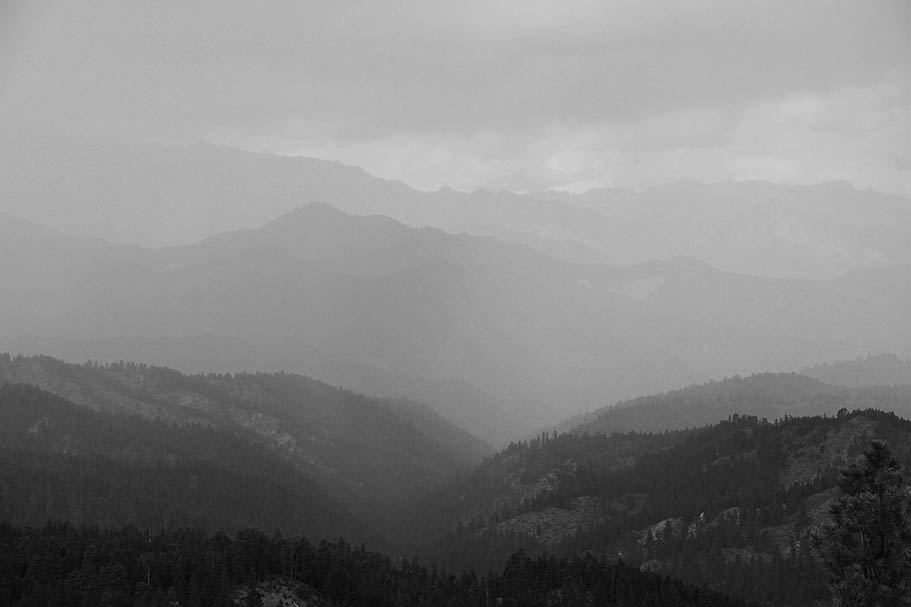
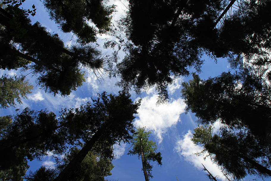
  As I was cruising along I noticed some puffy clouds rolling by and I was stoked at what an awesome looking day this was. At one of my stop-and-smell-the-flowers breaks I noticed that clouds were starting to look less puffy and more ominous. I started paying attention to the wind direction and looking over my shoulder more often. It looked like the gray bits were going to pass by me to the north. I was about 3/4ths of the way climb when the weather changed rather quickly behind me and soon overtook me. A bright flash of lighting and loud crack of lighting (not enough seconds afterwards for my taste) got my full attention in the valley below. At this point I realized I did not pack any rain gear. Over the course of just a few minutes the temperature dropped what seemed like 15-20 degrees. As I was cruising along I noticed some puffy clouds rolling by and I was stoked at what an awesome looking day this was. At one of my stop-and-smell-the-flowers breaks I noticed that clouds were starting to look less puffy and more ominous. I started paying attention to the wind direction and looking over my shoulder more often. It looked like the gray bits were going to pass by me to the north. I was about 3/4ths of the way climb when the weather changed rather quickly behind me and soon overtook me. A bright flash of lighting and loud crack of lighting (not enough seconds afterwards for my taste) got my full attention in the valley below. At this point I realized I did not pack any rain gear. Over the course of just a few minutes the temperature dropped what seemed like 15-20 degrees. |
 |
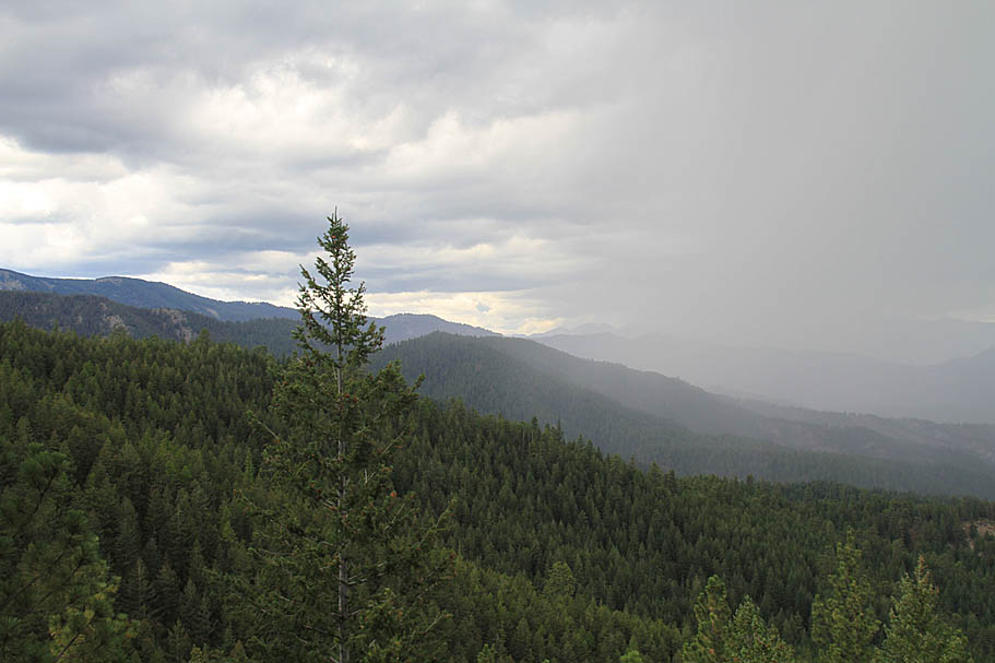 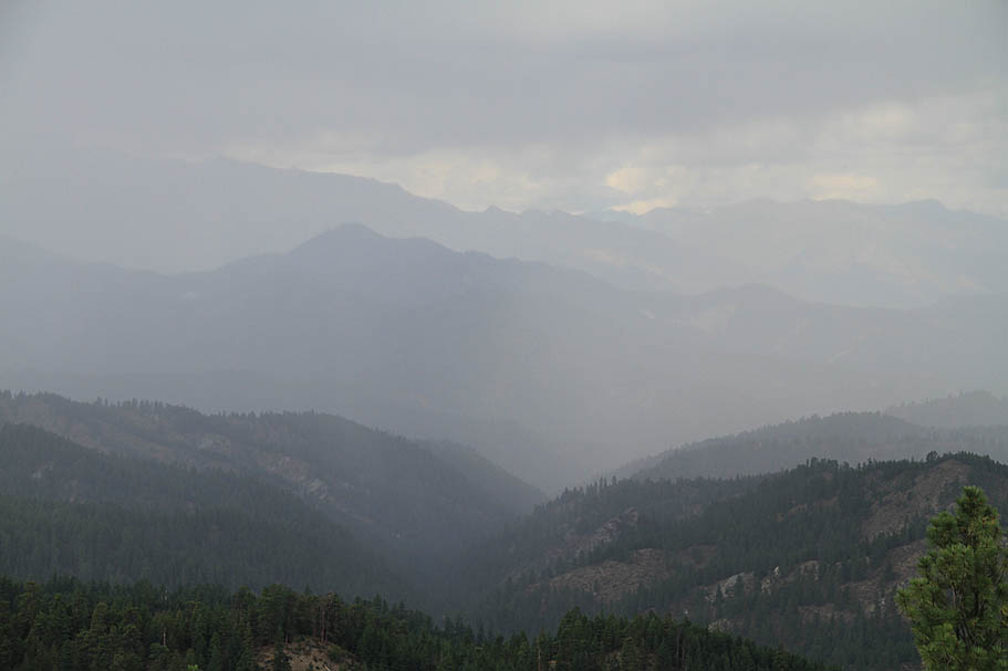  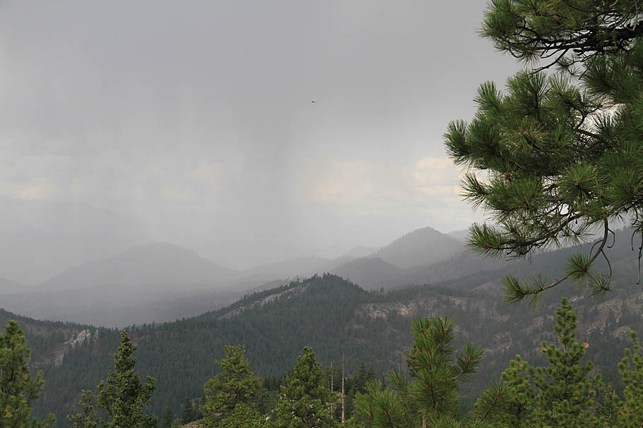 |
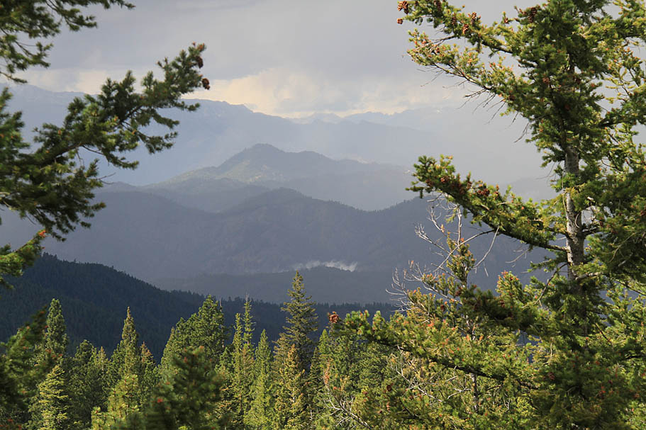
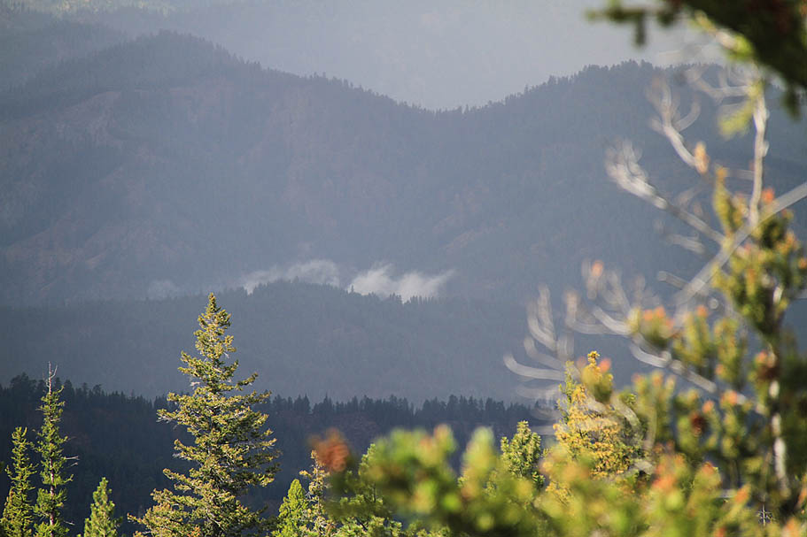
  After catching a few pictures I pressed on and shortly thereafter a light mist started. Nine miles from the lower trailhead I came up to a saddle and a four-way intersection (Waypoint DG-02 on my map) where I took a sharp right to remain on NF-7100. Shortly after this turn the mist was replaced with a solid light rain. A little over a half a mile further up the road NF-7100 ends at a T-intersection where I hung a right onto NF-9712 and continued onward. Right around in this area the rain started pelting and I was getting concerned about staying warm should I have a mechanical or the wind got any stiffer. I came across a discarded plastic grocery bag along the side of the road and stuffed it in the front of my jersey for a bit of wind breakage. The temperature equation was now much better and I kept on climbing in the rain. After catching a few pictures I pressed on and shortly thereafter a light mist started. Nine miles from the lower trailhead I came up to a saddle and a four-way intersection (Waypoint DG-02 on my map) where I took a sharp right to remain on NF-7100. Shortly after this turn the mist was replaced with a solid light rain. A little over a half a mile further up the road NF-7100 ends at a T-intersection where I hung a right onto NF-9712 and continued onward. Right around in this area the rain started pelting and I was getting concerned about staying warm should I have a mechanical or the wind got any stiffer. I came across a discarded plastic grocery bag along the side of the road and stuffed it in the front of my jersey for a bit of wind breakage. The temperature equation was now much better and I kept on climbing in the rain. |
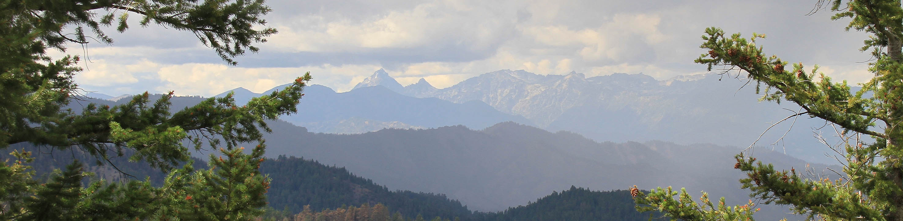
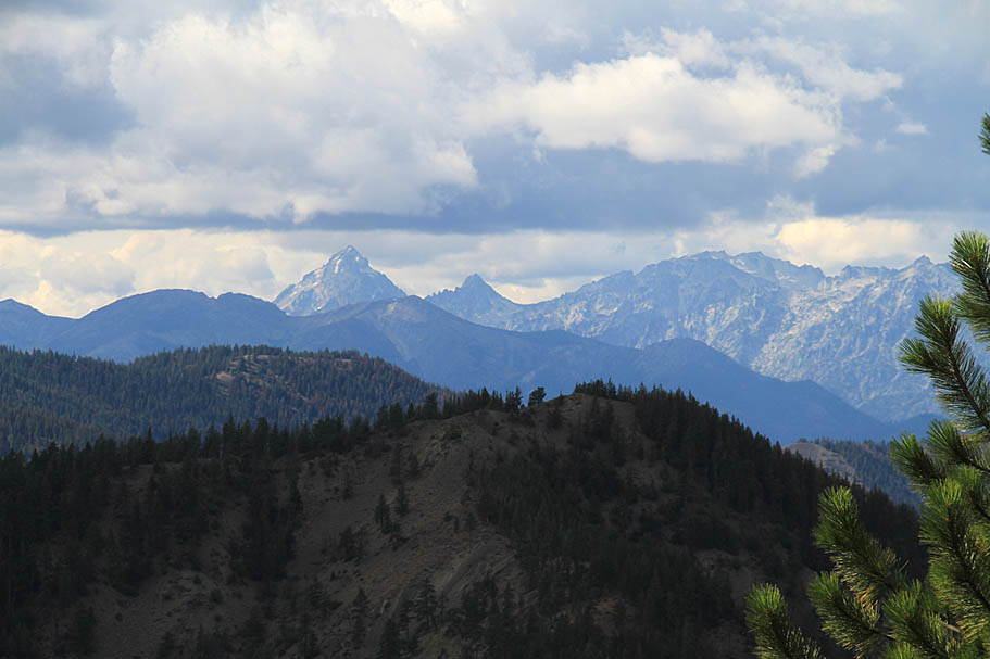
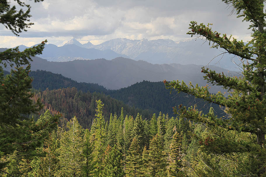
 After about 15 minutes of the full on rain, the clouds passed on to the east and the sun came back out. I was less than a mile from the upper trailhead now and it was awesome to see how quickly things were changes back to "normal". Having served me well the grocery bag moved to a nice tidy spot in my pack for a free ride back to a trailhead trashcan. I hung out in this area for a bit just to watch the light move from dark and gloomy back to sunny goodness. Mount Stuart at 9,415 feet in the distance was a pretty impressive looking peak. After about 15 minutes of the full on rain, the clouds passed on to the east and the sun came back out. I was less than a mile from the upper trailhead now and it was awesome to see how quickly things were changes back to "normal". Having served me well the grocery bag moved to a nice tidy spot in my pack for a free ride back to a trailhead trashcan. I hung out in this area for a bit just to watch the light move from dark and gloomy back to sunny goodness. Mount Stuart at 9,415 feet in the distance was a pretty impressive looking peak. |
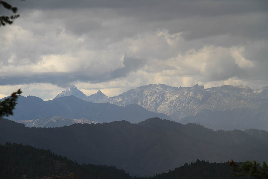 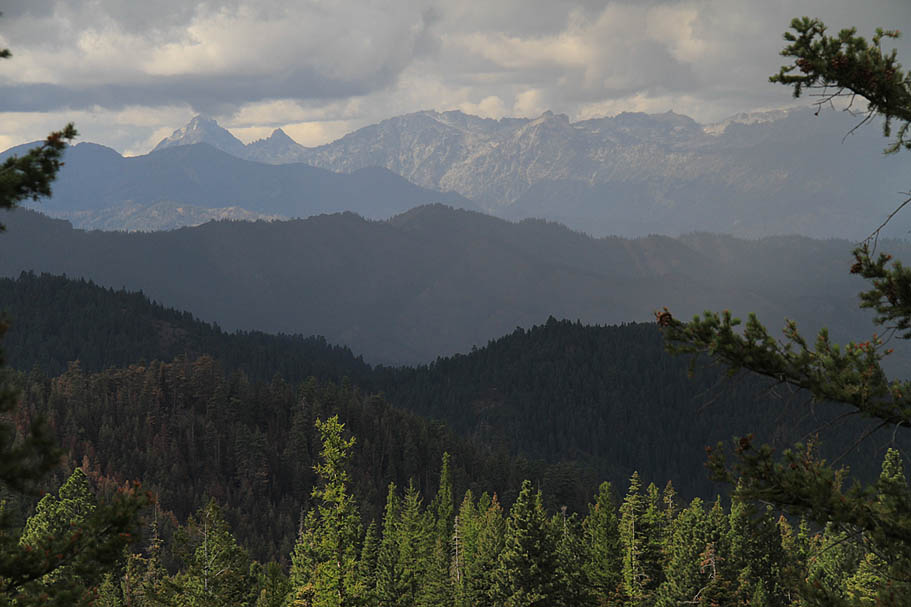 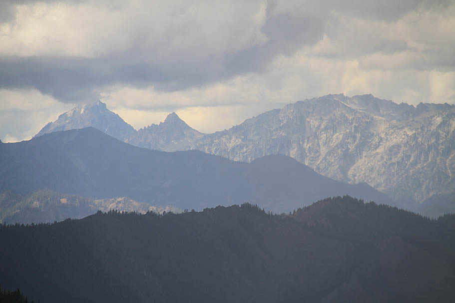    |
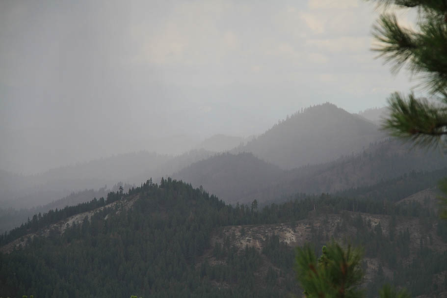
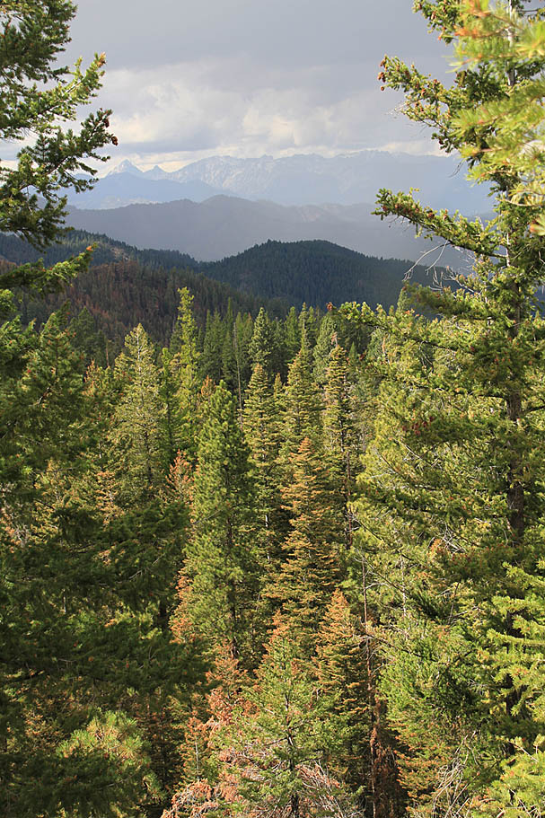
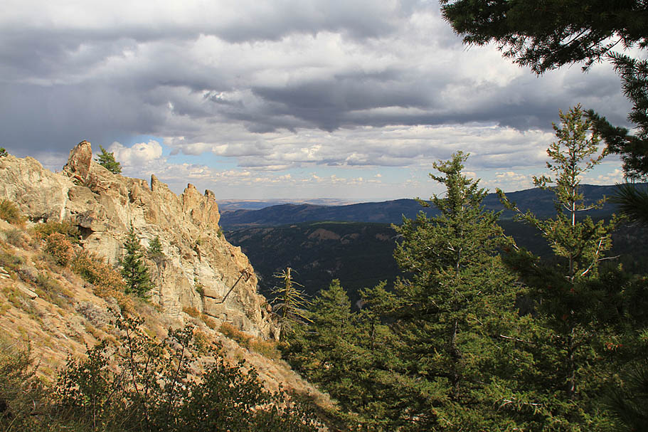  At 11 miles from the lower trailhead (DG-04 on my map) the Devil's Spur Trail (1203) crosses the road. If you like, you can peel off the road to the right and take this trail up to the upper Devil's Gulch trailhead (or just stay on the road). At 11.4 miles you will be at the upper trailhead. Before heading off on the trail take a bit of time to check out the views to the east and southeast. There is a small rocking outcropping nearby that is well worth the quick walk onto to get the best views. At 11 miles from the lower trailhead (DG-04 on my map) the Devil's Spur Trail (1203) crosses the road. If you like, you can peel off the road to the right and take this trail up to the upper Devil's Gulch trailhead (or just stay on the road). At 11.4 miles you will be at the upper trailhead. Before heading off on the trail take a bit of time to check out the views to the east and southeast. There is a small rocking outcropping nearby that is well worth the quick walk onto to get the best views. |
|
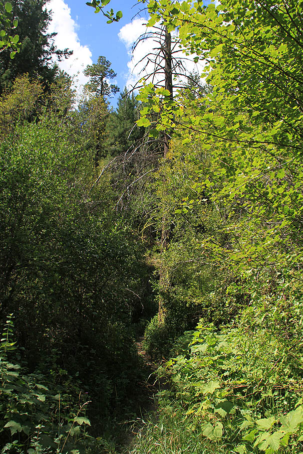
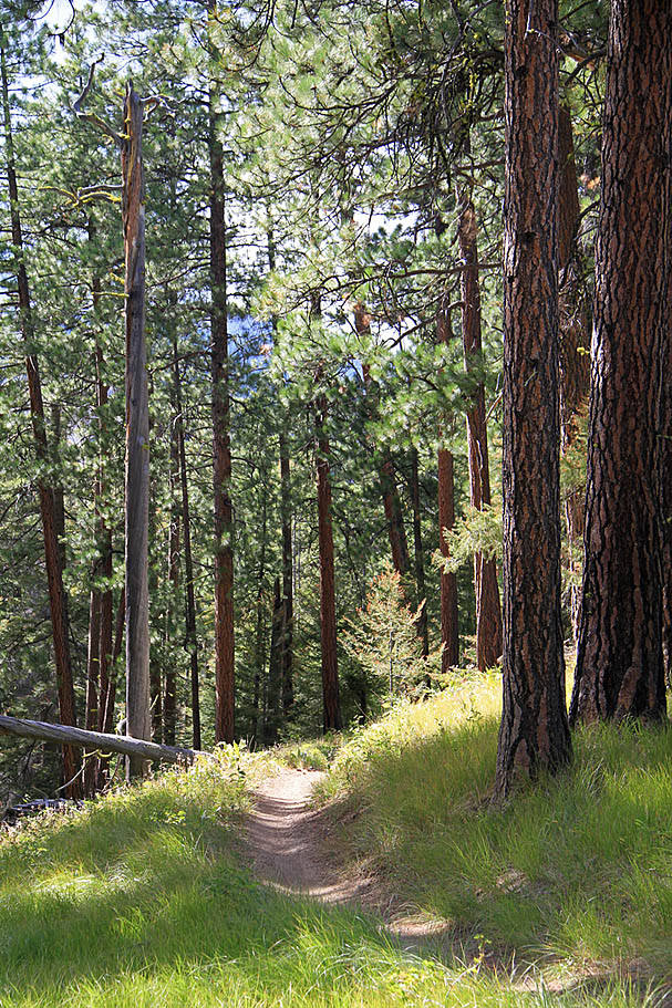
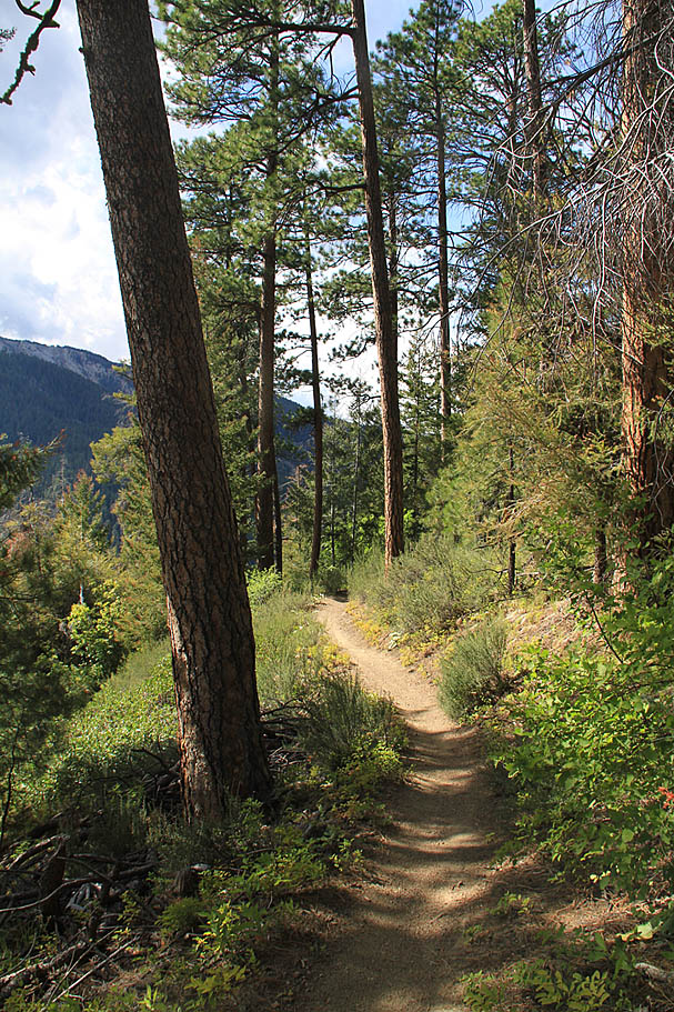
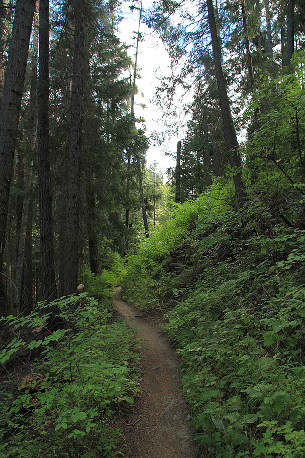
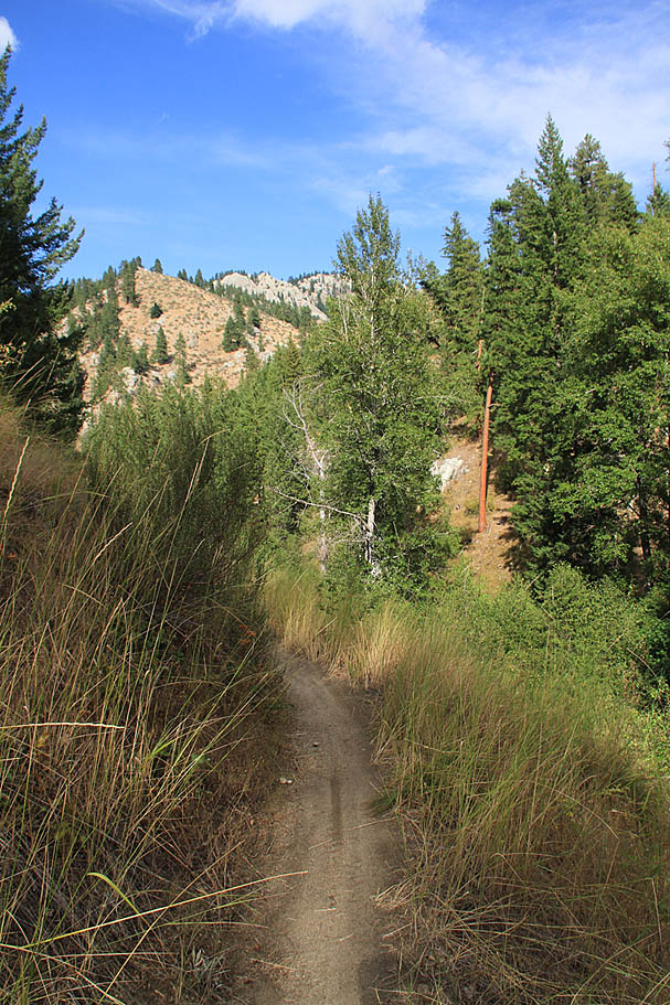
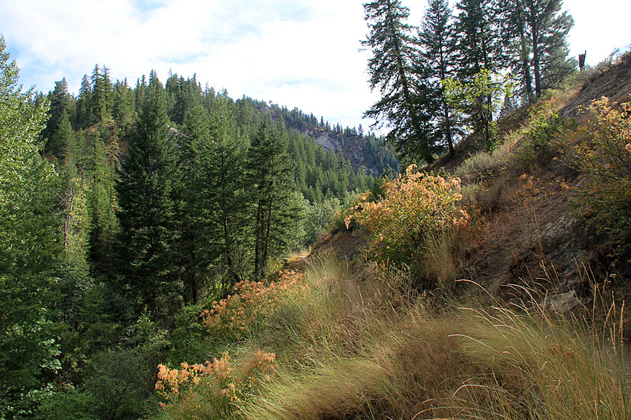
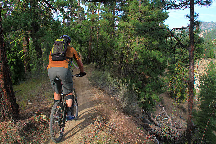
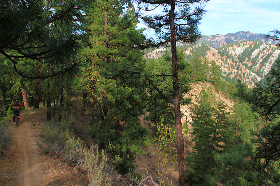
| Once I set off on the trail, the first 3/10ths of a miles was neither singletrack nor downhill as you follow a old forest service road up to a ridgeline. After this the trail turns into singletrack and shortly thereafter the downhill bliss begins. The next three miles offer some great long views along some of the sweetest singletrack I have ever been on. The trail is typically quite narrow and set on a steep side-hill. The forest here was often open and airy with an alpine forest kind of feel about it. |
 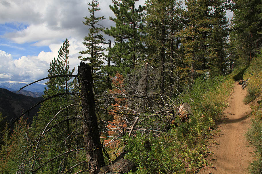  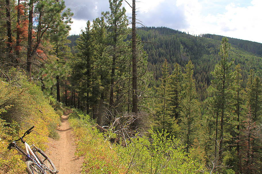 |
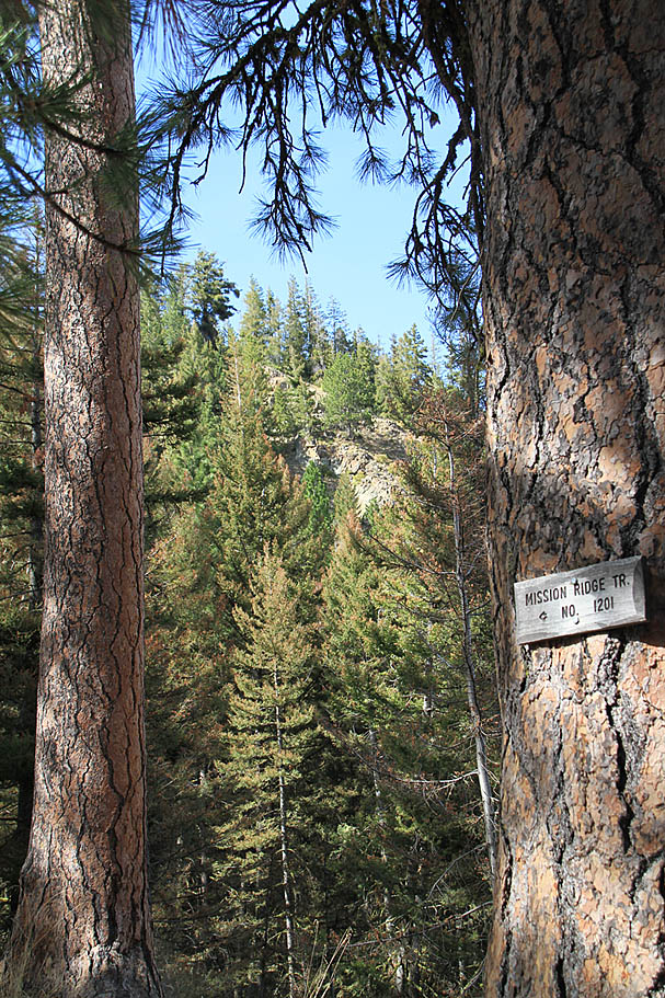  Three miles from the upper trail head you will come to the intersection with the Mission Ridge Trail. While the Mission Ridge Trail is considered more technical, I have heard that motos climbing this trail have made a rutted and blown out mess. It did not look that way in this area. The Mission Ridge Trail rejoins the Devil's Gulch Trail near the bottom very close to the lower trailhead. Over the next two miles the trail descends down into Devil's Gulch. There are some 10-12 switchbacks that could cause you some issues if you are not paying attention to the trail. The scenery through here is a hazard as tries to seduce your attention away from the trail. As you descend into gulch your views become shorter but no less impressive. The earlier rains that had pelted me did a fantastic job of tamping down any dust and made this upper section just about as perfectly buff as I could ever imagine a trail being. Many sections of the trail where pure bliss that was like riding on a 12" wide piece of suede leather for miles. Three miles from the upper trail head you will come to the intersection with the Mission Ridge Trail. While the Mission Ridge Trail is considered more technical, I have heard that motos climbing this trail have made a rutted and blown out mess. It did not look that way in this area. The Mission Ridge Trail rejoins the Devil's Gulch Trail near the bottom very close to the lower trailhead. Over the next two miles the trail descends down into Devil's Gulch. There are some 10-12 switchbacks that could cause you some issues if you are not paying attention to the trail. The scenery through here is a hazard as tries to seduce your attention away from the trail. As you descend into gulch your views become shorter but no less impressive. The earlier rains that had pelted me did a fantastic job of tamping down any dust and made this upper section just about as perfectly buff as I could ever imagine a trail being. Many sections of the trail where pure bliss that was like riding on a 12" wide piece of suede leather for miles. |
    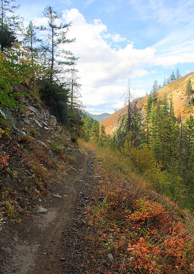  |
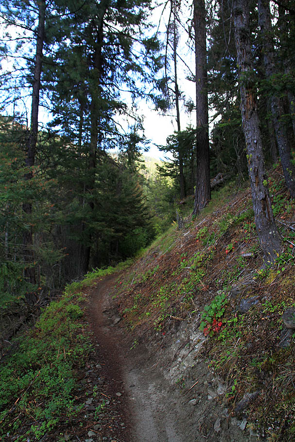
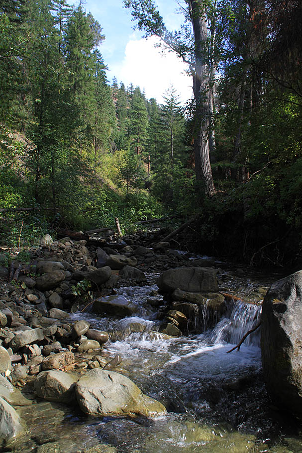
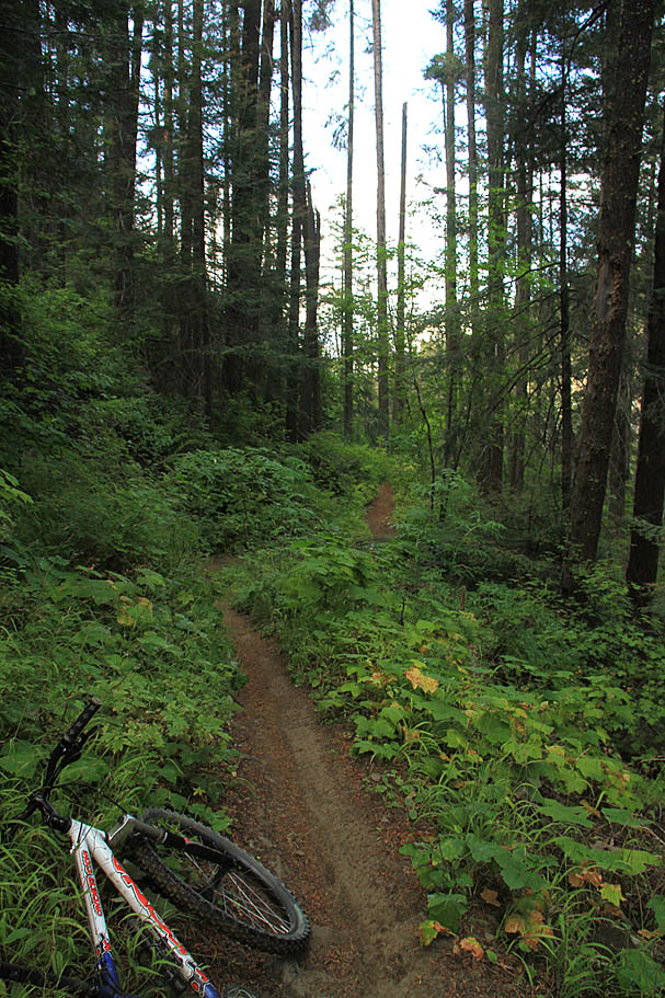
| Down in the gulch the forest was a bit thicker with less grass and more big leafed undergrowth. there were enough terrian change ups here and there to keep you wondering what was around the next turn. The trail crosses Mission Creek and some of its feeder watersheds some number of times and each time you do a quick bit of climbing follows and then it is back into the downhill cruise mode for a long stretch. This blissfulness just seems to go on and forever. |
     |
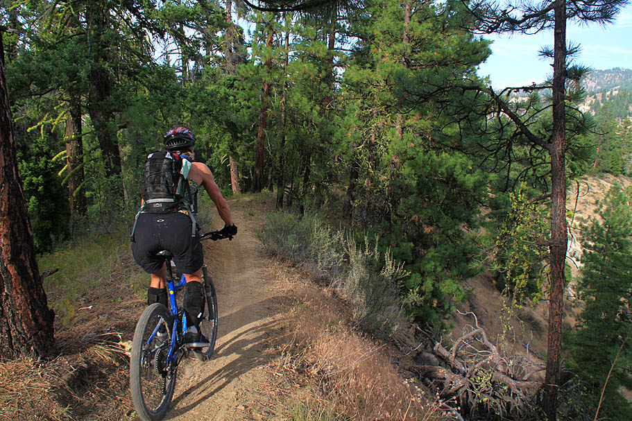
At 10.8 miles from the upper trailhead (Thats right, you will have been rocking this incredible trail downhill for over 10 freaking glorious miles....Hell Yeah!) you will come to the junction of the Red Hill Trail coming in from your left. Starting from the Sand Creek Trailhead, a loop out on the Red Hill and around back on the Red Devil Trail is considered a good ride on its own. I ran into a couple doing just that on my ride here. Continuing down the trail, the Mission Ridge Trail rejoins the trail at around 11.7 miles. At 11.9 miles the Red Devil Trail peels off to the left with the Devil's Gulch lower trailhead is just a couple hundred yards down the trail and across a bridge. |
Red Devil Trail |
| Since I had parked at the Sand Creek Trailhead and I was still feeling pretty good (My face muscles were a little sore from grinning from ear to ear on most of the Devil's Gulch Trail.) I decided to take the Red Devil trail back. Oh my what a bruiser this trail turned out to be. The first 1.5 miles were a pretty steady and typically steep climb that gaining to total of about 900 feet after factoring ing some undulations. This section certainly wiped the smile right off of my face and put a through burning into the quads. After what I thought was the end of the climbing the trail cycled up and down over the next 1.5 miles. The total mileage of the day was certainly being felt at this point. There were some really pretty views along this section of trail, but you had to sort of peek at them through the trees. Mercifully the trail finally started descended steadily over the final 1.7 miles back to the Sand Creek trailhead. |
    |
The total tally for this days adventures with the two trails was about 36 miles with about 4,500 feet of climbing. One of my best days on the bike ever. |