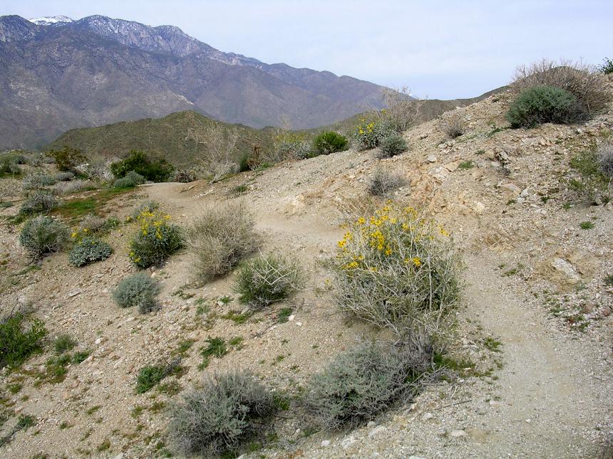
The Palm Canyon Epic
After reading this review make sure to check out more of Palm Canyon
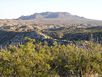
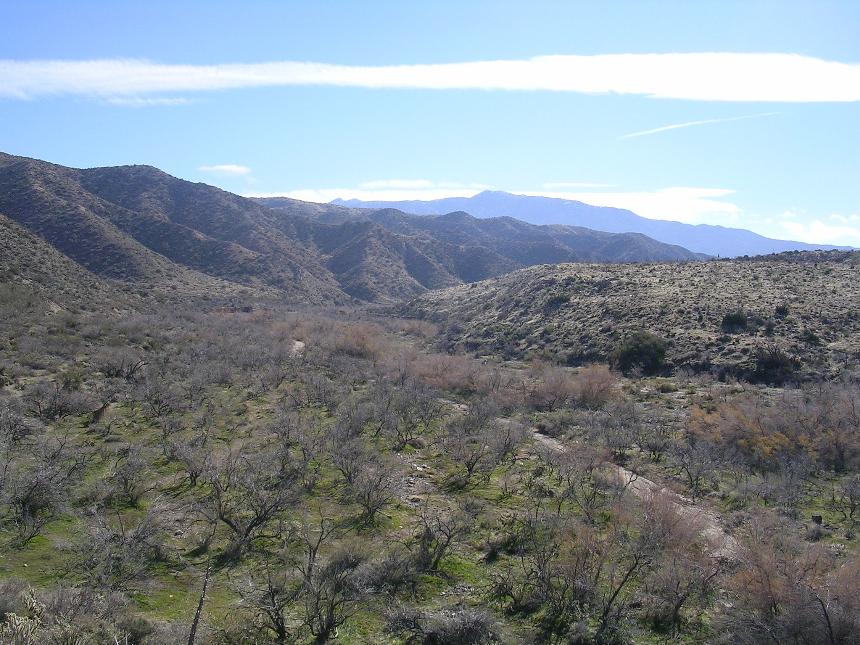
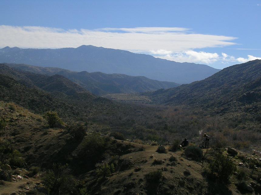
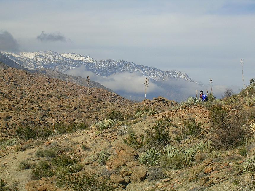
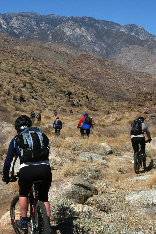
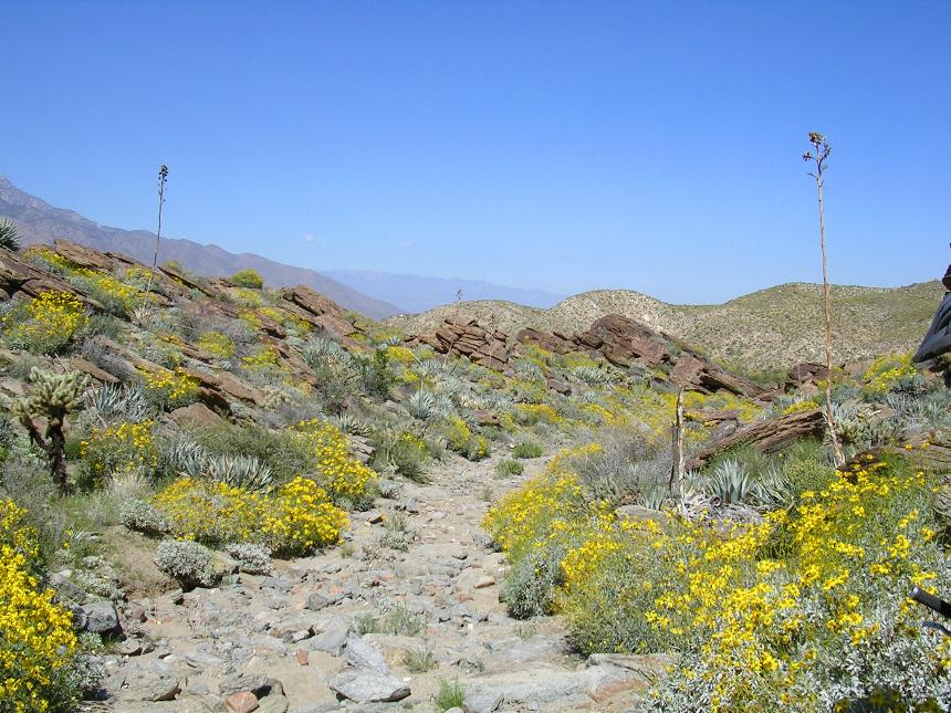
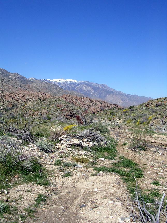
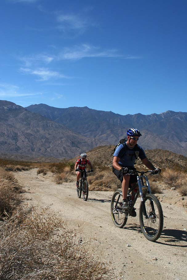
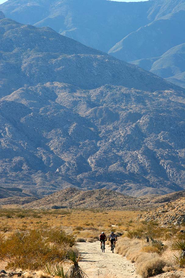
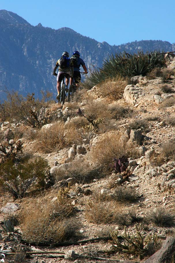
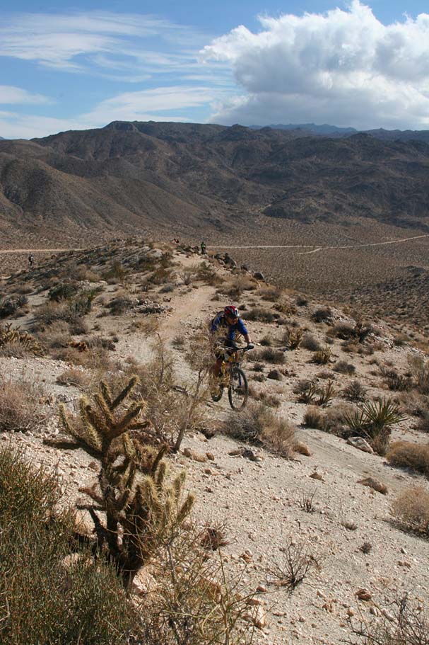
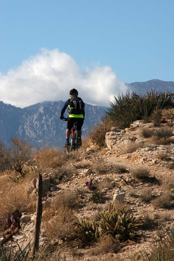
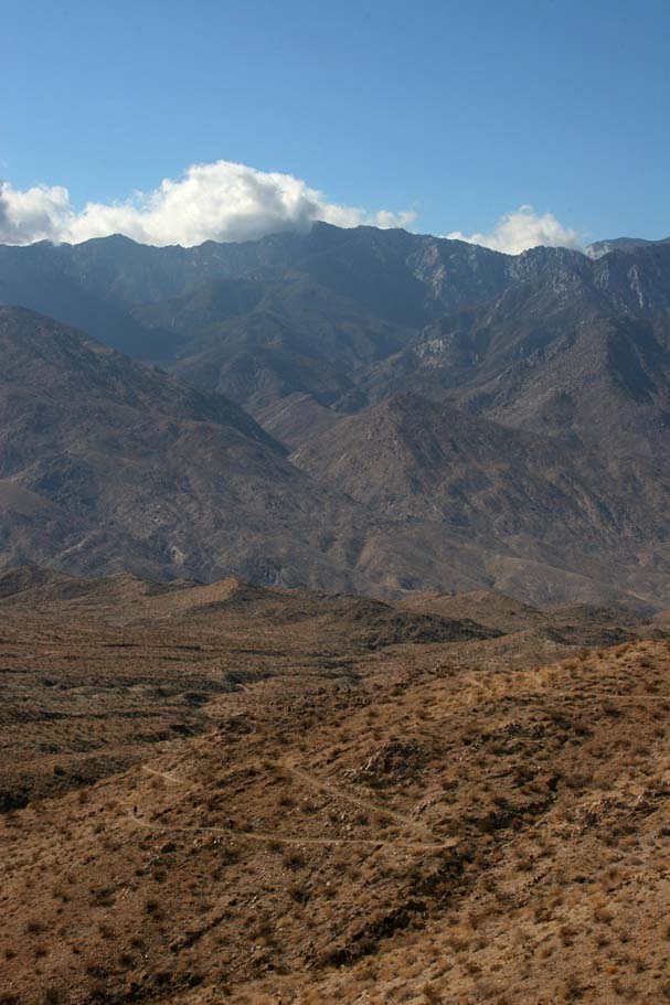
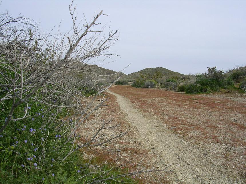
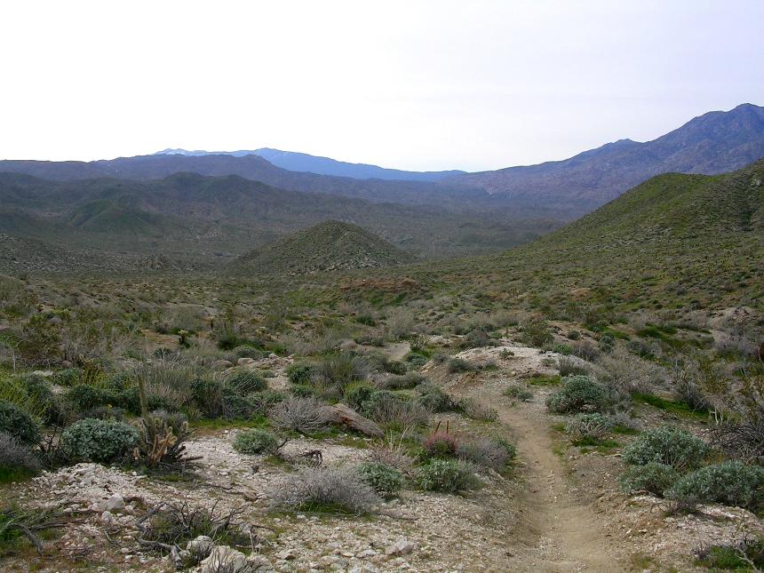
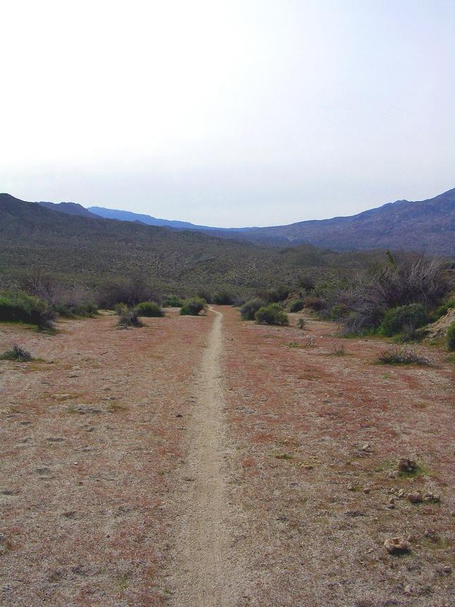
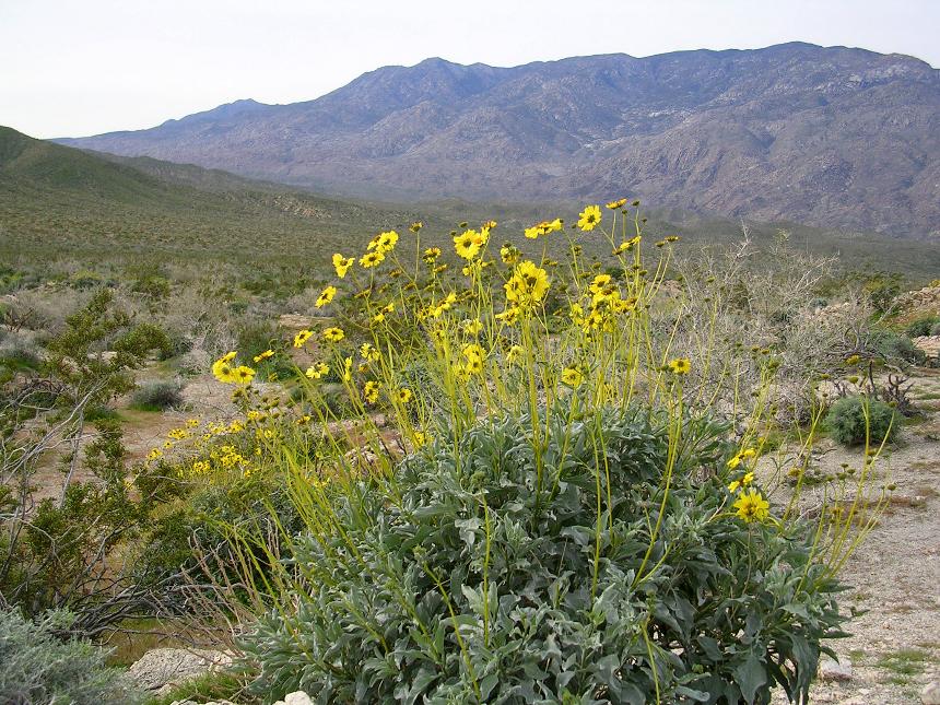
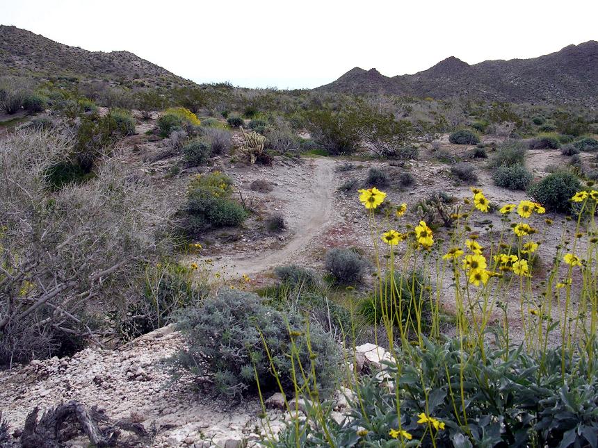
This is a true Southern California Epic Ride offering huge vistas, off-camber narrow singletrack, ridges, stream beds, rocks, sand, cacti, this ride will nearly overload your senses. This point-to-point route takes you through a varied array of desert trails from the foot of the north slope of Santa Rosa Mountain at 4500 plus feet down to Palm Springs 29 miles away at 500 feet. This is not a downhiller's dream as you will climb over 2,000 feet while descending over 6,000. If this area was a seafood restaurant this ride would be the Captain's Platter. This ride stresses self-sufficiency and you need to have a fair bit of navigational skills as well. I highly recommend that the first time you do this ride go with someone who has done it before. While this is not too technical of a route, due to it's length only solid and fit intermediate or better riders should attempt this route.
Note to repeat offenders: I revised the route and maps a handful of times since I first starting riding here 20+ years ago. I have cut out some sand slogs and added some newer/better single tracks as they have come into existent. If you have any of the old maps, descriptions, or GPS data, purge them and use the fresher stuff. I have made enough changes that mixing and matching the old with the new can get you even more confused than my normal trail rambling Engrish.
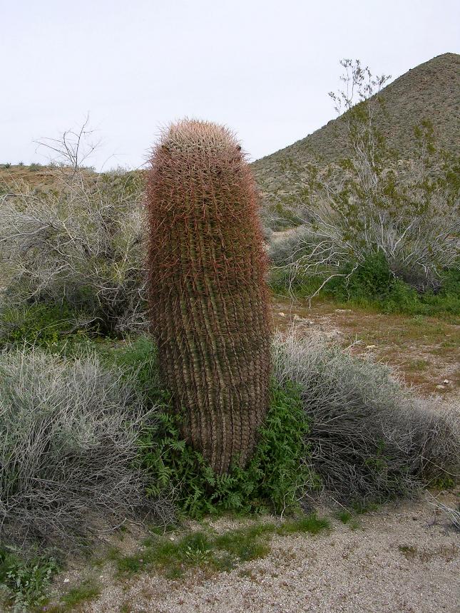
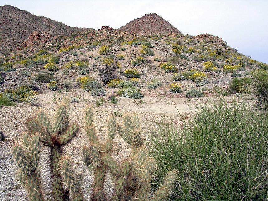
HAZARDS: Cacti - Many types that are just off the trail and often infringing into the trail's airspace. Exposure along canyon sides and some technical spots as well as a few steep descents. Also this is very long ride and at some points you are quite far from help. This ride can also test you navigational skills as well as your self-sufficiency skills. Carry plenty of fluids, foods and a spare derailleur hanger would be wise as well. This guy did not and he had a 6 mile hike back the way he came as a result. I highly recommend not doing this ride by yourself.
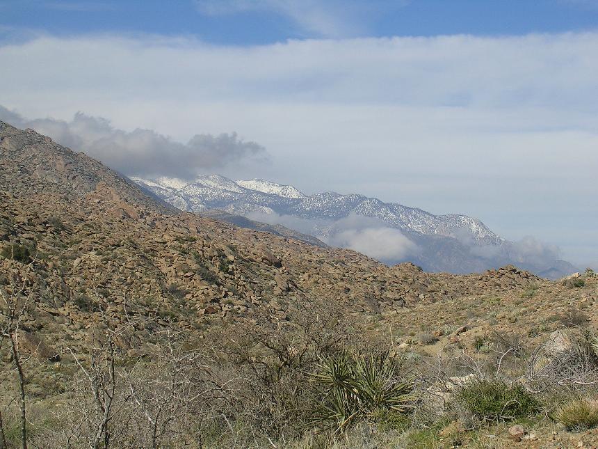
WHEN: This is not a summer time ride! The heat can be really bad here, I would say this a late fall to early spring ride. Make sure you check the weather forecast for Palm Springs.
The Classic Palm Canyon Epic :
Pinyon Flats - Palm Canyon Epic.

- Lower Trailhead: Next to the Rimrock Shopping Center
(Vons) at 4733 East Palm Canyon Drive which at the intersection with the
Gene Autry Trail.

- Upper Trailhead: The end of Pine View Road off of Highway 74. 30-45 minutes from lower trailhead .
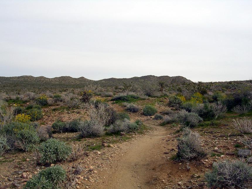
Ride Description: NOTE: These are very long routes were differences between cyclo-computer, GPS and application calibrations can create significant differences in mileage readings by the rides end. Additionally, these various units and applications widely vary in the manner in which they factor in elevation change into total miles traveled. See my GPS and TOPOs page for more information on this. I am using a lot of relative mileage measurements in this description (i.e. 2 miles past this ... instead of... at 24.3 miles) in a effort reduce confusion that can arise from these differences.
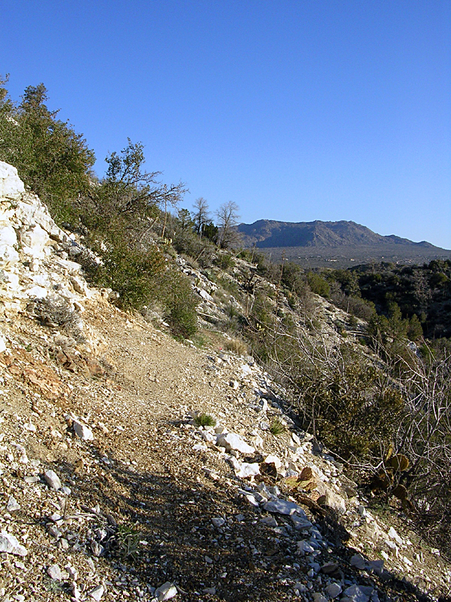
The Classic Route
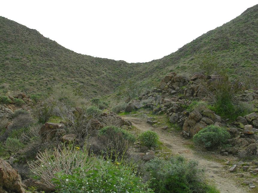
 From the end of Pine View Road travel along the old 4WD road that is nearly
singletrack now .1 miles until you see a split in the trail where you will go to
the right and slightly downhill. The trail to the right is marked by an
old square sign that is so rusted you can not read what used to be on it.
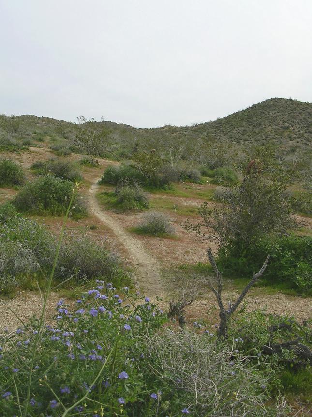
This trail curves around this way at that while heading downhill and at .3 miles
it will make a large sweeping right turn at some stone cairns while another less
used trail heads off slightly to the left. (Point B on the map)
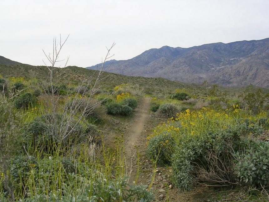
Continue to the right and downhill while the views of Palm Canyon start opening
up to you left. You will continue gently rolling
down hill as the trail twists back and forth for a little over a mile.
From the end of Pine View Road travel along the old 4WD road that is nearly
singletrack now .1 miles until you see a split in the trail where you will go to
the right and slightly downhill. The trail to the right is marked by an
old square sign that is so rusted you can not read what used to be on it.
This trail curves around this way at that while heading downhill and at .3 miles
it will make a large sweeping right turn at some stone cairns while another less
used trail heads off slightly to the left. (Point B on the map)
Continue to the right and downhill while the views of Palm Canyon start opening
up to you left. You will continue gently rolling
down hill as the trail twists back and forth for a little over a mile.
 As
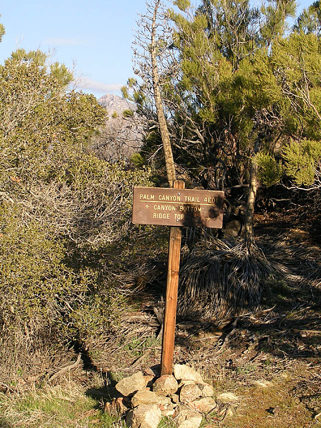
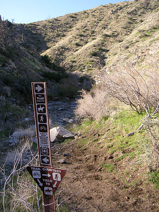
you near point C at 1.2 miles the trail descends sharply to a four-way junction,
with a sign making that you are on the Palm Canyon trail, Forest Service Trail
4E01. You have the option of taking the canyon bottom route or a ridge top
route. Take the ridge top route and climb just a bit and then you
are back to the descending thing. You soon come out to flat section where
the trail is back to being a full-size double track. The view down
into Palm Canyon to your left is quite impressive. The double track
ends abruptly at the foot on a hill and the trail continues on as single track
off to the right.
As
you near point C at 1.2 miles the trail descends sharply to a four-way junction,
with a sign making that you are on the Palm Canyon trail, Forest Service Trail
4E01. You have the option of taking the canyon bottom route or a ridge top
route. Take the ridge top route and climb just a bit and then you
are back to the descending thing. You soon come out to flat section where
the trail is back to being a full-size double track. The view down
into Palm Canyon to your left is quite impressive. The double track
ends abruptly at the foot on a hill and the trail continues on as single track
off to the right.
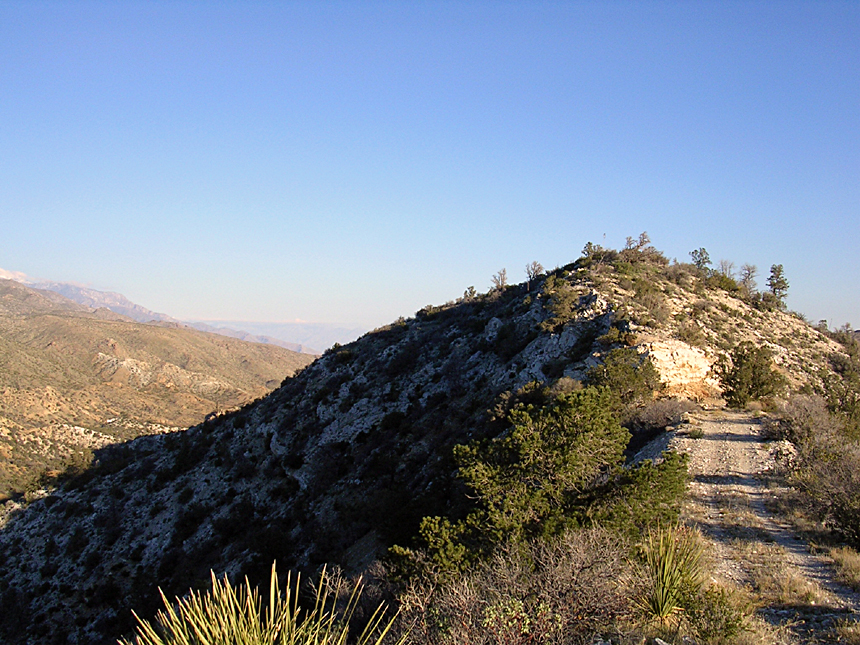
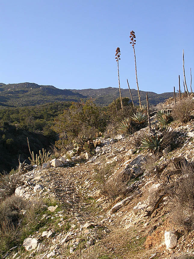
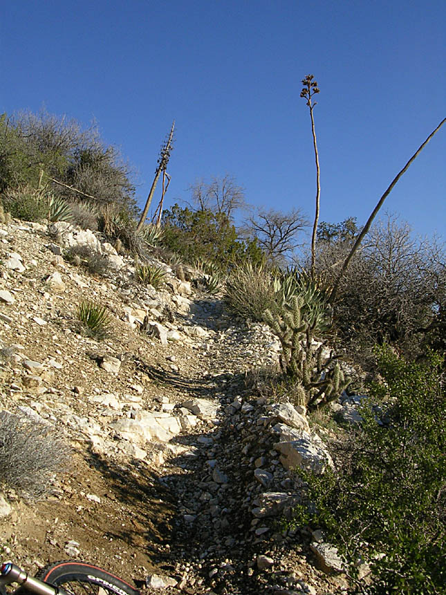
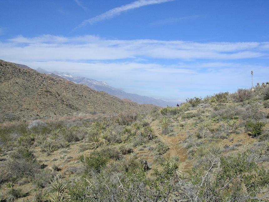
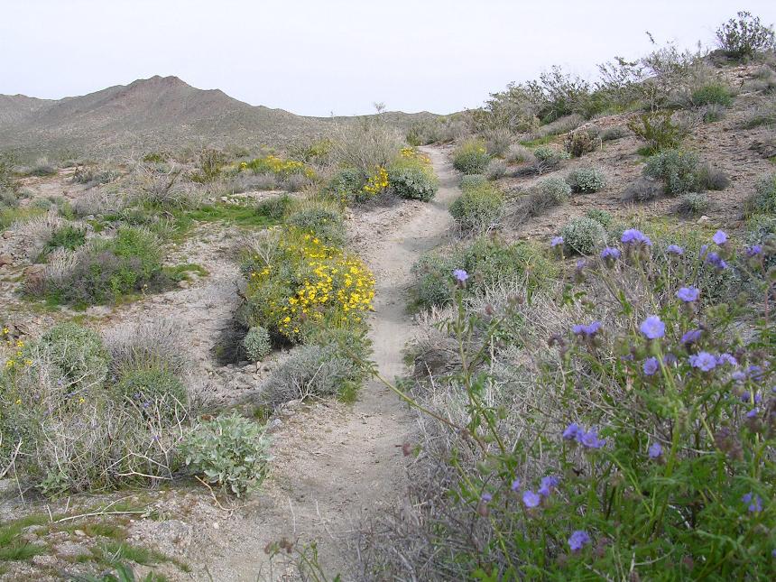
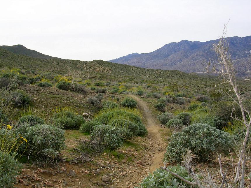
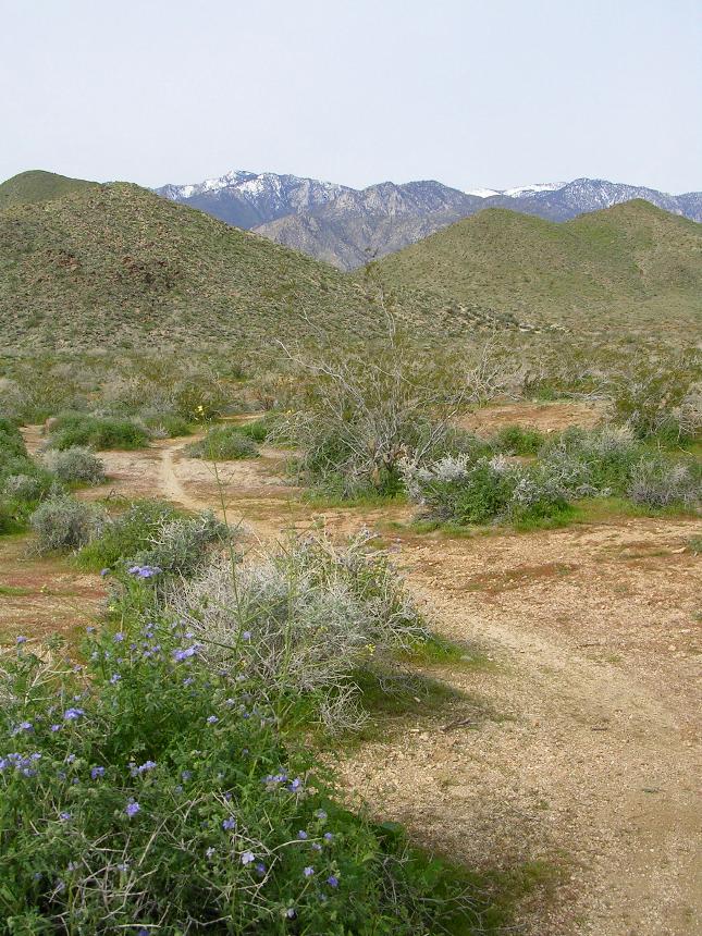
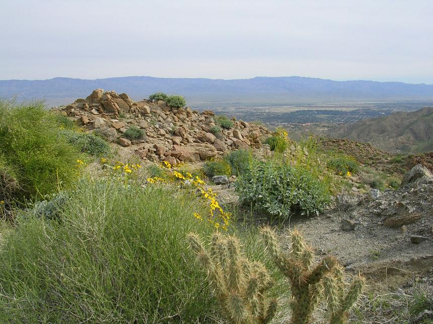
 The
single track in the next section is nothing short of great. The trail is
fairly narrow and travels either right along the top of the
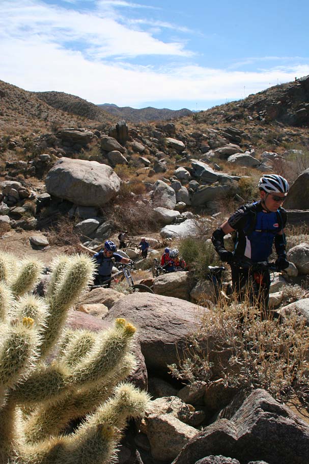
ridge or clings to the side of the canyon. Between the occasional technical
spots and the ever present cacti nudging its way into the trail's airspace you
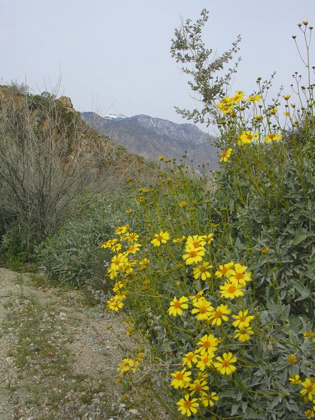
will find enough features to keep you on you toes. Of course with picturesque
views in every direction you may find it hard to keep your eyes on the
trail. Please do stop in a spot or two and take it all in as this is
singletrack of the "Top Flite" variety.
The
single track in the next section is nothing short of great. The trail is
fairly narrow and travels either right along the top of the
ridge or clings to the side of the canyon. Between the occasional technical
spots and the ever present cacti nudging its way into the trail's airspace you
will find enough features to keep you on you toes. Of course with picturesque
views in every direction you may find it hard to keep your eyes on the
trail. Please do stop in a spot or two and take it all in as this is
singletrack of the "Top Flite" variety.
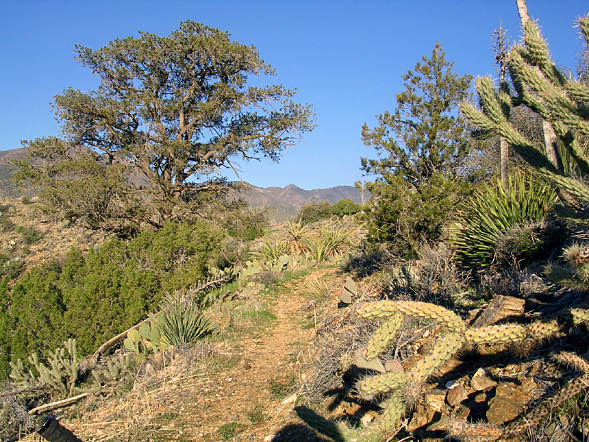
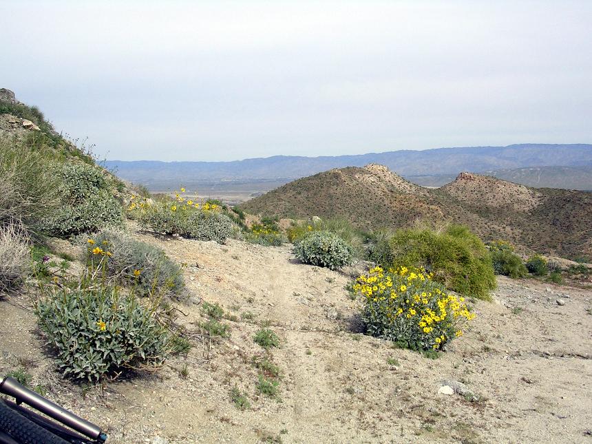
 At around mile 2.4 the trail switching from riding along the ridge top or along the
west slope over to the east slope and starts descending toward Omscott
Wash. The trail has some exposure in spots as the start descending in
earnest. You will also have a few switchbacks to deal with as well.
At around mile 2.4 the trail switching from riding along the ridge top or along the
west slope over to the east slope and starts descending toward Omscott
Wash. The trail has some exposure in spots as the start descending in
earnest. You will also have a few switchbacks to deal with as well.
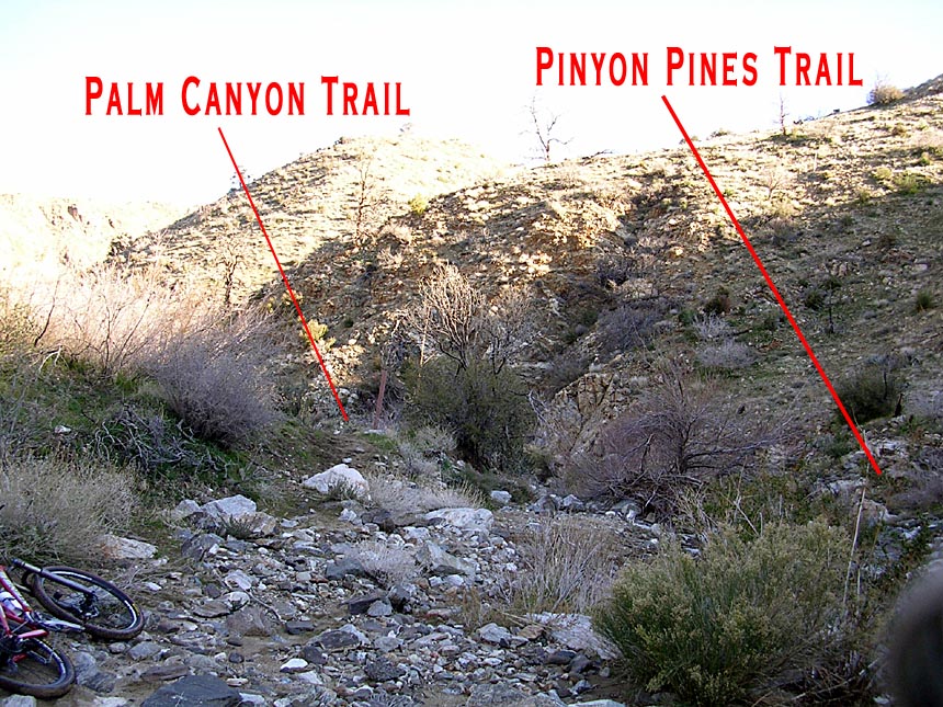
 The Palm Canyon trail will dump you out into Omscott Wash at 4.2 miles. As soon as
you go into the wash look to your left (downstream). You will see the back of a trail sign and the trail heading off past it. The picture to the right is view you should have. Almost directly across the wash from this sign is the Pinyon Pines Trail heading out of the other side of the wash. The picture to the right from the trail sign looking back up the wash from where you came. This is Point D on the map.
The Palm Canyon trail will dump you out into Omscott Wash at 4.2 miles. As soon as
you go into the wash look to your left (downstream). You will see the back of a trail sign and the trail heading off past it. The picture to the right is view you should have. Almost directly across the wash from this sign is the Pinyon Pines Trail heading out of the other side of the wash. The picture to the right from the trail sign looking back up the wash from where you came. This is Point D on the map.
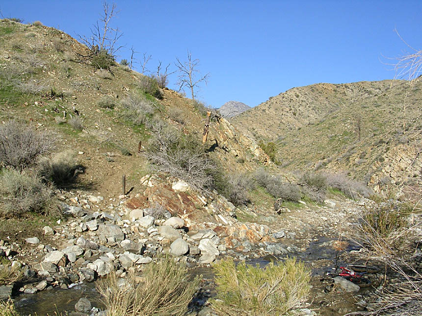
 Go down the wash .1 miles and head up the trail to the left
marked with 4x4 markers.
Go down the wash .1 miles and head up the trail to the left
marked with 4x4 markers.
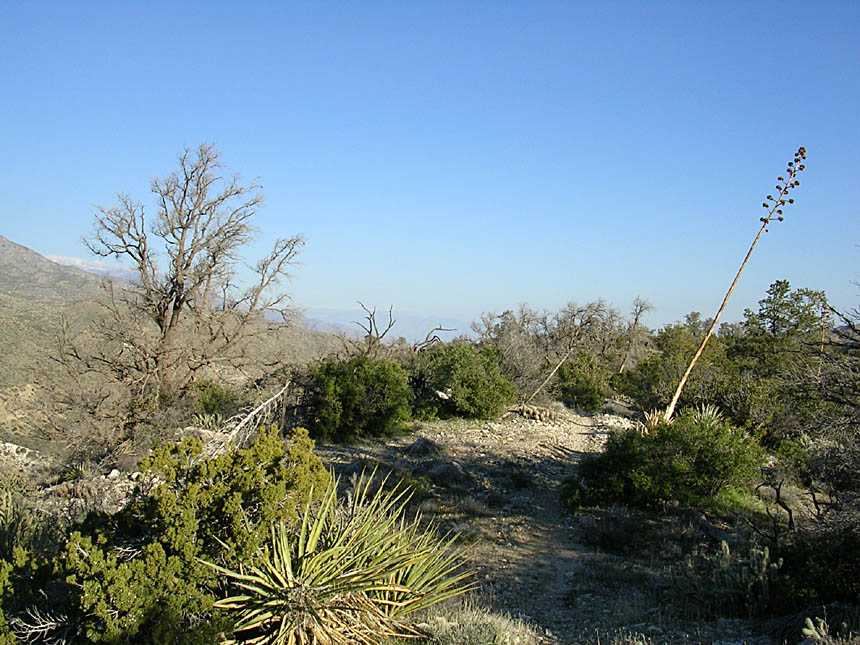
 For
about the next 3 miles it is mostly flat semi-grassy reedy riding going back and forth
across washes which involves a little bit of sand slogging. At
around 7.2 miles you will pass the Dutch Charlie trail on right - Keep straight.
For
about the next 3 miles it is mostly flat semi-grassy reedy riding going back and forth
across washes which involves a little bit of sand slogging. At
around 7.2 miles you will pass the Dutch Charlie trail on right - Keep straight.
 At
7.6 miles you will pass Live Oak Canyon trail merges in from the left.
This is almost a T-junction where you will go uphill and slightly right.
From here you leave the sand slogging behind and gain a little bit of
elevation as the trail transverses the side of a canyon, rise and falling
in short increments and it weaves around various bits of rock formations and
cacti. After about a mile and half of climbing that you may have not even
noticed, the trail descends in earnest for another half a mile until it crosses
another wash and merges with the Poterro Canyon 4WD road. Supposedly the
Agua Bonita Spring is located in this area and is signed but I was having too
much fun when I went through here to notice.
At
7.6 miles you will pass Live Oak Canyon trail merges in from the left.
This is almost a T-junction where you will go uphill and slightly right.
From here you leave the sand slogging behind and gain a little bit of
elevation as the trail transverses the side of a canyon, rise and falling
in short increments and it weaves around various bits of rock formations and
cacti. After about a mile and half of climbing that you may have not even
noticed, the trail descends in earnest for another half a mile until it crosses
another wash and merges with the Poterro Canyon 4WD road. Supposedly the
Agua Bonita Spring is located in this area and is signed but I was having too
much fun when I went through here to notice.
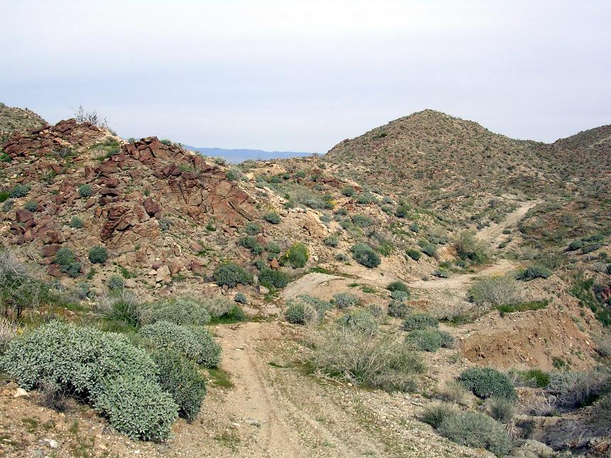
 Your overall mileage should be around 9.7 miles at this point. (Point J). Turn left and
downhill onto this old rocky and rutted 4WD road which quickly bends to
the right and northward. There are some really interesting red rocks along
the side of this section, but don't spend too much take gazing off of your line
as the descent is steep enough to allow you to go as fast as you dare.
Your overall mileage should be around 9.7 miles at this point. (Point J). Turn left and
downhill onto this old rocky and rutted 4WD road which quickly bends to
the right and northward. There are some really interesting red rocks along
the side of this section, but don't spend too much take gazing off of your line
as the descent is steep enough to allow you to go as fast as you dare.
Indian Potrero Trail
 After
about 1.25 miles of this speedy descent action the trail flattens for a short
bit. Start looking for a trail maker sign on your left that will be
about 1/2 mile from where the descent mellowed out. The sign is quite
easy to see, but if you have a case of tunnel vision going you could miss
it. The traditional Palm Canyon route continues
straight down the old 4x4 trail and then down a sandy sloggy wash to the bottom of Dry
Wash road. The Indian Potrero Trail will get you to the same place, but in
more interesting and fun way.
After
about 1.25 miles of this speedy descent action the trail flattens for a short
bit. Start looking for a trail maker sign on your left that will be
about 1/2 mile from where the descent mellowed out. The sign is quite
easy to see, but if you have a case of tunnel vision going you could miss
it. The traditional Palm Canyon route continues
straight down the old 4x4 trail and then down a sandy sloggy wash to the bottom of Dry
Wash road. The Indian Potrero Trail will get you to the same place, but in
more interesting and fun way.
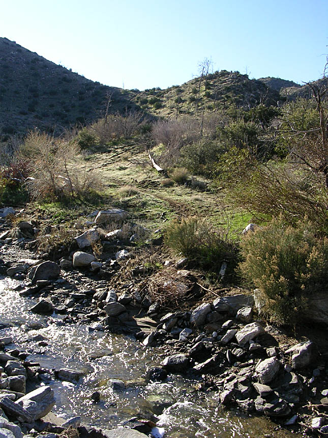
ACCESS NOTE: There was a land swap done between the BLM and the Agua Caliente Indian Reservation that has affected access to this trail. There is a 1/4th mile section of the Indian Potero trail that is now on reservation land. The Aqua Caliente tribe (at least for some periods of time) been very much anti-bike. Sometimes there are no-bikes sign at the sign post (PC-22) even though you are still on BLM at this point. There are groups looking to get the BLM to make a reroute to circumvent the "new" reservation land but until then if you take the Indian Potrero trail you will end up trespassing on a small section of reservation land. You will have to make your own choices. On my last two outing here, there was no longer a No-Bike sign for the Indian Poterro trail, but there was a arrow sign for mountain bikes to the primary Palm Canyon route. I'm going to describe the Indian Poterro route which is just as well traveled as the main route.
From the sign post (Waypoint PC-22), turn left and proceed for the next 100 yards through a technical section where you go down into a seasonal creek bed and then sharply up the other side. It will be a hike-a-bike for nearly all riders. This brings you up onto a mesa/meadow where for the next 1.2 miles you enjoy a mostly flat section that seems quite atypical from most of the early riding. At the north end of this mesa/meadow (Waypoint PC-25) the trail turns downhill and quite a bit more technical as it drops about 250 feet over the next 1/2 mile. After this section the trail mellows out and you travel another 1/2 mile to the bottom of Dry Wash Road.
 If you opt not to do the Indian Poterro trail, continue straight along the old 4x4 trail (Green Trail between Waypoint PC-22 and PC-on map) and in about 1/2 a mile you get a wakeup call as you will have to climb two short but steep enough hills to keep you honest. From the top of
the second hill at around 12.2 miles you will start descending again for another mile where the trail dumps up into a large wash. Turn left into the wash and follow it northward and slightly downhill. This can be a slogfest but there is enough of a downhill grade to allow you to keep enough speed to stay on top of the sand. You will ride/surf/slog down this wash for .8 miles until at 14 miles you coming to a large open area and the junction of the Palm Canyon trail, the Indian Potrero trail and Dry Wash Road. It is well signed but you will be turning to your right and slightly
uphill towards Dunn Road.
If you opt not to do the Indian Poterro trail, continue straight along the old 4x4 trail (Green Trail between Waypoint PC-22 and PC-on map) and in about 1/2 a mile you get a wakeup call as you will have to climb two short but steep enough hills to keep you honest. From the top of
the second hill at around 12.2 miles you will start descending again for another mile where the trail dumps up into a large wash. Turn left into the wash and follow it northward and slightly downhill. This can be a slogfest but there is enough of a downhill grade to allow you to keep enough speed to stay on top of the sand. You will ride/surf/slog down this wash for .8 miles until at 14 miles you coming to a large open area and the junction of the Palm Canyon trail, the Indian Potrero trail and Dry Wash Road. It is well signed but you will be turning to your right and slightly
uphill towards Dunn Road.
Dry Wash Road
 The 3 mile gradual but sandy climb up to Dunn Road on Dry Wash road can be quite frustrating. You
will certainly have an opportunity to refine your skills at reading the firm
sand lines, the gingerly use of the handlebars, and eloquent application of
power to the rear wheel. Basically it is a bummer of a
climb that cam suck the life out your legs, particularly if it is hot out.
TIP: Letting a bunch of air out of your tires so that they are really
squishy will help with riding over the sand.
The 3 mile gradual but sandy climb up to Dunn Road on Dry Wash road can be quite frustrating. You
will certainly have an opportunity to refine your skills at reading the firm
sand lines, the gingerly use of the handlebars, and eloquent application of
power to the rear wheel. Basically it is a bummer of a
climb that cam suck the life out your legs, particularly if it is hot out.
TIP: Letting a bunch of air out of your tires so that they are really
squishy will help with riding over the sand.
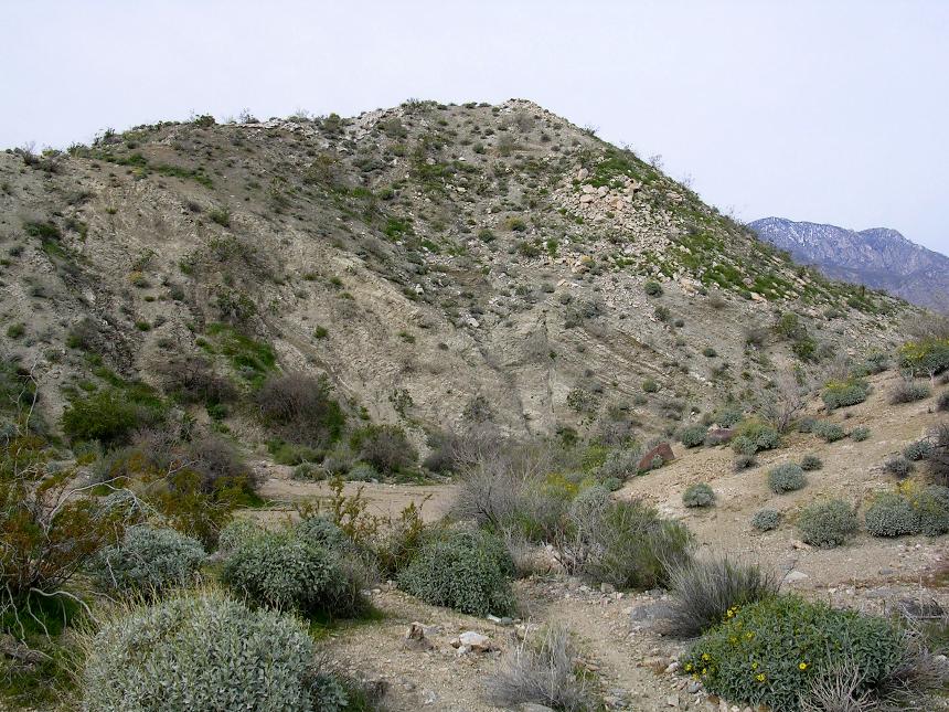
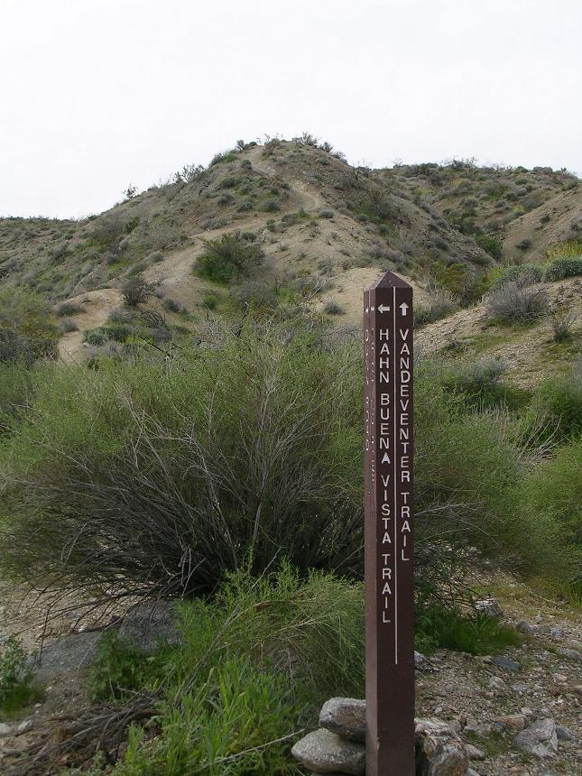
BAILOUT OPTION - The entire purpose for making this climb is to get to the Hahn Buena Vista trail. You can bypass this climb by taking the Vanderenter trail which after climbing up wash 3/4th of a mile to waypoint PC-29. Look for the signpost on the left hand side of the wash. It will take you to the bottom on the Hahn Buena Vista trail at waypoint PC-34 on my map. ACCESS NOTE: The Vanderenter trail is another trail that the Aqua Caliente reservation has marked as "No-Bikes" as a portion of it crosses their land. I love the Han Buena Vista trail enough that I would have to feel in physical distress to take the Vanderenter trail and bypass the Hahn. With that said, If I was in phyiscal distress, I would not hesitate to take this bailout.
Longer and harder than it looks
 At 17.1 miles you will
thankfully reach Dunn Road. Hang a left
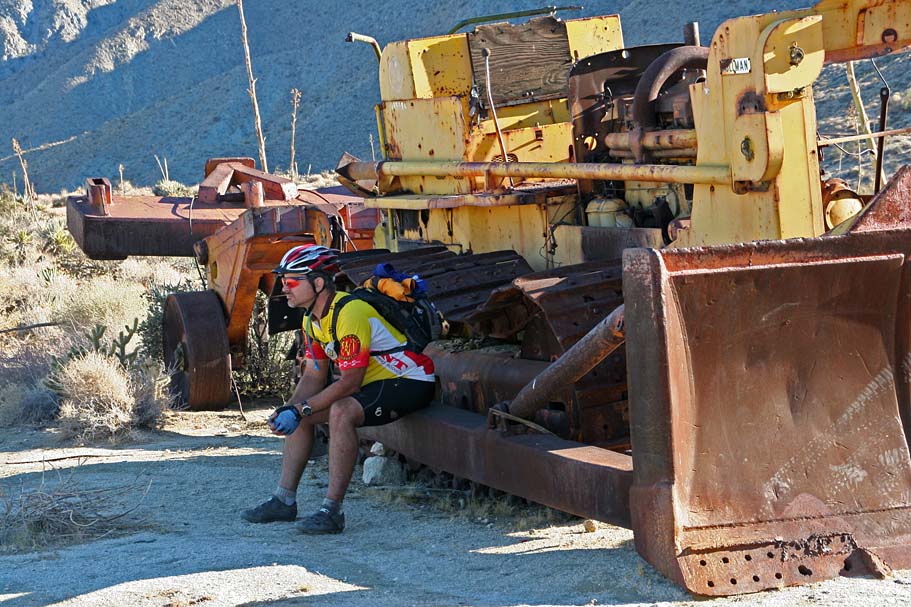
here and travel slightly uphill for .6 miles to Mike's Desert Oasis. Lord knows
how this place got this name because the only way you are going to find any
shade is to climb under the picnic table or crawl under and the old bulldozer
left here. After taking in the "splendor" of the place, catch
the single track off to left of Dunn Road directly across from the old
dozer.
At 17.1 miles you will
thankfully reach Dunn Road. Hang a left
here and travel slightly uphill for .6 miles to Mike's Desert Oasis. Lord knows
how this place got this name because the only way you are going to find any
shade is to climb under the picnic table or crawl under and the old bulldozer
left here. After taking in the "splendor" of the place, catch
the single track off to left of Dunn Road directly across from the old
dozer.
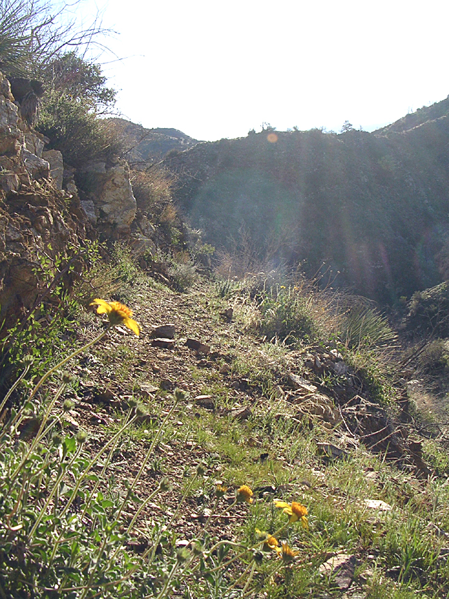
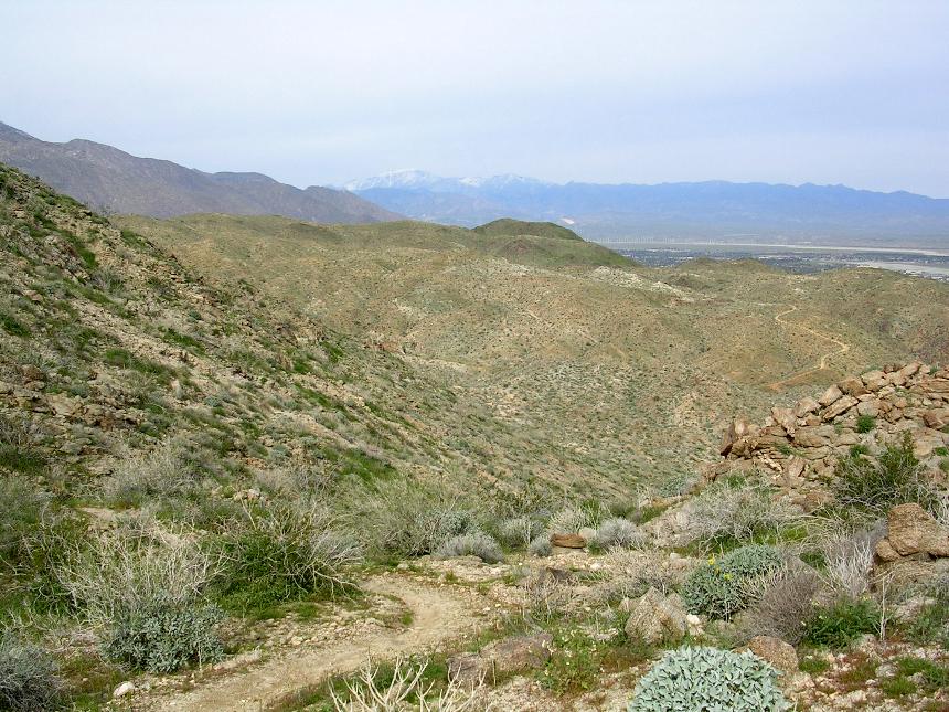
The Hahn Buena Vista Trail
 (17.7mi) The singletrack starts off as a manageable uphill for a little
offer half a mile to the Hahn Buena Vista sign. (18.4mi) There are some truly
inspiring views to take in from the point. Take it in now because you will
not want to stop on the rest of the ride. From here you get to
enjoy a 3 mile descent down the rest of the Hahn Buena Vista trail. (21.4mi)
(17.7mi) The singletrack starts off as a manageable uphill for a little
offer half a mile to the Hahn Buena Vista sign. (18.4mi) There are some truly
inspiring views to take in from the point. Take it in now because you will
not want to stop on the rest of the ride. From here you get to
enjoy a 3 mile descent down the rest of the Hahn Buena Vista trail. (21.4mi)
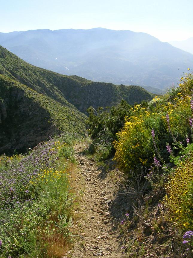
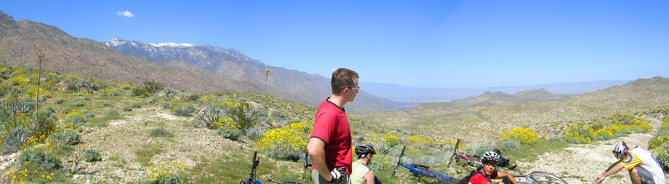
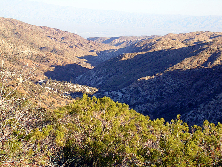
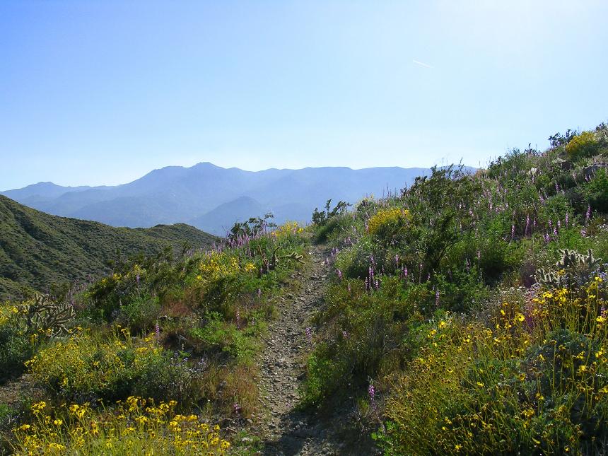
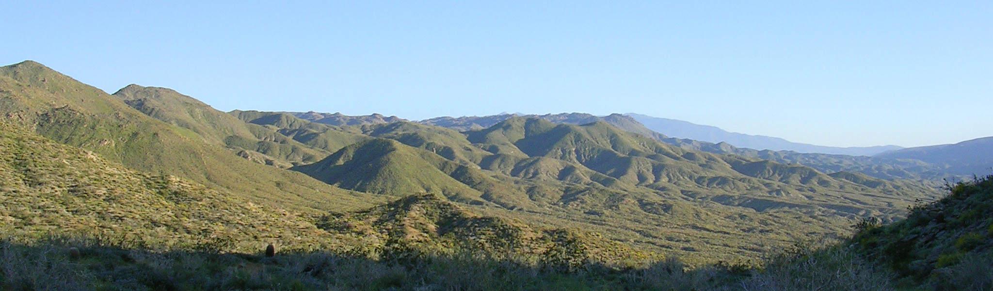
Some of the views from along the Hahn Buena Vista trail
 After enjoying the seeming endless descent of The Han Buena Vista trail you will go down into a wash with the hillside directly in front of you making a T-junction. To your left you should see the signpost marker annotating the junction with the Vanderenter trail. You are at Waypoint PC-34
 Turn right at this junction and trail about .1 miles until you see a trail going out of the wash to your right as well as another signpost. This signpost will
seem confusing particularly if you are planning to take my preferred route I describe in just a bit. Just remember to take the trail to the right
and go up the short but steep trail out of the wash. (The signpost will say Dunn Road and Trading Post for the direction you are going.
Turn right at this junction and trail about .1 miles until you see a trail going out of the wash to your right as well as another signpost. This signpost will
seem confusing particularly if you are planning to take my preferred route I describe in just a bit. Just remember to take the trail to the right
and go up the short but steep trail out of the wash. (The signpost will say Dunn Road and Trading Post for the direction you are going.
 You are now on the Cathedral Canyon trail and you will be doing some rolling up and downs while gradually gaining elevation. After 1/4 of a mile you will
come to another junction marked by a signpost. (Waypoint PC-35)
You are now on the Cathedral Canyon trail and you will be doing some rolling up and downs while gradually gaining elevation. After 1/4 of a mile you will
come to another junction marked by a signpost. (Waypoint PC-35)
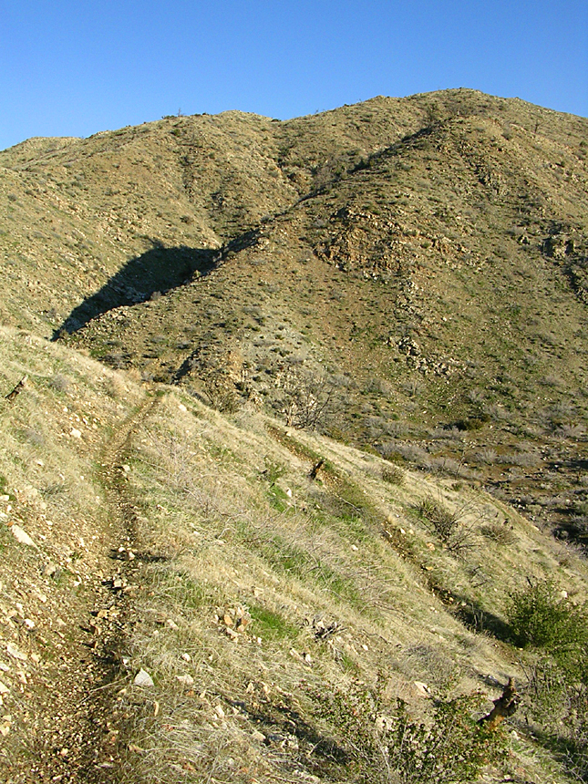
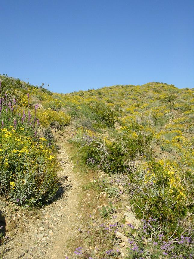
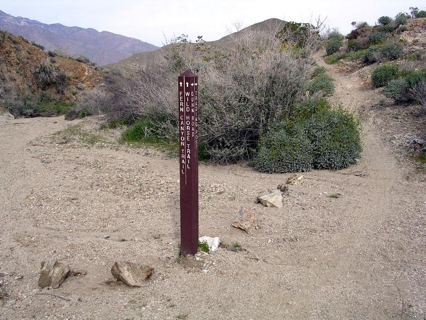
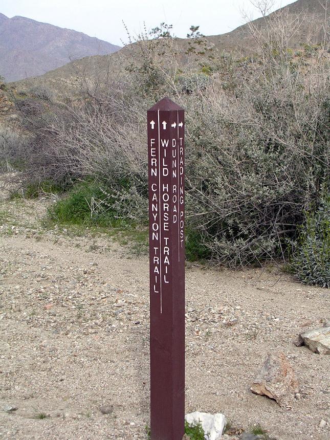
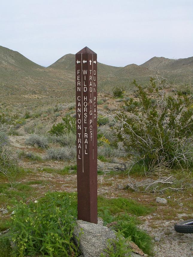
Note: In the past I would turn left here and take the Fern Canyon trail over to the Wild Horse Trail. Sometime in 2005 this route became stupidly sandy and a real slog fest after monsoon rains dumped upwards to a foot of loose sand onto most of the trail. A new trail was created later that same year that cuts out most of the Fern Canyon sand slog. This trail that I describe below is unsigned and I can not assure you that it is a 100% blessed trail. It is well used and has been getting routine maintenance since it was created.
Should you decide to take the entire Fern Canyon Trail to the Wild Horse Trail
 To
the left I have highlighted the route you will taking up to the distant saddle
to help with your visual bearings. Make a left at the signpost onto the Fern
Canyon and travel .5 miles downhill. You will go across and down a
narrow wash in a few places that will have you slogging in the sand a little but
it is quickly over. Soon the trail will open up in what appears to
be a very wide wash, however the ground is quite firm. The trail will turn to
the left (west) and you will see a line of three signposts. It is pretty
hard not to be able to figure out this route. Once you take the left and
you will travel west for only 50 or so yards and hang a right at the second sign
post and start a gradual climb up another wash. Just so you
know the 3rd signpost will inform you that mountain bikes are not allowed any
further west down the wash. From the turn at the second sign you
will ride/hike/slog up a very sandy wash gaining about 480 feet over 1.6 miles
up to the a saddle where The Clara Burgess, Wild Horse and Fern Canyon trails
meet (Waypoint 022).
To
the left I have highlighted the route you will taking up to the distant saddle
to help with your visual bearings. Make a left at the signpost onto the Fern
Canyon and travel .5 miles downhill. You will go across and down a
narrow wash in a few places that will have you slogging in the sand a little but
it is quickly over. Soon the trail will open up in what appears to
be a very wide wash, however the ground is quite firm. The trail will turn to
the left (west) and you will see a line of three signposts. It is pretty
hard not to be able to figure out this route. Once you take the left and
you will travel west for only 50 or so yards and hang a right at the second sign
post and start a gradual climb up another wash. Just so you
know the 3rd signpost will inform you that mountain bikes are not allowed any
further west down the wash. From the turn at the second sign you
will ride/hike/slog up a very sandy wash gaining about 480 feet over 1.6 miles
up to the a saddle where The Clara Burgess, Wild Horse and Fern Canyon trails
meet (Waypoint 022).
The New Preferred Route
 Continuing
straight from the signpost, stay on the Cathedral Canyon trail. The
trail gains elevation rather mildly but has numerous quick up and downs across
firmly packed and rocky washes. If you can stay off the brakes on
the way down you will normally roll at least halfway up the other side. In
1.5 miles, the Cathedral Canyon trail intersects Dunn Road.
(Waypoint PC-43)
Continuing
straight from the signpost, stay on the Cathedral Canyon trail. The
trail gains elevation rather mildly but has numerous quick up and downs across
firmly packed and rocky washes. If you can stay off the brakes on
the way down you will normally roll at least halfway up the other side. In
1.5 miles, the Cathedral Canyon trail intersects Dunn Road.
(Waypoint PC-43)
Cathedral Canyon Trail
Once back on Dunn Road turn left and go .2 miles. Look very closely at the left side of the road as you will see an unsigned trail going off to the left. Look for what is usually numerous bike tracks. (Waypoint PC-44)
This is a major decision point - Which route to get into Palm Springs via the Goat Trails
 You can take the trail to the left and
cut over to the Fern Canyon trail and
come into the Goat Trails from the south via the Wild Horse Trail or you can
continue straight on Dunn Road and connect with an old 4x4 trail and go into the Goat Trails from
the east. Either route is pretty
good but I prefer to the Fern Canyon/Wild Horse Route because you will spent
more time on single track and the afternoon light while riding along the Wild
Horse ridgeline is simply fantastic. If you take the Fern Canyon
route you are committed to this route while taking the Dunn Road route gives you
bailout options. If you are feeling pretty beat, or you are
concerned about how much daylight you have left, then go the Dunn Road
route. Otherwise I would say go the route of Fern Canyon and the
Wild Horse trail.
You can take the trail to the left and
cut over to the Fern Canyon trail and
come into the Goat Trails from the south via the Wild Horse Trail or you can
continue straight on Dunn Road and connect with an old 4x4 trail and go into the Goat Trails from
the east. Either route is pretty
good but I prefer to the Fern Canyon/Wild Horse Route because you will spent
more time on single track and the afternoon light while riding along the Wild
Horse ridgeline is simply fantastic. If you take the Fern Canyon
route you are committed to this route while taking the Dunn Road route gives you
bailout options. If you are feeling pretty beat, or you are
concerned about how much daylight you have left, then go the Dunn Road
route. Otherwise I would say go the route of Fern Canyon and the
Wild Horse trail.
Cutover Trail to Wild Horse Route
 Turn
left onto the unsigned trail (Waypoint PC-44) and follow the mostly firm trail
that serpentines its way west-northwest. Take note of a solitarily hill
just short of the main mountainside to the west less than a mile a way.
The trail should keep that hill directly ahead or a little to the left.
There is at least one new split in this trail that goes to your left 1/2 mile into
this trail. If that hill starts staying on your right you have
missed the split. If you pay attention at .75 miles the trail bends to
the right merges onto the the Fern Canyon trail heading north and up the canyon.
From this merge it is another .7 miles up to the junction the Fern Canyon, Wild
Horse and Clara Burgess trails. There are some slogging spots here and
there is much less of it than if you had taken the original route.
Turn
left onto the unsigned trail (Waypoint PC-44) and follow the mostly firm trail
that serpentines its way west-northwest. Take note of a solitarily hill
just short of the main mountainside to the west less than a mile a way.
The trail should keep that hill directly ahead or a little to the left.
There is at least one new split in this trail that goes to your left 1/2 mile into
this trail. If that hill starts staying on your right you have
missed the split. If you pay attention at .75 miles the trail bends to
the right merges onto the the Fern Canyon trail heading north and up the canyon.
From this merge it is another .7 miles up to the junction the Fern Canyon, Wild
Horse and Clara Burgess trails. There are some slogging spots here and
there is much less of it than if you had taken the original route.
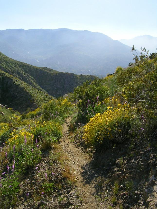
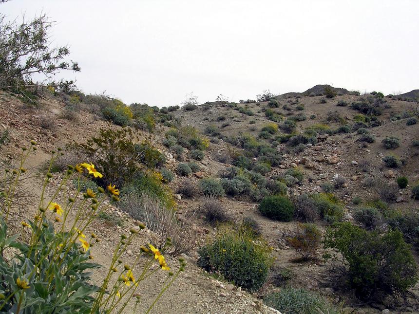
 Looking back down Fern Canyon to the North in the afternoon light.

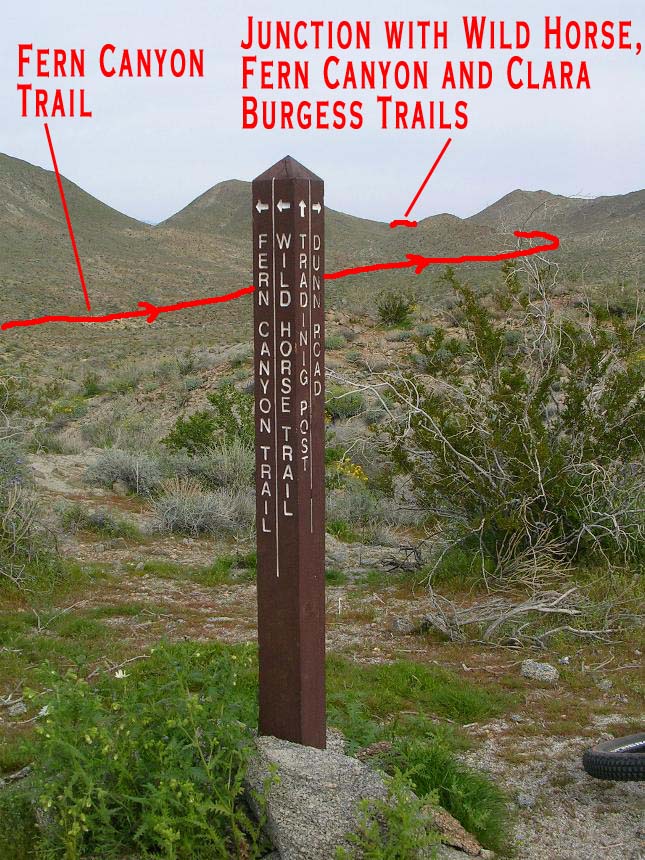
 From
the junction of Wild Horse, Fern Canyon, and Clara Burgess, turn left and uphill. The uphill is over in very short
order and you get into some descending or speedy pedaling as you ride along the
spine of a very picturesque ridge top. The ridge top will roll up to peak
and then will descend through a series of steep switchbacks. to a four-way
junction. The Garstin trail goes straight ahead, and I forget what the
trail is that goes downhill to the left. You want to turn right
(north) and proceed downhill. This will soon flatten out and and will even climb
a little until .6 miles from where you made the right you will come out to
T-junction. Turn right and uphill and almost immediately you will take the
trail that splits off to your left and uphill. After maybe 20 yards
where the trail peaks out look for a single track off to your left. It is
easy to miss where the single track splits off from here, but it is easy to see further
down the hillside to your left.
From
the junction of Wild Horse, Fern Canyon, and Clara Burgess, turn left and uphill. The uphill is over in very short
order and you get into some descending or speedy pedaling as you ride along the
spine of a very picturesque ridge top. The ridge top will roll up to peak
and then will descend through a series of steep switchbacks. to a four-way
junction. The Garstin trail goes straight ahead, and I forget what the
trail is that goes downhill to the left. You want to turn right
(north) and proceed downhill. This will soon flatten out and and will even climb
a little until .6 miles from where you made the right you will come out to
T-junction. Turn right and uphill and almost immediately you will take the
trail that splits off to your left and uphill. After maybe 20 yards
where the trail peaks out look for a single track off to your left. It is
easy to miss where the single track splits off from here, but it is easy to see further
down the hillside to your left.

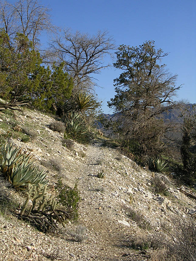
 Once you get on this trail you are in for treat this singletrack weaves back and forth
as it overall heads northeast and
downhill, although there are a view sections you have to power up short
rises. This will continue on for a little under a mile before it rolls out
onto double track. You will go maybe 30 yards are so and you will find
another single track going off to the left again. Take it enjoy some more
of the same until it once again dumps out back onto double track.
You should be approaching Waypoint 15 on the map. You will see a
single track off to the left that looks to parallel the double track. Take this
single track. (Have no worries if you miss this trail as the double track
will take you to the same place)
Once you get on this trail you are in for treat this singletrack weaves back and forth
as it overall heads northeast and
downhill, although there are a view sections you have to power up short
rises. This will continue on for a little under a mile before it rolls out
onto double track. You will go maybe 30 yards are so and you will find
another single track going off to the left again. Take it enjoy some more
of the same until it once again dumps out back onto double track.
You should be approaching Waypoint 15 on the map. You will see a
single track off to the left that looks to parallel the double track. Take this
single track. (Have no worries if you miss this trail as the double track
will take you to the same place)

 This
next bit of single track is the most technical bit of
trail you will have come across on this ride. While not gnarly you
might be tired at this point which could make things a little more
difficult. After .6 miles on this steep single track you come back out
onto a double track by a set of water towers. (This is the same double
track you peel off of at the top of this single track). Hang a left
here and go down the hill for less that half a mile and go around the gate and
you are back at the Rim Rock Shopping Center and your waiting
vehicle.
This
next bit of single track is the most technical bit of
trail you will have come across on this ride. While not gnarly you
might be tired at this point which could make things a little more
difficult. After .6 miles on this steep single track you come back out
onto a double track by a set of water towers. (This is the same double
track you peel off of at the top of this single track). Hang a left
here and go down the hill for less that half a mile and go around the gate and
you are back at the Rim Rock Shopping Center and your waiting
vehicle.
Dunn Road Route
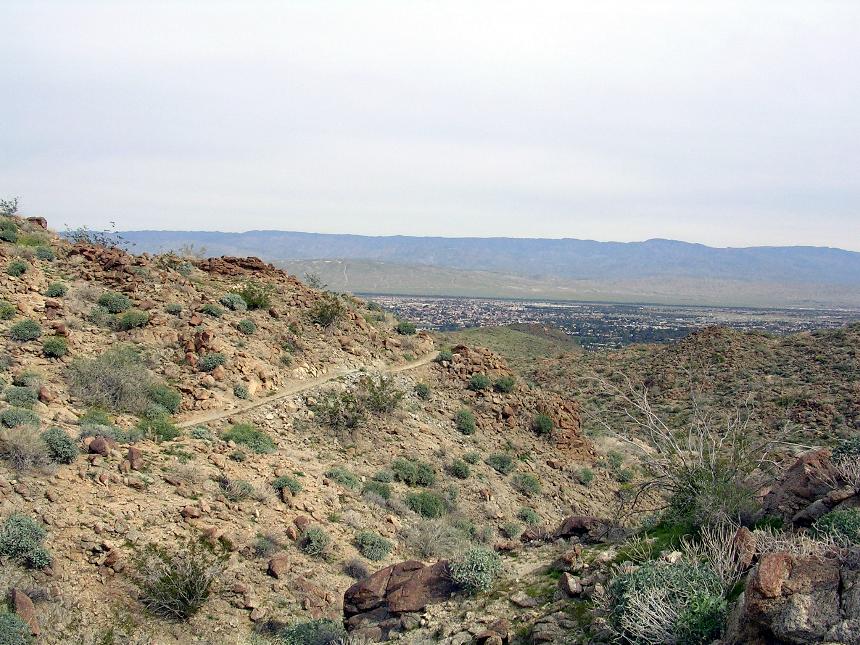
If you take the Dunn Road route into Goat trails, continue straight on Dunn Road at the junction of the unsigned trail. Dunn road is gradually climbing at this point, but it will soon turn downhill You will be on this road for about .9 miles. Be on the lookout for a 4WD road heading sharply off to the left where Dunn Road make a downhill right turn. You will immediately see a large mound of dirt blocking the 4WD road off. Just to the left of this mound is a space for bikes to go through.
BAILOUT OPTION #1 - You can opt not to take the 4WD road and stay on Dunn Road. All you have to do is stay on the main dirt road and drop 900 feet of elevation in 1.3 miles where you will come out at a city street. You can either take the streets downhill until you come to Palm Canyon Drive/Highway 111, or you can follow the levy that you will see off to your right until it passes under Palm Canyon Drive/Highway 111. Whichever way you take when you get onto Palm Canyon Drive you will take it west back towards the Rimrock Shopping Center.
So if you are not going to bailout go around the mound and ride this old 4WD road for .8 miles. Near the beginning of a climb, you'll see a rock cairn and a single-track that has seen plenty of traffic on it off to your left. Take it and you will descend down into the "Goat Trails" area.
BAILOUT OPTION #2 - If you stay on the 4WD road you will continue heading north and downhill where you will eventually come out on Palm Canyon Drive/Highway 111 where you can turn left and ride to Rimrock Shopping Center.
So you did not bail and took the single track off the left. You will quickly follow a steep and loose section of rocky trail that will loose 250 feet in 3/10ths of mile where you will with come to the junction of the Clara Burgess Trail marked with a stone cairn. Turn to the right and downhill on the Clara Burgess trail for .2 miles to the large metal sign marking the trailhead.
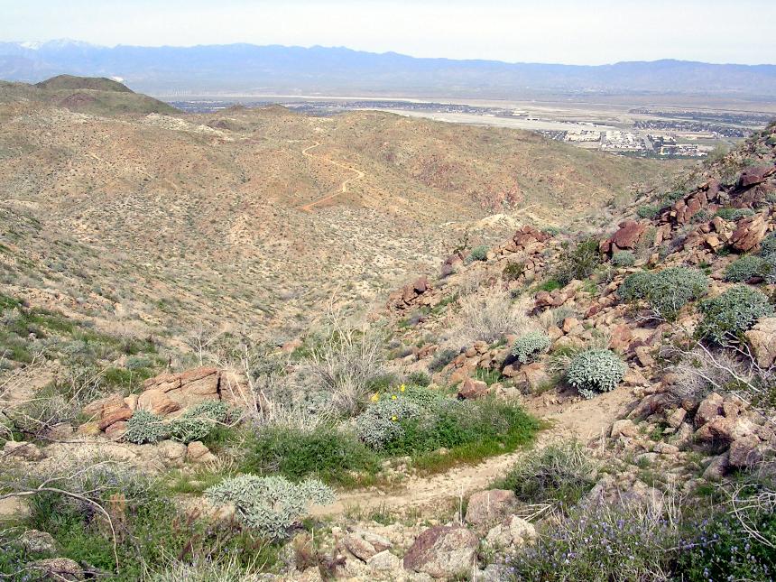
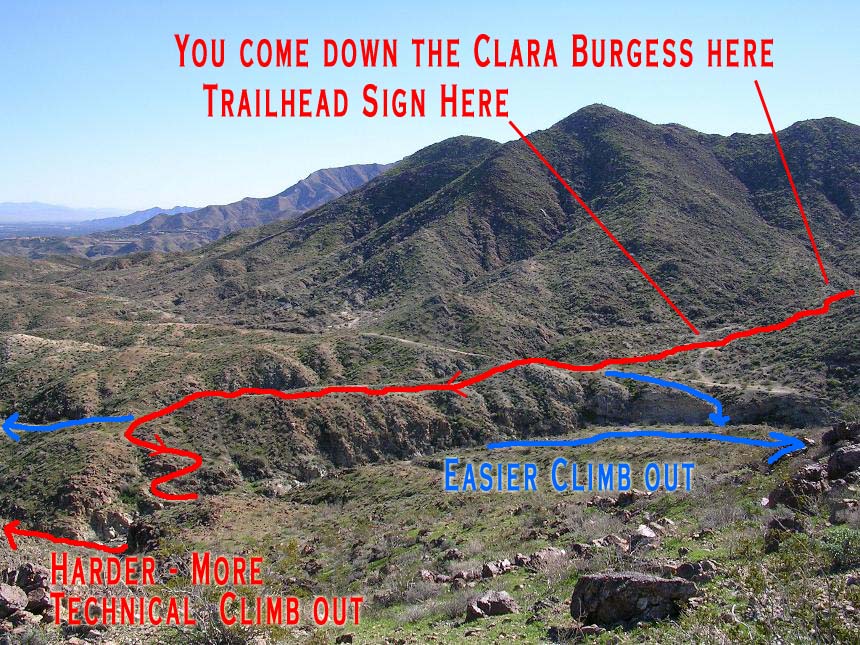 Once
at the Clara Burgess trailhead, stand with the your back to the trail
marker. You will see Eagle Canyon in front running from left to
right. You will see a few single tracks on the far side of the
canyon. As well a double track further in the distance to the
right. There is a myriad of trails on in the Goat Trails area an
there is really no wrong way to go. However when you get on the other side of
the canyon the trails to your left offer a more gradual and less technical climb
out of the canyon. Almost directly in front of you is a trail that
goes over a rise. Take this trail grab one of a couple of single
tracks that will take you down into the canyon/wash. Once across the
wash pick your poison. for the climb. The photo to the left was
taken on the far side of the canyon looking back towards the Clara Burgess
trailhead sign.
Once
at the Clara Burgess trailhead, stand with the your back to the trail
marker. You will see Eagle Canyon in front running from left to
right. You will see a few single tracks on the far side of the
canyon. As well a double track further in the distance to the
right. There is a myriad of trails on in the Goat Trails area an
there is really no wrong way to go. However when you get on the other side of
the canyon the trails to your left offer a more gradual and less technical climb
out of the canyon. Almost directly in front of you is a trail that
goes over a rise. Take this trail grab one of a couple of single
tracks that will take you down into the canyon/wash. Once across the
wash pick your poison. for the climb. The photo to the left was
taken on the far side of the canyon looking back towards the Clara Burgess
trailhead sign.
Once you climb up to the other side of the canyon views of Palm Springs and the airport should come into view. You will eventually end up on a bit of double track. From anyplace you come out on the double track you can head north and generally downhill which will eventually come to a spot where the double track turns significantly downhill. This spot is waypoint 15 on the map. You will see a single track off to the left tha looks to parallel the double track. Take this single track. (Have no worries if you miss this trail as the double track will take you to the same place)
This is next bit of single track is the most technical bit of trail you will have come across on this ride. While not gnarly you might be tired at this point which could make things a little more difficult. After .6 miles on this steep single track you come back out onto a double track by a set of water towers. (This is the same double track you peel off of at the top of this single track). Hang a left here and go down the hill for less that half a mile and go around the gate and you are back at the Rim Rock Shopping Center and your waiting vehicle.
Pinyon Flats - Palm Canyon Route
Linked above is another popular route for doing the Palm Canyon Epic which has you using the Pinyon Flats trail. This route has a different start point but connects to the proper Palm Canyon trail after 4.6 miles at Omscott Creek. Please see my Pinyon Flats Loop page for trailhead directions. I recommend you doing the Classic Palm Canyon start your first time doing Palm Canyon vice this route. This is a great route as well but you should do the classic first.
VIDEO