El Moro Canyon - Crystal Cove State Park
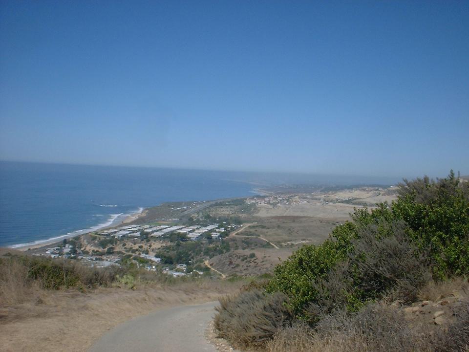
Crystal Cove State Park (AKA El Moro Canyon) is located along the coast between Laguna Beach and Newport Beach. The park offers trails for nearly all level of riders. While most of the trails are fireroads there are some exceptionally nice singletracks in the park that will put a smile on most peoples face. Aerobically this is a moderate (according to your fitness level) ride where the climbs tend to be a little on the steep side in places. However, the climbs are well worth it as the ridge tops offer some stunning views of the Pacific Ocean to the west and Santiago Peak to the west.. While this is a multiuse park, it is known as a mountain biking place. There are plenty of trail runners that use the park as well so be on gaurd.
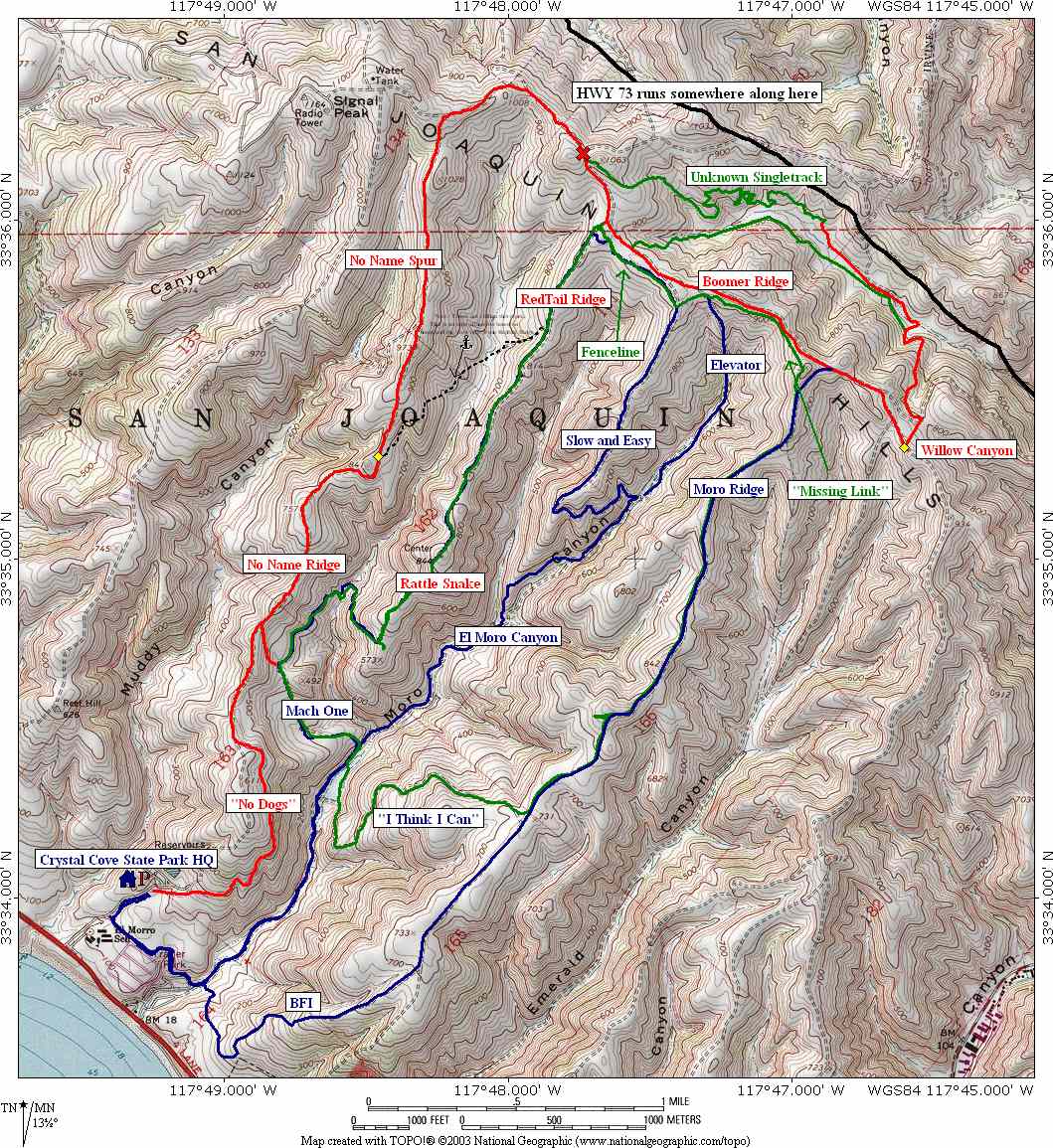 Here
is a map of the area
Here
is a map of the area
Download the TOPO File here.
![]() This is profile of one of the routes I describe below
This is profile of one of the routes I describe below
Directions: Crystal Cove Sate Park is located 1.5 miles north of Laguna Beach and 3.5 miles south of Newport Beach. Take Pacific Coast Highway north or south according to which town you started from and look for the sign for El Moro Canyon. It is just north of the El Moro Trailer Park so according to which way you are coming you are either almost there or just missed it. Turn east onto El Moro Drive and go past the booth and park inside the park ($6 day use fee) next to the Visitor Center. If you are feeling a little cheap, there is a school right next to the park where you can park and avoid the fee. Detailed maps can be purchased at the Visitor Center.
For additional information on the park, check out their website.
Trail Notes:
I normally do not start from the park headquarters
because I like to combine the Laguna Coast
Wilderness Park and El Moro together. However the route described here
is the route I would take if I started from the Visitors center. It is around 11
miles long and includes 1400 total feet of climbing.
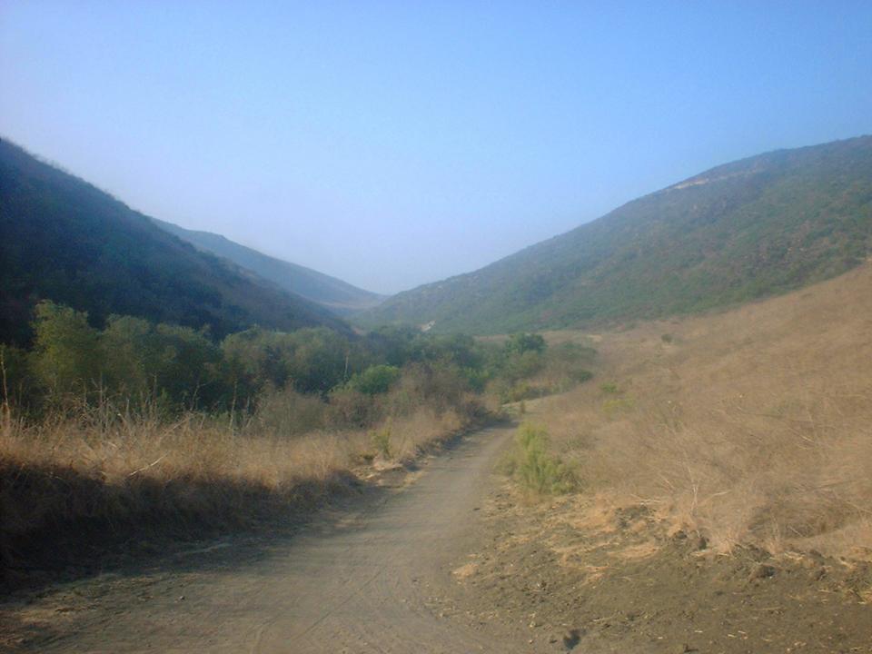 From
the Visitor Center parking lot stay on the main dirt road which is the El Moro
Canyon trail for 1.75 miles. From there you will hang a right onto the
East Side Cutover (Also known as the "I think I can" trail.
Hopefully you warmed up by the time you hit this trail as it is 1.25 miles
long and gains 550 feet. Where it joins up with the El Moro Ridge trail.
You should have some good views of the canyons and Pacific Ocean by
now.
From
the Visitor Center parking lot stay on the main dirt road which is the El Moro
Canyon trail for 1.75 miles. From there you will hang a right onto the
East Side Cutover (Also known as the "I think I can" trail.
Hopefully you warmed up by the time you hit this trail as it is 1.25 miles
long and gains 550 feet. Where it joins up with the El Moro Ridge trail.
You should have some good views of the canyons and Pacific Ocean by
now.
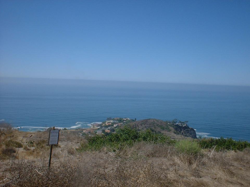
You will hang a left here and continue up El Moro Ridge. Worth noting is that if you where to hang a right here you could bomb down the ridge where the hardest part of the trail is looking at because the views of the Pacific are absolutely stunning. At a V in the trail bear right and continue down the BFI trail that will eventually take you back to the El Moro Canyon trail.


 Enough
of the side notes, you will hang a left on El Moro Ridge and continue
uphill for another 2 miles of mostly gradual climbing. Here you will see a
single track heading off to the left. This trail called "The Missing
Link". This trail is quite fun with some small drops here and
there as the trail weaves back and forth along the ridge line. As
you go along this trail you will pass by where the Elevator Trail (fire road)
heads off to the left. Continue along the singletrack. Shortly there
after you will meet up with the "Slow and Easy" trail. There
will be a gate off to your right. The single track continues along just to
the left of gate along a fence, hence the trail name of "Fenceline".
You will have just under a half mile of single track fun before Fenceline joins
up with the Redtail Ridge trail.
Enough
of the side notes, you will hang a left on El Moro Ridge and continue
uphill for another 2 miles of mostly gradual climbing. Here you will see a
single track heading off to the left. This trail called "The Missing
Link". This trail is quite fun with some small drops here and
there as the trail weaves back and forth along the ridge line. As
you go along this trail you will pass by where the Elevator Trail (fire road)
heads off to the left. Continue along the singletrack. Shortly there
after you will meet up with the "Slow and Easy" trail. There
will be a gate off to your right. The single track continues along just to
the left of gate along a fence, hence the trail name of "Fenceline".
You will have just under a half mile of single track fun before Fenceline joins
up with the Redtail Ridge trail.

 From
here you will hang a left onto the Redtail Ridge Trail. The trail is a
fireroad at this point but a half mile down the trail there is a Y intersection
where you will bear the left. (The trail that heads off to the right and
downhill is Deer Canyon trail.) Redtail Ridge Trail narrows into
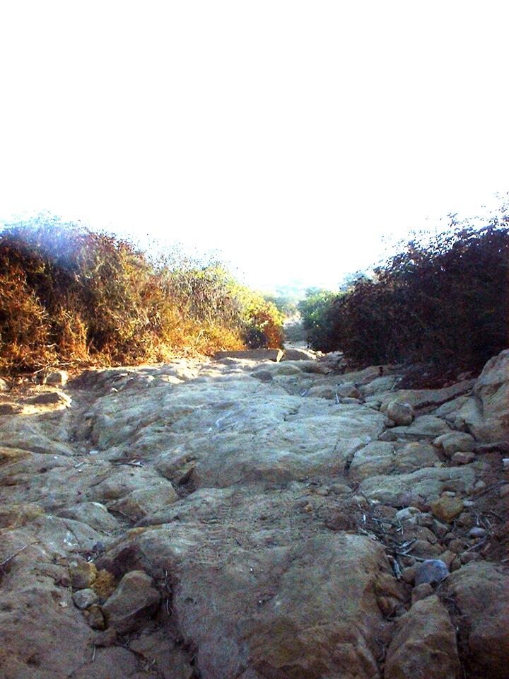
singletrack and transitions into Rattlesnake Trail. Rattlesnake Trail is a
wonderful singletrack which does a little roller coaster action with a little
more ups than downs until it peaks out at the ridgetop. From this point
the trail starts descending and the trail get a little on the gnarly side as the
trail gets steep with some ruts and rocks that place a premium on line placement
and momentum. The technical stuff is over all to quickly as the the trail
flattens out just before it comes to a T-junction by a power pole.
From
here you will hang a left onto the Redtail Ridge Trail. The trail is a
fireroad at this point but a half mile down the trail there is a Y intersection
where you will bear the left. (The trail that heads off to the right and
downhill is Deer Canyon trail.) Redtail Ridge Trail narrows into
singletrack and transitions into Rattlesnake Trail. Rattlesnake Trail is a
wonderful singletrack which does a little roller coaster action with a little
more ups than downs until it peaks out at the ridgetop. From this point
the trail starts descending and the trail get a little on the gnarly side as the
trail gets steep with some ruts and rocks that place a premium on line placement
and momentum. The technical stuff is over all to quickly as the the trail
flattens out just before it comes to a T-junction by a power pole.
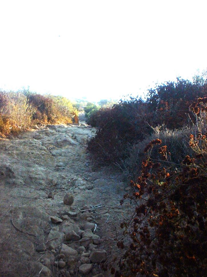
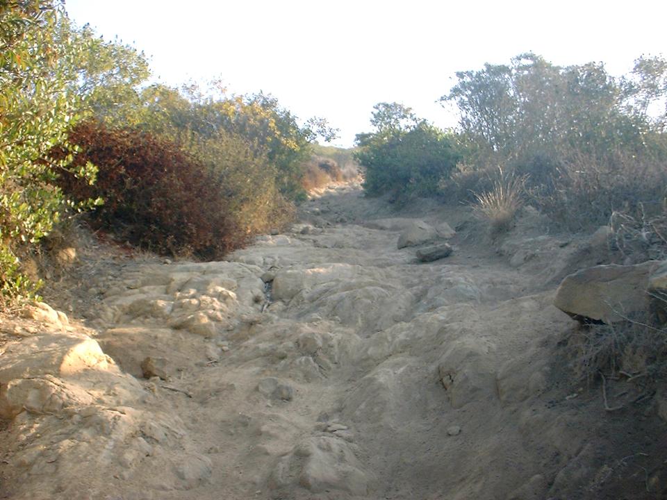
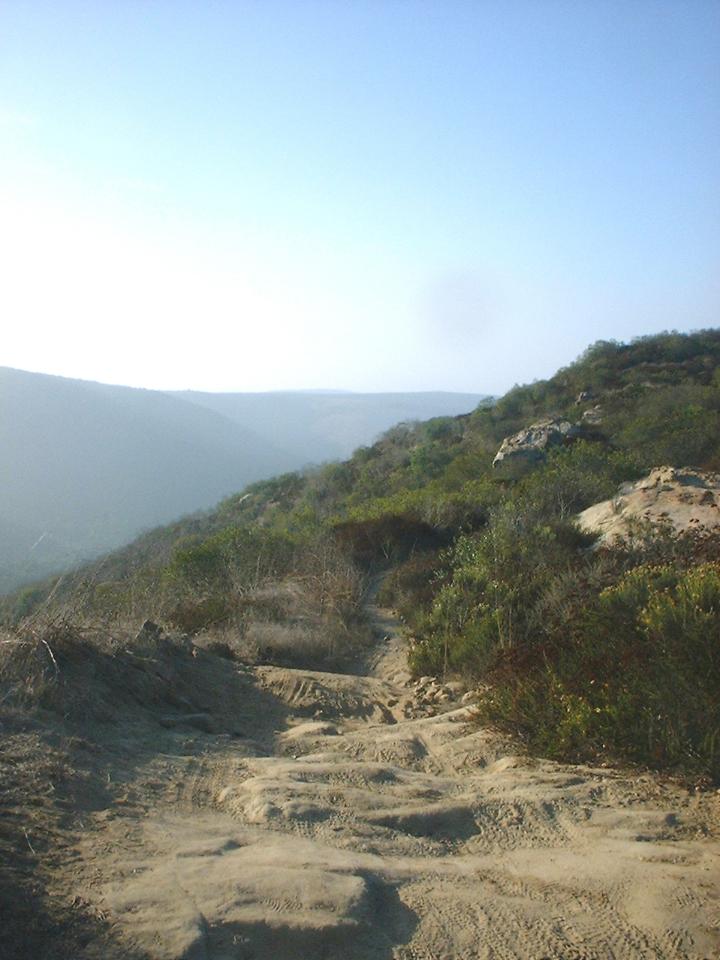
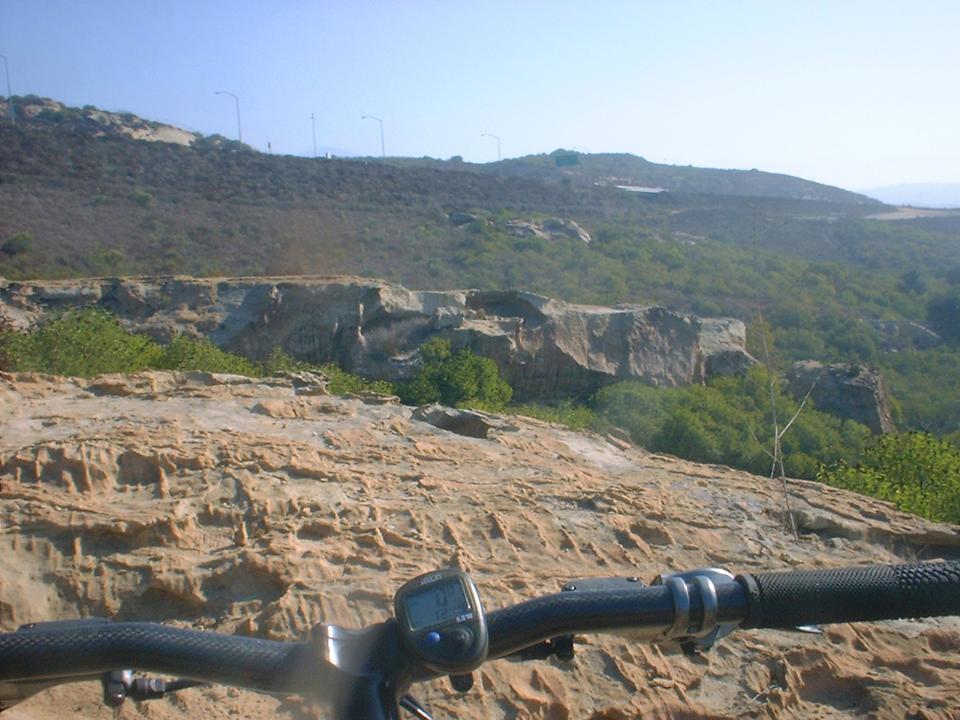
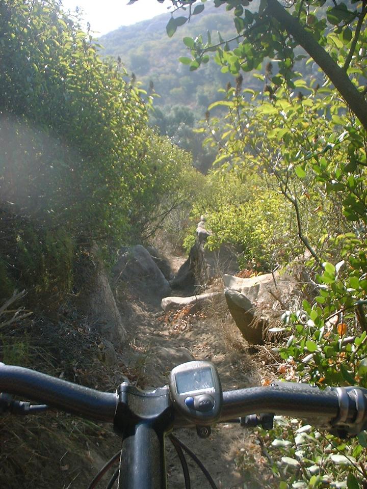
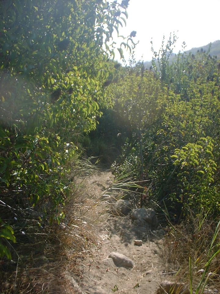
More Pictures of Rattlesnake
At the T-junction hang a right and bomb down the fire road. You will soon be climbing again after a sharp left hand turn. Climb for a bit at .8 miles from the T-junction you will come to another T-junction. This is the East side cutover trail which is also known as "Mach One". Hang a left here and you will soon see why it is called that as you fly down the hill back down to the El Moro Canyon trail. Once back down at the bottom hang a right a few hundred yards down the trail you will pass by the "I think I can" trail that you went up at the beginning of the ride. Continue along El Moro Canyon back to your car.
There are plenty of other trails in the park to check out. I highly recommend picking up a map from the visitors center. In particular look for Franko's Map of the South Coast Wilderness. It will run you $4 but it is printed on waterproof, rip-proof plastic that will hold up to some abuse.
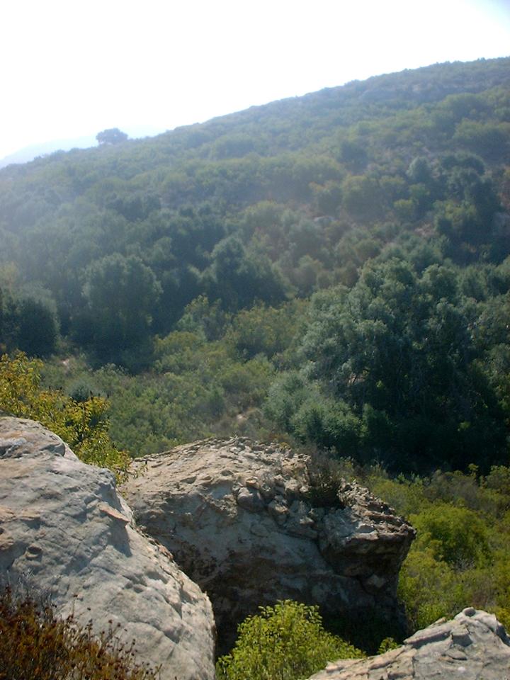
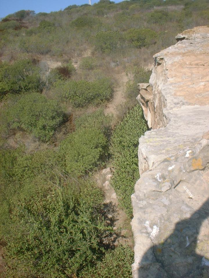
Other Pictures from around the El Moro Canyon area.