Flightline - Rest In Peace
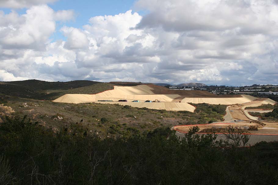
Flightline is closed with over half the area bulldozed for construction with other half is being protected as habitat. This page is basically a "Memorial" page now.
Flightline is officially closed until further notice. The bridge and structures shown on this page have been removed and a chain link fence has been erected at the trailhead with no trespassing signs. There is still hope that what is left of this area can be re-opened for bicycle use. You can help by reading more about the issues surrounding this area and sign the petition to help keep Flightline reopened for mountain biking.
Goto
Ride
Flightline,
Sign the Petition and find out how you can help!
 "Flightline" is an area where Oceanside, Vista and Carlsbad all
meet near the Palomar Airport. The planes typically
are lining up their landing approach over the trail system, hence the name
"Flightline". There are numerous trails meshing around the
entire area. Nearly all of the trails have been built by Mountain Bikers
starting in the early 80s (So I am told). In early 2005, nearly half of
the trails here were destroyed when a development project was started on
southern end of the area. Over the course of 2005 the local riders
did a tremendous job of connecting the orphaned trails back together as
well as creating new trails. One person in particular
single-handedly reestablished easy access to this area by building the
Safety Center Trail. This was some truly exceptional and hard work
for one man to perform. He asked not to be mentioned, but give him and the
rest of the builders a BIG THANK YOU by taking care of the trails by not dragging
you brakes through the turns, and fixing something if you break it.
"Flightline" is an area where Oceanside, Vista and Carlsbad all
meet near the Palomar Airport. The planes typically
are lining up their landing approach over the trail system, hence the name
"Flightline". There are numerous trails meshing around the
entire area. Nearly all of the trails have been built by Mountain Bikers
starting in the early 80s (So I am told). In early 2005, nearly half of
the trails here were destroyed when a development project was started on
southern end of the area. Over the course of 2005 the local riders
did a tremendous job of connecting the orphaned trails back together as
well as creating new trails. One person in particular
single-handedly reestablished easy access to this area by building the
Safety Center Trail. This was some truly exceptional and hard work
for one man to perform. He asked not to be mentioned, but give him and the
rest of the builders a BIG THANK YOU by taking care of the trails by not dragging
you brakes through the turns, and fixing something if you break it.

 While
Flightline was never considered an epic ride, it was a great North County ride,
and I still consider it an interesting ride, although somewhat shortened in length.. If you live
anywhere near Carlsbad you should put this on your list of local training rides,
particularly if you connect up to Calvera Lake.
For those who live down near San Diego it is worth a trip to the northern part
of the county to check it out, but remember this place takes a visit or two to
figure out as there is a maze of trails going all over and you can bet
something new is in the works so your first visit might be a navigationally frustrating
unless you go with someone who knows it well. During the summertime both Flightline and
its neighbor, Calvera Lake, get a nice ocean breeze
to keep things cool while the inland rides are baking. Ninety-five percent of the trails are
singletrack so you are bound to find some parts of it that you like. There
are many permutations of trails that you can connect up for a really good
workout while having fun loops. My best advice is to get out there and
explore.
While
Flightline was never considered an epic ride, it was a great North County ride,
and I still consider it an interesting ride, although somewhat shortened in length.. If you live
anywhere near Carlsbad you should put this on your list of local training rides,
particularly if you connect up to Calvera Lake.
For those who live down near San Diego it is worth a trip to the northern part
of the county to check it out, but remember this place takes a visit or two to
figure out as there is a maze of trails going all over and you can bet
something new is in the works so your first visit might be a navigationally frustrating
unless you go with someone who knows it well. During the summertime both Flightline and
its neighbor, Calvera Lake, get a nice ocean breeze
to keep things cool while the inland rides are baking. Ninety-five percent of the trails are
singletrack so you are bound to find some parts of it that you like. There
are many permutations of trails that you can connect up for a really good
workout while having fun loops. My best advice is to get out there and
explore.
Directions: Until all the construction is over your options are limited compared to what they used to be.
| Areas North: From I-5 exit HWY 78 east. Take the El Camino Real exit and go right. Go right on El Camino Real (south). Take El Camino Real about 5.5 miles to Faraday Ave. Turn left at the first stop light (Faraday Ave), then turn left at the first stop sign about 1/2 mile down the road. The road will bear to the right as it become a one-way street just as you pass a fire station. Just beyond the fire station is a skate park. Park in the skake park parking lot on your right just after the skate park. The trail starts is in the back corner of the parking lot on the other side of a rain culvert. This trail will take you down into what is left of the trail system. | |
| Areas South: From I-5 exit Palomar Airport Rd. Take Palomar Airport road east about 4.5 miles to El Camino Real. Go left on El Camino Real (north). Turn right at the first stop light (Faraday Ave), then turn left at the first stop sign about 1/2 mile down the road. The road will bear to the right as it become a one-way street just as you pass a fire station. Just beyond the fire station is a skate park. Park in the skake park parking lot on your right just after the skate park. The trail starts is in the back corner of the parking lot on the other side of a rain culvert. This trail will take you down into what is left of the trail system. | |
| Mo Bigger Ride: The connecter between Calvera Lake and Flightline has been revamped over the summer and provides the option for a big ride. See notes below |
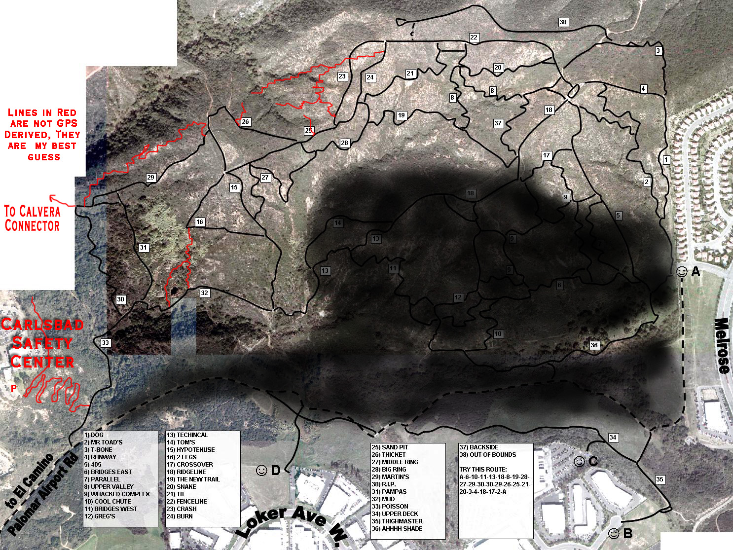
 On
the left is an updated version of Martin Navarre's 2003 map. I have shaded
in the approximate area that has been destroyed and have roughly sketched some of
the new trails. On the right I have included the original version of this
map for historical purposes.
I will be referring to the trail names on this map in
the description below.
On
the left is an updated version of Martin Navarre's 2003 map. I have shaded
in the approximate area that has been destroyed and have roughly sketched some of
the new trails. On the right I have included the original version of this
map for historical purposes.
I will be referring to the trail names on this map in
the description below.
NOTE: Martin sent me an updated map but nearly as soon as he pressed the send button, new stuff had already been cut.
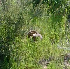
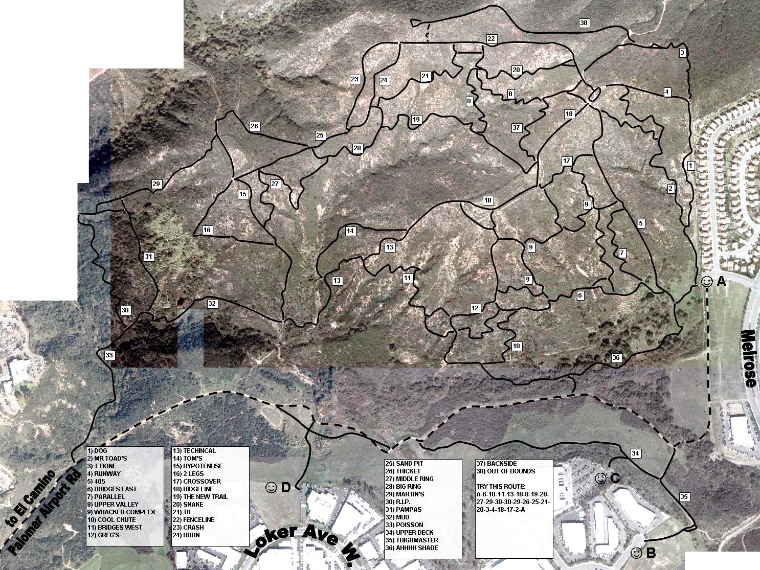
 In
the summertime be on the lookout for rattlesnakes. This fellow was seen on
(you guessed it), the Rattlesnake trail.
In
the summertime be on the lookout for rattlesnakes. This fellow was seen on
(you guessed it), the Rattlesnake trail.
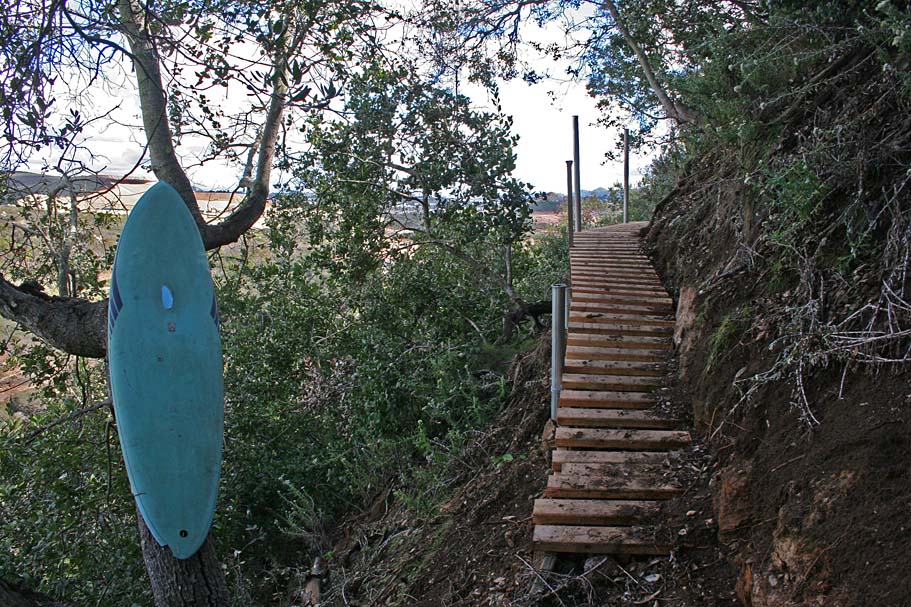
Trail Notes:
 Currently
the only way to get into the system other than the Calvera Connector is to
come in from the Carlsbad Safety Center. From the skate park/conference
center parking lot find the trail in the back corner of the lot on the other
side of a small concrete culvert. Stay on the main trail going
downhill and after some tight switchbacks, bridges, ramps, and otherwise fun
stuff you will come out at the bottom of the hill on the Poison trail.
Turn left and continue downhill to the creek and cross the bridge.
From here you can pick your poison, left gives you instant gratification on the
RIP trail, before having to climb, or go straight and gradually start climbing
on one of many trails. Either way just ride and be on the lookout
for singletrack turnoffs here and there. Some of the singletrack is best
done in one particular direction, but if I tried to give a turn-by-turn
description who would almost assuredly miss a turn as the directions would be
too confusing in the first place. Like I said, my best advice is to
get out there and explore.
Currently
the only way to get into the system other than the Calvera Connector is to
come in from the Carlsbad Safety Center. From the skate park/conference
center parking lot find the trail in the back corner of the lot on the other
side of a small concrete culvert. Stay on the main trail going
downhill and after some tight switchbacks, bridges, ramps, and otherwise fun
stuff you will come out at the bottom of the hill on the Poison trail.
Turn left and continue downhill to the creek and cross the bridge.
From here you can pick your poison, left gives you instant gratification on the
RIP trail, before having to climb, or go straight and gradually start climbing
on one of many trails. Either way just ride and be on the lookout
for singletrack turnoffs here and there. Some of the singletrack is best
done in one particular direction, but if I tried to give a turn-by-turn
description who would almost assuredly miss a turn as the directions would be
too confusing in the first place. Like I said, my best advice is to
get out there and explore.
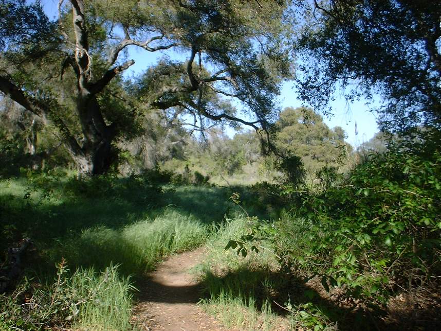
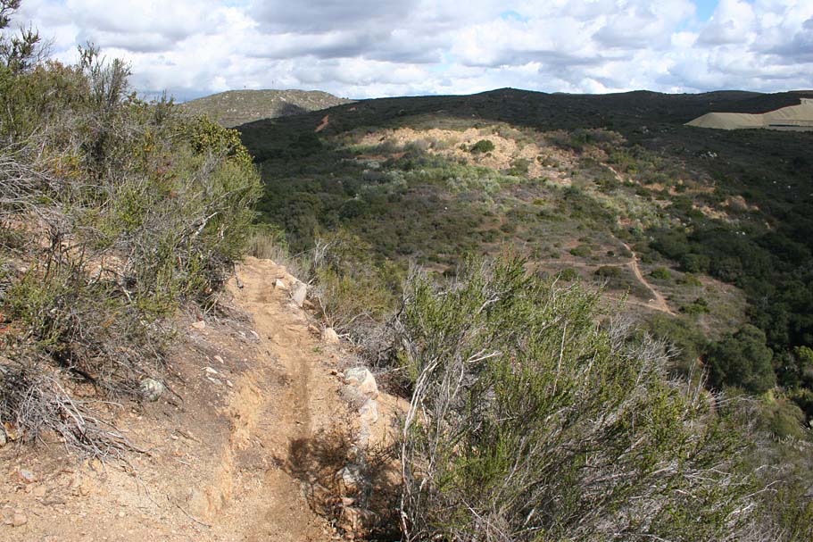
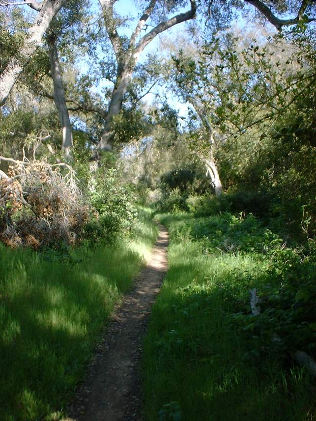
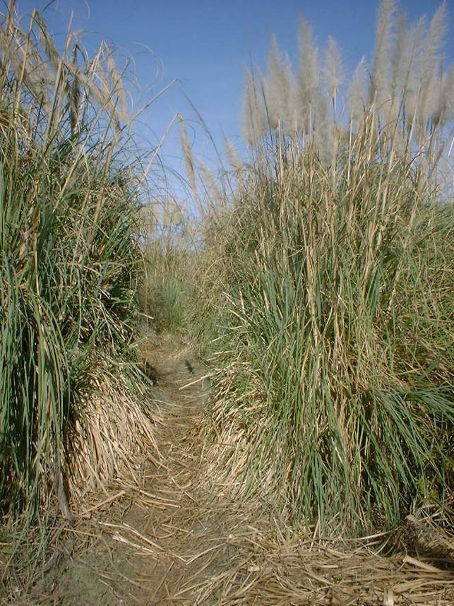
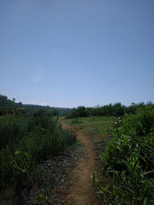
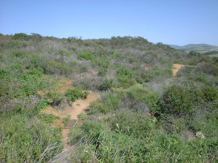
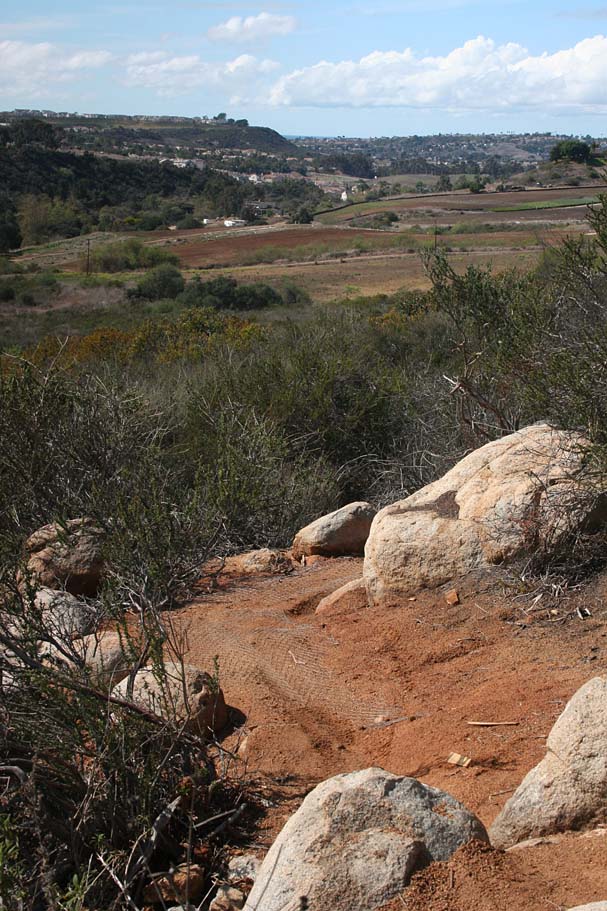
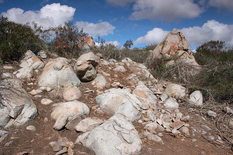
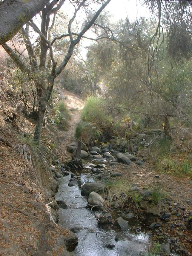
Here are some pictures taken along the low lying Ahh-Shade
trail. This trail might survive the
construction but it is currently cutoff from the rest of the network due to the
construction. Nearly completely shaded this trail is flat twisty and a lot
of fun to try and rail the turns. Don't venture too far offline or you may
find yourself in some Poison Oak.
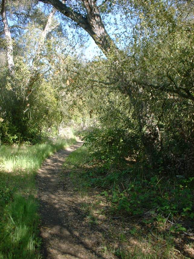
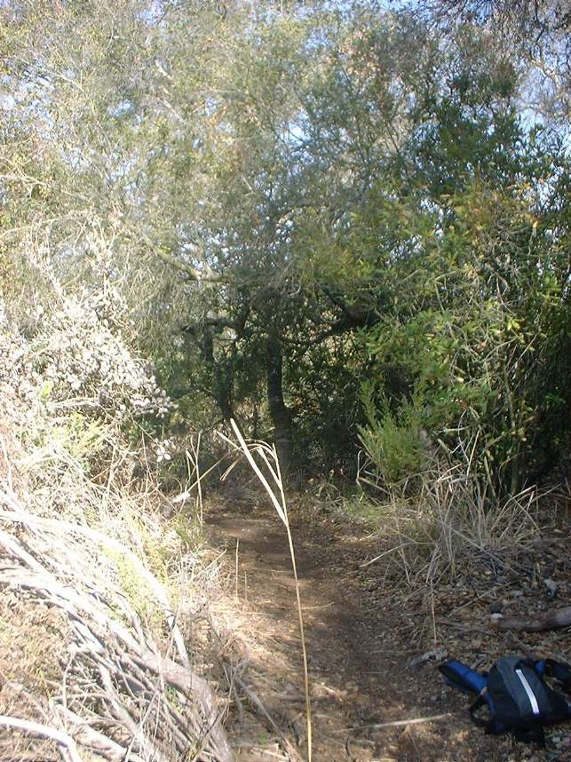
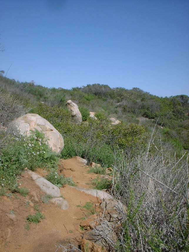
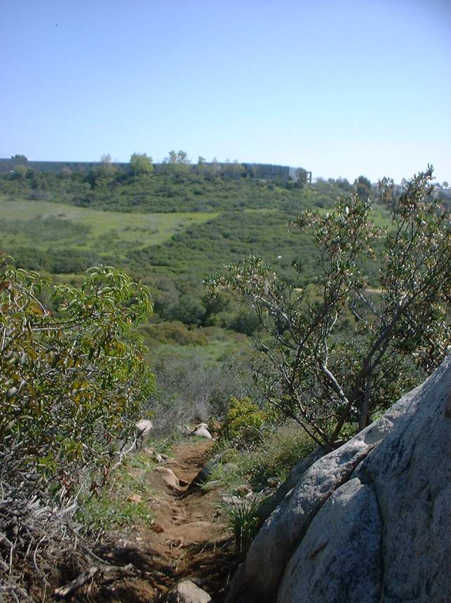
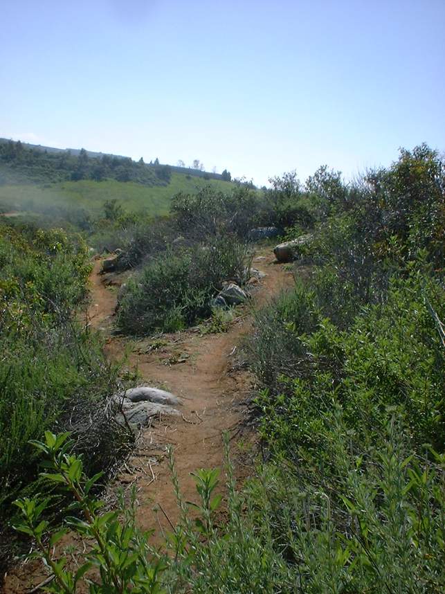
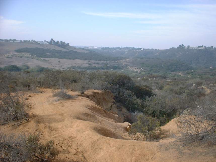
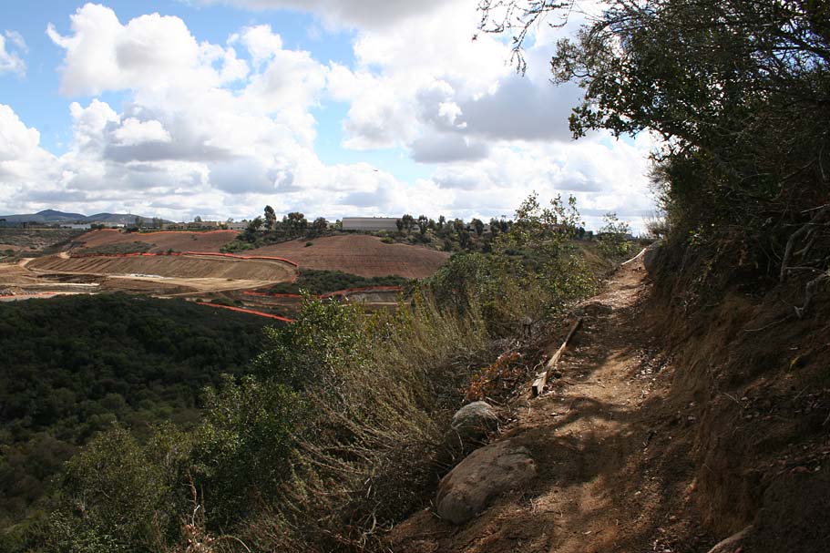
Here is the view near the top of the Two Legs trail looking
southwest. This trail is still there.
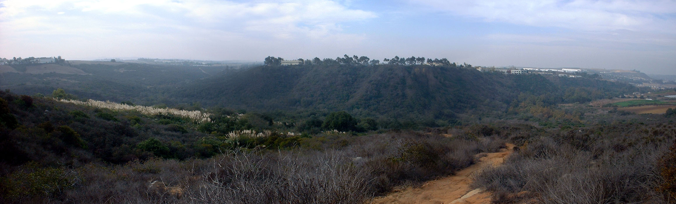
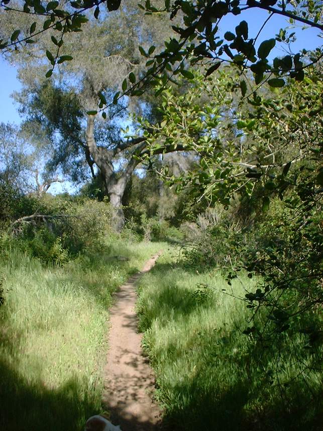
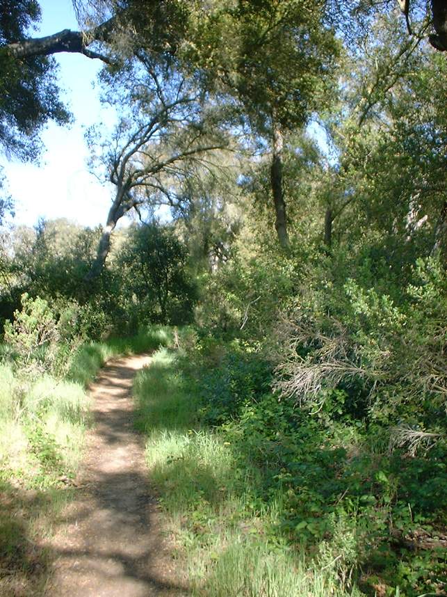
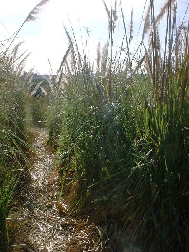
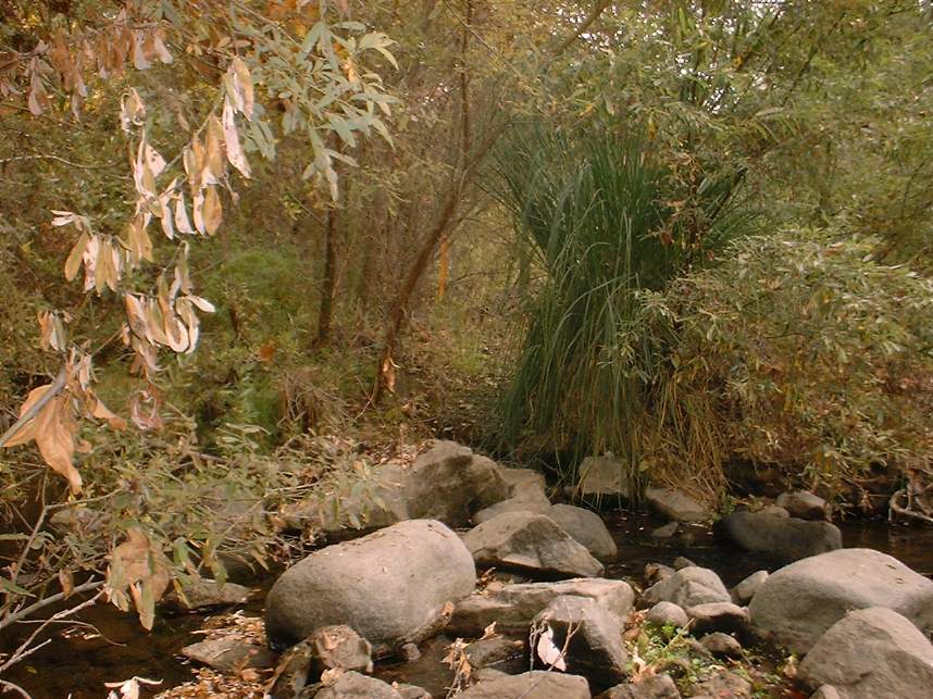
A few views from the Pampas trail which is still intact. One thing to be aware of, there is a natural spring in the area that even in the heat of summer can make this trail mushy in spots.
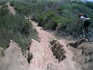
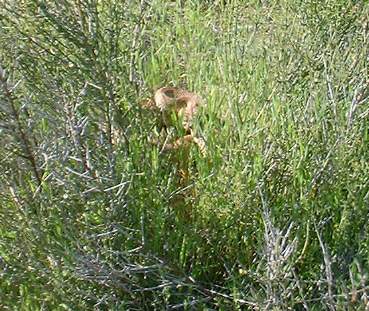
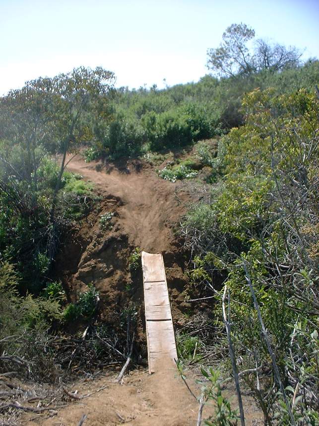
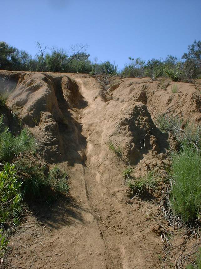
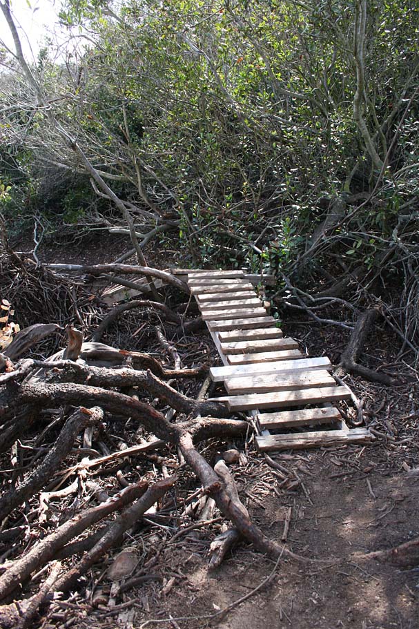
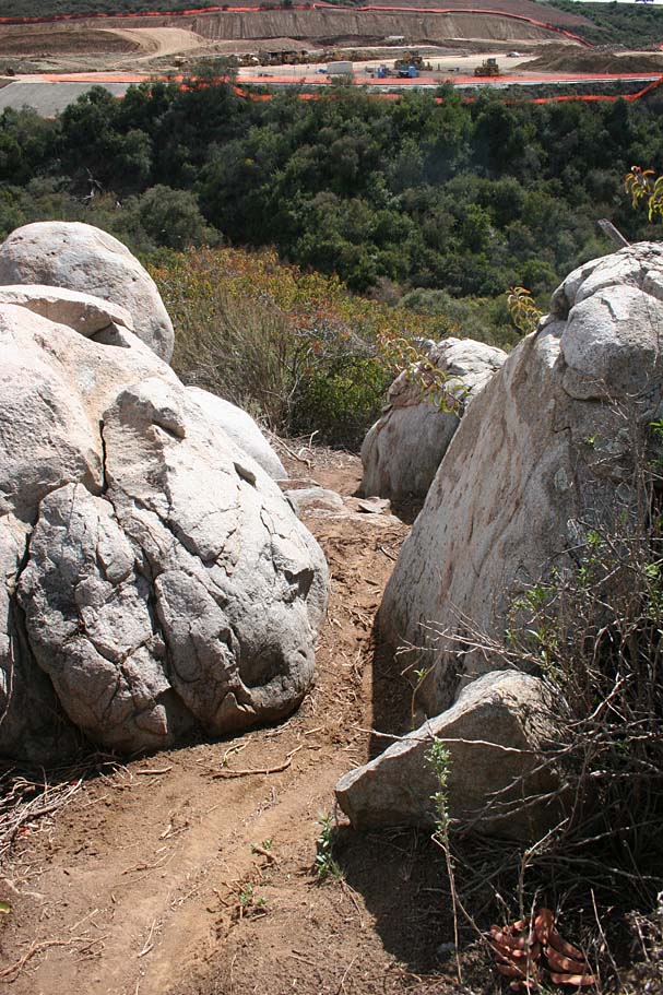
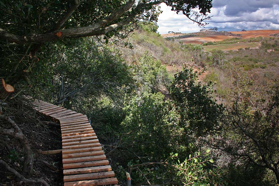
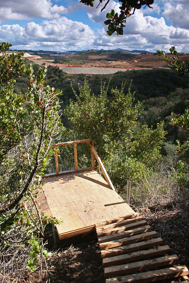
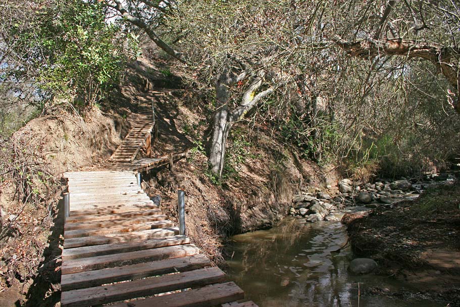
Here are pictures of the Bridges trail which has been
bulldozed. This was one of
my favorites out here with a couple of technical patches that took you into some contour riding
if ridden from west to east. As most of the trails out here have very practical names, the
Bridges trail had a couple of bridges. Nothing
North Shoreish but
something you did not see too much of down here in SoCal at the time.
GONE
Flightline IS NOT Dead
Some of the new stuff popping up at Flightline
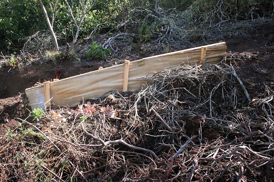
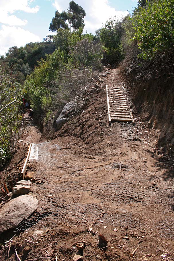
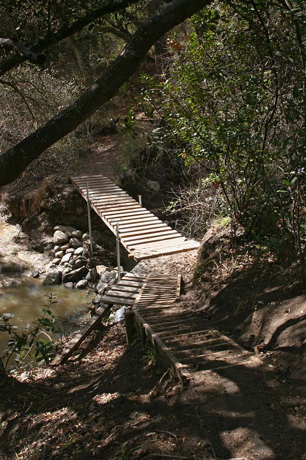
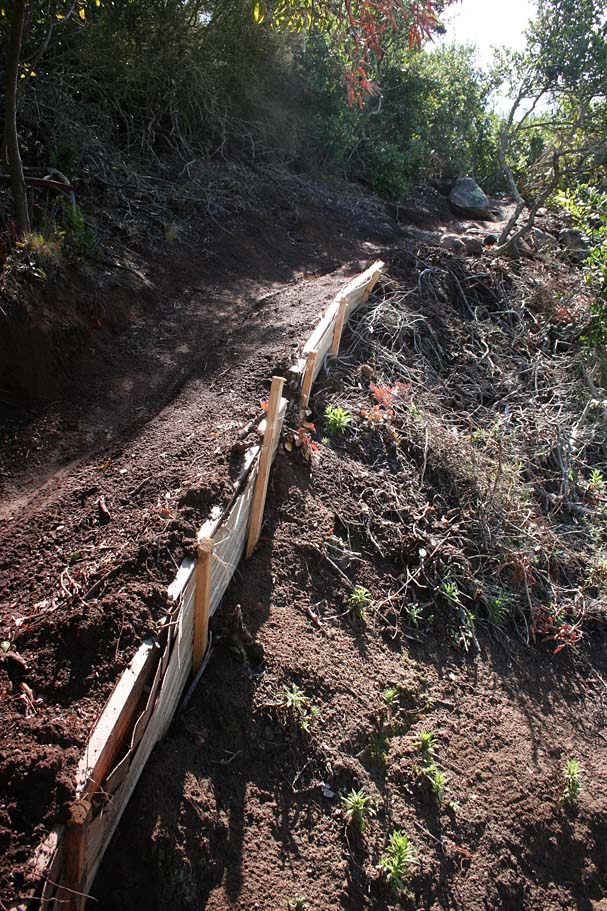 The
builders out have been exceptionally busy and have used some interesting materials on some of their
projects. Check out the door on the left and right. The use of chicken
wire to hold the soil together in spots has been quite effective. Each
iteration of the work has been getting better and better. For example one
of the earlier efforts below show the planks on the bridge hanging significantly
past the support beams. This overhang will cause the planks to pop off
after repeated times of a mountain bike's wheel going wide to the outside
the beam. When I visited the North Shore,
the folks up there do not allow the planks to extend past the support beams more
than an inch or so, (if any) and they make some mighty fine and durable bridges.
Most of the newer bridges out at Flightline have their planks cut back close to the beams.
The
builders out have been exceptionally busy and have used some interesting materials on some of their
projects. Check out the door on the left and right. The use of chicken
wire to hold the soil together in spots has been quite effective. Each
iteration of the work has been getting better and better. For example one
of the earlier efforts below show the planks on the bridge hanging significantly
past the support beams. This overhang will cause the planks to pop off
after repeated times of a mountain bike's wheel going wide to the outside
the beam. When I visited the North Shore,
the folks up there do not allow the planks to extend past the support beams more
than an inch or so, (if any) and they make some mighty fine and durable bridges.
Most of the newer bridges out at Flightline have their planks cut back close to the beams.
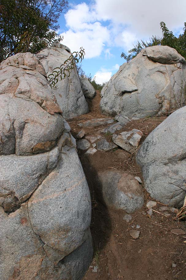
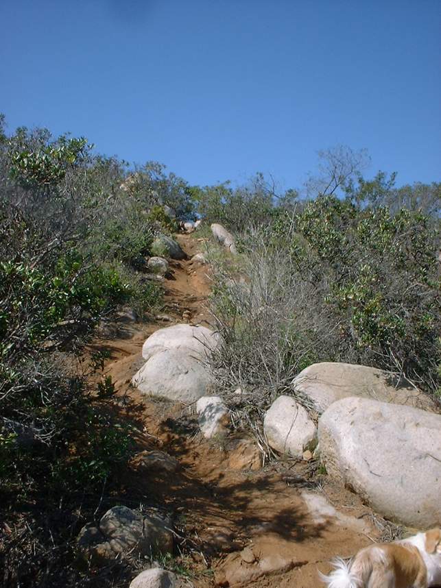
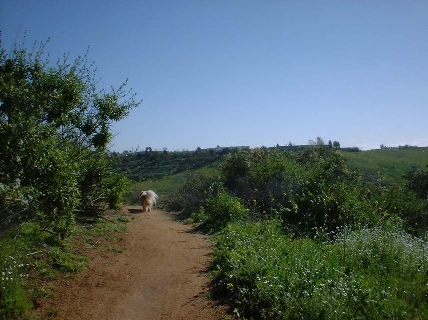
The Squeeze I and II trails
Some of the views and impressive construction along the trails weaving down the
hillside from the Safety
Center trailhead.
Calvera Lake to Flightline Connector
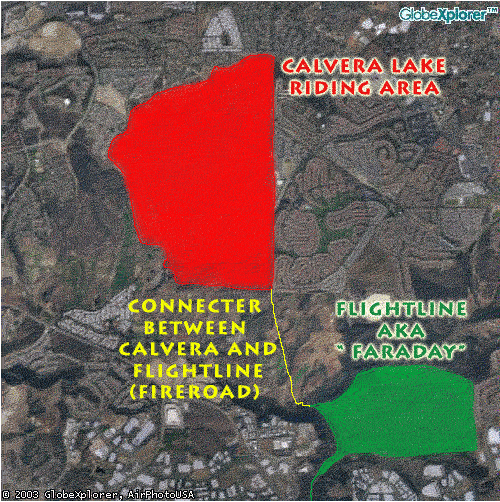 |
One of my favorite workout rides is to do Calvera Lake and Flightline together. The connector can be a little tricky but once you do it once it is easy to remember. There is a north-south fireroad that runs along the entire eastern border of the Lake Calvera riding area. Most of the fire road has the backyards of home along its edge. The far southeast corner of the area is marked by the ends of the homes along this fire road at the top of a hill. (Can be see on the aerial photo). To get to Flightline from here simply bomb down the fireroad to the south. There are three hills that you will roller coaster on until you come to a one lane paved road. Cross it and keep going on the fire road.
|
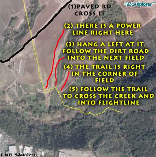 |
CONNECTER CLOSE UP
After crossing the paved road you will continue on the fire road
downhill. Just as the see the fire road end ahead, you will see a
power line crossing above the fireroad. There is a small farm road right at the
power line. Hang a left here and follow the farm road into the next |
 Connecter
Update (2006): Connecter
Update (2006):The connecter is in great shape as a the steep slope coming down from Calvera has been rerouted and now as a descent grade and a switchback. A fantastic bridge has also been build at the merge of the two creeks. |
|
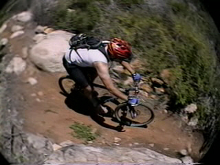
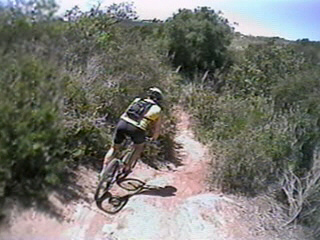
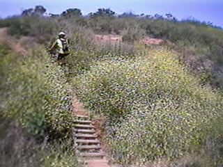
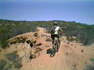
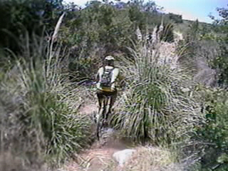
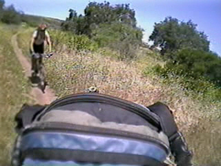
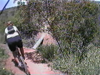
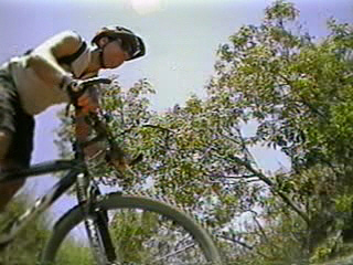
Video
 Check
out a video of Predestruction Flightline shot in May of 2003. 24MB
Check
out a video of Predestruction Flightline shot in May of 2003. 24MB
Note: This is with my old lip stick cam setup.
Here are some screen shots of the video