 |
| |
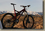
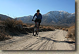
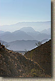
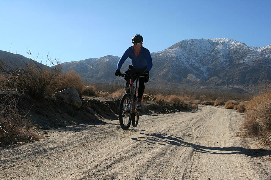
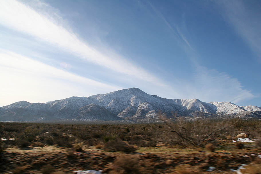
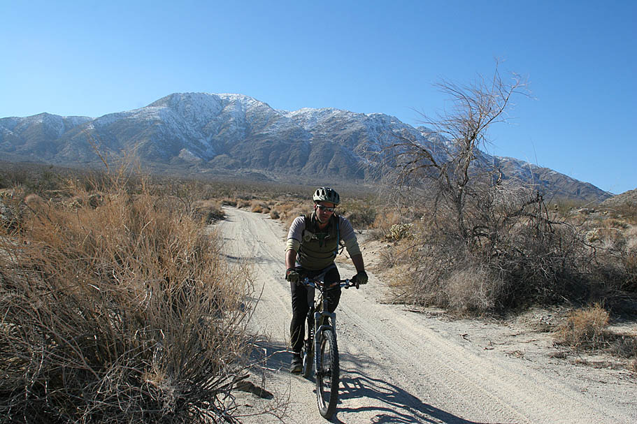
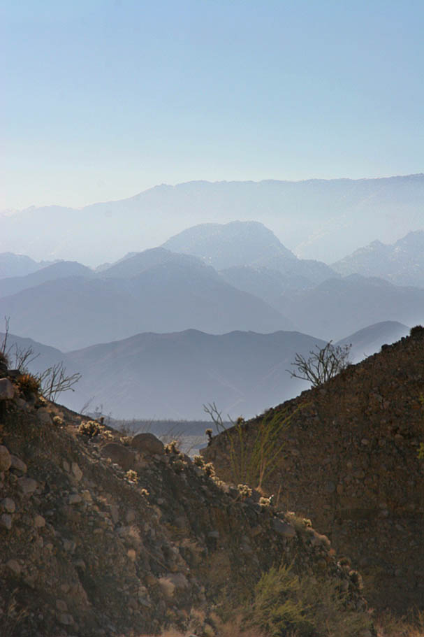
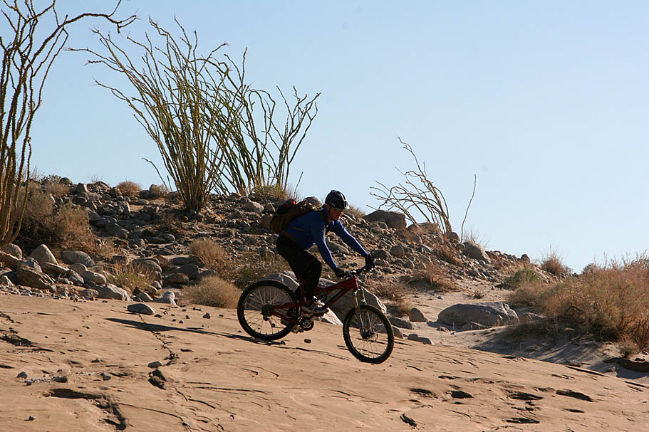
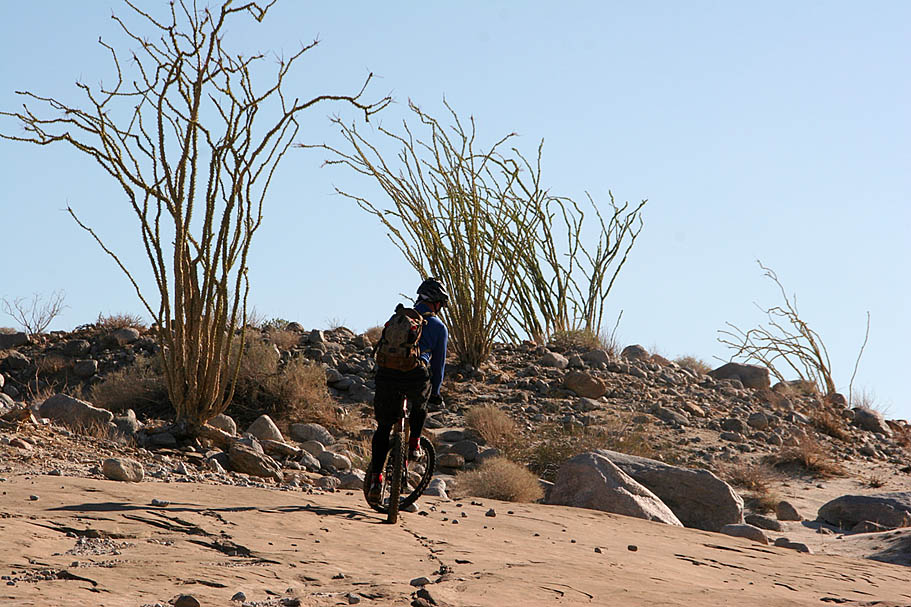
Looking for something quite different than your average San Diego County Ride? Feel the need to get your sand on? Do you like the idea of seeing some crazy scenery and geological formations. How about something that most would consider an epic while others might use terms approaching "Death March"? Well this trek across the Anza Borrego Desert State Park along a series of jeep trails might just be right up your alley (or sand wash in this case). This is a way out in east county ride that starts near the eastern base of the Laguna mountains and finishes mere feet from Imperial County south of Octillo Wells. During this adventure you cross some 30 miles of unique desert terrian that includes about 1,700 feet of climbing and 3,900 feet of descent. Don't let the elevation numbers fool you. Do this ride in the wrong conditions and those numbers can feel like they are reversed. This ride is considered my most to be a winter or early spring ride that should be done a few days after some rain. This ride is not about the trail, but the scenery that is all around you. While this ride offers little in the way of technical challenges, its length coupled with the overall enviromental hazards compel me to recommend this route for only experienced riders that can also take care of themselves in the outdoors.
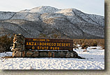
Directions: This place is way out about 80 miles inland from downtown San Diego. These directions are based on starting in Julian which is basically at the junction of Highway 78 and 79.
- Lower Trailhead. From Julian, take Highway 78 east 34 miles out of mountains and down into the desert to the town of Octillo Wells. Turn right onto Split Mountain Road travel south 7 miles and park on the side of the road near where Fish Creek Wash crosses the road. FYI, at about 2.5 miles on Split Mountain Road it turns east for a bit before turning south again. There is a large brown sign marking Fish Creek Wash and Split Mountain so it should be hard to miss. Leave a vehicle here.
- Upper Trailhead. From the lower trailhead, travel the 7 miles north on Split Mountain Road back to Highway 78. Turn left and head west for 22.8 miles. Turn left onto county road S2 (Great Southern Overland Stage Rd) and travel south for about 5 miles. Be on the lookout for the large stone Anza Borrego Desert State Park sign on your right as the trailhead (Pinyon Mountain Rd) is directly across from the sign on your left. Plenty of wide open parking.
Hazards: This is very much a seasonal trail. Trying this route in the summer is a good way to become buzzard food. Nighfall in winter brings on plummeting temps that are often below freezing. Much of this route is also in a wash which will most likely flash flood if there is any rain east of the Laguna Mountains. There is no water available on this ride. There are no bailouts either, your choices are the trailheads 30 miles apart. Don't plan on keeping a cell signal either. Yeah, this place is no joke. Be well prepared and carry more survival related stuff than you normally would. The good news is that this is a jeep route so help could come by way of a 4x4. |

Blog Posts mentioning the Anza Borrego Desert
|
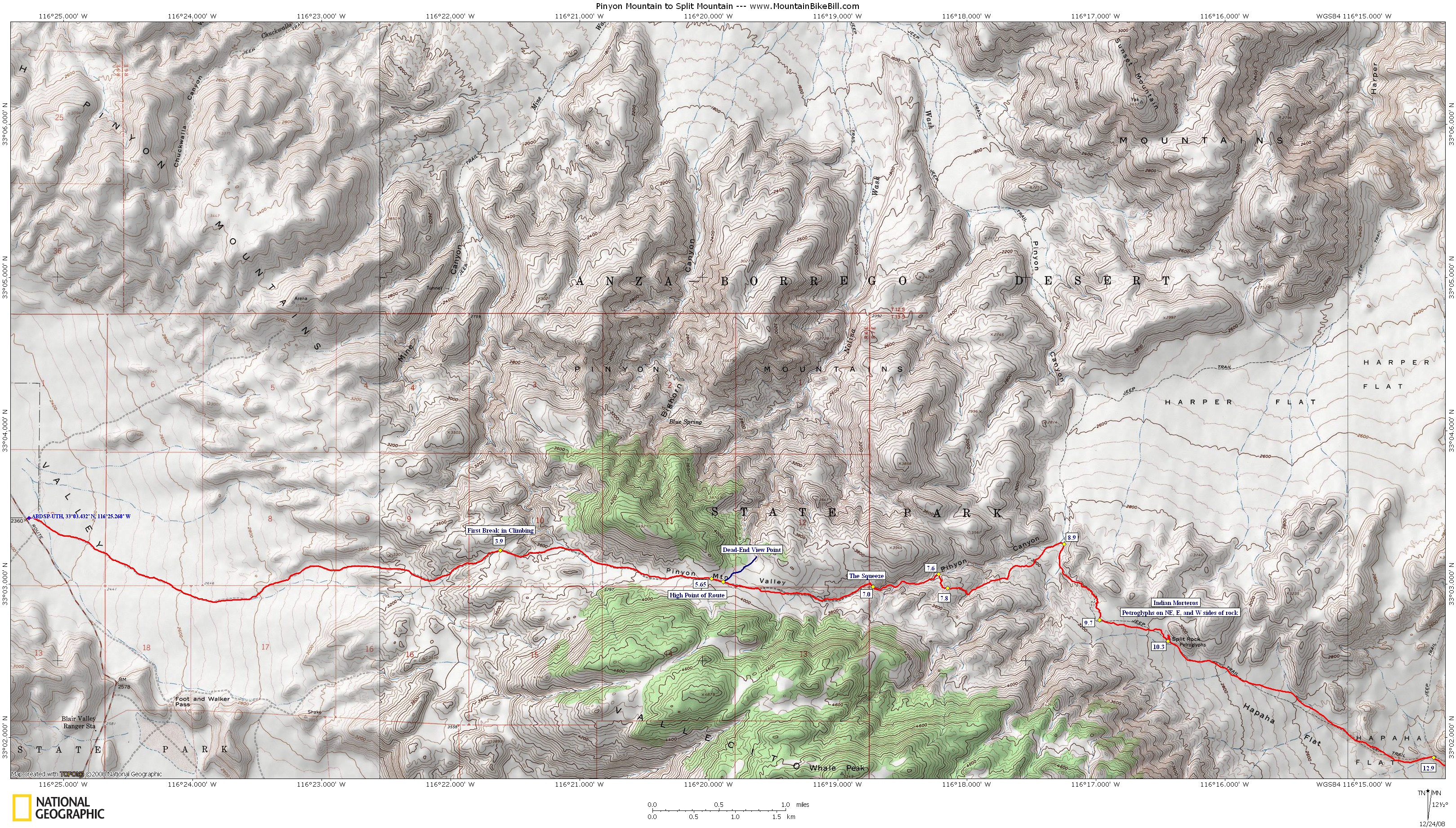
| Maps and data files: Below are my maps with annotations as well as the electronic version of the park's map. Here are the data file for this route in various formats: TOPO, GPX, KML, GDB |
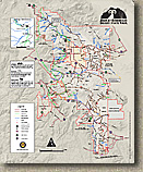
The State Park's Map (PDF)
|
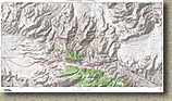
My TOPO Map of the Route (9MB PDF)
Sized for 8" by 14" Paper |
|
| |
Tips: Much of this route is sandy so it is best to be done within a few days of a rain. High volume tires with low pressure will make the sand much easier to negotiate. Some type of thorn protection is a good bet as well. The logistics of moving bikes, dropping off a vehicle at the bottom and setup of this ride can take longer than you think. Plan on about 2 hours between meeting at the trailhead to actually starting to pedal. Plan on a full-day out here. |
| |
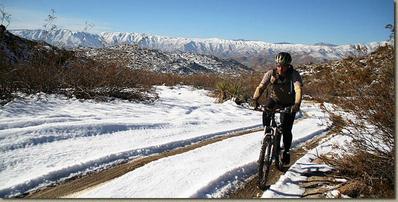
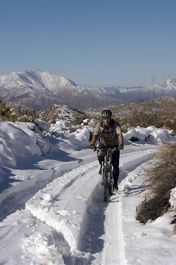
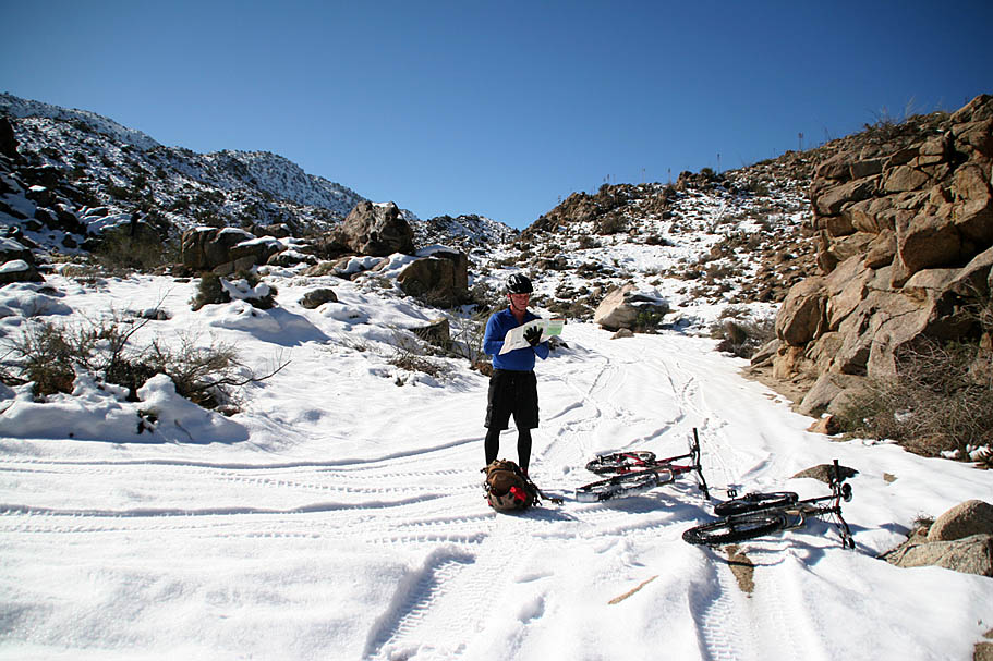
 Ride Notes: Foreward - The first time (and only time so far) I did this ride it was after a heavy winter storm that left snow in many places around the county that do not normally see the fluffy white stuff. This description is half story telling and half directions giving. If you do this ride when there is no snow present the first part of this ride will be quicker. If you do this ride in drier conditions you may find the lower half of this route to be more burdensome than I describe. Either way you should expect to do some form of slogging at some point during this ride. The general consenus from those who have done this ride is that it is simply the price for admission to see this wonderful bit of countryside. Ride Notes: Foreward - The first time (and only time so far) I did this ride it was after a heavy winter storm that left snow in many places around the county that do not normally see the fluffy white stuff. This description is half story telling and half directions giving. If you do this ride when there is no snow present the first part of this ride will be quicker. If you do this ride in drier conditions you may find the lower half of this route to be more burdensome than I describe. Either way you should expect to do some form of slogging at some point during this ride. The general consenus from those who have done this ride is that it is simply the price for admission to see this wonderful bit of countryside.
|
| |
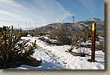
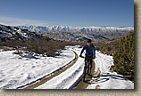
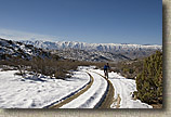
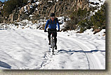
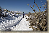
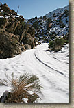
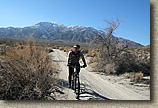
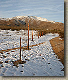
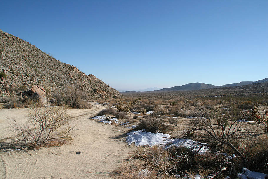
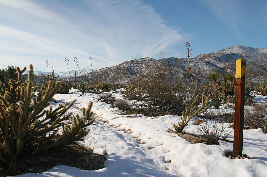
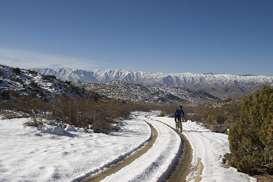
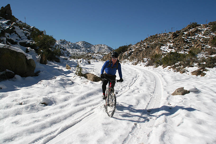
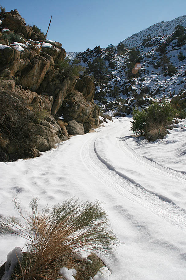
  First off from the trailhead there is another trail/jeep road heading off to the east-northeast. This is North Pinyon Mountain Road. That is not the way you want to go. You want to take the more east-southeast route that gradually climbs. The first chunk of the climbing up Pinyon Mountain Road off of Highway S2 was not bad at all as the snow was not deep and the tire treads from the four wheelers had created dirt lines in the jeep trail. First off from the trailhead there is another trail/jeep road heading off to the east-northeast. This is North Pinyon Mountain Road. That is not the way you want to go. You want to take the more east-southeast route that gradually climbs. The first chunk of the climbing up Pinyon Mountain Road off of Highway S2 was not bad at all as the snow was not deep and the tire treads from the four wheelers had created dirt lines in the jeep trail.
|
| |
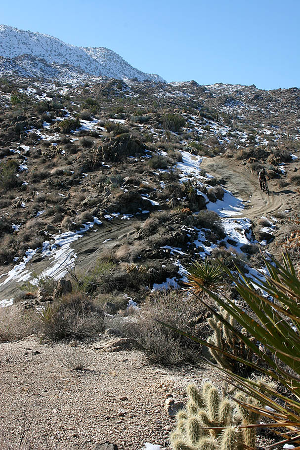
  Shortly after you start the route a spur of the California Riding and Hiking trail will crosses the road. At 3.9 miles you will get your first quick break from the climbing before you will get back into the gradually climbing. As we climbed higher the tire tracks became compacted snow vice dirt and climbing became more interesting. As the snow became deeper, you had to stay right in the middle of the tire tracks other wise your pedals would strike the side of the groove in the snow and on more than a few occasions this started a series of pinball pedaling that often ended in putting a foot down in the snow. Shortly after you start the route a spur of the California Riding and Hiking trail will crosses the road. At 3.9 miles you will get your first quick break from the climbing before you will get back into the gradually climbing. As we climbed higher the tire tracks became compacted snow vice dirt and climbing became more interesting. As the snow became deeper, you had to stay right in the middle of the tire tracks other wise your pedals would strike the side of the groove in the snow and on more than a few occasions this started a series of pinball pedaling that often ended in putting a foot down in the snow.
|
| |
|
| |
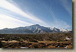
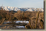
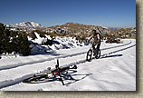
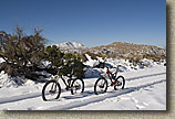
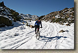
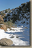
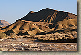
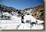
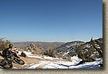
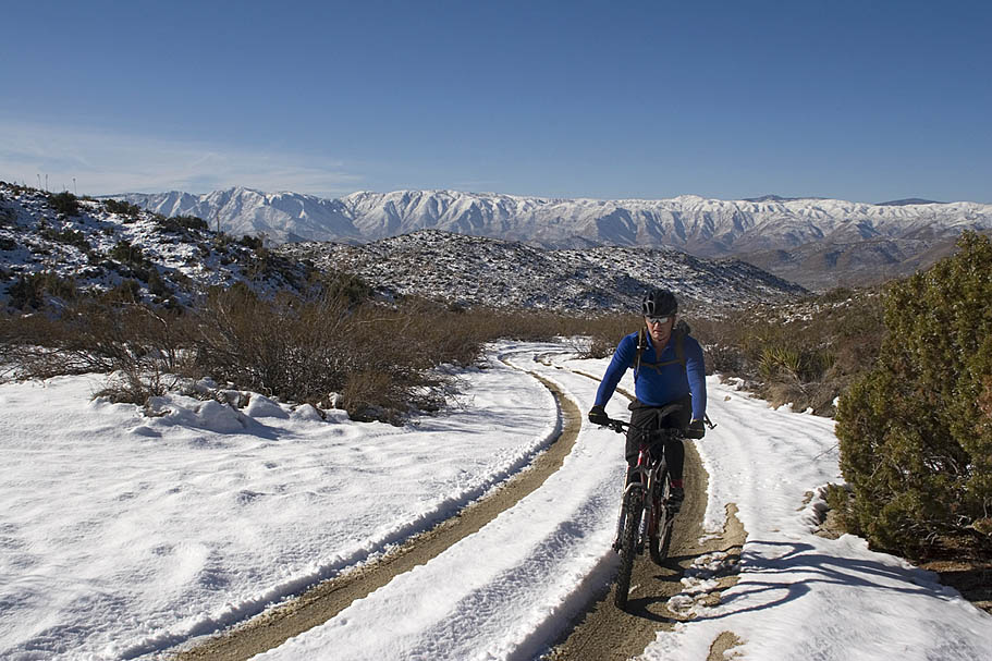
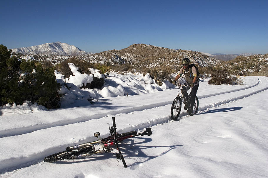
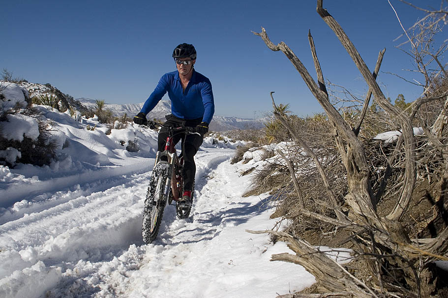
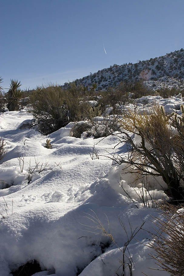
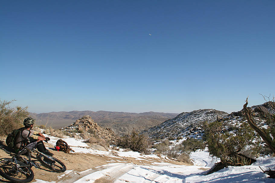
  At 5.6 miles, we reached the high point of the ride in the saddle between the Pinyon and the Vallecito Mountains at just under 4,000 feet the snow was a good foot deep. It was a gorgeous scene and the snow riding was still not too bad. We then came to an unmarked fork in the trail that was not annotated on the USGS topos or the printed map I had of the park. The electronic park map included here does show the spur as well as a few others that we did not see with all of the snow. After a bit of head scratching we came of with the theory that one of these forks is a dead-end and the other is the through route off the mountain. We opted to go with the fork that had the most tracks on it (The left hand fork). Slightly downhill we went and after a quarter of a mile we were presented with a wonderful vista at the turnaround of a dead-end trail. Damn It! The reason this fork had more tracks was because there was two sets of tracks for every vehicle, one coming and one going. (This is Bill's dumb thing not to do on the trail tip #276) The grade of this fork was just enough to make climbing back to the split in the snow way too energy consuming so we hoofed it back to the fork. At 5.6 miles, we reached the high point of the ride in the saddle between the Pinyon and the Vallecito Mountains at just under 4,000 feet the snow was a good foot deep. It was a gorgeous scene and the snow riding was still not too bad. We then came to an unmarked fork in the trail that was not annotated on the USGS topos or the printed map I had of the park. The electronic park map included here does show the spur as well as a few others that we did not see with all of the snow. After a bit of head scratching we came of with the theory that one of these forks is a dead-end and the other is the through route off the mountain. We opted to go with the fork that had the most tracks on it (The left hand fork). Slightly downhill we went and after a quarter of a mile we were presented with a wonderful vista at the turnaround of a dead-end trail. Damn It! The reason this fork had more tracks was because there was two sets of tracks for every vehicle, one coming and one going. (This is Bill's dumb thing not to do on the trail tip #276) The grade of this fork was just enough to make climbing back to the split in the snow way too energy consuming so we hoofed it back to the fork.
|
| |
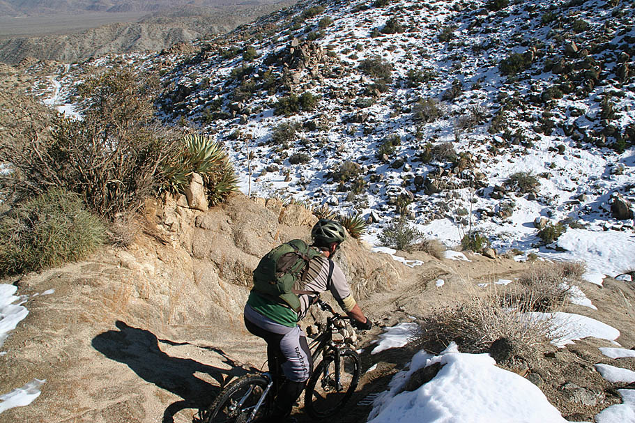
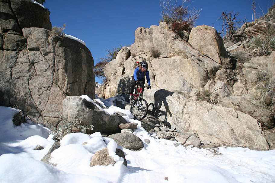
 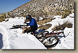 The correct fork turned out to be the path less traveled. The trail only had maybe two or three vehicles pass through since the storm so the snow was not particularly compacted. The temperature had also risen enough that there was a slush factor developing. This combined to make for a squirrely and often laborious descent that slowed our progress. It was a great exercise in finely balancing momentum, steering finesse, and body English to keep moving forward. Get just one of these factors out of whack for a split second and a comically frustrating series of escalating over corrections would ensue. The end result usually was finding myself standing in deep snow humping my bike back into the tire grooves. The correct fork turned out to be the path less traveled. The trail only had maybe two or three vehicles pass through since the storm so the snow was not particularly compacted. The temperature had also risen enough that there was a slush factor developing. This combined to make for a squirrely and often laborious descent that slowed our progress. It was a great exercise in finely balancing momentum, steering finesse, and body English to keep moving forward. Get just one of these factors out of whack for a split second and a comically frustrating series of escalating over corrections would ensue. The end result usually was finding myself standing in deep snow humping my bike back into the tire grooves.
|
| |
|
| |
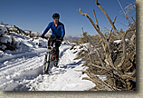
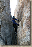
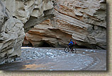
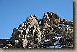
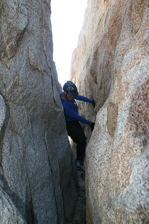
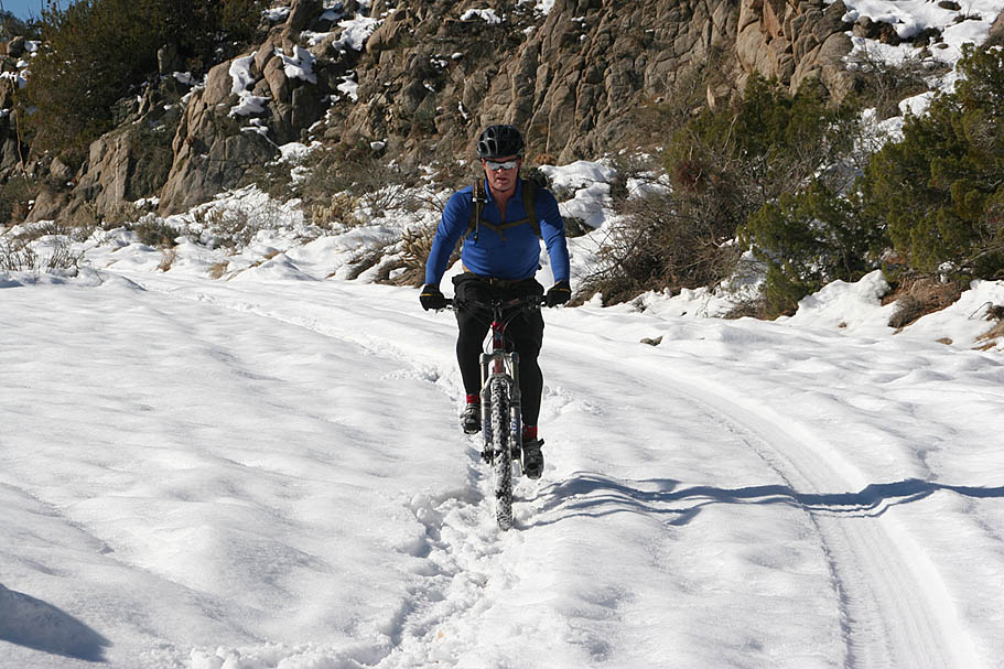
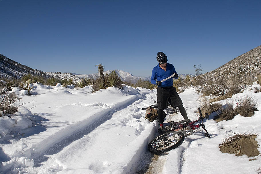
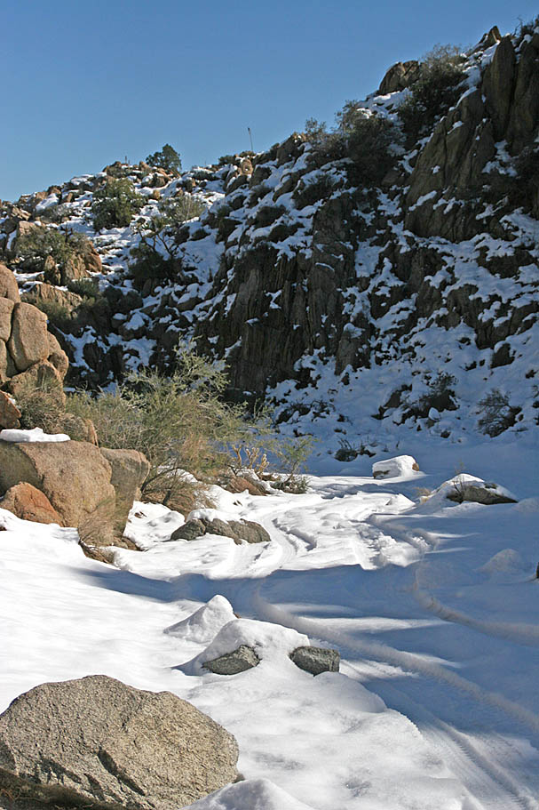
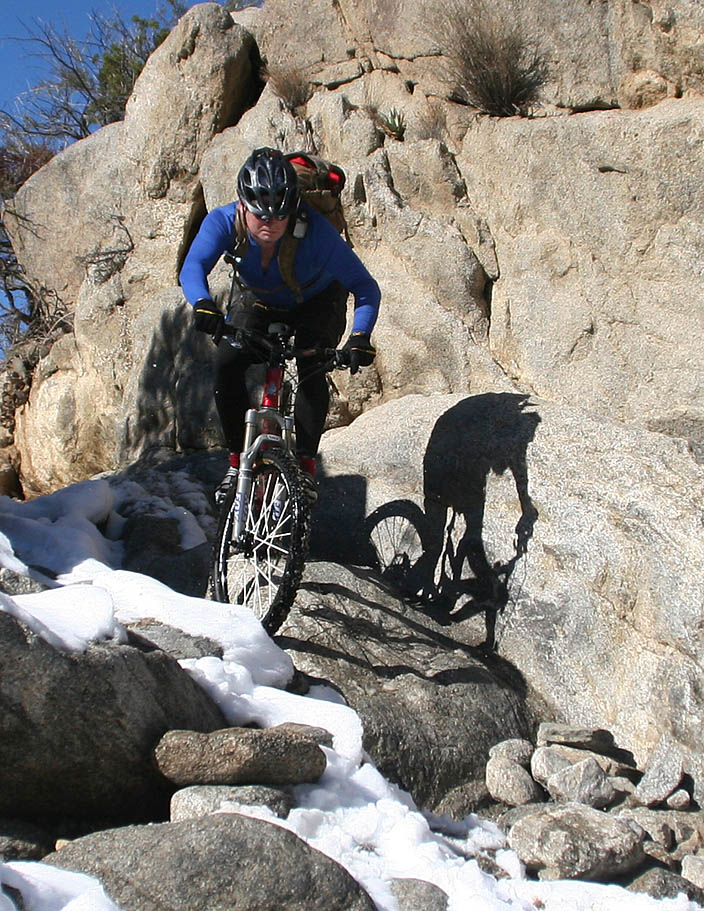
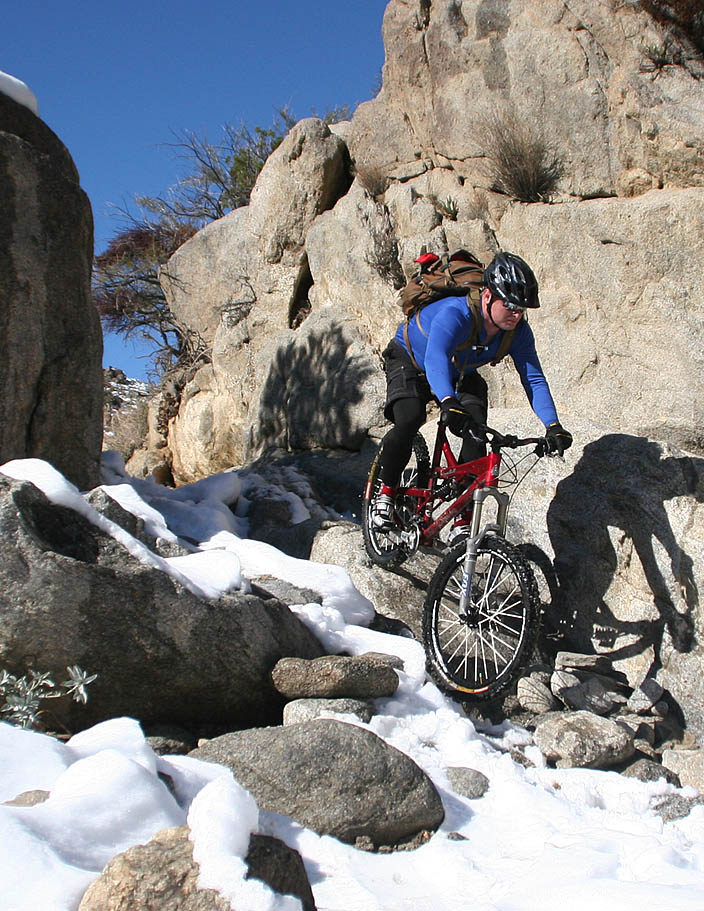
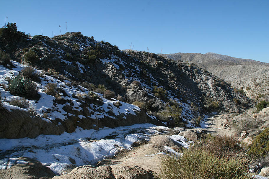
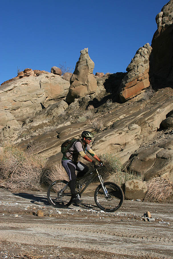
 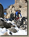 We soon came to one of the signature spots on this trail for the jeepers known as “The Squeeze”. It is a slot between two rocks that is just barely wide enough for a jeep to get through and it includes a step down. This was the only technical thing I had seen so far today so I felt inclined to give it a go despite some snow and ice in potentially inopportune spots. I ended up making it but not without the backend of the bike trying to pass the front for a scary second. From the Squeeze we continued our slight downhill slogging in narrowing canyon. We soon came to one of the signature spots on this trail for the jeepers known as “The Squeeze”. It is a slot between two rocks that is just barely wide enough for a jeep to get through and it includes a step down. This was the only technical thing I had seen so far today so I felt inclined to give it a go despite some snow and ice in potentially inopportune spots. I ended up making it but not without the backend of the bike trying to pass the front for a scary second. From the Squeeze we continued our slight downhill slogging in narrowing canyon.
|
| |
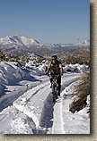
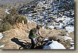
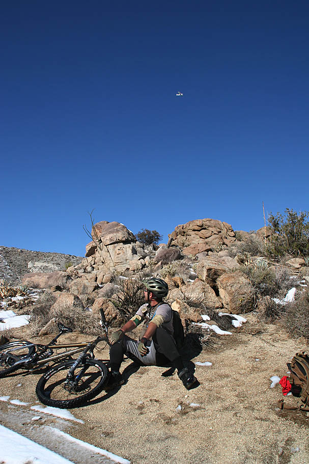
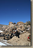  At 7.6 miles we were done with the downhill slogging in the snow as the trail turned sharply to the right and uphill for the next 2/10ths of a mile. This climb will have some technical bits in it on dry days but on this day it was a snowy uphill hike-a-bike. While taking a break at the top of this climb we saw a low flying prop plane pass overhead. The plane suddenly swung around and made another pass over top of us. We joked that this was probably a patrol plane and they were wondering what the hell we were doing out here and were already calling us idiots in for a rescue later on tonight. We chuckled as the plane flew off thinking that they were up there shaking their heads at the sight of us. At 7.6 miles we were done with the downhill slogging in the snow as the trail turned sharply to the right and uphill for the next 2/10ths of a mile. This climb will have some technical bits in it on dry days but on this day it was a snowy uphill hike-a-bike. While taking a break at the top of this climb we saw a low flying prop plane pass overhead. The plane suddenly swung around and made another pass over top of us. We joked that this was probably a patrol plane and they were wondering what the hell we were doing out here and were already calling us idiots in for a rescue later on tonight. We chuckled as the plane flew off thinking that they were up there shaking their heads at the sight of us.
|
| |
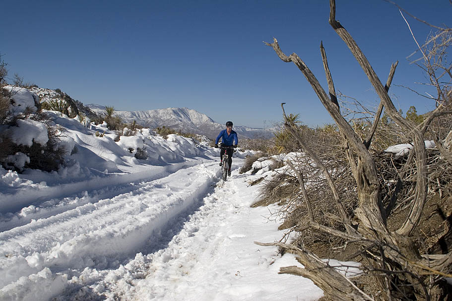
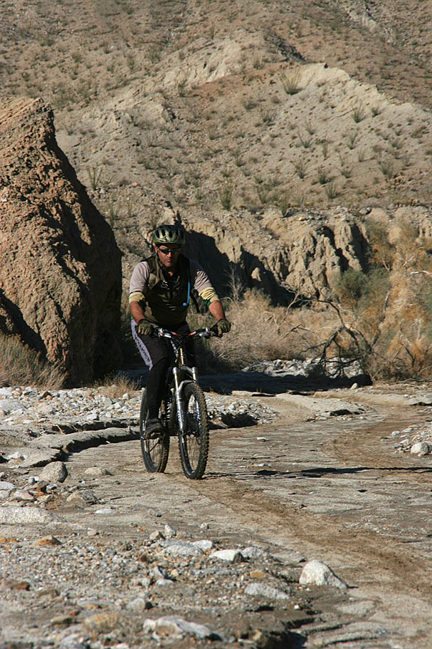
 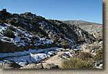 From this point we had a down right awesome bit of downhill riding that netted us our highest speeds of the day. It was not all downhill as it includes a series of small roller-coaster style rises that might require a handful of pedal strokes here and there. It was over far too quickly and we soon found came to a junction with a wash at 8.9 miles. Your only option at this point is to turn up the wash (right) and do a bit of mild climbing until at 9.7 miles you peak out and descend into Hapaha Flat. From this point we had a down right awesome bit of downhill riding that netted us our highest speeds of the day. It was not all downhill as it includes a series of small roller-coaster style rises that might require a handful of pedal strokes here and there. It was over far too quickly and we soon found came to a junction with a wash at 8.9 miles. Your only option at this point is to turn up the wash (right) and do a bit of mild climbing until at 9.7 miles you peak out and descend into Hapaha Flat.
|
| |
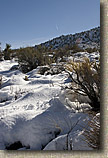
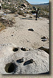
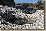
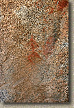
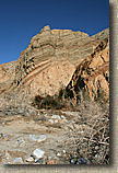
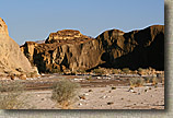
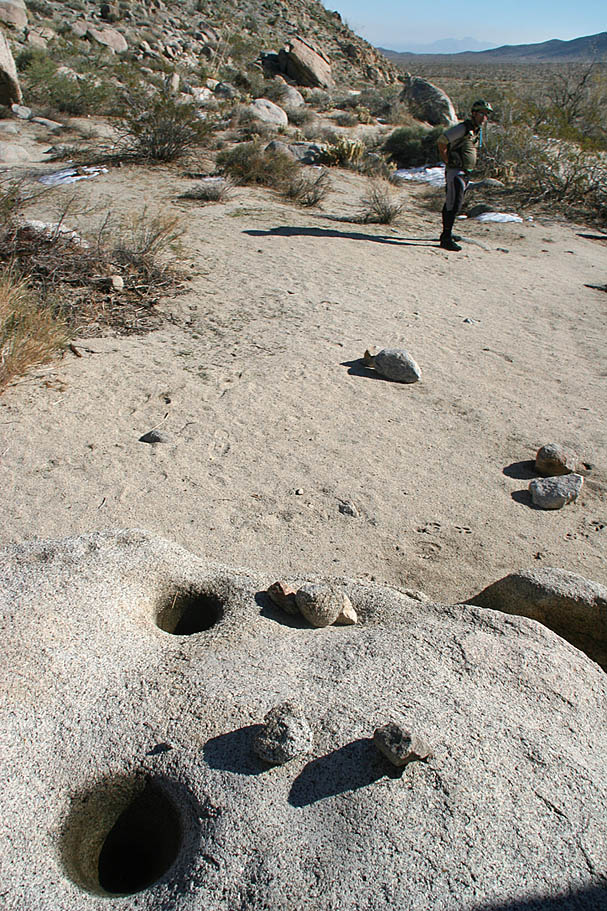
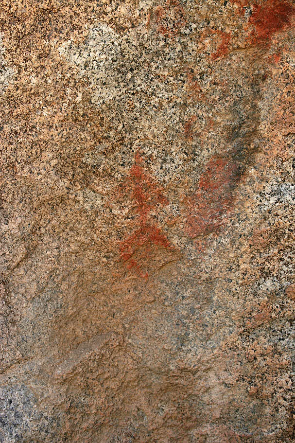
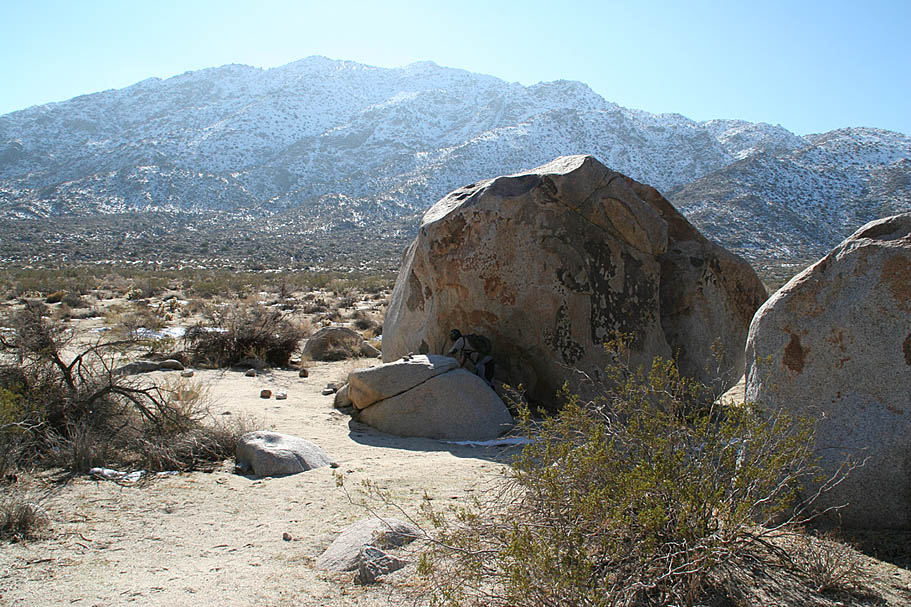
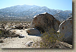  It was quite comfortable and sunny now and we stopped at Split Rock on the western end of the the flat at 10.3 miles for a snack. We also wanted to snope around for the Indian Pictographs which were supposed to be here. The reason for the name of the rock was much more obvious than the pictographs. We found indian morteros easy enough but only after carefully examination did we find the some faded and diminutive pictographs. I was expecting something more on the impressiveness scale like the ones in Moab so I was a little disappointed. It was quite comfortable and sunny now and we stopped at Split Rock on the western end of the the flat at 10.3 miles for a snack. We also wanted to snope around for the Indian Pictographs which were supposed to be here. The reason for the name of the rock was much more obvious than the pictographs. We found indian morteros easy enough but only after carefully examination did we find the some faded and diminutive pictographs. I was expecting something more on the impressiveness scale like the ones in Moab so I was a little disappointed.
|
| |
  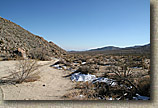  
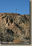
Some of the shots from around Split Rock |
|
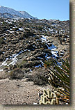
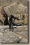
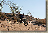
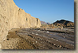
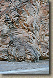
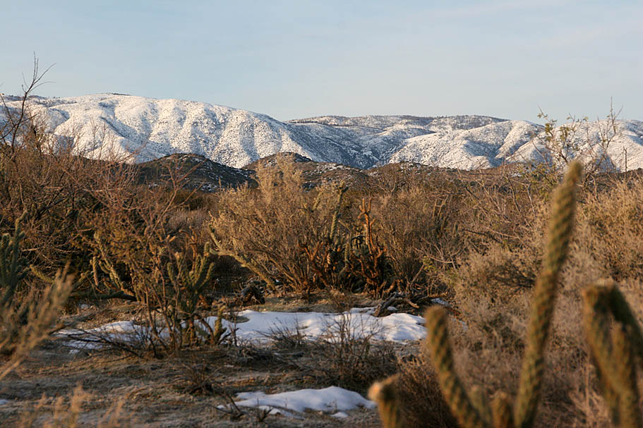
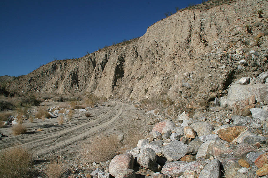
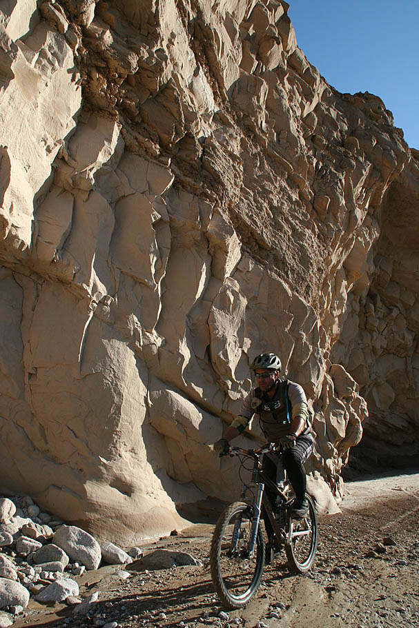
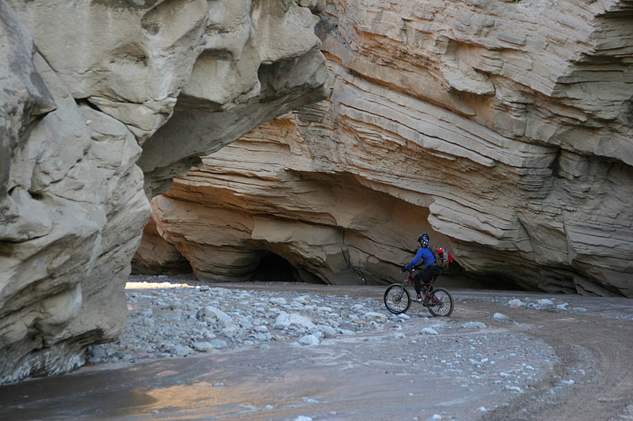
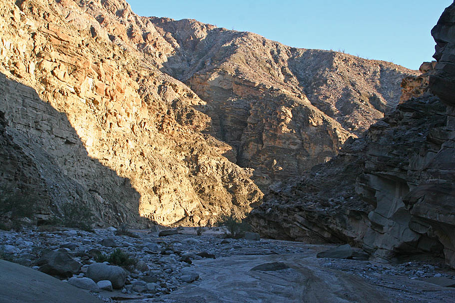
  The next two miles of sandy and slightly downhill trail were just what I hoped it would be, packed and fast. I was digging the easy cruising this section provided. The wide open Hapaha Flat soon gave way to the more defined Fish Creek Wash as we gradually descended into a different geological era when this area was the seabed of the Gulf of California. The steep walls were composed mostly of large sedimentary rocks that looked like you could pull one out from the bottom and the entire wall could come tumbling down. I was not going to test the theory. The next two miles of sandy and slightly downhill trail were just what I hoped it would be, packed and fast. I was digging the easy cruising this section provided. The wide open Hapaha Flat soon gave way to the more defined Fish Creek Wash as we gradually descended into a different geological era when this area was the seabed of the Gulf of California. The steep walls were composed mostly of large sedimentary rocks that looked like you could pull one out from the bottom and the entire wall could come tumbling down. I was not going to test the theory. |
| |
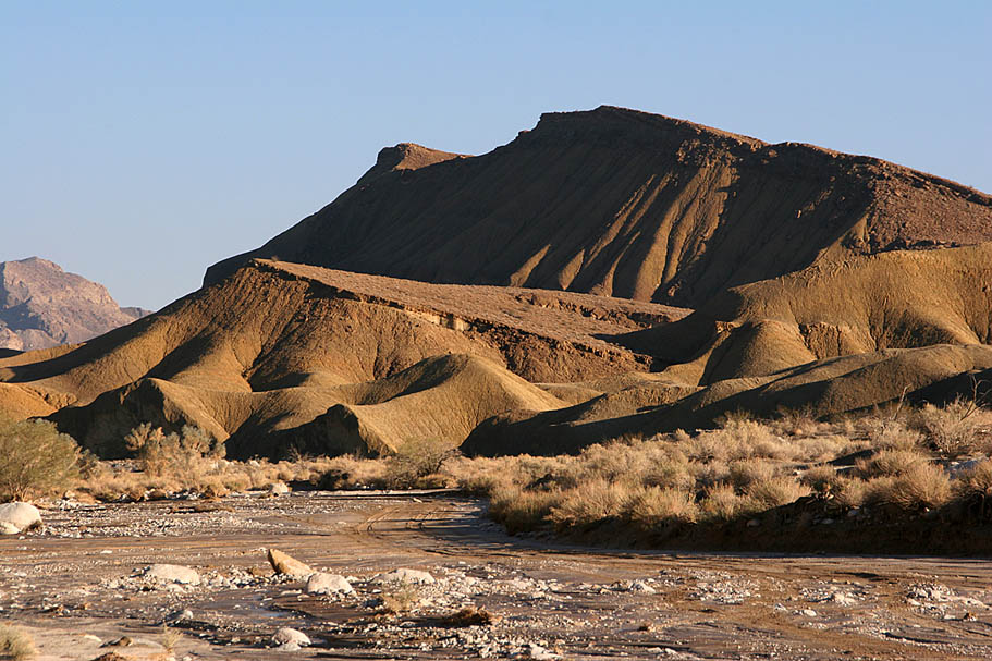
  At we continued along, the wash twisted and turned and the large sedimentary rocks gave way to mud sediments and sandstone layers. While the jeep trail was for the most part was “just a wash” the scenery around us was an ever changing tapestry of textures and colors. We passed by numerous smaller washes that feed into Fish Creek wash. At we continued along, the wash twisted and turned and the large sedimentary rocks gave way to mud sediments and sandstone layers. While the jeep trail was for the most part was “just a wash” the scenery around us was an ever changing tapestry of textures and colors. We passed by numerous smaller washes that feed into Fish Creek wash.
|
| |
  I have marked some of these feeder washes on my map. Many of the washes contain interesting features that I have only read about so far. Stuff like slot canyons, caves and mud palisades. There are numerous books that describe in great detail the interesting features of these washes you pass by. I am pretty sure that you would spend many years exploring through this area. "Afoot and Afield in San Diego" as well as
"Anza-borrego Desert Region: A Guide to State Park & Adjacent Areas of the Western Colorado Desert" are good resources for those that want to learn more about this place. I have marked some of these feeder washes on my map. Many of the washes contain interesting features that I have only read about so far. Stuff like slot canyons, caves and mud palisades. There are numerous books that describe in great detail the interesting features of these washes you pass by. I am pretty sure that you would spend many years exploring through this area. "Afoot and Afield in San Diego" as well as
"Anza-borrego Desert Region: A Guide to State Park & Adjacent Areas of the Western Colorado Desert" are good resources for those that want to learn more about this place. |
| |
  One thing that is somewhat of a bummer is the Anza-Borrego Desert State Park management lumps mountain bikes in with motorized vehicles and restricts mountain bikes to jeep trails and paved roads. This even includes the California Riding and Hiking trail which is designated as open to mountain bikes outside of the park and throughout most of the state. From what I been able to gather so far the general reasoning seems to be centered around trail damage concerns. This is a pretty outdated mindset that simply does not hold up modern studies that show that mountain biking impacts are similiar to those of hikers on properly build trails. One thing that is somewhat of a bummer is the Anza-Borrego Desert State Park management lumps mountain bikes in with motorized vehicles and restricts mountain bikes to jeep trails and paved roads. This even includes the California Riding and Hiking trail which is designated as open to mountain bikes outside of the park and throughout most of the state. From what I been able to gather so far the general reasoning seems to be centered around trail damage concerns. This is a pretty outdated mindset that simply does not hold up modern studies that show that mountain biking impacts are similiar to those of hikers on properly build trails.
|
| |
 Due to our late morning st 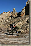 art of the ride, we opted to not ditch the bikes and go exploring up some of the feeder washes. We had already determined that we would most likely be pushing daylight at the end of the ride. With each passing wash both the moisture in the soil and the drag on our tires increased. By the time we reached the Loop Wash at 21.8 miles the resistance of the wash significantly overcame the pull of gravity and riding down the wash transitioned from mild spinning to increasingly laborious. I'm guessing we were a couple days early on hitting perfect conditions for riding here. |
| |
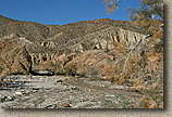
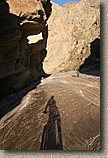
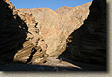
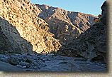
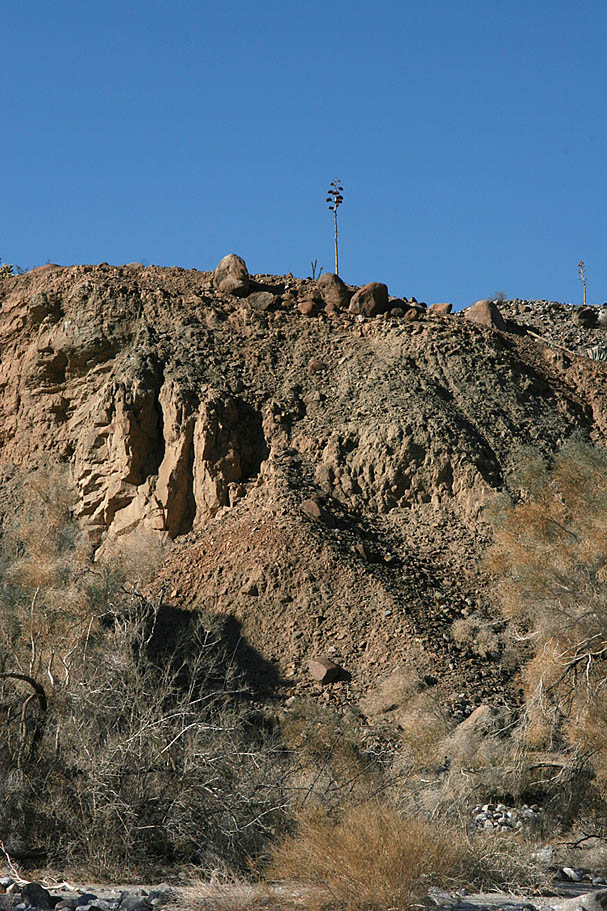
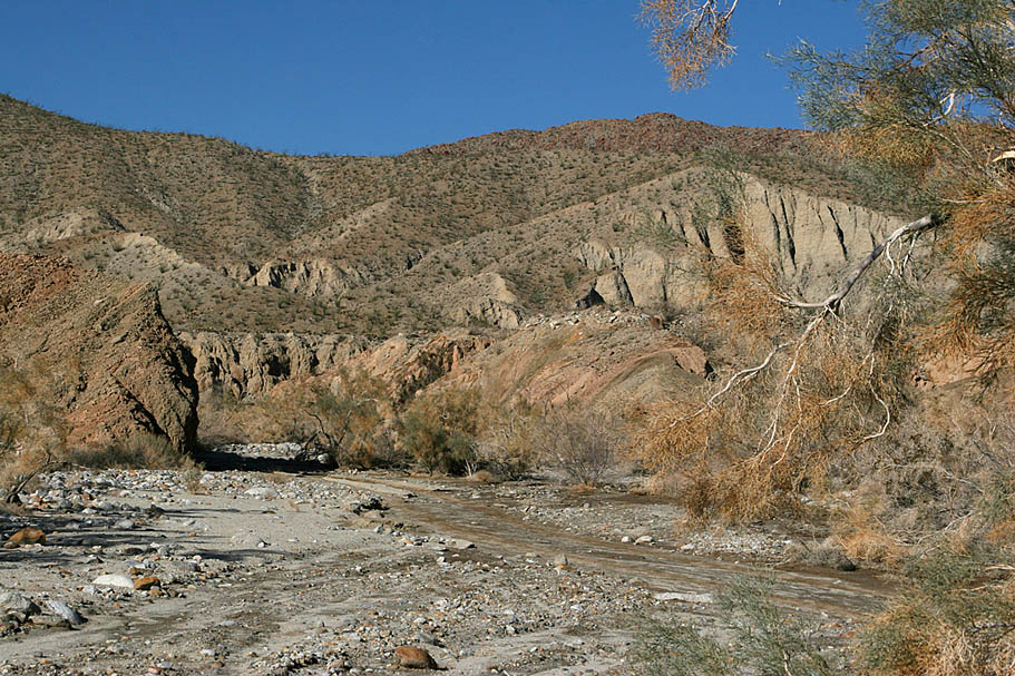
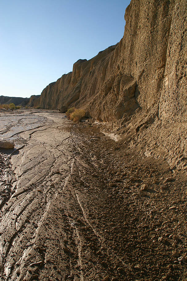
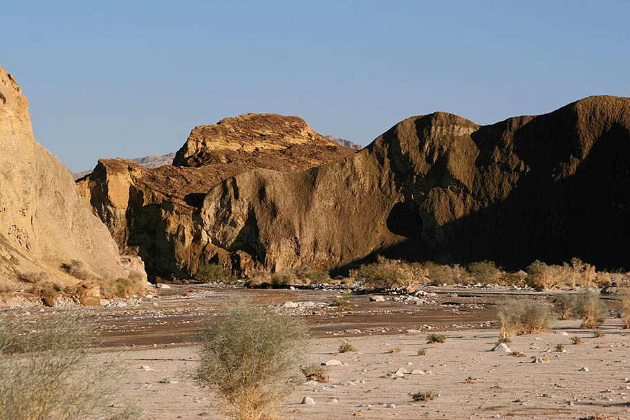
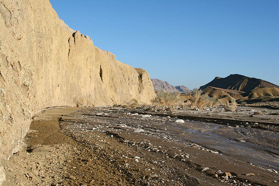
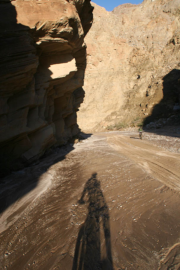
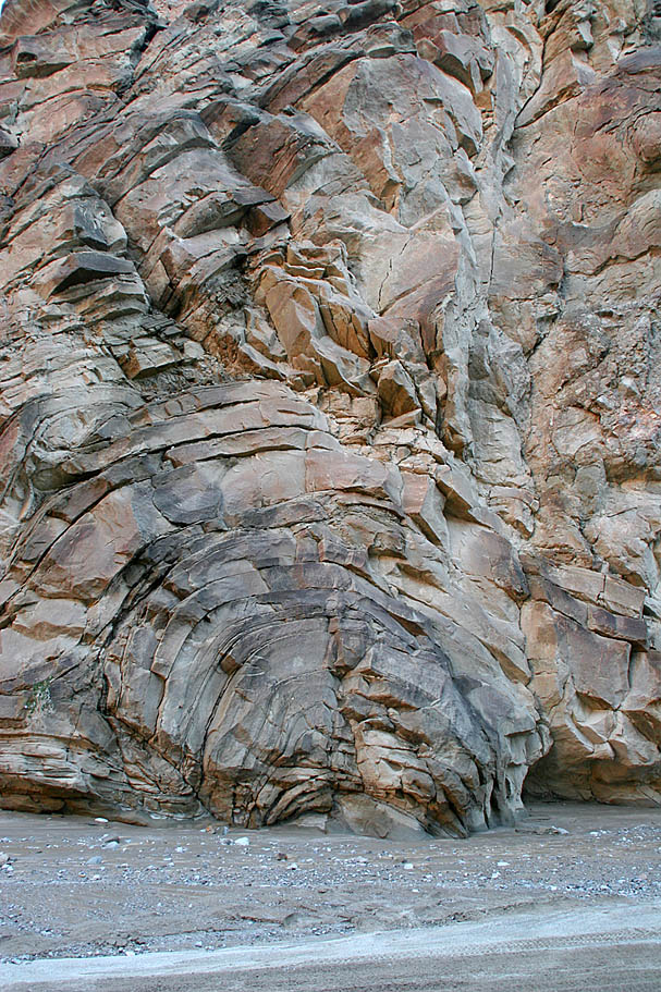
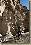 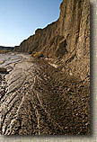 Fish Creek Wash used to be a free flowing creek that cut through soil and rock faster than tectonic forces could push up what is now Split Mountain from underneath. The result is a spectacular gorge that I was not expecting to see in San Diego County. Even though I was pretty pooped and the wash was a solid slog and at this point, this was cool stuff. The kind of stuff you should see at least once. On the picture to the left, take note of the high water mark on the canyon wall from a few days earlier. I bet there was quite a torrent of water rushing through here. On the picture to right, the sheer walls of the wash in this area were continually sluffing off a little dirt that was a poignant reminder that errosion is always happening. Fish Creek Wash used to be a free flowing creek that cut through soil and rock faster than tectonic forces could push up what is now Split Mountain from underneath. The result is a spectacular gorge that I was not expecting to see in San Diego County. Even though I was pretty pooped and the wash was a solid slog and at this point, this was cool stuff. The kind of stuff you should see at least once. On the picture to the left, take note of the high water mark on the canyon wall from a few days earlier. I bet there was quite a torrent of water rushing through here. On the picture to right, the sheer walls of the wash in this area were continually sluffing off a little dirt that was a poignant reminder that errosion is always happening.
|
| |
More shots from the lower end of the Fry Creek Wash approaching Split Mountain
|
| |
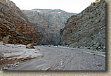
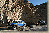
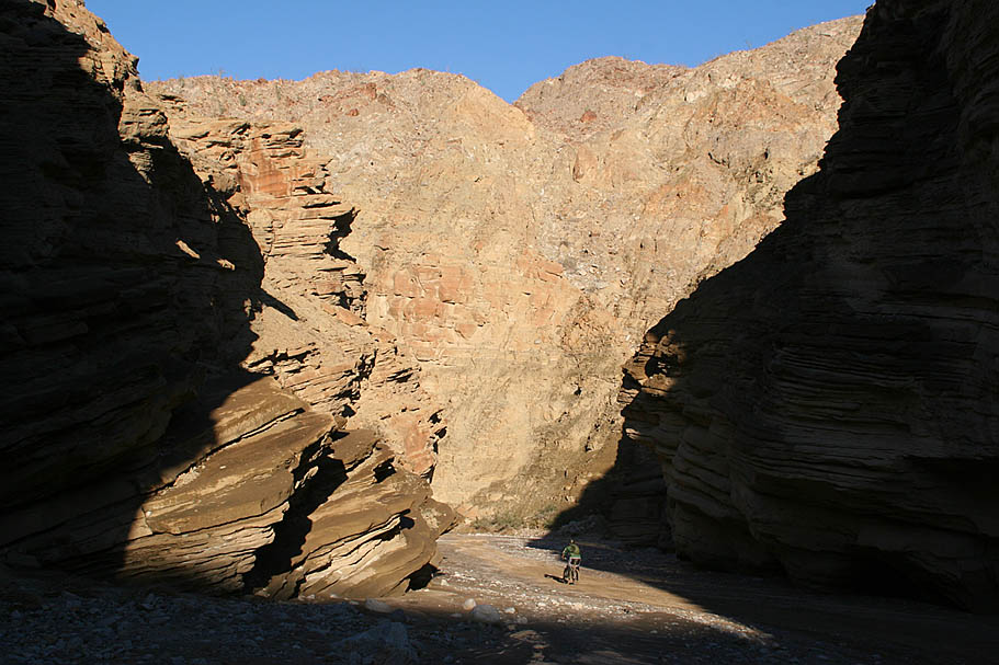
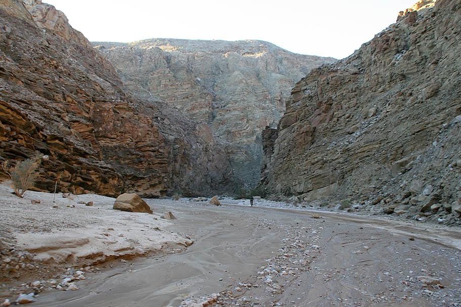
  Entering the Split Mountain Gorge at 26.3 miles is quite a transition in topology. The wash quickly narrows as the Gorge towers hundreds of feet above and blocks out most of the direct sunlight from the gorge floor. While mashing along through Split Mountain a State Park Ranger rolled up in his jeep and eagerly greeted us with “Hey we have been talking about you guys”. The plane that overflew us was indeed the state park patrol plane and they did do a double take and before radioing in a “You are not going to be believe this” call. He was happy to see us as he knew he would not have to spend the night out looking for lost and stranded bikers. After some chit-chat we went along our way and finished up the final and downright brutal two miles of slogging to the waiting car. Entering the Split Mountain Gorge at 26.3 miles is quite a transition in topology. The wash quickly narrows as the Gorge towers hundreds of feet above and blocks out most of the direct sunlight from the gorge floor. While mashing along through Split Mountain a State Park Ranger rolled up in his jeep and eagerly greeted us with “Hey we have been talking about you guys”. The plane that overflew us was indeed the state park patrol plane and they did do a double take and before radioing in a “You are not going to be believe this” call. He was happy to see us as he knew he would not have to spend the night out looking for lost and stranded bikers. After some chit-chat we went along our way and finished up the final and downright brutal two miles of slogging to the waiting car.
|
| |
  This was an amazing ride that is not about the trail but the scenery all around it. Slogging builds character, and I sure felt like one after this ride. With the diverse spread of terrain that you travel through, I suspect there will be some measure of slogging no matter when you do it. While I'm in no hurry to rush out and do it again in the coming weeks, I am going to get back out here with my truck, hiking gear and my boys to do some exploring in the lower reaches where there are mud caves, slot canyons and more pictographs. I am stoked to have gotten out into this back corner of San Diego County. This was an amazing ride that is not about the trail but the scenery all around it. Slogging builds character, and I sure felt like one after this ride. With the diverse spread of terrain that you travel through, I suspect there will be some measure of slogging no matter when you do it. While I'm in no hurry to rush out and do it again in the coming weeks, I am going to get back out here with my truck, hiking gear and my boys to do some exploring in the lower reaches where there are mud caves, slot canyons and more pictographs. I am stoked to have gotten out into this back corner of San Diego County.
|
| |
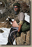
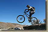
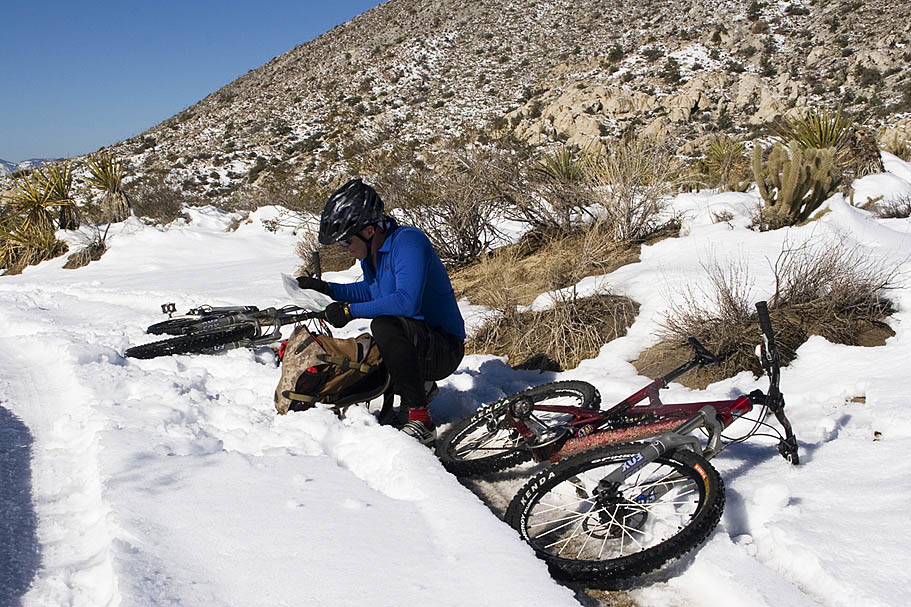
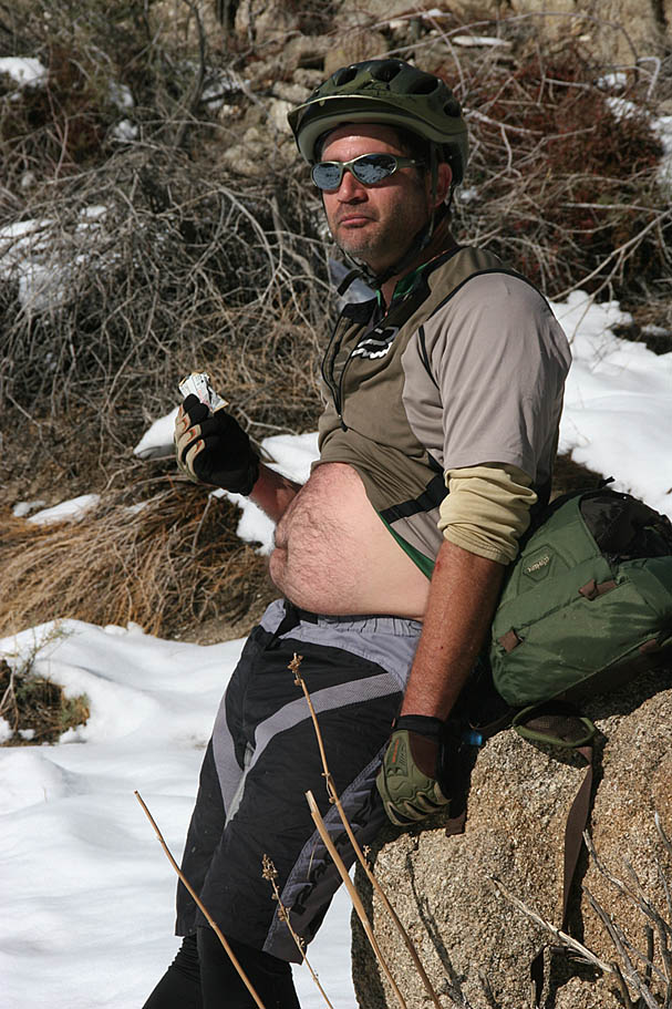
Special Thanks is owed to Greg Lambert, who took quite a few of the shots here, particularly of the fat guy in the blue shirt. My family really appreicated seeing shots of me on the trail since I'm normally behind the lens.
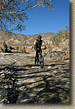
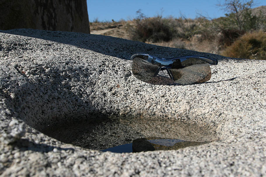
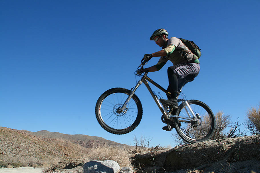
Other Pictures from the day out in the desert |
| |
|

 The next two miles of sandy and slightly downhill trail were just what I hoped it would be, packed and fast. I was digging the easy cruising this section provided. The wide open Hapaha Flat soon gave way to the more defined Fish Creek Wash as we gradually descended into a different geological era when this area was the seabed of the Gulf of California. The steep walls were composed mostly of large sedimentary rocks that looked like you could pull one out from the bottom and the entire wall could come tumbling down. I was not going to test the theory.
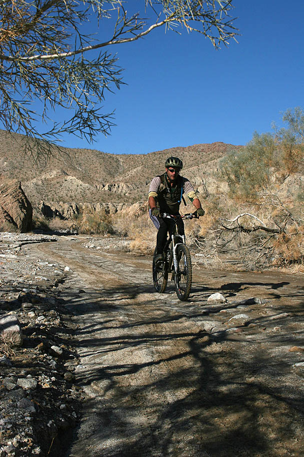
 I have marked some of these feeder washes on my map. Many of the washes contain interesting features that I have only read about so far. Stuff like slot canyons, caves and mud palisades. There are numerous books that describe in great detail the interesting features of these washes you pass by. I am pretty sure that you would spend many years exploring through this area. "Afoot and Afield in San Diego" as well as
"Anza-borrego Desert Region: A Guide to State Park & Adjacent Areas of the Western Colorado Desert" are good resources for those that want to learn more about this place.
I have marked some of these feeder washes on my map. Many of the washes contain interesting features that I have only read about so far. Stuff like slot canyons, caves and mud palisades. There are numerous books that describe in great detail the interesting features of these washes you pass by. I am pretty sure that you would spend many years exploring through this area. "Afoot and Afield in San Diego" as well as
"Anza-borrego Desert Region: A Guide to State Park & Adjacent Areas of the Western Colorado Desert" are good resources for those that want to learn more about this place.  Due to our late morning st
