
The Good Water Rim Trail
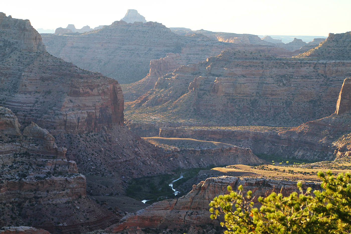
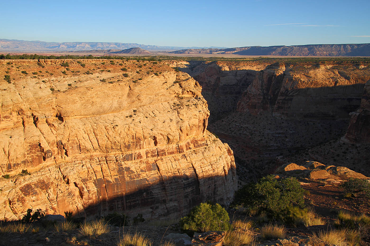
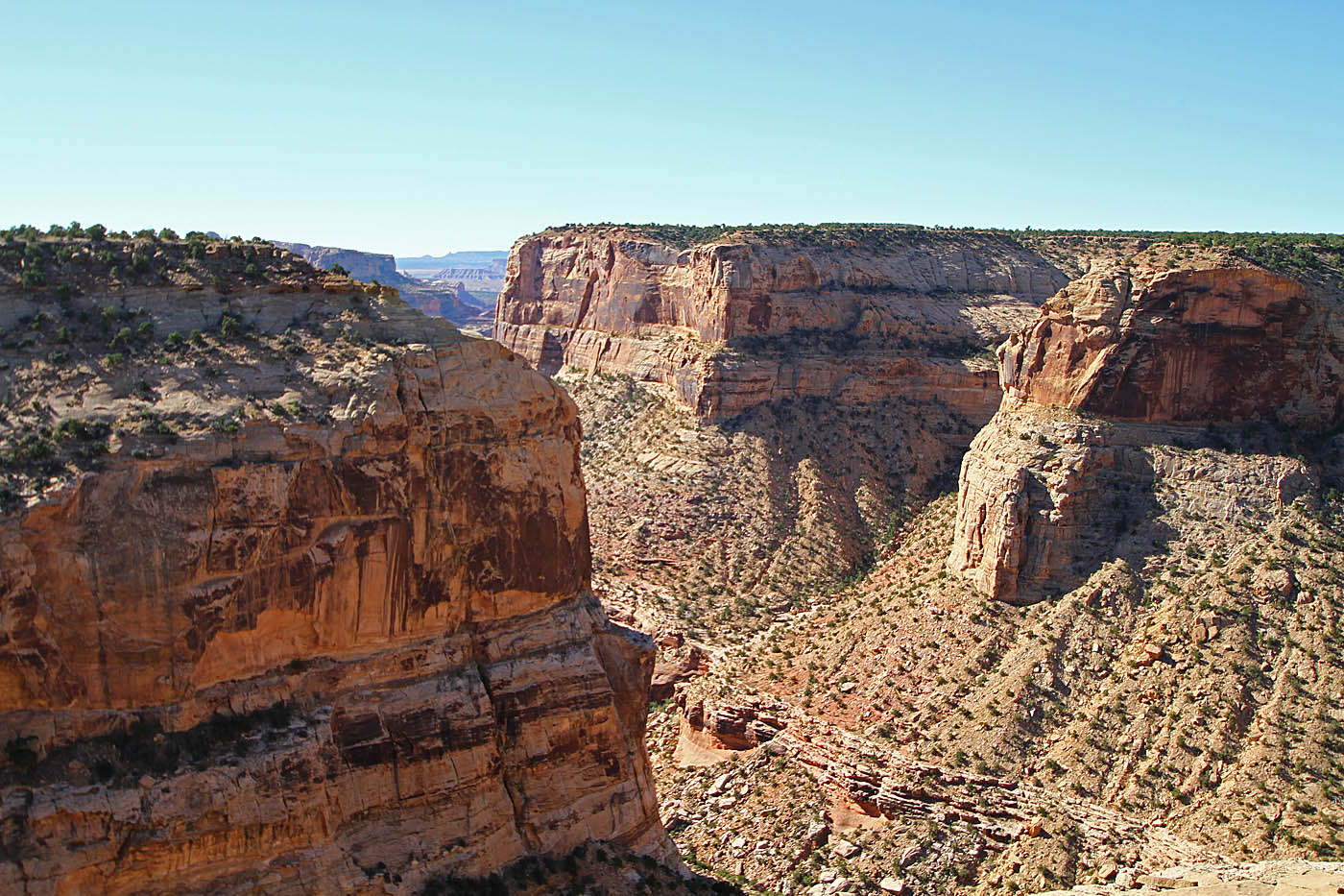
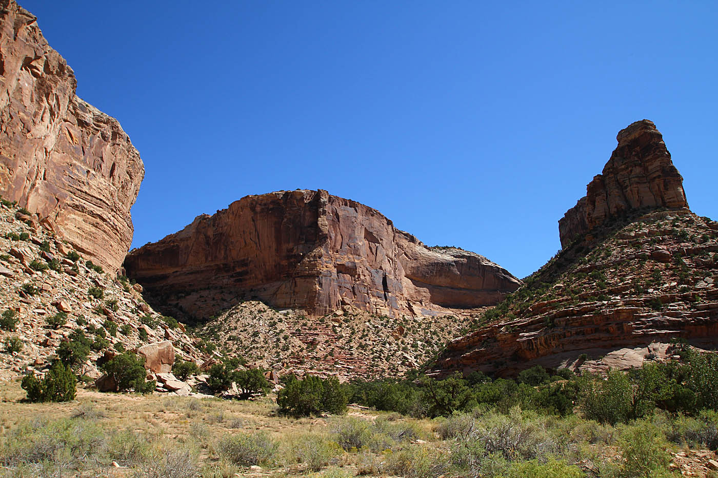
The Good Water Rim Trail is located in an area of the San Rafael Swell of Utah know as "The Wedge". It is not exactly on the way to most MTB road trip destination but it is well worth the stop if you can fit it in. This 15 mile long trail is great XC singletrack that spends the bulk of its route along the rim of Goodwater Canyon which opens up into the "Little Grand Canyon" with the San Rafael River at its bottom.
Good Water Rim Loop:
Hazards: There is no water anywhere along this route, bring a plenty. During the summer time this area can be like a billion degrees. I would consider this a fall through spring ride. You are going to be riding near the rim of a canyon most of this ride. Falling into the canyon would suck. There is a damn good chance help is not goign to be anywhere nearby.
- From Crystal Dale: This is the primary trailhead I would use.


- From I-70 Sinbad/Buckhorn Exit:
Ride Report:I first learned of this place from the fellows over at UtahMountainBiking, so please take a look at thier write-up of this place. They have some additional details that I don't cover.
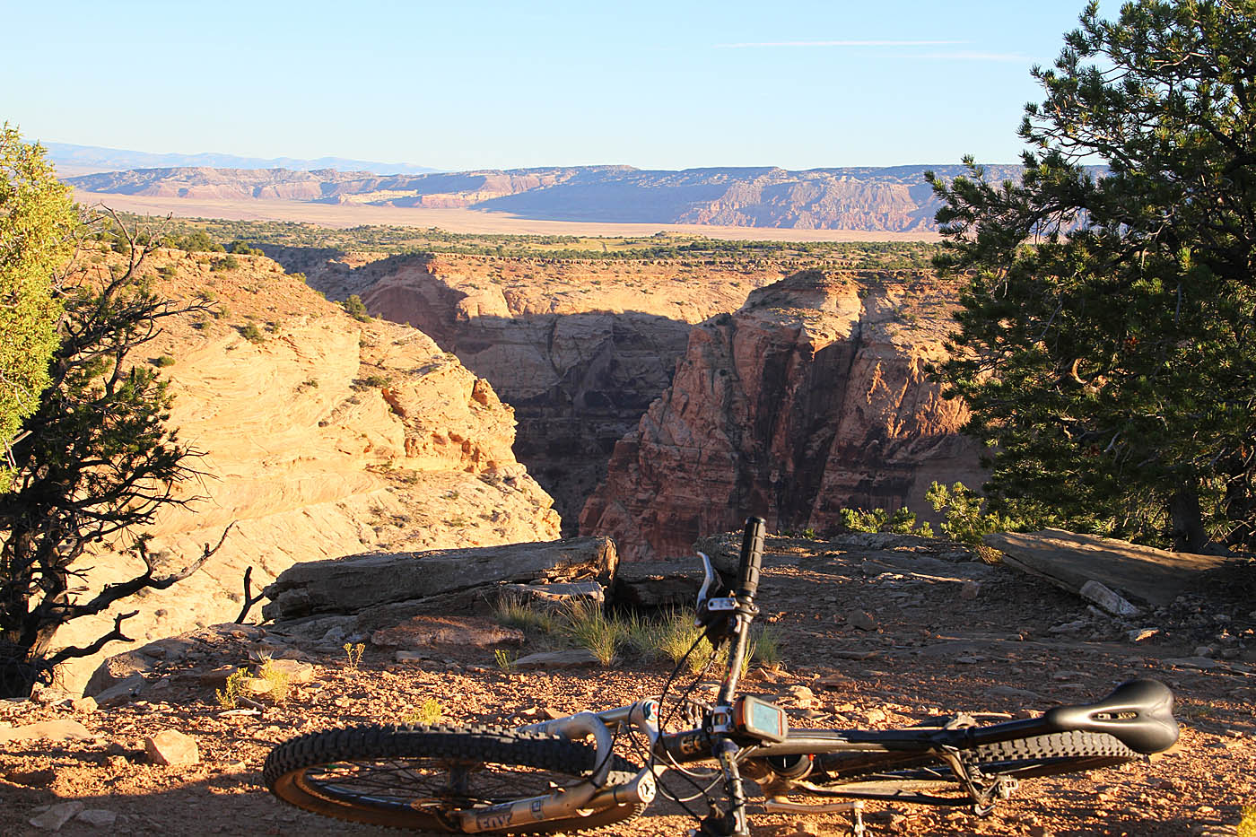
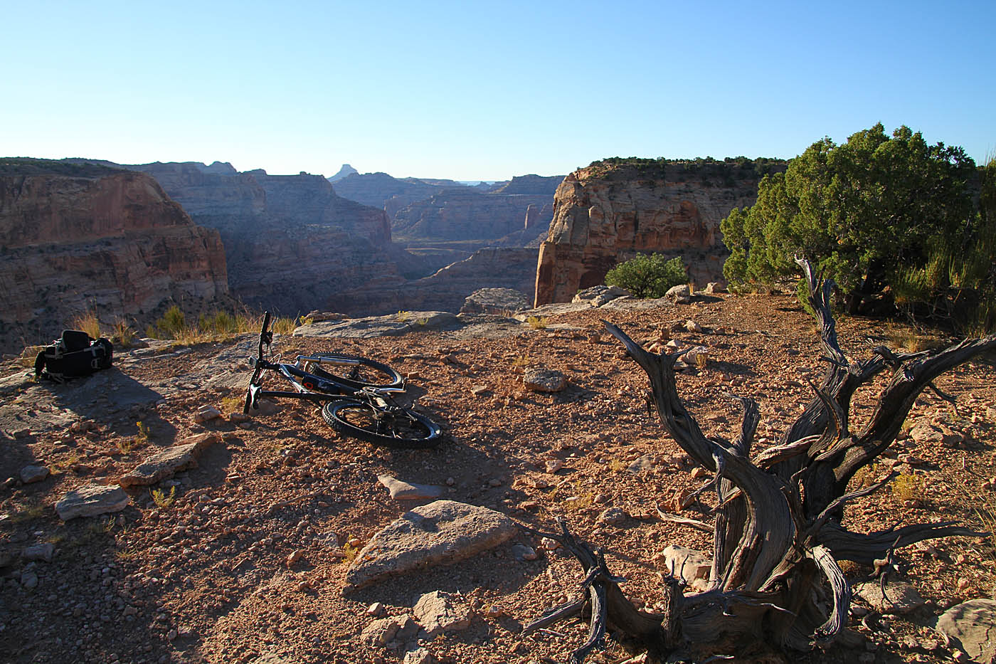
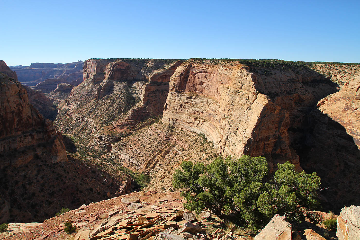
I did this ride as part of what I calling my 2015 Chasing Aspens Tour. It was a 10 day jaunt through Colorado (and this trail). On day one I did the long drive from San Diego to here where I setup camp along the doubletrack on the southwest section of this loop along the rim of the Little Grand Canyon. There is a pit toilet near main overlook "spot" that you come to when you first drive up to the edge. (Its shown on the interactive map above). There are a couple of kiosks in this area but its interesting that the trail is not shown on those maps.

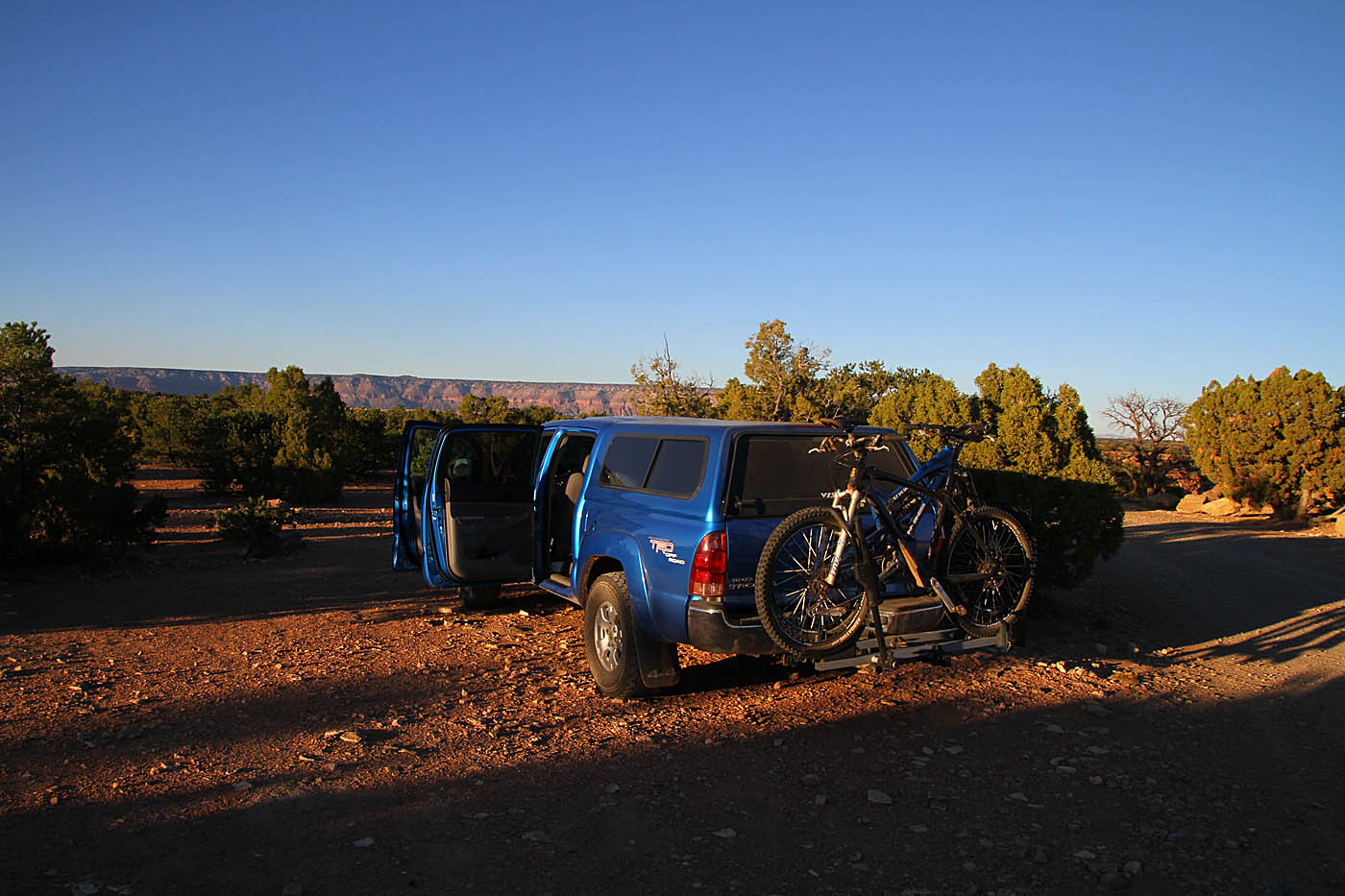

Knowing that I had a good chunk of driving the following day, I actually set my alarm clock. I was up a little pre-dawn to get ready for the morning's ride. I strolled across the doubletrack from camp to enjoy my morning coffee and oatmeal on the edge of the Little Grand Canyon.
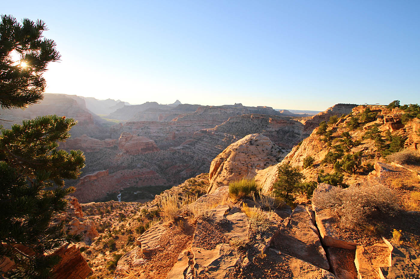

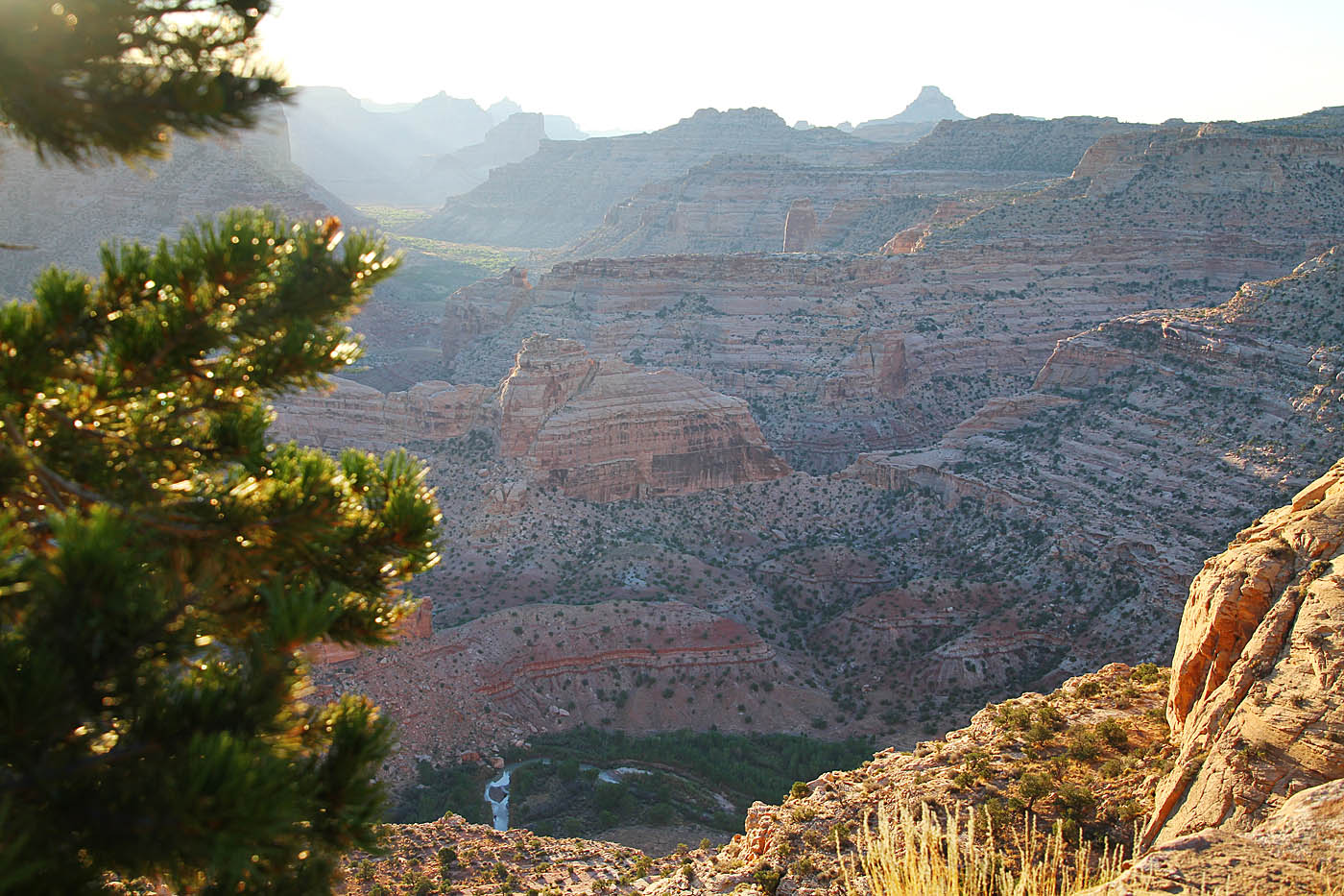


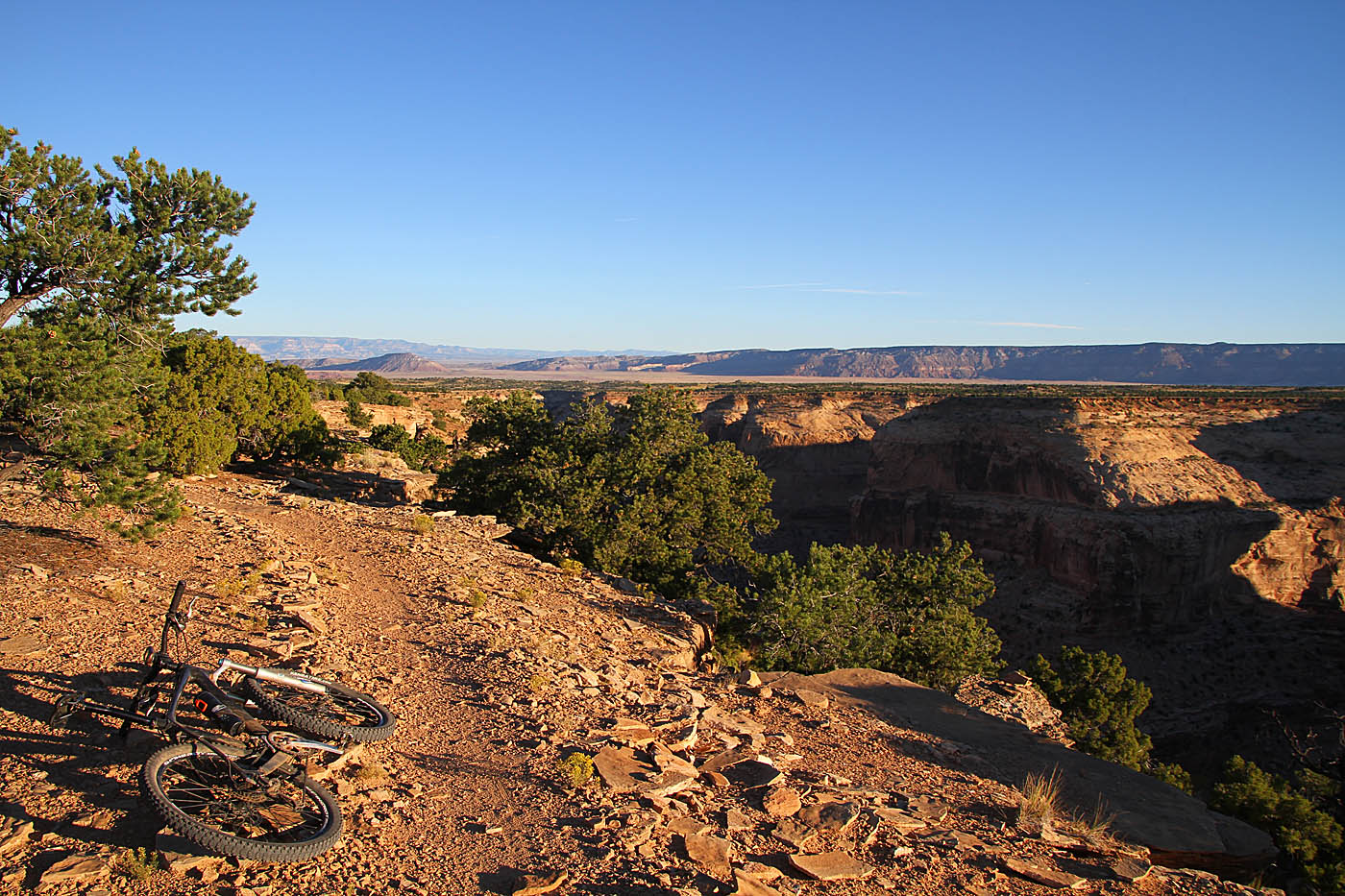
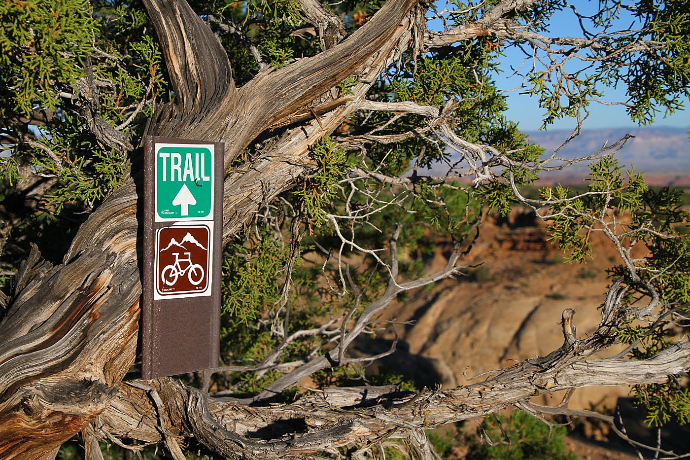
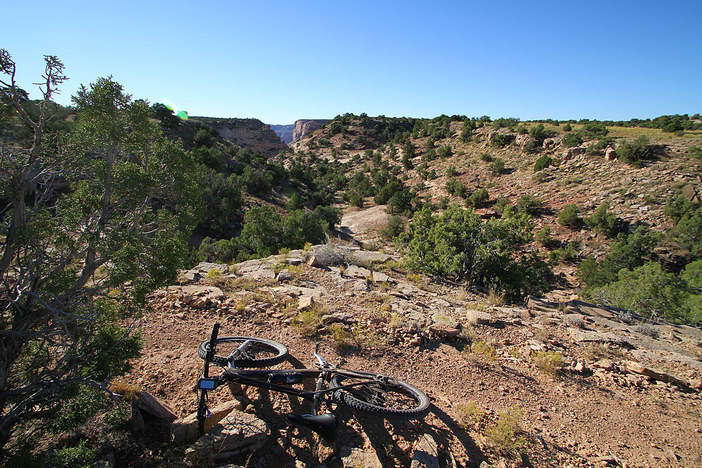
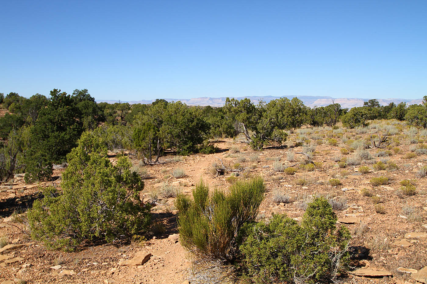
There were a few other people camping in the area and the afternoon before I did some quick chit-chat with them. They all recommended doing the singletrack clockwise with and then loop back on the dirt roads. I heard that recommendation from three different sources so that was the plan. Rolling out along the doubletrack from camp, the singletrack soon starts along the rim of the canyon. There are very view signs for the trail but it easy enough to follow.
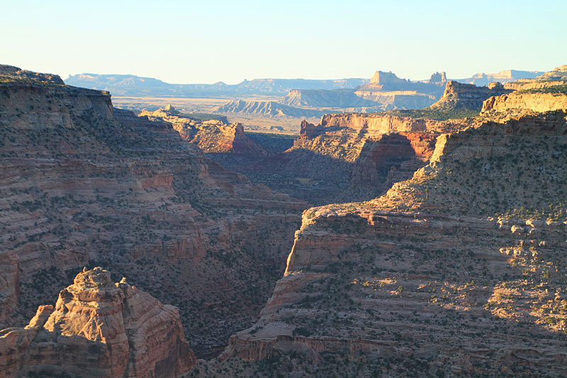
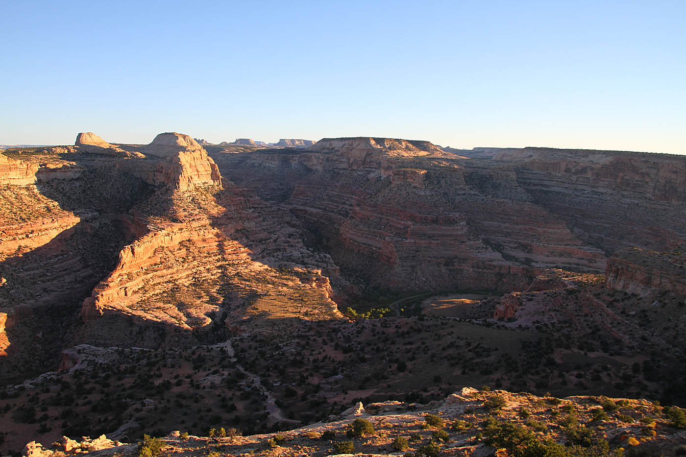
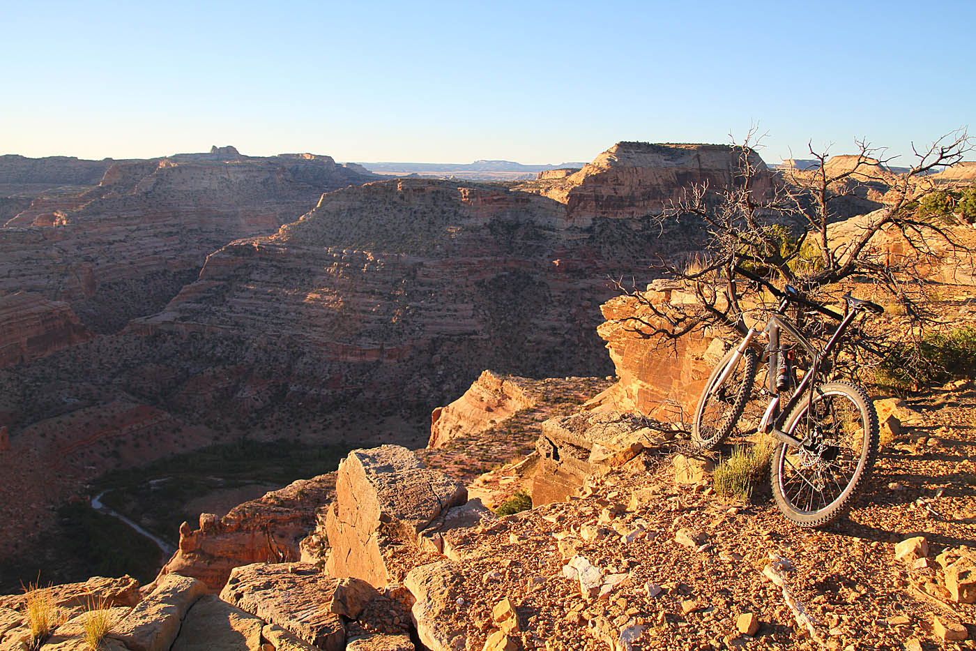
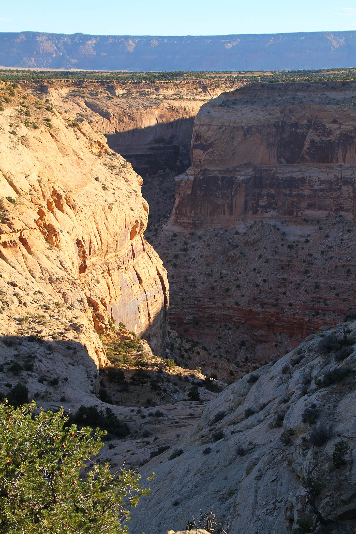
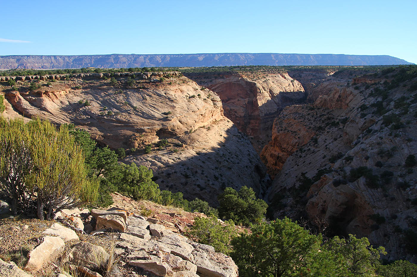
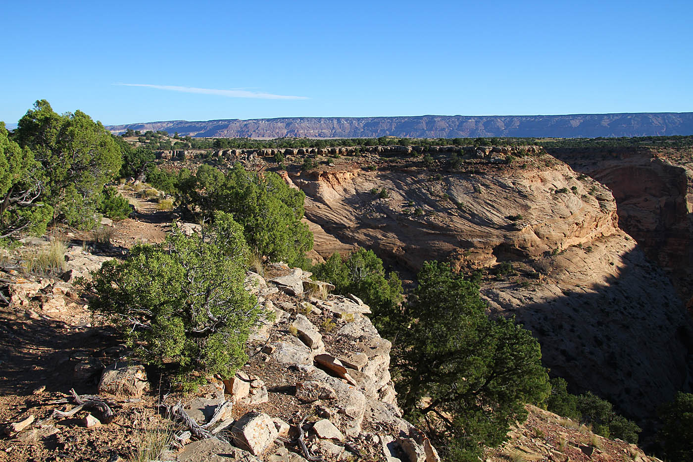
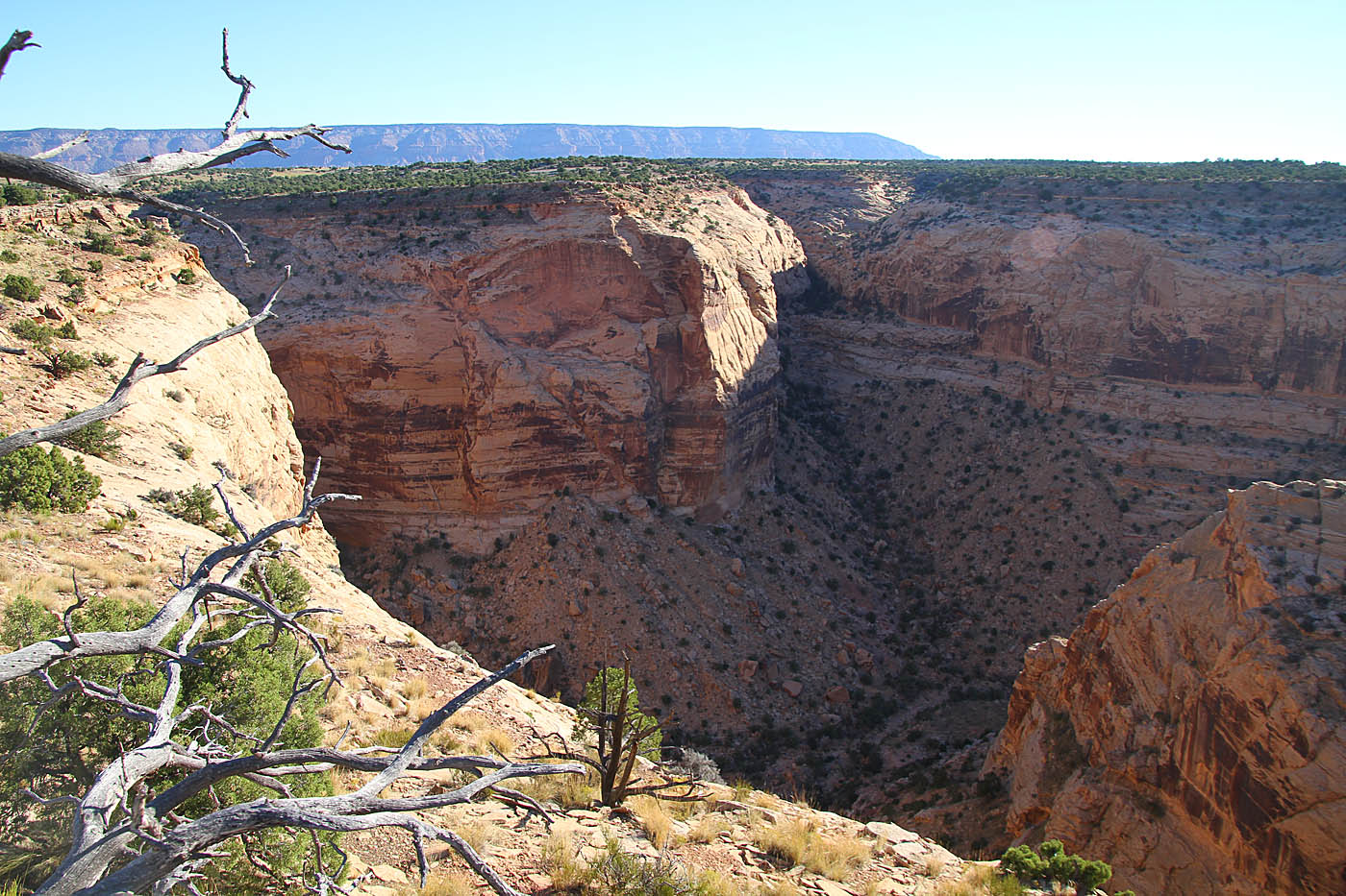
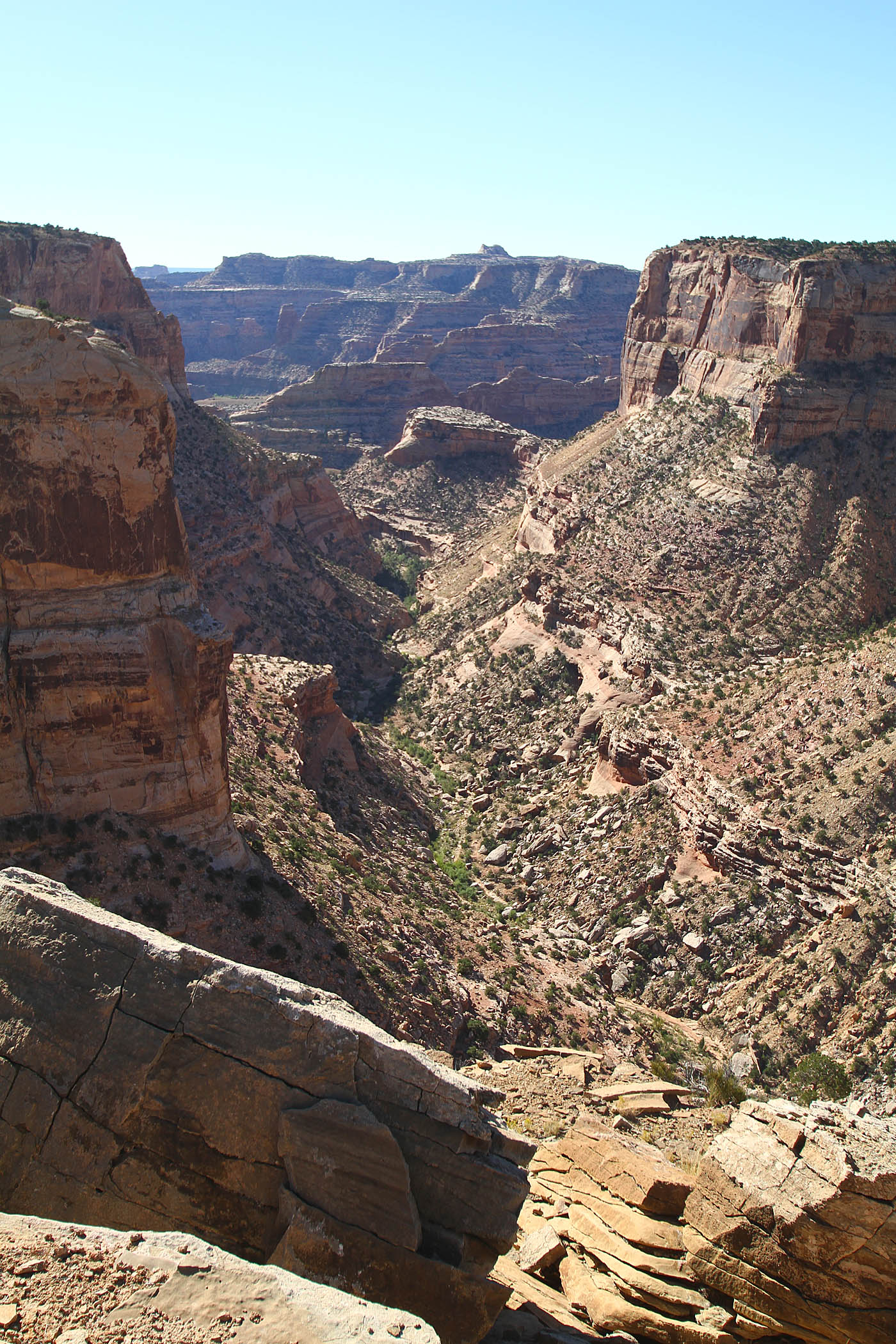
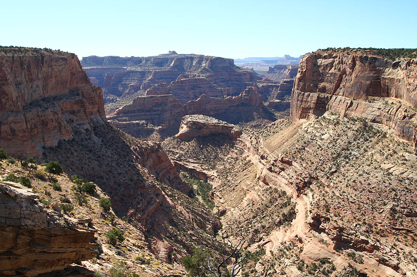
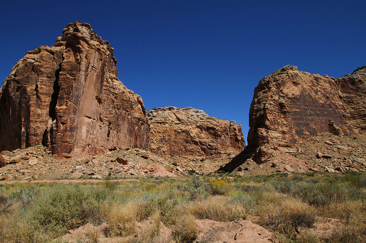
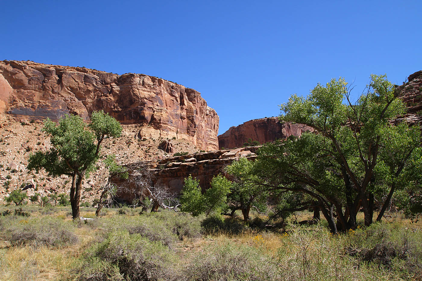
The primary take away from this shot is that all of the rim of the canyon you see is where the trail is. On the rim, good stuff.

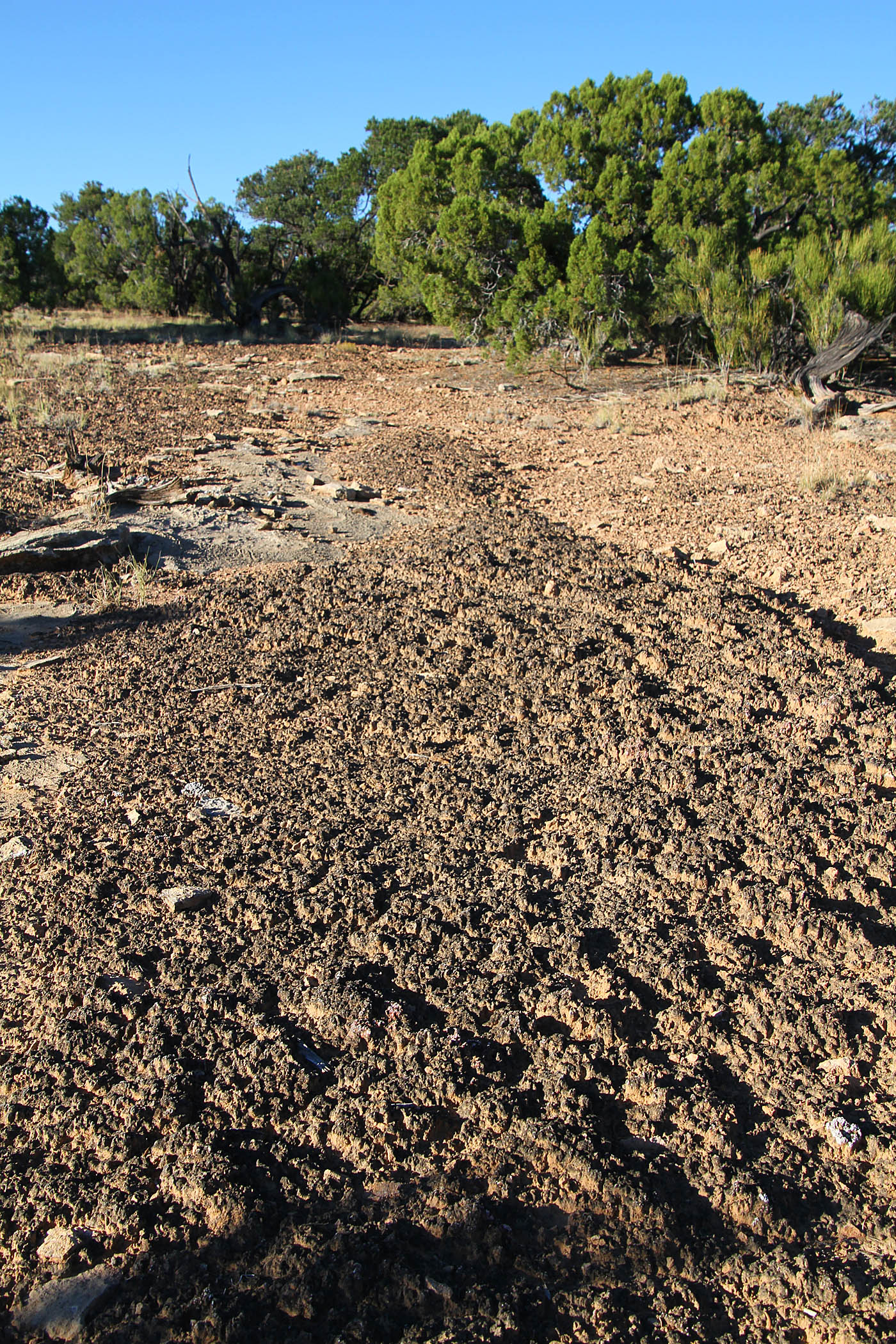
With that side the trail is not overly trammeled so there are quite a few spots particularly in the rockier spots you will need to pay a bit of attention to follow the trail. I found in almost all of the questionable spots the trail was more towards the rim. There is cryptobiotic soil in the area (Blackish Crust) so you should take all due caution to stay on the trail and off of the undistubed soil. Crytobiotic soils crusts are an important part of the high desert ecosystem and it will take five to seven years for even a thin layer to regenerate and somewhere between 50-250 years to fully recover.So DON'T BUST THE CRUST!

This trail does not contain anything partciular technical, it does not contain any signficant climbs nor descents and has no stunt features. This is Grade A fantastic cross-country goodness with amazing views along a skinny, untrammeled well built singletrack. It is well built in that fact that it just enough built. The trail seems part of the landscape vice punched through the landscape. Bravo of to the builders of this trail.

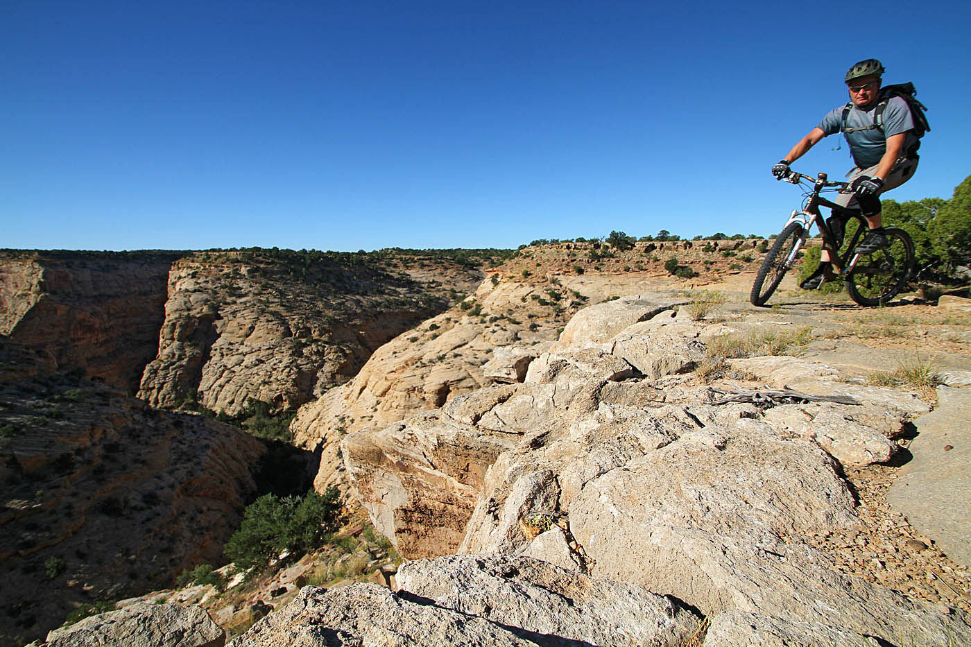
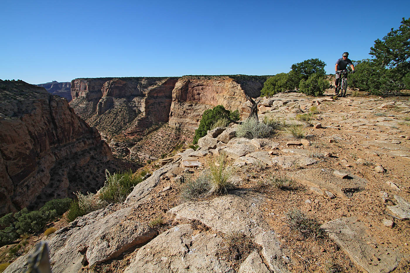
Even when you are going uphill you feel like you are barely going uphill and when you are going downhill you are barely going downhill but enough so that you can coast and just enjoy yourself. And you should enjoy yourself. Bring your camera and take in all the fantastic views along this singletrack.


If I had to sum up this singletrack I would say it is like having a tasty lollipop in your mouth. It is just enjoyable and stays that way.
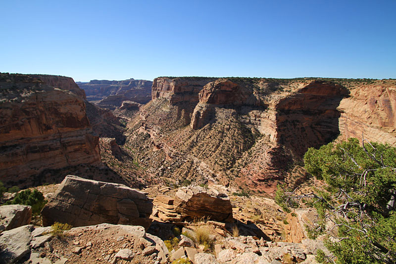
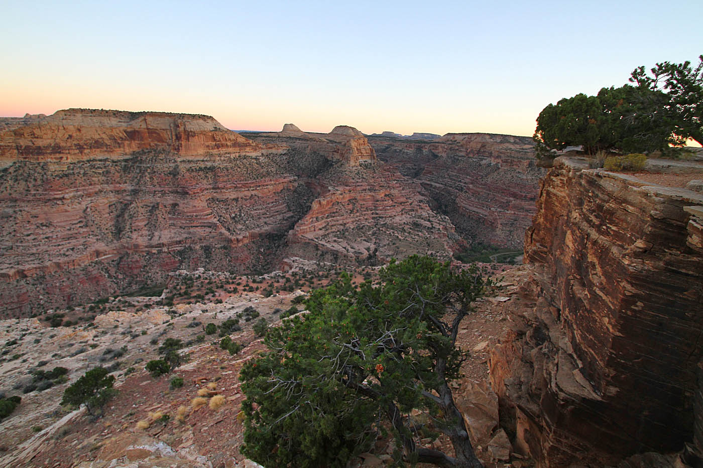
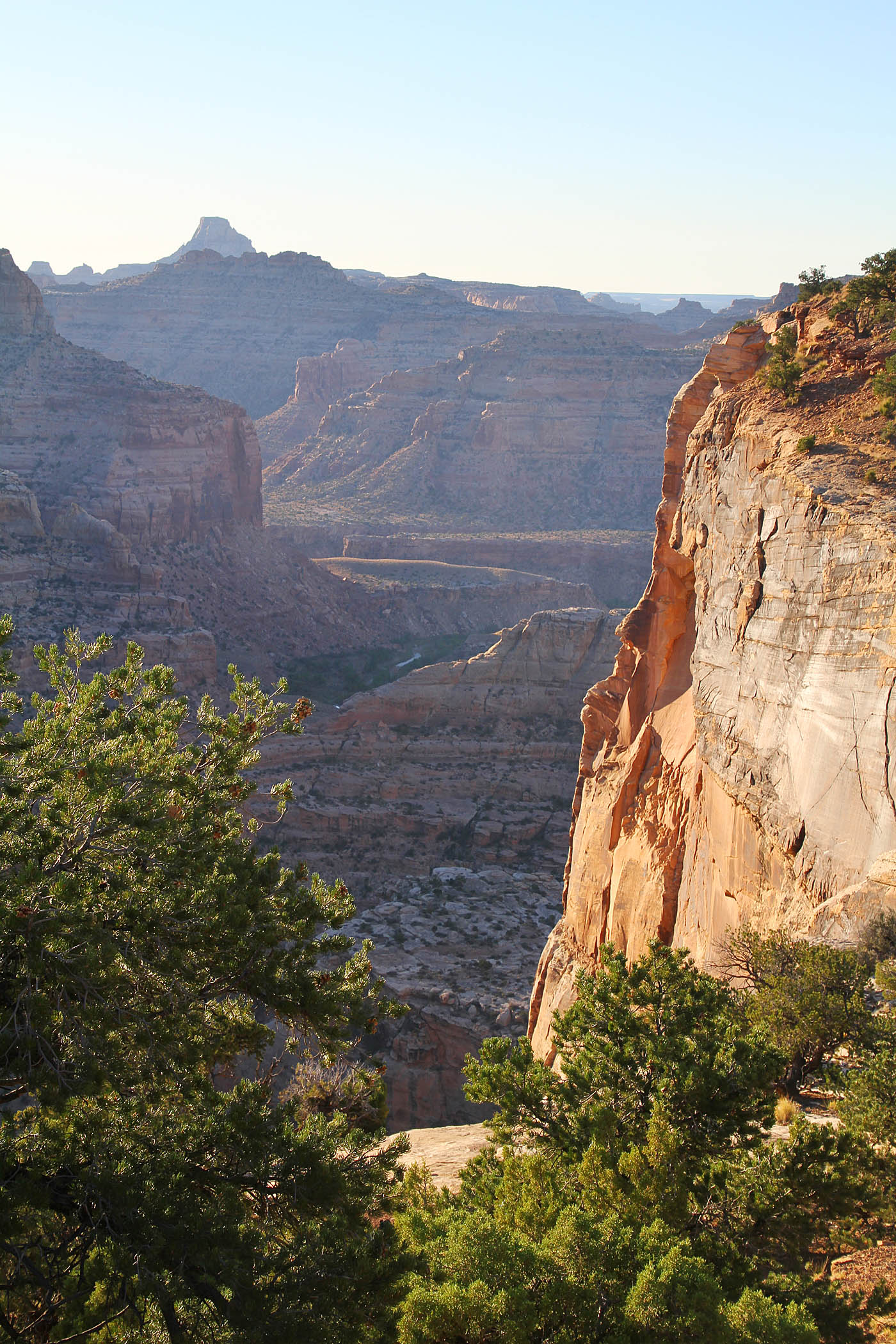
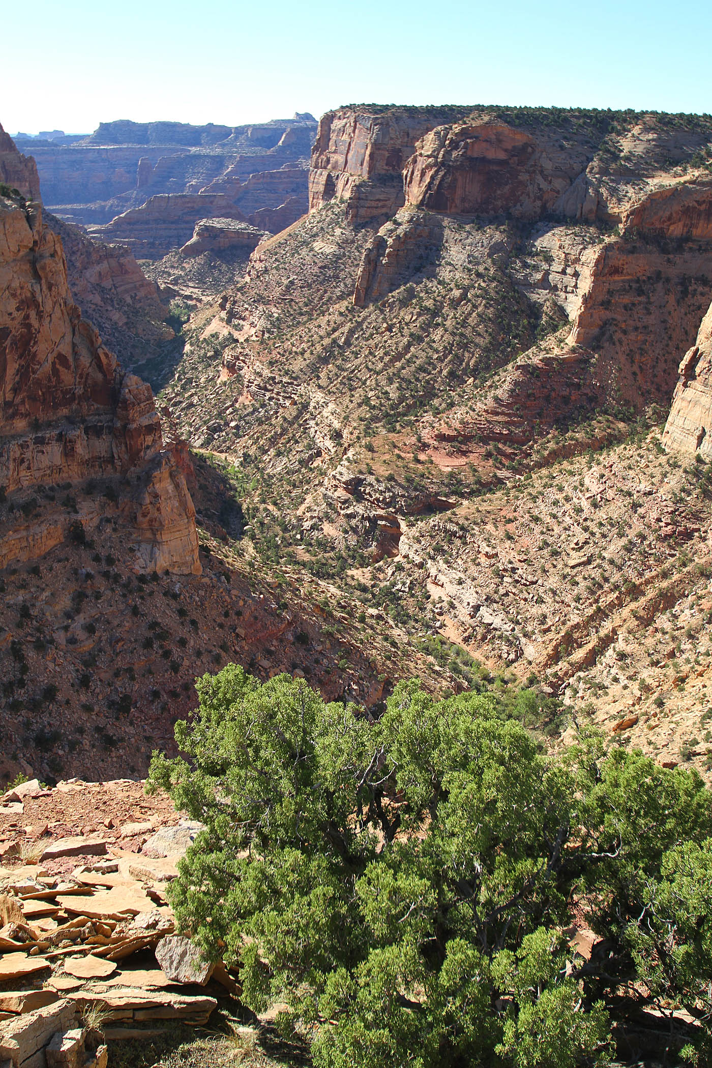
Along the rim of the Good Water Canyon Rim. In the distance the canyon opens out into the Little Grand Canyon. The trail is along all of the rim in the picture.
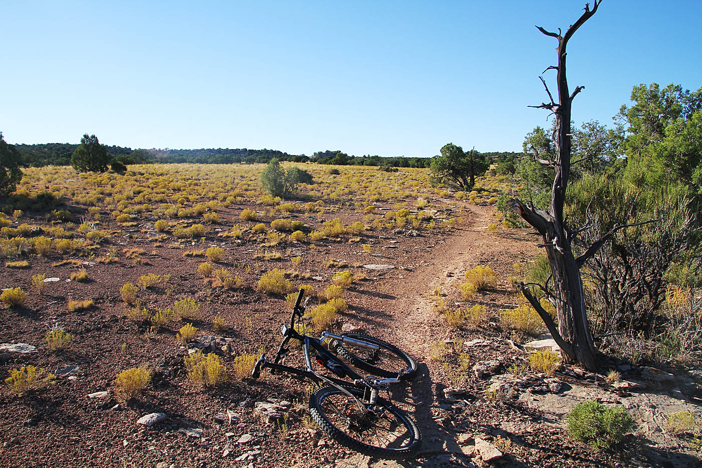
 After about 15 miles of this singletrack goodness on both the east and west side of the Good Water Canyon. The singletrack ends at the southeast end of the canyon and primitve campsite area at the end of a doubltrack. You will be taking that doubletrack east and then follow it around to the north and west where it will connect back up to the dirt road that you drove in. You will then turn south and close back off the loop. The total doubletrack cruising you will do is six miles for a total of around 21 miles all together. I see no reason why you could not turn around and do the singletrack going the other way but I have no compliants about the recommended route I took.
The Drive Out

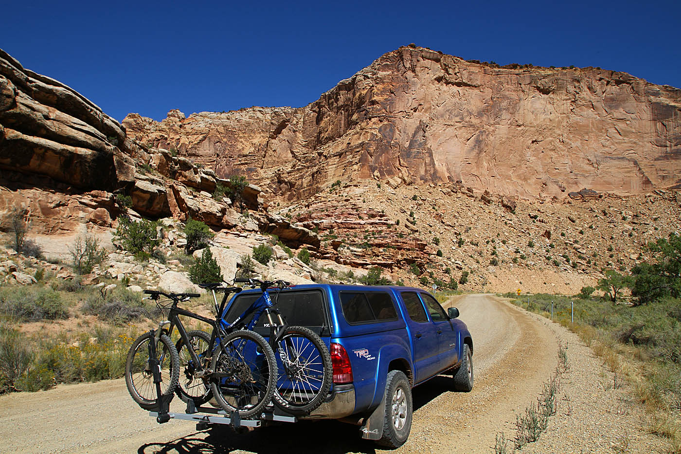
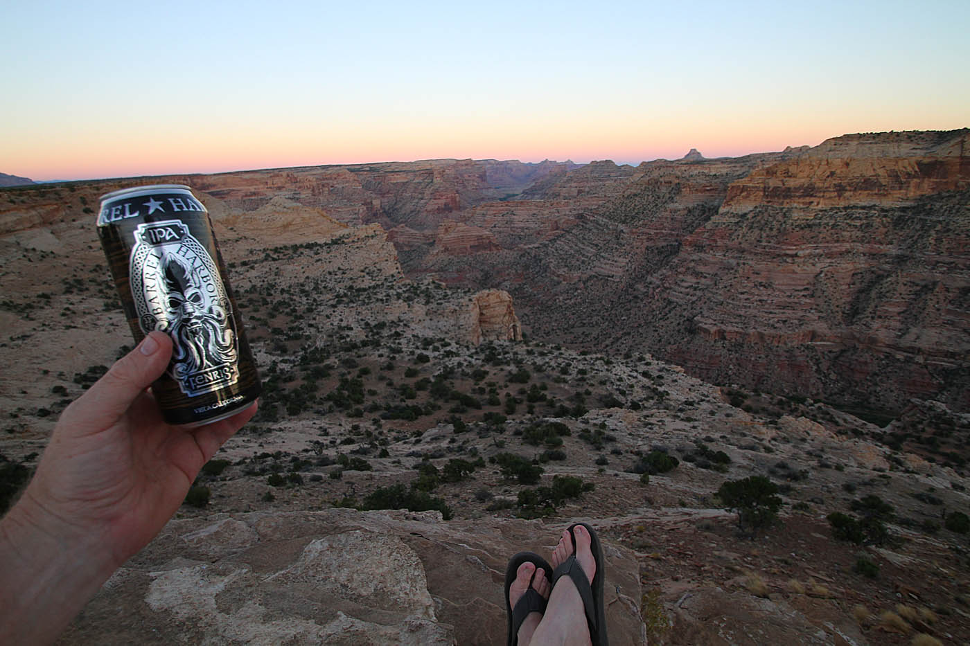
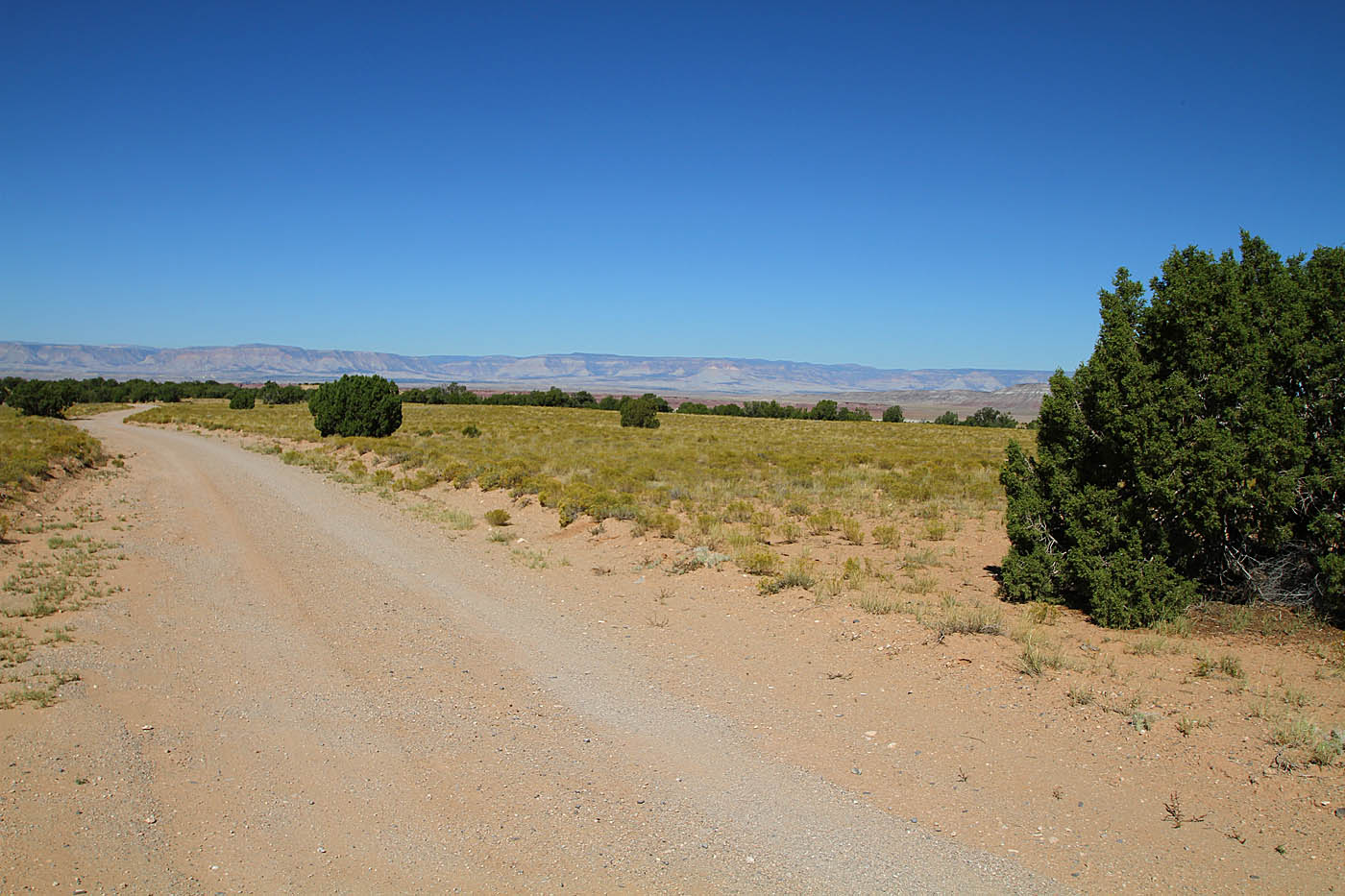
Once back at camp, I enjoyed a tasty beverage while breaking down camp. I had came in from the west via Crystal Dale and I was going to go out via Buckhorn Wash out to I-70. It was about 32 miles of dirt road riding to get back to the interstate. (I included the route in my GPX file above). There was some pretty countryside along this route that went down into some of the distant lower areas you could see from the Little Grand Canyon overlook area.

One of the highlights of this drive was a couple of spots where you could like at some of Indian rock art. I did not mark it in my GPS, but at least two of the spots are signned so it is hard to miss. It was well work the stop. Once back on the interest I made a long drive to Winter Park Colorado where the adventures of Day 3 would start.
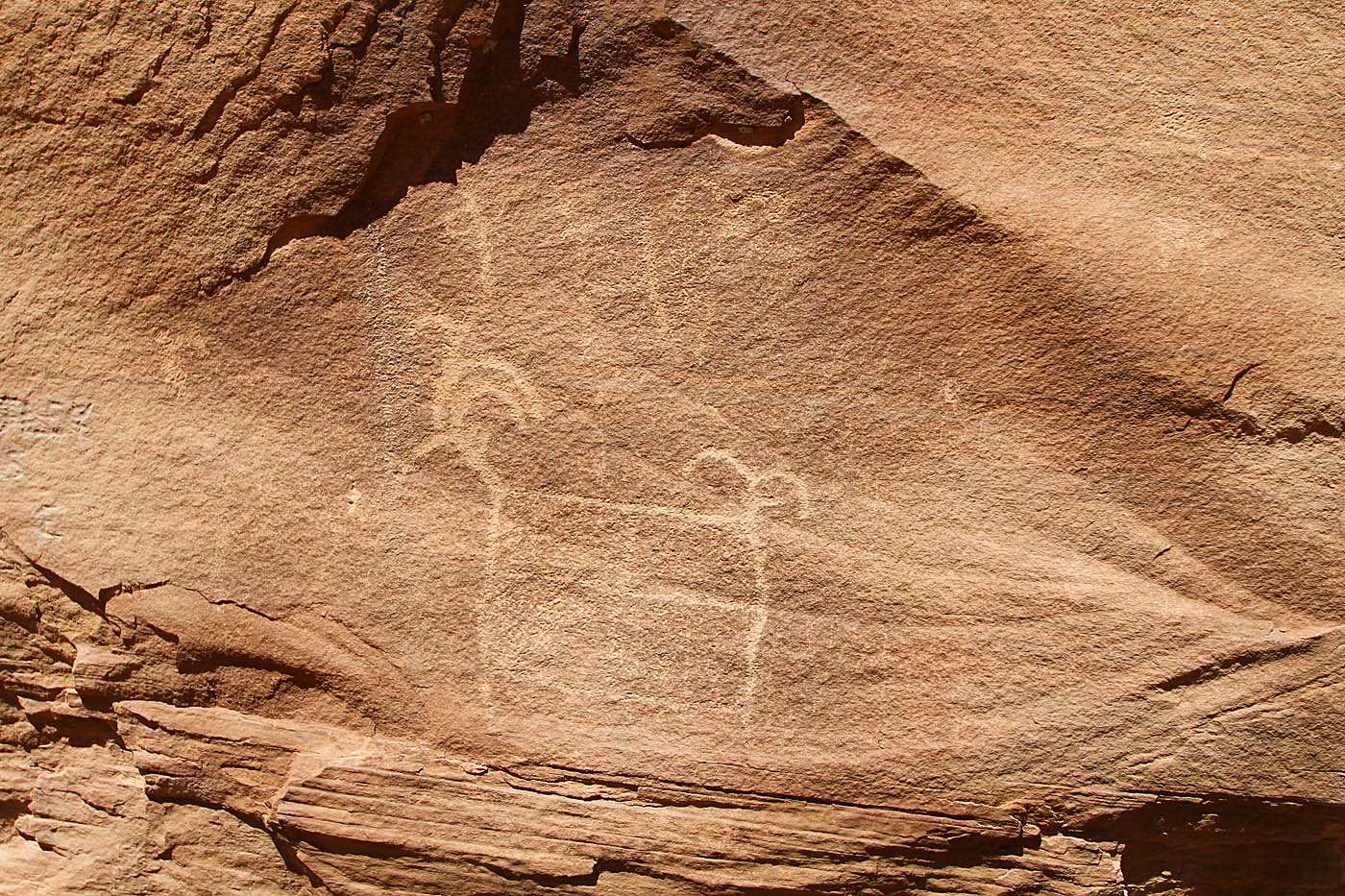
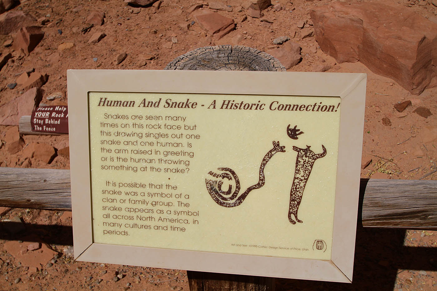
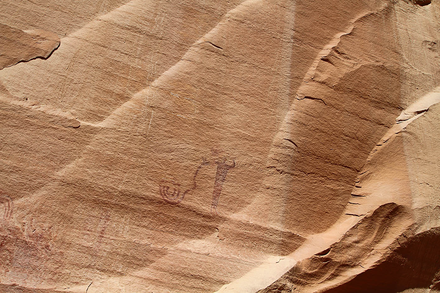
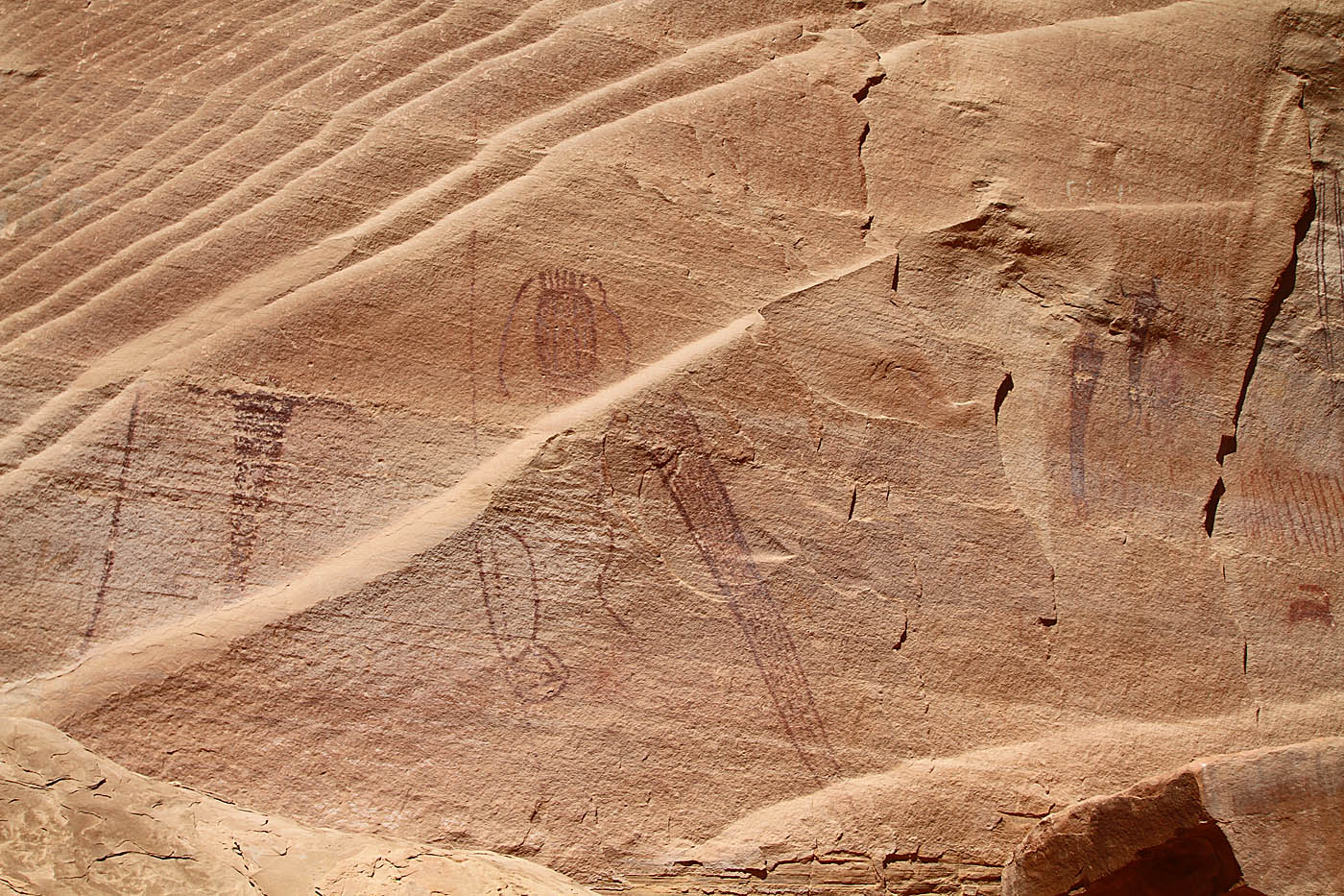
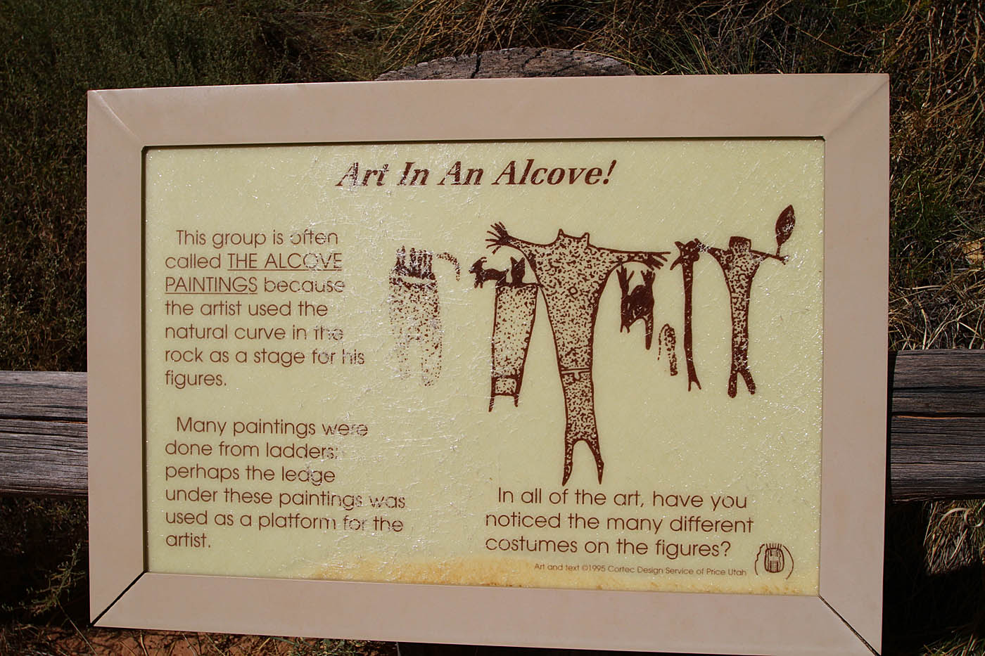
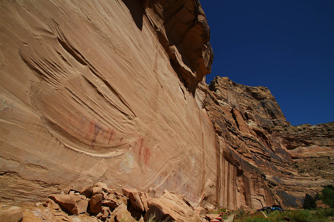
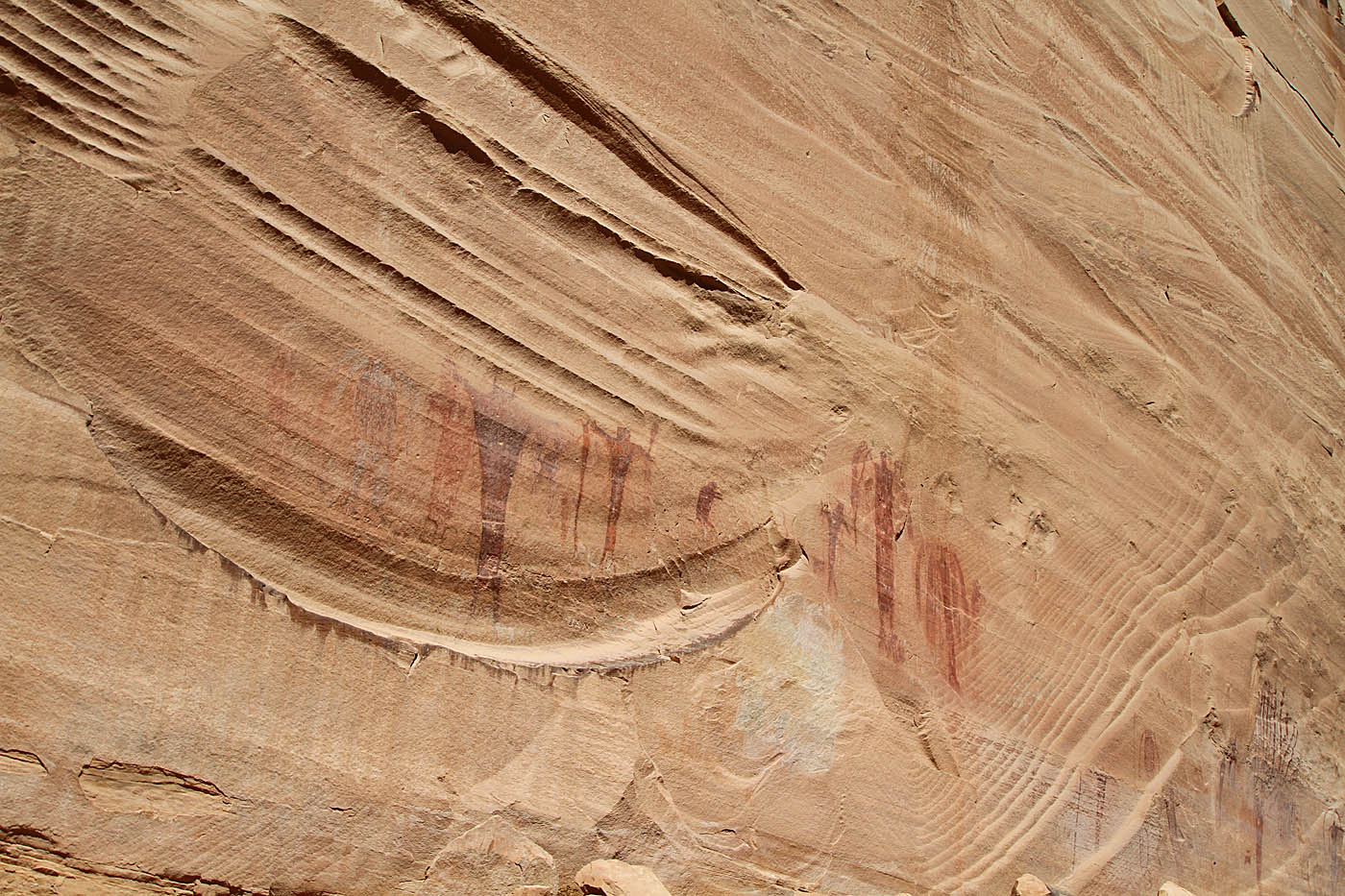
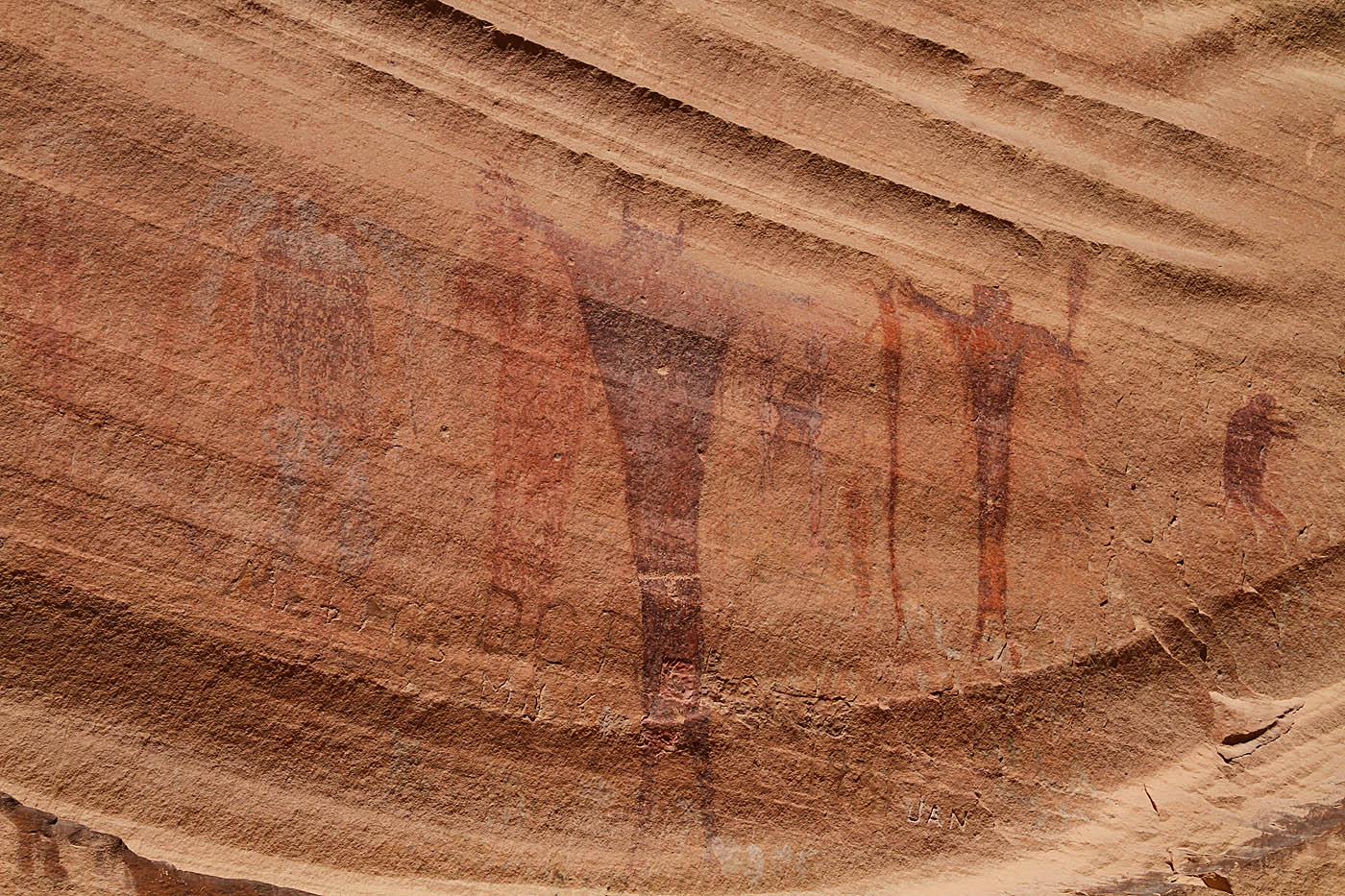
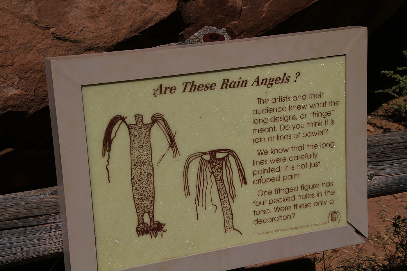
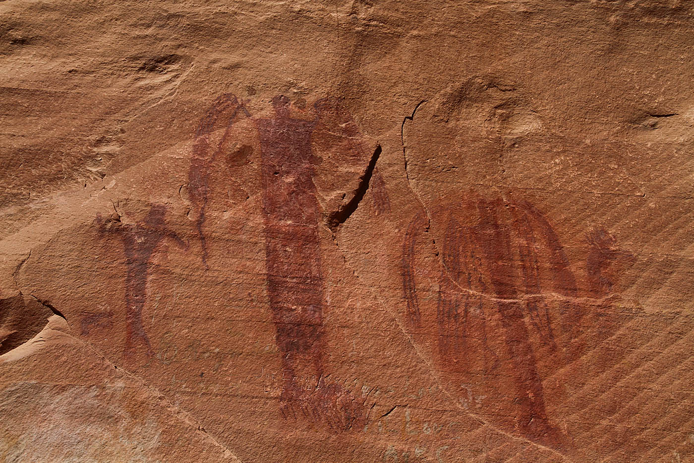
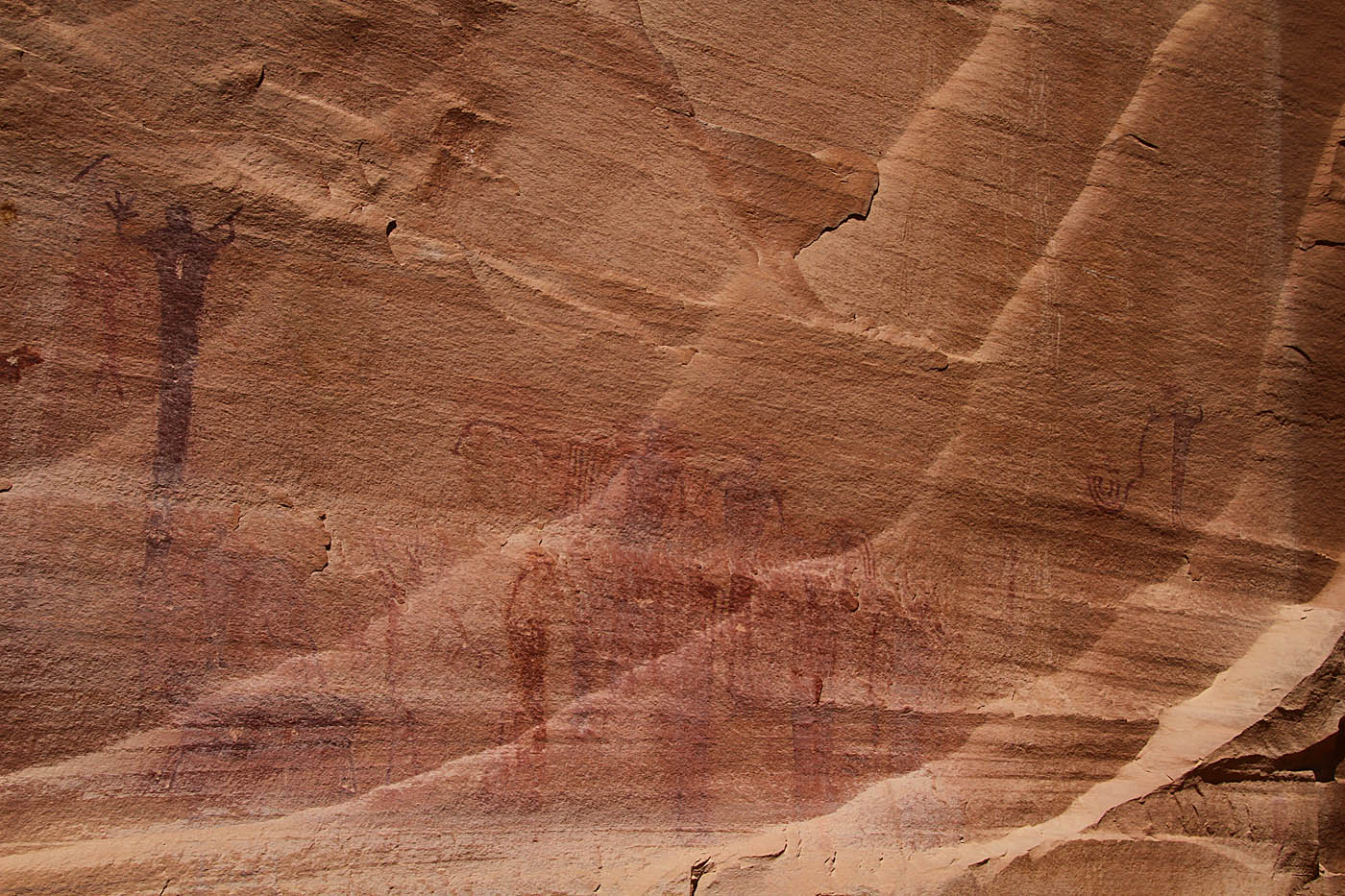
Some of the various Indian Rock art of the canyon wall