
Thomas Mountain and the Ramona Trail
GPS Files for all trails and spurs on the immediate area: TOPO!, GDB, GPX, KML.
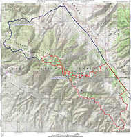
The route described: ![]()
![]()

DIRECTIONS: You can do this loop starting from either the bottom of the Ramona Trail or at the start of the Thomas Mountain Truck Trail. It depends on if you want to do the 2.8 mile road part of the loop at the beginning or end of the ride.
- Get directions from your current location to Ramona Trailhead.
Start of Thomas Mountain Truck Trail from Ramona Trailhead: From Ramona Trailhead parking lot, turn right and take HWY-74 1.5 miles to Pyramid Peak Road. Hang a right here and go .4 miles to another T-junction at Hop Patch Springs road. Turn left miles and follow the road .8 miles where you will see a dirt pullout on your left just aa the road turns to dirt. Park Here. Get directions from your current location to this spot.
RIDE NOTES: These notes are for starting at the beginning of Thomas Mountain Truck Trail. Add to 2.8 miles to the mileage I mention if you start from Ramona Trailhead.
2021 Update
I first did this ride with Mike Kim on December 20th, 2003 with an early start. It was quite nippy by Southern California standards (around 40 degrees) at 4,750 feet. The initial climb was actually welcomed as it was guaranteed to get us warmed up a little. The fireroad was not too tough and we made good time up to the ridgeline at the 1.2 mile mark where we broke out into some welcomed sunshine..
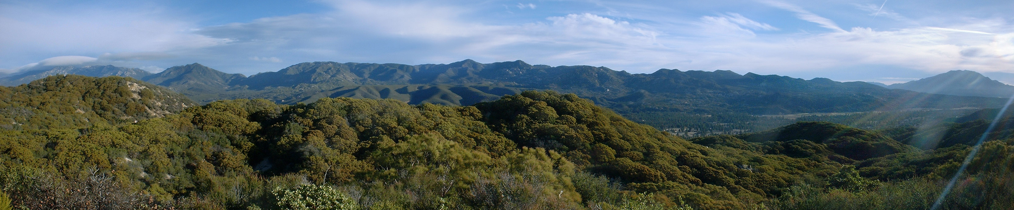
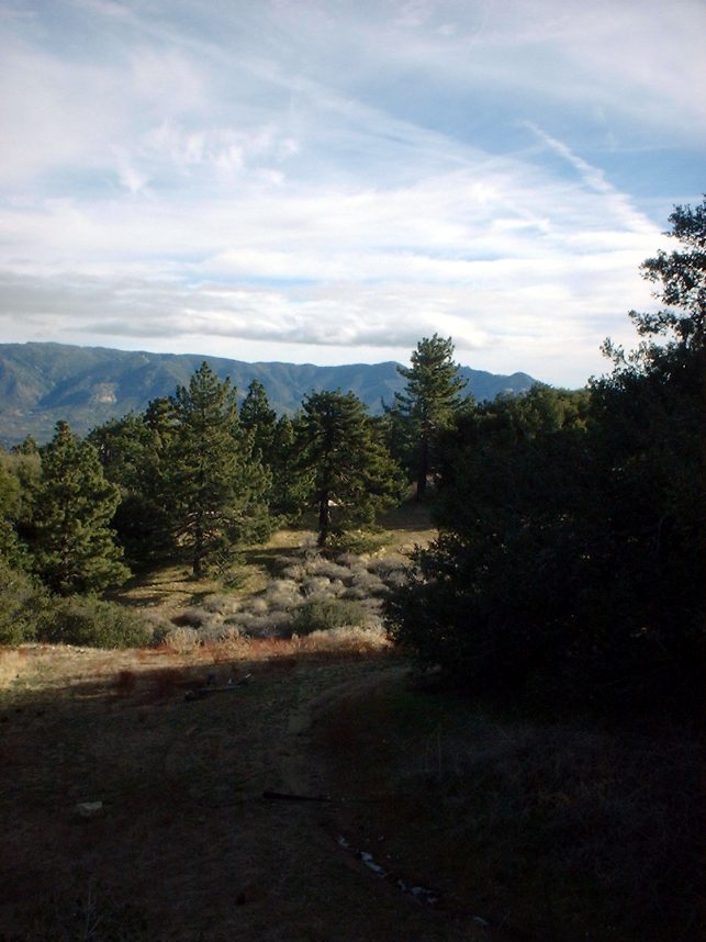
 Here is a panoramic shot take once up on the ridgeline at
Point A (see map) looking south-southwest across the Cahuilla and Anza Valley at
the Iron Spring (near) and Palomar (far) Mountains in the distance.
Here is a panoramic shot take once up on the ridgeline at
Point A (see map) looking south-southwest across the Cahuilla and Anza Valley at
the Iron Spring (near) and Palomar (far) Mountains in the distance. 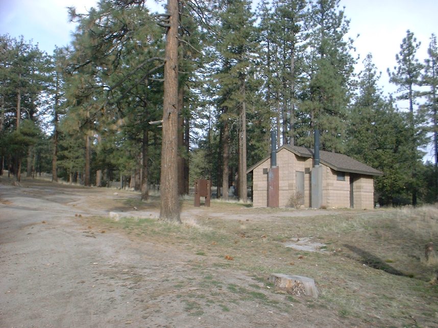
 The
next section of mountain road started out as chaparral and slowly gave way to
sparse pine trees as we climbed up to Toolbox Springs Campground at 6,150
feet at mile 5.5. This is the "traditional" start of
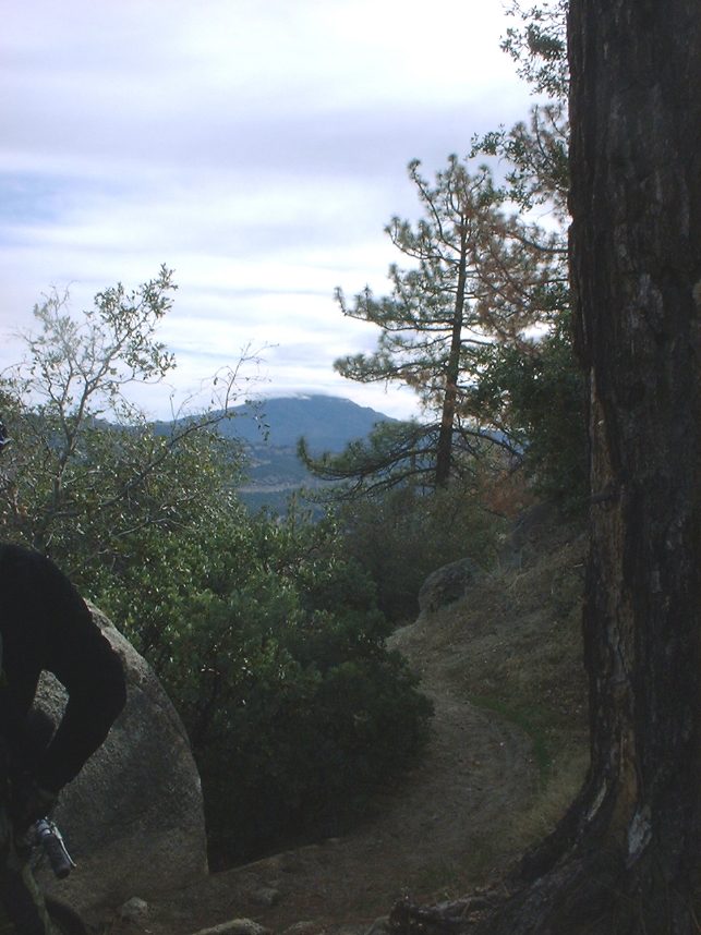
the Ramona trail. We did something different that added some more
singletrack. We picked up the Ramona trail off to the right of the
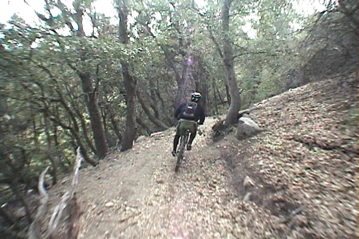
restrooms. (The picture to the left was taken from the trail).
We then rode down the trail for maybe 100 yards and then hung a left onto another
single track. I am unsure what the trail name is, but it is labeled with
a USFS trail marker that does show it is open to Mountain Bikes.
The
next section of mountain road started out as chaparral and slowly gave way to
sparse pine trees as we climbed up to Toolbox Springs Campground at 6,150
feet at mile 5.5. This is the "traditional" start of
the Ramona trail. We did something different that added some more
singletrack. We picked up the Ramona trail off to the right of the
restrooms. (The picture to the left was taken from the trail).
We then rode down the trail for maybe 100 yards and then hung a left onto another
single track. I am unsure what the trail name is, but it is labeled with
a USFS trail marker that does show it is open to Mountain Bikes.

 We
followed this rolling singletrack (more rolling up than down) until at mile 6.15
it crossed a fireroad that connects some primitive campsites to Thomass Mountain Road. We did not continue on the singletrack at
this point. Instead we hung and left on the fireroad and went uphill. We rejoined Thomas Mountain road at mile 6.5 and continued uphill
(to the right). This section of singletrack is a nice break from the climbing, but you may just want to continue on Thomas Mountain Road
instead of taking this side trip as you will go down this singletrack latter in the ride. (My GPX route, reflects staying on the road)
We
followed this rolling singletrack (more rolling up than down) until at mile 6.15
it crossed a fireroad that connects some primitive campsites to Thomass Mountain Road. We did not continue on the singletrack at
this point. Instead we hung and left on the fireroad and went uphill. We rejoined Thomas Mountain road at mile 6.5 and continued uphill
(to the right). This section of singletrack is a nice break from the climbing, but you may just want to continue on Thomas Mountain Road
instead of taking this side trip as you will go down this singletrack latter in the ride. (My GPX route, reflects staying on the road)
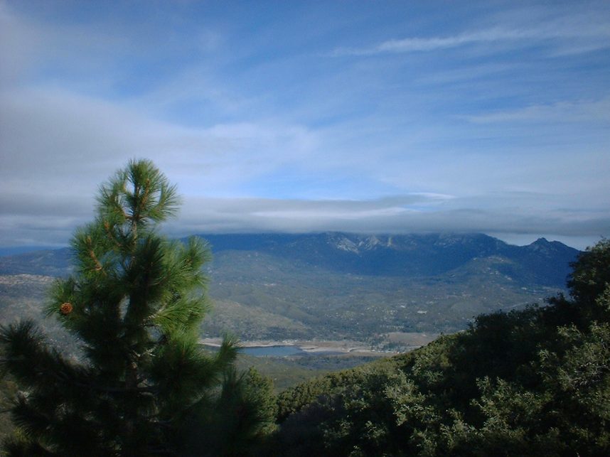
 From
this point the climbing became a little more intensive and the pine trees became
larger and views just kept getting better. We also starting noticing the remnants
of snow in the shade which is always nice to see in SoCal. At 8.3
miles we peaked out at 6,667 feet near the peak of Thomas Mountain. There
is a trail off to the left that takes you up to the peak at 6,825 feet (we did
not take it). From here Thomas Mountain Road turns downhill, but we only
went a short ways (at little over .1 mile) to the first sharp turn (left) where we
picked up a single track. There is a trail marker right in the
middle of the turn so it is somewhat hard to miss. The trail does not have a signed name or forest service trail number. For lack of anything else I will refer to it as Upper Ramona Trail.(Update: As of May 2021, the trail marker does not reflect a name or number but the update forest service maps show it to be "Thomas Mountain Bike Trail", number 3E37.)
From
this point the climbing became a little more intensive and the pine trees became
larger and views just kept getting better. We also starting noticing the remnants
of snow in the shade which is always nice to see in SoCal. At 8.3
miles we peaked out at 6,667 feet near the peak of Thomas Mountain. There
is a trail off to the left that takes you up to the peak at 6,825 feet (we did
not take it). From here Thomas Mountain Road turns downhill, but we only
went a short ways (at little over .1 mile) to the first sharp turn (left) where we
picked up a single track. There is a trail marker right in the
middle of the turn so it is somewhat hard to miss. The trail does not have a signed name or forest service trail number. For lack of anything else I will refer to it as Upper Ramona Trail.(Update: As of May 2021, the trail marker does not reflect a name or number but the update forest service maps show it to be "Thomas Mountain Bike Trail", number 3E37.)
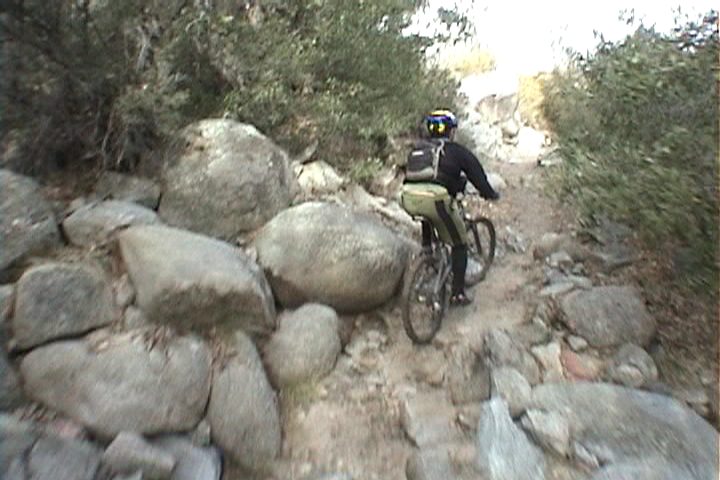
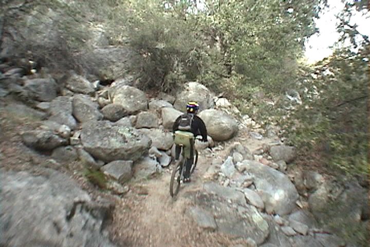
 If I had to describe this upper trail in one word it would be CHANGE. Up near the top the trail is somewhat soft as you weave through pine
trees on mostly buff trails. However there are small technical sections that pop here and there that
can trip you up if you do not pay attention. There are also a few roots to contend with as well
that could get you an unscheduled dismount if you start zoning out.
The top of the singletrack started out rolling through a wide open meadow
that cut through sparsely spaced pines that provided a very alpine feeling to the
experience. The trail did have a few tight places and transited through dense brush along the
hillside at times.
If I had to describe this upper trail in one word it would be CHANGE. Up near the top the trail is somewhat soft as you weave through pine
trees on mostly buff trails. However there are small technical sections that pop here and there that
can trip you up if you do not pay attention. There are also a few roots to contend with as well
that could get you an unscheduled dismount if you start zoning out.
The top of the singletrack started out rolling through a wide open meadow
that cut through sparsely spaced pines that provided a very alpine feeling to the
experience. The trail did have a few tight places and transited through dense brush along the
hillside at times.
 After
2 miles or so of fun singletrack riding we crossed campsite fire road at
mile 10.75 where we came out on before. This time we went straight across the
fireroad and enjoyed this section of the trails going the other direction. We
soon were back to where we had originally peeled off from the traditional Ramona
trail. We hung a left here and the trail started to get a little more technical with rocks and
roots as well as some tight switchbacks.
The trail made you stay on our toes as sections of rocks would often pop up
around corners they required you to stay fully engaged mentally. This added a really cool feel to the trail.
After
2 miles or so of fun singletrack riding we crossed campsite fire road at
mile 10.75 where we came out on before. This time we went straight across the
fireroad and enjoyed this section of the trails going the other direction. We
soon were back to where we had originally peeled off from the traditional Ramona
trail. We hung a left here and the trail started to get a little more technical with rocks and
roots as well as some tight switchbacks.
The trail made you stay on our toes as sections of rocks would often pop up
around corners they required you to stay fully engaged mentally. This added a really cool feel to the trail.
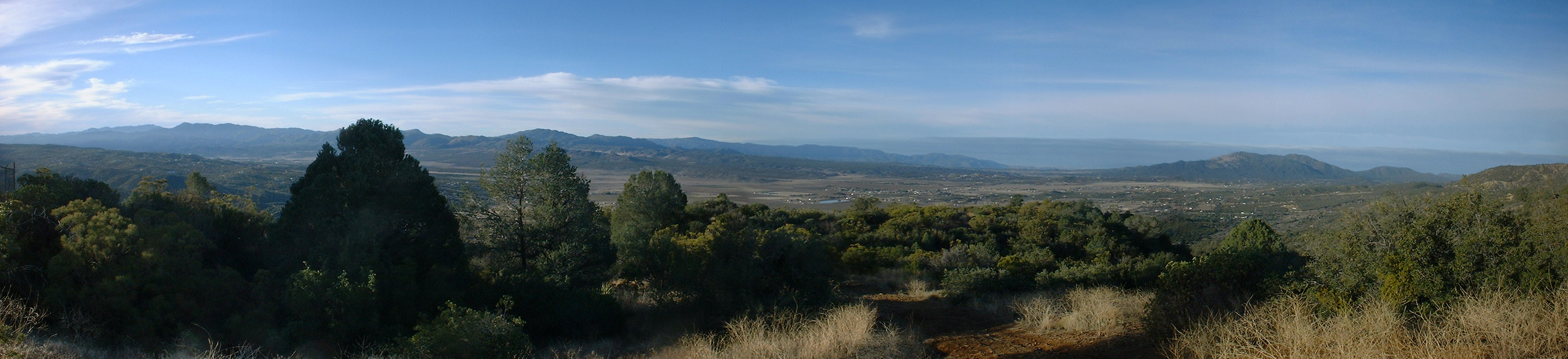
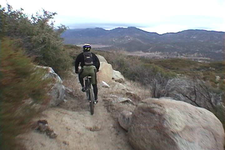
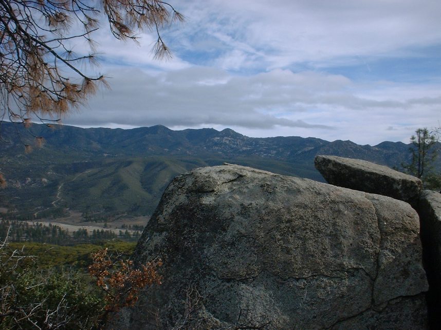
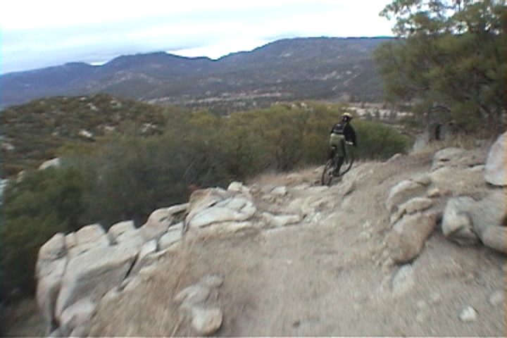
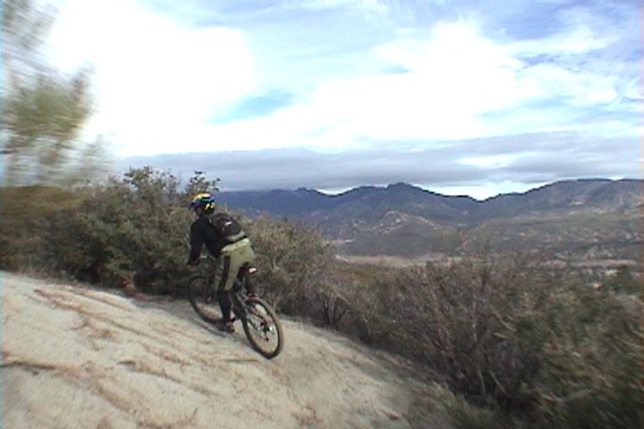
 The upper portion of the trail has quite a few sweeping turns that offer stunning views of the Garner Valley as well as Santa Rosa Mountains off in the distance.
It would be worth your time to take a break and take it all in at least once during the descent.
The upper portion of the trail has quite a few sweeping turns that offer stunning views of the Garner Valley as well as Santa Rosa Mountains off in the distance.
It would be worth your time to take a break and take it all in at least once during the descent.
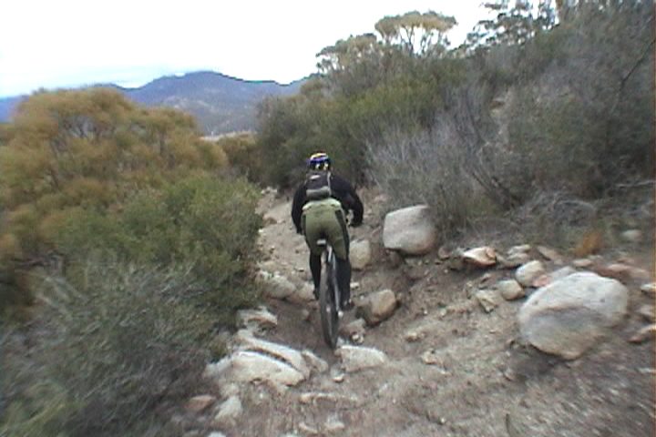 For many of the rock sections the
adage "Speed is your Friend" is quite true because many of these rocks could get you an express pass to Endo City if you hit them going too slow. The further down the trail we went the more technical the trail got as it
transitioned from pines to chaparral. The lower portions of the trail were quite reminiscent of Noble Canyon with lots of small rock drops and loose sections. As of 2021, this trail is a lot less like Noble Canyon and the speed is your friend thing is less of a concern.
For many of the rock sections the
adage "Speed is your Friend" is quite true because many of these rocks could get you an express pass to Endo City if you hit them going too slow. The further down the trail we went the more technical the trail got as it
transitioned from pines to chaparral. The lower portions of the trail were quite reminiscent of Noble Canyon with lots of small rock drops and loose sections. As of 2021, this trail is a lot less like Noble Canyon and the speed is your friend thing is less of a concern.
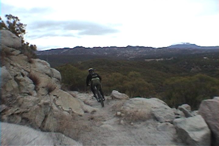 The switchbacks also got harder as they became more armored with large enough rocks that required
some interesting weight shifts while navigating the turn. (As of 2021, I just don't think this is the case, the trail is not longer like Noble Canyon. It is still a technical trail but it is much more of like a flow trail down at the bottom. Ultimately the trail dumps out onto HWY 74 at mile 14.8. You will hang a right and take the highway for 1.5 miles until you reach Pyramid Peak road where you will hang a right and go .4 miles to a T-junction at Hop Patch Springs road where you hang and left and go .8 miles back up to your parked
vehicle. If this is where you started the loop, your done! Hopefully you have a cooler with something tasty and cold in it. If not you can head over to the Paradise Cafe at the junction of Hwy 371 and 74 where you can both tasty beverages and grub.
The switchbacks also got harder as they became more armored with large enough rocks that required
some interesting weight shifts while navigating the turn. (As of 2021, I just don't think this is the case, the trail is not longer like Noble Canyon. It is still a technical trail but it is much more of like a flow trail down at the bottom. Ultimately the trail dumps out onto HWY 74 at mile 14.8. You will hang a right and take the highway for 1.5 miles until you reach Pyramid Peak road where you will hang a right and go .4 miles to a T-junction at Hop Patch Springs road where you hang and left and go .8 miles back up to your parked
vehicle. If this is where you started the loop, your done! Hopefully you have a cooler with something tasty and cold in it. If not you can head over to the Paradise Cafe at the junction of Hwy 371 and 74 where you can both tasty beverages and grub. 2021 VIDEO
2003 VIDEO
Here is a video of the ride on December 20th, 2003. 29MB
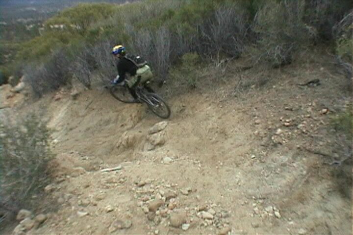


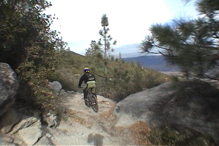
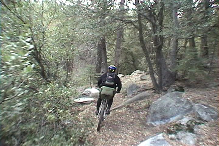
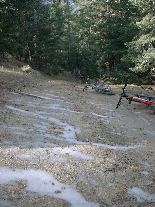
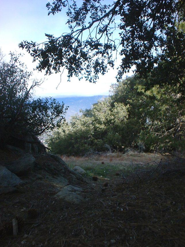
Here are some video capture shots