
Mount Fuji in Japan
The Video Second Trip Panoramic Shots
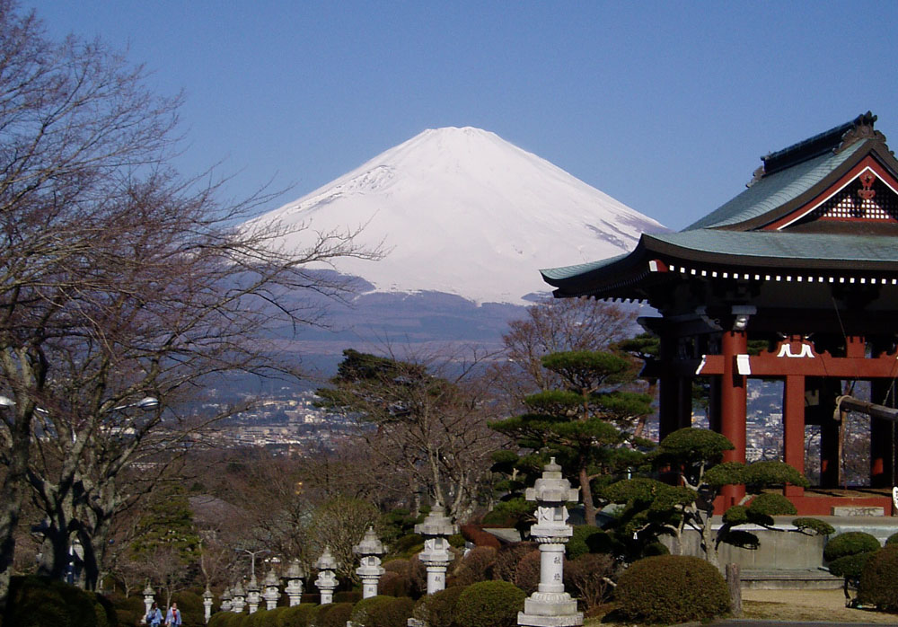
Climbing Mt Fuji was something I had planned on doing since I first found out I would be in Japan for the summer. It is a once in a lifetime event for most people and I was not going to miss the opportunity.The supported climbing season for Fuji is July and August when the snow is clear and there are series of huts operating along the climb to offer aid, food and shelter. Shortly after arriving in Japan in March, I found some fellow mountain bikers and had been enjoying Japanese singletrack ever since. One of my riding regulars, Ken Morgan, came up with an awesome idea; lets carry our bikes up Mt Fuji just before the main climbing season, and then ride down! Crazy? Yeah, but what the heck, how often does one get a chance to mountain bike down Fuji? (NOTE: Mountain Bikes are not allowed on Fuji during July and August hiking season)
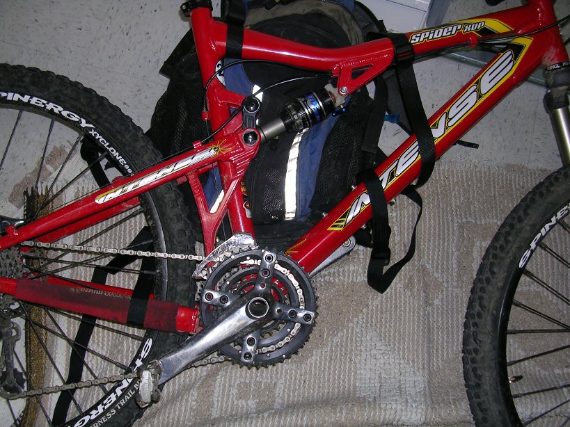
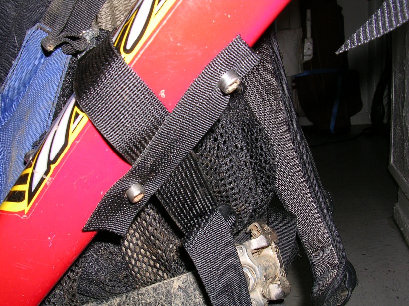
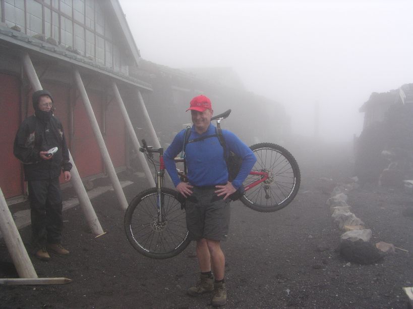
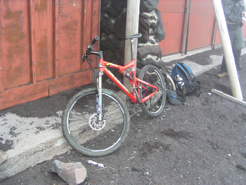
So the logistics of trying to do this started settling in. The climb to 12,388 feet was going to suck with a bike on my back. Even with my lightweight Intense Spider, I was sure that I would be cussing at the bike before reaching the top. I thought of getting a frame pack and disassembling the bike and strapping it to the pack, but I did not like the idea of riding down the mountain with frame pack on. I decided to use my Camelbak Transalp, which is a very large cycling specific pack. I went to a local outfitting store and bought a handful of straps and figured out a way get the bike strapped on.
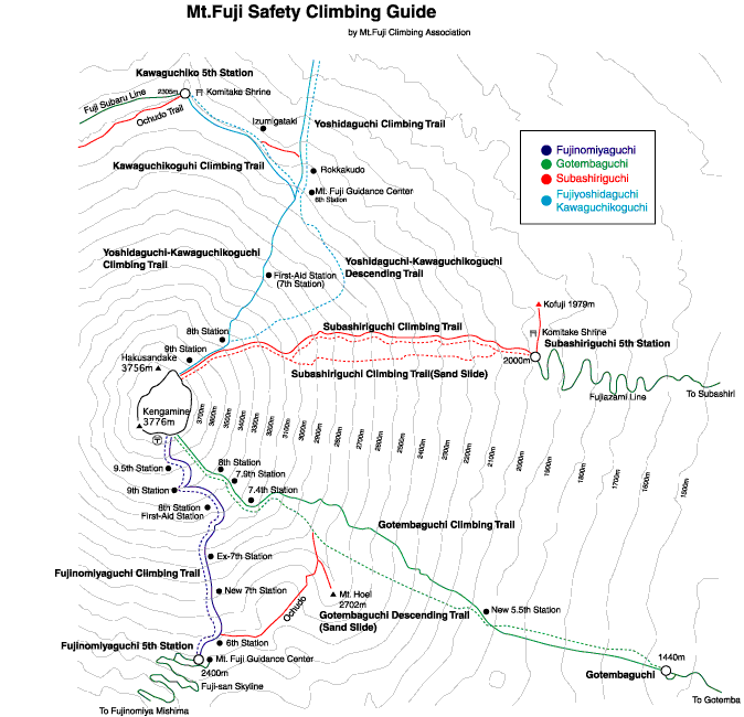
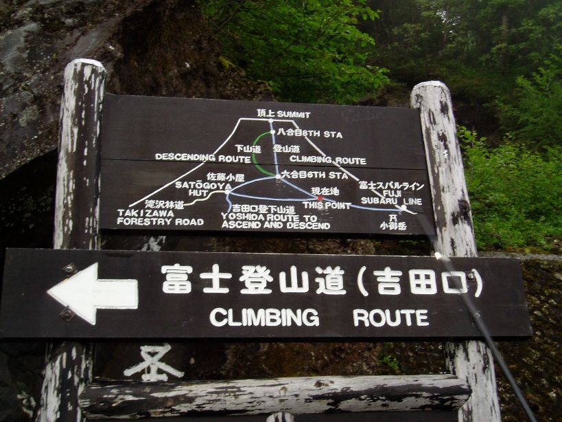
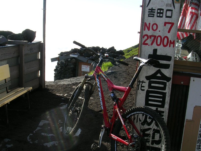
You can climb Mt Fuji via several routes; we would be going up the Subaru line. The Subaru line goes up the north side of the mountain and has separate ascending and descending routes with the exception of the lower portion, which is common to both.

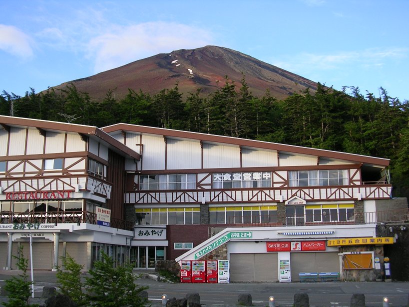
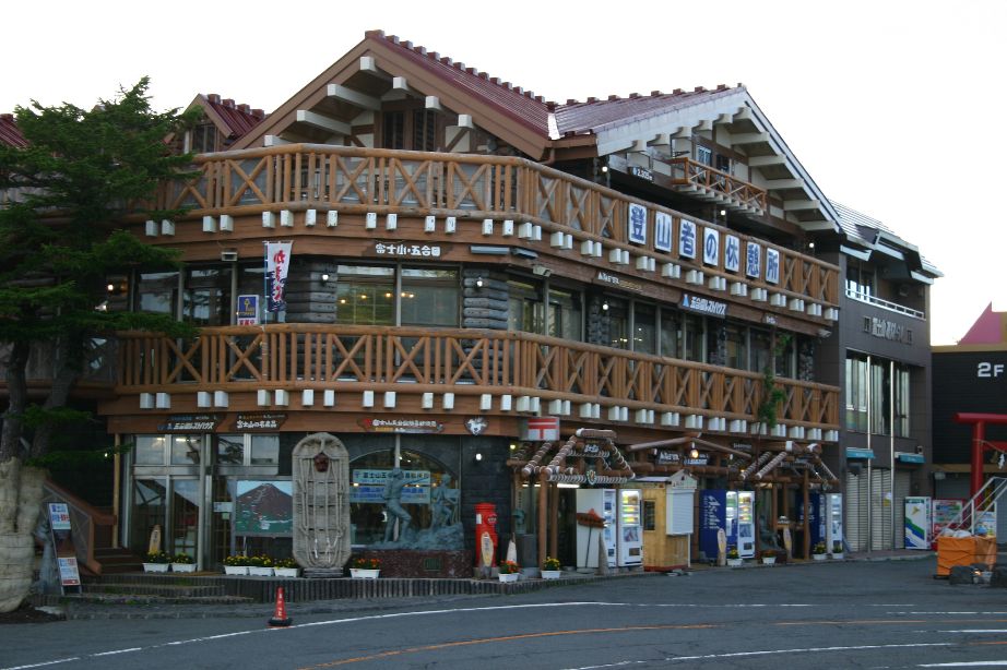
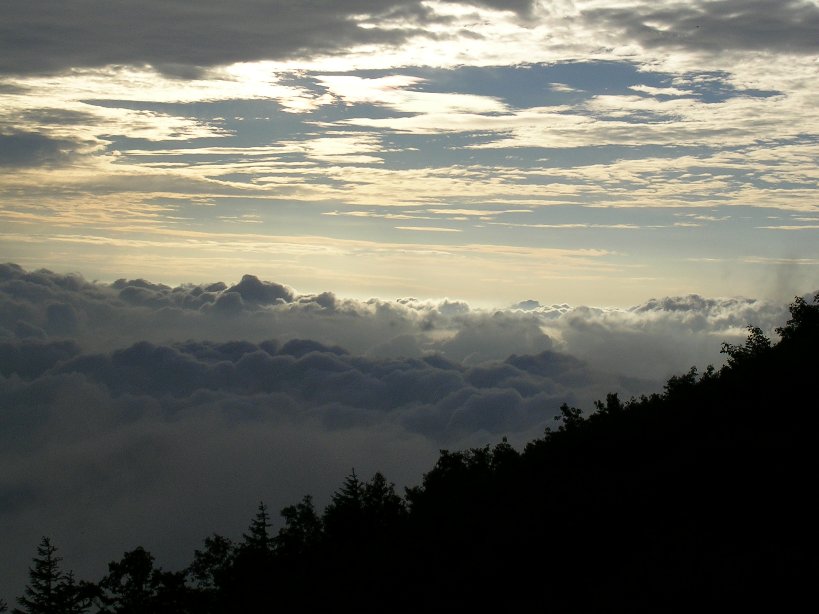
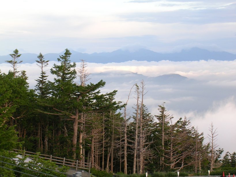
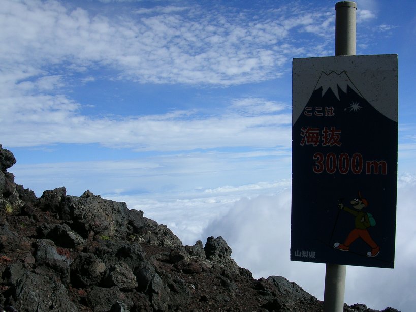
I was a little concerned about the weather at 2AM on the morning of June 27th, 2004 when we headed out to Fuji as it was drizzling. As we drove up to the Kawaguchiko 5th station shortly before 5AM we climbed above the clouds and into beautiful weather. We were already at 7,700 feet and above the morning cloud layer. The 5th station is a actually a little village that has all of the tourist accouterments as well as legitimate supplies someone may need. From the 5th station we could see the peak that did not look that high at all. I soon found out that that was not Fuji’s peak we were looking at it, but merely a bump on the side of the mountain.

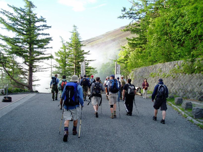
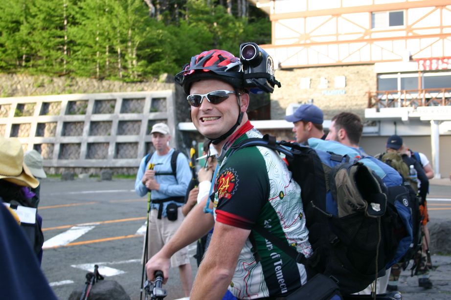

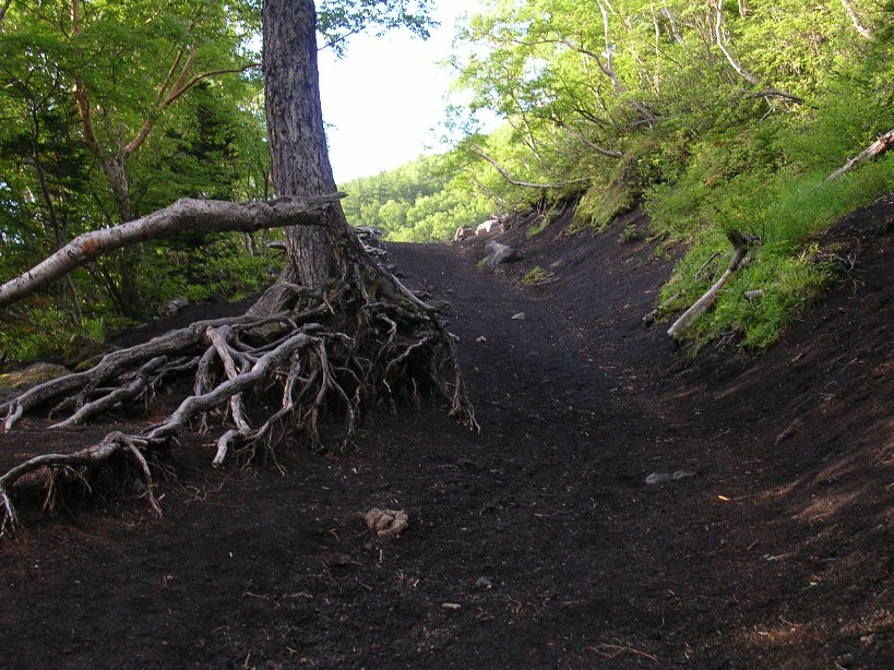
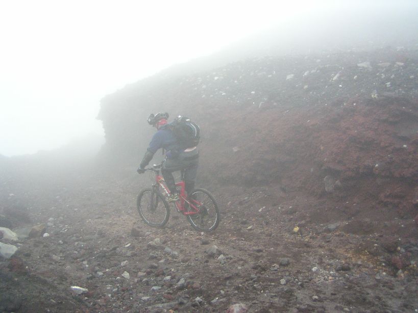
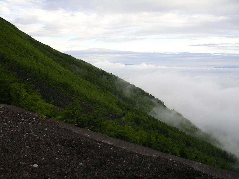
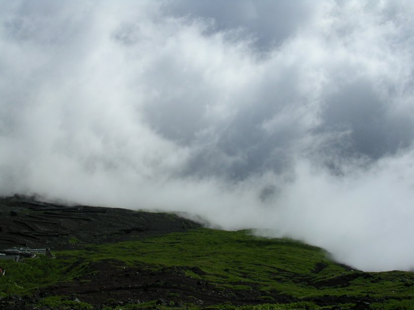
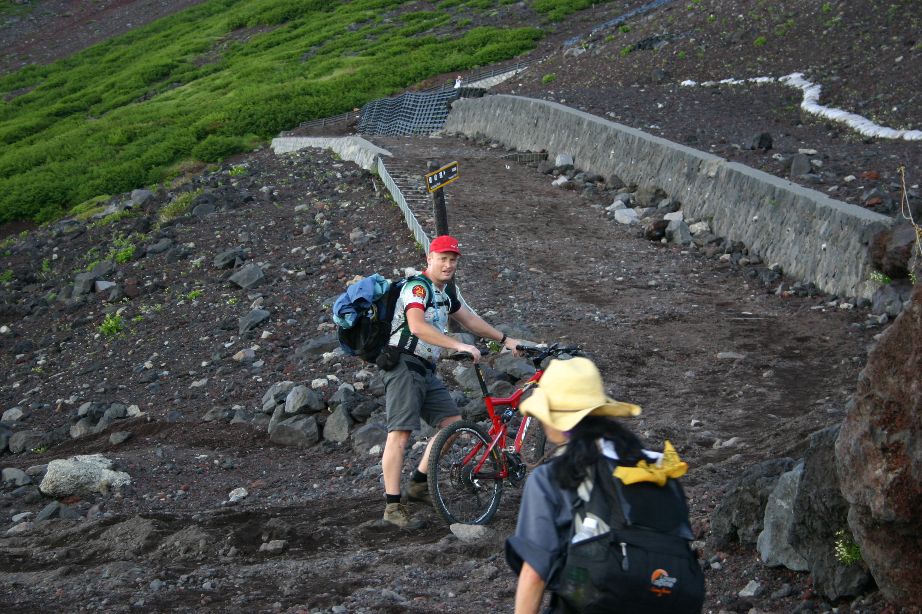
After Ken and I got our stuff together, we took off riding ahead of the hikers into the cool crisp morning air. The first part was a very wide gravelly walkway that was not steep at all. We were soon riding along the misty edge of a cloud that rolled through the trees. The cloud looked like a set of wispy fingers reaching out into our path. It was quite surreal.

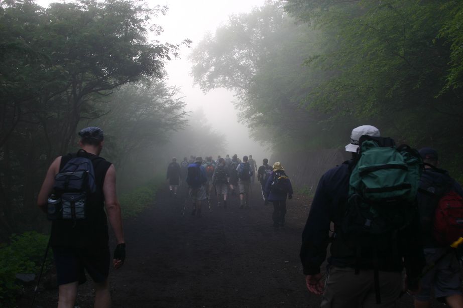
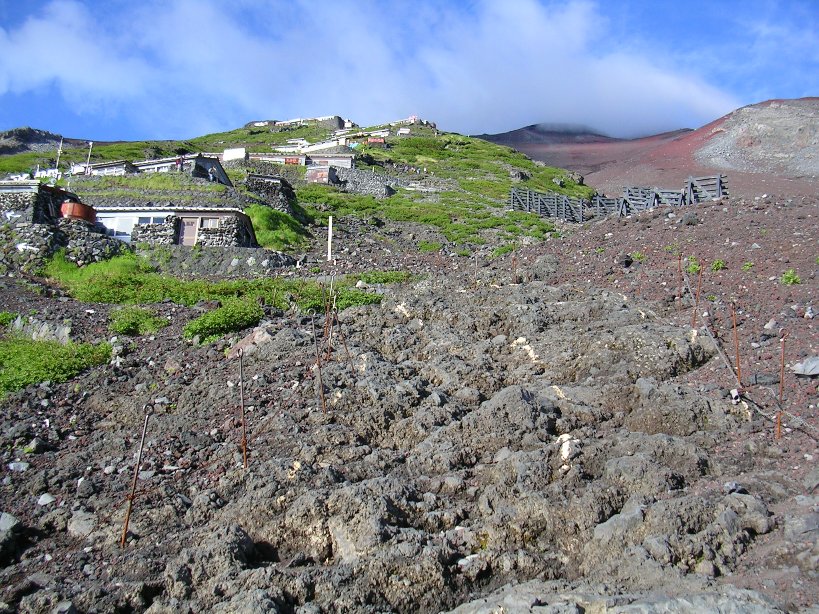
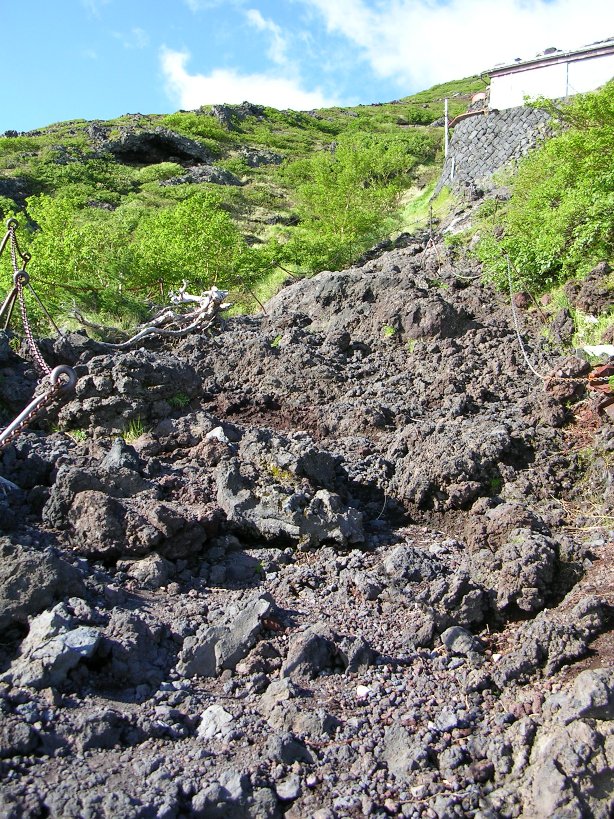
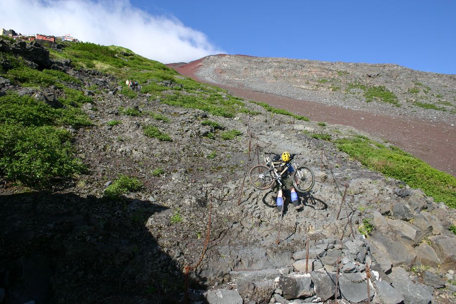
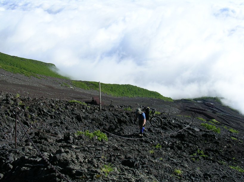
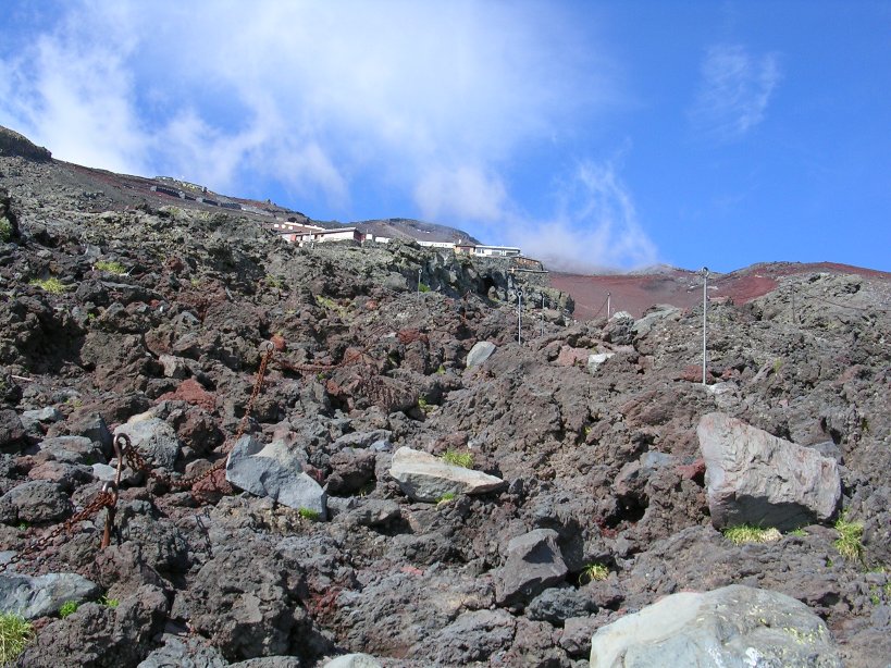
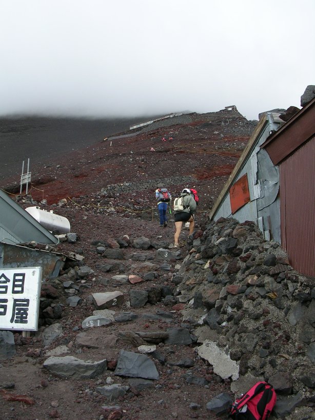
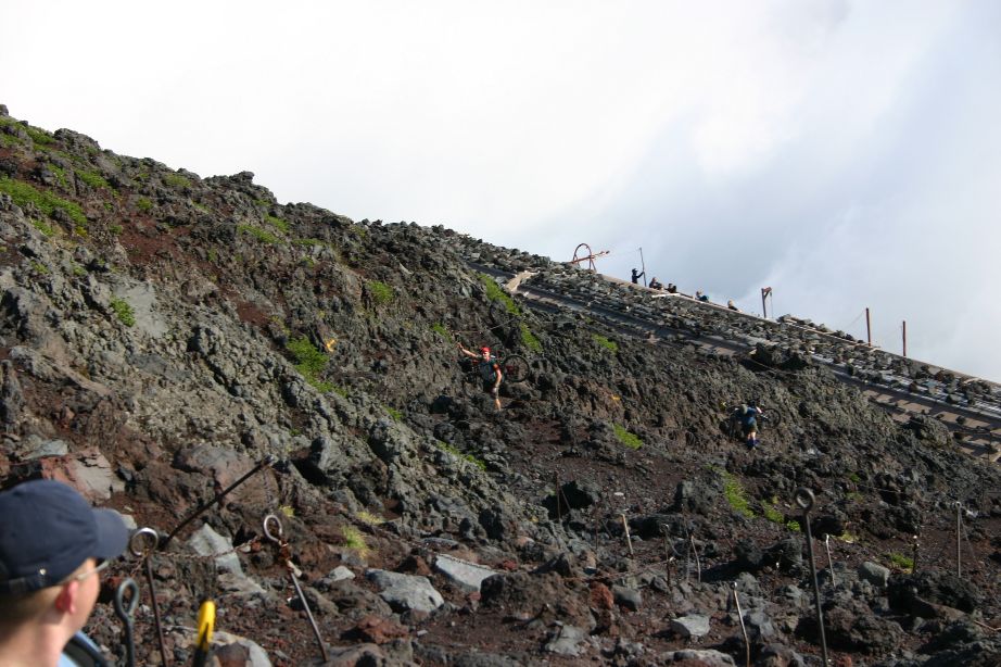
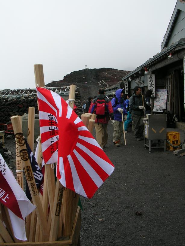
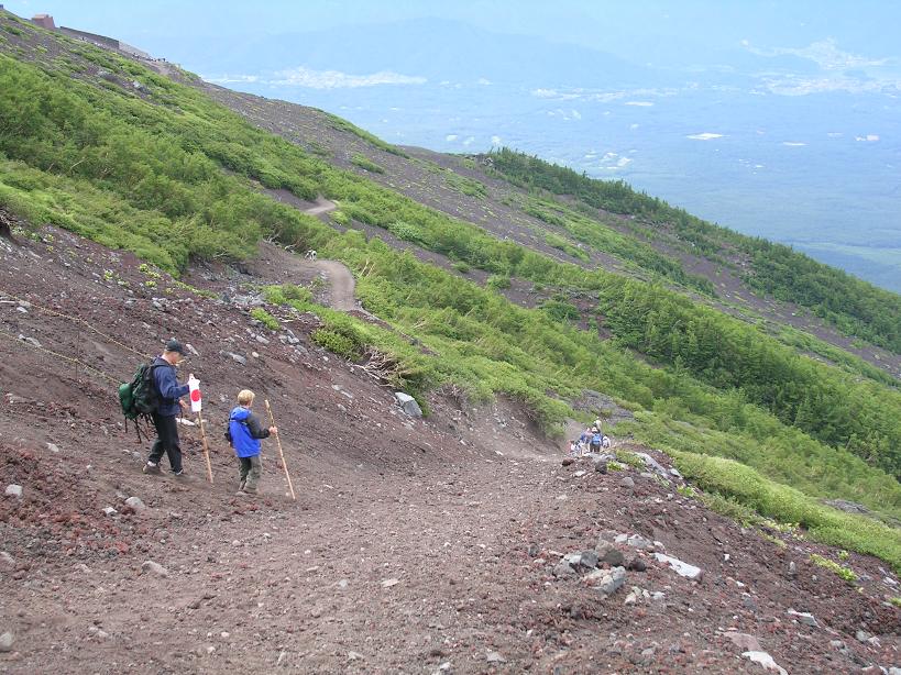
We only rode along this way for about a mile before the terrain became loose enough that it was taking more energy to pedal than it was worth, especially considering we knew we had along long way left to go yet. We were right along the timberline now at 8,000 feet and views of the large expanse of clouds below us and the towering mountain above us came into view. We started pushing our bikes alongside of us and soon turned onto the ascending route where the grade became steeper. Soon we could see the string of huts that are along the ascending route. The hiking was not too bad as it was mostly a smooth trail with semi-loose mostly quarter sized or smaller lava rocks. The rocks varied in color from reddish rusty hues to dark brown tones. As we neared the 7th station at the Hanagoya Hut the trail became more of a series of large lava rock steps. I put the nose of the saddle on my shoulder and hiked up to the hut.
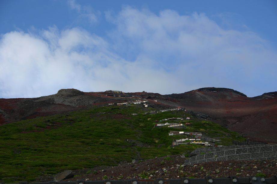
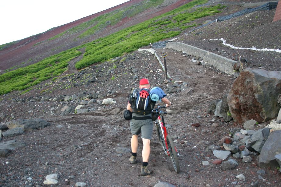
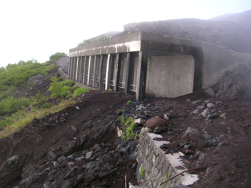
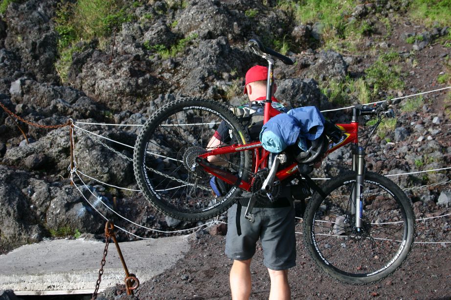
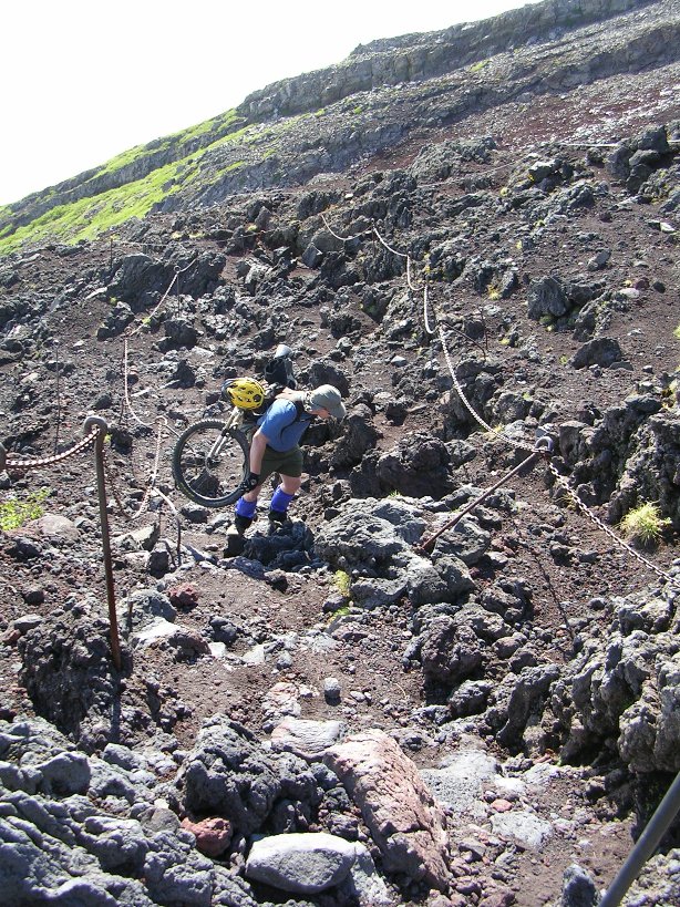
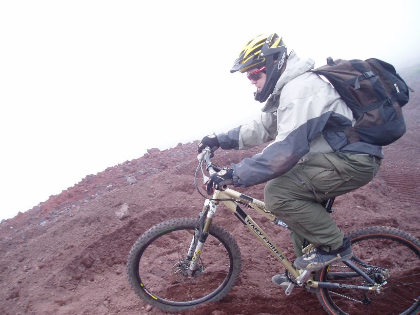
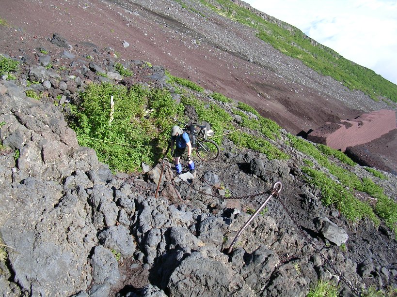
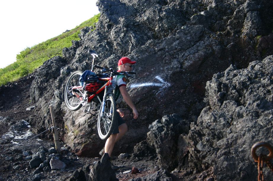
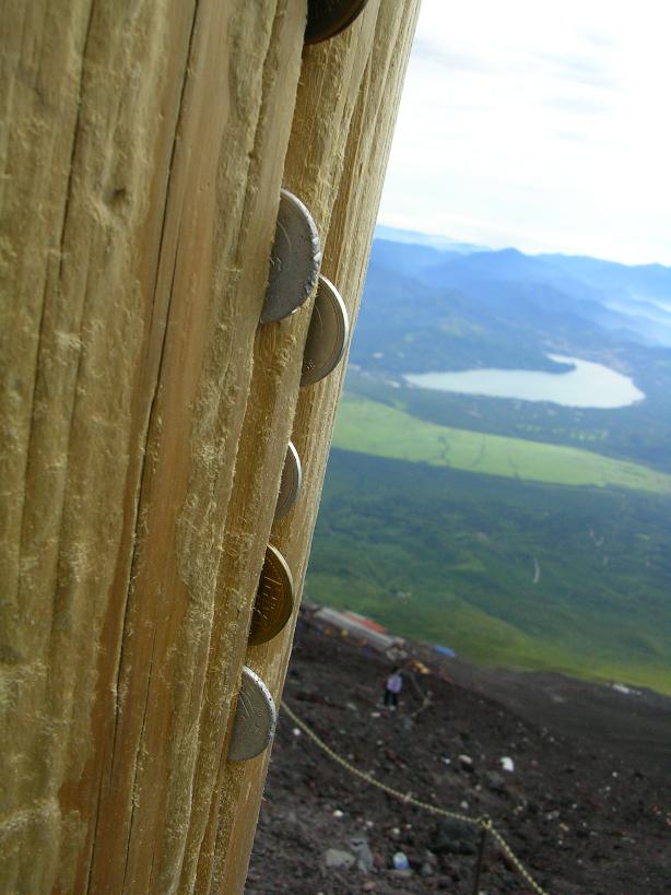
The huts offer a little shelter, a place to buy expensive water and get your walking stick stamped or branded. Getting the stamps on your walking stick as you ascend Fuji is certainly the tourist thing to do, but it makes a really nice souvenir. I took a short rest here while soaking up the wonderful enery. While doing this I noticed that just beyond the hut the trail got somewhat nasty. There would be no carrying the bike on my shoulder up the next section; it was time to strap on the bike onto the backpack. It took me about five minutes or so to get the bike strapped. There was plenty of weight on the pack, between the bike, video gear, water, food, knee/shin and elbow guards I probably had 50lbs our so on my back. The bike was strapped with the front wheel lower that than the rear but the weight was distributed evenly. I left the wheels on as I wanted to keep the weight from being too far off my back.
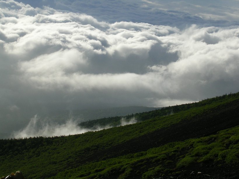
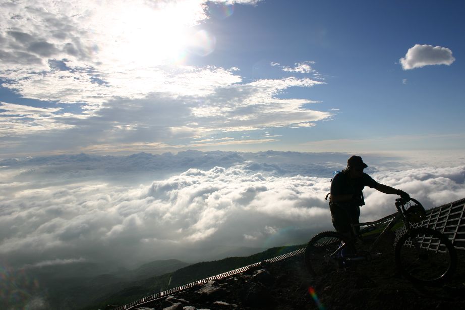
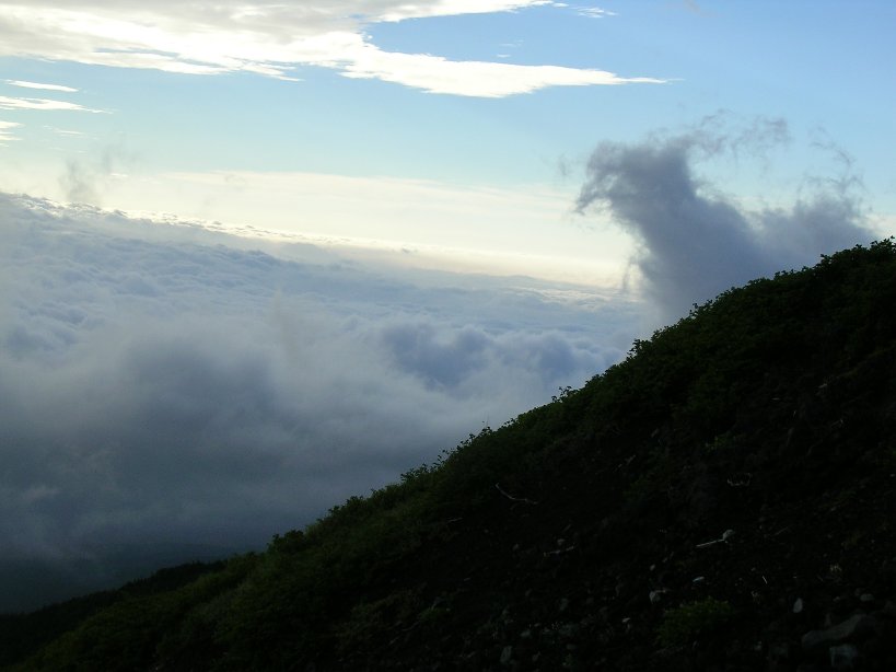
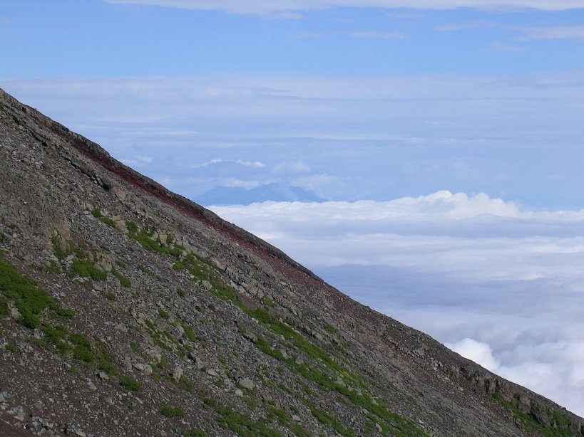
The setup was pretty stable but I soon found out there were several spots which required me to step sideways to get the wheels to clear the rocks. The views as I continued up were quite surreal. Sometimes the views of the puffy white cloud backs below me made me think I was in a jet at 35,000 feet or so.


My pace kept ahead of Ken and when I would take breaks it was taking him longer and longer to catch up. During some of my longer rest periods I was starting to get a little stiff so I told Ken that I needed to keep moving while I could and we would meet up at the top so the rest of my climb would be on my own. From here I kept plodding along.
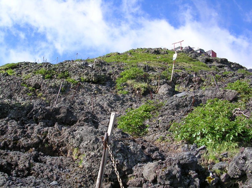
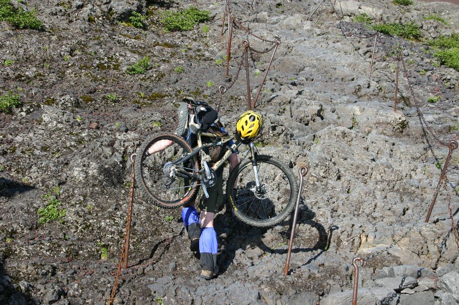
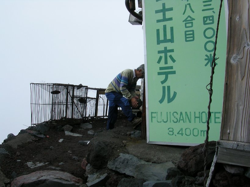
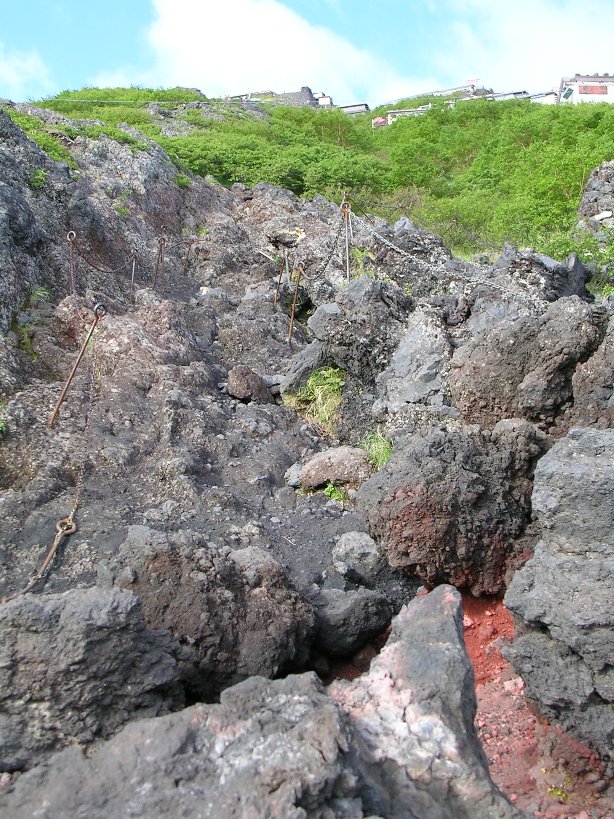
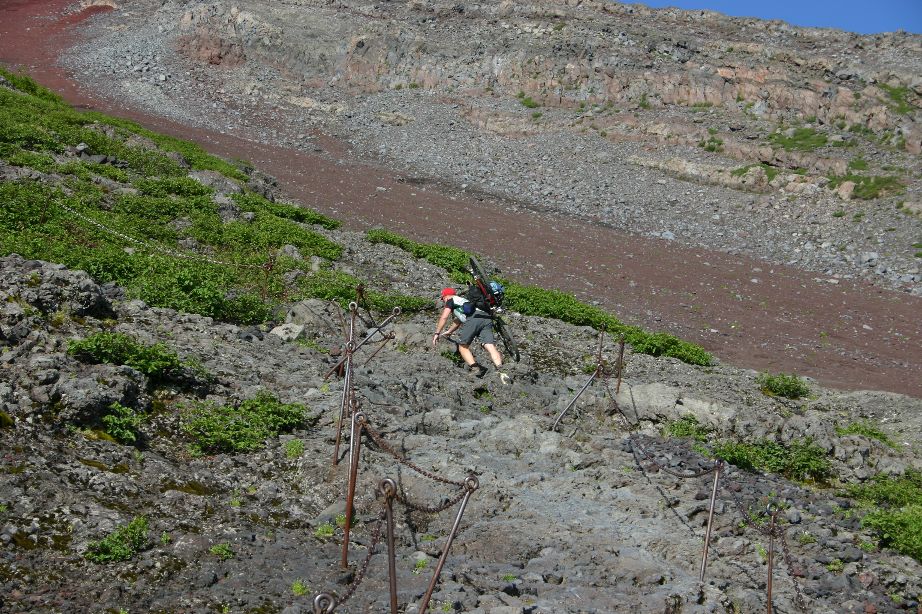
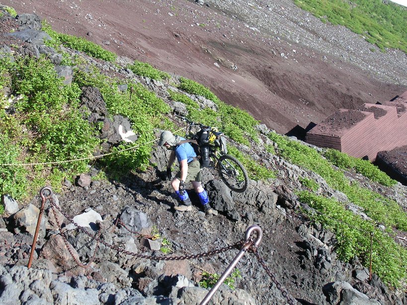
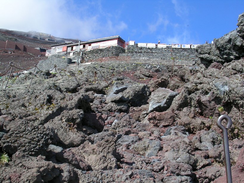
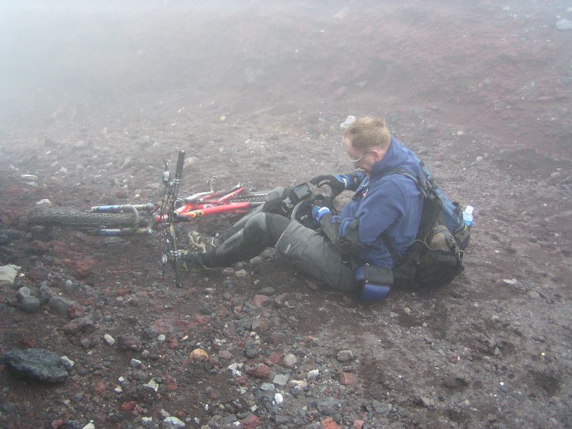
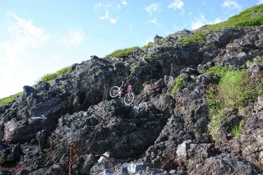
Between the 7th and 8th stations were some particularly difficult sections that required more climbing and two handed scrabbling than hiking. The awkwardness of the bike required some tricky maneuvers on more than a few occasions to get over and between some of the larger rock formations. I eventually made my way up to the Fuji-San Hotel at the 8th station. The term hotel is used loosely as it basically large room with mats on the floor and a blanket. It was starting to get chilly and the wind started to bite a little so I switched out of the short sleeve jersey for a long sleeve one.
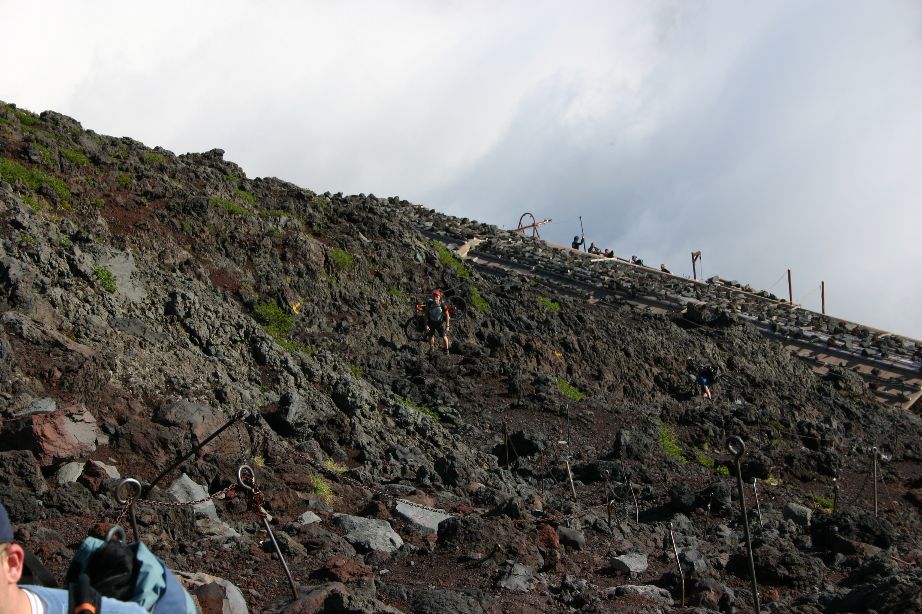
The sky was darkening now and I could not see the summit as thick clouds had settled in across the top. My shoulders were pretty much on fire and my quads were hurting. I was starting to not have any fun. I continued onward and upward where I found the thinning air had my heart racing with even the easiest of steps. I found that I had to take breaks much more often than before. The trail did offer a break from the rock scrambling where I could simply put one foot in front of the other up the volcanic ash and small lava rocks covered trail.
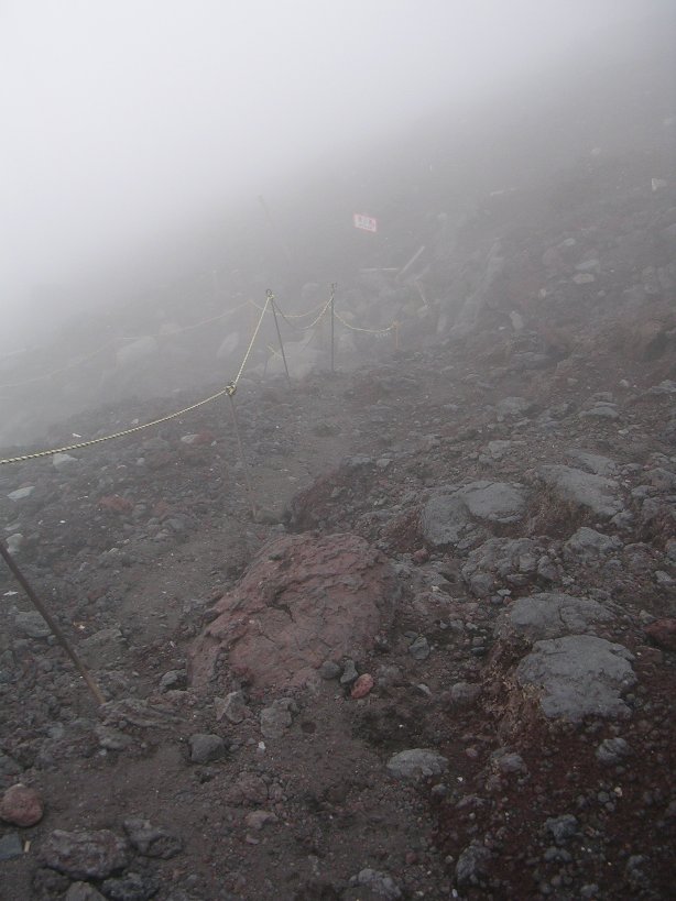
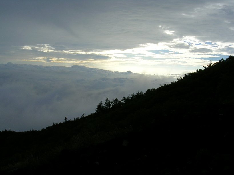
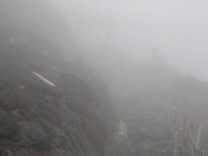
The weather continued to deteriorate as I climbed into the cloudbank. Visibility was down to less that 100 feet and the wind would occasionally gust upwards to what I would guess was 25 to 30 mph. I was newly blown over on a couple of occasions.
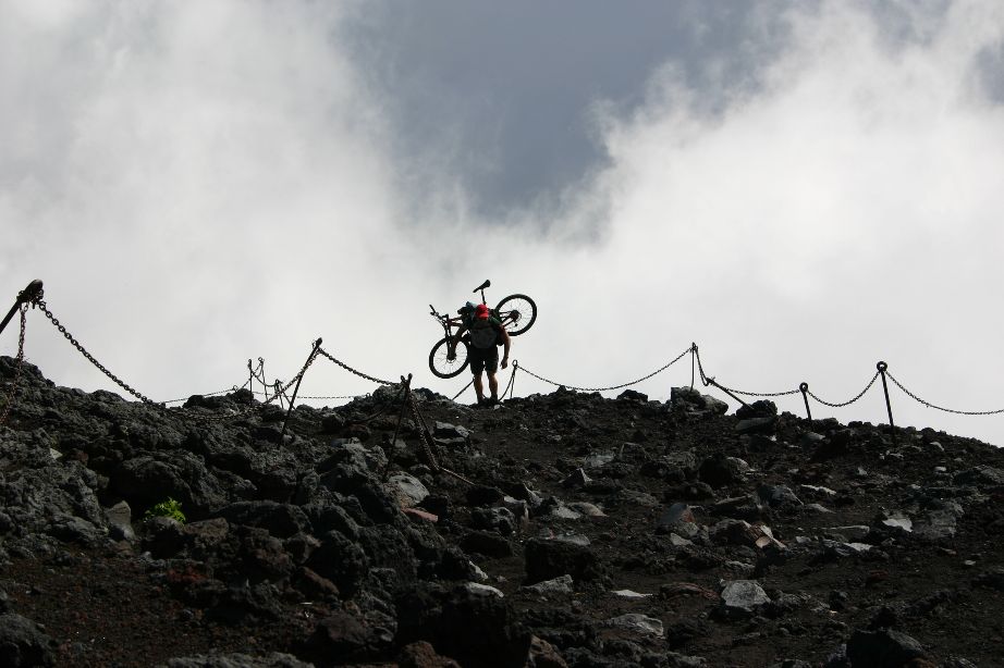
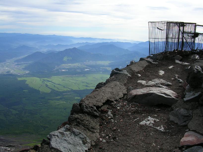
I eventually made it up to the Goraikokan hut, the last shelter before the summit. Above here the trail turned back into a series of jumbled rock scrambles that now had become quite a task to get up and over them. I felt like Frodo Baggins trying to climb Mt Doom at this point. What was I thinking when I decided to do this? That downhill better be awesome. I was in a one foot and hand placement at a time mode now. I was above 12,000 feet now and my heart was racing and my lungs struggled to pull oxygen out of the thin air. I’m sure some of my Colorado cycling friends would laugh at me for whining about a little thin at this altitude, but if they were here now, I would let them carry the bike for a while.
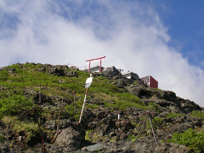
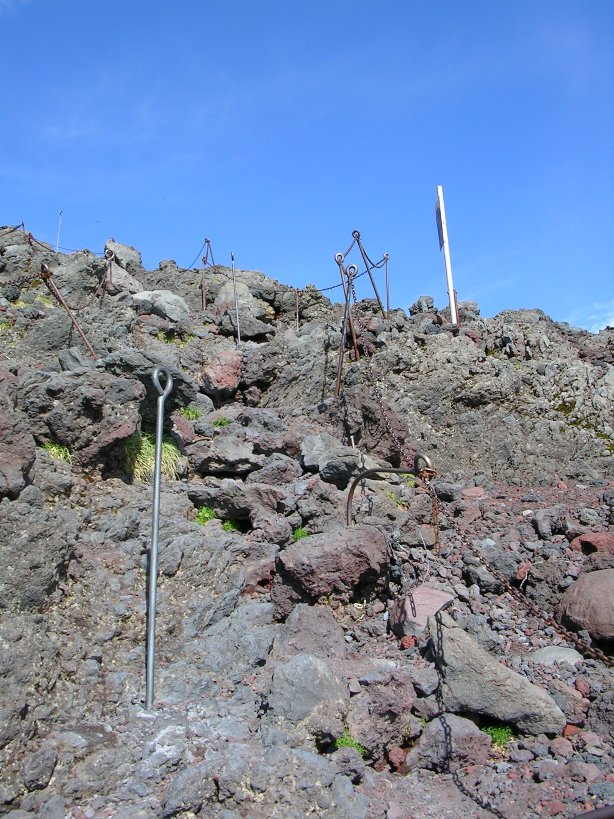
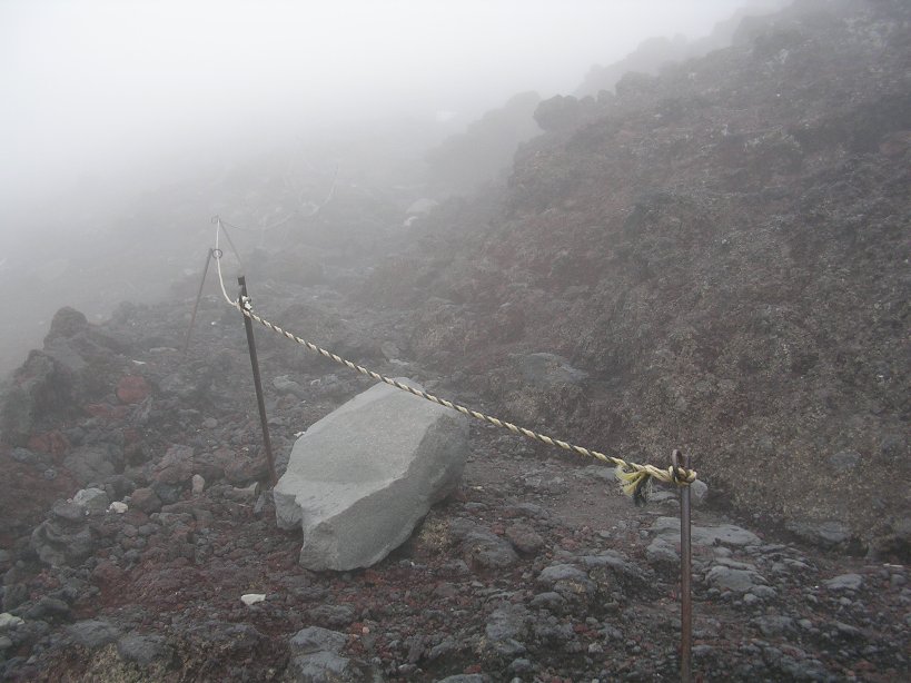
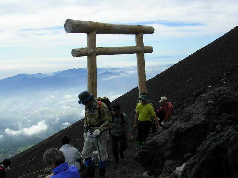
I had to take breaks every few minutes now. My shoulders were really hurting, but I dare not take off my pack, as it would only feel worse to put it back on. I certainly had my head in the clouds now as the visibility was 30 feet at most and the wind was chilly and damp. I wanted to put on my gloves, not so much to take the chill off of them, but because they were becoming a little tender in spots from grabbing onto the rocks to help get up the more difficult sections of the trail. But getting to my gloves would require taking off my pack, and I could have nothing to do with that. I soon passed through a the lower archway/gate. I knew I was within several hundred feet of the summit now although I could not see it.
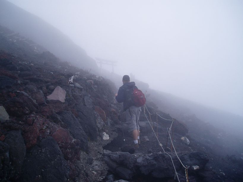
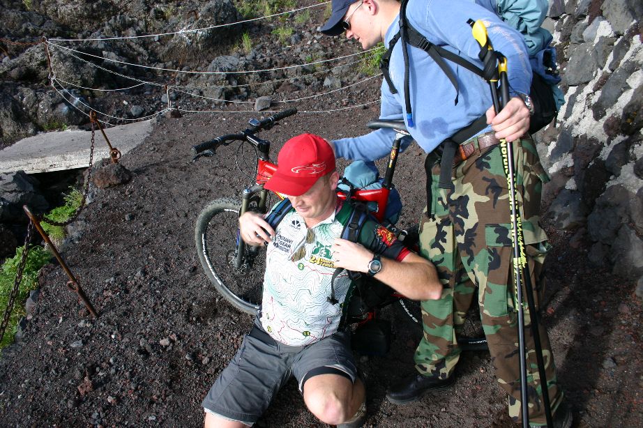
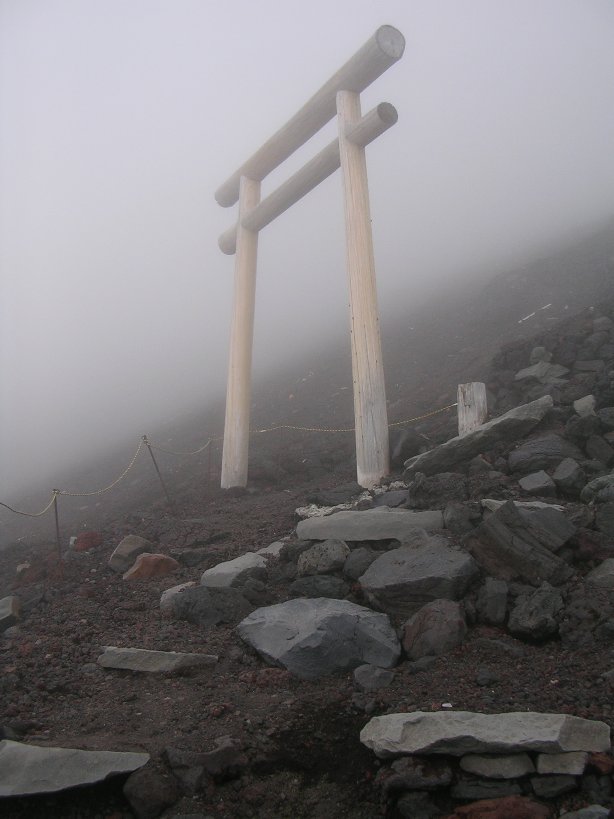
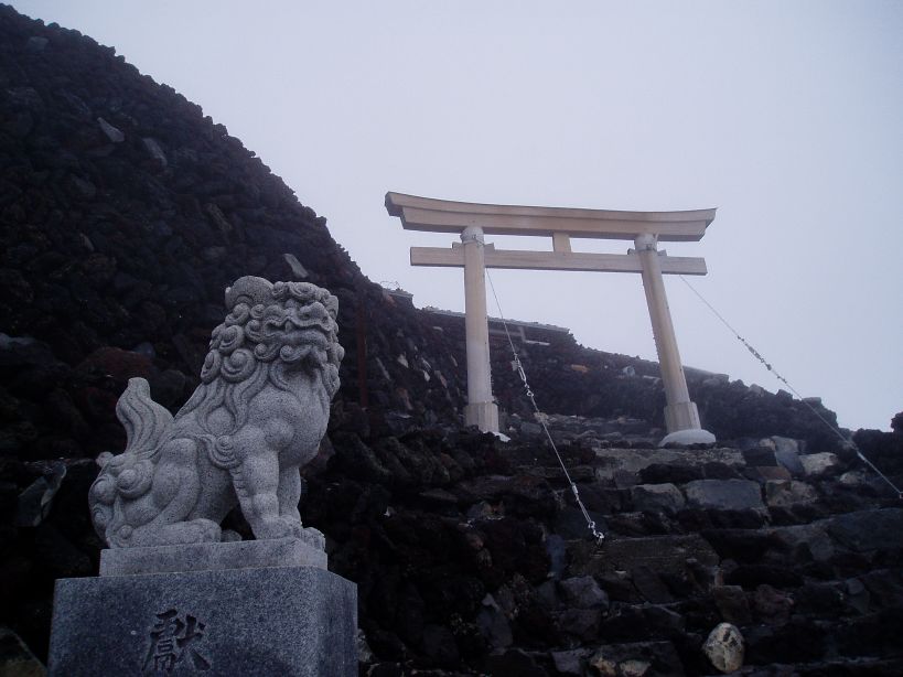
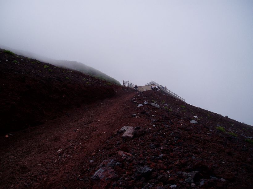
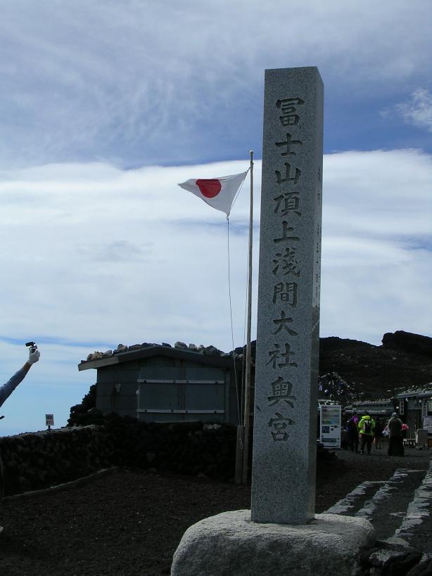
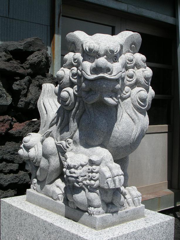
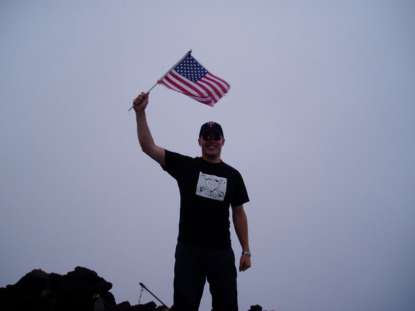
Before long I could make out the facing lions and the arch that marked the entrance to the summit. I broke out the camcorder (which I had on the waist belt of my pack, meaning I did not have to take off the pack) to mark the moment and found some new energy as I passed between the lions and the gate. I had made it, although it was somewhat anticlimactic. I was by myself, it was cold, and visibility was now about 20 feet or so. I walked on the wonderful flat ground between the huts while looking for a somewhat sheltered spot to take the pack off and take a rest. I then heard some voices out the fog saying they see a bike. Some of the hikers from our group where still on the top and congratulated me on getting to the top.
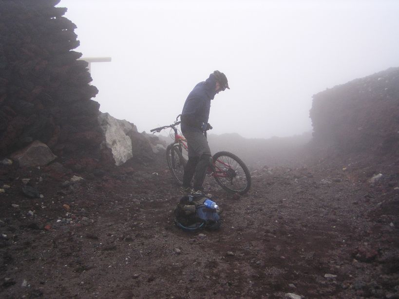
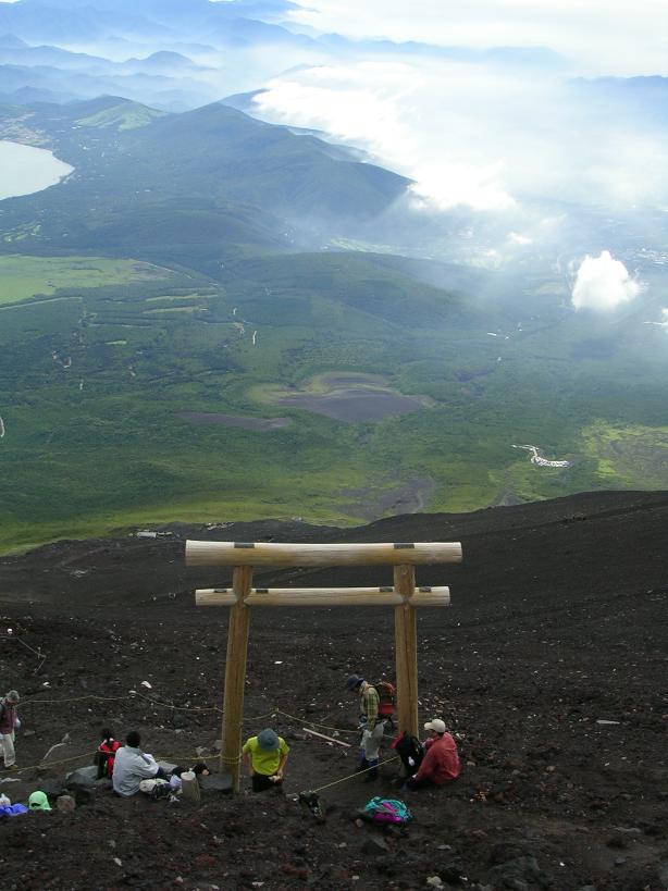
This picture of the gate was taken a little less than two hours before I arrived at this point
This is what it looked like when I arrived. You can barely make out the out outline of the lions and gate
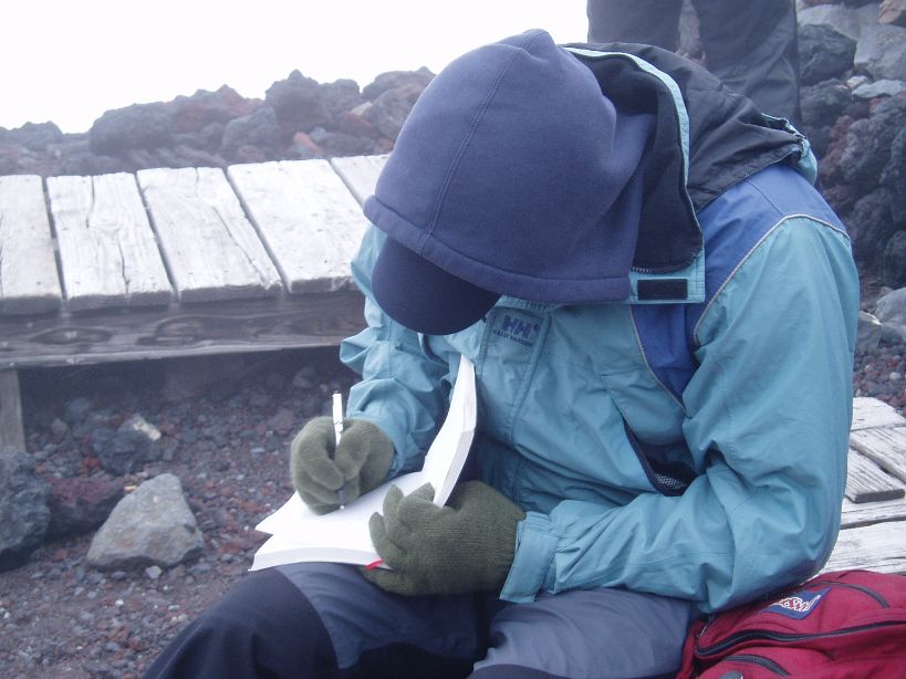
Tetsuya keeping track of who from the group has made it to the top so far.
Setting down the pack felt awesome, my shoulders ached and my quads still burned but my entire body let out a huge sigh of relief as the weight came off. I was starting to get cold now so I threw on my leg warmers, gloves, a fleece pullover, and swapped out my ball cap for knit cap. I had made the climb in 5 hours and 25 minutes. I found out from our trip leader that Ken had his asthma act up on him so he would not make it to the summit today. He had cutover to the descending route at the 8th station and I would meet me at the Edoya hut.

The original plan was for Ken and I ride and video the trail that goes around Fuji’s crater. With the whiteout and Ken not on the summit I decided a solo trip around the crater would not be worth it or wise. After a few more pictures and congratulations from some Japanese folks I was ready to head down. I strapped on some protective gear, and fired up the helmet cam and proceeded down the descending route.
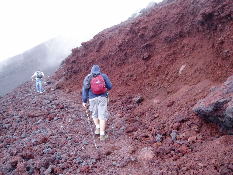
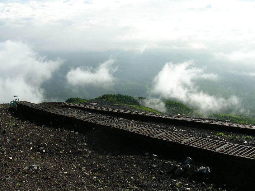
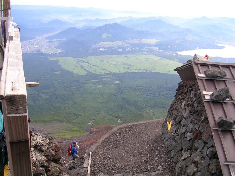
The descending route is called bulldozer road because a smallish bulldozer made it. It is a very long series of switchbacks that make there way down the mountain. The terrain here is mostly small lava rocks and volcanic ash. The trail is quite steep and the lava rocks make the riding seem like you are descending a road covered six inches deep in marbles. The switchbacks were even worse as they were exceptional loose with deep ash and crushed lava rocks. The slightest twitch of the front wheel or more than a whisper of a feathering on the brakes would cause your wheels to dig way down which would most likely cause you to tip over or put a foot down.
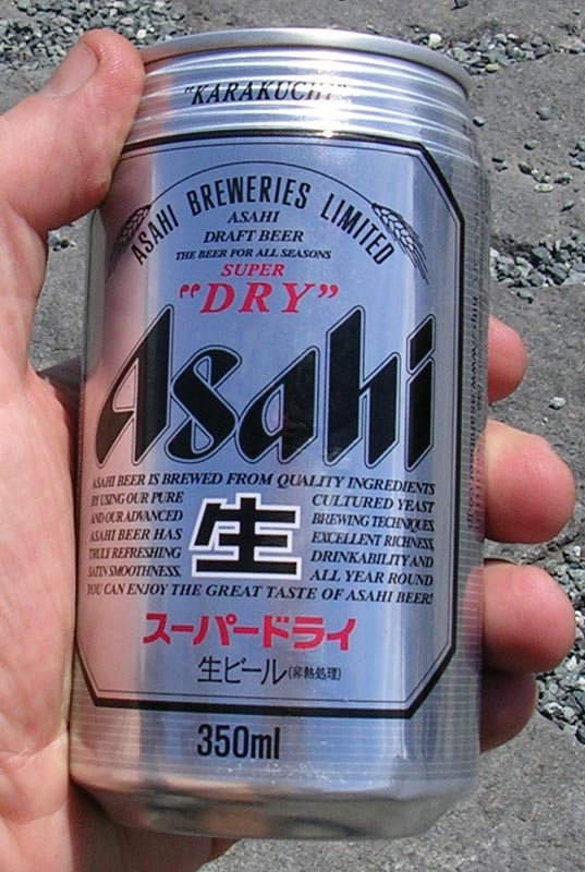
These switchbacks caused me to take a few "soil samples" on a couple of occasions. The upper part of the descending route was still in a whiteout and to make matters worse my riding glasses were fogging up. I was particularly uncomfortable about not having glasses on so I put them in "granny mode" (Pulled down on the nose a bit).After a couple of switchbacks I somewhat figured them out and I soon was down to the Edoya hut where I rejoined Ken and we both continued on down the trail. The rest of the descent was full of steep straight-aways with marginal control and extremely delicate braking into the switchbacks. During part of the descent we dropped out on the clouds and regained some visibility. This was short lived as we soon descended back into another cloud layer where the visibility was even worse than at the summit. The whiteout continued until we were nearly back to the 5th Station where we suddenly rode out of the clouds and rolled into the parking lot about a minute later. After a change of clothes we were ready for a well-earned celebratory Japanese Beer.
It only took us about 40 minutes to descend Fuji including a couple of stops. I would not consider the descent fun, more like challenging. Was the descent worth the torture required to get the bike to the summit? Yes and No. From a trail fun perspective, I will say a resounding NO. The fun simply was not there. Now on the basis of the challenge and simply being able to say I did it, YES it was worth it. I had my helmet camera running during the descent but the moisture from the clouds created water droplets on my lens. This would not have been a big deal except that my camcorder’s autofocus feature decided that the droplets were more interesting that my mountain biking follies down the largest mountain in Japan. I wiped off the lens once while doing some off the bike taping, but unfortunately I promptly forgot to unzoom the camcorder before putting it back in the helmet enclosure. While this made for some unique views that were not particularly usable. I did have enough usable video so I put something together (Link Above). I most certainly have no desire to take the bike back up again to get better video. There is an old Japanese saying that goes, “A wise man hikes Fuji once, but the person who hikes Fuji more than once is a fool”. I would like to add onto this saying “…and anyone who bikes Fuji has a village somewhere searching for their idiot.”
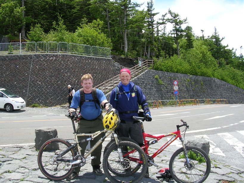
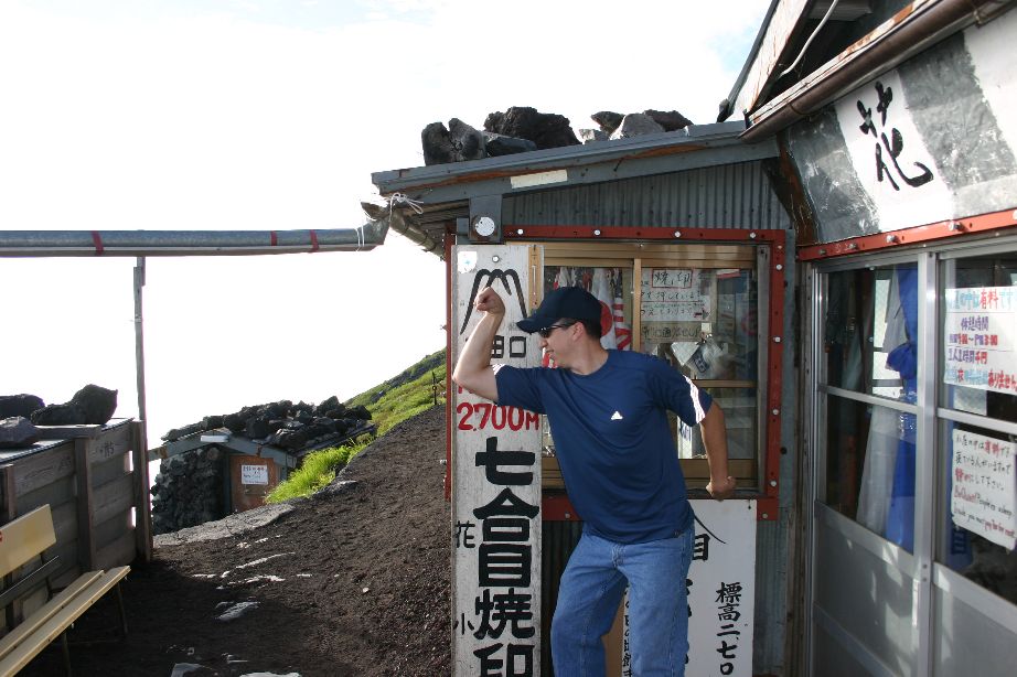
Other Pictures from the day

VIDEO
This video was shot on June27th, 2004 just before the hiking season opened. This video is a little different than most of my videos, somewhat brooding in tone. There are a few pictures in here taken on my second climb that show the views on clear days.
Second Trip
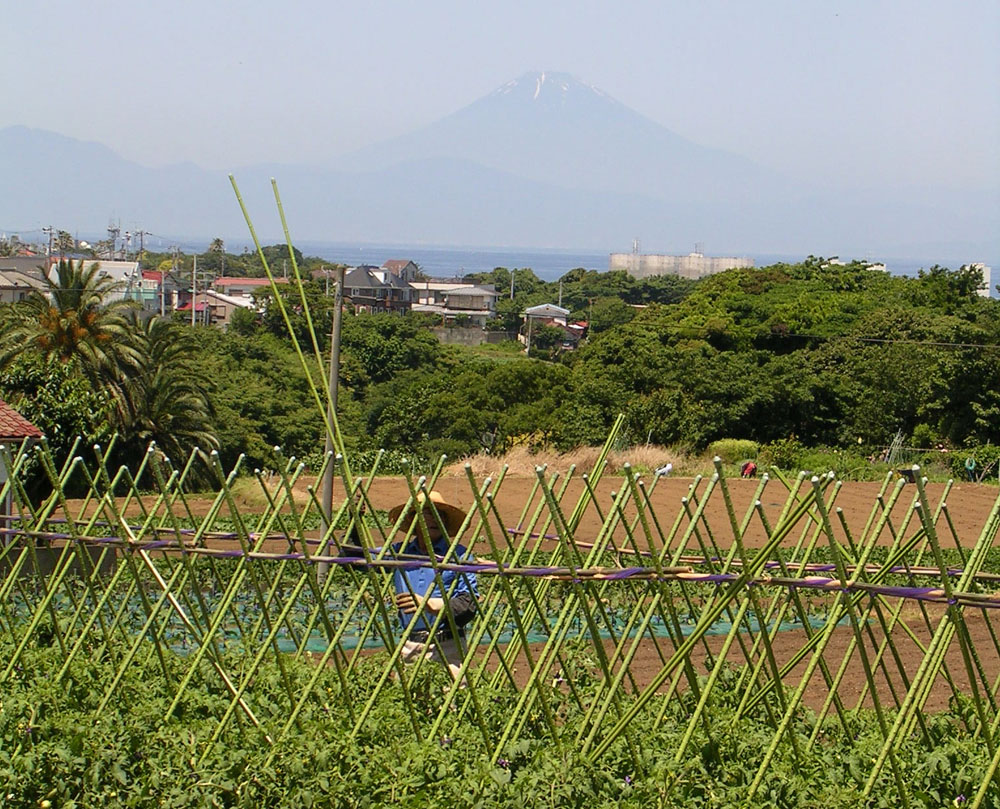
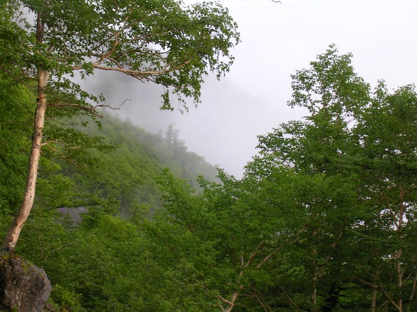
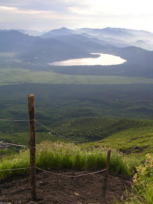
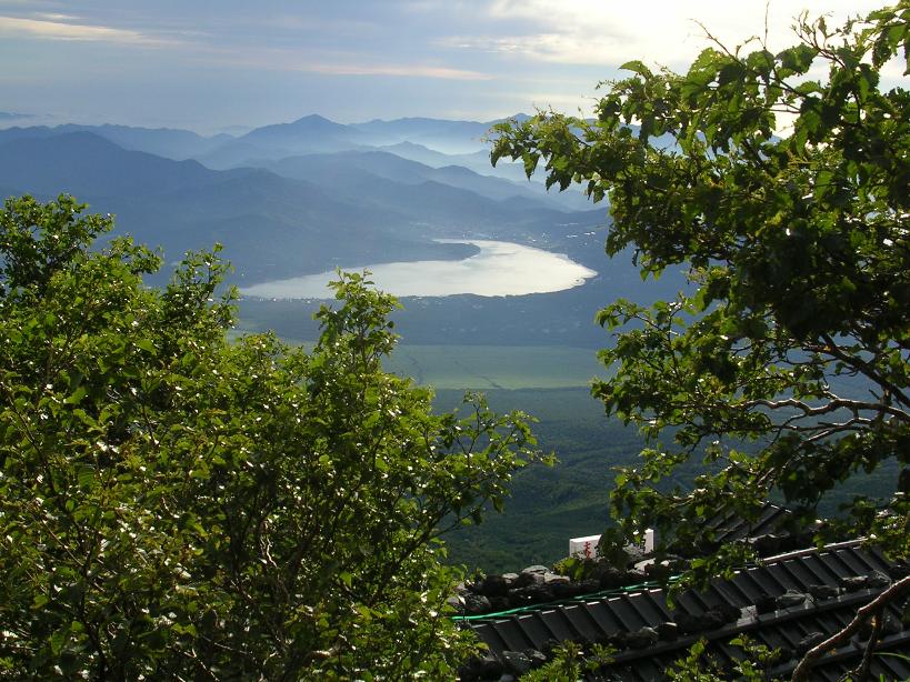
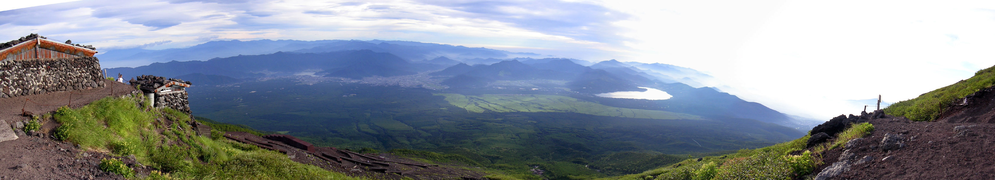
Yeah Yeah I know only a fool climbs Fuji more than once. But it was well worth it. On July 17th I climbed Fuji for a second time. This time the climb was much easier without that bike thing strapped on my back so I may it up in 3 hours and 45 minutes. Of course the hike down took much longer at around one hour and 30 minutes. The sky was for the most part clear and the expansive views were truly incredible.
Shots taken at the "lower" elevations on the way up to the 8th station
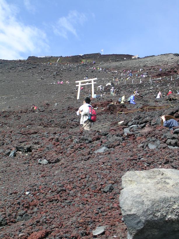
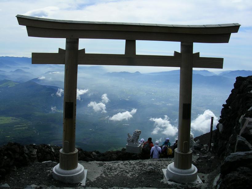
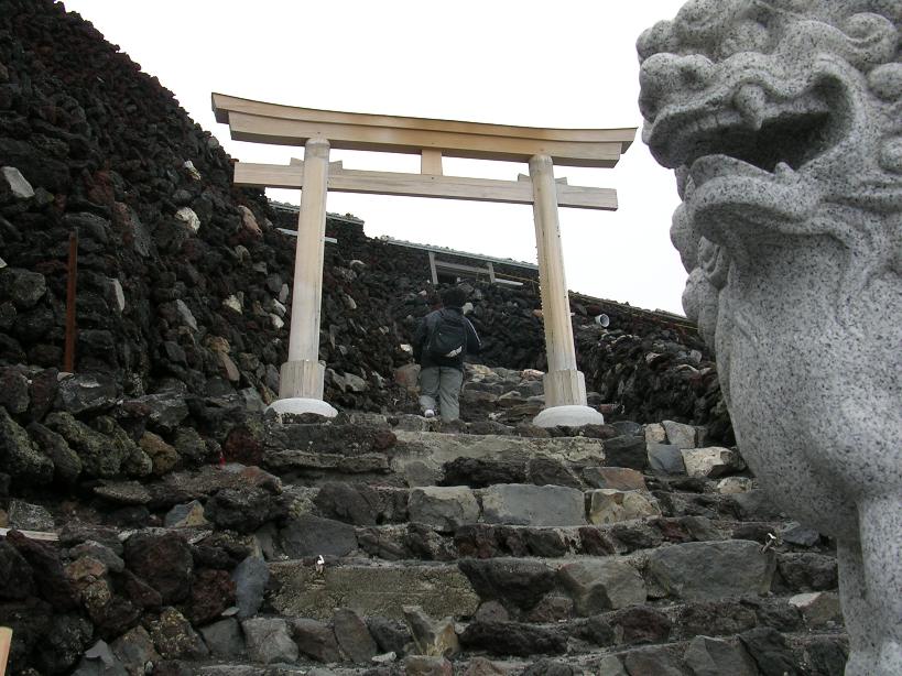
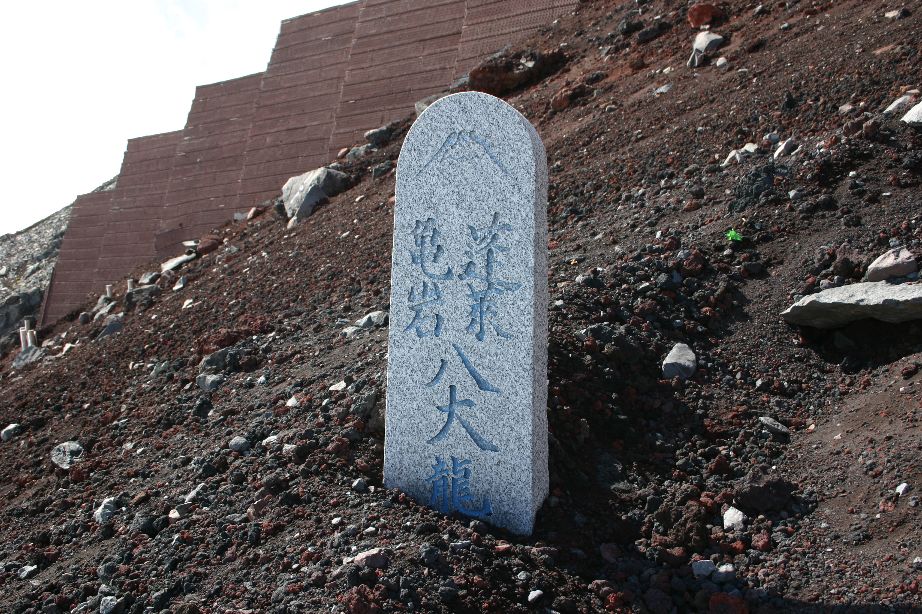
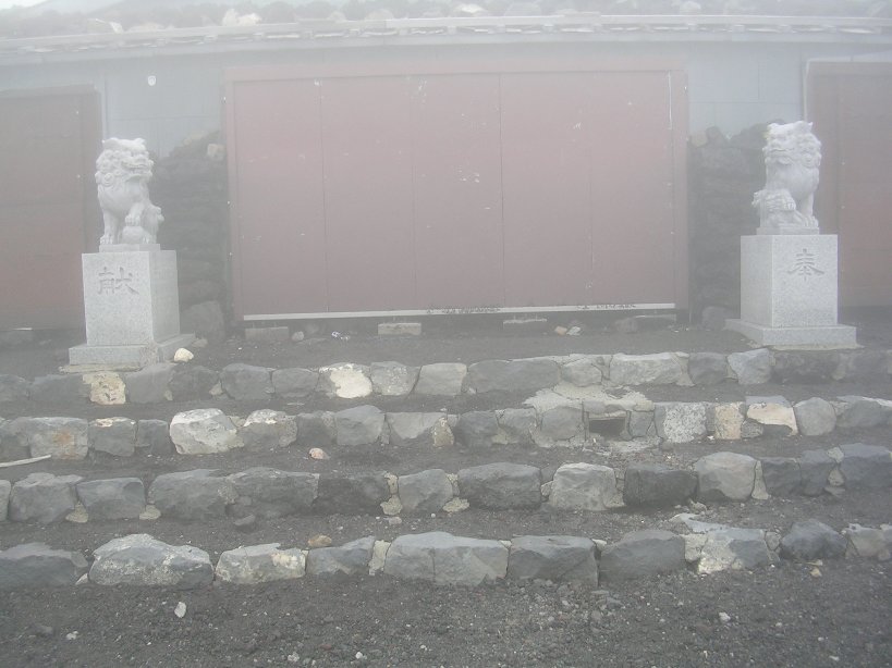
Views of the gates, through out Japan you will see entrances to shrines that have two gates with facing lions between them. I have yet to do the research their meaning, but it certainly feels great to pass through the last one at the summit!
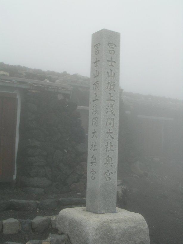
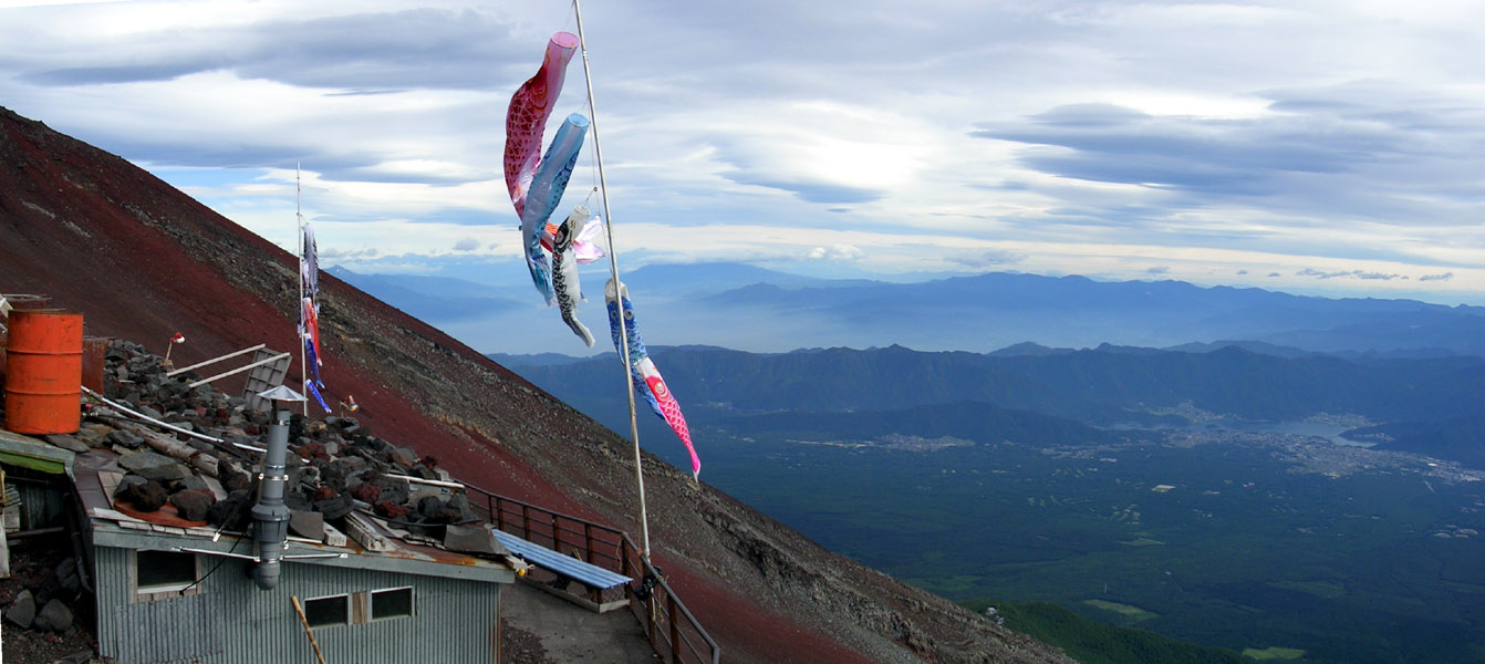
Views from the huts and shrine and the summit
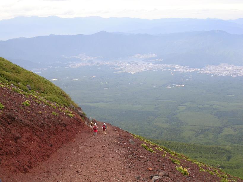
Some of the views on the descent
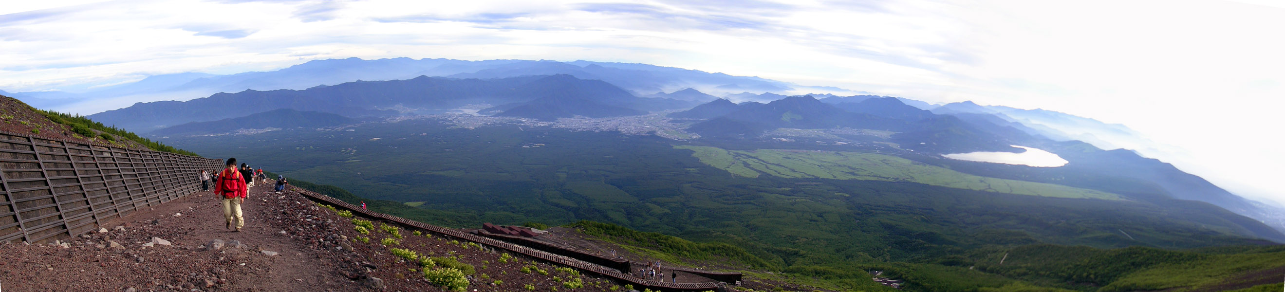
Panoramic Shots
Here are some shots put together on my 17th of July trip on Fuji
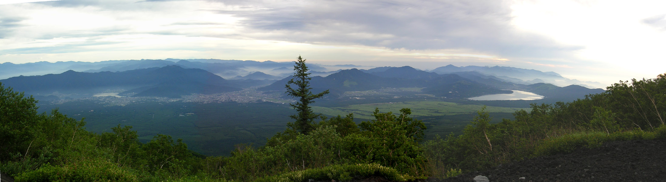
Less than a mile into the hike here are your views.
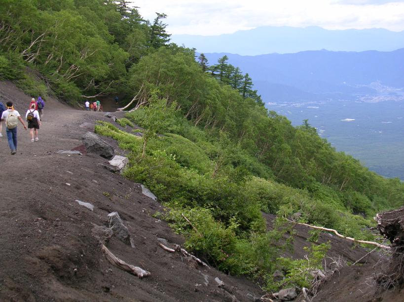
About the 6th Station on the ascending route
At the 7th station.
Still climbing, the grass is all gone.

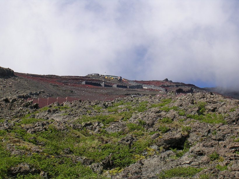
Above the Fuji-San Hotel and the 8th Station
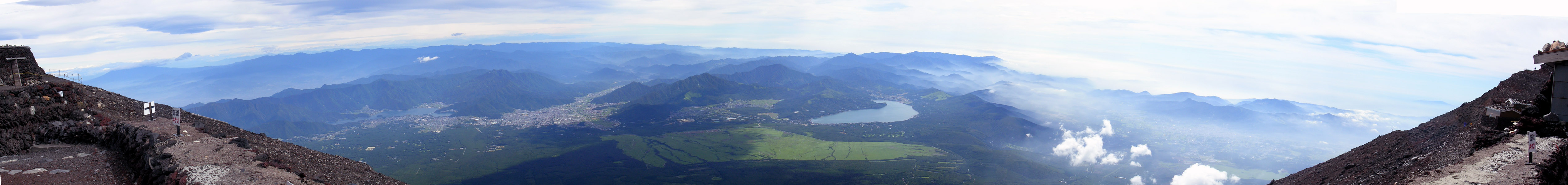
At the summit
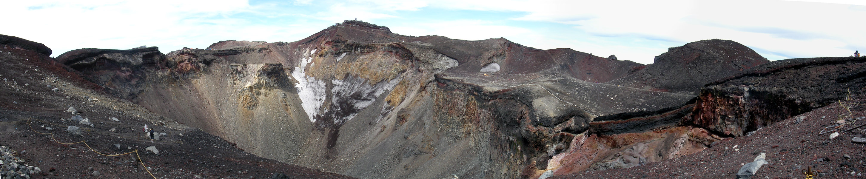
The Daiinaiin Crater (aka the crater at the top :) )
A Special Thank You goes out to some of the folks who helped with photos for this page
Drew Anderson
Rafael Hernandez
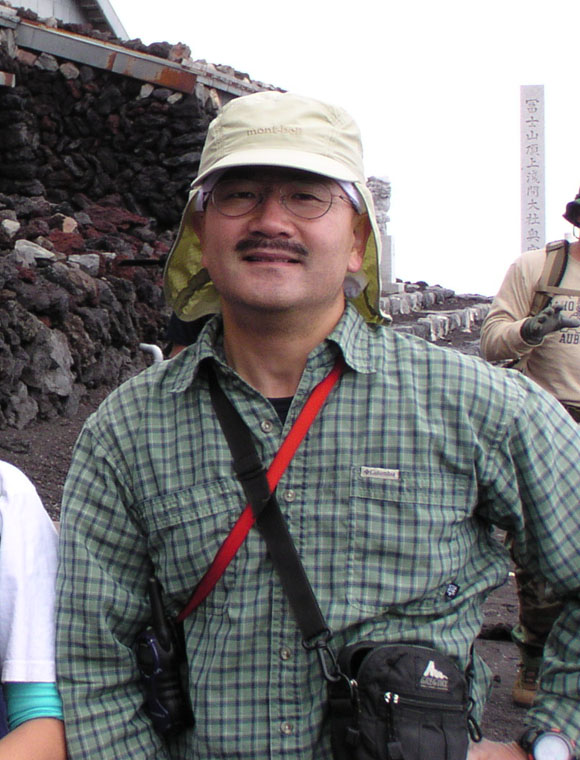
Tetsuya