Downieville - 2007 - Day 2
Day Six of the Norcal 2007 trip
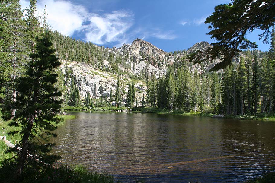
  I was pretty freaking impressed with our campsite when I lazily got up
this morning. Having setup camp in the dark last night, I
knew it sounded nice, but it looked even better. Once we got
up and around we rolled into town to see what the Yuba folks would
recommend for us today. "You guys will be riding like Rockstars".
That was what Wayne from Yuba Expeditions had to say about this route
after it was concocted on the maps in the shop. This was a
combination of the Deer Lake, Tamarask, and Sardine Overlook trails
combined with the Classic Downhill route from
yesterday.
I was pretty freaking impressed with our campsite when I lazily got up
this morning. Having setup camp in the dark last night, I
knew it sounded nice, but it looked even better. Once we got
up and around we rolled into town to see what the Yuba folks would
recommend for us today. "You guys will be riding like Rockstars".
That was what Wayne from Yuba Expeditions had to say about this route
after it was concocted on the maps in the shop. This was a
combination of the Deer Lake, Tamarask, and Sardine Overlook trails
combined with the Classic Downhill route from
yesterday. |
||
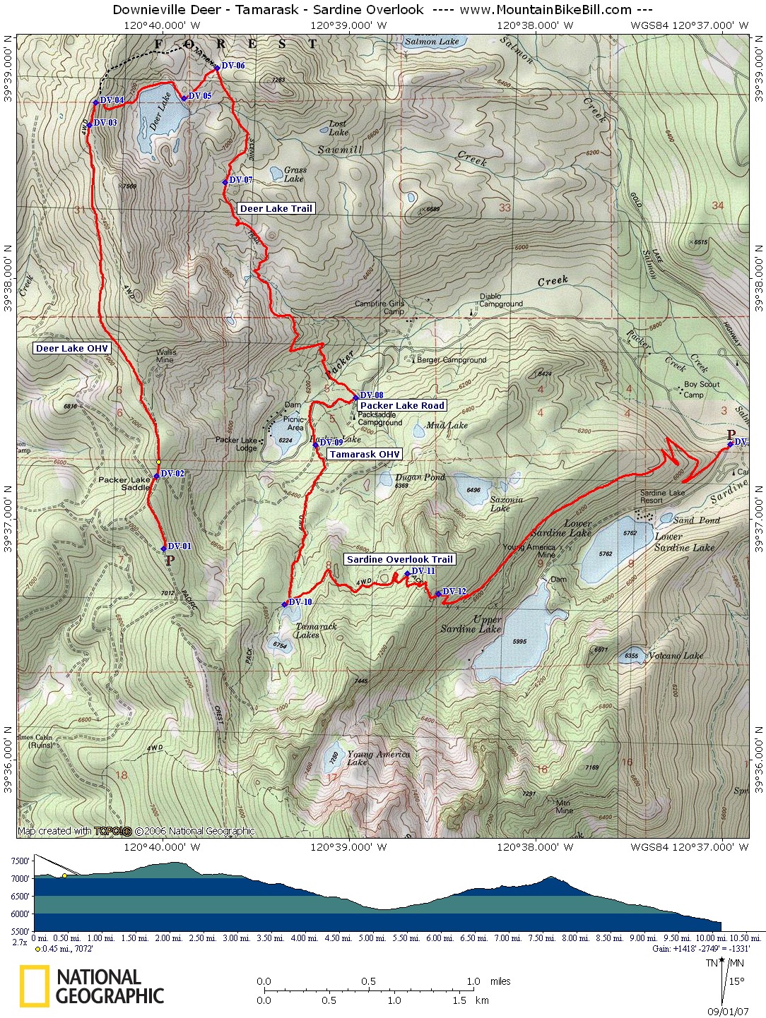 |
Map: This is the map for the first portion of the ride. The second part of the ride was the same as our Day One in Downieville Morning Ride. | |
| This would be no simple loop today, as a matter of fact it was the most complicated logistical ride I have every done considering it was just two people. My truck would be staying in town. Both of our bikes went on Yuba's shuttle van. Bill took off out of town ahead us in his truck. Bill parked his truck off of Packer Lake Road near the Sardine campground and waited for us to pick him up on our way up to Packer Saddle. We picked up Bill and headed up to Packer Saddle. Once all unloaded and rolling we went back down the road from Packer Saddle just a little bit and picked up the Deer Lake OHV trail (93.1) I would warn you about not accidentally getting on the Pacific Crest Trail at this point, but it pretty well marked and you would have a hard time confusing the two. | ||
|
||
 |
My map, as well as a couple of older maps, shows the Deer Lake Trail as the PCT. These same maps also show the section of the PCT that parallels the OHV road (DV-02 to DV-03) as the Lake Basin Ridge trail. While I have not been able to confirm this I think this is a reflection of a reroute of the PCT at some point after either 1975 or 1981. If you know the story let me know. Anyway from the junction of these trails, turn right onto the Deer Lakes trail and get ready for some seriously fun and often technically challenging descending on some very rocky terrain. About a third of the way down you will pass a trail that will take you out to Grass Lake (DV-07). We skipped it. After a couple of miles on this wonderful trail we crossed Packer Creek and soon popped out on Packer Lake Road. | 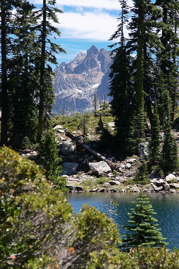 |
 |
We hung a right and started climbing on the pavement. 3/10ths of a mile later we took the left split at Packer Lake. (This is the same route you came in on the shuttle). A little over a 1/10th of a mile further we turned off of the pavement and onto a very rocky Tamarask OHV road on our left. For almost the next mile we climbed on this rocky beater of an OHV trail. The phrase "energy sapping" just does not seem to adequately convey the effect on the legs. It about a 10 percent grade but it is the loose rocks that really get you. | |
|
||
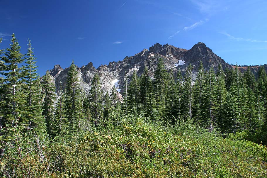 |
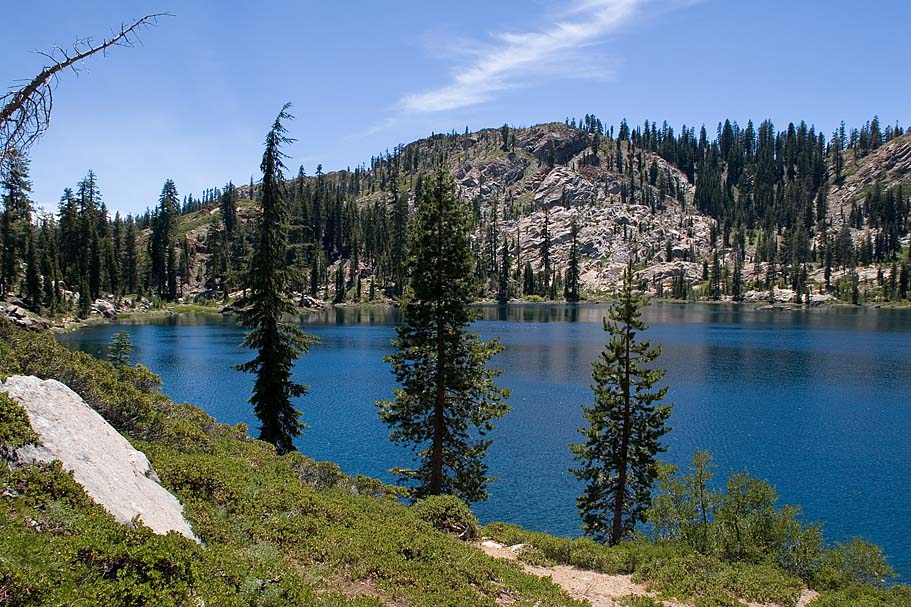
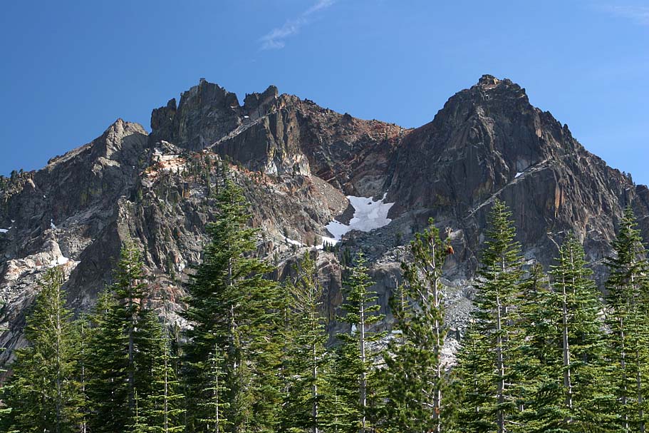
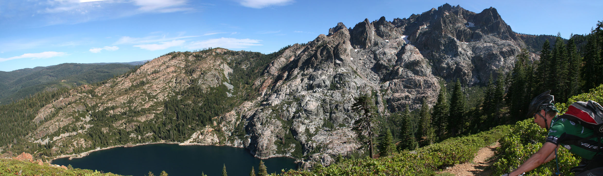
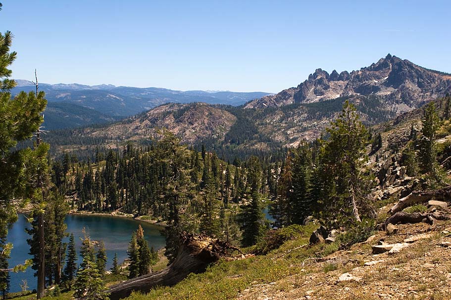
Once on the saddle we were treated to some truly amazing views. After getting over the saddle, the scenic beauty of the next 2.5 miles is impossible to adequately describe. I have seen plenty of pretty in my day, but this was "advanced" pretty. The chiseled rocks of the Sierra Buttes above with remnants of snow still on it's north face along with the deeply blue-hued water of the Sardine Lakes below where hazards all to their own as you will be incapable of not looking. So please stop and take in the majesty of this place. | 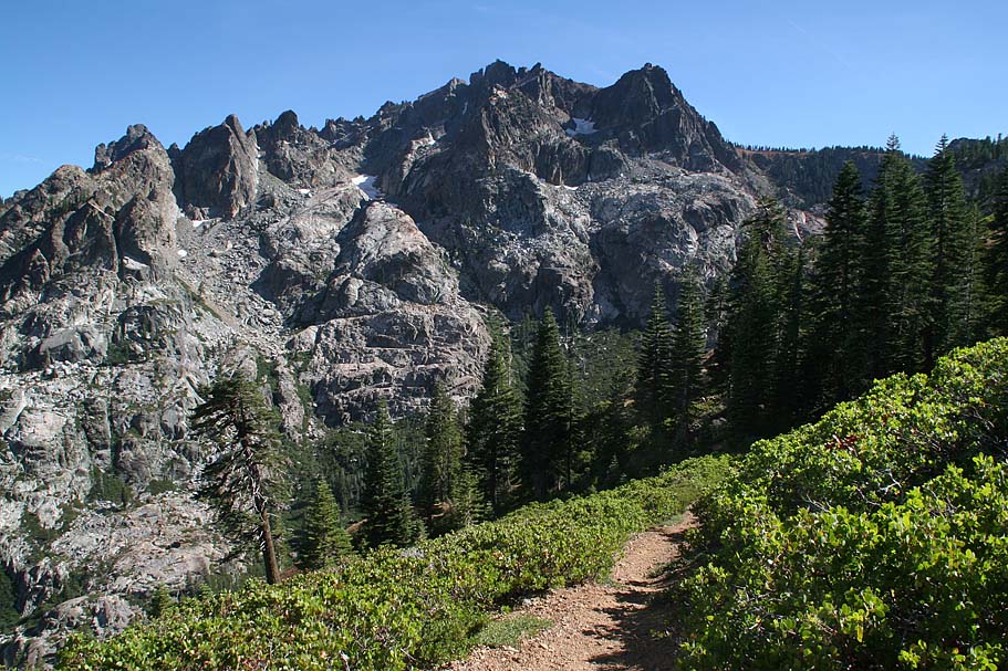 |
|
|
||
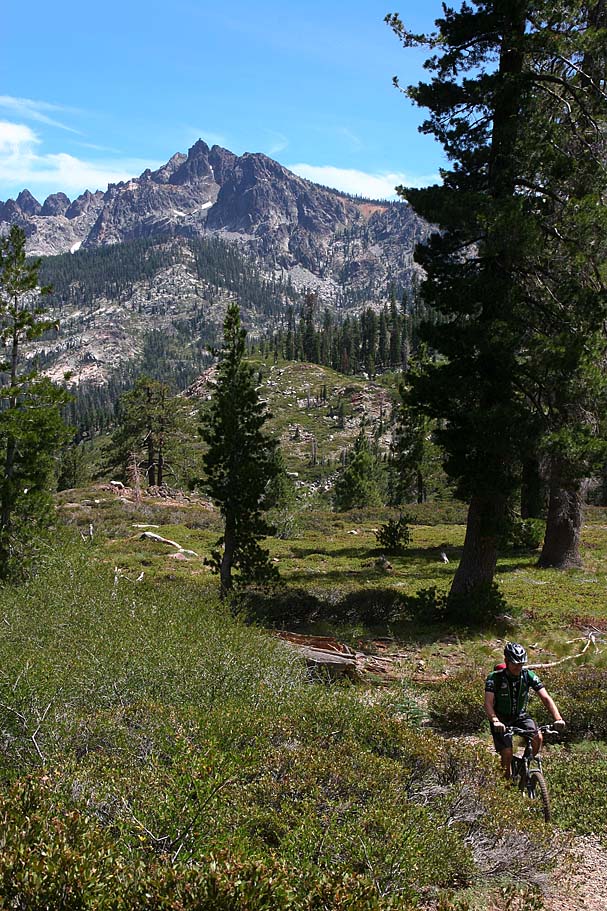 |
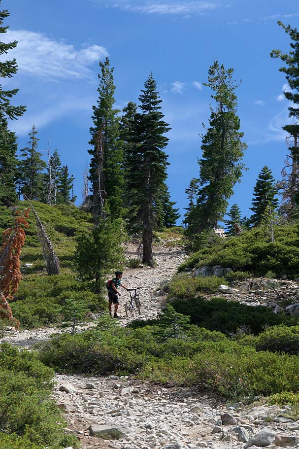
Once you have achieved sensory overload, then get to riding this trail. It is by no means a sidewalk with plenty of rocks to throw you should your eyes stray away for too long. The bottom half of this trail has been described as "Neanderthal Heads". I was thinking either Rosie O'Donnell or Rush Limbaugh heads but either way, they are big freaking rocks and a bunch of them. Keep your speed up or you are going to get the crap beat out you. The trail eventually dumped us out right near the Sardine Campground and Bill's awaiting truck. We had knocked out about 11 miles of riding with 1400 feet of climbing and 2800 feet of descending. | 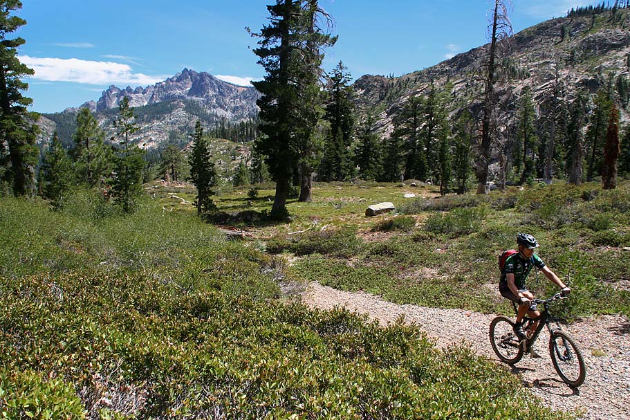 |
| Time for a mid-ride snack and this is where the riding like Rock Stars comment came from. Bill's truck just happened to have a cooler nestled inside with four beers and a couple of kick-ass deli sandwiches that we had made that morning in the grocery store. We feasted, drank, and giggled at our awesome ride thus far in the day. We soon hopped in the truck and drove up to Packer Saddle and finished our second beer (drinking two before the drive would have been wrong ;-). After polishing off all of the goodies we hit the Sunrise trail for a blazing run on Butcher Ranch, 3rd, and 1st Divides back to town. We rolled back into to my awaiting truck and another cooler ;-) After retrieving Bill's truck and returning to camp we enjoyed a great evening of camp chow and some exceptionally fine brews and spirits. | ||