Los Penasquitos Canyon and Del Mar Mesa
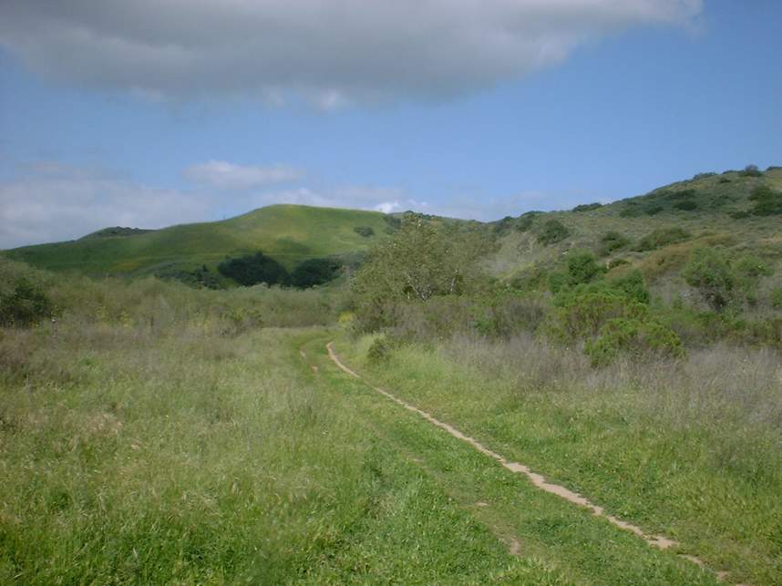
The Los Penasquitos Canyon and Del Mar Mesa loop ride is downright fun and it allows you to get in a great workout as well. The canyon itself is quite boring with the main "trail" being a fire road. However when combine with the Del Mar Mesa this ride ends up being a little over 19 miles that give you a chance to work on you flat land speed in the canyon, test your bike handling skills on some tight rocky singletrack and give your legs and lungs a test on a couple of climbs.
Maps:
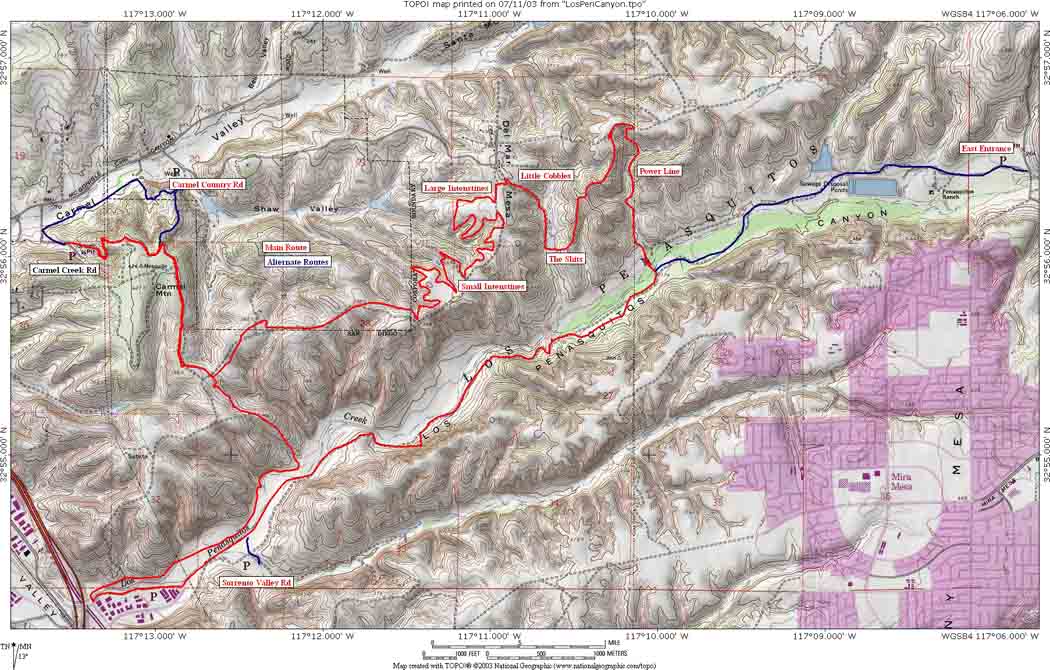 Click
on the image to the left to see a map of the ride. To see the full
resolution version of the map (that is 1.4MB) click here. Elevation
Profile for this ride
Click
on the image to the left to see a map of the ride. To see the full
resolution version of the map (that is 1.4MB) click here. Elevation
Profile for this ride ![]() Download the TOPO! file.
Download the TOPO! file.
Directions: There are many options to get into the Del Mar Mesa and Los Penasquitos Canyon area. There are the ones I have used.
| Carmel Creek Road (My Primary) : Take I-5 or I-805 north through the merge of the freeways. Take the HWY 56 exit. The first exit you will have is Carmel Creek Road. Take the exit and turn right at the stop light. Take it to its end at an apartment complex. Park in the turnaround circle. The is at the east end of the complex. | |
| Carmel Valley Road: Take I-5 or I-805 north through the merge of the freeways. Take the HWY 56 exit. Take the second exit Carmel Country Road. Turn right at the light. Take your an almost immediate right into the parking lot. | |
| East end of the Canyon: For the east end, take I-15 to Mercy Rd. Go west on Mercy Rd, to Black Mountain Rd. Turn right on Black Mountain Rd. You will see an entrance to the county park on the West side of the road. The county park charges for entrance, whereas the city park on the other side of the bridge does not. Continue over the bridge and enter the park on the left. Look for the signs to the Los Penasquitos Ranch House. | |
| West End of the Canyon: take I-5 or I-805 to Sorrento Valley Rd. From 805 you will take Sorrento Valley Rd. To Sorrento Valley Blvd. The I-5 Exit will work around to Sorrento Valley Blvd. Take Sorrento Valley Blvd. past all the industrial complexes. The entrance is on your right. You can also park in on the complexes on the left side of Sorrento Valley Blvd and pick up the trail as it goes behind the complexes. |
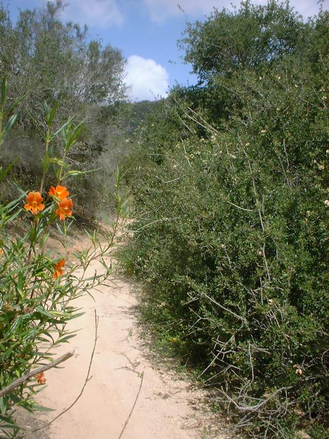
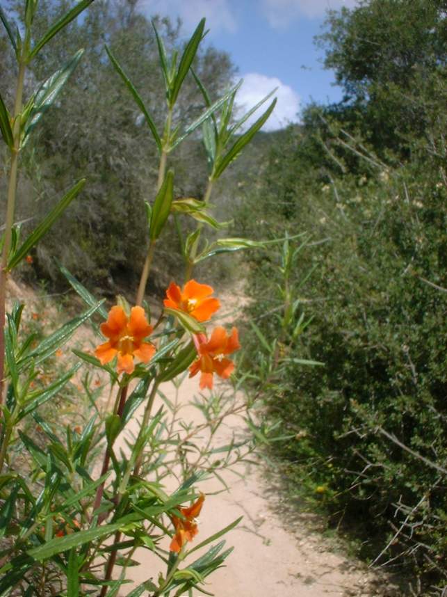
Hazards: Beside the normal stuff, this area is home to many rattlesnakes so be alert.
Ride Notes:
I almost exclusively start from the Carmel Creek Road
"trailhead". One of the guys I ride with used to live in the
apartment complex at the trailhead some I have come to like the route from
here. From the turnaround where you parked. Go into the
apartment complex and ride to the back side of the complex where you will see a
bit of pavement and a gate going up the hill. Go around the gate and start
climbing. The pavement ends in about 50 yards. Follow the dirt road
up the short but brutal hill to the get up on the mesa. The final pitch of
this climb is extremely challenging and even on the best of days it is 50/50 as
to wither or not a strong rider will make it up or not.
Once up on the mesa you will ride into a large open
area. There is a single track that leads off from the far left corner of
opening. Take this singletrack and it wind back and forth and take you out
to a fire road. Follow the fire road until you see a well used trail
peeling off to the right. Follow this along the top of the mesa and views
of the canyon to the south will open up. After a little less than a a mile
the trail will take you out to a closed paved road. Take a left and
follow it downhill. The pavement ends after about 100 yards later.
Follow the now dirt road around to the left. Take note of the dirt road
coming in from the left as well as the construction. You will be rejoining
this trail on near the end of the ride at this spot. Continue along
straight for another 100 yards and the road turns uphill again. Look for a
single track off to the left that follows the contour of the north side of the
finger canyon. Take this single track. This single track
crosses some double track in about 300 yards. Cross the double track and
continue along the single track which will feed into another piece of double
track. You will be heading downhill with a good chunk of speed by
now. You will come to another doubletrack heading off slight to the
right which is well used with tracks. Take it. You will be blazing
once again. Look for another singletrack off to the right and the very top
of a steep downhill. Take the singletrack that will weave you down the
hill. It has some loose rocky spots that will keep you on your
toes. This trail will dump you out on singletrack on the north side of the
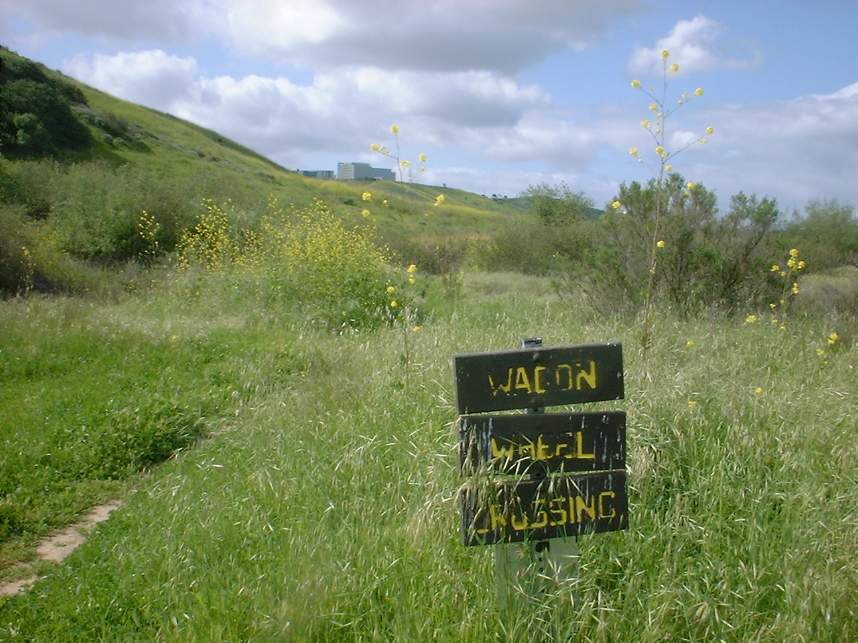
canyon floor at the Wagon Wheel Crossing (Not Bike Legal). If you missed
the single track off the right you will just bomb straight down the hill and
hang a right it will bring to the bottom of the singletrack. After finishing up
the singletrack hang a right and follow the singletrack along the north side of
the canyon and across the meadow. Follow the trail all the way out out to
the Vista Sorrento Road bridge. Hang a left and ride along the sidewalk
across the very short bridge. Immediately hand a left after crossing the
bridge and follow the trail heads west behind the industrial complexes. Most of
this section is old pavement. You will soon be brought out at Sorrento
Valley Road. Hang a left and ride along the sidewalk for a couple hundred
yards will the trail will go off the left.
This is the main fire
road part of the Canyon. Follow this fire road for 3.5 miles where you see
a gravel/rock double track off to the left. Take this and you will cross
over the creek back over to the north side of the canyon floor. From here
you will start a climb that follows along some power lines. This climb is
about a mile long and it gains right around 300 feet. At the top of Powerline
hang a left and follow the fire road up a little further then hang a left
underneath the trees. Follow this fire road along mesa that rolls up and
down a bit. You may have to ride around a gate that is sometimes
closed. You will soon see a fork in the fire road, hang a right. The
fire road will take you to the power line pole where a single heads down a loose
rocky descent.
This is the top of the "The Shits". The Shits
is a rocky (baby head style) downhill with sweeping turns and ruts that can put
a premium on picking a good line. It is over far too quick and you will
hang a right at a tee junction by a small pond (sometimes a puddle in the
summer). You will start climbing again. You will soon come to a fork
in the trail, take it (Bad Yogi-ism I know) either way will bring you to the
same place. To the left is the Big Cobbles which offers big rocks and a
steep ascent. To the right is the Little Cobbles which has lots of small
of rock, a longer climb that is not quite as steep. Both ways are
challenging, more power needed to the Big, come off line on the Little and you
could be walking. You decide.
The top of both of the climbs will bring you out on a fire
road. There are three single track that head off to the right from this
fire road and they all loop back to the fire road. So take the first one
you see. Ride it until it loops back to the fire road. Go
right and take the next one. I have heard these trails called the
Large and Small Intestines and Little Bean. Whatever you call them they
are fast twisty with some roller coaster mixed in here and there. Keep
this up and you will eventually come out near a housing development. Climb the
trail up to the end of Carmel Mountain Road (It doe not full connect as pavement
yet to HWY 56). Follow the road through the intersection with Carmel
Valley Road (Some folks hang a right here if they were parking at the Carmel
Country Road Trailhead. Anyway, continue on Carmel Mountain Road, when you
see a school on your left look for a singletrack heading off to the right.
Take it and then hang a left about 20 yards down the trail. This dirt
road/trail will take you by the construction area and connect with trail you
where on at the beginning on the ride. Go back the way you
came.
There are many many options in this area and I have only
describe maybe 70 percent of the trails. So get out and explore!