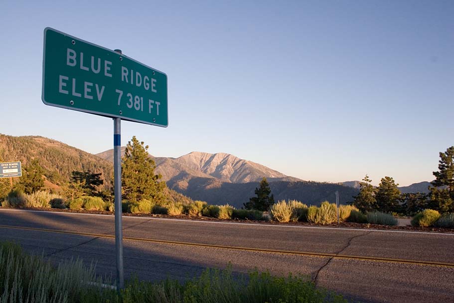
Blue Ridge D
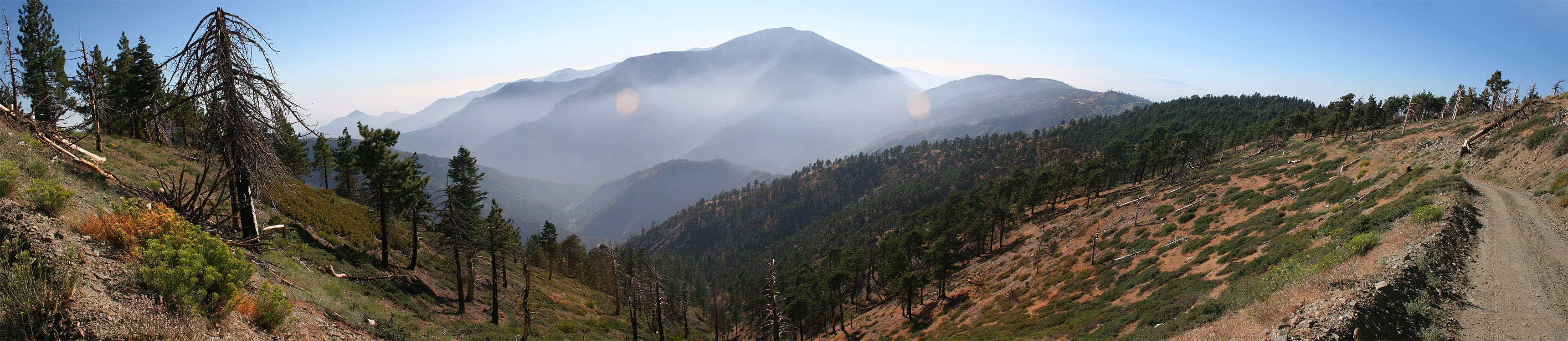
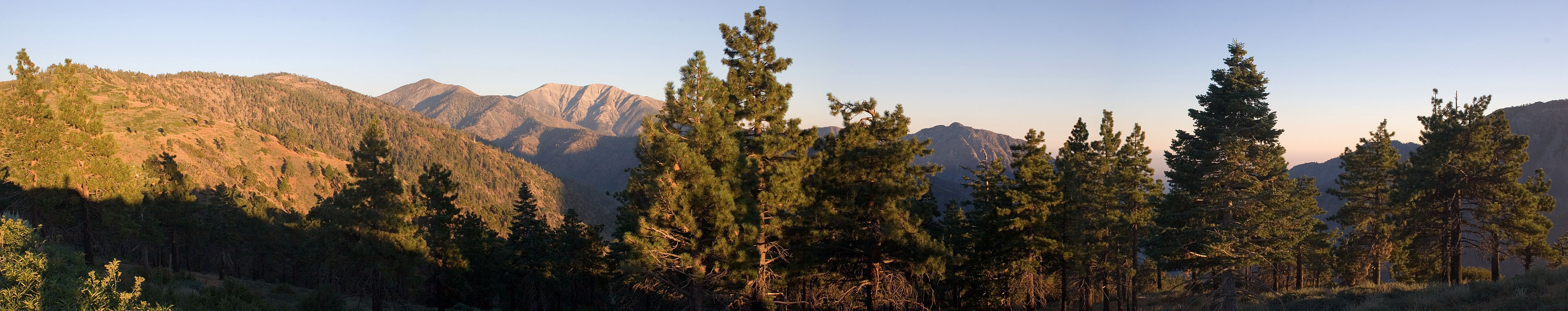
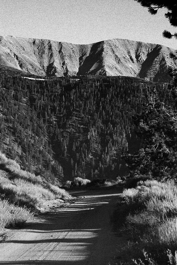 Located in the San Gabriel Mountains high above the town of Wrightwood this 18
mile ride has some expansive views while giving you the opportunity for a great
cardio workout. Nearly all of this ride is on a mountain forest service
dirt road. There is a bit of singletrack near the ride ends that will have
even the most brazen of fire road despisers glad they did all the double track work
to get to it. With the ride starting at 7,381 feet you will find an escape
from the blistering summer heat of the Mojave desert to the north and the San
Bernardino area to the south. On the day I did this ride in August, the
afternoon temperature was around 70 degrees. This ride is often referred
to at the "Blue Ridge 'D'" due to the shape of the route on the map.
The trailhead is maybe 20 minutes from Interstate 15 so this could be a great
trail to take a break from a long road trip.
Located in the San Gabriel Mountains high above the town of Wrightwood this 18
mile ride has some expansive views while giving you the opportunity for a great
cardio workout. Nearly all of this ride is on a mountain forest service
dirt road. There is a bit of singletrack near the ride ends that will have
even the most brazen of fire road despisers glad they did all the double track work
to get to it. With the ride starting at 7,381 feet you will find an escape
from the blistering summer heat of the Mojave desert to the north and the San
Bernardino area to the south. On the day I did this ride in August, the
afternoon temperature was around 70 degrees. This ride is often referred
to at the "Blue Ridge 'D'" due to the shape of the route on the map.
The trailhead is maybe 20 minutes from Interstate 15 so this could be a great
trail to take a break from a long road trip.
Directions: From San Diego, take I-15 north until it merges with I-215 north of San Bernardino. Stay on I-15 for 7.6 more miles and take the CA-138 exit. Turn left onto CA-138 and take it 8.5 miles. Turn left onto CA-2. 5.1 miles later you will pass through the town of Wrightwood. At around 9 miles after you turned onto CA-2, There is a split in the road. Go to the left and uphill to stay on CA-2 (This is also where the Mountain High Ski resort is at). About two miles latter look for a vista turnout for Inspiration Point on your right. Pull in and park.
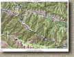
 Map: Below is a topographic map of this ride and below is the elevation profile TOPO! file here.
![]() GPS Files for this route: TOPO!, GPX, GDB, KML
GPS Files for this route: TOPO!, GPX, GDB, KML
RIDE NOTES:
  From
the parking lot at Inspiration Point (Waypoint BR-ST), go across the road and
start up an old paved road which is forest service road 3N06. The
views aren't bad from here and they just keep getting better.
You will not have reached the one mile mark yet when you will see the Pacific
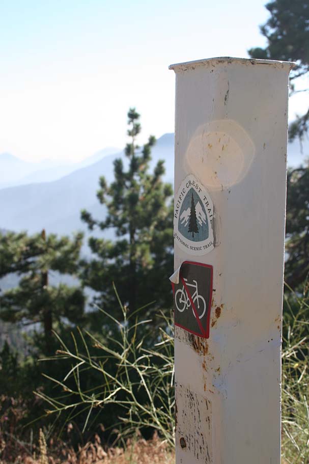
Crest Trail singletrack crossing the road. The PCT parallels this
route for just about its entirety and cuts across the route many times.
Sadly it is off limits to bikes. From
the parking lot at Inspiration Point (Waypoint BR-ST), go across the road and
start up an old paved road which is forest service road 3N06. The
views aren't bad from here and they just keep getting better.
You will not have reached the one mile mark yet when you will see the Pacific
Crest Trail singletrack crossing the road. The PCT parallels this
route for just about its entirety and cuts across the route many times.
Sadly it is off limits to bikes. |
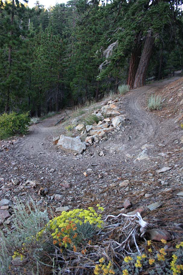
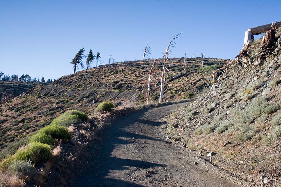
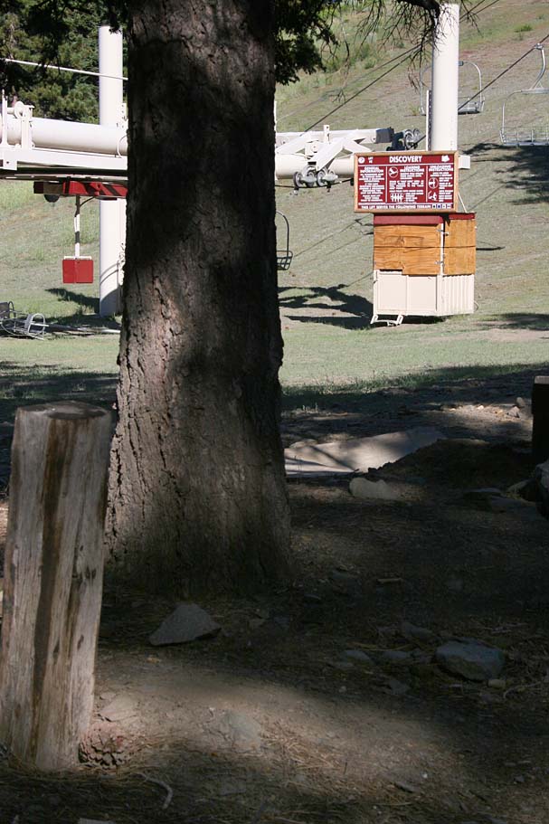 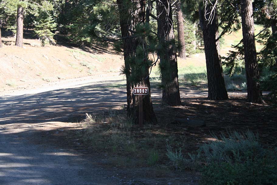 At
2.4 miles you will reach the Blue Ridge campground. This part is really
important as the junction for the singletrack you are going to love later
on in this ride is poorly marked. As you ride along the road, look for the
view of the ski lift labeled "Discovery" on your left. Just before the
last tree opening into a field is the trail (BR-A). The picture to left is
the view you are looking for. If you go past the sign shown in the
picture on the right, you have missed it. At
2.4 miles you will reach the Blue Ridge campground. This part is really
important as the junction for the singletrack you are going to love later
on in this ride is poorly marked. As you ride along the road, look for the
view of the ski lift labeled "Discovery" on your left. Just before the
last tree opening into a field is the trail (BR-A). The picture to left is
the view you are looking for. If you go past the sign shown in the
picture on the right, you have missed it.
|
  But
for now you are going to keep going straight. You will continue
climbing from this point and you will soon pass by a pond on your left used to
store the water for the snow machines in the winter. This area wide open as a
result of a wildfire in 1997. Continue climbing and
before too long you will reach the highest point of this ride at 8,461 ft. But
for now you are going to keep going straight. You will continue
climbing from this point and you will soon pass by a pond on your left used to
store the water for the snow machines in the winter. This area wide open as a
result of a wildfire in 1997. Continue climbing and
before too long you will reach the highest point of this ride at 8,461 ft. |
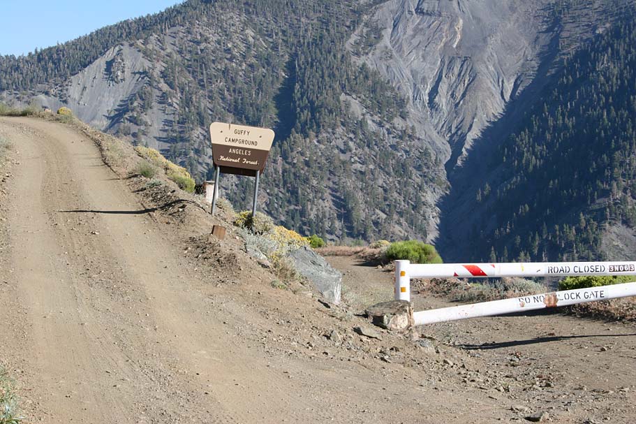  As
you crest this highpoint, you will see the road sweeping downhill and curving to
the left across more of the old burn area. Soon you will come the
turnoff for the Guffy Campground turnoff at 4.3 miles. (Waypoint BR-B on the map). Go to your right around the usually locked gate
and continue traveling downhill. As
you crest this highpoint, you will see the road sweeping downhill and curving to
the left across more of the old burn area. Soon you will come the
turnoff for the Guffy Campground turnoff at 4.3 miles. (Waypoint BR-B on the map). Go to your right around the usually locked gate
and continue traveling downhill. |
|
|
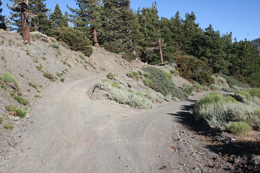  Pay
attention around the 6 mile mark as you will come to the intersection with FS3N39.
Its is very hard to miss this junction but with all downhill speed you are
carrying at this point you could be tempted to keep going downhill. Don't do it.
Stay straight and turn uphill staying on FS3N06. (To the left is a picture
of the junction which is waypoint BR-C on the map). The road soon becomes a
bit more rocky and quickly becomes exceptionally shaded by tall Jeffery and
Ponderosa pines. While you are still climbing in this section it is more
mellow than your earlier efforts. Pay
attention around the 6 mile mark as you will come to the intersection with FS3N39.
Its is very hard to miss this junction but with all downhill speed you are
carrying at this point you could be tempted to keep going downhill. Don't do it.
Stay straight and turn uphill staying on FS3N06. (To the left is a picture
of the junction which is waypoint BR-C on the map). The road soon becomes a
bit more rocky and quickly becomes exceptionally shaded by tall Jeffery and
Ponderosa pines. While you are still climbing in this section it is more
mellow than your earlier efforts. |
  At waypoint BR-D on the map is the junction with the Acorn trail. I do
not know the status of this trail as far as wither mountain bikes are allowed
or not, but I did not see any no-bike signs. If you have any information
on it please
email me the goods. Also at this spot is another of the many
junctions with the Pacific Crest Trail along this route. It is most certainly
off-limits to bikes, which is a real shame since a good portion of this route
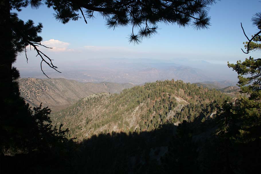
would be on singletrack instead of a fireroad. Anyway, as you continue
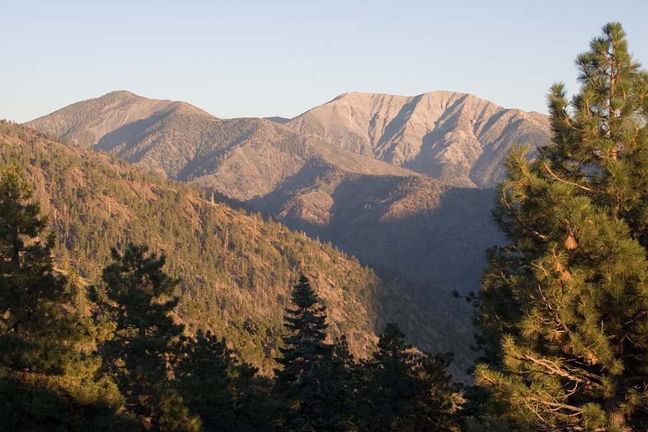
along the fireroad from this point you will almost certainly be amazed by the
ever increasingly gorgeous views of the north face of Pine Mountain and the
Sheep Mountain Wilderness to the south. At waypoint BR-D on the map is the junction with the Acorn trail. I do
not know the status of this trail as far as wither mountain bikes are allowed
or not, but I did not see any no-bike signs. If you have any information
on it please
email me the goods. Also at this spot is another of the many
junctions with the Pacific Crest Trail along this route. It is most certainly
off-limits to bikes, which is a real shame since a good portion of this route
would be on singletrack instead of a fireroad. Anyway, as you continue
along the fireroad from this point you will almost certainly be amazed by the
ever increasingly gorgeous views of the north face of Pine Mountain and the
Sheep Mountain Wilderness to the south. |
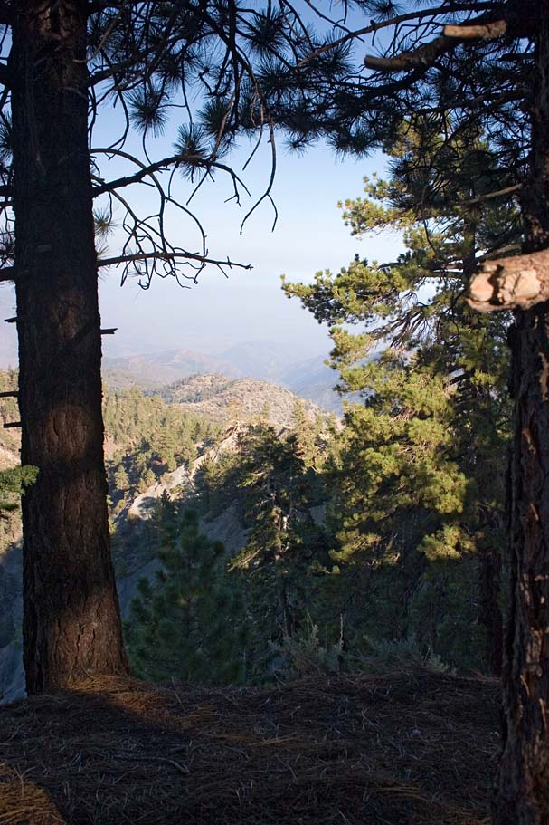
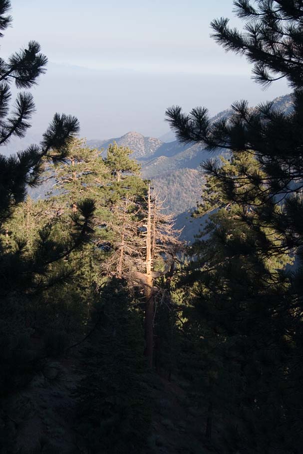
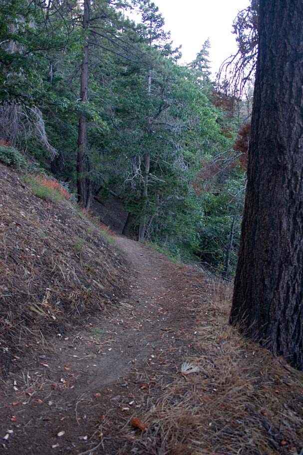
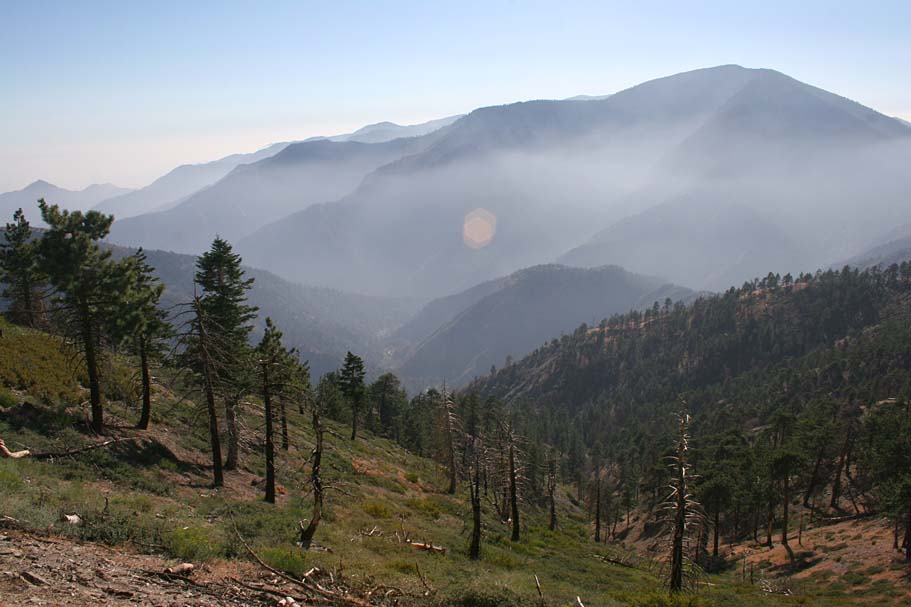
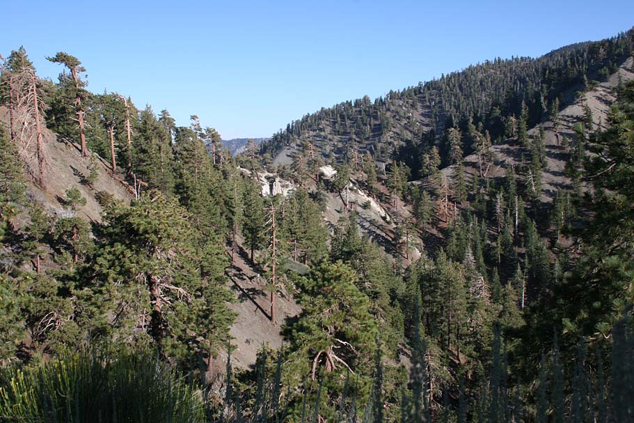
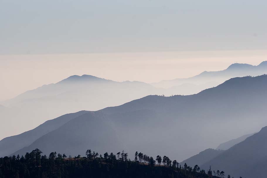
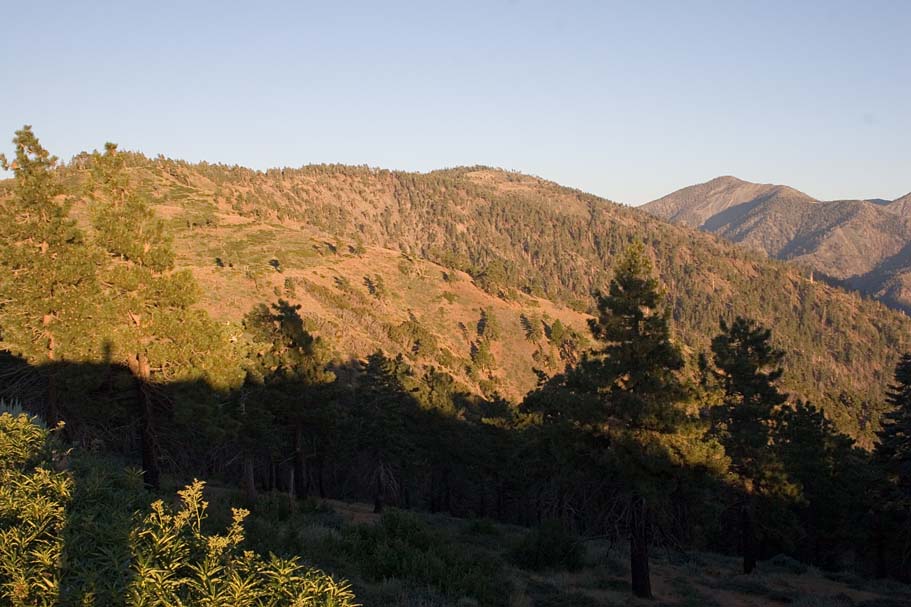
  At 8.3 miles you reach the end of the road where you can peer down into the
Cajon Pass far below and to the west and the Mojave Desert to the north.
Please take the time to take in everything as the vista from here is too great
to simply gloss over. At 8.3 miles you reach the end of the road where you can peer down into the
Cajon Pass far below and to the west and the Mojave Desert to the north.
Please take the time to take in everything as the vista from here is too great
to simply gloss over. |
|
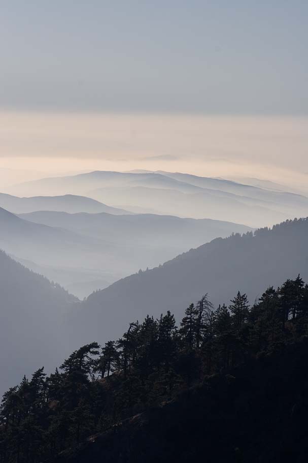
Views from the end of the road
|
  Once you had your fill of the end of the road views, head back the way you
came and resist the strong temptation to hop on a few sections of the Pacific
Crest Trail. For some reason the climbing seemed easier to me headed in this
direction. Once you get past the peak just after the Guffy
Campground, the ride turns into a fire road bombfest for the next 1.75 mile
on your way back down to the Blue Ridge Campground.. Once you had your fill of the end of the road views, head back the way you
came and resist the strong temptation to hop on a few sections of the Pacific
Crest Trail. For some reason the climbing seemed easier to me headed in this
direction. Once you get past the peak just after the Guffy
Campground, the ride turns into a fire road bombfest for the next 1.75 mile
on your way back down to the Blue Ridge Campground.. |
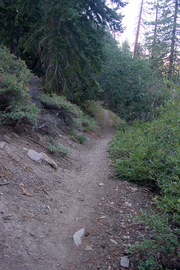
  Once you get back to the Blue Ridge Campground, your trip counter should be
around 14.1 miles at this point. Hang a right onto the Blue Ridge trail and
start smiling.
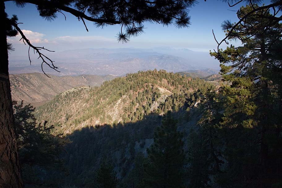
This is an exceptional stretch of mostly buff singletrack that is just as pretty
as it is fun. There are a few switchbacks to negotiate near the
top of the trail but besides that the most difficult part of the trail will be
controlling your speed. You can absolutely reach near-ludicrous speed as you
cash out around 1,100 feet of elevation in just over two miles. The trail
is nice and firm but venture off line and you will find much less than optimal
traction in the adjacent soil. So control your speed because all of the
trees along the trail could cause some Bono-fide issues for those going off
trail. Once you get back to the Blue Ridge Campground, your trip counter should be
around 14.1 miles at this point. Hang a right onto the Blue Ridge trail and
start smiling.
This is an exceptional stretch of mostly buff singletrack that is just as pretty
as it is fun. There are a few switchbacks to negotiate near the
top of the trail but besides that the most difficult part of the trail will be
controlling your speed. You can absolutely reach near-ludicrous speed as you
cash out around 1,100 feet of elevation in just over two miles. The trail
is nice and firm but venture off line and you will find much less than optimal
traction in the adjacent soil. So control your speed because all of the
trees along the trail could cause some Bono-fide issues for those going off
trail. |
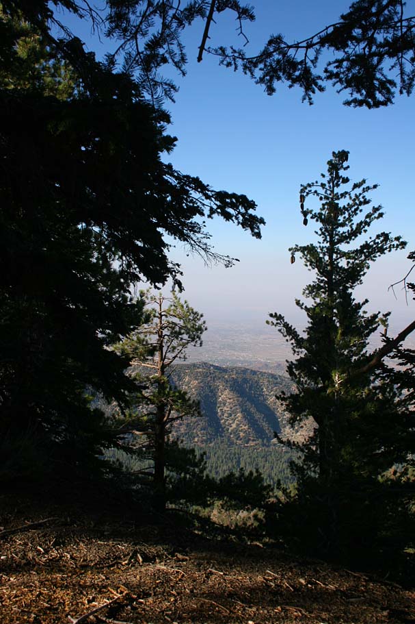
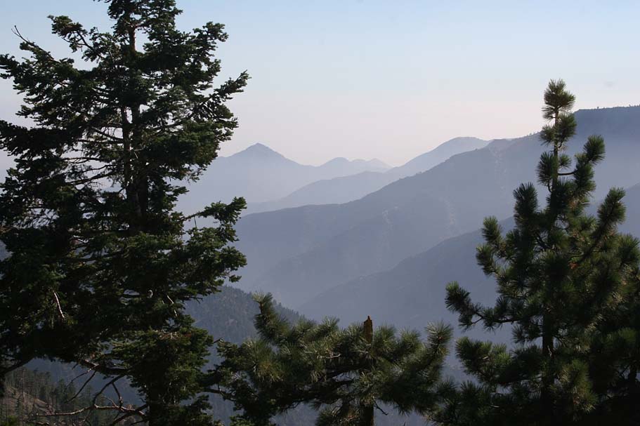
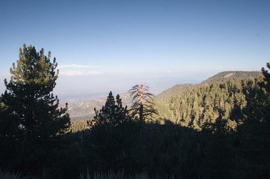
|
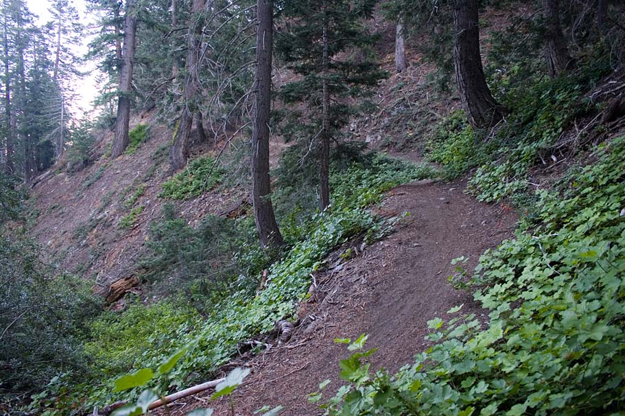
Views from along the Blue Ridge singletrack.
|
  Sadly at 16.4 miles after crossing a bridge and a quick uphill the trail will dump you out on CA-2 (Waypoint BR-F). From here you hang a left and go uphill on the pavement. Shortly you will come to a split in the road with the Big Pine highway heading off to the right and downhill and CA2 heading to the left and uphill. Go uphill and left and grind up the pavement until you return to Inspiration Point where you parked at 18.6 miles. |
|
|